

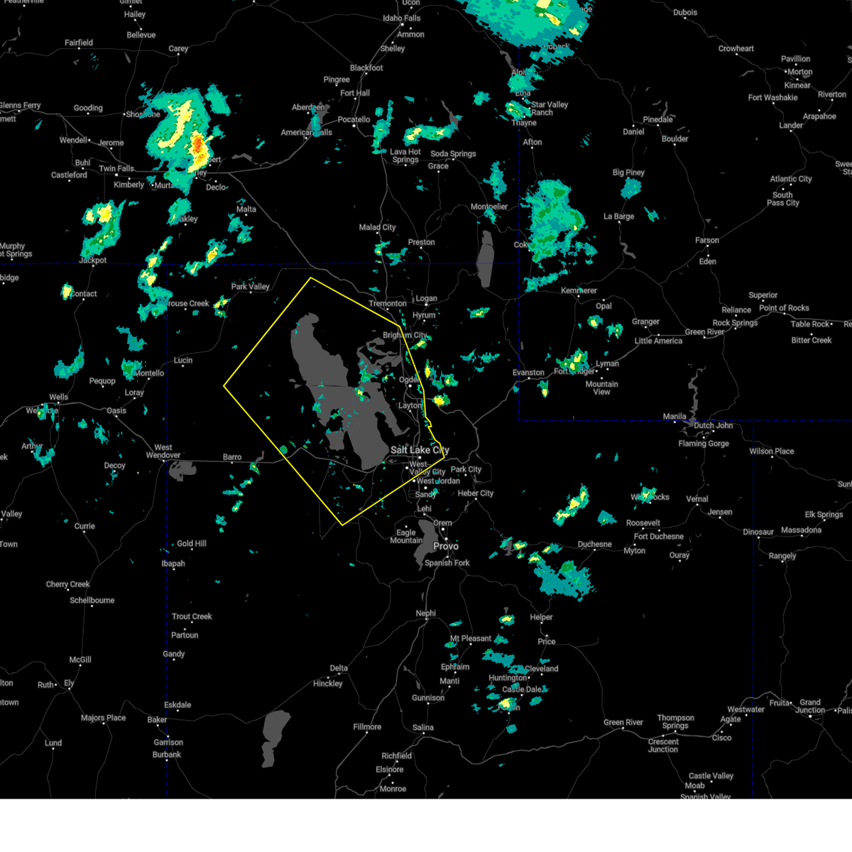
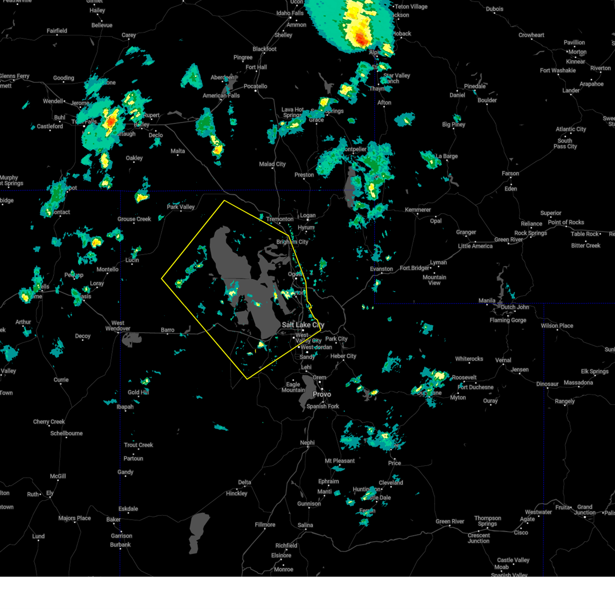
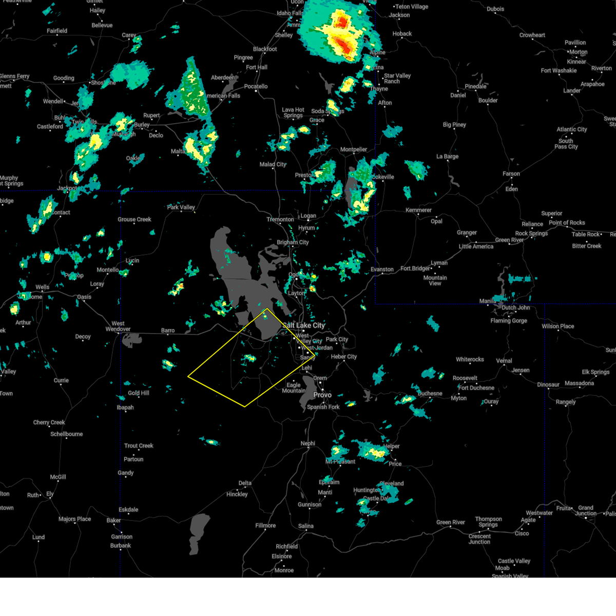
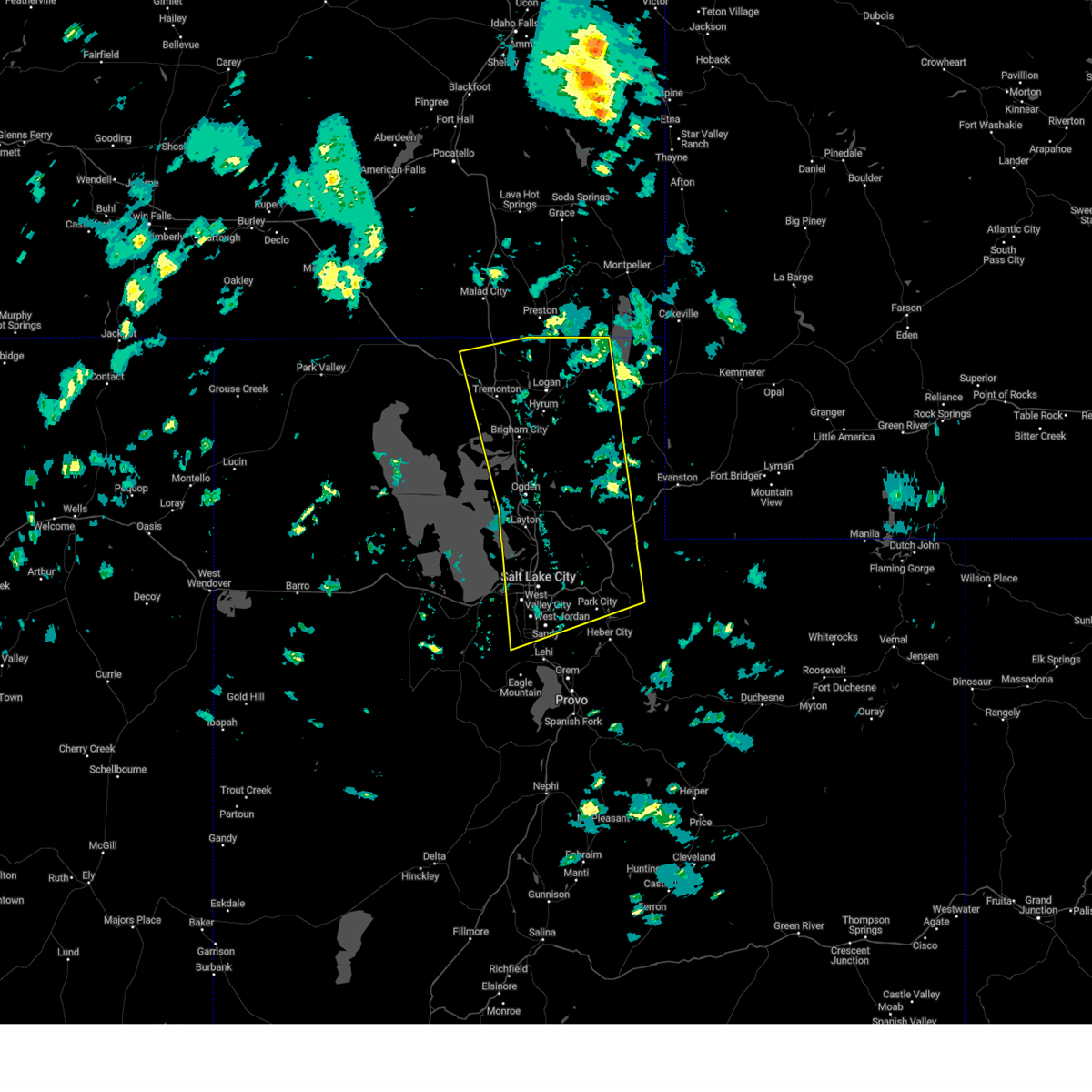
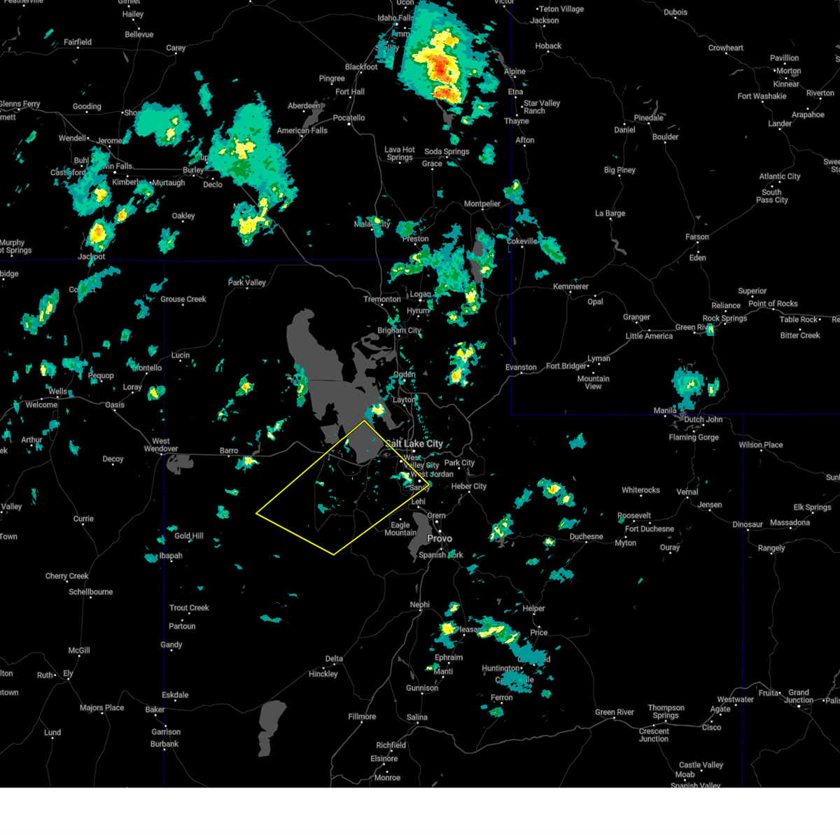
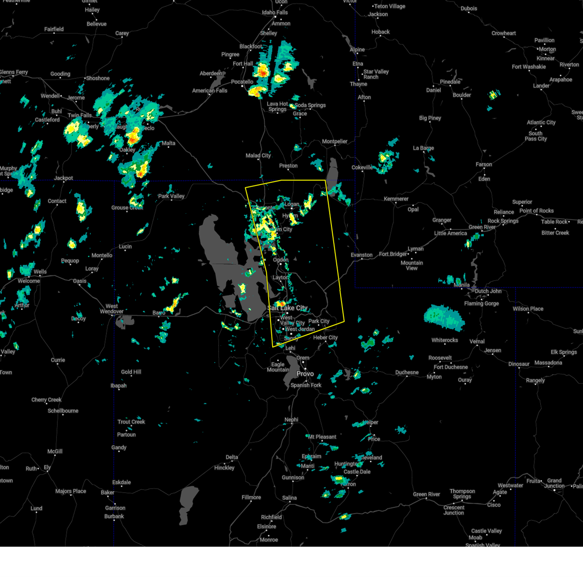
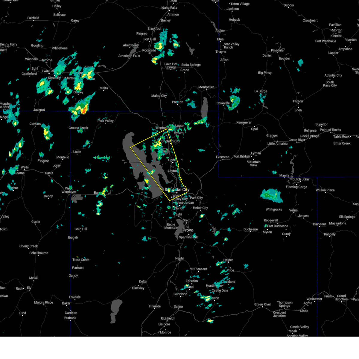
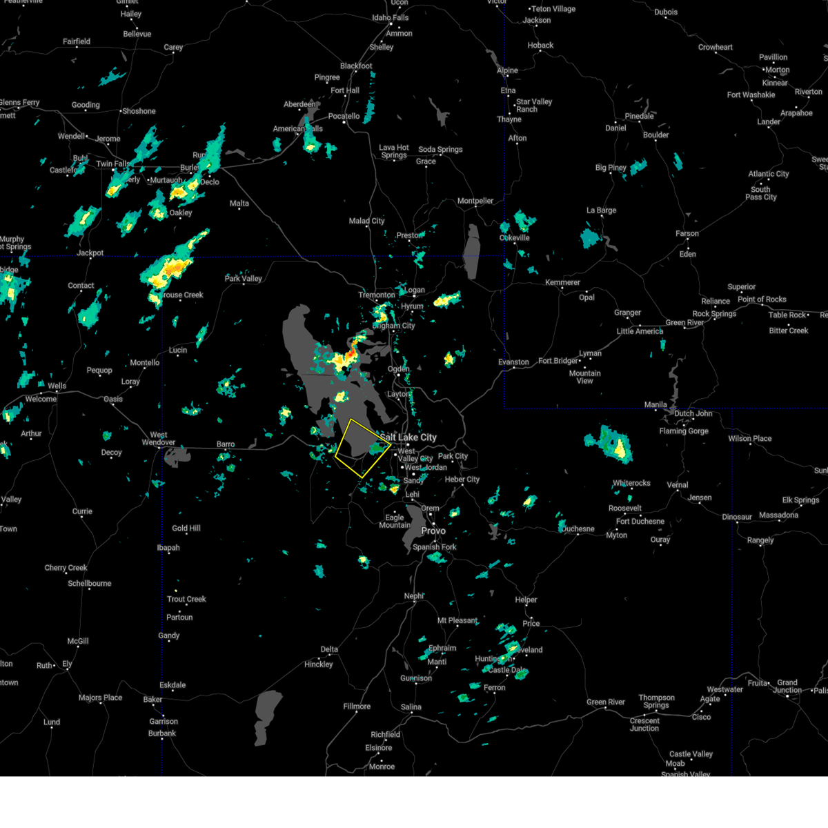
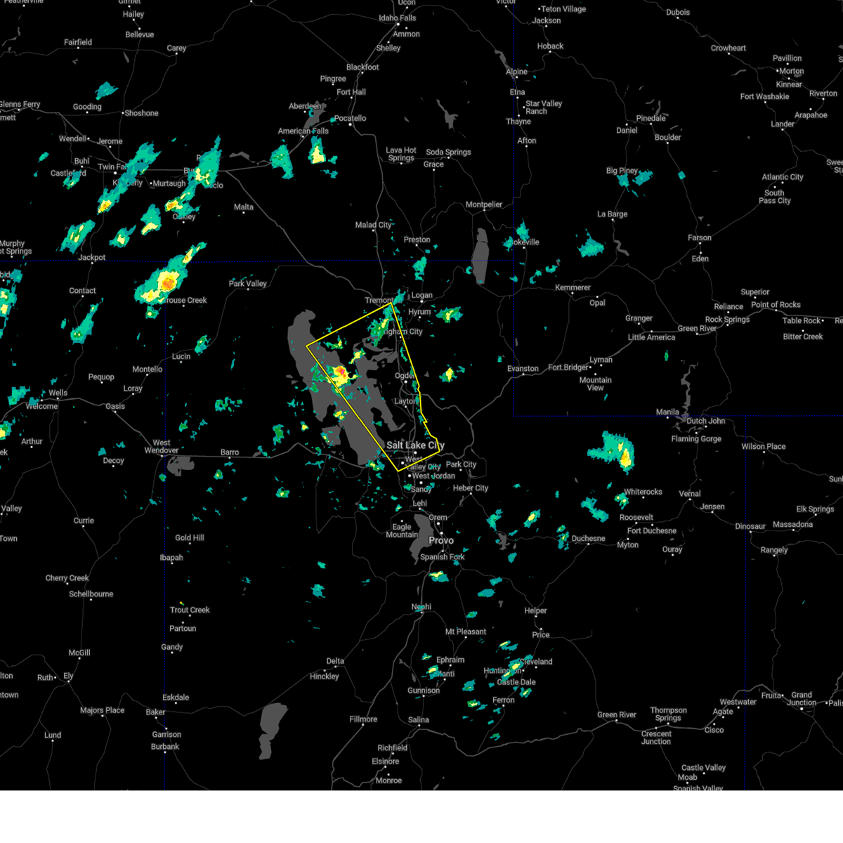
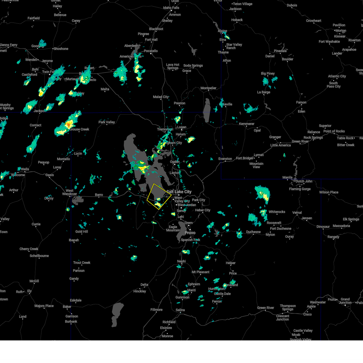
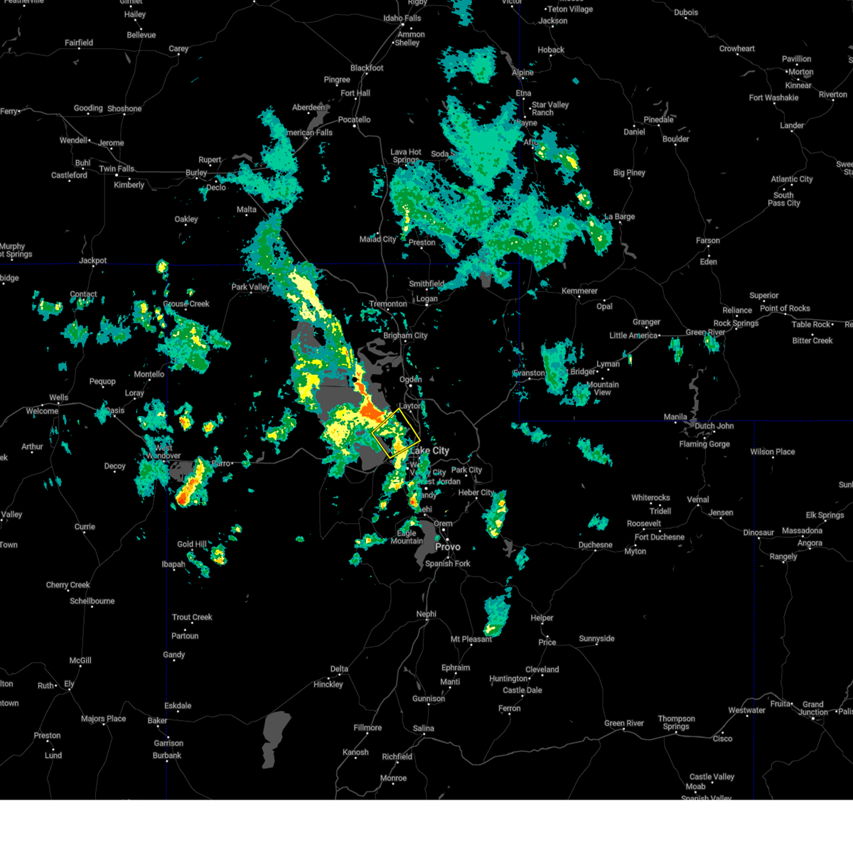
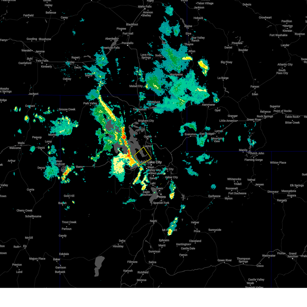
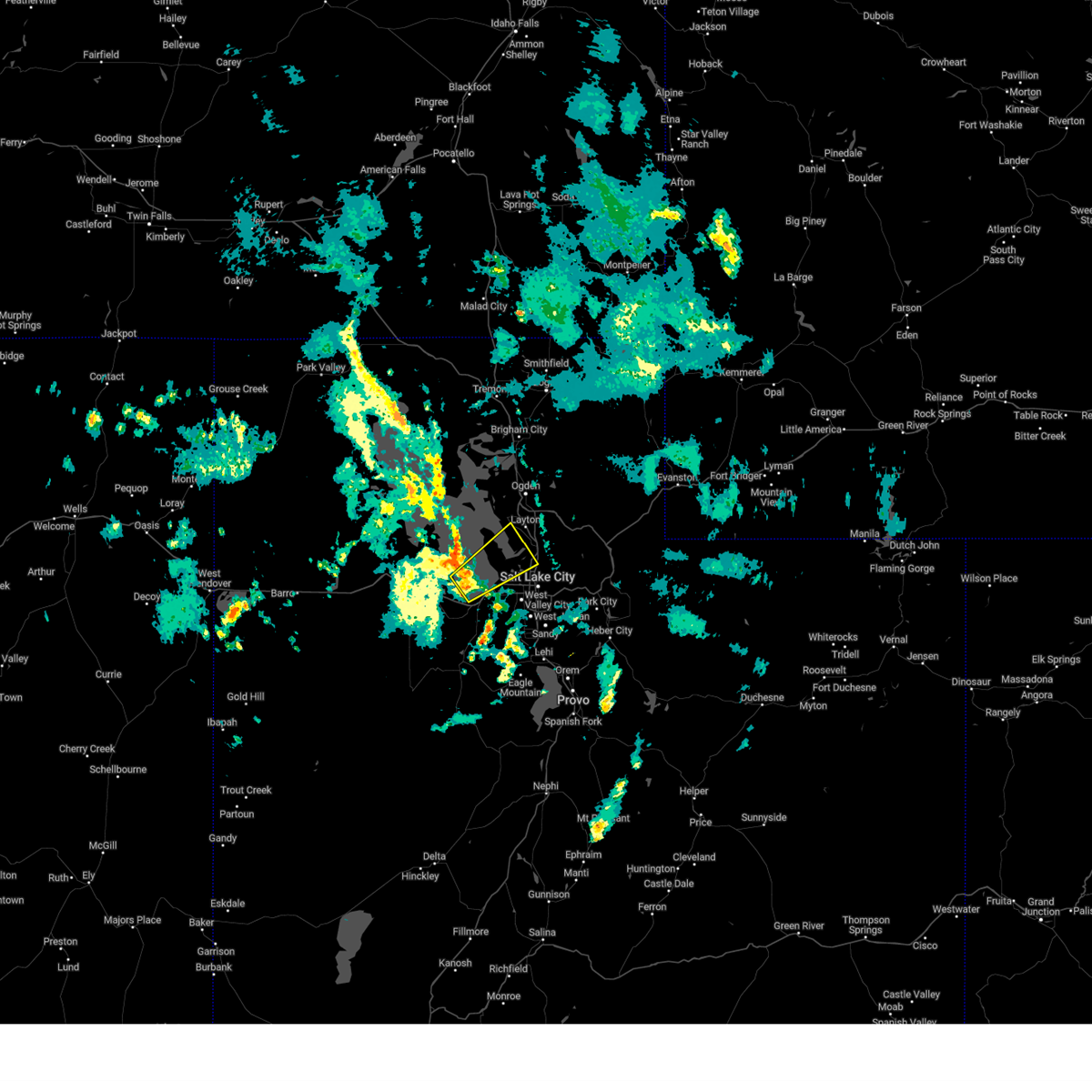
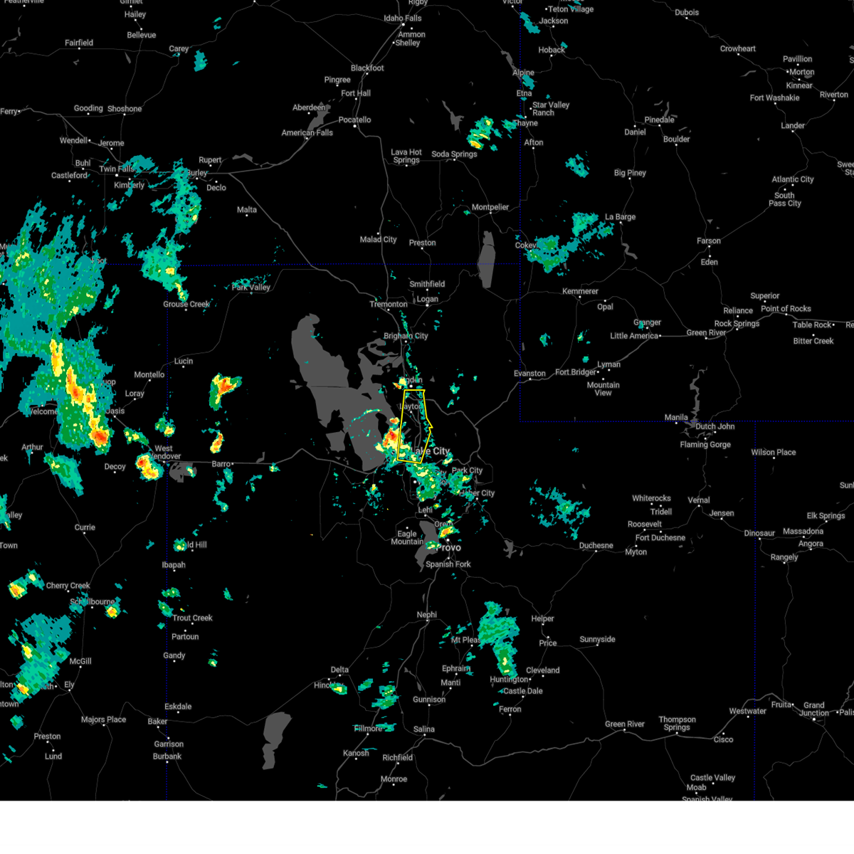
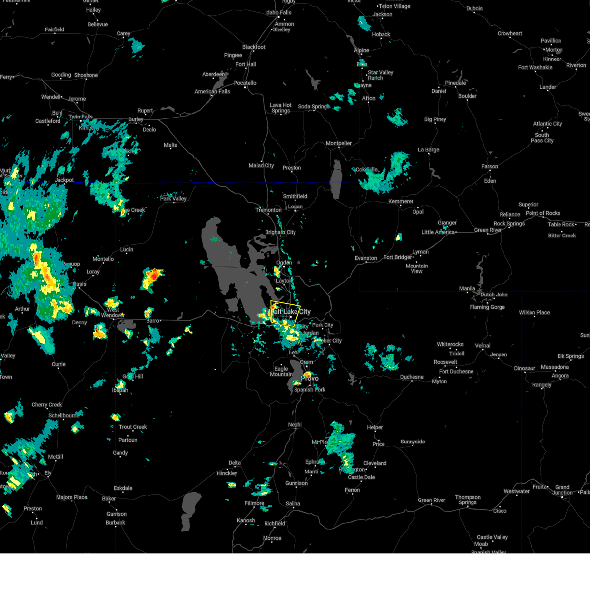
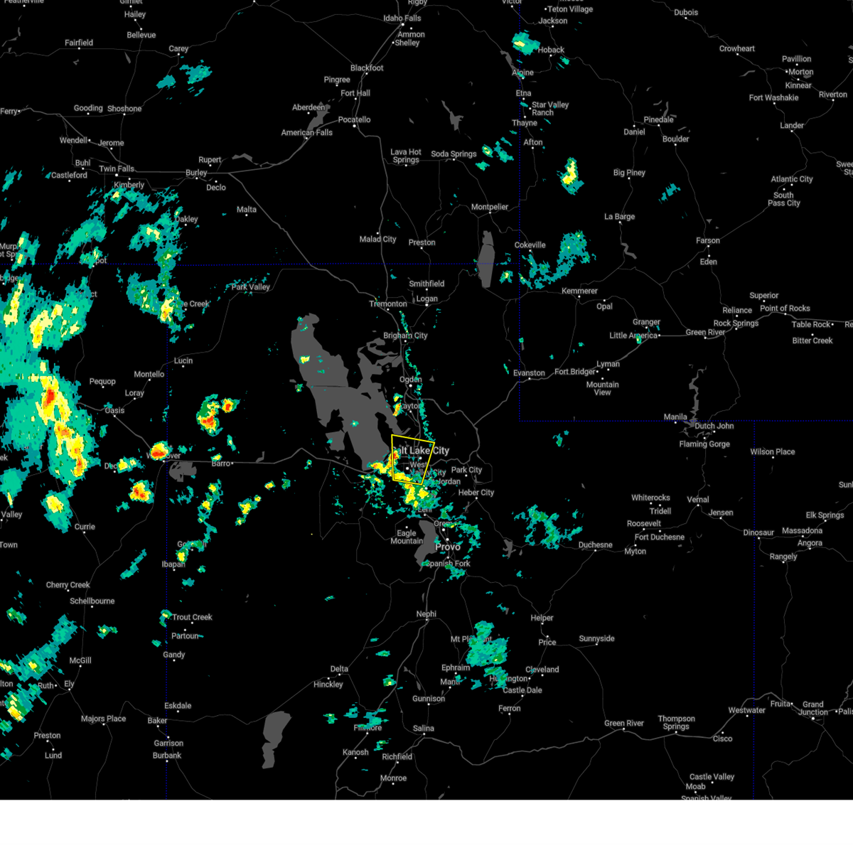
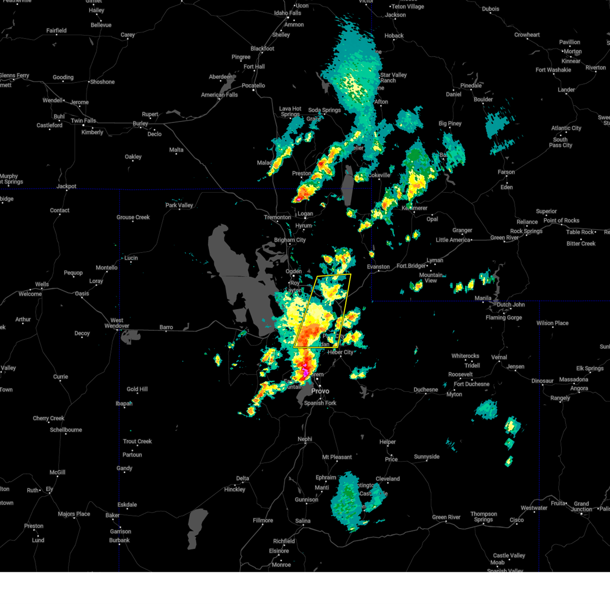
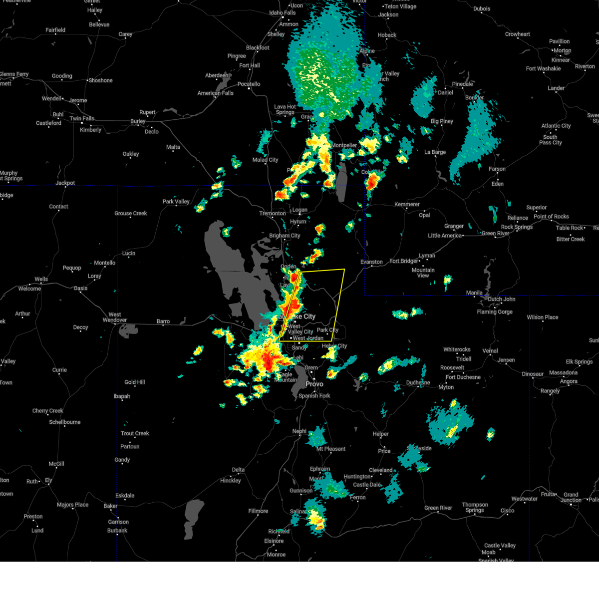
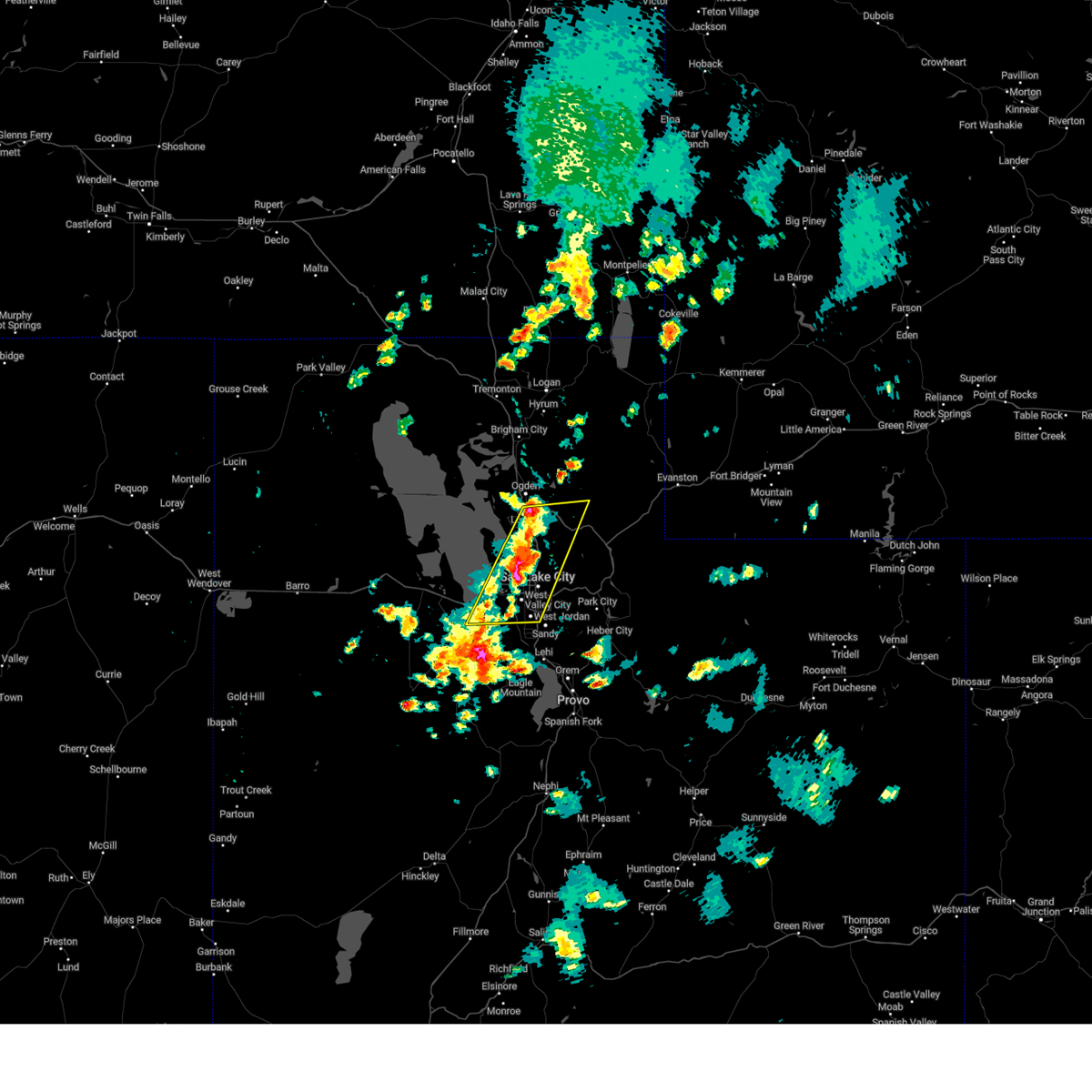
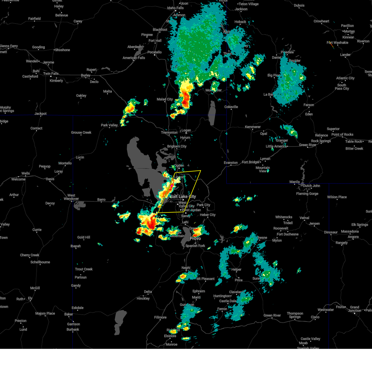
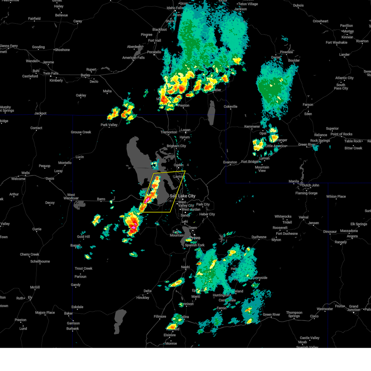
Hail Map for Salt Lake City, UT
The Salt Lake City, UT area has had 13 reports of on-the-ground hail by trained spotters, and has been under severe weather warnings 23 times during the past 12 months. Doppler radar has detected hail at or near Salt Lake City, UT on 22 occasions, including 3 occasions during the past year.
| Name: | Salt Lake City, UT |
| Where Located: | 1.2 miles W of Salt Lake City, UT |
| Map: | Google Map for Salt Lake City, UT |
| Population: | 186440 |
| Housing Units: | 80724 |
| More Info: | Search Google for Salt Lake City, UT |
5
The Top Recent Hail Date for Salt Lake City, UT is Friday, June 21, 2024 (1st out of 22)

Hail and Wind Damage Spotted near Salt Lake City, UT
| Date / Time | Report Details |
|---|---|
| 5/17/2025 4:46 PM MDT | Salt lake city intl airport asos - 4226 ft in salt lake county UT, 2.3 miles ESE of Salt Lake City, UT |
| 5/11/2025 3:45 PM MDT |
 At 344 pm mdt, severe thunderstorms were located along a line extending from 9 miles south of snowville to near east canyon state park, moving east at 45 mph (radar indicated). Hazards include 70 mph wind gusts. Expect considerable tree damage. damage is likely to mobile homes, roofs, and outbuildings. Locations impacted include, salt lake city, west valley city, ogden, layton, murray, bountiful, tooele, farmington, brigham city, grantsville, hill air force base, west jordan, taylorsville, roy, clearfield, kaysville, syracuse, south salt lake, clinton, and north ogden. At 344 pm mdt, severe thunderstorms were located along a line extending from 9 miles south of snowville to near east canyon state park, moving east at 45 mph (radar indicated). Hazards include 70 mph wind gusts. Expect considerable tree damage. damage is likely to mobile homes, roofs, and outbuildings. Locations impacted include, salt lake city, west valley city, ogden, layton, murray, bountiful, tooele, farmington, brigham city, grantsville, hill air force base, west jordan, taylorsville, roy, clearfield, kaysville, syracuse, south salt lake, clinton, and north ogden.
|
| 5/11/2025 3:14 PM MDT |
 Svrslc the national weather service in salt lake city has issued a * severe thunderstorm warning for, western weber county in northern utah, central box elder county in northern utah, northern salt lake county in northern utah, davis county in northern utah, west central morgan county in northern utah, northeastern tooele county in northern utah, * until 400 pm mdt. * at 311 pm mdt, severe thunderstorms were located along a line extending from 20 miles northwest of great salt lake north of the causeway to salt lake valley, moving northeast at 40 mph. widespread gusts in excess of 60 mph have been observed, including isolated gusts up to 75 mph (radar indicated). Hazards include 70 mph wind gusts. Expect considerable tree damage. Damage is likely to mobile homes, roofs, and outbuildings. Svrslc the national weather service in salt lake city has issued a * severe thunderstorm warning for, western weber county in northern utah, central box elder county in northern utah, northern salt lake county in northern utah, davis county in northern utah, west central morgan county in northern utah, northeastern tooele county in northern utah, * until 400 pm mdt. * at 311 pm mdt, severe thunderstorms were located along a line extending from 20 miles northwest of great salt lake north of the causeway to salt lake valley, moving northeast at 40 mph. widespread gusts in excess of 60 mph have been observed, including isolated gusts up to 75 mph (radar indicated). Hazards include 70 mph wind gusts. Expect considerable tree damage. Damage is likely to mobile homes, roofs, and outbuildings.
|
| 5/11/2025 3:04 PM MDT |
 At 304 pm mdt, a severe thunderstorm was located 7 miles southwest of syracuse, or 11 miles southwest of layton, moving northeast at 45 mph (radar indicated). Hazards include 60 mph wind gusts. Expect damage to roofs, siding, and trees. Locations impacted include, salt lake city, west valley city, sandy, murray, tooele, grantsville, dugway english village, west jordan, taylorsville, south jordan, draper, riverton, midvale, herriman, stansbury park, bluffdale, ophir, camp williams, kearns, and tooele army depot. At 304 pm mdt, a severe thunderstorm was located 7 miles southwest of syracuse, or 11 miles southwest of layton, moving northeast at 45 mph (radar indicated). Hazards include 60 mph wind gusts. Expect damage to roofs, siding, and trees. Locations impacted include, salt lake city, west valley city, sandy, murray, tooele, grantsville, dugway english village, west jordan, taylorsville, south jordan, draper, riverton, midvale, herriman, stansbury park, bluffdale, ophir, camp williams, kearns, and tooele army depot.
|
| 5/11/2025 2:46 PM MDT |
 The storms which prompted the warning have moved out of the area. therefore, the warning has been allowed to expire. a severe thunderstorm watch remains in effect until 800 pm mdt for northern utah. The storms which prompted the warning have moved out of the area. therefore, the warning has been allowed to expire. a severe thunderstorm watch remains in effect until 800 pm mdt for northern utah.
|
| 5/11/2025 2:38 PM MDT |
 Svrslc the national weather service in salt lake city has issued a * severe thunderstorm warning for, southwestern salt lake county in northern utah, southwestern davis county in northern utah, western utah county in northern utah, southeastern tooele county in northern utah, * until 315 pm mdt. * at 237 pm mdt, a severe thunderstorm was located 11 miles northwest of stansbury park, or 13 miles north of grantsville, moving northeast at 45 mph (radar indicated). Hazards include 60 mph wind gusts. expect damage to roofs, siding, and trees Svrslc the national weather service in salt lake city has issued a * severe thunderstorm warning for, southwestern salt lake county in northern utah, southwestern davis county in northern utah, western utah county in northern utah, southeastern tooele county in northern utah, * until 315 pm mdt. * at 237 pm mdt, a severe thunderstorm was located 11 miles northwest of stansbury park, or 13 miles north of grantsville, moving northeast at 45 mph (radar indicated). Hazards include 60 mph wind gusts. expect damage to roofs, siding, and trees
|
| 5/11/2025 2:00 PM MDT |
 Svrslc the national weather service in salt lake city has issued a * severe thunderstorm warning for, weber county in northern utah, cache county in northern utah, northeastern box elder county in northern utah, western rich county in northern utah, northwestern wasatch county in northern utah, salt lake county in northern utah, eastern davis county in northern utah, morgan county in northern utah, western summit county in northern utah, northwestern utah county in northern utah, * until 245 pm mdt. * at 159 pm mdt, severe thunderstorms were located along a line extending from near riverside to near bluffdale, moving northeast at 40 mph. gusts up to 70 mph have been observed (radar indicated). Hazards include 70 mph wind gusts. Expect considerable tree damage. Damage is likely to mobile homes, roofs, and outbuildings. Svrslc the national weather service in salt lake city has issued a * severe thunderstorm warning for, weber county in northern utah, cache county in northern utah, northeastern box elder county in northern utah, western rich county in northern utah, northwestern wasatch county in northern utah, salt lake county in northern utah, eastern davis county in northern utah, morgan county in northern utah, western summit county in northern utah, northwestern utah county in northern utah, * until 245 pm mdt. * at 159 pm mdt, severe thunderstorms were located along a line extending from near riverside to near bluffdale, moving northeast at 40 mph. gusts up to 70 mph have been observed (radar indicated). Hazards include 70 mph wind gusts. Expect considerable tree damage. Damage is likely to mobile homes, roofs, and outbuildings.
|
| 5/11/2025 1:43 PM MDT |
 At 143 pm mdt, severe thunderstorms were located along a line extending from 9 miles northeast of great salt lake north of the causeway to salt lake city, moving northeast at 35 mph (radar indicated). Hazards include 70 mph wind gusts. Expect considerable tree damage. damage is likely to mobile homes, roofs, and outbuildings. Locations impacted include, salt lake city, west valley city, ogden, layton, bountiful, farmington, brigham city, tremonton, hill air force base, taylorsville, roy, clearfield, kaysville, syracuse, south salt lake, clinton, north ogden, south ogden, north salt lake, and centerville. At 143 pm mdt, severe thunderstorms were located along a line extending from 9 miles northeast of great salt lake north of the causeway to salt lake city, moving northeast at 35 mph (radar indicated). Hazards include 70 mph wind gusts. Expect considerable tree damage. damage is likely to mobile homes, roofs, and outbuildings. Locations impacted include, salt lake city, west valley city, ogden, layton, bountiful, farmington, brigham city, tremonton, hill air force base, taylorsville, roy, clearfield, kaysville, syracuse, south salt lake, clinton, north ogden, south ogden, north salt lake, and centerville.
|
| 5/11/2025 1:28 PM MDT |
 The storm which prompted the warning has moved out of the area. therefore, the warning will be allowed to expire. however gusty winds are still possible with this thunderstorm. a severe thunderstorm watch remains in effect until 800 pm mdt for northern utah. remember, a severe thunderstorm warning still remains in effect for salt lake and davis counties. The storm which prompted the warning has moved out of the area. therefore, the warning will be allowed to expire. however gusty winds are still possible with this thunderstorm. a severe thunderstorm watch remains in effect until 800 pm mdt for northern utah. remember, a severe thunderstorm warning still remains in effect for salt lake and davis counties.
|
| 5/11/2025 1:25 PM MDT |
 Svrslc the national weather service in salt lake city has issued a * severe thunderstorm warning for, western weber county in northern utah, southeastern box elder county in northern utah, northern salt lake county in northern utah, davis county in northern utah, * until 200 pm mdt. * at 124 pm mdt, severe thunderstorms were located along a line extending from near great salt lake north of the causeway to near magna, moving northeast at 35 mph. multiple gusts in excess of 60 mph have been observed (radar indicated). Hazards include 60 mph wind gusts. expect damage to roofs, siding, and trees Svrslc the national weather service in salt lake city has issued a * severe thunderstorm warning for, western weber county in northern utah, southeastern box elder county in northern utah, northern salt lake county in northern utah, davis county in northern utah, * until 200 pm mdt. * at 124 pm mdt, severe thunderstorms were located along a line extending from near great salt lake north of the causeway to near magna, moving northeast at 35 mph. multiple gusts in excess of 60 mph have been observed (radar indicated). Hazards include 60 mph wind gusts. expect damage to roofs, siding, and trees
|
| 5/11/2025 1:17 PM MDT |
 At 116 pm mdt, a severe thunderstorm was located 8 miles northwest of magna, or 12 miles northwest of west valley city, moving northeast at 40 mph. gusts to 65 and 63 mph have been reported (radar indicated). Hazards include 65 mph wind gusts. Expect damage to roofs, siding, and trees. Locations impacted include, salt lake city, tooele, stansbury park, magna, great salt lake south of the causeway, lake point, and erda. At 116 pm mdt, a severe thunderstorm was located 8 miles northwest of magna, or 12 miles northwest of west valley city, moving northeast at 40 mph. gusts to 65 and 63 mph have been reported (radar indicated). Hazards include 65 mph wind gusts. Expect damage to roofs, siding, and trees. Locations impacted include, salt lake city, tooele, stansbury park, magna, great salt lake south of the causeway, lake point, and erda.
|
| 5/11/2025 12:59 PM MDT |
 Svrslc the national weather service in salt lake city has issued a * severe thunderstorm warning for, west central salt lake county in northern utah, southwestern davis county in northern utah, east central tooele county in northern utah, * until 130 pm mdt. * at 1258 pm mdt, a severe thunderstorm was located near stansbury park, or near grantsville, moving northeast at 40 mph. gusts to 65 mph have been observed (radar indicated). Hazards include 65 mph wind gusts. expect damage to roofs, siding, and trees Svrslc the national weather service in salt lake city has issued a * severe thunderstorm warning for, west central salt lake county in northern utah, southwestern davis county in northern utah, east central tooele county in northern utah, * until 130 pm mdt. * at 1258 pm mdt, a severe thunderstorm was located near stansbury park, or near grantsville, moving northeast at 40 mph. gusts to 65 mph have been observed (radar indicated). Hazards include 65 mph wind gusts. expect damage to roofs, siding, and trees
|
| 9/17/2024 12:18 PM MDT |
 The storm which prompted the warning has moved out of the area. therefore, the warning has been allowed to expire. a new severe thunderstorm warning has been issued for davis county and northwestern utah county. The storm which prompted the warning has moved out of the area. therefore, the warning has been allowed to expire. a new severe thunderstorm warning has been issued for davis county and northwestern utah county.
|
| 9/17/2024 12:02 PM MDT |
 At 1201 pm mdt, a severe thunderstorm was located 7 miles northwest of salt lake city international airport, or 10 miles northwest of salt lake city, moving northeast at 40 mph (radar indicated). Hazards include 70 mph wind gusts. Expect considerable tree damage. damage is likely to mobile homes, roofs, and outbuildings. locations impacted include, salt lake city, syracuse, north salt lake, woods cross, west bountiful, great salt lake south of the causeway, and antelope island state park. this includes the following highways, interstate 15 near mile marker 316. Interstate 80 in utah between mile markers 107 and 108. At 1201 pm mdt, a severe thunderstorm was located 7 miles northwest of salt lake city international airport, or 10 miles northwest of salt lake city, moving northeast at 40 mph (radar indicated). Hazards include 70 mph wind gusts. Expect considerable tree damage. damage is likely to mobile homes, roofs, and outbuildings. locations impacted include, salt lake city, syracuse, north salt lake, woods cross, west bountiful, great salt lake south of the causeway, and antelope island state park. this includes the following highways, interstate 15 near mile marker 316. Interstate 80 in utah between mile markers 107 and 108.
|
| 9/17/2024 12:02 PM MDT |
 the severe thunderstorm warning has been cancelled and is no longer in effect the severe thunderstorm warning has been cancelled and is no longer in effect
|
| 9/17/2024 11:50 AM MDT |
 Svrslc the national weather service in salt lake city has issued a * severe thunderstorm warning for, central davis county in northern utah, northwestern salt lake county in northern utah, northeastern tooele county in northern utah, * until 1215 pm mdt. * at 1150 am mdt, a severe thunderstorm was located 10 miles northwest of magna, or 14 miles northwest of west valley city, moving northeast at 40 mph (radar indicated). Hazards include 70 mph wind gusts. Expect considerable tree damage. Damage is likely to mobile homes, roofs, and outbuildings. Svrslc the national weather service in salt lake city has issued a * severe thunderstorm warning for, central davis county in northern utah, northwestern salt lake county in northern utah, northeastern tooele county in northern utah, * until 1215 pm mdt. * at 1150 am mdt, a severe thunderstorm was located 10 miles northwest of magna, or 14 miles northwest of west valley city, moving northeast at 40 mph (radar indicated). Hazards include 70 mph wind gusts. Expect considerable tree damage. Damage is likely to mobile homes, roofs, and outbuildings.
|
| 9/15/2024 5:44 PM MDT |
 Svrslc the national weather service in salt lake city has issued a * severe thunderstorm warning for, south central weber county in northern utah, eastern davis county in northern utah, north central salt lake county in northern utah, * until 615 pm mdt. * at 544 pm mdt, a severe thunderstorm was located near farmington, moving north at 45 mph (radar indicated). Hazards include 60 mph wind gusts. expect damage to roofs, siding, and trees Svrslc the national weather service in salt lake city has issued a * severe thunderstorm warning for, south central weber county in northern utah, eastern davis county in northern utah, north central salt lake county in northern utah, * until 615 pm mdt. * at 544 pm mdt, a severe thunderstorm was located near farmington, moving north at 45 mph (radar indicated). Hazards include 60 mph wind gusts. expect damage to roofs, siding, and trees
|
| 9/15/2024 5:40 PM MDT | Measured by the udot rwis sensor at the intersection of interstate 80 and interstate 21 in salt lake county UT, 2.3 miles ESE of Salt Lake City, UT |
| 9/15/2024 5:38 PM MDT | Measured at the salt lake city international airport aso in salt lake county UT, 3.3 miles ESE of Salt Lake City, UT |
| 9/15/2024 5:36 PM MDT |
 At 536 pm mdt, a severe thunderstorm was located over west valley city, moving north at 25 mph (radar indicated). Hazards include 60 mph wind gusts. Expect damage to roofs, siding, and trees. locations impacted include, salt lake city, west valley city, murray, bountiful, taylorsville, south salt lake, north salt lake, woods cross, millcreek, salt lake city international airport, magna, canyon rim, east millcreek, sugarhouse, and university of utah. this includes the following highways, interstate 15 between mile markers 302 and 316. Interstate 80 in utah between mile markers 109 and 126. At 536 pm mdt, a severe thunderstorm was located over west valley city, moving north at 25 mph (radar indicated). Hazards include 60 mph wind gusts. Expect damage to roofs, siding, and trees. locations impacted include, salt lake city, west valley city, murray, bountiful, taylorsville, south salt lake, north salt lake, woods cross, millcreek, salt lake city international airport, magna, canyon rim, east millcreek, sugarhouse, and university of utah. this includes the following highways, interstate 15 between mile markers 302 and 316. Interstate 80 in utah between mile markers 109 and 126.
|
| 9/15/2024 5:22 PM MDT |
 Svrslc the national weather service in salt lake city has issued a * severe thunderstorm warning for, southeastern davis county in northern utah, central salt lake county in northern utah, * until 545 pm mdt. * at 522 pm mdt, a severe thunderstorm was located over oquirrh, or near west valley city, moving north at 25 mph (radar indicated). Hazards include 60 mph wind gusts. expect damage to roofs, siding, and trees Svrslc the national weather service in salt lake city has issued a * severe thunderstorm warning for, southeastern davis county in northern utah, central salt lake county in northern utah, * until 545 pm mdt. * at 522 pm mdt, a severe thunderstorm was located over oquirrh, or near west valley city, moving north at 25 mph (radar indicated). Hazards include 60 mph wind gusts. expect damage to roofs, siding, and trees
|
| 8/17/2024 11:50 AM MDT | Mesonet station ut107 i-80 at mp 10 in salt lake county UT, 12.6 miles E of Salt Lake City, UT |
| 8/13/2024 6:12 PM MDT |
 At 609 pm mdt, severe thunderstorms were located along a line extending from 15 miles northeast of morgan to mill creek canyon, moving east at 25 mph (public). Hazards include 60 mph wind gusts. Possible damage to roofs, siding, and trees. locations impacted include, salt lake city, sandy, murray, bountiful, park city, morgan, coalville, west jordan, taylorsville, cottonwood heights, midvale, holladay, south salt lake, summit park, millcreek, wanship, south snyderville basin, mill creek canyon, cottonwood west, and east canyon state park. this includes the following highways, interstate 15 between mile markers 296 and 305. interstate 84 between mile markers 99 and 119. interstate 80 in utah between mile markers 123 and 173. Us route 40 between mile markers 0 and 8. At 609 pm mdt, severe thunderstorms were located along a line extending from 15 miles northeast of morgan to mill creek canyon, moving east at 25 mph (public). Hazards include 60 mph wind gusts. Possible damage to roofs, siding, and trees. locations impacted include, salt lake city, sandy, murray, bountiful, park city, morgan, coalville, west jordan, taylorsville, cottonwood heights, midvale, holladay, south salt lake, summit park, millcreek, wanship, south snyderville basin, mill creek canyon, cottonwood west, and east canyon state park. this includes the following highways, interstate 15 between mile markers 296 and 305. interstate 84 between mile markers 99 and 119. interstate 80 in utah between mile markers 123 and 173. Us route 40 between mile markers 0 and 8.
|
| 8/13/2024 5:26 PM MDT |
 Svrslc the national weather service in salt lake city has issued a * severe thunderstorm warning for, southeastern weber county in northern utah, northwestern wasatch county in northern utah, eastern davis county in northern utah, central salt lake county in northern utah, morgan county in northern utah, western summit county in northern utah, * until 615 pm mdt. * at 524 pm mdt, severe thunderstorms were located along a line extending from 6 miles east of uintah to oquirrh, moving east at 30 mph (public). Hazards include 60 mph wind gusts and quarter size hail. hail damage to vehicles is possible, as well as wind damage to roofs, siding, and trees Svrslc the national weather service in salt lake city has issued a * severe thunderstorm warning for, southeastern weber county in northern utah, northwestern wasatch county in northern utah, eastern davis county in northern utah, central salt lake county in northern utah, morgan county in northern utah, western summit county in northern utah, * until 615 pm mdt. * at 524 pm mdt, severe thunderstorms were located along a line extending from 6 miles east of uintah to oquirrh, moving east at 30 mph (public). Hazards include 60 mph wind gusts and quarter size hail. hail damage to vehicles is possible, as well as wind damage to roofs, siding, and trees
|
| 8/13/2024 5:16 PM MDT |
 At 516 pm mdt, severe thunderstorms were located along a line extending from near kaysville to near bingham canyon mine, moving east at 25 mph (radar indicated). Hazards include 60 mph wind gusts and quarter size hail. Hail damage to vehicles is possible, as well as wind damage to roofs, siding, and trees locations impacted include, salt lake city, west valley city, sandy, layton, murray, bountiful, tooele, farmington, morgan, hill air force base, west jordan, taylorsville, south jordan, clearfield, midvale, kaysville, holladay, syracuse, south salt lake, and south ogden. this includes the following highways, interstate 15 between mile markers 296 and 335. interstate 84 between mile markers 84 and 106. Interstate 80 in utah between mile markers 96 and 127. At 516 pm mdt, severe thunderstorms were located along a line extending from near kaysville to near bingham canyon mine, moving east at 25 mph (radar indicated). Hazards include 60 mph wind gusts and quarter size hail. Hail damage to vehicles is possible, as well as wind damage to roofs, siding, and trees locations impacted include, salt lake city, west valley city, sandy, layton, murray, bountiful, tooele, farmington, morgan, hill air force base, west jordan, taylorsville, south jordan, clearfield, midvale, kaysville, holladay, syracuse, south salt lake, and south ogden. this includes the following highways, interstate 15 between mile markers 296 and 335. interstate 84 between mile markers 84 and 106. Interstate 80 in utah between mile markers 96 and 127.
|
| 8/13/2024 4:59 PM MDT |
 Svrslc the national weather service in salt lake city has issued a * severe thunderstorm warning for, south central weber county in northern utah, eastern davis county in northern utah, northwestern salt lake county in northern utah, southwestern morgan county in northern utah, northeastern tooele county in northern utah, * until 530 pm mdt. * at 457 pm mdt, severe thunderstorms were located along a line extending from near layton to stansbury park, moving east at 25 mph (radar indicated). Hazards include 60 mph wind gusts and quarter size hail. the best chance of quarter sized hail is from bountiful to kaysville. hail damage to vehicles is possible, as well as wind damage to roofs, siding, and trees Svrslc the national weather service in salt lake city has issued a * severe thunderstorm warning for, south central weber county in northern utah, eastern davis county in northern utah, northwestern salt lake county in northern utah, southwestern morgan county in northern utah, northeastern tooele county in northern utah, * until 530 pm mdt. * at 457 pm mdt, severe thunderstorms were located along a line extending from near layton to stansbury park, moving east at 25 mph (radar indicated). Hazards include 60 mph wind gusts and quarter size hail. the best chance of quarter sized hail is from bountiful to kaysville. hail damage to vehicles is possible, as well as wind damage to roofs, siding, and trees
|
| 8/13/2024 4:22 PM MDT |
 Svrslc the national weather service in salt lake city has issued a * severe thunderstorm warning for, southwestern weber county in northern utah, southeastern box elder county in northern utah, davis county in northern utah, northwestern salt lake county in northern utah, northwestern morgan county in northern utah, northeastern tooele county in northern utah, * until 500 pm mdt. * at 421 pm mdt, severe thunderstorms were located along a line extending from near great salt lake south of the causeway to 9 miles west of grantsville, moving east at 25 mph (radar indicated). Hazards include 60 mph wind gusts and quarter size hail. the best chance of quarter sized hail is currently near the southern end of the great salt lake. hail damage to vehicles is possible, as well as wind damage to roofs, siding, and trees Svrslc the national weather service in salt lake city has issued a * severe thunderstorm warning for, southwestern weber county in northern utah, southeastern box elder county in northern utah, davis county in northern utah, northwestern salt lake county in northern utah, northwestern morgan county in northern utah, northeastern tooele county in northern utah, * until 500 pm mdt. * at 421 pm mdt, severe thunderstorms were located along a line extending from near great salt lake south of the causeway to 9 miles west of grantsville, moving east at 25 mph (radar indicated). Hazards include 60 mph wind gusts and quarter size hail. the best chance of quarter sized hail is currently near the southern end of the great salt lake. hail damage to vehicles is possible, as well as wind damage to roofs, siding, and trees
|
| 8/9/2024 5:50 PM MDT | Mesonet station uupt1 uu portable trailer in salt lake county UT, 6.6 miles SE of Salt Lake City, UT |
| 8/5/2024 4:21 PM MDT | Large section of tree roughly 12 inches or so in diameter split from trunk. per pictures... this fell mostly into yard... but some minor gutter damage to house was repo in salt lake county UT, 4.9 miles NW of Salt Lake City, UT |
| 7/13/2024 1:58 PM MDT | Center field observatio in salt lake county UT, 5.1 miles SE of Salt Lake City, UT |
| 5/28/2024 3:50 PM MDT | Mesonet station ut215 i-215 at i-8 in salt lake county UT, 2.3 miles ESE of Salt Lake City, UT |
| 8/17/2023 5:15 PM MDT |
 At 515 pm mdt, a severe thunderstorm was located over stansbury park, or 8 miles northeast of grantsville, moving northeast at 20 mph (radar indicated). Hazards include 60 mph wind gusts and penny size hail. expect damage to roofs, siding, and trees At 515 pm mdt, a severe thunderstorm was located over stansbury park, or 8 miles northeast of grantsville, moving northeast at 20 mph (radar indicated). Hazards include 60 mph wind gusts and penny size hail. expect damage to roofs, siding, and trees
|
| 8/17/2023 3:51 PM MDT |
 The severe thunderstorm warning for north central salt lake, southeastern davis and southwestern morgan counties will expire at 400 pm mdt, the storm which prompted the warning has weakened below severe limits, and no longer poses an immediate threat to life or property. therefore, the warning will be allowed to expire. The severe thunderstorm warning for north central salt lake, southeastern davis and southwestern morgan counties will expire at 400 pm mdt, the storm which prompted the warning has weakened below severe limits, and no longer poses an immediate threat to life or property. therefore, the warning will be allowed to expire.
|
| 8/17/2023 3:29 PM MDT |
 At 328 pm mdt, a severe thunderstorm was located over salt lake city international airport, or over salt lake city, moving northeast at 20 mph (radar indicated). Hazards include 70 mph wind gusts and nickel size hail. Expect considerable tree damage. damage is likely to mobile homes, roofs, and outbuildings. locations impacted include, salt lake city, bountiful, farmington, kaysville, north salt lake, centerville, woods cross, west bountiful, salt lake city international airport, emigration canyon and university of utah. this includes the following highways, interstate 15 between mile markers 307 and 327. interstate 80 in utah between mile markers 113 and 119. thunderstorm damage threat, considerable hail threat, radar indicated max hail size, 0. 88 in wind threat, observed max wind gust, 70 mph. At 328 pm mdt, a severe thunderstorm was located over salt lake city international airport, or over salt lake city, moving northeast at 20 mph (radar indicated). Hazards include 70 mph wind gusts and nickel size hail. Expect considerable tree damage. damage is likely to mobile homes, roofs, and outbuildings. locations impacted include, salt lake city, bountiful, farmington, kaysville, north salt lake, centerville, woods cross, west bountiful, salt lake city international airport, emigration canyon and university of utah. this includes the following highways, interstate 15 between mile markers 307 and 327. interstate 80 in utah between mile markers 113 and 119. thunderstorm damage threat, considerable hail threat, radar indicated max hail size, 0. 88 in wind threat, observed max wind gust, 70 mph.
|
| 8/17/2023 3:27 PM MDT | Asos station kslc salt lake city intl arp in salt lake county UT, 3.3 miles ESE of Salt Lake City, UT |
| 8/17/2023 3:19 PM MDT |
 At 319 pm mdt, a severe thunderstorm was located over salt lake city international airport, or near salt lake city, moving northeast at 20 mph (radar indicated). Hazards include 60 mph wind gusts and nickel size hail. expect damage to roofs, siding, and trees At 319 pm mdt, a severe thunderstorm was located over salt lake city international airport, or near salt lake city, moving northeast at 20 mph (radar indicated). Hazards include 60 mph wind gusts and nickel size hail. expect damage to roofs, siding, and trees
|
| 8/3/2023 9:38 PM MDT |
 The severe thunderstorm warning for central salt lake and northern utah counties will expire at 945 pm mdt, the storm which prompted the warning has weakened below severe limits, and has exited the warned area. therefore, the warning will be allowed to expire. The severe thunderstorm warning for central salt lake and northern utah counties will expire at 945 pm mdt, the storm which prompted the warning has weakened below severe limits, and has exited the warned area. therefore, the warning will be allowed to expire.
|
| 8/3/2023 9:23 PM MDT |
 At 922 pm mdt, a severe thunderstorm was located over taylorsville, or near murray, moving north at 10 mph (radar indicated). Hazards include 60 mph wind gusts and quarter size hail. Hail damage to vehicles is expected. expect wind damage to roofs, siding, and trees. locations impacted include, sandy, murray, south jordan, draper, cottonwood heights, midvale, holladay, south salt lake, millcreek, mount olympus, little cottonwood creek valley, granite, east millcreek, cottonwood west, canyon rim, mill creek canyon, little cottonwood canyon, big cottonwood canyon and sugarhouse. this includes interstate 15 between mile markers 291 and 296, near mile marker 298, and between mile markers 300 and 301. hail threat, radar indicated max hail size, 1. 00 in wind threat, radar indicated max wind gust, 60 mph. At 922 pm mdt, a severe thunderstorm was located over taylorsville, or near murray, moving north at 10 mph (radar indicated). Hazards include 60 mph wind gusts and quarter size hail. Hail damage to vehicles is expected. expect wind damage to roofs, siding, and trees. locations impacted include, sandy, murray, south jordan, draper, cottonwood heights, midvale, holladay, south salt lake, millcreek, mount olympus, little cottonwood creek valley, granite, east millcreek, cottonwood west, canyon rim, mill creek canyon, little cottonwood canyon, big cottonwood canyon and sugarhouse. this includes interstate 15 between mile markers 291 and 296, near mile marker 298, and between mile markers 300 and 301. hail threat, radar indicated max hail size, 1. 00 in wind threat, radar indicated max wind gust, 60 mph.
|
| 8/3/2023 8:58 PM MDT |
 At 858 pm mdt, a severe thunderstorm was located over south jordan, or near sandy, moving north at 10 mph (radar indicated). Hazards include 60 mph wind gusts and quarter size hail. Hail damage to vehicles is expected. Expect wind damage to roofs, siding, and trees. At 858 pm mdt, a severe thunderstorm was located over south jordan, or near sandy, moving north at 10 mph (radar indicated). Hazards include 60 mph wind gusts and quarter size hail. Hail damage to vehicles is expected. Expect wind damage to roofs, siding, and trees.
|
| 8/2/2023 4:36 PM MDT |
 At 435 pm mdt, severe thunderstorms were located along a line extending from 11 miles north of delle to near great salt lake south of the causeway to kaysville, moving north at 35 mph (radar indicated). Hazards include 60 mph wind gusts and penny size hail. Expect damage to roofs, siding, and trees. locations impacted include, salt lake city, ogden, layton, bountiful, farmington, hill air force base, roy, clearfield, kaysville, syracuse, clinton, north ogden, south ogden, north salt lake, centerville, woods cross, washington terrace, riverdale, hooper and south weber. this includes the following highways, interstate 15 between mile markers 307 and 350. interstate 84 between mile markers 82 and 91. interstate 80 in utah between mile markers 62 and 68, between mile markers 71 and 90, and between mile markers 100 and 119. hail threat, radar indicated max hail size, 0. 75 in wind threat, radar indicated max wind gust, 60 mph. At 435 pm mdt, severe thunderstorms were located along a line extending from 11 miles north of delle to near great salt lake south of the causeway to kaysville, moving north at 35 mph (radar indicated). Hazards include 60 mph wind gusts and penny size hail. Expect damage to roofs, siding, and trees. locations impacted include, salt lake city, ogden, layton, bountiful, farmington, hill air force base, roy, clearfield, kaysville, syracuse, clinton, north ogden, south ogden, north salt lake, centerville, woods cross, washington terrace, riverdale, hooper and south weber. this includes the following highways, interstate 15 between mile markers 307 and 350. interstate 84 between mile markers 82 and 91. interstate 80 in utah between mile markers 62 and 68, between mile markers 71 and 90, and between mile markers 100 and 119. hail threat, radar indicated max hail size, 0. 75 in wind threat, radar indicated max wind gust, 60 mph.
|
| 8/2/2023 4:12 PM MDT |
 At 411 pm mdt, severe thunderstorms were located along a line extending from near delle to 9 miles north of stansbury park to near north salt lake, moving northwest at 35 mph (radar indicated). Hazards include 60 mph wind gusts and penny size hail. Expect damage to roofs, siding, and trees. locations impacted include, salt lake city, ogden, layton, bountiful, farmington, hill air force base, roy, clearfield, kaysville, syracuse, clinton, north ogden, south ogden, north salt lake, centerville, woods cross, washington terrace, riverdale, hooper and south weber. this includes the following highways, interstate 15 between mile markers 307 and 350. interstate 84 between mile markers 82 and 91. interstate 80 in utah between mile markers 43 and 90, and between mile markers 100 and 119. hail threat, radar indicated max hail size, 0. 75 in wind threat, radar indicated max wind gust, 60 mph. At 411 pm mdt, severe thunderstorms were located along a line extending from near delle to 9 miles north of stansbury park to near north salt lake, moving northwest at 35 mph (radar indicated). Hazards include 60 mph wind gusts and penny size hail. Expect damage to roofs, siding, and trees. locations impacted include, salt lake city, ogden, layton, bountiful, farmington, hill air force base, roy, clearfield, kaysville, syracuse, clinton, north ogden, south ogden, north salt lake, centerville, woods cross, washington terrace, riverdale, hooper and south weber. this includes the following highways, interstate 15 between mile markers 307 and 350. interstate 84 between mile markers 82 and 91. interstate 80 in utah between mile markers 43 and 90, and between mile markers 100 and 119. hail threat, radar indicated max hail size, 0. 75 in wind threat, radar indicated max wind gust, 60 mph.
|
| 8/2/2023 4:00 PM MDT | Mesonet station pc022 mount aire canyo in salt lake county UT, 9 miles W of Salt Lake City, UT |
| 8/2/2023 4:00 PM MDT | Two 2-inch tree branches downed from an otherwise healthy tre in salt lake county UT, 5.6 miles WNW of Salt Lake City, UT |
| 8/2/2023 3:45 PM MDT |
 At 344 pm mdt, severe thunderstorms were located along a line extending from 10 miles north of skull valley to near magna to near mount olympus, moving north at 35 mph (radar indicated). Hazards include 60 mph wind gusts and penny size hail. expect damage to roofs, siding, and trees At 344 pm mdt, severe thunderstorms were located along a line extending from 10 miles north of skull valley to near magna to near mount olympus, moving north at 35 mph (radar indicated). Hazards include 60 mph wind gusts and penny size hail. expect damage to roofs, siding, and trees
|
| 8/2/2023 3:32 PM MDT |
 At 331 pm mdt, severe thunderstorms were located along a line extending from tooele to little cottonwood canyon to near daniel, moving northeast at 40 mph (radar indicated. at 320 pm a wind gust to 61 mph was observed in charleston near deer creek reservoir). Hazards include 60 mph wind gusts and penny size hail. Expect damage to roofs, siding, and trees. locations impacted include, salt lake city, west valley city, provo, sandy, murray, tooele, grantsville, park city, heber city, west jordan, orem, taylorsville, south jordan, lehi, draper, riverton, pleasant grove, cottonwood heights, midvale and holladay. this includes the following highways, interstate 15 between mile markers 273 and 309. interstate 80 in utah between mile markers 85 and 152. us route 40 between mile markers 0 and 25. hail threat, radar indicated max hail size, 0. 75 in wind threat, observed max wind gust, 60 mph. At 331 pm mdt, severe thunderstorms were located along a line extending from tooele to little cottonwood canyon to near daniel, moving northeast at 40 mph (radar indicated. at 320 pm a wind gust to 61 mph was observed in charleston near deer creek reservoir). Hazards include 60 mph wind gusts and penny size hail. Expect damage to roofs, siding, and trees. locations impacted include, salt lake city, west valley city, provo, sandy, murray, tooele, grantsville, park city, heber city, west jordan, orem, taylorsville, south jordan, lehi, draper, riverton, pleasant grove, cottonwood heights, midvale and holladay. this includes the following highways, interstate 15 between mile markers 273 and 309. interstate 80 in utah between mile markers 85 and 152. us route 40 between mile markers 0 and 25. hail threat, radar indicated max hail size, 0. 75 in wind threat, observed max wind gust, 60 mph.
|
| 8/2/2023 3:13 PM MDT |
 At 313 pm mdt, severe thunderstorms were located along a line extending from near tooele army depot south to 6 miles northeast of lindon, moving north at 40 mph (radar indicated). Hazards include 70 mph wind gusts and penny size hail. Expect considerable tree damage. damage is likely to mobile homes, roofs, and outbuildings. locations impacted include, salt lake city, west valley city, provo, sandy, murray, tooele, grantsville, park city, heber city, west jordan, orem, taylorsville, south jordan, lehi, draper, riverton, pleasant grove, cottonwood heights, midvale and holladay. this includes the following highways, interstate 15 between mile markers 263 and 309. interstate 80 in utah between mile markers 85 and 152. us route 40 between mile markers 0 and 25. mirror lake highway near mile marker 0. thunderstorm damage threat, considerable hail threat, radar indicated max hail size, 0. 75 in wind threat, observed max wind gust, 70 mph. At 313 pm mdt, severe thunderstorms were located along a line extending from near tooele army depot south to 6 miles northeast of lindon, moving north at 40 mph (radar indicated). Hazards include 70 mph wind gusts and penny size hail. Expect considerable tree damage. damage is likely to mobile homes, roofs, and outbuildings. locations impacted include, salt lake city, west valley city, provo, sandy, murray, tooele, grantsville, park city, heber city, west jordan, orem, taylorsville, south jordan, lehi, draper, riverton, pleasant grove, cottonwood heights, midvale and holladay. this includes the following highways, interstate 15 between mile markers 263 and 309. interstate 80 in utah between mile markers 85 and 152. us route 40 between mile markers 0 and 25. mirror lake highway near mile marker 0. thunderstorm damage threat, considerable hail threat, radar indicated max hail size, 0. 75 in wind threat, observed max wind gust, 70 mph.
|
| 8/2/2023 3:01 PM MDT |
 At 301 pm mdt, severe thunderstorms were located along a line extending from near tooele army depot south to near orem, moving north at 40 mph (radar indicated). Hazards include 70 mph wind gusts and penny size hail. Expect considerable tree damage. Damage is likely to mobile homes, roofs, and outbuildings. At 301 pm mdt, severe thunderstorms were located along a line extending from near tooele army depot south to near orem, moving north at 40 mph (radar indicated). Hazards include 70 mph wind gusts and penny size hail. Expect considerable tree damage. Damage is likely to mobile homes, roofs, and outbuildings.
|
| 8/1/2023 5:07 PM MDT | Rocky mountain power outage of 11...000+ customers resulting from crane hitting power lines. crane was reported to have fallen in part due to high winds. winds were gus in salt lake county UT, 3.3 miles NW of Salt Lake City, UT |
| 7/24/2023 8:08 PM MDT |
 At 807 pm mdt, a severe thunderstorm was located near farmington, moving northeast at 45 mph (radar and observation indicated). Hazards include 60 mph wind gusts. Expect damage to roofs, siding, and trees. locations impacted include, salt lake city, bountiful, farmington, kaysville, north salt lake, centerville, woods cross, west bountiful, emigration canyon, fruit heights and university of utah. this includes interstate 15 between mile markers 310 and 327. hail threat, radar indicated max hail size, <. 75 in wind threat, observed max wind gust, 60 mph. At 807 pm mdt, a severe thunderstorm was located near farmington, moving northeast at 45 mph (radar and observation indicated). Hazards include 60 mph wind gusts. Expect damage to roofs, siding, and trees. locations impacted include, salt lake city, bountiful, farmington, kaysville, north salt lake, centerville, woods cross, west bountiful, emigration canyon, fruit heights and university of utah. this includes interstate 15 between mile markers 310 and 327. hail threat, radar indicated max hail size, <. 75 in wind threat, observed max wind gust, 60 mph.
|
| 7/24/2023 7:54 PM MDT |
 At 753 pm mdt, a severe thunderstorm was located over north salt lake, or near salt lake city, moving northeast at 45 mph (radar indicated). Hazards include 60 mph wind gusts. expect damage to roofs, siding, and trees At 753 pm mdt, a severe thunderstorm was located over north salt lake, or near salt lake city, moving northeast at 45 mph (radar indicated). Hazards include 60 mph wind gusts. expect damage to roofs, siding, and trees
|
| 7/24/2023 7:51 PM MDT | Measured at the slc airport faa wind senso in salt lake county UT, 5.2 miles SE of Salt Lake City, UT |
| 7/24/2023 5:40 PM MDT | Approximately 12 inch diameter tree branch down. time estimate in salt lake county UT, 1.6 miles NW of Salt Lake City, UT |
| 7/24/2023 5:09 PM MDT | Approx 14 inch diameter tree limb dow in salt lake county UT, 3.7 miles WNW of Salt Lake City, UT |
| 7/19/2023 7:09 PM MDT |
 At 708 pm mdt, a severe thunderstorm was located over farmington, moving northeast at 45 mph (radar indicated). Hazards include 70 mph wind gusts and penny size hail. Expect considerable tree damage. Damage is likely to mobile homes, roofs, and outbuildings. At 708 pm mdt, a severe thunderstorm was located over farmington, moving northeast at 45 mph (radar indicated). Hazards include 70 mph wind gusts and penny size hail. Expect considerable tree damage. Damage is likely to mobile homes, roofs, and outbuildings.
|
| 7/19/2023 6:56 PM MDT |
 At 656 pm mdt, a severe thunderstorm was located 10 miles southeast of great salt lake south of the causeway, or 17 miles southwest of layton, moving northeast at 30 mph (radar indicated). Hazards include 70 mph wind gusts and penny size hail. Expect considerable tree damage. Damage is likely to mobile homes, roofs, and outbuildings. At 656 pm mdt, a severe thunderstorm was located 10 miles southeast of great salt lake south of the causeway, or 17 miles southwest of layton, moving northeast at 30 mph (radar indicated). Hazards include 70 mph wind gusts and penny size hail. Expect considerable tree damage. Damage is likely to mobile homes, roofs, and outbuildings.
|
| 7/3/2023 6:14 PM MDT |
 At 614 pm mdt, severe thunderstorms were located along a line extending from 8 miles north of morgan to 10 miles south of timber lakes, moving northeast at 40 mph (radar indicated). Hazards include 60 mph wind gusts. Expect damage to roofs, siding, and trees. locations impacted include, park city, morgan, coalville, heber city, heber, summit park, kamas, oakley, francis, daniel, wanship, wasatch mountain state park, south snyderville basin, samak, east canyon state park, north snyderville basin, timber lakes, emigration canyon, mill creek canyon and big cottonwood canyon. this includes the following highways, interstate 84 between mile markers 92 and 119. interstate 80 in utah between mile markers 136 and 177. us route 40 between mile markers 0 and 47. utah route 35 between mile markers 0 and 21. mirror lake highway between mile markers 0 and 14. hail threat, radar indicated max hail size, <. 75 in wind threat, observed max wind gust, 60 mph. At 614 pm mdt, severe thunderstorms were located along a line extending from 8 miles north of morgan to 10 miles south of timber lakes, moving northeast at 40 mph (radar indicated). Hazards include 60 mph wind gusts. Expect damage to roofs, siding, and trees. locations impacted include, park city, morgan, coalville, heber city, heber, summit park, kamas, oakley, francis, daniel, wanship, wasatch mountain state park, south snyderville basin, samak, east canyon state park, north snyderville basin, timber lakes, emigration canyon, mill creek canyon and big cottonwood canyon. this includes the following highways, interstate 84 between mile markers 92 and 119. interstate 80 in utah between mile markers 136 and 177. us route 40 between mile markers 0 and 47. utah route 35 between mile markers 0 and 21. mirror lake highway between mile markers 0 and 14. hail threat, radar indicated max hail size, <. 75 in wind threat, observed max wind gust, 60 mph.
|
| 7/3/2023 5:52 PM MDT |
 At 552 pm mdt, severe thunderstorms were located along a line extending from layton to 9 miles northeast of mapleton, moving northeast at 40 mph (radar indicated). Hazards include 60 mph wind gusts. expect damage to roofs, siding, and trees At 552 pm mdt, severe thunderstorms were located along a line extending from layton to 9 miles northeast of mapleton, moving northeast at 40 mph (radar indicated). Hazards include 60 mph wind gusts. expect damage to roofs, siding, and trees
|
| 7/3/2023 5:41 PM MDT |
 At 540 pm mdt, a severe thunderstorm was located over american fork, or 11 miles northwest of provo, moving northeast at 30 mph (radar indicated). Hazards include 60 mph wind gusts. Expect damage to roofs, siding, and trees. locations impacted include, salt lake city, west valley city, provo, sandy, murray, payson, west jordan, orem, taylorsville, south jordan, lehi, draper, riverton, spanish fork, pleasant grove, cottonwood heights, springville, midvale, holladay and american fork. this includes the following highways, interstate 15 between mile markers 249 and 307. interstate 80 in utah between mile markers 123 and 139. us route 6 between mile markers 174 and 182. hail threat, radar indicated max hail size, <. 75 in wind threat, radar indicated max wind gust, 60 mph. At 540 pm mdt, a severe thunderstorm was located over american fork, or 11 miles northwest of provo, moving northeast at 30 mph (radar indicated). Hazards include 60 mph wind gusts. Expect damage to roofs, siding, and trees. locations impacted include, salt lake city, west valley city, provo, sandy, murray, payson, west jordan, orem, taylorsville, south jordan, lehi, draper, riverton, spanish fork, pleasant grove, cottonwood heights, springville, midvale, holladay and american fork. this includes the following highways, interstate 15 between mile markers 249 and 307. interstate 80 in utah between mile markers 123 and 139. us route 6 between mile markers 174 and 182. hail threat, radar indicated max hail size, <. 75 in wind threat, radar indicated max wind gust, 60 mph.
|
| 7/3/2023 5:40 PM MDT |
 At 539 pm mdt, a severe thunderstorm was located over west bountiful, or near bountiful, moving northeast at 40 mph (radar indicated). Hazards include 70 mph wind gusts. Expect considerable tree damage. damage is likely to mobile homes, roofs, and outbuildings. locations impacted include, salt lake city, west valley city, layton, bountiful, farmington, morgan, kaysville, north salt lake, centerville, woods cross, west bountiful, salt lake city international airport, magna, emigration canyon, great salt lake south of the causeway, fruit heights, portersville, stoddard, peterson and richville. this includes the following highways, interstate 15 between mile markers 308 and 331. interstate 84 between mile markers 94 and 102. interstate 80 in utah between mile markers 107 and 119. thunderstorm damage threat, considerable hail threat, radar indicated max hail size, <. 75 in wind threat, radar indicated max wind gust, 70 mph. At 539 pm mdt, a severe thunderstorm was located over west bountiful, or near bountiful, moving northeast at 40 mph (radar indicated). Hazards include 70 mph wind gusts. Expect considerable tree damage. damage is likely to mobile homes, roofs, and outbuildings. locations impacted include, salt lake city, west valley city, layton, bountiful, farmington, morgan, kaysville, north salt lake, centerville, woods cross, west bountiful, salt lake city international airport, magna, emigration canyon, great salt lake south of the causeway, fruit heights, portersville, stoddard, peterson and richville. this includes the following highways, interstate 15 between mile markers 308 and 331. interstate 84 between mile markers 94 and 102. interstate 80 in utah between mile markers 107 and 119. thunderstorm damage threat, considerable hail threat, radar indicated max hail size, <. 75 in wind threat, radar indicated max wind gust, 70 mph.
|
| 7/3/2023 5:34 PM MDT | Asos station kslc salt lake city intl arpt station elevation: 4225 f in salt lake county UT, 3.3 miles ESE of Salt Lake City, UT |
| 7/3/2023 5:34 PM MDT | Asos station kslc salt lake city intl arpt station elevation: 4225 f in salt lake county UT, 3.3 miles ESE of Salt Lake City, UT |
| 7/3/2023 5:30 PM MDT | Powerlines dow in salt lake county UT, 6.5 miles NNE of Salt Lake City, UT |
| 7/3/2023 5:30 PM MDT |
 At 530 pm mdt, a severe thunderstorm was located near american fork, or 13 miles northwest of provo, moving east at 30 mph (radar indicated). Hazards include 60 mph wind gusts. expect damage to roofs, siding, and trees At 530 pm mdt, a severe thunderstorm was located near american fork, or 13 miles northwest of provo, moving east at 30 mph (radar indicated). Hazards include 60 mph wind gusts. expect damage to roofs, siding, and trees
|
| 7/3/2023 5:23 PM MDT |
 At 523 pm mdt, a severe thunderstorm was located 8 miles west of salt lake city international airport, or 10 miles west of salt lake city, moving northeast at 40 mph (radar indicated). Hazards include 70 mph wind gusts. Expect considerable tree damage. Damage is likely to mobile homes, roofs, and outbuildings. At 523 pm mdt, a severe thunderstorm was located 8 miles west of salt lake city international airport, or 10 miles west of salt lake city, moving northeast at 40 mph (radar indicated). Hazards include 70 mph wind gusts. Expect considerable tree damage. Damage is likely to mobile homes, roofs, and outbuildings.
|
| 7/3/2023 5:20 PM MDT | Mesonet station ut107 i-80 at mp 107 station elevation: 4225 f in salt lake county UT, 12.6 miles E of Salt Lake City, UT |
| 6/3/2023 1:28 PM MDT |
 The severe thunderstorm warning for northeastern salt lake, eastern davis, southwestern morgan and western summit counties will expire at 130 pm mdt, the storm which prompted the warning has weakened below severe limits, and no longer poses an immediate threat to life or property. therefore, the warning will be allowed to expire. however small hail, gusty winds and heavy rain are still possible with this thunderstorm. The severe thunderstorm warning for northeastern salt lake, eastern davis, southwestern morgan and western summit counties will expire at 130 pm mdt, the storm which prompted the warning has weakened below severe limits, and no longer poses an immediate threat to life or property. therefore, the warning will be allowed to expire. however small hail, gusty winds and heavy rain are still possible with this thunderstorm.
|
| 6/3/2023 1:20 PM MDT |
 At 120 pm mdt, a severe thunderstorm was located near canyon rim, or 7 miles east of salt lake city, moving northeast at 15 mph (radar indicated). Hazards include quarter size hail. Damage to vehicles is expected. locations impacted include, salt lake city, south salt lake, summit park, emigration canyon, canyon rim, mill creek canyon, mount olympus, sugarhouse, parleys summit and university of utah. this includes the following highways, interstate 15 near mile marker 306, and between mile markers 309 and 310. Interstate 80 in utah between mile markers 124 and 140. At 120 pm mdt, a severe thunderstorm was located near canyon rim, or 7 miles east of salt lake city, moving northeast at 15 mph (radar indicated). Hazards include quarter size hail. Damage to vehicles is expected. locations impacted include, salt lake city, south salt lake, summit park, emigration canyon, canyon rim, mill creek canyon, mount olympus, sugarhouse, parleys summit and university of utah. this includes the following highways, interstate 15 near mile marker 306, and between mile markers 309 and 310. Interstate 80 in utah between mile markers 124 and 140.
|
| 6/3/2023 1:19 PM MDT |
 At 119 pm mdt, a severe thunderstorm was located near canyon rim, or 7 miles east of salt lake city, moving northeast at 15 mph (radar indicated). Hazards include quarter size hail. Damage to vehicles is expected. locations impacted include, salt lake city, south salt lake, summit park, emigration canyon, canyon rim, mill creek canyon, mount olympus, sugarhouse, parleys summit and university of utah. this includes the following highways, interstate 15 near mile marker 306, and between mile markers 309 and 310. Interstate 80 in utah between mile markers 124 and 140. At 119 pm mdt, a severe thunderstorm was located near canyon rim, or 7 miles east of salt lake city, moving northeast at 15 mph (radar indicated). Hazards include quarter size hail. Damage to vehicles is expected. locations impacted include, salt lake city, south salt lake, summit park, emigration canyon, canyon rim, mill creek canyon, mount olympus, sugarhouse, parleys summit and university of utah. this includes the following highways, interstate 15 near mile marker 306, and between mile markers 309 and 310. Interstate 80 in utah between mile markers 124 and 140.
|
| 6/3/2023 1:10 PM MDT |
 At 110 pm mdt, a severe thunderstorm was located over canyon rim, or near murray, moving northeast at 15 mph (radar indicated). Hazards include quarter size hail. Damage to vehicles is expected. locations impacted include, salt lake city, west valley city, taylorsville, south salt lake, summit park, emigration canyon, canyon rim, millcreek, east millcreek, mount olympus, mill creek canyon, sugarhouse, parleys summit and university of utah. this includes the following highways, interstate 15 between mile markers 303 and 310. Interstate 80 in utah between mile markers 117 and 140. At 110 pm mdt, a severe thunderstorm was located over canyon rim, or near murray, moving northeast at 15 mph (radar indicated). Hazards include quarter size hail. Damage to vehicles is expected. locations impacted include, salt lake city, west valley city, taylorsville, south salt lake, summit park, emigration canyon, canyon rim, millcreek, east millcreek, mount olympus, mill creek canyon, sugarhouse, parleys summit and university of utah. this includes the following highways, interstate 15 between mile markers 303 and 310. Interstate 80 in utah between mile markers 117 and 140.
|
| 6/3/2023 1:04 PM MDT |
 At 103 pm mdt, a severe thunderstorm was located over millcreek, or near murray, moving northeast at 15 mph (radar indicated. at 102 pm public reported quarter sized hail in murray, ut). Hazards include quarter size hail. damage to vehicles is expected At 103 pm mdt, a severe thunderstorm was located over millcreek, or near murray, moving northeast at 15 mph (radar indicated. at 102 pm public reported quarter sized hail in murray, ut). Hazards include quarter size hail. damage to vehicles is expected
|
| 6/3/2023 1:03 PM MDT | Quarter sized hail reported 6.7 miles N of Salt Lake City, UT, received via social media. |
| 6/3/2023 12:59 PM MDT |
 At 1258 pm mdt, a severe thunderstorm was located over south salt lake, or over murray, moving northeast at 15 mph (radar indicated. trained spotters report periodic lowering of a funnel cloud). Hazards include quarter size hail. damage to vehicles is expected At 1258 pm mdt, a severe thunderstorm was located over south salt lake, or over murray, moving northeast at 15 mph (radar indicated. trained spotters report periodic lowering of a funnel cloud). Hazards include quarter size hail. damage to vehicles is expected
|
| 6/3/2023 12:49 PM MDT |
 At 1249 pm mdt, a severe thunderstorm was located over taylorsville, or over murray, moving northeast at 15 mph (trained weather spotters). Hazards include 60 mph wind gusts and quarter size hail. Hail damage to vehicles is expected. expect wind damage to roofs, siding, and trees. locations impacted include, salt lake city, west valley city, murray, west jordan, taylorsville, cottonwood heights, midvale, holladay, south salt lake, north salt lake, millcreek, mount olympus, salt lake city international airport, mill creek canyon, east millcreek, cottonwood west, canyon rim, kearns, emigration canyon and sugarhouse. this includes the following highways, interstate 15 between mile markers 298 and 313. Interstate 80 in utah between mile markers 116 and 132. At 1249 pm mdt, a severe thunderstorm was located over taylorsville, or over murray, moving northeast at 15 mph (trained weather spotters). Hazards include 60 mph wind gusts and quarter size hail. Hail damage to vehicles is expected. expect wind damage to roofs, siding, and trees. locations impacted include, salt lake city, west valley city, murray, west jordan, taylorsville, cottonwood heights, midvale, holladay, south salt lake, north salt lake, millcreek, mount olympus, salt lake city international airport, mill creek canyon, east millcreek, cottonwood west, canyon rim, kearns, emigration canyon and sugarhouse. this includes the following highways, interstate 15 between mile markers 298 and 313. Interstate 80 in utah between mile markers 116 and 132.
|
| 6/3/2023 12:39 PM MDT |
 At 1239 pm mdt, a severe thunderstorm was located over taylorsville, or near west valley city, moving northeast at 15 mph (trained weather spotters). Hazards include 60 mph wind gusts and quarter size hail. Hail damage to vehicles is expected. expect wind damage to roofs, siding, and trees. locations impacted include, salt lake city, west valley city, sandy, murray, west jordan, taylorsville, cottonwood heights, midvale, holladay, south salt lake, north salt lake, millcreek, kearns, mount olympus, salt lake city international airport, oquirrh, mill creek canyon, east millcreek, cottonwood west and canyon rim. this includes the following highways, interstate 15 between mile markers 297 and 313. Interstate 80 in utah between mile markers 115 and 133. At 1239 pm mdt, a severe thunderstorm was located over taylorsville, or near west valley city, moving northeast at 15 mph (trained weather spotters). Hazards include 60 mph wind gusts and quarter size hail. Hail damage to vehicles is expected. expect wind damage to roofs, siding, and trees. locations impacted include, salt lake city, west valley city, sandy, murray, west jordan, taylorsville, cottonwood heights, midvale, holladay, south salt lake, north salt lake, millcreek, kearns, mount olympus, salt lake city international airport, oquirrh, mill creek canyon, east millcreek, cottonwood west and canyon rim. this includes the following highways, interstate 15 between mile markers 297 and 313. Interstate 80 in utah between mile markers 115 and 133.
|
| 6/3/2023 12:29 PM MDT |
 At 1229 pm mdt, a severe thunderstorm was located over oquirrh, or near west valley city, moving northeast at 15 mph (radar indicated). Hazards include 60 mph wind gusts and nickel size hail. expect damage to roofs, siding, and trees At 1229 pm mdt, a severe thunderstorm was located over oquirrh, or near west valley city, moving northeast at 15 mph (radar indicated). Hazards include 60 mph wind gusts and nickel size hail. expect damage to roofs, siding, and trees
|
| 6/3/2023 12:17 PM MDT |
 At 1216 pm mdt, a severe thunderstorm was located over oquirrh, or near west valley city, moving northeast at 5 mph (trained weather spotters). Hazards include 60 mph wind gusts and penny size hail. Expect damage to roofs, siding, and trees. locations impacted include, salt lake city, west valley city, sandy, murray, west jordan, taylorsville, south jordan, cottonwood heights, midvale, holladay, south salt lake, millcreek, kearns, magna, oquirrh, cottonwood west, salt lake city international airport, east millcreek, bingham canyon mine and little cottonwood creek valley. this includes the following highways, interstate 15 between mile markers 296 and 308. Interstate 80 in utah between mile markers 111 and 124. At 1216 pm mdt, a severe thunderstorm was located over oquirrh, or near west valley city, moving northeast at 5 mph (trained weather spotters). Hazards include 60 mph wind gusts and penny size hail. Expect damage to roofs, siding, and trees. locations impacted include, salt lake city, west valley city, sandy, murray, west jordan, taylorsville, south jordan, cottonwood heights, midvale, holladay, south salt lake, millcreek, kearns, magna, oquirrh, cottonwood west, salt lake city international airport, east millcreek, bingham canyon mine and little cottonwood creek valley. this includes the following highways, interstate 15 between mile markers 296 and 308. Interstate 80 in utah between mile markers 111 and 124.
|
| 6/3/2023 12:07 PM MDT |
 At 1206 pm mdt, a severe thunderstorm was located over oquirrh, or near west valley city, moving northeast at 5 mph (trained weather spotters). Hazards include 60 mph wind gusts and quarter size hail. Hail damage to vehicles is expected. Expect wind damage to roofs, siding, and trees. At 1206 pm mdt, a severe thunderstorm was located over oquirrh, or near west valley city, moving northeast at 5 mph (trained weather spotters). Hazards include 60 mph wind gusts and quarter size hail. Hail damage to vehicles is expected. Expect wind damage to roofs, siding, and trees.
|
| 4/18/2023 11:58 AM MDT | Quarter sized hail reported 3.7 miles WNW of Salt Lake City, UT, photo of quarter size hail in sugarhouse. |
| 4/18/2023 11:56 AM MDT | At 1156 am mdt, a severe thunderstorm was located over bountiful, moving northeast at 40 mph (public). Hazards include quarter size hail. Damage to vehicles is expected. locations impacted include, salt lake city, west valley city, murray, bountiful, taylorsville, south salt lake, north salt lake, centerville, woods cross, summit park, west bountiful, emigration canyon, millcreek, kearns, salt lake city international airport, magna, canyon rim, east millcreek, oquirrh and mount olympus. this includes the following highways, interstate 15 between mile markers 302 and 321. interstate 80 in utah between mile markers 107 and 138. hail threat, observed max hail size, 1. 00 in wind threat, radar indicated max wind gust, <50 mph. |
| 4/18/2023 11:41 AM MDT | At 1140 am mdt, a severe thunderstorm was located near salt lake city international airport, or near west valley city, moving northeast at 40 mph (public). Hazards include quarter size hail. damage to vehicles is expected |
| 3/10/2023 6:07 PM MST | Kslc reported a wind gust of 60 mp in salt lake county UT, 2.7 miles SW of Salt Lake City, UT |
| 3/10/2023 6:07 PM MST | Kslc asos reported a wind gust of 60 mp in salt lake county UT, 2.8 miles ESE of Salt Lake City, UT |
| 9/28/2022 8:54 PM MDT |
 The severe thunderstorm warning for southwestern weber, southeastern box elder, northwestern salt lake, davis and northeastern tooele counties will expire at 900 pm mdt, the storm which prompted the warning has weakened below severe limits, and no longer poses an immediate threat to life or property. therefore, the warning will be allowed to expire. however, wind gusts around 40 mph are still possible. The severe thunderstorm warning for southwestern weber, southeastern box elder, northwestern salt lake, davis and northeastern tooele counties will expire at 900 pm mdt, the storm which prompted the warning has weakened below severe limits, and no longer poses an immediate threat to life or property. therefore, the warning will be allowed to expire. however, wind gusts around 40 mph are still possible.
|
| 9/28/2022 8:35 PM MDT |
 At 832 pm mdt, a severe thunderstorm was located over kaysville, or over layton, moving northeast at 30 mph (mesonet sites near i-80 and sr-201 reported wind gusts around 60 mph at 820 pm). Hazards include 60 mph wind gusts. Expect damage to roofs, siding, and trees. locations impacted include, salt lake city, west valley city, ogden, layton, bountiful, farmington, hill air force base, roy, clearfield, kaysville, syracuse, clinton, north ogden, south ogden, north salt lake, centerville, woods cross, washington terrace, riverdale and hooper. this includes the following highways, interstate 15 between mile markers 310 and 346. interstate 84 between mile markers 82 and 91. interstate 80 in utah between mile markers 101 and 117. hail threat, radar indicated max hail size, <. 75 in wind threat, observed max wind gust, 60 mph. At 832 pm mdt, a severe thunderstorm was located over kaysville, or over layton, moving northeast at 30 mph (mesonet sites near i-80 and sr-201 reported wind gusts around 60 mph at 820 pm). Hazards include 60 mph wind gusts. Expect damage to roofs, siding, and trees. locations impacted include, salt lake city, west valley city, ogden, layton, bountiful, farmington, hill air force base, roy, clearfield, kaysville, syracuse, clinton, north ogden, south ogden, north salt lake, centerville, woods cross, washington terrace, riverdale and hooper. this includes the following highways, interstate 15 between mile markers 310 and 346. interstate 84 between mile markers 82 and 91. interstate 80 in utah between mile markers 101 and 117. hail threat, radar indicated max hail size, <. 75 in wind threat, observed max wind gust, 60 mph.
|
| 9/28/2022 8:11 PM MDT |
 At 809 pm mdt, a severe thunderstorm was located 10 miles south of syracuse, or 11 miles west of farmington, moving northeast at 30 mph (kennecottt beach mesonet site reported a wind gust 75 mph at 800 pm). Hazards include 75 mph wind gusts. Expect considerable tree damage. damage is likely to mobile homes, roofs, and outbuildings. locations impacted include, salt lake city, west valley city, ogden, layton, bountiful, farmington, hill air force base, roy, clearfield, kaysville, syracuse, clinton, north ogden, south ogden, north salt lake, centerville, woods cross, washington terrace, riverdale and hooper. this includes the following highways, interstate 15 between mile markers 310 and 346. interstate 84 between mile markers 82 and 91. interstate 80 in utah between mile markers 101 and 117. thunderstorm damage threat, considerable hail threat, radar indicated max hail size, <. 75 in wind threat, observed max wind gust, 70 mph. At 809 pm mdt, a severe thunderstorm was located 10 miles south of syracuse, or 11 miles west of farmington, moving northeast at 30 mph (kennecottt beach mesonet site reported a wind gust 75 mph at 800 pm). Hazards include 75 mph wind gusts. Expect considerable tree damage. damage is likely to mobile homes, roofs, and outbuildings. locations impacted include, salt lake city, west valley city, ogden, layton, bountiful, farmington, hill air force base, roy, clearfield, kaysville, syracuse, clinton, north ogden, south ogden, north salt lake, centerville, woods cross, washington terrace, riverdale and hooper. this includes the following highways, interstate 15 between mile markers 310 and 346. interstate 84 between mile markers 82 and 91. interstate 80 in utah between mile markers 101 and 117. thunderstorm damage threat, considerable hail threat, radar indicated max hail size, <. 75 in wind threat, observed max wind gust, 70 mph.
|
| 9/28/2022 8:01 PM MDT |
 At 800 pm mdt, a severe thunderstorm was located 12 miles northwest of salt lake city international airport, or 15 miles northwest of salt lake city, moving northeast at 30 mph (mesonet station reported gust up to 65 mph). Hazards include 60 mph wind gusts. expect damage to roofs, siding, and trees At 800 pm mdt, a severe thunderstorm was located 12 miles northwest of salt lake city international airport, or 15 miles northwest of salt lake city, moving northeast at 30 mph (mesonet station reported gust up to 65 mph). Hazards include 60 mph wind gusts. expect damage to roofs, siding, and trees
|
| 9/21/2022 3:17 PM MDT |
 At 316 pm mdt, a severe thunderstorm was located 10 miles southwest of kaysville, or 11 miles west of farmington, moving north at 50 mph (radar indicated). Hazards include 60 mph wind gusts and quarter size hail. Hail damage to vehicles is expected. expect wind damage to roofs, siding, and trees. locations impacted include, salt lake city, layton, hill air force base, clearfield, kaysville, syracuse, clinton, south weber, west point, sunset and antelope island state park. this includes the following highways, interstate 15 between mile markers 329 and 337. interstate 84 near mile marker 86. interstate 80 in utah near mile marker 113. hail threat, radar indicated max hail size, 1. 00 in wind threat, radar indicated max wind gust, 60 mph. At 316 pm mdt, a severe thunderstorm was located 10 miles southwest of kaysville, or 11 miles west of farmington, moving north at 50 mph (radar indicated). Hazards include 60 mph wind gusts and quarter size hail. Hail damage to vehicles is expected. expect wind damage to roofs, siding, and trees. locations impacted include, salt lake city, layton, hill air force base, clearfield, kaysville, syracuse, clinton, south weber, west point, sunset and antelope island state park. this includes the following highways, interstate 15 between mile markers 329 and 337. interstate 84 near mile marker 86. interstate 80 in utah near mile marker 113. hail threat, radar indicated max hail size, 1. 00 in wind threat, radar indicated max wind gust, 60 mph.
|
| 9/21/2022 2:58 PM MDT |
 At 257 pm mdt, a severe thunderstorm was located near magna, or 8 miles west of west valley city, moving north at 55 mph (radar indicated). Hazards include 60 mph wind gusts and quarter size hail. Hail damage to vehicles is expected. Expect wind damage to roofs, siding, and trees. At 257 pm mdt, a severe thunderstorm was located near magna, or 8 miles west of west valley city, moving north at 55 mph (radar indicated). Hazards include 60 mph wind gusts and quarter size hail. Hail damage to vehicles is expected. Expect wind damage to roofs, siding, and trees.
|
| 9/21/2022 2:48 PM MDT |
 At 248 pm mdt, a severe thunderstorm was located near bingham canyon mine, or near tooele, moving north at 50 mph (radar indicated). Hazards include 60 mph wind gusts and quarter size hail. Hail damage to vehicles is expected. expect wind damage to roofs, siding, and trees. locations impacted include, salt lake city, west valley city, tooele, west jordan, south jordan, herriman, north salt lake, stansbury park, kearns, salt lake city international airport, magna, bingham canyon mine, oquirrh, copperton, lake point, erda and antelope island state park. this includes interstate 80 in utah between mile markers 96 and 116. hail threat, radar indicated max hail size, 1. 00 in wind threat, radar indicated max wind gust, 60 mph. At 248 pm mdt, a severe thunderstorm was located near bingham canyon mine, or near tooele, moving north at 50 mph (radar indicated). Hazards include 60 mph wind gusts and quarter size hail. Hail damage to vehicles is expected. expect wind damage to roofs, siding, and trees. locations impacted include, salt lake city, west valley city, tooele, west jordan, south jordan, herriman, north salt lake, stansbury park, kearns, salt lake city international airport, magna, bingham canyon mine, oquirrh, copperton, lake point, erda and antelope island state park. this includes interstate 80 in utah between mile markers 96 and 116. hail threat, radar indicated max hail size, 1. 00 in wind threat, radar indicated max wind gust, 60 mph.
|
| 9/21/2022 2:32 PM MDT |
 At 232 pm mdt, a severe thunderstorm was located over ophir, or 13 miles southeast of tooele, moving north at 50 mph (radar indicated). Hazards include 60 mph wind gusts and quarter size hail. Hail damage to vehicles is expected. Expect wind damage to roofs, siding, and trees. At 232 pm mdt, a severe thunderstorm was located over ophir, or 13 miles southeast of tooele, moving north at 50 mph (radar indicated). Hazards include 60 mph wind gusts and quarter size hail. Hail damage to vehicles is expected. Expect wind damage to roofs, siding, and trees.
|
| 8/1/2022 10:17 PM MDT |
 At 1015 pm mdt, a severe thunderstorm was located near north salt lake, or near bountiful, moving north at 45 mph (radar indicated. at 1015 pm, a wind gust of 58 mph was reported at the salt lake international airport). Hazards include 60 mph wind gusts. expect damage to roofs, siding, and trees At 1015 pm mdt, a severe thunderstorm was located near north salt lake, or near bountiful, moving north at 45 mph (radar indicated. at 1015 pm, a wind gust of 58 mph was reported at the salt lake international airport). Hazards include 60 mph wind gusts. expect damage to roofs, siding, and trees
|
| 8/1/2022 10:10 PM MDT | Utmv2 sensor in salt lake county UT, 6.8 miles ENE of Salt Lake City, UT |
| 8/1/2022 10:08 PM MDT | Storm damage reported in salt lake county UT, 2.8 miles ESE of Salt Lake City, UT |
| 7/22/2022 5:54 PM MDT |
 At 554 pm mdt, severe thunderstorms were located along a line extending from 7 miles southwest of kaysville to near american fork, moving east at 30 mph (radar indicated). Hazards include 60 mph wind gusts. Expect damage to roofs, siding, and trees. locations impacted include, salt lake city, west valley city, provo, sandy, ogden, layton, murray, bountiful, farmington, park city, morgan, hill air force base, heber city, west jordan, orem, taylorsville, south jordan, lehi, draper and riverton. this includes the following highways, interstate 15 between mile markers 257 and 336. interstate 84 between mile markers 85 and 109. interstate 80 in utah between mile markers 110 and 154. us route 40 between mile markers 0 and 22. hail threat, radar indicated max hail size, <. 75 in wind threat, observed max wind gust, 60 mph. At 554 pm mdt, severe thunderstorms were located along a line extending from 7 miles southwest of kaysville to near american fork, moving east at 30 mph (radar indicated). Hazards include 60 mph wind gusts. Expect damage to roofs, siding, and trees. locations impacted include, salt lake city, west valley city, provo, sandy, ogden, layton, murray, bountiful, farmington, park city, morgan, hill air force base, heber city, west jordan, orem, taylorsville, south jordan, lehi, draper and riverton. this includes the following highways, interstate 15 between mile markers 257 and 336. interstate 84 between mile markers 85 and 109. interstate 80 in utah between mile markers 110 and 154. us route 40 between mile markers 0 and 22. hail threat, radar indicated max hail size, <. 75 in wind threat, observed max wind gust, 60 mph.
|
| 7/22/2022 5:26 PM MDT |
 At 525 pm mdt, severe thunderstorms were located along a line extending from 8 miles southeast of great salt lake south of the causeway to near cedar fort, moving east at 30 mph (radar indicated). Hazards include 60 mph wind gusts. expect damage to roofs, siding, and trees At 525 pm mdt, severe thunderstorms were located along a line extending from 8 miles southeast of great salt lake south of the causeway to near cedar fort, moving east at 30 mph (radar indicated). Hazards include 60 mph wind gusts. expect damage to roofs, siding, and trees
|
| 7/22/2022 5:20 PM MDT | I-80 mp 107 in salt lake county UT, 12.6 miles E of Salt Lake City, UT |
| 7/22/2022 5:11 PM MDT |
 At 511 pm mdt, severe thunderstorms were located along a line extending from 6 miles east of delle to near stansbury park to 10 miles southeast of tooele army depot south, moving east at 35 mph (radar indicated). Hazards include 60 mph wind gusts. Expect damage to roofs, siding, and trees. locations impacted include, salt lake city, west valley city, sandy, murray, tooele, grantsville, west jordan, taylorsville, south jordan, lehi, draper, riverton, midvale, south salt lake, herriman, eagle mountain, north salt lake, stansbury park, bluffdale and cedar fort. this includes the following highways, interstate 15 between mile markers 280 and 301. interstate 80 in utah between mile markers 64 and 118. hail threat, radar indicated max hail size, <. 75 in wind threat, observed max wind gust, 60 mph. At 511 pm mdt, severe thunderstorms were located along a line extending from 6 miles east of delle to near stansbury park to 10 miles southeast of tooele army depot south, moving east at 35 mph (radar indicated). Hazards include 60 mph wind gusts. Expect damage to roofs, siding, and trees. locations impacted include, salt lake city, west valley city, sandy, murray, tooele, grantsville, west jordan, taylorsville, south jordan, lehi, draper, riverton, midvale, south salt lake, herriman, eagle mountain, north salt lake, stansbury park, bluffdale and cedar fort. this includes the following highways, interstate 15 between mile markers 280 and 301. interstate 80 in utah between mile markers 64 and 118. hail threat, radar indicated max hail size, <. 75 in wind threat, observed max wind gust, 60 mph.
|
| 7/22/2022 4:45 PM MDT |
 At 444 pm mdt, severe thunderstorms were located along a line extending from 7 miles west of delle to 7 miles west of grantsville to near vernon, moving east at 35 mph (radar indicated). Hazards include 60 mph wind gusts. expect damage to roofs, siding, and trees At 444 pm mdt, severe thunderstorms were located along a line extending from 7 miles west of delle to 7 miles west of grantsville to near vernon, moving east at 35 mph (radar indicated). Hazards include 60 mph wind gusts. expect damage to roofs, siding, and trees
|
| 7/17/2022 7:24 PM MDT |
 The severe thunderstorm warning for eastern weber, northern wasatch, northeastern salt lake, northeastern davis, morgan, western summit and north central utah counties will expire at 730 pm mdt, the storms which prompted the warning have weakened below severe limits, though wind gusts to 55 mph are still possible from mountain green to sundance and east. a special weather statement is now in effect. The severe thunderstorm warning for eastern weber, northern wasatch, northeastern salt lake, northeastern davis, morgan, western summit and north central utah counties will expire at 730 pm mdt, the storms which prompted the warning have weakened below severe limits, though wind gusts to 55 mph are still possible from mountain green to sundance and east. a special weather statement is now in effect.
|
| 7/17/2022 7:10 PM MDT |
 At 708 pm mdt, severe thunderstorms were located along a line extending from 14 miles east of weber state university to timber lakes, moving east at 35 mph (trained weather spotters). Hazards include 60 mph wind gusts. Expect damage to roofs, siding, and trees. locations impacted include, park city, morgan, coalville, heber city, heber, summit park, kamas, oakley, francis, daniel, wanship, south snyderville basin, mill creek canyon, samak, east canyon state park and emigration canyon. this includes the following highways, interstate 84 between mile markers 88 and 119. interstate 80 in utah between mile markers 131 and 179. us route 40 between mile markers 0 and 27. utah route 35 between mile markers 0 and 14. mirror lake highway between mile markers 0 and 17. hail threat, radar indicated max hail size, <. 75 in wind threat, radar indicated max wind gust, 60 mph. At 708 pm mdt, severe thunderstorms were located along a line extending from 14 miles east of weber state university to timber lakes, moving east at 35 mph (trained weather spotters). Hazards include 60 mph wind gusts. Expect damage to roofs, siding, and trees. locations impacted include, park city, morgan, coalville, heber city, heber, summit park, kamas, oakley, francis, daniel, wanship, south snyderville basin, mill creek canyon, samak, east canyon state park and emigration canyon. this includes the following highways, interstate 84 between mile markers 88 and 119. interstate 80 in utah between mile markers 131 and 179. us route 40 between mile markers 0 and 27. utah route 35 between mile markers 0 and 14. mirror lake highway between mile markers 0 and 17. hail threat, radar indicated max hail size, <. 75 in wind threat, radar indicated max wind gust, 60 mph.
|
| 7/17/2022 6:45 PM MDT |
 At 644 pm mdt, severe thunderstorms were located along a line extending from near weber state university to near daniel, moving east at 40 mph (trained weather spotters). Hazards include 60 mph wind gusts. expect damage to roofs, siding, and trees At 644 pm mdt, severe thunderstorms were located along a line extending from near weber state university to near daniel, moving east at 40 mph (trained weather spotters). Hazards include 60 mph wind gusts. expect damage to roofs, siding, and trees
|
| 7/17/2022 6:30 PM MDT | Wind gust recorded at s-turns mesonet site in big cottonwood canyo in salt lake county UT, 13.3 miles NW of Salt Lake City, UT |
| 7/17/2022 6:28 PM MDT |
 At 627 pm mdt, severe thunderstorms were located along a line extending from 12 miles northwest of hooper to near draper, moving northeast at 35 mph (trained weather spotters). Hazards include 60 mph wind gusts. Expect damage to roofs, siding, and trees. locations impacted include, salt lake city, west valley city, sandy, ogden, layton, murray, bountiful, farmington, brigham city, park city, morgan, hill air force base, west jordan, taylorsville, south jordan, draper, riverton, roy, cottonwood heights and clearfield. this includes the following highways, interstate 15 between mile markers 287 and 361. interstate 84 between mile markers 82 and 100. interstate 80 in utah between mile markers 107 and 146. hail threat, radar indicated max hail size, <. 75 in wind threat, radar indicated max wind gust, 60 mph. At 627 pm mdt, severe thunderstorms were located along a line extending from 12 miles northwest of hooper to near draper, moving northeast at 35 mph (trained weather spotters). Hazards include 60 mph wind gusts. Expect damage to roofs, siding, and trees. locations impacted include, salt lake city, west valley city, sandy, ogden, layton, murray, bountiful, farmington, brigham city, park city, morgan, hill air force base, west jordan, taylorsville, south jordan, draper, riverton, roy, cottonwood heights and clearfield. this includes the following highways, interstate 15 between mile markers 287 and 361. interstate 84 between mile markers 82 and 100. interstate 80 in utah between mile markers 107 and 146. hail threat, radar indicated max hail size, <. 75 in wind threat, radar indicated max wind gust, 60 mph.
|
| 7/17/2022 6:14 PM MDT | Wind gust recorded at mount aire canyon mesonet sit in salt lake county UT, 9 miles W of Salt Lake City, UT |
| 7/17/2022 6:14 PM MDT | Wind gust recorded at kslc aso in salt lake county UT, 2.8 miles ESE of Salt Lake City, UT |
| 7/17/2022 6:11 PM MDT |
 At 611 pm mdt, severe thunderstorms were located along a line extending from 14 miles north of great salt lake south of the causeway to near camp williams, moving northeast at 30 mph (trained weather spotters). Hazards include 60 mph wind gusts. Expect damage to roofs, siding, and trees. Blowing dust may reduce visibility to a mile or less. At 611 pm mdt, severe thunderstorms were located along a line extending from 14 miles north of great salt lake south of the causeway to near camp williams, moving northeast at 30 mph (trained weather spotters). Hazards include 60 mph wind gusts. Expect damage to roofs, siding, and trees. Blowing dust may reduce visibility to a mile or less.
|
| 7/17/2022 6:01 PM MDT |
 At 601 pm mdt, severe thunderstorms were located along a line extending from near great salt lake south of the causeway to camp williams, moving east at 25 mph (trained weather spotters). Hazards include 60 mph wind gusts. Expect damage to roofs, siding, and trees. locations impacted include, salt lake city, west valley city, sandy, murray, bountiful, tooele, west jordan, taylorsville, south jordan, draper, riverton, cottonwood heights, midvale, south salt lake, herriman, north salt lake, centerville, woods cross, stansbury park and bluffdale. this includes the following highways, interstate 15 between mile markers 286 and 319. interstate 80 in utah between mile markers 94 and 125. hail threat, radar indicated max hail size, <. 75 in wind threat, radar indicated max wind gust, 60 mph. At 601 pm mdt, severe thunderstorms were located along a line extending from near great salt lake south of the causeway to camp williams, moving east at 25 mph (trained weather spotters). Hazards include 60 mph wind gusts. Expect damage to roofs, siding, and trees. locations impacted include, salt lake city, west valley city, sandy, murray, bountiful, tooele, west jordan, taylorsville, south jordan, draper, riverton, cottonwood heights, midvale, south salt lake, herriman, north salt lake, centerville, woods cross, stansbury park and bluffdale. this includes the following highways, interstate 15 between mile markers 286 and 319. interstate 80 in utah between mile markers 94 and 125. hail threat, radar indicated max hail size, <. 75 in wind threat, radar indicated max wind gust, 60 mph.
|
| 7/17/2022 5:55 PM MDT | Wind gust recorded at kennecott mesonet sit in salt lake county UT, 11.5 miles E of Salt Lake City, UT |
| 7/17/2022 5:42 PM MDT |
 At 541 pm mdt, severe thunderstorms were located along a line extending from 10 miles south of great salt lake south of the causeway to near tooele army depot, moving east at 30 mph (trained weather spotters). Hazards include 60 mph wind gusts. expect damage to roofs, siding, and trees At 541 pm mdt, severe thunderstorms were located along a line extending from 10 miles south of great salt lake south of the causeway to near tooele army depot, moving east at 30 mph (trained weather spotters). Hazards include 60 mph wind gusts. expect damage to roofs, siding, and trees
|
| 7/14/2022 7:06 PM MDT |
 At 705 pm mdt, a severe thunderstorm was located near magna, or 8 miles northwest of west valley city, moving northeast at 20 mph. wind gusts of 57 mph have been reported with this thunderstorm (radar indicated). Hazards include 60 mph wind gusts. Expect damage to roofs, siding, and trees. locations impacted include, salt lake city, lake point and antelope island state park. this includes interstate 80 in utah between mile markers 100 and 113. hail threat, radar indicated max hail size, <. 75 in wind threat, radar indicated max wind gust, 60 mph. At 705 pm mdt, a severe thunderstorm was located near magna, or 8 miles northwest of west valley city, moving northeast at 20 mph. wind gusts of 57 mph have been reported with this thunderstorm (radar indicated). Hazards include 60 mph wind gusts. Expect damage to roofs, siding, and trees. locations impacted include, salt lake city, lake point and antelope island state park. this includes interstate 80 in utah between mile markers 100 and 113. hail threat, radar indicated max hail size, <. 75 in wind threat, radar indicated max wind gust, 60 mph.
|
| 7/14/2022 6:50 PM MDT |
 At 649 pm mdt, a severe thunderstorm was located near stansbury park, or 12 miles north of tooele, moving northeast at 20 mph (radar indicated). Hazards include 60 mph wind gusts. expect damage to roofs, siding, and trees At 649 pm mdt, a severe thunderstorm was located near stansbury park, or 12 miles north of tooele, moving northeast at 20 mph (radar indicated). Hazards include 60 mph wind gusts. expect damage to roofs, siding, and trees
|
| 7/1/2022 4:20 PM MDT | Measured from i-80 at milepost 107 udot rwis senso in salt lake county UT, 12.6 miles E of Salt Lake City, UT |
| 6/28/2022 3:24 PM MDT |
 At 324 pm mdt, a severe thunderstorm was located over salt lake city, moving northeast at 25 mph (radar indicated). Hazards include 60 mph wind gusts. expect damage to roofs, siding, and trees At 324 pm mdt, a severe thunderstorm was located over salt lake city, moving northeast at 25 mph (radar indicated). Hazards include 60 mph wind gusts. expect damage to roofs, siding, and trees
|
| 6/28/2022 3:20 PM MDT | Salt lake international airport in salt lake county UT, 3.5 miles ESE of Salt Lake City, UT |
| 6/19/2022 3:50 PM MDT | Mount aire canyon pc022 in salt lake county UT, 9 miles W of Salt Lake City, UT |
| 6/19/2022 3:45 PM MDT | Parleys canyon at quarry utqry in salt lake county UT, 7.6 miles WNW of Salt Lake City, UT |
| 5/2/2022 10:04 PM MDT | Social media post shows a large downed tree on cars in a west valley city apartment comple in salt lake county UT, 7 miles NE of Salt Lake City, UT |
| 5/2/2022 9:32 PM MDT |
 At 931 pm mdt, severe outflow winds from showers were located along a line extending from 6 miles east of uintah to taylorsville to near vernon, moving east at 30 mph (weather station observed). Hazards include 60 mph wind gusts. Expect damage to roofs, siding, and trees. locations impacted include, salt lake city, west valley city, sandy, layton, murray, bountiful, tooele, farmington, morgan, hill air force base, west jordan, taylorsville, south jordan, lehi, draper, riverton, roy, pleasant grove, cottonwood heights and clearfield. this includes the following highways, interstate 15 between mile markers 274 and 338. interstate 84 between mile markers 84 and 109. interstate 80 in utah between mile markers 103 and 140. hail threat, radar indicated max hail size, <. 75 in wind threat, radar indicated max wind gust, 60 mph. At 931 pm mdt, severe outflow winds from showers were located along a line extending from 6 miles east of uintah to taylorsville to near vernon, moving east at 30 mph (weather station observed). Hazards include 60 mph wind gusts. Expect damage to roofs, siding, and trees. locations impacted include, salt lake city, west valley city, sandy, layton, murray, bountiful, tooele, farmington, morgan, hill air force base, west jordan, taylorsville, south jordan, lehi, draper, riverton, roy, pleasant grove, cottonwood heights and clearfield. this includes the following highways, interstate 15 between mile markers 274 and 338. interstate 84 between mile markers 84 and 109. interstate 80 in utah between mile markers 103 and 140. hail threat, radar indicated max hail size, <. 75 in wind threat, radar indicated max wind gust, 60 mph.
|
| 5/2/2022 9:30 PM MDT | Mesonet station pc022 3.8 e sugarhouse (pacificorp in salt lake county UT, 9 miles W of Salt Lake City, UT |
| 5/2/2022 9:11 PM MDT |
 At 910 pm mdt, severe thunderstorms were located along a line extending from riverdale to near magna to near vernon, moving east at 30 mph (observed gusts to 67 mph at the salt lake airport). Hazards include 70 mph wind gusts. Expect considerable tree damage. Damage is likely to mobile homes, roofs, and outbuildings. At 910 pm mdt, severe thunderstorms were located along a line extending from riverdale to near magna to near vernon, moving east at 30 mph (observed gusts to 67 mph at the salt lake airport). Hazards include 70 mph wind gusts. Expect considerable tree damage. Damage is likely to mobile homes, roofs, and outbuildings.
|
| 5/2/2022 9:10 PM MDT | Mesonet station utmv2 sr-85 at sr-20 in salt lake county UT, 6.8 miles ENE of Salt Lake City, UT |
| 5/2/2022 9:07 PM MDT | Asos station kslc salt lake city intl arp in salt lake county UT, 3.3 miles ESE of Salt Lake City, UT |
| 5/2/2022 9:00 PM MDT | Mesonet station ut107 i-80 at mp 10 in salt lake county UT, 12.6 miles E of Salt Lake City, UT |
| 9/10/2021 7:42 PM MDT |
 The severe thunderstorm warning for central salt lake and southeastern davis counties will expire at 745 pm mdt, the storms which prompted the warning have weakened below severe limits, and no longer pose an immediate threat to life or property. therefore, the warning will be allowed to expire. however gusty winds are still possible with these thunderstorms. The severe thunderstorm warning for central salt lake and southeastern davis counties will expire at 745 pm mdt, the storms which prompted the warning have weakened below severe limits, and no longer pose an immediate threat to life or property. therefore, the warning will be allowed to expire. however gusty winds are still possible with these thunderstorms.
|
| 9/10/2021 7:31 PM MDT |
 At 731 pm mdt, severe thunderstorms were located along a line extending from bountiful to near draper, moving northeast at 35 mph (radar indicated). Hazards include 60 mph wind gusts. Expect damage to roofs, siding, and trees. locations impacted include, salt lake city, west valley city, sandy, murray, bountiful, taylorsville, draper, cottonwood heights, midvale, holladay, south salt lake, north salt lake, millcreek, granite, cottonwood west, mount olympus, little cottonwood creek valley, east millcreek, canyon rim and emigration canyon. this includes the following highways, interstate 15 between mile markers 295 and 313. interstate 80 in utah between mile markers 118 and 130. hail threat, radar indicated max hail size, <. 75 in wind threat, radar indicated max wind gust, 60 mph. At 731 pm mdt, severe thunderstorms were located along a line extending from bountiful to near draper, moving northeast at 35 mph (radar indicated). Hazards include 60 mph wind gusts. Expect damage to roofs, siding, and trees. locations impacted include, salt lake city, west valley city, sandy, murray, bountiful, taylorsville, draper, cottonwood heights, midvale, holladay, south salt lake, north salt lake, millcreek, granite, cottonwood west, mount olympus, little cottonwood creek valley, east millcreek, canyon rim and emigration canyon. this includes the following highways, interstate 15 between mile markers 295 and 313. interstate 80 in utah between mile markers 118 and 130. hail threat, radar indicated max hail size, <. 75 in wind threat, radar indicated max wind gust, 60 mph.
|
| 9/10/2021 7:16 PM MDT |
 At 716 pm mdt, severe thunderstorms were located along a line extending from west valley city to bluffdale, moving northeast at 45 mph (radar indicated). Hazards include 60 mph wind gusts. expect damage to roofs, siding, and trees At 716 pm mdt, severe thunderstorms were located along a line extending from west valley city to bluffdale, moving northeast at 45 mph (radar indicated). Hazards include 60 mph wind gusts. expect damage to roofs, siding, and trees
|
| 9/10/2021 7:13 PM MDT |
 The severe thunderstorm warning for northwestern salt lake, central davis and northeastern tooele counties will expire at 715 pm mdt, the storm which prompted the warning has moved out of the area. a new warning has been issued for the storm. The severe thunderstorm warning for northwestern salt lake, central davis and northeastern tooele counties will expire at 715 pm mdt, the storm which prompted the warning has moved out of the area. a new warning has been issued for the storm.
|
| 9/10/2021 7:10 PM MDT |
 At 710 pm mdt, a severe thunderstorm was located near west bountiful, or 8 miles southwest of farmington, moving northeast at 40 mph (radar indicated). Hazards include 60 mph wind gusts and penny size hail. expect damage to roofs, siding, and trees At 710 pm mdt, a severe thunderstorm was located near west bountiful, or 8 miles southwest of farmington, moving northeast at 40 mph (radar indicated). Hazards include 60 mph wind gusts and penny size hail. expect damage to roofs, siding, and trees
|
| 9/10/2021 7:05 PM MDT |
 At 705 pm mdt, a severe thunderstorm was located 7 miles west of west bountiful, or 9 miles west of bountiful, moving northeast at 35 mph (radar indicated). Hazards include 60 mph wind gusts and penny size hail. Expect damage to roofs, siding, and trees. locations impacted include, salt lake city, layton, bountiful, farmington, clearfield, kaysville, syracuse, north salt lake, centerville, woods cross, west bountiful, salt lake city international airport, fruit heights and antelope island state park. this includes the following highways, interstate 15 between mile markers 312 and 333. interstate 80 in utah between mile markers 102 and 113. hail threat, radar indicated max hail size, 0. 75 in wind threat, radar indicated max wind gust, 60 mph. At 705 pm mdt, a severe thunderstorm was located 7 miles west of west bountiful, or 9 miles west of bountiful, moving northeast at 35 mph (radar indicated). Hazards include 60 mph wind gusts and penny size hail. Expect damage to roofs, siding, and trees. locations impacted include, salt lake city, layton, bountiful, farmington, clearfield, kaysville, syracuse, north salt lake, centerville, woods cross, west bountiful, salt lake city international airport, fruit heights and antelope island state park. this includes the following highways, interstate 15 between mile markers 312 and 333. interstate 80 in utah between mile markers 102 and 113. hail threat, radar indicated max hail size, 0. 75 in wind threat, radar indicated max wind gust, 60 mph.
|
| 9/10/2021 6:50 PM MDT |
 At 649 pm mdt, a severe thunderstorm was located 7 miles northwest of magna, or 11 miles northwest of west valley city, moving northeast at 35 mph (radar indicated). Hazards include 60 mph wind gusts and penny size hail. expect damage to roofs, siding, and trees At 649 pm mdt, a severe thunderstorm was located 7 miles northwest of magna, or 11 miles northwest of west valley city, moving northeast at 35 mph (radar indicated). Hazards include 60 mph wind gusts and penny size hail. expect damage to roofs, siding, and trees
|
| 9/10/2021 2:51 PM MDT |
 The severe thunderstorm warning for southeastern weber, northeastern davis and southwestern morgan counties will expire at 300 pm mdt, the storm which prompted the warning has weakened below severe limits, and no longer poses an immediate threat to life or property. therefore, the warning will be allowed to expire. however gusty winds are still possible with this thunderstorm. The severe thunderstorm warning for southeastern weber, northeastern davis and southwestern morgan counties will expire at 300 pm mdt, the storm which prompted the warning has weakened below severe limits, and no longer poses an immediate threat to life or property. therefore, the warning will be allowed to expire. however gusty winds are still possible with this thunderstorm.
|
| 9/10/2021 2:39 PM MDT |
 At 239 pm mdt, a severe thunderstorm was located over centerville, or near bountiful, moving northeast at 30 mph (radar indicated). Hazards include 60 mph wind gusts and penny size hail. Expect damage to roofs, siding, and trees. locations impacted include, layton, bountiful, farmington, morgan, kaysville, centerville, woods cross, south weber, west bountiful, uintah, fruit heights, mountain green, portersville, stoddard, peterson, richville, east layton and snowbasin. this includes the following highways, interstate 15 between mile markers 316 and 330. interstate 84 between mile markers 88 and 108. hail threat, radar indicated max hail size, 0. 75 in wind threat, radar indicated max wind gust, 60 mph. At 239 pm mdt, a severe thunderstorm was located over centerville, or near bountiful, moving northeast at 30 mph (radar indicated). Hazards include 60 mph wind gusts and penny size hail. Expect damage to roofs, siding, and trees. locations impacted include, layton, bountiful, farmington, morgan, kaysville, centerville, woods cross, south weber, west bountiful, uintah, fruit heights, mountain green, portersville, stoddard, peterson, richville, east layton and snowbasin. this includes the following highways, interstate 15 between mile markers 316 and 330. interstate 84 between mile markers 88 and 108. hail threat, radar indicated max hail size, 0. 75 in wind threat, radar indicated max wind gust, 60 mph.
|
| 9/10/2021 2:33 PM MDT |
 At 232 pm mdt, a severe thunderstorm was located over woods cross, or near bountiful, moving northeast at 25 mph (radar indicated). Hazards include 60 mph wind gusts and penny size hail. Expect damage to roofs, siding, and trees. locations impacted include, salt lake city, layton, bountiful, farmington, morgan, kaysville, north salt lake, centerville, woods cross, south weber, west bountiful, uintah, fruit heights, mountain green, portersville, stoddard, peterson, richville, east layton and snowbasin. this includes the following highways, interstate 15 between mile markers 312 and 330. interstate 84 between mile markers 88 and 108. hail threat, radar indicated max hail size, 0. 75 in wind threat, radar indicated max wind gust, 60 mph. At 232 pm mdt, a severe thunderstorm was located over woods cross, or near bountiful, moving northeast at 25 mph (radar indicated). Hazards include 60 mph wind gusts and penny size hail. Expect damage to roofs, siding, and trees. locations impacted include, salt lake city, layton, bountiful, farmington, morgan, kaysville, north salt lake, centerville, woods cross, south weber, west bountiful, uintah, fruit heights, mountain green, portersville, stoddard, peterson, richville, east layton and snowbasin. this includes the following highways, interstate 15 between mile markers 312 and 330. interstate 84 between mile markers 88 and 108. hail threat, radar indicated max hail size, 0. 75 in wind threat, radar indicated max wind gust, 60 mph.
|
| 9/10/2021 2:23 PM MDT |
 At 223 pm mdt, a severe thunderstorm was located over salt lake city international airport, or 7 miles northwest of salt lake city, moving northeast at 25 mph (radar indicated). Hazards include 60 mph wind gusts and penny size hail. expect damage to roofs, siding, and trees At 223 pm mdt, a severe thunderstorm was located over salt lake city international airport, or 7 miles northwest of salt lake city, moving northeast at 25 mph (radar indicated). Hazards include 60 mph wind gusts and penny size hail. expect damage to roofs, siding, and trees
|
| 9/2/2021 6:57 PM MDT |
 The severe thunderstorm warning for northwestern salt lake, eastern davis and west central morgan counties will expire at 700 pm mdt, the storm which prompted the warning has weakened below severe limits, and no longer poses an immediate threat to life or property. therefore, the warning will be allowed to expire. however heavy rain, strong gusty winds to 50 mph, and small hail are still possible with this thunderstorm, so a special weather statement will be in effect for this storm until 730 pm mdt. The severe thunderstorm warning for northwestern salt lake, eastern davis and west central morgan counties will expire at 700 pm mdt, the storm which prompted the warning has weakened below severe limits, and no longer poses an immediate threat to life or property. therefore, the warning will be allowed to expire. however heavy rain, strong gusty winds to 50 mph, and small hail are still possible with this thunderstorm, so a special weather statement will be in effect for this storm until 730 pm mdt.
|
| 9/2/2021 6:46 PM MDT |
 At 646 pm mdt, a severe thunderstorm was located near west bountiful, or near farmington, moving northeast at 20 mph (radar indicated). Hazards include 60 mph wind gusts and penny size hail. Expect damage to roofs, siding, and trees. locations impacted include, salt lake city, layton, bountiful, farmington, kaysville, north salt lake, centerville, woods cross, south weber, west bountiful, salt lake city international airport, great salt lake south of the causeway, fruit heights, east layton and antelope island state park. this includes the following highways, interstate 15 between mile markers 314 and 332. interstate 80 in utah between mile markers 112 and 113. hail threat, radar indicated max hail size, 0. 75 in wind threat, radar indicated max wind gust, 60 mph. At 646 pm mdt, a severe thunderstorm was located near west bountiful, or near farmington, moving northeast at 20 mph (radar indicated). Hazards include 60 mph wind gusts and penny size hail. Expect damage to roofs, siding, and trees. locations impacted include, salt lake city, layton, bountiful, farmington, kaysville, north salt lake, centerville, woods cross, south weber, west bountiful, salt lake city international airport, great salt lake south of the causeway, fruit heights, east layton and antelope island state park. this includes the following highways, interstate 15 between mile markers 314 and 332. interstate 80 in utah between mile markers 112 and 113. hail threat, radar indicated max hail size, 0. 75 in wind threat, radar indicated max wind gust, 60 mph.
|
| 9/2/2021 6:29 PM MDT |
 At 628 pm mdt, a severe thunderstorm was located 7 miles west of west bountiful, or 10 miles west of bountiful, moving northeast at 20 mph (radar indicated). Hazards include 60 mph wind gusts and penny size hail. expect damage to roofs, siding, and trees At 628 pm mdt, a severe thunderstorm was located 7 miles west of west bountiful, or 10 miles west of bountiful, moving northeast at 20 mph (radar indicated). Hazards include 60 mph wind gusts and penny size hail. expect damage to roofs, siding, and trees
|
| 9/2/2021 6:09 PM MDT | Quarter sized hail reported 4.4 miles WNW of Salt Lake City, UT, time estimated based on radar |
| 8/21/2021 7:28 PM MDT |
 The severe thunderstorm warning for eastern weber, southern rich, salt lake, davis, morgan, northwestern summit and east central tooele counties will expire at 730 pm mdt, the storms which prompted the warning have moved out of the area. therefore, the warning will be allowed to expire. however gusty winds and heavy rain are still possible with these thunderstorms. The severe thunderstorm warning for eastern weber, southern rich, salt lake, davis, morgan, northwestern summit and east central tooele counties will expire at 730 pm mdt, the storms which prompted the warning have moved out of the area. therefore, the warning will be allowed to expire. however gusty winds and heavy rain are still possible with these thunderstorms.
|
| 8/21/2021 7:10 PM MDT |
 At 709 pm mdt, severe thunderstorms were located along a line extending from 6 miles southwest of randolph to 6 miles north of east canyon state park to near ophir, moving east at 40 mph (trained weather spotters). Hazards include 70 mph wind gusts and penny size hail. Expect considerable tree damage. damage is likely to mobile homes, roofs, and outbuildings. locations impacted include, salt lake city, west valley city, sandy, ogden, layton, murray, bountiful, tooele, farmington, park city, morgan, coalville, hill air force base, west jordan, taylorsville, south jordan, draper, riverton, roy and cottonwood heights. this includes the following highways, interstate 15 between mile markers 286 and 342. interstate 84 between mile markers 82 and 119. interstate 80 in utah between mile markers 92 and 196. us route 40 between mile markers 0 and 5. thunderstorm damage threat, considerable hail threat, radar indicated max hail size, 0. 75 in wind threat, observed max wind gust, 70 mph. At 709 pm mdt, severe thunderstorms were located along a line extending from 6 miles southwest of randolph to 6 miles north of east canyon state park to near ophir, moving east at 40 mph (trained weather spotters). Hazards include 70 mph wind gusts and penny size hail. Expect considerable tree damage. damage is likely to mobile homes, roofs, and outbuildings. locations impacted include, salt lake city, west valley city, sandy, ogden, layton, murray, bountiful, tooele, farmington, park city, morgan, coalville, hill air force base, west jordan, taylorsville, south jordan, draper, riverton, roy and cottonwood heights. this includes the following highways, interstate 15 between mile markers 286 and 342. interstate 84 between mile markers 82 and 119. interstate 80 in utah between mile markers 92 and 196. us route 40 between mile markers 0 and 5. thunderstorm damage threat, considerable hail threat, radar indicated max hail size, 0. 75 in wind threat, observed max wind gust, 70 mph.
|
| 8/21/2021 6:45 PM MDT | Tree down in salt lake county UT, 6.1 miles N of Salt Lake City, UT |
| 8/21/2021 6:40 PM MDT | Measured at the university of utah in salt lake county UT, 3.2 miles W of Salt Lake City, UT |
| 8/21/2021 6:40 PM MDT |
 At 639 pm mdt, severe thunderstorms were located along a line extending from 12 miles east of hyrum to farmington to 7 miles southeast of skull valley, moving east at 40 mph (trained weather spotters reported wind gusts to 73 mph with widespread property damage). Hazards include 70 mph wind gusts and penny size hail. Expect considerable tree damage. Damage is likely to mobile homes, roofs, and outbuildings. At 639 pm mdt, severe thunderstorms were located along a line extending from 12 miles east of hyrum to farmington to 7 miles southeast of skull valley, moving east at 40 mph (trained weather spotters reported wind gusts to 73 mph with widespread property damage). Hazards include 70 mph wind gusts and penny size hail. Expect considerable tree damage. Damage is likely to mobile homes, roofs, and outbuildings.
|
| 8/21/2021 6:32 PM MDT | Measured at the midfield faa sensor at salt lake city interantional airport in salt lake county UT, 3.5 miles ESE of Salt Lake City, UT |
| 8/21/2021 6:23 PM MDT |
 At 622 pm mdt, severe thunderstorms were located along a line extending from near hyrum to 7 miles south of syracuse to near skull valley, moving east at 40 mph (trained weather spotters have reported wind gusts to 65 mph and large branches down causing property damage). Hazards include 70 mph wind gusts. Expect considerable tree damage. damage is likely to mobile homes, roofs, and outbuildings. locations impacted include, salt lake city, west valley city, ogden, layton, murray, bountiful, tooele, farmington, brigham city, grantsville, morgan, randolph, hill air force base, dugway english village, west jordan, taylorsville, south jordan, roy, clearfield and midvale. this includes the following highways, interstate 15 between mile markers 299 and 371. interstate 84 between mile markers 82 and 113. interstate 80 in utah between mile markers 48 and 127. thunderstorm damage threat, considerable hail threat, radar indicated max hail size, <. 75 in wind threat, observed max wind gust, 70 mph. At 622 pm mdt, severe thunderstorms were located along a line extending from near hyrum to 7 miles south of syracuse to near skull valley, moving east at 40 mph (trained weather spotters have reported wind gusts to 65 mph and large branches down causing property damage). Hazards include 70 mph wind gusts. Expect considerable tree damage. damage is likely to mobile homes, roofs, and outbuildings. locations impacted include, salt lake city, west valley city, ogden, layton, murray, bountiful, tooele, farmington, brigham city, grantsville, morgan, randolph, hill air force base, dugway english village, west jordan, taylorsville, south jordan, roy, clearfield and midvale. this includes the following highways, interstate 15 between mile markers 299 and 371. interstate 84 between mile markers 82 and 113. interstate 80 in utah between mile markers 48 and 127. thunderstorm damage threat, considerable hail threat, radar indicated max hail size, <. 75 in wind threat, observed max wind gust, 70 mph.
|
| 8/21/2021 6:06 PM MDT |
 At 605 pm mdt, severe thunderstorms were located along a line extending from near wellsville to 7 miles east of great salt lake south of the causeway to 13 miles west of skull valley, moving east at 40 mph (trained weather spotters). Hazards include 70 mph wind gusts. Expect considerable tree damage. Damage is likely to mobile homes, roofs, and outbuildings. At 605 pm mdt, severe thunderstorms were located along a line extending from near wellsville to 7 miles east of great salt lake south of the causeway to 13 miles west of skull valley, moving east at 40 mph (trained weather spotters). Hazards include 70 mph wind gusts. Expect considerable tree damage. Damage is likely to mobile homes, roofs, and outbuildings.
|
| 8/21/2021 5:52 PM MDT |
 At 550 pm mdt, severe thunderstorms were located along a line extending from 11 miles northwest of great salt lake south of the causeway to 11 miles west of skull valley, moving east at 45 mph (trained weather spotters). Hazards include 60 mph wind gusts. Expect damage to roofs, siding, and trees. locations impacted include, salt lake city, west valley city, layton, bountiful, tooele, farmington, grantsville, west jordan, south jordan, kaysville, north salt lake, centerville, woods cross, stansbury park, west bountiful, ophir, kearns, delle, salt lake city international airport and tooele army depot. this includes the following highways, interstate 15 between mile markers 314 and 315, and between mile markers 317 and 330. interstate 80 in utah between mile markers 66 and 117. this lines of storms has a history of producing wind gusts to 65 mph even behind the main area of thunderstorms. hail threat, radar indicated max hail size, <. 75 in wind threat, observed max wind gust, 60 mph. At 550 pm mdt, severe thunderstorms were located along a line extending from 11 miles northwest of great salt lake south of the causeway to 11 miles west of skull valley, moving east at 45 mph (trained weather spotters). Hazards include 60 mph wind gusts. Expect damage to roofs, siding, and trees. locations impacted include, salt lake city, west valley city, layton, bountiful, tooele, farmington, grantsville, west jordan, south jordan, kaysville, north salt lake, centerville, woods cross, stansbury park, west bountiful, ophir, kearns, delle, salt lake city international airport and tooele army depot. this includes the following highways, interstate 15 between mile markers 314 and 315, and between mile markers 317 and 330. interstate 80 in utah between mile markers 66 and 117. this lines of storms has a history of producing wind gusts to 65 mph even behind the main area of thunderstorms. hail threat, radar indicated max hail size, <. 75 in wind threat, observed max wind gust, 60 mph.
|
| 8/21/2021 5:42 PM MDT |
 At 542 pm mdt, severe thunderstorms were located along a line extending from 15 miles northwest of great salt lake south of the causeway to 15 miles west of skull valley, moving east at 45 mph (radar indicated). Hazards include 60 mph wind gusts. expect damage to roofs, siding, and trees At 542 pm mdt, severe thunderstorms were located along a line extending from 15 miles northwest of great salt lake south of the causeway to 15 miles west of skull valley, moving east at 45 mph (radar indicated). Hazards include 60 mph wind gusts. expect damage to roofs, siding, and trees
|
| 8/17/2021 6:12 PM MDT |
 The severe thunderstorm warning for central salt lake and eastern davis counties will expire at 615 pm mdt, the storms which prompted the warning have weakened below severe limits, and no longer pose an immediate threat to life or property. therefore, the warning will be allowed to expire. however small hail is still possible with these thunderstorms. The severe thunderstorm warning for central salt lake and eastern davis counties will expire at 615 pm mdt, the storms which prompted the warning have weakened below severe limits, and no longer pose an immediate threat to life or property. therefore, the warning will be allowed to expire. however small hail is still possible with these thunderstorms.
|
| 8/17/2021 5:54 PM MDT |
 At 554 pm mdt, severe thunderstorms were located along a line extending from 9 miles west of west bountiful to cottonwood west, moving northeast at 35 mph (radar indicated). Hazards include 60 mph wind gusts and quarter size hail. Hail damage to vehicles is expected. expect wind damage to roofs, siding, and trees. locations impacted include, salt lake city, west valley city, sandy, layton, murray, bountiful, farmington, hill air force base, west jordan, taylorsville, south jordan, draper, riverton, cottonwood heights, clearfield, midvale, kaysville, holladay, syracuse and south salt lake. this includes the following highways, interstate 15 between mile markers 289 and 337. interstate 84 between mile markers 86 and 87. interstate 80 in utah between mile markers 109 and 132. hail threat, radar indicated max hail size, 1. 00 in wind threat, observed max wind gust, 60 mph. At 554 pm mdt, severe thunderstorms were located along a line extending from 9 miles west of west bountiful to cottonwood west, moving northeast at 35 mph (radar indicated). Hazards include 60 mph wind gusts and quarter size hail. Hail damage to vehicles is expected. expect wind damage to roofs, siding, and trees. locations impacted include, salt lake city, west valley city, sandy, layton, murray, bountiful, farmington, hill air force base, west jordan, taylorsville, south jordan, draper, riverton, cottonwood heights, clearfield, midvale, kaysville, holladay, syracuse and south salt lake. this includes the following highways, interstate 15 between mile markers 289 and 337. interstate 84 between mile markers 86 and 87. interstate 80 in utah between mile markers 109 and 132. hail threat, radar indicated max hail size, 1. 00 in wind threat, observed max wind gust, 60 mph.
|
| 8/17/2021 5:30 PM MDT |
 At 530 pm mdt, severe thunderstorms were located along a line extending from 11 miles northwest of magna to near south jordan, moving northeast at 40 mph (radar indicated). Hazards include 70 mph wind gusts and quarter size hail. Hail damage to vehicles is expected. expect considerable tree damage. Wind damage is also likely to mobile homes, roofs, and outbuildings. At 530 pm mdt, severe thunderstorms were located along a line extending from 11 miles northwest of magna to near south jordan, moving northeast at 40 mph (radar indicated). Hazards include 70 mph wind gusts and quarter size hail. Hail damage to vehicles is expected. expect considerable tree damage. Wind damage is also likely to mobile homes, roofs, and outbuildings.
|
| 8/17/2021 5:23 PM MDT | Thunderstorm wind gust of 68 mph measured at the center tailings statio in salt lake county UT, 11.5 miles E of Salt Lake City, UT |
| 8/17/2021 5:19 PM MDT |
 At 517 pm mdt, a severe thunderstorm was located near stansbury park, or 10 miles west of west valley city, moving northeast at 30 mph (radar indicated. at 505 pm a 65 mph wind gust was reported at the great salt lake marina). Hazards include 70 mph wind gusts and quarter size hail. Hail damage to vehicles is expected. expect considerable tree damage. wind damage is also likely to mobile homes, roofs, and outbuildings. locations impacted include, salt lake city, west valley city, layton, bountiful, farmington, grantsville, hill air force base, clearfield, kaysville, syracuse, clinton, north salt lake, centerville, woods cross, stansbury park, south weber, west bountiful, uintah, salt lake city international airport and magna. this includes the following highways, interstate 15 between mile markers 307 and 337. interstate 84 between mile markers 86 and 87. interstate 80 in utah between mile markers 83 and 119. thunderstorm damage threat, considerable hail threat, radar indicated max hail size, 1. 00 in wind threat, observed max wind gust, 70 mph. At 517 pm mdt, a severe thunderstorm was located near stansbury park, or 10 miles west of west valley city, moving northeast at 30 mph (radar indicated. at 505 pm a 65 mph wind gust was reported at the great salt lake marina). Hazards include 70 mph wind gusts and quarter size hail. Hail damage to vehicles is expected. expect considerable tree damage. wind damage is also likely to mobile homes, roofs, and outbuildings. locations impacted include, salt lake city, west valley city, layton, bountiful, farmington, grantsville, hill air force base, clearfield, kaysville, syracuse, clinton, north salt lake, centerville, woods cross, stansbury park, south weber, west bountiful, uintah, salt lake city international airport and magna. this includes the following highways, interstate 15 between mile markers 307 and 337. interstate 84 between mile markers 86 and 87. interstate 80 in utah between mile markers 83 and 119. thunderstorm damage threat, considerable hail threat, radar indicated max hail size, 1. 00 in wind threat, observed max wind gust, 70 mph.
|
| 8/17/2021 5:00 PM MDT |
 At 459 pm mdt, a severe thunderstorm was located over stansbury park, or 7 miles north of tooele, moving northeast at 40 mph (radar indicated). Hazards include 60 mph wind gusts and quarter size hail. Hail damage to vehicles is expected. Expect wind damage to roofs, siding, and trees. At 459 pm mdt, a severe thunderstorm was located over stansbury park, or 7 miles north of tooele, moving northeast at 40 mph (radar indicated). Hazards include 60 mph wind gusts and quarter size hail. Hail damage to vehicles is expected. Expect wind damage to roofs, siding, and trees.
|
| 8/1/2021 7:54 PM MDT |
 The severe thunderstorm warning for northwestern salt lake and davis counties will expire at 800 pm mdt, the storm which prompted the warning has weakened below severe limits, and no longer poses an immediate threat to life or property. therefore, the warning will be allowed to expire. however gusty winds are still possible with this thunderstorm. The severe thunderstorm warning for northwestern salt lake and davis counties will expire at 800 pm mdt, the storm which prompted the warning has weakened below severe limits, and no longer poses an immediate threat to life or property. therefore, the warning will be allowed to expire. however gusty winds are still possible with this thunderstorm.
|
| 8/1/2021 7:25 PM MDT |
 At 724 pm mdt, a severe thunderstorm was located near south weber, or near layton, moving northeast at 35 mph (radar indicated). Hazards include 60 mph wind gusts. expect damage to roofs, siding, and trees At 724 pm mdt, a severe thunderstorm was located near south weber, or near layton, moving northeast at 35 mph (radar indicated). Hazards include 60 mph wind gusts. expect damage to roofs, siding, and trees
|
| 8/1/2021 7:13 PM MDT |
 At 712 pm mdt, a severe thunderstorm was located over kaysville, or near layton, moving northeast at 35 mph (radar indicated). Hazards include 60 mph wind gusts. Expect damage to roofs, siding, and trees. locations impacted include, salt lake city, west valley city, layton, bountiful, farmington, hill air force base, roy, clearfield, kaysville, syracuse, clinton, north salt lake, centerville, woods cross, riverdale, south weber, west bountiful, uintah, salt lake city international airport and magna. this includes the following highways, interstate 15 between mile markers 307 and 338. interstate 84 between mile markers 85 and 86. Interstate 80 in utah between mile markers 97 and 119. At 712 pm mdt, a severe thunderstorm was located over kaysville, or near layton, moving northeast at 35 mph (radar indicated). Hazards include 60 mph wind gusts. Expect damage to roofs, siding, and trees. locations impacted include, salt lake city, west valley city, layton, bountiful, farmington, hill air force base, roy, clearfield, kaysville, syracuse, clinton, north salt lake, centerville, woods cross, riverdale, south weber, west bountiful, uintah, salt lake city international airport and magna. this includes the following highways, interstate 15 between mile markers 307 and 338. interstate 84 between mile markers 85 and 86. Interstate 80 in utah between mile markers 97 and 119.
|
| 8/1/2021 6:47 PM MDT |
 At 646 pm mdt, a severe thunderstorm was located 9 miles northwest of salt lake city international airport, or 13 miles northwest of west valley city, moving northeast at 35 mph (radar indicated). Hazards include 60 mph wind gusts. expect damage to roofs, siding, and trees At 646 pm mdt, a severe thunderstorm was located 9 miles northwest of salt lake city international airport, or 13 miles northwest of west valley city, moving northeast at 35 mph (radar indicated). Hazards include 60 mph wind gusts. expect damage to roofs, siding, and trees
|
| 7/22/2021 8:56 PM MDT |
 The severe thunderstorm warning for northwestern salt lake, southern davis and east central tooele counties will expire at 900 pm mdt, the storm which prompted the warning has weakened below severe limits, and no longer poses an immediate threat to life or property. therefore, the warning will be allowed to expire. however gusty winds are still possible with this thunderstorm. The severe thunderstorm warning for northwestern salt lake, southern davis and east central tooele counties will expire at 900 pm mdt, the storm which prompted the warning has weakened below severe limits, and no longer poses an immediate threat to life or property. therefore, the warning will be allowed to expire. however gusty winds are still possible with this thunderstorm.
|
| 7/22/2021 8:44 PM MDT |
 At 843 pm mdt, a severe thunderstorm was located over woods cross, or near bountiful, moving east at 15 mph (radar indicated). Hazards include 70 mph wind gusts. Expect considerable tree damage. damage is likely to mobile homes, roofs, and outbuildings. locations impacted include, salt lake city, west valley city, layton, bountiful, farmington, kaysville, north salt lake, centerville, woods cross, west bountiful, salt lake city international airport, magna, great salt lake south of the causeway, lake point and antelope island state park. this includes the following highways, interstate 15 between mile markers 308 and 322, and between mile markers 325 and 329. Interstate 80 in utah between mile markers 97 and 119. At 843 pm mdt, a severe thunderstorm was located over woods cross, or near bountiful, moving east at 15 mph (radar indicated). Hazards include 70 mph wind gusts. Expect considerable tree damage. damage is likely to mobile homes, roofs, and outbuildings. locations impacted include, salt lake city, west valley city, layton, bountiful, farmington, kaysville, north salt lake, centerville, woods cross, west bountiful, salt lake city international airport, magna, great salt lake south of the causeway, lake point and antelope island state park. this includes the following highways, interstate 15 between mile markers 308 and 322, and between mile markers 325 and 329. Interstate 80 in utah between mile markers 97 and 119.
|
| 7/22/2021 8:30 PM MDT | Damage to homes... roofing on shed... downed full-sized trees in salt lake county UT, 8.8 miles N of Salt Lake City, UT |
| 7/22/2021 8:29 PM MDT |
 At 828 pm mdt, a severe thunderstorm was located near salt lake city international airport, or 8 miles west of bountiful, moving east at 20 mph. 70 mph winds have been reported in this thunderstorm (radar indicated). Hazards include 70 mph wind gusts. Expect considerable tree damage. Damage is likely to mobile homes, roofs, and outbuildings. At 828 pm mdt, a severe thunderstorm was located near salt lake city international airport, or 8 miles west of bountiful, moving east at 20 mph. 70 mph winds have been reported in this thunderstorm (radar indicated). Hazards include 70 mph wind gusts. Expect considerable tree damage. Damage is likely to mobile homes, roofs, and outbuildings.
|
| 7/22/2021 7:31 PM MDT |
 At 731 pm mdt, a severe thunderstorm was located over salt lake city, moving northeast at 15 mph (radar indicated). Hazards include 60 mph wind gusts and quarter size hail. Hail damage to vehicles is expected. expect wind damage to roofs, siding, and trees. locations impacted include, salt lake city, bountiful, north salt lake, woods cross, summit park, emigration canyon, salt lake city international airport, university of utah and sugarhouse. this includes the following highways, interstate 15 between mile markers 306 and 316. Interstate 80 in utah between mile markers 117 and 119, and between mile markers 131 and 138. At 731 pm mdt, a severe thunderstorm was located over salt lake city, moving northeast at 15 mph (radar indicated). Hazards include 60 mph wind gusts and quarter size hail. Hail damage to vehicles is expected. expect wind damage to roofs, siding, and trees. locations impacted include, salt lake city, bountiful, north salt lake, woods cross, summit park, emigration canyon, salt lake city international airport, university of utah and sugarhouse. this includes the following highways, interstate 15 between mile markers 306 and 316. Interstate 80 in utah between mile markers 117 and 119, and between mile markers 131 and 138.
|
| 7/22/2021 7:28 PM MDT |
 The severe thunderstorm warning for southern salt lake and north central utah counties will expire at 730 pm mdt, the storm which prompted the warning has weakened below severe limits, and no longer poses an immediate threat to life or property. therefore, the warning will be allowed to expire. however gusty winds are still possible with this thunderstorm. The severe thunderstorm warning for southern salt lake and north central utah counties will expire at 730 pm mdt, the storm which prompted the warning has weakened below severe limits, and no longer poses an immediate threat to life or property. therefore, the warning will be allowed to expire. however gusty winds are still possible with this thunderstorm.
|
| 7/22/2021 7:21 PM MDT |
 At 720 pm mdt, a severe thunderstorm was located near salt lake city, moving northeast at 15 mph (radar indicated). Hazards include 60 mph wind gusts and quarter size hail. Hail damage to vehicles is expected. Expect wind damage to roofs, siding, and trees. At 720 pm mdt, a severe thunderstorm was located near salt lake city, moving northeast at 15 mph (radar indicated). Hazards include 60 mph wind gusts and quarter size hail. Hail damage to vehicles is expected. Expect wind damage to roofs, siding, and trees.
|
| 7/22/2021 7:18 PM MDT |
 At 717 pm mdt, a severe thunderstorm was located over midvale, or over murray, moving east at 15 mph (trained weather spotters). Hazards include 60 mph wind gusts and penny size hail. Expect damage to roofs, siding, and trees. locations impacted include, salt lake city, west valley city, sandy, murray, west jordan, taylorsville, south jordan, draper, riverton, cottonwood heights, midvale, holladay, south salt lake, herriman, alpine, bluffdale, little cottonwood canyon, millcreek, kearns and magna. this includes the following highways, interstate 15 between mile markers 288 and 305. Interstate 80 in utah between mile markers 123 and 130. At 717 pm mdt, a severe thunderstorm was located over midvale, or over murray, moving east at 15 mph (trained weather spotters). Hazards include 60 mph wind gusts and penny size hail. Expect damage to roofs, siding, and trees. locations impacted include, salt lake city, west valley city, sandy, murray, west jordan, taylorsville, south jordan, draper, riverton, cottonwood heights, midvale, holladay, south salt lake, herriman, alpine, bluffdale, little cottonwood canyon, millcreek, kearns and magna. this includes the following highways, interstate 15 between mile markers 288 and 305. Interstate 80 in utah between mile markers 123 and 130.
|
| 7/22/2021 7:07 PM MDT |
 At 706 pm mdt, a severe thunderstorm was located over midvale, or over murray, moving east at 15 mph (trained weather spotters have reported wind gusts to 60 mph). Hazards include 60 mph wind gusts and penny size hail. expect damage to roofs, siding, and trees At 706 pm mdt, a severe thunderstorm was located over midvale, or over murray, moving east at 15 mph (trained weather spotters have reported wind gusts to 60 mph). Hazards include 60 mph wind gusts and penny size hail. expect damage to roofs, siding, and trees
|
| 5/16/2021 1:22 PM MDT |
 At 122 pm mdt, a severe thunderstorm was located near bingham canyon mine, or 7 miles southwest of west valley city, moving northwest at 35 mph (public reported hail up to quarter sized). Hazards include 60 mph wind gusts and quarter size hail. Hail damage to vehicles is expected. Expect wind damage to roofs, siding, and trees. At 122 pm mdt, a severe thunderstorm was located near bingham canyon mine, or 7 miles southwest of west valley city, moving northwest at 35 mph (public reported hail up to quarter sized). Hazards include 60 mph wind gusts and quarter size hail. Hail damage to vehicles is expected. Expect wind damage to roofs, siding, and trees.
|
| 6/28/2020 4:17 PM MDT |
 At 417 pm mdt, a severe thunderstorm was located 8 miles north of grantsville, moving northeast at 60 mph (radar indicated). Hazards include 60 mph wind gusts. Expect damage to roofs, siding, and trees. locations impacted include, salt lake city, grantsville, great salt lake south of the causeway, skull valley, lake point and antelope island state park. This includes interstate 80 in utah between mile markers 71 and 95, and between mile markers 100 and 101. At 417 pm mdt, a severe thunderstorm was located 8 miles north of grantsville, moving northeast at 60 mph (radar indicated). Hazards include 60 mph wind gusts. Expect damage to roofs, siding, and trees. locations impacted include, salt lake city, grantsville, great salt lake south of the causeway, skull valley, lake point and antelope island state park. This includes interstate 80 in utah between mile markers 71 and 95, and between mile markers 100 and 101.
|
| 6/28/2020 4:08 PM MDT |
 At 407 pm mdt, a severe thunderstorm was located 8 miles west of grantsville, moving northeast at 60 mph (radar indicated). Hazards include 60 mph wind gusts. expect damage to roofs, siding, and trees At 407 pm mdt, a severe thunderstorm was located 8 miles west of grantsville, moving northeast at 60 mph (radar indicated). Hazards include 60 mph wind gusts. expect damage to roofs, siding, and trees
|
| 6/5/2020 7:05 PM MDT | Mesonet station kcc13 3.8 nw magna (kennecott in salt lake county UT, 11.5 miles E of Salt Lake City, UT |
| 6/5/2020 6:49 PM MDT | Mesonet station ew5685 salt lake cit in salt lake county UT, 3.5 miles SW of Salt Lake City, UT |
| 6/5/2020 6:44 PM MDT |
 At 644 pm mdt, severe thunderstorms were located along a line extending from 9 miles southeast of clive to near mill creek canyon, moving north at 45 mph (radar indicated). Hazards include 60 mph wind gusts. Expect damage to roofs, siding, and trees. locations impacted include, salt lake city, west valley city, sandy, murray, bountiful, tooele, grantsville, west jordan, taylorsville, south jordan, draper, riverton, cottonwood heights, midvale, holladay, south salt lake, herriman, north salt lake, centerville and woods cross. this includes the following highways, interstate 15 between mile markers 287 and 321. Interstate 80 in utah between mile markers 52 and 134. At 644 pm mdt, severe thunderstorms were located along a line extending from 9 miles southeast of clive to near mill creek canyon, moving north at 45 mph (radar indicated). Hazards include 60 mph wind gusts. Expect damage to roofs, siding, and trees. locations impacted include, salt lake city, west valley city, sandy, murray, bountiful, tooele, grantsville, west jordan, taylorsville, south jordan, draper, riverton, cottonwood heights, midvale, holladay, south salt lake, herriman, north salt lake, centerville and woods cross. this includes the following highways, interstate 15 between mile markers 287 and 321. Interstate 80 in utah between mile markers 52 and 134.
|
| 6/5/2020 6:40 PM MDT | Mesonet station utqry 2.3 e sugarhouse (utah dot in salt lake county UT, 7.6 miles WNW of Salt Lake City, UT |
| 6/5/2020 6:33 PM MDT |
 At 633 pm mdt, a severe thunderstorm was located near west bountiful, or near bountiful, moving north at 35 mph (radar indicated). Hazards include 60 mph wind gusts. expect damage to roofs, siding, and trees At 633 pm mdt, a severe thunderstorm was located near west bountiful, or near bountiful, moving north at 35 mph (radar indicated). Hazards include 60 mph wind gusts. expect damage to roofs, siding, and trees
|
| 6/5/2020 6:18 PM MDT | Storm damage reported in salt lake county UT, 3.5 miles SW of Salt Lake City, UT |
| 6/5/2020 6:06 PM MDT |
 At 605 pm mdt, severe thunderstorms were located along a line extending from near dugway proving ground test range to near lehi, moving north at 45 mph (radar indicated). Hazards include 60 mph wind gusts. expect damage to roofs, siding, and trees At 605 pm mdt, severe thunderstorms were located along a line extending from near dugway proving ground test range to near lehi, moving north at 45 mph (radar indicated). Hazards include 60 mph wind gusts. expect damage to roofs, siding, and trees
|
| 5/30/2020 5:44 PM MDT |
 At 544 pm mdt, a severe thunderstorm was located near salt lake city international airport, or near west valley city, moving northeast at 35 mph (radar indicated). Hazards include 60 mph wind gusts. Expect damage to roofs, siding, and trees. locations impacted include, salt lake city, west valley city, sandy, murray, bountiful, west jordan, taylorsville, south jordan, draper, riverton, midvale, south salt lake, herriman, north salt lake, centerville, woods cross, bluffdale, west bountiful, kearns and salt lake city international airport. this includes the following highways, interstate 15 between mile markers 288 and 321. Interstate 80 in utah between mile markers 102 and 123. At 544 pm mdt, a severe thunderstorm was located near salt lake city international airport, or near west valley city, moving northeast at 35 mph (radar indicated). Hazards include 60 mph wind gusts. Expect damage to roofs, siding, and trees. locations impacted include, salt lake city, west valley city, sandy, murray, bountiful, west jordan, taylorsville, south jordan, draper, riverton, midvale, south salt lake, herriman, north salt lake, centerville, woods cross, bluffdale, west bountiful, kearns and salt lake city international airport. this includes the following highways, interstate 15 between mile markers 288 and 321. Interstate 80 in utah between mile markers 102 and 123.
|
| 5/30/2020 5:29 PM MDT |
 At 528 pm mdt, a severe thunderstorm was located over magna, or near west valley city, moving north at 45 mph (radar indicated). Hazards include 60 mph wind gusts. expect damage to roofs, siding, and trees At 528 pm mdt, a severe thunderstorm was located over magna, or near west valley city, moving north at 45 mph (radar indicated). Hazards include 60 mph wind gusts. expect damage to roofs, siding, and trees
|
| 5/30/2020 5:24 PM MDT | Asos station kslc salt lake city intl arp in salt lake county UT, 3.3 miles ESE of Salt Lake City, UT |
| 5/30/2020 5:06 PM MDT |
 At 506 pm mdt, a severe thunderstorm was located near bingham canyon mine, or near tooele, moving north at 50 mph (radar indicated). Hazards include 60 mph wind gusts. expect damage to roofs, siding, and trees At 506 pm mdt, a severe thunderstorm was located near bingham canyon mine, or near tooele, moving north at 50 mph (radar indicated). Hazards include 60 mph wind gusts. expect damage to roofs, siding, and trees
|
| 5/11/2020 5:15 PM MDT | Large tree branches downed on 300 east and 400 east near liberty par in salt lake county UT, 2.7 miles SW of Salt Lake City, UT |
| 9/8/2019 2:10 PM MDT | Storm damage reported in salt lake county UT, 14.1 miles NW of Salt Lake City, UT |
| 9/8/2019 2:10 PM MDT | Storm damage reported in salt lake county UT, 13.3 miles NW of Salt Lake City, UT |
| 9/8/2019 2:00 PM MDT | Storm damage reported in salt lake county UT, 12.6 miles NW of Salt Lake City, UT |
| 7/4/2019 6:24 PM MDT |
 At 621 pm mdt, a severe thunderstorm was located near morgan, moving east at 50 mph (radar indicated). Hazards include 60 mph wind gusts. Expect damage to roofs, siding, and trees. Locations impacted include, salt lake city, west valley city, ogden, layton, bountiful, farmington, park city, morgan, coalville, roy, clearfield, kaysville, syracuse, south salt lake, clinton, north ogden, south ogden, north salt lake, centerville and woods cross. At 621 pm mdt, a severe thunderstorm was located near morgan, moving east at 50 mph (radar indicated). Hazards include 60 mph wind gusts. Expect damage to roofs, siding, and trees. Locations impacted include, salt lake city, west valley city, ogden, layton, bountiful, farmington, park city, morgan, coalville, roy, clearfield, kaysville, syracuse, south salt lake, clinton, north ogden, south ogden, north salt lake, centerville and woods cross.
|
| 7/4/2019 6:13 PM MDT | Downed trees and fence in salt lake county UT, 2.8 miles WSW of Salt Lake City, UT |
| 7/4/2019 6:08 PM MDT |
 At 607 pm mdt, a severe thunderstorm was located over kaysville, or near layton, moving east at 50 mph (radar indicated). Hazards include 60 mph wind gusts. expect damage to roofs, siding, and trees At 607 pm mdt, a severe thunderstorm was located over kaysville, or near layton, moving east at 50 mph (radar indicated). Hazards include 60 mph wind gusts. expect damage to roofs, siding, and trees
|
| 7/4/2019 6:05 PM MDT | Storm damage reported in salt lake county UT, 1.9 miles SSE of Salt Lake City, UT |
| 6/13/2019 7:28 PM MDT | Storm damage reported in salt lake county UT, 6.9 miles E of Salt Lake City, UT |
| 6/6/2019 6:22 PM MDT |
 At 622 pm mdt, severe thunderstorms were located along a line extending from 23 miles west of hooper to 8 miles north of stansbury park, moving northeast at 40 mph (radar indicated). Hazards include 60 mph wind gusts. Expect damage to roofs, siding, and trees. Locations impacted include, stansbury park, magna, hat island, lake point, erda and antelope island state park. At 622 pm mdt, severe thunderstorms were located along a line extending from 23 miles west of hooper to 8 miles north of stansbury park, moving northeast at 40 mph (radar indicated). Hazards include 60 mph wind gusts. Expect damage to roofs, siding, and trees. Locations impacted include, stansbury park, magna, hat island, lake point, erda and antelope island state park.
|
| 6/6/2019 5:56 PM MDT |
 The severe thunderstorm warning for weber, central cache, eastern box elder, northeastern salt lake, eastern davis, morgan and west central summit counties will expire at 600 pm mdt, the storms which prompted the warning have weakened below severe limits, and no longer pose an immediate threat to life or property. therefore, the warning will be allowed to expire. however gusty winds and heavy rain are still possible with these thunderstorms. a severe thunderstorm watch remains in effect until 1100 pm mdt for northern utah. The severe thunderstorm warning for weber, central cache, eastern box elder, northeastern salt lake, eastern davis, morgan and west central summit counties will expire at 600 pm mdt, the storms which prompted the warning have weakened below severe limits, and no longer pose an immediate threat to life or property. therefore, the warning will be allowed to expire. however gusty winds and heavy rain are still possible with these thunderstorms. a severe thunderstorm watch remains in effect until 1100 pm mdt for northern utah.
|
| 6/6/2019 5:55 PM MDT |
 At 554 pm mdt, severe thunderstorms were located along a line extending from 18 miles north of delle to 6 miles west of grantsville, moving northeast at 40 mph (radar indicated). Hazards include 60 mph wind gusts. expect damage to roofs, siding, and trees At 554 pm mdt, severe thunderstorms were located along a line extending from 18 miles north of delle to 6 miles west of grantsville, moving northeast at 40 mph (radar indicated). Hazards include 60 mph wind gusts. expect damage to roofs, siding, and trees
|
| 6/6/2019 5:49 PM MDT |
 At 549 pm mdt, severe thunderstorms were located along a line extending from near clarkston to 10 miles north of summit park, moving east at 45 mph (radar indicated). Hazards include 60 mph wind gusts. Expect damage to roofs, siding, and trees. Locations impacted include, salt lake city, ogden, layton, logan, bountiful, farmington, morgan, cache, roy, clearfield, kaysville, syracuse, clinton, north ogden, south ogden, north salt lake, centerville, woods cross, smithfield and washington terrace. At 549 pm mdt, severe thunderstorms were located along a line extending from near clarkston to 10 miles north of summit park, moving east at 45 mph (radar indicated). Hazards include 60 mph wind gusts. Expect damage to roofs, siding, and trees. Locations impacted include, salt lake city, ogden, layton, logan, bountiful, farmington, morgan, cache, roy, clearfield, kaysville, syracuse, clinton, north ogden, south ogden, north salt lake, centerville, woods cross, smithfield and washington terrace.
|
| 6/6/2019 5:30 PM MDT |
 At 530 pm mdt, severe thunderstorms were located along a line extending from 9 miles northwest of plymouth to north salt lake, moving east at 45 mph (radar indicated). Hazards include 60 mph wind gusts. expect damage to roofs, siding, and trees At 530 pm mdt, severe thunderstorms were located along a line extending from 9 miles northwest of plymouth to north salt lake, moving east at 45 mph (radar indicated). Hazards include 60 mph wind gusts. expect damage to roofs, siding, and trees
|
| 6/6/2019 5:18 PM MDT |
 At 518 pm mdt, severe thunderstorms were located along a line extending from 11 miles northwest of plymouth to near south weber, moving northeast at 50 mph (radar indicated). Hazards include 60 mph wind gusts. Expect damage to roofs, siding, and trees. Locations impacted include, ogden, layton, farmington, brigham city, tremonton, roy, clearfield, kaysville, syracuse, clinton, north ogden, south ogden, centerville, washington terrace, riverdale, hooper, south weber, perry, wellsville and willard. At 518 pm mdt, severe thunderstorms were located along a line extending from 11 miles northwest of plymouth to near south weber, moving northeast at 50 mph (radar indicated). Hazards include 60 mph wind gusts. Expect damage to roofs, siding, and trees. Locations impacted include, ogden, layton, farmington, brigham city, tremonton, roy, clearfield, kaysville, syracuse, clinton, north ogden, south ogden, centerville, washington terrace, riverdale, hooper, south weber, perry, wellsville and willard.
|
| 6/6/2019 4:49 PM MDT |
 At 448 pm mdt, severe thunderstorms were located along a line extending from 12 miles west of howell to 11 miles northwest of magna, moving northeast at 50 mph (radar indicated). Hazards include 60 mph wind gusts and quarter size hail. Hail damage to vehicles is expected. Expect wind damage to roofs, siding, and trees. At 448 pm mdt, severe thunderstorms were located along a line extending from 12 miles west of howell to 11 miles northwest of magna, moving northeast at 50 mph (radar indicated). Hazards include 60 mph wind gusts and quarter size hail. Hail damage to vehicles is expected. Expect wind damage to roofs, siding, and trees.
|
| 5/6/2019 4:42 PM MDT | Multiple power poles down on 2200 west... one pole snapped in hal in salt lake county UT, 5.5 miles WSW of Salt Lake City, UT |
| 8/22/2018 3:36 PM MDT |
 At 336 pm mdt, a severe thunderstorm was located 7 miles south of morgan, moving northeast at 50 mph (radar indicated). Hazards include 60 mph wind gusts and quarter size hail. Hail damage to vehicles is expected. expect wind damage to roofs, siding, and trees. Locations impacted include, salt lake city, bountiful, north salt lake, centerville, woods cross and west bountiful. At 336 pm mdt, a severe thunderstorm was located 7 miles south of morgan, moving northeast at 50 mph (radar indicated). Hazards include 60 mph wind gusts and quarter size hail. Hail damage to vehicles is expected. expect wind damage to roofs, siding, and trees. Locations impacted include, salt lake city, bountiful, north salt lake, centerville, woods cross and west bountiful.
|
| 8/22/2018 3:22 PM MDT |
 At 322 pm mdt, a severe thunderstorm was located over woods cross, or over bountiful, moving northeast at 50 mph (radar indicated). Hazards include 60 mph wind gusts and quarter size hail. Hail damage to vehicles is expected. Expect wind damage to roofs, siding, and trees. At 322 pm mdt, a severe thunderstorm was located over woods cross, or over bountiful, moving northeast at 50 mph (radar indicated). Hazards include 60 mph wind gusts and quarter size hail. Hail damage to vehicles is expected. Expect wind damage to roofs, siding, and trees.
|
| 6/18/2018 12:12 PM MDT |
 At 1211 pm mdt, a severe thunderstorm was located 7 miles northwest of summit park, or 8 miles east of salt lake city, moving northeast at 25 mph (trained weather spotters). Hazards include 60 mph wind gusts and quarter size hail. Hail damage to vehicles is expected. Expect wind damage to roofs, siding, and trees. At 1211 pm mdt, a severe thunderstorm was located 7 miles northwest of summit park, or 8 miles east of salt lake city, moving northeast at 25 mph (trained weather spotters). Hazards include 60 mph wind gusts and quarter size hail. Hail damage to vehicles is expected. Expect wind damage to roofs, siding, and trees.
|
| 6/18/2018 12:11 PM MDT | Quarter sized hail reported 4.5 miles WSW of Salt Lake City, UT |
| 6/18/2018 11:52 AM MDT | Quarter sized hail reported 2.7 miles SW of Salt Lake City, UT, time is estimated. |
| 6/18/2018 11:15 AM MDT | Quarter sized hail reported 11.4 miles NNW of Salt Lake City, UT |
| 6/18/2018 11:04 AM MDT |
 At 1103 am mdt, a severe thunderstorm was located over holladay, or near murray, moving northeast at 15 mph (public). Hazards include 60 mph wind gusts and half dollar size hail. Hail damage to vehicles is expected. expect wind damage to roofs, siding, and trees. Locations impacted include, salt lake city, sandy, murray, west jordan, taylorsville, south jordan, draper, cottonwood heights, midvale, holladay, south salt lake, millcreek, mount olympus, little cottonwood creek valley, granite, white city, east millcreek, cottonwood west and canyon rim. At 1103 am mdt, a severe thunderstorm was located over holladay, or near murray, moving northeast at 15 mph (public). Hazards include 60 mph wind gusts and half dollar size hail. Hail damage to vehicles is expected. expect wind damage to roofs, siding, and trees. Locations impacted include, salt lake city, sandy, murray, west jordan, taylorsville, south jordan, draper, cottonwood heights, midvale, holladay, south salt lake, millcreek, mount olympus, little cottonwood creek valley, granite, white city, east millcreek, cottonwood west and canyon rim.
|
| 6/18/2018 10:57 AM MDT |
 At 1055 am mdt, a severe thunderstorm was located over cottonwood west, or over murray, moving northeast at 15 mph (public. hail of at least quarter size has been reported in south jordan and sandy). Hazards include 60 mph wind gusts and half dollar size hail. Hail damage to vehicles is expected. expect wind damage to roofs, siding, and trees. Locations impacted include, salt lake city, sandy, murray, west jordan, taylorsville, south jordan, draper, cottonwood heights, midvale, holladay, south salt lake, millcreek, mount olympus, little cottonwood creek valley, granite, white city, east millcreek, cottonwood west and canyon rim. At 1055 am mdt, a severe thunderstorm was located over cottonwood west, or over murray, moving northeast at 15 mph (public. hail of at least quarter size has been reported in south jordan and sandy). Hazards include 60 mph wind gusts and half dollar size hail. Hail damage to vehicles is expected. expect wind damage to roofs, siding, and trees. Locations impacted include, salt lake city, sandy, murray, west jordan, taylorsville, south jordan, draper, cottonwood heights, midvale, holladay, south salt lake, millcreek, mount olympus, little cottonwood creek valley, granite, white city, east millcreek, cottonwood west and canyon rim.
|
| 6/18/2018 10:41 AM MDT |
 At 1040 am mdt, a severe thunderstorm was located over midvale, or near sandy, moving northeast at 20 mph (radar indicated). Hazards include 60 mph wind gusts and quarter size hail. Hail damage to vehicles is expected. Expect wind damage to roofs, siding, and trees. At 1040 am mdt, a severe thunderstorm was located over midvale, or near sandy, moving northeast at 20 mph (radar indicated). Hazards include 60 mph wind gusts and quarter size hail. Hail damage to vehicles is expected. Expect wind damage to roofs, siding, and trees.
|
| 5/20/2018 1:57 PM MDT | Center field sensor at salt lake city airport in salt lake county UT, 2.7 miles SW of Salt Lake City, UT |
| 7/17/2017 6:29 PM MDT |
 At 627 pm mdt, a severe thunderstorm was located over kearns, or near west valley city, moving northeast at 20 mph (radar indicated). Hazards include wind gusts up to 60 mph. Damage to roofs, siding, and trees will be possible. Locations impacted include, salt lake city, west valley city, sandy, murray, west jordan, taylorsville, south jordan, draper, riverton, cottonwood heights, midvale, holladay, south salt lake, millcreek, kearns, magna, granite, oquirrh, cottonwood west and little cottonwood creek valley. At 627 pm mdt, a severe thunderstorm was located over kearns, or near west valley city, moving northeast at 20 mph (radar indicated). Hazards include wind gusts up to 60 mph. Damage to roofs, siding, and trees will be possible. Locations impacted include, salt lake city, west valley city, sandy, murray, west jordan, taylorsville, south jordan, draper, riverton, cottonwood heights, midvale, holladay, south salt lake, millcreek, kearns, magna, granite, oquirrh, cottonwood west and little cottonwood creek valley.
|
| 7/17/2017 6:05 PM MDT |
 At 604 pm mdt, a severe thunderstorm was located near oquirrh, or 8 miles southwest of west valley city, moving northeast at 20 mph (radar indicated). Hazards include 60 mph wind gusts and quarter size hail. Hail damage to vehicles is expected. Expect wind damage to roofs, siding, and trees. At 604 pm mdt, a severe thunderstorm was located near oquirrh, or 8 miles southwest of west valley city, moving northeast at 20 mph (radar indicated). Hazards include 60 mph wind gusts and quarter size hail. Hail damage to vehicles is expected. Expect wind damage to roofs, siding, and trees.
|
| 5/24/2017 7:13 PM MDT |
 At 713 pm mdt, a severe thunderstorm was located near kaysville, or near layton, moving northeast at 60 mph. this storm has a history of producing gusts over 60 mph (radar indicated). Hazards include 70 mph wind gusts. Expect considerable tree damage. Damage is likely to mobile homes, roofs, and outbuildings. At 713 pm mdt, a severe thunderstorm was located near kaysville, or near layton, moving northeast at 60 mph. this storm has a history of producing gusts over 60 mph (radar indicated). Hazards include 70 mph wind gusts. Expect considerable tree damage. Damage is likely to mobile homes, roofs, and outbuildings.
|
| 5/24/2017 7:04 PM MDT |
 At 703 pm mdt, a severe thunderstorm was located near kaysville, or near farmington, moving northeast at 65 mph. this storm has a history of producing gusts over 60 mph (radar indicated). Hazards include 70 mph wind gusts. Expect considerable tree damage. damage is likely to mobile homes, roofs, and outbuildings. Locations impacted include, salt lake city, layton, bountiful, farmington, clearfield, kaysville, syracuse, clinton, north salt lake, centerville, woods cross, west bountiful, west point, sunset, fruit heights, hill air force base and antelope island state park. At 703 pm mdt, a severe thunderstorm was located near kaysville, or near farmington, moving northeast at 65 mph. this storm has a history of producing gusts over 60 mph (radar indicated). Hazards include 70 mph wind gusts. Expect considerable tree damage. damage is likely to mobile homes, roofs, and outbuildings. Locations impacted include, salt lake city, layton, bountiful, farmington, clearfield, kaysville, syracuse, clinton, north salt lake, centerville, woods cross, west bountiful, west point, sunset, fruit heights, hill air force base and antelope island state park.
|
| 5/24/2017 7:00 PM MDT | Storm damage reported in salt lake county UT, 11.5 miles E of Salt Lake City, UT |
| 5/24/2017 6:47 PM MDT |
 At 647 pm mdt, a severe thunderstorm was located 14 miles northwest of magna, or 18 miles northwest of west valley city, moving northeast at 60 mph (radar indicated). Hazards include 70 mph wind gusts. Expect considerable tree damage. Damage is likely to mobile homes, roofs, and outbuildings. At 647 pm mdt, a severe thunderstorm was located 14 miles northwest of magna, or 18 miles northwest of west valley city, moving northeast at 60 mph (radar indicated). Hazards include 70 mph wind gusts. Expect considerable tree damage. Damage is likely to mobile homes, roofs, and outbuildings.
|
| 5/8/2017 5:51 PM MDT |
 At 550 pm mdt, doppler radar indicated a severe thunderstorm capable of producing quarter size hail and damaging winds in excess of 60 mph. this storm was located over cottonwood west, or over murray, moving northwest at 25 mph. locations impacted include, salt lake city, west valley city, sandy, murray, west jordan, taylorsville, cottonwood heights, midvale, holladay, south salt lake, millcreek, kearns, mount olympus, little cottonwood creek valley, granite, white city, east millcreek, cottonwood west, canyon rim and oquirrh. At 550 pm mdt, doppler radar indicated a severe thunderstorm capable of producing quarter size hail and damaging winds in excess of 60 mph. this storm was located over cottonwood west, or over murray, moving northwest at 25 mph. locations impacted include, salt lake city, west valley city, sandy, murray, west jordan, taylorsville, cottonwood heights, midvale, holladay, south salt lake, millcreek, kearns, mount olympus, little cottonwood creek valley, granite, white city, east millcreek, cottonwood west, canyon rim and oquirrh.
|
| 5/8/2017 5:37 PM MDT |
 At 536 pm mdt, doppler radar indicated a severe thunderstorm capable of producing quarter size hail and damaging winds in excess of 60 mph. this storm was located over cottonwood heights, or near sandy, and moving northwest at 25 mph. At 536 pm mdt, doppler radar indicated a severe thunderstorm capable of producing quarter size hail and damaging winds in excess of 60 mph. this storm was located over cottonwood heights, or near sandy, and moving northwest at 25 mph.
|
| 5/8/2017 3:27 PM MDT |
 At 326 pm mdt, doppler radar indicated a severe thunderstorm capable of producing quarter size hail and damaging winds in excess of 60 mph. this storm was located near farmington, and moving northwest at 20 mph. At 326 pm mdt, doppler radar indicated a severe thunderstorm capable of producing quarter size hail and damaging winds in excess of 60 mph. this storm was located near farmington, and moving northwest at 20 mph.
|
| 5/6/2017 2:55 PM MDT | Windows broken and pavilions damaged by strong thunderstorm winds at antelope island state par in davis county UT, 20.2 miles SE of Salt Lake City, UT |
| 12/16/2016 12:58 PM MST |
 The severe thunderstorm warning for utah, southeastern tooele, eastern salt lake, northeastern juab, south central morgan, northwestern wasatch and southwestern summit counties will expire at 100 pm mst, the storms which prompted the warning have weakened below severe limits, and no longer pose an immediate threat to life or property. therefore the warning will be allowed to expire. however gusty winds are still possible with any lingering thunderstorms. The severe thunderstorm warning for utah, southeastern tooele, eastern salt lake, northeastern juab, south central morgan, northwestern wasatch and southwestern summit counties will expire at 100 pm mst, the storms which prompted the warning have weakened below severe limits, and no longer pose an immediate threat to life or property. therefore the warning will be allowed to expire. however gusty winds are still possible with any lingering thunderstorms.
|
| 12/16/2016 12:20 PM MST |
 At 1218 pm mst, doppler radar indicated a line of severe thunderstorms capable of producing damaging winds in excess of 60 mph. these storms were located along a line extending from near summit park to 25 miles northwest of delta, and moving southeast at 35 mph. At 1218 pm mst, doppler radar indicated a line of severe thunderstorms capable of producing damaging winds in excess of 60 mph. these storms were located along a line extending from near summit park to 25 miles northwest of delta, and moving southeast at 35 mph.
|
| 12/16/2016 12:00 PM MST |
 At 1154 am mst, doppler radar indicated a line of severe thunderstorms capable of producing damaging winds in excess of 60 mph. these storms were located along a line extending from 8 mile northeast of morgan to 8 miles southwest of vernon, moving southeast at 45 mph. the strongest storms along this line will exist across salt lake, northwest utah and southeast tooele counties through 1215 pm mst. locations impacted include, salt lake city, west valley city, sandy, murray, bountiful, tooele, farmington, park city, morgan, coalville, west jordan, taylorsville, south jordan, lehi, draper, riverton, pleasant grove, cottonwood heights, midvale and kaysville. At 1154 am mst, doppler radar indicated a line of severe thunderstorms capable of producing damaging winds in excess of 60 mph. these storms were located along a line extending from 8 mile northeast of morgan to 8 miles southwest of vernon, moving southeast at 45 mph. the strongest storms along this line will exist across salt lake, northwest utah and southeast tooele counties through 1215 pm mst. locations impacted include, salt lake city, west valley city, sandy, murray, bountiful, tooele, farmington, park city, morgan, coalville, west jordan, taylorsville, south jordan, lehi, draper, riverton, pleasant grove, cottonwood heights, midvale and kaysville.
|
| 12/16/2016 11:43 AM MST | Salt lake intl airport midfield wind sensor in salt lake county UT, 4.7 miles SE of Salt Lake City, UT |
| 12/16/2016 11:40 AM MST |
 At 1138 am mst, doppler radar indicated a line of severe thunderstorms capable of producing damaging winds in excess of 60 mph. these storms were located along a line extending from 14 miles north of morgan to 12 miles south of dugway, and moving southeast at 45 mph. At 1138 am mst, doppler radar indicated a line of severe thunderstorms capable of producing damaging winds in excess of 60 mph. these storms were located along a line extending from 14 miles north of morgan to 12 miles south of dugway, and moving southeast at 45 mph.
|
| 12/16/2016 11:20 AM MST |
 At 1119 am mst, doppler radar indicated a line of severe thunderstorms capable of producing damaging winds in excess of 60 mph. these storms were located along a line extending from north ogden to 6 miles north of dugway, and moving east at 40 mph. At 1119 am mst, doppler radar indicated a line of severe thunderstorms capable of producing damaging winds in excess of 60 mph. these storms were located along a line extending from north ogden to 6 miles north of dugway, and moving east at 40 mph.
|
| 10/2/2016 9:40 PM MDT |
 The severe thunderstorm warning for east central davis, morgan and northwestern summit counties will expire at 945 pm mdt, the storm which prompted the warning has weakened below severe limits, and no longer poses an immediate threat to life or property. therefore the warning will be allowed to expire. The severe thunderstorm warning for east central davis, morgan and northwestern summit counties will expire at 945 pm mdt, the storm which prompted the warning has weakened below severe limits, and no longer poses an immediate threat to life or property. therefore the warning will be allowed to expire.
|
| 10/2/2016 9:37 PM MDT |
 The severe thunderstorm warning for salt lake county will expire at 945 pm mdt, the storm which prompted the warning has weakened below severe limits, and no longer poses an immediate threat to life or property. therefore the warning will be allowed to expire. The severe thunderstorm warning for salt lake county will expire at 945 pm mdt, the storm which prompted the warning has weakened below severe limits, and no longer poses an immediate threat to life or property. therefore the warning will be allowed to expire.
|
| 10/2/2016 9:16 PM MDT |
 At 915 pm mdt, doppler radar indicated a severe thunderstorm capable of producing destructive winds in excess of 70 mph. this storm was located near centerville, or near bountiful, and moving northeast at 55 mph. another similar storm was in eastern salt lake county moving northeast. penny size hail may also accompany the damaging winds. At 915 pm mdt, doppler radar indicated a severe thunderstorm capable of producing destructive winds in excess of 70 mph. this storm was located near centerville, or near bountiful, and moving northeast at 55 mph. another similar storm was in eastern salt lake county moving northeast. penny size hail may also accompany the damaging winds.
|
| 10/2/2016 9:06 PM MDT |
 At 905 pm mdt, doppler radar indicated a severe thunderstorm capable of producing destructive winds in excess of 70 mph. this storm was located over canyon rim, or near salt lake city, moving northeast at 55 mph. penny size hail may also accompany the damaging winds. winds greater than 70 mph have been observered with these storms! locations impacted include, salt lake city, west valley city, sandy, murray, west jordan, taylorsville, south jordan, lehi, draper, riverton, cottonwood heights, midvale, holladay, south salt lake, herriman, north salt lake, bluffdale, summit park, oquirrh and kearns. At 905 pm mdt, doppler radar indicated a severe thunderstorm capable of producing destructive winds in excess of 70 mph. this storm was located over canyon rim, or near salt lake city, moving northeast at 55 mph. penny size hail may also accompany the damaging winds. winds greater than 70 mph have been observered with these storms! locations impacted include, salt lake city, west valley city, sandy, murray, west jordan, taylorsville, south jordan, lehi, draper, riverton, cottonwood heights, midvale, holladay, south salt lake, herriman, north salt lake, bluffdale, summit park, oquirrh and kearns.
|
| 10/2/2016 9:00 PM MDT | Portable rwis 1 - utpr1 4959 ft in salt lake county UT, 10 miles NE of Salt Lake City, UT |
| 10/2/2016 9:00 PM MDT |
 At 900 pm mdt, doppler radar indicated a severe thunderstorm capable of producing damaging winds in excess of 60 mph. this storm was located over millcreek, or over murray, and moving northeast at 55 mph. a second storm was near draper moving northeast at 55mph. penny size hail may also accompany the damaging winds. At 900 pm mdt, doppler radar indicated a severe thunderstorm capable of producing damaging winds in excess of 60 mph. this storm was located over millcreek, or over murray, and moving northeast at 55 mph. a second storm was near draper moving northeast at 55mph. penny size hail may also accompany the damaging winds.
|
| 9/22/2016 4:00 PM MDT | Center tailings mesonet site in salt lake county UT, 11.5 miles E of Salt Lake City, UT |
| 9/22/2016 3:23 PM MDT | Report is from university of utah sensor near antelope island in davis county UT, 17.7 miles SE of Salt Lake City, UT |
| 8/10/2016 6:58 PM MDT |
 At 658 pm mdt, doppler radar indicated a severe thunderstorm capable of producing quarter size hail and damaging winds in excess of 60 mph. this storm was located near magna, or 8 miles northwest of west valley city, moving north at 25 mph. locations impacted include, salt lake city, west valley city, north salt lake, centerville, woods cross, west bountiful, kearns and magna. At 658 pm mdt, doppler radar indicated a severe thunderstorm capable of producing quarter size hail and damaging winds in excess of 60 mph. this storm was located near magna, or 8 miles northwest of west valley city, moving north at 25 mph. locations impacted include, salt lake city, west valley city, north salt lake, centerville, woods cross, west bountiful, kearns and magna.
|
| 8/10/2016 6:42 PM MDT |
 At 642 pm mdt, doppler radar indicated a severe thunderstorm capable of producing quarter size hail and damaging winds in excess of 60 mph. this storm was located over magna, or near west valley city, and moving north at 25 mph. At 642 pm mdt, doppler radar indicated a severe thunderstorm capable of producing quarter size hail and damaging winds in excess of 60 mph. this storm was located over magna, or near west valley city, and moving north at 25 mph.
|
| 6/29/2016 6:10 PM MDT | Mesowest site utstr s-turns big cottonwood canyon in salt lake county UT, 13.9 miles NW of Salt Lake City, UT |
| 6/13/2016 1:05 PM MDT |
 At 103 pm mdt, the public reported a severe thunderstorm producing half dollar size hail and damaging winds in excess of 60 mph. this storm was located over taylorsville, or over west valley city. this storm was nearly stationary. the storm is weakening but large hail remains possible. locations impacted include, salt lake city, west valley city, sandy, murray, west jordan, taylorsville, south jordan, cottonwood heights, midvale, holladay, south salt lake, oquirrh, east millcreek, kearns, canyon rim, mount olympus, cottonwood west, magna, millcreek and little cottonwood creek valley. At 103 pm mdt, the public reported a severe thunderstorm producing half dollar size hail and damaging winds in excess of 60 mph. this storm was located over taylorsville, or over west valley city. this storm was nearly stationary. the storm is weakening but large hail remains possible. locations impacted include, salt lake city, west valley city, sandy, murray, west jordan, taylorsville, south jordan, cottonwood heights, midvale, holladay, south salt lake, oquirrh, east millcreek, kearns, canyon rim, mount olympus, cottonwood west, magna, millcreek and little cottonwood creek valley.
|
| 6/13/2016 12:58 PM MDT | Ping Pong Ball sized hail reported 7 miles NE of Salt Lake City, UT, reported via broadcast media |
| 6/13/2016 12:49 PM MDT |
 At 1248 pm mdt, the public reported a severe thunderstorm producing half dollar size hail. this storm was located over kearns, or over west valley city. this storm was nearly stationary. At 1248 pm mdt, the public reported a severe thunderstorm producing half dollar size hail. this storm was located over kearns, or over west valley city. this storm was nearly stationary.
|
| 6/13/2016 12:37 PM MDT | Golf Ball sized hail reported 9 miles NE of Salt Lake City, UT |
| 6/13/2016 12:36 PM MDT |
 At 1235 pm mdt, the public reported a severe thunderstorm producing half dollar size hail. this storm was located over kearns, or over west valley city, moving southeast at 5 mph. locations impacted include, salt lake city, west valley city, murray, west jordan, taylorsville, south jordan, midvale, holladay, south salt lake, oquirrh, kearns, cottonwood west, magna, millcreek and east millcreek. At 1235 pm mdt, the public reported a severe thunderstorm producing half dollar size hail. this storm was located over kearns, or over west valley city, moving southeast at 5 mph. locations impacted include, salt lake city, west valley city, murray, west jordan, taylorsville, south jordan, midvale, holladay, south salt lake, oquirrh, kearns, cottonwood west, magna, millcreek and east millcreek.
|
| 6/13/2016 12:25 PM MDT | Quarter sized hail reported 7 miles NE of Salt Lake City, UT |
| 6/13/2016 12:21 PM MDT |
 At 1221 pm mdt, the public reported a severe thunderstorm producing quarter size hail. this storm was located over magna, or over west valley city. this storm was nearly stationary. At 1221 pm mdt, the public reported a severe thunderstorm producing quarter size hail. this storm was located over magna, or over west valley city. this storm was nearly stationary.
|
| 6/13/2016 12:15 PM MDT | Quarter sized hail reported 9 miles NE of Salt Lake City, UT, quarter sized hail photographed by a member of the public and reported on twitter. |
| 5/6/2016 4:00 PM MDT | Time estimate in salt lake county UT, 7.8 miles SE of Salt Lake City, UT |
| 8/7/2015 7:49 PM MDT |
 At 749 pm mdt, doppler radar indicated a severe thunderstorm capable of producing damaging winds in excess of 60 mph. this storm was located near granite, or 7 miles east of sandy, moving southeast at 25 mph. locations impacted include, salt lake city, west valley city, sandy, murray, west jordan, taylorsville, south jordan, draper, riverton, cottonwood heights, midvale, holladay, south salt lake, herriman, bluffdale, summit park, kearns, little cottonwood creek valley, granite and mount olympus. At 749 pm mdt, doppler radar indicated a severe thunderstorm capable of producing damaging winds in excess of 60 mph. this storm was located near granite, or 7 miles east of sandy, moving southeast at 25 mph. locations impacted include, salt lake city, west valley city, sandy, murray, west jordan, taylorsville, south jordan, draper, riverton, cottonwood heights, midvale, holladay, south salt lake, herriman, bluffdale, summit park, kearns, little cottonwood creek valley, granite and mount olympus.
|
| 8/7/2015 7:25 PM MDT |
 At 724 pm mdt, doppler radar indicated a line of severe thunderstorms capable of producing destructive winds in excess of 70 mph. these storms were located along a line extending from near south willard to north salt lake, moving east at 30 mph. at 716 mph farmington gusted to 65 mph. locations impacted include, ogden, layton, bountiful, tooele, farmington, brigham city, tremonton, cache, roy, clearfield, kaysville, syracuse, clinton, north ogden, south ogden, north salt lake, centerville, woods cross, washington terrace and stansbury park. At 724 pm mdt, doppler radar indicated a line of severe thunderstorms capable of producing destructive winds in excess of 70 mph. these storms were located along a line extending from near south willard to north salt lake, moving east at 30 mph. at 716 mph farmington gusted to 65 mph. locations impacted include, ogden, layton, bountiful, tooele, farmington, brigham city, tremonton, cache, roy, clearfield, kaysville, syracuse, clinton, north ogden, south ogden, north salt lake, centerville, woods cross, washington terrace and stansbury park.
|
| 8/7/2015 7:20 PM MDT | *** 2 inj *** finish line structure at tour of utah bike race collapsed injuring 2 peopl in salt lake county UT, 1.9 miles SSE of Salt Lake City, UT |
| 8/7/2015 7:10 PM MDT | Storm damage reported in salt lake county UT, 3.3 miles WSW of Salt Lake City, UT |
| 8/7/2015 6:54 PM MDT |
 At 652 pm mdt, doppler radar indicated a line of severe thunderstorms capable of producing destructive winds in excess of 70 mph. these storms were located over the central portion of the great salt lake, moving northeast at 45 mph. these storms have recently produced winds in the 60 to 75 mph range as well as copious lightning and brief heavy rainfall. locations impacted include, ogden, layton, bountiful, tooele, farmington, brigham city, grantsville, tremonton, cache, roy, clearfield, kaysville, syracuse, clinton, north ogden, south ogden, north salt lake, centerville, woods cross and washington terrace. At 652 pm mdt, doppler radar indicated a line of severe thunderstorms capable of producing destructive winds in excess of 70 mph. these storms were located over the central portion of the great salt lake, moving northeast at 45 mph. these storms have recently produced winds in the 60 to 75 mph range as well as copious lightning and brief heavy rainfall. locations impacted include, ogden, layton, bountiful, tooele, farmington, brigham city, grantsville, tremonton, cache, roy, clearfield, kaysville, syracuse, clinton, north ogden, south ogden, north salt lake, centerville, woods cross and washington terrace.
|
| 8/7/2015 6:53 PM MDT | Salt lake international airport in salt lake county UT, 2.8 miles ESE of Salt Lake City, UT |
| 8/7/2015 6:51 PM MDT |
 At 650 pm mdt, doppler radar indicated a severe thunderstorm capable of producing destructive winds in excess of 70 mph. this storm was located near magna, or near west valley city, moving east at 30 mph. this storm produced a 76 mph wind gust at lake point at 640 pm, in addition to copious lightning and a brief heavy rainfall. locations impacted include, salt lake city, west valley city, sandy, murray, west jordan, taylorsville, south jordan, draper, riverton, cottonwood heights, midvale, holladay, south salt lake, herriman, north salt lake, bluffdale, summit park, kearns, magna and little cottonwood creek valley. At 650 pm mdt, doppler radar indicated a severe thunderstorm capable of producing destructive winds in excess of 70 mph. this storm was located near magna, or near west valley city, moving east at 30 mph. this storm produced a 76 mph wind gust at lake point at 640 pm, in addition to copious lightning and a brief heavy rainfall. locations impacted include, salt lake city, west valley city, sandy, murray, west jordan, taylorsville, south jordan, draper, riverton, cottonwood heights, midvale, holladay, south salt lake, herriman, north salt lake, bluffdale, summit park, kearns, magna and little cottonwood creek valley.
|
| 8/7/2015 6:35 PM MDT |
 At 633 pm mdt, doppler radar indicated a severe thunderstorm capable of producing destructive winds in excess of 70 mph. this storm was located near stansbury park, or 11 miles northeast of grantsville, and moving east southeast at 30 mph. At 633 pm mdt, doppler radar indicated a severe thunderstorm capable of producing destructive winds in excess of 70 mph. this storm was located near stansbury park, or 11 miles northeast of grantsville, and moving east southeast at 30 mph.
|
| 8/7/2015 6:15 PM MDT |
 At 613 pm mdt, doppler radar indicated a line of severe thunderstorms capable of producing quarter size hail and destructive winds in excess of 70 mph. these storms were located over the great salt lake, nearing grantsville, and dugway , and moving northeast at 40 mph. At 613 pm mdt, doppler radar indicated a line of severe thunderstorms capable of producing quarter size hail and destructive winds in excess of 70 mph. these storms were located over the great salt lake, nearing grantsville, and dugway , and moving northeast at 40 mph.
|
| 6/15/2015 7:00 PM MDT | Center trailings sensor kcc13 in salt lake county UT, 11.5 miles E of Salt Lake City, UT |
| 6/15/2015 6:19 PM MDT |
 At 615 pm mdt, doppler radar indicated a severe thunderstorm capable of producing damaging winds in excess of 60 mph. multiple microburst winds have occurred on the north end of the salt lake city terminal per terminal doppler radar, but at this time have remained primarily over southeastern portions of the great salt lake and farmington bay. this storm was located near kaysville, or near layton, moving northeast at 30 mph. locations impacted include, salt lake city, layton, bountiful, farmington, clearfield, kaysville, syracuse, north salt lake, centerville, woods cross, south weber, west bountiful, uintah, fruit heights, east layton and hill air force base. At 615 pm mdt, doppler radar indicated a severe thunderstorm capable of producing damaging winds in excess of 60 mph. multiple microburst winds have occurred on the north end of the salt lake city terminal per terminal doppler radar, but at this time have remained primarily over southeastern portions of the great salt lake and farmington bay. this storm was located near kaysville, or near layton, moving northeast at 30 mph. locations impacted include, salt lake city, layton, bountiful, farmington, clearfield, kaysville, syracuse, north salt lake, centerville, woods cross, south weber, west bountiful, uintah, fruit heights, east layton and hill air force base.
|
| 6/15/2015 5:59 PM MDT |
 The national weather service in salt lake city has issued a * severe thunderstorm warning for. north central salt lake county in utah. eastern davis county in utah. until 630 pm mdt * at 556 pm mdt. Doppler radar indicated a severe thunderstorm. The national weather service in salt lake city has issued a * severe thunderstorm warning for. north central salt lake county in utah. eastern davis county in utah. until 630 pm mdt * at 556 pm mdt. Doppler radar indicated a severe thunderstorm.
|
| 6/3/2015 9:03 PM MDT | At 902 pm mdt, doppler radar indicated a line of showers capable of producing damaging winds in excess of 60 mph. these showers were located over salt lake city county, moving northeast at 25 mph. locations impacted include, salt lake city, west valley city, sandy, layton, murray, bountiful, farmington, west jordan, taylorsville, south jordan, draper, riverton, cottonwood heights, clearfield, midvale, kaysville, holladay, syracuse, south salt lake and north salt lake. |
| 6/3/2015 8:42 PM MDT | At 840 pm mdt, doppler radar indicated a line of severe thunderstorms capable of producing destructive winds in excess of 70 mph. these storms were located along a line extending from 9 miles west of west bountiful to cottonwood west, moving northeast at 30 mph. in addition, a sensor in west jordan reported a wind gust to 71 mph. there may be little thunder with this line. locations impacted include, salt lake city, west valley city, sandy, layton, murray, bountiful, farmington, west jordan, taylorsville, south jordan, draper, riverton, cottonwood heights, clearfield, midvale, kaysville, holladay, syracuse, south salt lake and north salt lake. |
| 6/3/2015 8:38 PM MDT | At 838 pm mdt, doppler radar indicated a line of severe thunderstorms capable of producing destructive winds in excess of 70 mph. these storms were located along a line extending from 10 miles west of north salt lake to white city, and moving northeast at 70 mph. |
| 6/3/2015 7:00 PM MDT | Center tailings sensor kcc13 in salt lake county UT, 11.5 miles E of Salt Lake City, UT |
| 5/27/2015 8:35 PM MDT | At 835 pm mdt, doppler radar indicated a line of severe thunderstorms capable of producing damaging winds in excess of 60 mph. these storms were located along a line extending from 9 miles southeast of hyrum to 12 miles east of north ogden to near morgan, moving east at 30 mph. penny size hail may also accompany the damaging winds. locations impacted include, ogden, layton, bountiful, farmington, brigham city, morgan, kaysville, north ogden, south ogden, north salt lake, centerville, woods cross, south weber, west bountiful, uintah, mantua, pleasant view, harrisville, fruit heights and paradise. |
| 5/27/2015 8:11 PM MDT | At 811 pm mdt, doppler radar indicated a line of severe thunderstorms capable of producing damaging winds in excess of 60 mph. these storms were located along a line extending from near mantua to near ogden to farmington, and moving east at 30 mph. penny size hail may also accompany the damaging winds. |
| 5/27/2015 8:00 PM MDT | Center tailings sensor in salt lake county UT, 11.5 miles E of Salt Lake City, UT |
| 5/12/2015 7:00 PM MDT | Several tree limbs down due to microburst winds...some appearing to be 2 to 3 inches in diamete in salt lake county UT, 5.6 miles WNW of Salt Lake City, UT |
| 8/12/2014 6:14 PM MDT | Trees uprooted near the international center. time estimate in salt lake county UT, 5.5 miles ESE of Salt Lake City, UT |
| 8/12/2014 6:14 PM MDT | Building and aircraft damage at salt lake city international airport. time of damage estimate in salt lake county UT, 2.7 miles SW of Salt Lake City, UT |
| 8/12/2014 6:14 PM MDT | Salt lake city asos in salt lake county UT, 4.5 miles ESE of Salt Lake City, UT |
| 8/12/2014 6:00 PM MDT | Center tailings sensor kcc13 in salt lake county UT, 11.5 miles E of Salt Lake City, UT |
| 8/6/2014 2:00 PM MDT | Quarter sized hail reported 7 miles NE of Salt Lake City, UT |
| 8/24/2013 4:57 PM MDT | Quarter sized hail reported 3.3 miles N of Salt Lake City, UT |
| 8/10/2012 7:30 PM MDT | *** 1 inj *** tree knocked down at liberty wells senior c in salt lake county UT, 1.9 miles SSE of Salt Lake City, UT |
| 1/1/0001 12:00 AM | Ping Pong Ball sized hail reported 9 miles NE of Salt Lake City, UT |
| 1/1/0001 12:00 AM | University of utah wbb sensor in salt lake county UT, 1.9 miles SSW of Salt Lake City, UT |
| 1/1/0001 12:00 AM | Center tailings c in salt lake county UT, 11.5 miles E of Salt Lake City, UT |
| 1/1/0001 12:00 AM | A russian olive tree was knocked over at the north side of the salt lake city international airport and fell on a building. reported by airport operation in salt lake county UT, 5.6 miles ESE of Salt Lake City, UT |
| 1/1/0001 12:00 AM | Salt lake city international airport aso in salt lake county UT, 3.5 miles ESE of Salt Lake City, UT |
| 1/1/0001 12:00 AM | Faa sensor at the salt lake city international airpor in salt lake county UT, 4.3 miles ESE of Salt Lake City, UT |
| 1/1/0001 12:00 AM | Semi truck blown over in salt lake county UT, 2.3 miles ESE of Salt Lake City, UT |
| 1/1/0001 12:00 AM | 18-24 inch diameter tree snapped and landed on house causing minor roof damage in the avenues in salt lake county UT, 2.5 miles SSE of Salt Lake City, UT |
| 1/1/0001 12:00 AM | Large trees down in rose park in salt lake county UT, 3.9 miles SE of Salt Lake City, UT |
| 1/1/0001 12:00 AM | Light pole fell on 2 cars at salt lake international airport in salt lake county UT, 3.5 miles ESE of Salt Lake City, UT |
| 1/1/0001 12:00 AM | Salt lake city airport sensor in salt lake county UT, 3.5 miles ESE of Salt Lake City, UT |
Hail Maps for Salt Lake City, UT


Connect with Interactive Hail Maps