

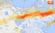
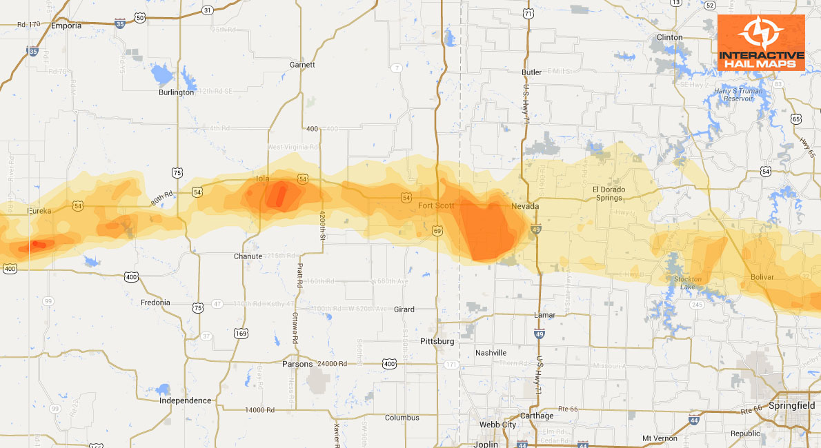
Hail Map Rome, NY July 23, 2012
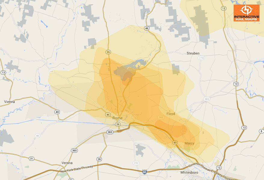
Here is the hail map for Rome, New York on July 23, 2012. Use Interactive Hail Maps to pinpoint hail locations throughout the US and zoom all the way to street view.
Cities Most Affected by Hail Storms of 7/23/2012
| Hail Size | Demographics of Zip Codes Affected | ||||||
|---|---|---|---|---|---|---|---|
| City | Count | Average | Largest | Pop Density | House Value | Income | Age |
| Rome, NY | 3 | 1.83 | 2.00 | 350 | $70k | $36.9k | 41.5 |
| Fultonville, NY | 1 | 2.50 | 2.50 | 46 | $69k | $38.7k | 37.3 |
| Harpursville, NY | 1 | 2.50 | 2.50 | 55 | $63k | $39.1k | 41.9 |
| Marcy, NY | 1 | 2.00 | 2.00 | 155 | $92k | $47.2k | 39.8 |
| New Haven, VT | 1 | 2.00 | 2.00 | 42 | $103k | $47.3k | 44.5 |
| Turner, MT | 1 | 1.75 | 1.75 | 0 | $51k | $28.1k | 46.5 |
| Worcester, NY | 1 | 1.75 | 1.75 | 26 | $73k | $31.1k | 47.1 |
| Utica, NY | 1 | 1.75 | 1.75 | 3998 | $65k | $23.8k | 34.5 |
| Middlebury, VT | 1 | 1.75 | 1.75 | 90 | $126k | $39.7k | 33.0 |
| Moretown, VT | 1 | 1.75 | 1.75 | 41 | $133k | $51.7k | 45.6 |
| Inlet, NY | 1 | 1.75 | 1.75 | 2 | $121k | $32.6k | 46.9 |
| Lakewood, PA | 1 | 1.75 | 1.75 | 13 | $82k | $30.8k | 49.1 |
| Waitsfield, VT | 1 | 1.75 | 1.75 | 36 | $147k | $47.6k | 45.6 |
| Binghamton, NY | 1 | 1.75 | 1.75 | 837 | $78k | $31.4k | 41.1 |

Connect with Interactive Hail Maps