

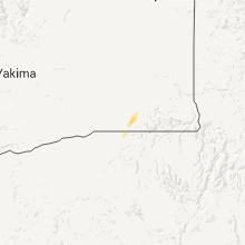
Hail Map for Sunday, April 22, 2012

Number of Impacted Households on 4/22/2012
0
Impacted by 1" or Larger Hail
0
Impacted by 1.75" or Larger Hail
0
Impacted by 2.5" or Larger Hail
Square Miles of Populated Area Impacted on 4/22/2012
0
Impacted by 1" or Larger Hail
0
Impacted by 1.75" or Larger Hail
0
Impacted by 2.5" or Larger Hail

Cities Most Affected by Hail Storms of 4/22/2012
| Hail Size | Demographics of Zip Codes Affected | ||||||
|---|---|---|---|---|---|---|---|
| City | Count | Average | Largest | Pop Density | House Value | Income | Age |
Hail and Wind Damage Spotted on 4/22/2012
Filter by Report Type:Hail ReportsWind Reports
Florida
| Local Time | Report Details |
|---|---|
| 12:55 PM EDT | A tree of 12 to 18 inches in diameter was snapped at the intersection of nob hill rd and cleary blv in broward county FL, 26.9 miles N of Miami, FL |
| 2:05 PM EDT | At 205 pm a thunderstorm produced a wind gust of 50 kts...or 58 mph at the fowey rocks cman station in amz651 county FL, 13 miles SE of Miami, FL |
Nevada
| Local Time | Report Details |
|---|---|
| 5:56 PM PDT | 59 mph wind gust measured at fallon naval air statio in churchill county NV, 55.3 miles E of Reno, NV |
Connect with Interactive Hail Maps