

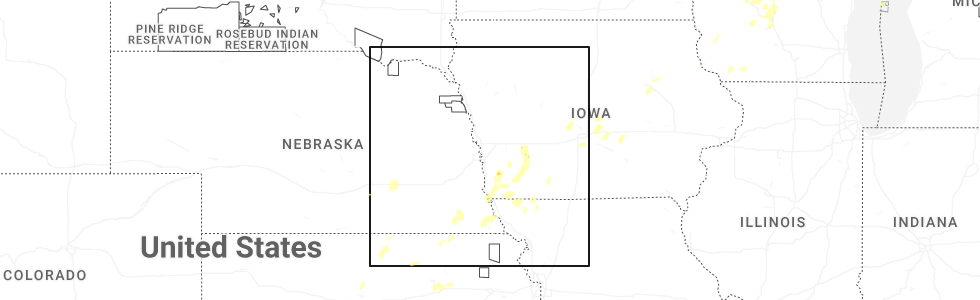
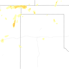
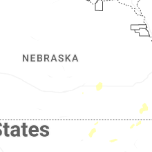
Hail Map for Monday, June 23, 2025
Number of Impacted Households on 6/23/2025
0
Impacted by 1" or Larger Hail
0
Impacted by 1.75" or Larger Hail
0
Impacted by 2.5" or Larger Hail
Square Miles of Populated Area Impacted on 6/23/2025
0
Impacted by 1" or Larger Hail
0
Impacted by 1.75" or Larger Hail
0
Impacted by 2.5" or Larger Hail


Cities Most Affected by Hail Storms of 6/23/2025
| Hail Size | Demographics of Zip Codes Affected | ||||||
|---|---|---|---|---|---|---|---|
| City | Count | Average | Largest | Pop Density | House Value | Income | Age |
Hail and Wind Damage Spotted on 6/23/2025
Filter by Report Type:Hail ReportsWind Reports
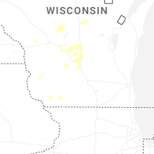
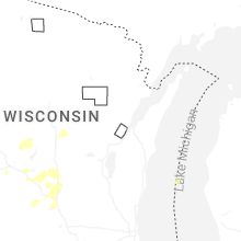
Wisconsin
| Local Time | Report Details |
|---|---|
| 1:19 PM CDT | Storm damage reported in wood county WI, 59 miles ENE of La Crosse, WI |
| 1:45 PM CDT | Report from public via local media. downed tree on a power lin in wood county WI, 75.6 miles ENE of La Crosse, WI |
| 1:46 PM CDT | Gust to 62 mph at isw aso in wood county WI, 79.8 miles ENE of La Crosse, WI |
| 1:50 PM CDT | Report from public via local media. located in grand rapids... on south side of wisconsin rapids. 3 big trees down. time estimate in wood county WI, 81.1 miles ENE of La Crosse, WI |
| 1:50 PM CDT | Photos of tree trunk and large branch snapped via social medi in wood county WI, 75.6 miles ENE of La Crosse, WI |
| 1:51 PM CDT | Gust to 69 mph at isw aso in wood county WI, 79.8 miles ENE of La Crosse, WI |
| 2:20 PM CDT | Report via local media. semi overturned traveling east on us hwy 10 near amherst junction. time estimate in portage county WI, 64.3 miles W of Green Bay, WI |
| 2:25 PM CDT | Trees down near hwy 73 and mm northwest of wautoma. time estimated by rada in waushara county WI, 70.5 miles WSW of Green Bay, WI |
| 2:27 PM CDT | Several reports of trees down across roadways in the northwest part of waushara county. these reports were from n of hancock to just w of saxeville. time of specific ls in waushara county WI, 67.9 miles WSW of Green Bay, WI |
| 2:32 PM CDT | 2 trees down. time estimated via rada in waupaca county WI, 50.4 miles WSW of Green Bay, WI |
| 3:15 PM CDT | Tree reported down over roadway. time estimated via rada in outagamie county WI, 26.3 miles SW of Green Bay, WI |
| 3:29 PM CDT | 58 mph measured by the green bay airport aso in brown county WI, 6.3 miles WSW of Green Bay, WI |
| 3:32 PM CDT | Several trees reported down across the east side of green bay... including one on a car. no injuries reported. time estimated via rada in brown county WI, 2.5 miles WNW of Green Bay, WI |
| 3:35 PM CDT | Traffic light down near bridge downtown... blocking traffic. time estimated via rada in brown county WI, 0.5 miles WSW of Green Bay, WI |
| 4:55 PM CDT | Reports of tree fallen on a vehicl in vernon county WI, 47 miles ESE of La Crosse, WI |
| 5:05 PM CDT | Boats and big pine tree blown ove in adams county WI, 64.8 miles NNW of Madison, WI |
| 5:17 PM CDT | Tree down in cit in richland county WI, 53.4 miles WNW of Madison, WI |
| 5:27 PM CDT | Large tree branch over roa in richland county WI, 48.1 miles ESE of La Crosse, WI |
| 5:30 PM CDT | Dispatch reports numerous trees down scattered across the count in sauk county WI, 33 miles NNW of Madison, WI |
| 5:35 PM CDT | Dispatch reports numerous trees down through the count in columbia county WI, 32.5 miles N of Madison, WI |
| 5:36 PM CDT | Large tree blocking the road on county cc and 4th avenue. time estimated by rada in waushara county WI, 64.5 miles N of Madison, WI |
| 5:40 PM CDT | Tree dow in richland county WI, 40.5 miles ESE of La Crosse, WI |
| 5:45 PM CDT | Numerous reports of trees down throughout the count in marquette county WI, 49.6 miles N of Madison, WI |
| 5:50 PM CDT | Storm damage reported in columbia county WI, 22.2 miles N of Madison, WI |
| 6:00 PM CDT | Scattered trees downed throughout the count in green lake county WI, 48.4 miles NNE of Madison, WI |
| 6:22 PM CDT | Multiple large branches and some trees dow in fond du lac county WI, 55.3 miles NNE of Madison, WI |
| 6:25 PM CDT | Trees uprooted in waupu in dodge county WI, 50.7 miles NE of Madison, WI |
Minnesota
| Local Time | Report Details |
|---|---|
| 1:58 PM CDT | Healthy pine trees snapped at the trunk at the dexter cemetery. time estimated on rada in mower county MN, 47.2 miles NNE of Mason City, IA |
| 2:00 PM CDT | Mesonet station mn010 i-90 - dexter - mp 19 in mower county MN, 48 miles NNE of Mason City, IA |
| 2:07 PM CDT | Dispatch relayed report of trees down in grand meado in mower county MN, 50.2 miles NE of Mason City, IA |
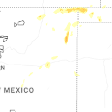
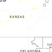
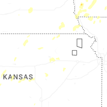
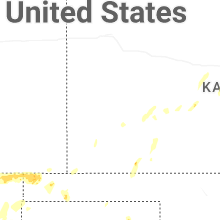
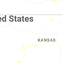
Kansas
| Local Time | Report Details |
|---|---|
| 3:35 PM CDT | Storm damage reported in rice county KS, 66.4 miles NW of Wichita, KS |
| 4:30 PM CDT | Courtesy of kake... about 50-60mph in rice county KS, 64.8 miles NW of Wichita, KS |
| 5:03 PM CDT | Quarter sized hail reported near Windom, KS, 57.5 miles NNW of Wichita, KS, courtesy of kake. |
| 6:19 PM CDT | Asos station kddc dodge city regional airpor in ford county KS, 51.2 miles ESE of Garden City, KS |
| 6:29 PM CDT | Asos station kddc dodge city regional airpor in ford county KS, 51.2 miles ESE of Garden City, KS |
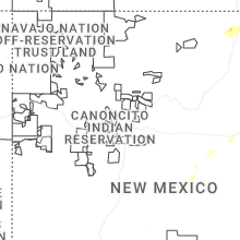
New Mexico
| Local Time | Report Details |
|---|---|
| 2:47 PM MDT | Asos station krtn raton crews airpor in colfax county NM, 63.6 miles ENE of Taos, NM |
| 5:14 PM MDT | Quarter sized hail reported near Amistad, NM, 50.9 miles NNE of Tucumcari, NM, quarter size hail was able to break 2 storm windows at a residence. |
| 5:40 PM MDT | Quarter sized hail reported near Clayton, NM, 66.2 miles NNE of Tucumcari, NM, report from mping: quarter (1.00 in.). |
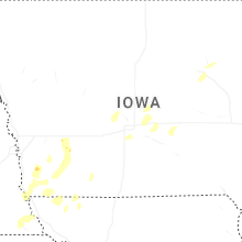
Iowa
| Local Time | Report Details |
|---|---|
| 5:27 PM CDT | Storm damage reported in polk county IA, 4.7 miles SSW of Des Moines, IA |
| 5:43 PM CDT | Delayed report. relayed through social medi in polk county IA, 6.1 miles ENE of Des Moines, IA |
| 5:45 PM CDT | Delayed report. relayed via social medi in polk county IA, 8.2 miles ENE of Des Moines, IA |
| 6:12 PM CDT | 2 reports from personal weather stations of 59 mph wind gus in guthrie county IA, 42.2 miles W of Des Moines, IA |
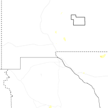
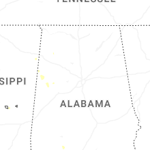
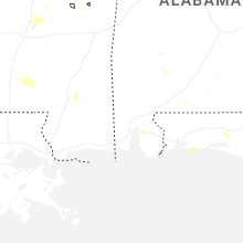
Alabama
| Local Time | Report Details |
|---|---|
| 5:35 PM CDT | Quarter sized hail reported near Spanish Fort, AL, 14.5 miles E of Mobile, AL, broadcast media relayed an image of 1 inch diamater hail near the stonebridge neighborhood. other videos of hail were also sent in. time estimated by radar. |
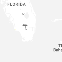
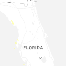
Florida
| Local Time | Report Details |
|---|---|
| 6:10 PM CDT | Mesonet station 0401w 2.0 s navarre (weatherstem) recorded a 57 knot (66 mph) thunderstorm wind gus in santa rosa county FL, 29.8 miles W of Miramar Beach, FL |
| 6:28 PM CDT | Weather flow mesonet station xsrs santa rosa sound db127 recorded a 58 knot (67 mph) marine thunderstorm wind gus in gmz634 county FL, 43 miles W of Miramar Beach, FL |
Mississippi
| Local Time | Report Details |
|---|---|
| 6:44 PM CDT | A few trees were downed in utic in hinds county MS, 28.8 miles WSW of Jackson, MS |
| 6:55 PM CDT | Tree downed on ms hwy 4 in madison county MS, 33.6 miles NNE of Jackson, MS |
| 7:00 PM CDT | Tree downed on barnes r in madison county MS, 24.5 miles NE of Jackson, MS |
| 7:10 PM CDT | A few trees were downed in monticell in lawrence county MS, 51.8 miles S of Jackson, MS |
| 7:35 PM CDT | Multiple trees downed in lincoln count in lincoln county MS, 52.8 miles SSW of Jackson, MS |
| 7:45 PM CDT | Tree downed in flor in madison county MS, 18.3 miles NNW of Jackson, MS |
Connect with Interactive Hail Maps