

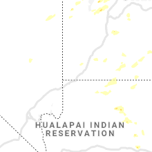
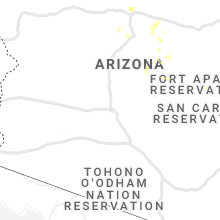
Hail Map for Tuesday, August 17, 2021

Number of Impacted Households on 8/17/2021
0
Impacted by 1" or Larger Hail
0
Impacted by 1.75" or Larger Hail
0
Impacted by 2.5" or Larger Hail
Square Miles of Populated Area Impacted on 8/17/2021
0
Impacted by 1" or Larger Hail
0
Impacted by 1.75" or Larger Hail
0
Impacted by 2.5" or Larger Hail


Cities Most Affected by Hail Storms of 8/17/2021
| Hail Size | Demographics of Zip Codes Affected | ||||||
|---|---|---|---|---|---|---|---|
| City | Count | Average | Largest | Pop Density | House Value | Income | Age |
Hail and Wind Damage Spotted on 8/17/2021
Filter by Report Type:Hail ReportsWind Reports
States Impacted
Georgia, South Carolina, Utah, North Carolina, Virginia, Florida, Montana, Missouri, New York, Colorado, South Dakota, Wyoming, ArizonaGeorgia
| Local Time | Report Details |
|---|---|
| 8:20 AM EDT | Minor damage to a few grain bins and barns...tree downed onto a vehicle...and numerous tree tops broken off... all along hwy 98 from just southwest of danielsville to i in madison county GA, 60.2 miles SW of Greenville, SC |
| 8:20 AM EDT | Two trees downed on the 1300 block of apalachee woods trail in morgan county GA, 62.9 miles E of Atlanta, GA |
South Carolina
| Local Time | Report Details |
|---|---|
| 11:30 AM EDT | Large tree down along centerville rd. near i-85 in anderson county SC, 21.3 miles SSW of Greenville, SC |
| 12:12 PM EDT | Tree down on centerville roa in anderson county SC, 21.2 miles SSW of Greenville, SC |
| 12:38 PM EDT | Tree on a house on crowe drive senec in oconee county SC, 18.9 miles W of Greenville, SC |
| 4:01 PM EDT | Powerlines down along crystal cove ct. time estimated from rada in lexington county SC, 54.9 miles NE of Augusta, GA |
| 5:33 PM EDT | Public reported a funnel cloud dropped down near church along new hope and columbia rd. em found 100 yd of trees fallen in multiple directions. possibly tornado damag in orangeburg county SC, 56.8 miles WNW of Charleston, SC |
| 6:05 PM EDT | Trees down and general vegetation damage off thackston road and highway 418 in laurens county SC, 25.6 miles ESE of Greenville, SC |
| 6:45 PM EDT | Multiple trees down with road blockages on ritchie road in fountain inn in laurens county SC, 26.9 miles ESE of Greenville, SC |
| 9:01 PM EDT | Sc highway patrol reported tree down in roadway at flowing well road and coleman bridge road. time estimated by rada in aiken county SC, 27.8 miles ENE of Augusta, GA |
Utah
| Local Time | Report Details |
|---|---|
| 10:40 AM MDT | Udot sensor i-15 at tremonton in box elder county UT, 65.8 miles NNW of Salt Lake City, UT |
| 3:58 PM MDT | Tstorm wind gust to 62 mph in tooele county UT, 60.5 miles W of Salt Lake City, UT |
| 4:15 PM MDT | Upper cedar mtn mesonet sensor in tooele county UT, 64.4 miles WSW of Salt Lake City, UT |
| 4:20 PM MDT | I-80 at west delle in tooele county UT, 47.9 miles W of Salt Lake City, UT |
| 4:20 PM MDT | Mesonet site near delle in tooele county UT, 46.8 miles W of Salt Lake City, UT |
| 4:53 PM MDT | Tstorm wind gust to 64 mph at black rock in millard county UT, 43.7 miles WNW of Monroe, UT |
| 4:55 PM MDT | Storm damage reported in tooele county UT, 79.1 miles WSW of Salt Lake City, UT |
| 5:15 PM MDT | Storm damage reported in tooele county UT, 66.3 miles WSW of Salt Lake City, UT |
| 5:15 PM MDT | Storm damage reported in tooele county UT, 64.4 miles WSW of Salt Lake City, UT |
| 5:19 PM MDT | Thunderstorm wind gust measured at the marina statio in tooele county UT, 21 miles WSW of Salt Lake City, UT |
| 5:23 PM MDT | Thunderstorm wind gust of 68 mph measured at the center tailings statio in salt lake county UT, 12.7 miles W of Salt Lake City, UT |
| 5:45 PM MDT | Storm damage reported in tooele county UT, 71.3 miles SW of Salt Lake City, UT |
| 6:57 PM MDT | Thunderstorm wind gust recorded at the provo canyon statio in utah county UT, 32.7 miles SSE of Salt Lake City, UT |
| 7:00 PM MDT | Thunderstorm wind gust of 69 mph recorded at the deer creek dam statio in wasatch county UT, 30.6 miles SE of Salt Lake City, UT |
| 8:36 PM MDT | Upper cedar mountain mesonet recorded a 69 mph wind gus in tooele county UT, 64.4 miles WSW of Salt Lake City, UT |
North Carolina
| Local Time | Report Details |
|---|---|
| 1:37 PM EDT | Multiple trees blown down on cane creek church roa in wilkes county NC, 61.7 miles ESE of Bristol, TN |
| 1:41 PM EDT | Tree down on mobile home. report from social medi in yadkin county NC, 69.1 miles NNE of Charlotte, NC |
| 1:56 PM EDT | A couple of trees blown down on the blue ridge parkwa in alleghany county NC, 66.7 miles E of Bristol, TN |
| 1:56 PM EDT | Trees down across brush creek road in buncombe county NC, 46.3 miles NNE of Greenville, SC |
| 2:00 PM EDT | Trees down blocking roadway on hillsdale road near love valley in iredell county NC, 56.4 miles N of Charlotte, NC |
| 2:04 PM EDT | One or two trees blown dow in alleghany county NC, 66.3 miles E of Bristol, TN |
| 2:18 PM EDT | One tree and several branches down on burton chapel roa in caswell county NC, 52.7 miles NW of Raleigh, NC |
| 5:14 PM EDT | Large tree limbs/branches down greater than 2 inches in burke county NC, 55.5 miles NW of Charlotte, NC |
| 5:34 PM EDT | Small tree limbs down in mcdowell county NC, 46.3 miles SSE of Bristol, TN |
| 6:03 PM EDT | Fallen tree has taken down powerline near strawberry ridge in mitchell county NC, 52.2 miles S of Bristol, TN |
| 8:10 PM EDT | Em reports multiple trees down... street flooding in downtown linville in avery county NC, 41.9 miles SSE of Bristol, TN |
| 11:40 PM EDT | Tree dow in surry county NC, 73.6 miles N of Charlotte, NC |
| 12:53 AM EDT | Tree dow in surry county NC, 66.1 miles SW of Roanoke, VA |
| 12:54 AM EDT | Tree dow in surry county NC, 69 miles SSW of Roanoke, VA |
| 1:08 AM EDT | Tree dow in surry county NC, 61.2 miles SSW of Roanoke, VA |
Virginia
| Local Time | Report Details |
|---|---|
| 2:34 PM EDT | A tree was blown down by thunderstorm winds along reservoir roa in henry county VA, 49.8 miles S of Roanoke, VA |
| 11:20 PM EDT | Tree dow in patrick county VA, 36.4 miles SW of Roanoke, VA |
Florida
| Local Time | Report Details |
|---|---|
| 4:00 PM EDT | Delayed report of large tree branches snapped and palm tree topple in duval county FL, 15.4 miles E of Jacksonville, FL |
Montana
| Local Time | Report Details |
|---|---|
| 2:45 PM MDT | Storm damage reported in beaverhead county MT, 66 miles E of Salmon, ID |
| 2:45 PM MDT | Imet relayed that gusty winds from a thunderstorm rolled through the icp for the alder creek fire and knocked down all of the portable toilet in beaverhead county MT, 59.4 miles E of Salmon, ID |
| 12:29 AM MDT | Asos station kggw glasgow airport (asos in valley county MT, 1.9 miles NNE of Glasgow, MT |
Missouri
| Local Time | Report Details |
|---|---|
| 4:47 PM CDT | Severe thunderstorm wind gusts destroyed a power pole and several trees along highway v in rural st. clair count in st. clair county MO, 56.5 miles NNW of Springfield, MO |
| 5:02 PM CDT | Severe thunderstorm wind gusts damaged several trees creating damage to some powerlines south of osceola along highway ww. this resulted in power outages to numerous ho in st. clair county MO, 59.4 miles NNW of Springfield, MO |
New York
| Local Time | Report Details |
|---|---|
| 6:04 PM EDT | Several trees down on ford avenue. time estimated from rada in onondaga county NY, 0.8 miles SSE of Syracuse, NY |
Colorado
| Local Time | Report Details |
|---|---|
| 6:16 PM MDT | Asos station kapa denver arapaho in arapahoe county CO, 14 miles SSE of Denver, CO |
South Dakota
| Local Time | Report Details |
|---|---|
| 6:37 PM MDT | Storm damage reported in harding county SD, 106 miles N of Rapid City, SD |
Wyoming
| Local Time | Report Details |
|---|---|
| 8:15 PM MDT | Thunderstorm outflow winds at kemm kemmerer airpor in lincoln county WY, 70.5 miles WNW of Rock Springs, WY |
Arizona
| Local Time | Report Details |
|---|---|
| 7:21 PM MST | Tree in roadwa in pima county AZ, 8.7 miles ESE of Tucson, AZ |
| 7:24 PM MST | Traffic light malfunctioning at irvington and country clu in pima county AZ, 8.7 miles ESE of Tucson, AZ |
| 7:26 PM MST | Wire down at irvington and tucson blv in pima county AZ, 4.6 miles SSE of Tucson, AZ |
| 7:32 PM MST | Pole leaning on irvington east of campbel in pima county AZ, 4.6 miles SSE of Tucson, AZ |
| 7:32 PM MST | Cactus has fallen into the roadway at tucson blvd and drexe in pima county AZ, 5.5 miles SSE of Tucson, AZ |
| 7:33 PM MST | Power poles down at benson hwy and palo verd in pima county AZ, 5.7 miles SSE of Tucson, AZ |
Connect with Interactive Hail Maps