

Hail Map for Wednesday, August 17, 2022

Number of Impacted Households on 8/17/2022
0
Impacted by 1" or Larger Hail
0
Impacted by 1.75" or Larger Hail
0
Impacted by 2.5" or Larger Hail
Square Miles of Populated Area Impacted on 8/17/2022
0
Impacted by 1" or Larger Hail
0
Impacted by 1.75" or Larger Hail
0
Impacted by 2.5" or Larger Hail


Cities Most Affected by Hail Storms of 8/17/2022
| Hail Size | Demographics of Zip Codes Affected | ||||||
|---|---|---|---|---|---|---|---|
| City | Count | Average | Largest | Pop Density | House Value | Income | Age |
| Quitman, TX | 2 | 1.75 | 1.75 | 54 | $72k | $33.2k | 48.1 |
| Kettle River, MN | 1 | 1.75 | 1.75 | 7 | $48k | $32.3k | 45.0 |
Hail and Wind Damage Spotted on 8/17/2022
Filter by Report Type:Hail ReportsWind Reports
States Impacted
Florida, Mississippi, Michigan, South Dakota, Alabama, New York, Louisiana, Arizona, District of Columbia, Minnesota, Texas, Montana, California, North DakotaFlorida
| Local Time | Report Details |
|---|---|
| 1:07 PM EDT | Strong winds blew down trees and power lines along benham ave. from 20th street to 17th street. reports and pictures/video from twitter and wft in volusia county FL, 28.2 miles N of Orlando, FL |
| 2:45 PM EDT | Thunderstorm winds downed trees near se 80th and se 42nd sse of ocala and n of belleview. the time of damage was based on rada in marion county FL, 58 miles NW of Orlando, FL |
| 5:18 PM EDT | Report of trees and power lines down due to thunderstorm wind in gilchrist county FL, 81.4 miles WSW of Jacksonville, FL |
| 5:35 PM EDT | Duke energy reported damage to utility equipment due to fallen trees and/or large limbs along se 11th terrace... just east of trenton. the time of damage was based on r in gilchrist county FL, 83.8 miles SW of Jacksonville, FL |
| 5:43 PM EDT | Jacksonville electric authority reported severe thunderstorm damage to utility equipment along n village grove drive off of scott mill road. the time of damage was base in duval county FL, 9.9 miles S of Jacksonville, FL |
| 5:55 PM EDT | The jacksonville electric authority reported severe thunderstorm damage to utility equipment along harp street... just north of julington creek road. the time of damage in duval county FL, 13.9 miles SSE of Jacksonville, FL |
| 6:05 PM EDT | The jacksonville electric authority reported severe thunderstorm damage along michaela street just east of veterans parkway. the time of damage was based on rada in st. johns county FL, 17.6 miles SSE of Jacksonville, FL |
| 7:00 PM EDT | Spotter reported estimated wind gust of 60 mp in st. johns county FL, 33.5 miles SE of Jacksonville, FL |
| 7:00 PM EDT | Trees were blown down into power lines by thunderstorm winds. the time of damage was based on rada in st. johns county FL, 34.9 miles SSE of Jacksonville, FL |
| 7:00 PM EDT | Fallen trees or limbs resulted in a power outage along frank mckamey wa in franklin county FL, 49.2 miles SSW of Tallahassee, FL |
| 7:05 PM EDT | County dispatch reported trees and limbs were blown down into power lines near the county jail along old lewis speedway. the time of damage was based on rada in st. johns county FL, 32.9 miles SE of Jacksonville, FL |
Mississippi
| Local Time | Report Details |
|---|---|
| 2:09 PM CDT | Corrects previous tstm wnd dmg report from 1 nnw escatawpa. trees down on highway 613 and donniebrook ln. additional trees down reported at riverbend campgroun in jackson county MS, 32.3 miles WSW of Mobile, AL |
| 3:30 PM CDT | Media relayed pictures of tree and metal roofing damage on big point r in jackson county MS, 26.5 miles WSW of Mobile, AL |
| 3:55 PM CDT | Em reports downed trees and powerlines near highway 613 and donniebrook lan in jackson county MS, 32.3 miles WSW of Mobile, AL |
| 4:45 PM CDT | Pictures of trees down in moss point. time and exact location estimated by rada in jackson county MS, 35.1 miles SW of Mobile, AL |
Michigan
| Local Time | Report Details |
|---|---|
| 3:51 PM EDT | Small hail was also present. reported at willow run airpor in wayne county MI, 53.8 miles S of Flint, MI |
South Dakota
| Local Time | Report Details |
|---|---|
| 2:30 PM MDT | Storm damage reported in butte county SD, 63.5 miles NNW of Rapid City, SD |
| 2:44 PM MDT | Storm damage reported in butte county SD, 63.4 miles NW of Rapid City, SD |
| 2:49 PM MDT | Storm damage reported in butte county SD, 63.4 miles NW of Rapid City, SD |
| 2:55 PM MDT | Storm damage reported in butte county SD, 68.8 miles N of Rapid City, SD |
| 4:28 PM MDT | Storm damage reported in meade county SD, 88.7 miles NE of Rapid City, SD |
| 5:19 PM MDT | Storm damage reported in pennington county SD, 36.4 miles E of Rapid City, SD |
Alabama
| Local Time | Report Details |
|---|---|
| 3:32 PM CDT | Pine tree snapped and damaged a vehicl in baldwin county AL, 27.2 miles SE of Mobile, AL |
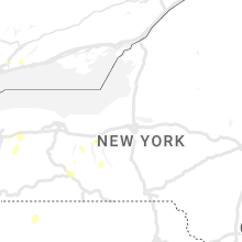
New York
| Local Time | Report Details |
|---|---|
| 5:00 PM EDT | Trees and wires dow in albany county NY, 13.5 miles ESE of Schenectady, NY |
| 5:12 PM EDT | Several trees and power lines down on columbia street on the lower end of the cit in rensselaer county NY, 15.9 miles SE of Schenectady, NY |
| 5:15 PM EDT | Large tree snapped on green st between ferry and rensselaer ave. radar time estimate in albany county NY, 15.4 miles SE of Schenectady, NY |
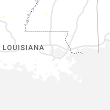
Louisiana
| Local Time | Report Details |
|---|---|
| 4:00 PM CDT | Tree down 492 and alford r in grant county LA, 94.6 miles NNW of Lafayette, LA |
| 4:07 PM CDT | Tree down north of bentle in grant county LA, 92.6 miles SSW of Bastrop, LA |
| 4:23 PM CDT | Corrects previous tstm wnd dmg report from 4 sse dry prong. tree down north of bentle in grant county LA, 92.6 miles SSW of Bastrop, LA |
Arizona
| Local Time | Report Details |
|---|---|
| 2:29 PM MST | Storm damage reported in maricopa county AZ, 54.6 miles NW of Phoenix, AZ |
| 4:05 PM MST | Mesonet in litchfield park measured thunderstorm wind gust of 61 mp in maricopa county AZ, 23.4 miles W of Phoenix, AZ |
| 5:04 PM MST | Aps power lines down due to storm in maricopa county AZ, 23.7 miles W of Phoenix, AZ |
| 6:16 PM MST | Road sign blown over. supports snapped in hal in pinal county AZ, 42.8 miles S of Phoenix, AZ |
| 6:45 PM MST | Storm damage reported in pinal county AZ, 39.3 miles ESE of Phoenix, AZ |
| 6:46 PM MST | Storm damage reported in pinal county AZ, 35.9 miles ESE of Phoenix, AZ |
| 7:11 PM MST | Yuma proving ground station 48 mesonet station reports 69 mph gus in yuma county AZ, 55.6 miles NNE of Yuma, AZ |
District of Columbia
| Local Time | Report Details |
|---|---|
| 5:36 PM EDT | Tree down at 1500 raum st. ne in district of columb county DC, 32.9 miles SW of Baltimore, MD |
| 5:38 PM EDT | Tree down at 1401 maryland ave ne in district of columb county DC, 33.8 miles SW of Baltimore, MD |
Minnesota
| Local Time | Report Details |
|---|---|
| 5:10 PM CDT | Golf Ball sized hail reported near Kettle River, MN, 42.4 miles WSW of Duluth, MN, report relayed by the media. |
| 5:10 PM CDT | Quarter sized hail reported near Tamarack, MN, 47.1 miles WSW of Duluth, MN |
| 6:12 PM CDT | Photos on social media of uprooted trees and large limbs down in cambridge. time estimated by rada in isanti county MN, 40.9 miles N of Minneapolis, MN |
Texas
| Local Time | Report Details |
|---|---|
| 5:12 PM CDT | 18 wheeler box trailer flipped on hwy 14 and cr 983. large tree branches dow in limestone county TX, 72.7 miles SSE of Dallas, TX |
| 5:30 PM CDT | Golf Ball sized hail reported near Quitman, TX, 84.3 miles E of Dallas, TX, fm 14 and hwy 37 sw of winnsboro. |
| 5:35 PM CDT | Golf Ball sized hail reported near Quitman, TX, 84.3 miles E of Dallas, TX, corrects previous hail report from 7 ssw winnsboro. fm 14 and hwy 37 sw of winnsboro. |
| 5:44 PM CDT | Storm damage reported in wood county TX, 78.3 miles E of Dallas, TX |
| 5:44 PM CDT | Quarter sized hail reported near Quitman, TX, 78.9 miles E of Dallas, TX, 1 inch hail reported quitman. |
| 6:08 PM CDT | Mesonet station 123 1nw castolon... bbnp big bend np/brewste in brewster county TX, 83.6 miles S of Alpine, TX |
| 6:12 PM CDT | Large tree down in tola in hood county TX, 70.9 miles WSW of Dallas, TX |
| 6:24 PM CDT | 1nw castolon bbn in brewster county TX, 83.7 miles S of Alpine, TX |
| 6:42 PM CDT | Gust estimated up to 40 mph blew over greenhouse and large limbs dow in wood county TX, 84.9 miles W of Shreveport, LA |
| 6:42 PM CDT | Quarter sized hail reported near Hawkins, TX, 84.9 miles W of Shreveport, LA, hail dimes to quarter size. |
Montana
| Local Time | Report Details |
|---|---|
| 5:15 PM MDT | Measured on home weather statio in sheridan county MT, 53.7 miles NNW of Williston, ND |
California
| Local Time | Report Details |
|---|---|
| 4:56 PM PDT | The needles asos recorded gusts in excess of 58 mph between 456 pm and 508 pm. the peak gust during this time was 63 mph and occurred at 456 p in san bernardino county CA, 25.7 miles NW of Lake Havasu City, AZ |
North Dakota
| Local Time | Report Details |
|---|---|
| 8:59 PM CDT | 2 e watford city ndaw in mckenzie county ND, 29.8 miles SE of Williston, ND |
| 9:46 PM CDT | Storm damage reported in kidder county ND, 55.5 miles E of Bismarck, ND |
| 2:21 AM CDT | Niles 3 se ndawn 10 meter wind senso in benson county ND, 23.1 miles WNW of Devils Lake, ND |
| 3:05 AM CDT | Nd dot rwis senso in ramsey county ND, 3.5 miles SW of Devils Lake, ND |
Connect with Interactive Hail Maps