

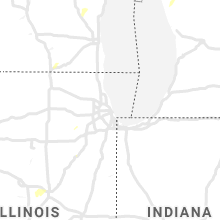
Hail Map for Sunday, August 8, 2021

Number of Impacted Households on 8/8/2021
0
Impacted by 1" or Larger Hail
0
Impacted by 1.75" or Larger Hail
0
Impacted by 2.5" or Larger Hail
Square Miles of Populated Area Impacted on 8/8/2021
0
Impacted by 1" or Larger Hail
0
Impacted by 1.75" or Larger Hail
0
Impacted by 2.5" or Larger Hail


Cities Most Affected by Hail Storms of 8/8/2021
| Hail Size | Demographics of Zip Codes Affected | ||||||
|---|---|---|---|---|---|---|---|
| City | Count | Average | Largest | Pop Density | House Value | Income | Age |
Hail and Wind Damage Spotted on 8/8/2021
Filter by Report Type:Hail ReportsWind Reports
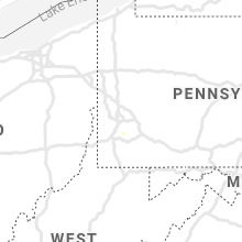
States Impacted
Missouri, Illinois, Montana, Wisconsin, Pennsylvania, Virginia, Arizona, Michigan, WyomingMissouri
| Local Time | Report Details |
|---|---|
| 2:12 PM CDT | Power lines down and broken tree limbs 8-12 inches in diamete in phelps county MO, 26.2 miles NW of Salem, MO |
| 3:18 PM CDT | Several trees and tree limbs blown dow in franklin county MO, 48.7 miles W of Saint Louis, MO |
| 3:20 PM CDT | Several power lines blown down between hopewell and marthasvill in warren county MO, 48.8 miles W of Saint Louis, MO |
| 3:38 PM CDT | 4 inch diameter branch dow in st. charles county MO, 38.8 miles WNW of Saint Louis, MO |
| 3:56 PM CDT | Tree down onto wires; via faceboook vide in jefferson county MO, 38.9 miles SSW of Saint Louis, MO |
| 4:05 PM CDT | Large tree (3+ ft diameter) down along n forty dr immediately north of i-6 in st. louis county MO, 12 miles W of Saint Louis, MO |
| 4:10 PM CDT | Small to medium size tree limb dow in st. louis county MO, 11.3 miles WNW of Saint Louis, MO |
| 4:11 PM CDT | Several large tree limbs blown down along page avenue and lindbergh blvd in maryland heights and creve coeu in st. louis county MO, 12.9 miles WNW of Saint Louis, MO |
| 4:20 PM CDT | Large tree limb snapped—via twitter phot in st. louis county MO, 13.6 miles NW of Saint Louis, MO |
| 7:17 PM CDT | Corrects previous tstm wnd dmg report from 4 sw broseley. roof damaged at a home. trees and powerlines down along/near hwy 5 in butler county MO, 61.9 miles SW of Cape Girardeau, MO |
Illinois
| Local Time | Report Details |
|---|---|
| 3:13 PM CDT | Photos shared on social media of several tree limbs (estimated around 6 inches to one foot in diameter) downed along with damage to a greenhouse. time estimated based o in kane county IL, 40 miles WNW of Chicago, IL |
| 4:00 PM CDT | Large tree limb down along highway 123 south of town. time estimated from rada in morgan county IL, 62.8 miles SSW of Peoria, IL |
| 5:55 PM CDT | Photo of large tree limb (over 1-2ft) snapped relayed via twitter. additional report of power lines down and a broken power poll northeast of west chicago relayed by em in dupage county IL, 27.2 miles WNW of Chicago, IL |
| 6:15 PM CDT | Small tree snappe in tazewell county IL, 1.6 miles SSE of Peoria, IL |
Montana
| Local Time | Report Details |
|---|---|
| 2:35 PM MDT | Report from broadwater sheriff of minor tree damage in broadwater count in broadwater county MT, 52.4 miles NNW of Bozeman, MT |
| 4:20 PM MDT | Location estimate in madison county MT, 37.6 miles WSW of Bozeman, MT |
| 5:00 PM MDT | Mesonet station mtm14 (mt-meso in beaverhead county MT, 49.9 miles E of Salmon, ID |
| 10:08 PM MDT | Mesonet station mtbvr 3.8 ne hodges (mt dot in dawson county MT, 83.7 miles ENE of Miles City, MT |
Wisconsin
| Local Time | Report Details |
|---|---|
| 3:48 PM CDT | Several trees blown down in adams county WI, 63.4 miles NNW of Madison, WI |
| 4:05 PM CDT | Trees down on hwy 21 near i-3 in waushara county WI, 66.4 miles N of Madison, WI |
| 4:15 PM CDT | Tree damage on i-3 in waushara county WI, 73.2 miles N of Madison, WI |
| 4:56 PM CDT | 2 trees on power lines. time estimate in waupaca county WI, 46.7 miles WSW of Green Bay, WI |
| 5:07 PM CDT | Trees on powerlines. time estimate in waupaca county WI, 41 miles WSW of Green Bay, WI |
| 5:07 PM CDT | Reports of a two foot diameter tree down across beaver dam road just west of townline rd and a 12 inch diameter branch down across townline r in washington county WI, 61.6 miles ENE of Madison, WI |
| 5:11 PM CDT | One foot diameter tree down across ridge rd. one quarter mile west of highland dr. multiple six inch diameter branches down nearby as wel in washington county WI, 63.3 miles ENE of Madison, WI |
| 5:15 PM CDT | Power poles snapped and lines down at the intersection of county road h and highland driv in washington county WI, 64.3 miles ENE of Madison, WI |
| 5:16 PM CDT | Tree down and split in kewasku in washington county WI, 66 miles ENE of Madison, WI |
| 6:47 PM CDT | Corrects previous tstm wnd dmg report from 3 wsw lincoln. multiple trees down on road near county road ab and in kewaunee county WI, 16.9 miles ENE of Green Bay, WI |
Pennsylvania
| Local Time | Report Details |
|---|---|
| 5:01 PM EDT | Trees and limbs down near finleyville from microburs in washington county PA, 13.7 miles S of Pittsburgh, PA |
Virginia
| Local Time | Report Details |
|---|---|
| 5:37 PM EDT | A few brances snapped and in the roadway along stony run dr. in mcgaheysville. brances were 2-4 inches in diamete in rockingham county VA, 70.5 miles ESE of Elkins, WV |
Arizona
| Local Time | Report Details |
|---|---|
| 5:50 PM MST | Down power lines along dragoon rd near mile marker in cochise county AZ, 53.6 miles NNW of Douglas, AZ |
| 6:50 PM MST | Tree fell on power lines on sabin rd... st davi in cochise county AZ, 46.9 miles ESE of Tucson, AZ |
Michigan
| Local Time | Report Details |
|---|---|
| 10:04 PM EDT | Muskegon glerl observatio in lmz847 county MI, 38.4 miles WNW of Grand Rapids, MI |
Wyoming
| Local Time | Report Details |
|---|---|
| 9:26 PM MDT | Storm damage reported in sheridan county WY, 67.8 miles WNW of Gillette, WY |
Connect with Interactive Hail Maps