

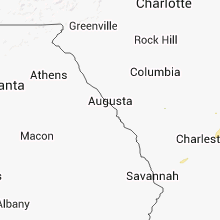
Hail Map for Friday, July 25, 2014

Number of Impacted Households on 7/25/2014
0
Impacted by 1" or Larger Hail
0
Impacted by 1.75" or Larger Hail
0
Impacted by 2.5" or Larger Hail
Square Miles of Populated Area Impacted on 7/25/2014
0
Impacted by 1" or Larger Hail
0
Impacted by 1.75" or Larger Hail
0
Impacted by 2.5" or Larger Hail


Cities Most Affected by Hail Storms of 7/25/2014
| Hail Size | Demographics of Zip Codes Affected | ||||||
|---|---|---|---|---|---|---|---|
| City | Count | Average | Largest | Pop Density | House Value | Income | Age |
| Myrtle Beach, SC | 1 | 1.75 | 1.75 | 1958 | $137k | $41.8k | 50.5 |
Hail and Wind Damage Spotted on 7/25/2014
Filter by Report Type:Hail ReportsWind Reports
South Carolina
| Local Time | Report Details |
|---|---|
| 2:57 PM EDT | Half Dollar sized hail reported near Myrtle Beach, SC, 64.5 miles ENE of Charleston, SC, intersection of bay road with hwy 707 |
| 2:58 PM EDT | Golf Ball sized hail reported near Myrtle Beach, SC, 66.2 miles ENE of Charleston, SC, golfball size hail was reported. |
| 3:10 PM EDT | Multiple trees down on sc hwy 45 near intersection with us hwy 1 in charleston county SC, 31.6 miles ESE of Charleston, SC |
| 3:40 PM EDT | Highway patrol reported a tree down on bears bluff rd at truckfarm r in charleston county SC, 34.9 miles S of Charleston, SC |
| 5:19 PM EDT | Tree and powerlines down on highway 17 near william a campbell r in beaufort county SC, 40 miles NNE of Savannah, GA |
| 5:50 PM EDT | Tree down on vehicle on ladys island drive. no injuries reporte in beaufort county SC, 33.9 miles NE of Savannah, GA |
| 5:51 PM EDT | Tree down on sea island pkwy on ladys islan in beaufort county SC, 34.4 miles NE of Savannah, GA |
| 6:01 PM EDT | Sc hwy patrol reports a tree down on glover rd on st helena islan in beaufort county SC, 35.3 miles NE of Savannah, GA |
| 6:11 PM EDT | Tree down on perry rd at orange grove r in beaufort county SC, 35 miles NE of Savannah, GA |
| 7:12 PM EDT | Sc hwy patrol reported a tree down on old house rd and bees creek r in jasper county SC, 28 miles NNE of Savannah, GA |
| 9:12 PM EDT | Sc highway patrol reports a tree down and in the roadway on jericho road between augusta stage coach road and collie road. time estimated from rada in hampton county SC, 45.4 miles NNW of Savannah, GA |
Missouri
| Local Time | Report Details |
|---|---|
| 2:05 PM CDT | Tree limbs reported downing powerlines both north and south of warrento in warren county MO, 52.5 miles WNW of Saint Louis, MO |
Florida
| Local Time | Report Details |
|---|---|
| 4:26 PM EDT | Skywarn spotter reported three ft diameter 50 foot tall pine tree down near intersection of pine tree drive and 30th st. time estimated from rada in volusia county FL, 40.1 miles NE of Orlando, FL |
| 4:30 PM EDT | Minor roof damage to apartment building on south atlantic ave. in new smyrna beach. time estimated by rada in volusia county FL, 44.3 miles NE of Orlando, FL |
| 5:20 PM EDT | Power lines were damaged by thunderstorm wind in east palatka per the satsuma fire dep in putnam county FL, 47.1 miles S of Jacksonville, FL |
Wyoming
| Local Time | Report Details |
|---|---|
| 5:13 PM MDT | Out building destroyed by straight line winds where highway 158 turns east towards nebrask in goshen county WY, 25.2 miles W of Scottsbluff, NE |
Colorado
| Local Time | Report Details |
|---|---|
| 5:15 PM MDT | Large tree down at 8th and hudso in pueblo county CO, 0.4 miles NNE of Pueblo, CO |
| 5:27 PM MDT | Large tree down at 8th and hudso in pueblo county CO, 0.4 miles NNE of Pueblo, CO |
Kansas
| Local Time | Report Details |
|---|---|
| 6:50 PM MDT | A mobile home was destroyed and a roof was blown from a barn in coolidg in hamilton county KS, 62.2 miles W of Garden City, KS |
| 7:15 PM MDT | Seven power poles were blown down by high wind in hamilton county KS, 53.8 miles WNW of Garden City, KS |
| 7:20 PM MDT | Four power poles were blown down by high wind in hamilton county KS, 53.8 miles WNW of Garden City, KS |
| 7:26 PM MDT | Trees were uprooted and windows were blown from a residenc in hamilton county KS, 48.2 miles WNW of Garden City, KS |
| 7:30 PM MDT | The thunderstorm winds were estimated at 60 mph or greate in hamilton county KS, 51.1 miles WNW of Garden City, KS |
Indiana
| Local Time | Report Details |
|---|---|
| 7:05 AM EDT | Quarter sized hail reported near Covington, IN, 69.4 miles NE of Mattoon, IL, largest hailstones were quarter size. |
Connect with Interactive Hail Maps