

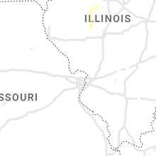
Hail Map for Thursday, May 26, 2022

Number of Impacted Households on 5/26/2022
0
Impacted by 1" or Larger Hail
0
Impacted by 1.75" or Larger Hail
0
Impacted by 2.5" or Larger Hail
Square Miles of Populated Area Impacted on 5/26/2022
0
Impacted by 1" or Larger Hail
0
Impacted by 1.75" or Larger Hail
0
Impacted by 2.5" or Larger Hail


Cities Most Affected by Hail Storms of 5/26/2022
| Hail Size | Demographics of Zip Codes Affected | ||||||
|---|---|---|---|---|---|---|---|
| City | Count | Average | Largest | Pop Density | House Value | Income | Age |
| Granite Falls, NC | 1 | 1.75 | 1.75 | 318 | $94k | $39.8k | 39.9 |
Hail and Wind Damage Spotted on 5/26/2022
Filter by Report Type:Hail ReportsWind Reports
States Impacted
Illinois, Ohio, Alabama, Georgia, Kentucky, North Carolina, South Carolina, Idaho, Nevada, VirginiaIllinois
| Local Time | Report Details |
|---|---|
| 12:16 PM CDT | Quarter sized hail reported near Monmouth, IL, 57.2 miles WNW of Peoria, IL, dime to quarter size hail and torrential rain in monmouth. |
| 1:33 PM CDT | Tree down over road near andove in henry county IL, 55.7 miles NW of Peoria, IL |
| 2:15 PM CDT | Large fully leafed tree limb snapped. time estimated from rada in christian county IL, 57.3 miles WNW of Mattoon, IL |
| 2:47 PM CDT | Quarter sized hail reported near Marshall, IL, 37.5 miles E of Mattoon, IL, report from mping: quarter (1.00 in.). |
| 2:47 PM CDT | Report from mping: 3-inch tree limbs broken; power poles broke in clark county IL, 36.4 miles E of Mattoon, IL |
Ohio
| Local Time | Report Details |
|---|---|
| 1:55 PM EDT | Tree down. photo posted on social medi in hamilton county OH, 18.2 miles WNW of Cincinnati, OH |
| 6:35 PM EDT | Several trees downed in the lynx area. time estimated by rada in adams county OH, 63.4 miles ESE of Cincinnati, OH |
| 7:25 PM EDT | Trees down through the area in pike county OH, 61.5 miles S of Columbus, OH |
| 7:25 PM EDT | Trees down in pike county OH, 57.4 miles S of Columbus, OH |
| 7:28 PM EDT | Emergency manager reports about 75 trees blow down. time estimated by rada in ross county OH, 47.7 miles S of Columbus, OH |
| 7:37 PM EDT | Report of twisted trees along eastern avenue near us-23. time estimated from rada in ross county OH, 45.1 miles S of Columbus, OH |
Alabama
| Local Time | Report Details |
|---|---|
| 1:20 PM CDT | Powerlines and trees down near the 500 block wilson mountain rd at lindsey private d in morgan county AL, 57.9 miles ESE of Florence, AL |
Georgia
| Local Time | Report Details |
|---|---|
| 3:15 PM EDT | Ema report of trees and powerlines down near the intersection of hwy 68 and 27 in washington county GA, 71.2 miles SW of Augusta, GA |
Kentucky
| Local Time | Report Details |
|---|---|
| 2:37 PM CDT | Trees down blocking the 52 mile marker on the cumberland parkwa in adair county KY, 66.4 miles SSE of Louisville, KY |
| 2:46 PM CDT | Reports of power line down at the state park entranc in russell county KY, 83 miles SSE of Louisville, KY |
| 3:59 PM EDT | A tree was reported to have been blown down on ky highway 789 near ramseys point road and the highway department was called to remove the tree from the roadwa in wayne county KY, 74.3 miles SW of Irvine, KY |
| 4:12 PM EDT | A tree was reported to have been blown down on webster drive in the city of monticell in wayne county KY, 77.1 miles SW of Irvine, KY |
| 4:26 PM EDT | Report from mping: tree damage such as uprooted or snapped tree in pulaski county KY, 54.6 miles SW of Irvine, KY |
| 4:28 PM EDT | Reports of trees dow in casey county KY, 55.4 miles WSW of Irvine, KY |
| 4:32 PM EDT | Trees were reported to have been blow down onto powerlines on etna roa in pulaski county KY, 50.6 miles SW of Irvine, KY |
| 4:38 PM EDT | Reports of trees dow in lincoln county KY, 42.1 miles WSW of Irvine, KY |
| 4:47 PM EDT | A tree was blown down along bandy roa in rockcastle county KY, 38.8 miles SW of Irvine, KY |
| 4:53 PM EDT | Lincoln county emergency manager reported trees down and shingle damage near us 150 and boone roa in lincoln county KY, 35 miles WSW of Irvine, KY |
| 5:02 PM EDT | A tree was reported to have been blown down along north wilderness road a little north of mount verno in rockcastle county KY, 28.8 miles SW of Irvine, KY |
| 5:02 PM EDT | Reports of trees dow in garrard county KY, 31 miles W of Irvine, KY |
| 5:07 PM EDT | A large tree was blown down on bluetick road and reported via a picture on social medi in rockcastle county KY, 24.7 miles SW of Irvine, KY |
| 5:16 PM EDT | Emergency manager reports tree down on peytontown road. time estimated from rada in madison county KY, 20.2 miles W of Irvine, KY |
| 5:19 PM EDT | Emergency manager reports trees down in the pilot knob area. time estimated from rada in madison county KY, 15.3 miles WSW of Irvine, KY |
| 5:45 PM EDT | A tree was reported down on log lick road to county dispatch. time estimated from rada in clark county KY, 12.1 miles NNW of Irvine, KY |
| 5:51 PM EDT | A tree was reported down to local dispatc in clark county KY, 13.9 miles N of Irvine, KY |
| 5:57 PM EDT | Tree limbs were reported to have been blown down onto kidville road and the highway department was called to removed them from the roadwa in montgomery county KY, 19.3 miles N of Irvine, KY |
| 6:06 PM EDT | Tree limbs were reported to have been blown down in the vicinity of the intersection of camargo levee road and welch road and the highway department had been called to in montgomery county KY, 18.5 miles NNE of Irvine, KY |
North Carolina
| Local Time | Report Details |
|---|---|
| 4:25 PM EDT | Power poles and trees reported dow in cleveland county NC, 46.4 miles W of Charlotte, NC |
| 5:25 PM EDT | Golf Ball sized hail reported near Granite Falls, NC, 52 miles NW of Charlotte, NC |
| 5:30 PM EDT | Shed damaged from high wind in caldwell county NC, 51.4 miles NW of Charlotte, NC |
| 5:30 PM EDT | Trees and power lines down dow in burke county NC, 50.7 miles NW of Charlotte, NC |
| 5:55 PM EDT | Quarter sized hail reported near Hickory, NC, 48.8 miles NW of Charlotte, NC |
| 6:25 PM EDT | Tree down along fishing creek roa in wilkes county NC, 63.9 miles NNW of Charlotte, NC |
| 6:30 PM EDT | Trees down on power lines near startown elementar in catawba county NC, 37.7 miles NW of Charlotte, NC |
| 6:35 PM EDT | Tree down blocking the roa in cleveland county NC, 42 miles W of Charlotte, NC |
| 6:38 PM EDT | Tree down along ruth linney roa in wilkes county NC, 66.6 miles N of Charlotte, NC |
| 6:40 PM EDT | Trees dow in cleveland county NC, 33 miles WNW of Charlotte, NC |
| 6:45 PM EDT | Tree dow in wilkes county NC, 68.7 miles N of Charlotte, NC |
| 7:05 PM EDT | Trees dow in iredell county NC, 50.3 miles N of Charlotte, NC |
| 7:07 PM EDT | Structured collaps in iredell county NC, 51.9 miles N of Charlotte, NC |
| 7:15 PM EDT | Corrects previous tstm wnd dmg report from 2 wsw buck shoals. two trees down and a couple of outbuildings damage in yadkin county NC, 59.8 miles N of Charlotte, NC |
| 7:20 PM EDT | 4 trees down along old highway 42 in wilkes county NC, 64.2 miles N of Charlotte, NC |
| 7:20 PM EDT | Tree dow in wilkes county NC, 65.3 miles ESE of Bristol, TN |
| 7:25 PM EDT | Tree dow in iredell county NC, 52.2 miles N of Charlotte, NC |
| 7:30 PM EDT | Multiple trees dow in cleveland county NC, 40 miles W of Charlotte, NC |
| 7:34 PM EDT | Tree down. time estimated from rada in yadkin county NC, 68.8 miles N of Charlotte, NC |
| 7:45 PM EDT | A few trees down in the western portion of surry county... starting in elkin at 7:45 pm and continuing until around 8:10. a funnel cloud was reported on crotts road but in surry county NC, 71.5 miles N of Charlotte, NC |
| 7:49 PM EDT | Corrects previous tstm wnd dmg report from 3 ne love valley. trees down. part of church roof is gon in iredell county NC, 55.4 miles N of Charlotte, NC |
| 7:49 PM EDT | Quarter sized hail reported near Lincolnton, NC, 26.5 miles WNW of Charlotte, NC |
| 8:15 PM EDT | Trees down across highwa in surry county NC, 67.1 miles SW of Roanoke, VA |
| 8:27 PM EDT | Tree down near intersection of clingman road and old 6 in wilkes county NC, 66.9 miles N of Charlotte, NC |
| 8:44 PM EDT | Tree dow in iredell county NC, 35.9 miles N of Charlotte, NC |
| 9:38 PM EDT | Tree down. time estimated from rada in stokes county NC, 61.7 miles SSW of Roanoke, VA |
South Carolina
| Local Time | Report Details |
|---|---|
| 4:50 PM EDT | Tree fell on a hous in cherokee county SC, 47.2 miles WSW of Charlotte, NC |
| 5:04 PM EDT | Mccormick dispatch reported trees down on country club dr at hwy 7. time estimated by rada in mccormick county SC, 37.1 miles NW of Augusta, GA |
| 5:10 PM EDT | Multiple trees blown dow in cherokee county SC, 41.8 miles W of Charlotte, NC |
| 5:10 PM EDT | Tree down on car at blacksburg hwy and blackwell r in cherokee county SC, 41.3 miles W of Charlotte, NC |
| 5:22 PM EDT | Quarter sized hail reported near Blacksburg, SC, 41.8 miles W of Charlotte, NC, quarter size hail. |
| 6:02 PM EDT | Multiple trees dow in laurens county SC, 31.6 miles ESE of Greenville, SC |
Idaho
| Local Time | Report Details |
|---|---|
| 3:55 PM MDT | Mesonet station tra inl reactor tech comple in butte county ID, 47 miles W of Idaho Falls, ID |
| 6:05 PM MDT | Mesonet station ket kettle butt in bonneville county ID, 15 miles WNW of Idaho Falls, ID |
Nevada
| Local Time | Report Details |
|---|---|
| 4:08 PM PDT | At 4:08 pm pdt... the observation at the spring creek roundabout on sr-227 measure a wind gust of 62 mph. radar and satellite indicated this was the result of a downbur in elko county NV, 10.2 miles SE of Elko, NV |
| 5:09 PM PDT | Mesonet station bmrnv 0.6 sw battle mountain (nv dot) reported a 65 mph gust. downed tree onto a house was also reported on social media along with pictur in lander county NV, 47.5 miles ESE of Winnemucca, NV |
| 5:12 PM PDT | Mesonet station up972 3.2 e beowawe (upr). 58 mph wind gust was reporte in eureka county NV, 38.4 miles WSW of Elko, NV |
| 5:26 PM PDT | Mesonet station crsn2 crane springs raws. 68 mph wind gust was reporte in elko county NV, 26.3 miles S of Elko, NV |
| 5:26 PM PDT | Mesonet station crsn2 crane springs raw in elko county NV, 26.3 miles S of Elko, NV |
| 6:25 PM PDT | 64 mph wind gust reported at the nws office in elk in elko county NV, 2.2 miles NE of Elko, NV |
| 7:00 PM PDT | Microburst of unknown wind speed toppled trees in ryndon and bent a flag pole onto a house in osin in elko county NV, 10.4 miles NE of Elko, NV |
Virginia
| Local Time | Report Details |
|---|---|
| 9:35 PM EDT | Six trees down along route 103. time estimated from rada in patrick county VA, 53.4 miles SSW of Roanoke, VA |
| 10:18 PM EDT | Telephone lines down. time estimated from rada in franklin county VA, 25 miles SSW of Roanoke, VA |
| 11:25 PM EDT | One tree dow in bedford county VA, 16.6 miles ENE of Roanoke, VA |
Connect with Interactive Hail Maps