

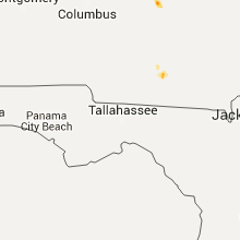
Hail Map for Thursday, October 1, 2015

Number of Impacted Households on 10/1/2015
0
Impacted by 1" or Larger Hail
0
Impacted by 1.75" or Larger Hail
0
Impacted by 2.5" or Larger Hail
Square Miles of Populated Area Impacted on 10/1/2015
0
Impacted by 1" or Larger Hail
0
Impacted by 1.75" or Larger Hail
0
Impacted by 2.5" or Larger Hail


Cities Most Affected by Hail Storms of 10/1/2015
| Hail Size | Demographics of Zip Codes Affected | ||||||
|---|---|---|---|---|---|---|---|
| City | Count | Average | Largest | Pop Density | House Value | Income | Age |
Hail and Wind Damage Spotted on 10/1/2015
Filter by Report Type:Hail ReportsWind Reports
Georgia
| Local Time | Report Details |
|---|---|
| 8:43 PM EDT | Multiple trees were blown down in the kathleen area including two trees onto houses at roberts rd and south blackberry circl in houston county GA, 82.1 miles NNW of Douglas, GA |
| 8:45 PM EDT | Trees down in omega. one on roof of house. note- there has been 2.5-3 inches rain in the area recently so this could be from sub-severe winds and saturated soi in tift county GA, 45.2 miles WSW of Douglas, GA |
Utah
| Local Time | Report Details |
|---|---|
| 9:50 PM MDT | Storm damage reported in tooele county UT, 80.1 miles NE of Ely, NV |
| 10:45 PM MDT | Storm damage reported in tooele county UT, 94.4 miles NE of Ely, NV |
| 11:15 PM MDT | Storm damage reported in tooele county UT, 95.5 miles NE of Ely, NV |
| 11:55 PM MDT | Storm damage reported in tooele county UT, 99.3 miles W of Salt Lake City, UT |
Connect with Interactive Hail Maps