

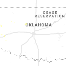
Hail Map for Wednesday, September 2, 2020

Number of Impacted Households on 9/2/2020
0
Impacted by 1" or Larger Hail
0
Impacted by 1.75" or Larger Hail
0
Impacted by 2.5" or Larger Hail
Square Miles of Populated Area Impacted on 9/2/2020
0
Impacted by 1" or Larger Hail
0
Impacted by 1.75" or Larger Hail
0
Impacted by 2.5" or Larger Hail


Cities Most Affected by Hail Storms of 9/2/2020
| Hail Size | Demographics of Zip Codes Affected | ||||||
|---|---|---|---|---|---|---|---|
| City | Count | Average | Largest | Pop Density | House Value | Income | Age |
Hail and Wind Damage Spotted on 9/2/2020
Filter by Report Type:Hail ReportsWind Reports
Texas
| Local Time | Report Details |
|---|---|
| 8:47 AM CDT | Damaging thunderstorm winds knocked down some power lines and tree limbs just west of brownwood. this resulted in some power outages across the area. winds were estimat in brown county TX, 66.1 miles SE of Abilene, TX |
| 4:25 PM CDT | Storm damage reported in hall county TX, 27.6 miles NW of Childress, TX |
Virginia
| Local Time | Report Details |
|---|---|
| 5:48 PM EDT | Tree down at the intersection of spout spring road and us-46 in appomattox county VA, 56.5 miles E of Roanoke, VA |
| 6:49 PM EDT | A tree was blown down in the 12300 block of va-671 harpers ferry roa in loudoun county VA, 60.1 miles W of Baltimore, MD |
| 7:05 PM EDT | Tree down near the intersection of charles town pike and hamilton station roa in loudoun county VA, 56 miles W of Baltimore, MD |
Maryland
| Local Time | Report Details |
|---|---|
| 6:21 PM EDT | Tree down on wires near the intersection of federal lookout road and wolfsville roa in washington county MD, 56.2 miles WNW of Baltimore, MD |
| 6:30 PM EDT | Tree down on i-70 westbound at mile marker 3 in washington county MD, 57.2 miles WNW of Baltimore, MD |
| 7:09 PM EDT | A tree was blown down on harp road in the walkersville are in frederick county MD, 39.2 miles WNW of Baltimore, MD |
| 7:31 PM EDT | Tree down on md-31 near wakefield valley roa in carroll county MD, 31 miles WNW of Baltimore, MD |
| 7:46 PM EDT | Tree down on route 26 in eldersburg blocking one lan in carroll county MD, 20.5 miles WNW of Baltimore, MD |
| 7:47 PM EDT | Tree down near the intersection of damascus road and griffith roa in montgomery county MD, 26.1 miles W of Baltimore, MD |
| 7:49 PM EDT | Tree blocking the road near the intersection of jennings chapel road and howard chapel roa in howard county MD, 24.3 miles W of Baltimore, MD |
| 8:00 PM EDT | A tree blew down near the intersection of homewood road and farside road/masters ru in howard county MD, 16.9 miles W of Baltimore, MD |
| 8:02 PM EDT | A tree was blown down onto wires on greenspring avenue between garrison forest road and baublitz road. a tree was blown down onto wires near the intersection of copper in baltimore county MD, 14.8 miles NNW of Baltimore, MD |
| 8:12 PM EDT | Tree down on md-145 at ashland roa in baltimore county MD, 13.9 miles N of Baltimore, MD |
North Dakota
| Local Time | Report Details |
|---|---|
| 7:45 PM CDT | Estimated 70 mph wind gust. blew patio furniture about 50 yards awa in foster county ND, 46.2 miles SSW of Devils Lake, ND |
| 7:54 PM CDT | Personal weather station measuremen in foster county ND, 38.9 miles S of Devils Lake, ND |
| 8:21 PM CDT | Public estimated wind gust of 75 mph in hannaford... received via social media in griggs county ND, 67.4 miles WNW of Fargo, ND |
| 8:30 PM CDT | Social media report measured on davis vantage pro 2 in griggs county ND, 53.9 miles SE of Devils Lake, ND |
| 8:33 PM CDT | Measured gust at air force base awos in grand forks county ND, 67.9 miles E of Devils Lake, ND |
| 8:38 PM CDT | 64 mph wind gust received from a home weather station via social media in grand forks county ND, 75 miles NNW of Fargo, ND |
| 8:42 PM CDT | Measured gust at ndawn site near pillsbury in barnes county ND, 53.6 miles WNW of Fargo, ND |
| 8:46 PM CDT | Gfk asos site measured a 64 mph wind gust in grand forks county ND, 74.5 miles NNW of Fargo, ND |
| 8:54 PM CDT | Off-duty nws meteorologist reports 2-3 inch diameter branches down on south side of town in grand forks county ND, 71.8 miles N of Fargo, ND |
| 8:59 PM CDT | Measured wind gust at grand forks nd dot rwis i-29 mp 145 in grand forks county ND, 73.4 miles N of Fargo, ND |
| 9:00 PM CDT | Public report of large tree... approximately 24 inches in diameter... snapped in half near riverside park area in grand forks county ND, 73.4 miles N of Fargo, ND |
| 9:00 PM CDT | 71 mph wind gust reported by the rwis near emerado in grand forks county ND, 67.3 miles E of Devils Lake, ND |
| 9:00 PM CDT | Pictures relayed via social media of 4 to 6 inch diameter branches down in hillsboro in traill county ND, 38.5 miles NNW of Fargo, ND |
Minnesota
| Local Time | Report Details |
|---|---|
| 8:48 PM CDT | Public reports 60 mph wind gust in east grand forks in polk county MN, 73.7 miles N of Fargo, ND |
| 9:30 PM CDT | Report from public via broadcast media social media in red lake county MN, 69.9 miles SSW of Roseau, MN |
| 9:34 PM CDT | Personal weather station measured 59 mph wind gust in red lake county MN, 65 miles WNW of Bemidji, MN |
| 9:35 PM CDT | Ndawn site measured 50 knot wind gust in pennington county MN, 50.5 miles SSW of Roseau, MN |
| 9:40 PM CDT | Time approximate and based on radar. reports of 30-40 trees down... some approximately 3+ ft in diameter. neighboring roof blown off. power outages reporte in polk county MN, 52.6 miles NNE of Fargo, ND |
| 9:55 PM CDT | Airport awos measured a wind gust of 59 mph in polk county MN, 41.4 miles W of Bemidji, MN |
Connect with Interactive Hail Maps