

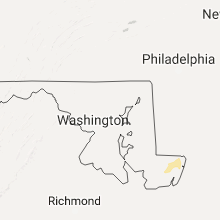
Hail Map for Wednesday, September 6, 2017

Number of Impacted Households on 9/6/2017
0
Impacted by 1" or Larger Hail
0
Impacted by 1.75" or Larger Hail
0
Impacted by 2.5" or Larger Hail
Square Miles of Populated Area Impacted on 9/6/2017
0
Impacted by 1" or Larger Hail
0
Impacted by 1.75" or Larger Hail
0
Impacted by 2.5" or Larger Hail


Cities Most Affected by Hail Storms of 9/6/2017
| Hail Size | Demographics of Zip Codes Affected | ||||||
|---|---|---|---|---|---|---|---|
| City | Count | Average | Largest | Pop Density | House Value | Income | Age |
Hail and Wind Damage Spotted on 9/6/2017
Filter by Report Type:Hail ReportsWind Reports
New York
| Local Time | Report Details |
|---|---|
| 9:30 AM EDT | Tree down on old main road in suffolk county NY, 66 miles SW of Providence, RI |
| 9:30 AM EDT | Wires down on shelter islan in suffolk county NY, 70.4 miles SW of Providence, RI |
Connecticut
| Local Time | Report Details |
|---|---|
| 9:51 AM EDT | Multiple reports of trees dow in new london county CT, 40.2 miles SW of Providence, RI |
| 9:51 AM EDT | *** 1 fatal... 1 inj *** uprooted tree down on a car on pequot avenu in new london county CT, 48.4 miles SW of Providence, RI |
| 10:01 AM EDT | Numerous trees and power lines down across town and debris on roads with road closures in new london county CT, 40.2 miles SW of Providence, RI |
Rhode Island
| Local Time | Report Details |
|---|---|
| 10:08 AM EDT | Wires down on main street in washington county RI, 37.5 miles SSW of Providence, RI |
| 10:30 AM EDT | Tree down on house on tidewater driver in kent county RI, 8.6 miles S of Providence, RI |
| 10:30 AM EDT | Large tree and wires down are down blocking major potter road in kent county RI, 11.2 miles SSW of Providence, RI |
Massachusetts
| Local Time | Report Details |
|---|---|
| 10:42 AM EDT | Wires down on warren ave near hollister road in bristol county MA, 13 miles ESE of Providence, RI |
| 10:55 AM EDT | Wires down at pembroke ave at dalton street in bristol county MA, 27.5 miles ESE of Providence, RI |
| 11:00 AM EDT | Power lines down on oneill road in bristol county MA, 14.2 miles ESE of Providence, RI |
| 11:00 AM EDT | Tree down on car on tuttle street in bristol county MA, 17.5 miles ESE of Providence, RI |
| 11:10 AM EDT | Tree down on plymouth street in plymouth county MA, 26.3 miles E of Providence, RI |
| 11:20 AM EDT | Tree down on weston avenue at union street in norfolk county MA, 30.6 miles NE of Providence, RI |
| 11:24 AM EDT | Tree down in road near stop and shop in norfolk county MA, 33.5 miles NE of Providence, RI |
| 11:34 AM EDT | Wires down on oakland street in middlesex county MA, 39.5 miles NNE of Providence, RI |
| 11:34 AM EDT | Wires down on summer street in norfolk county MA, 35.7 miles NE of Providence, RI |
| 11:34 AM EDT | Tree down on car between howard and western street in middlesex county MA, 41.2 miles NNE of Providence, RI |
South Carolina
| Local Time | Report Details |
|---|---|
| 1:46 PM EDT | Highway patrol reported trees down on i-95 at mile markers 105 and 106 northbound. time estimated based on rada in clarendon county SC, 33.9 miles NW of Charleston, SC |
| 1:59 PM EDT | Reported a power line down due to trees on it along chewing roa in clarendon county SC, 41.6 miles NW of Charleston, SC |
| 4:40 PM EDT | Highway patrol reported trees down on sc 527 and us 76. time estimated based on rada in lee county SC, 56.8 miles N of Charleston, SC |
Connect with Interactive Hail Maps