

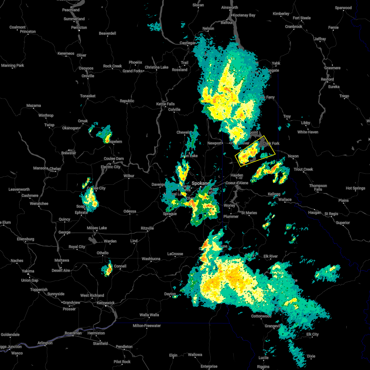
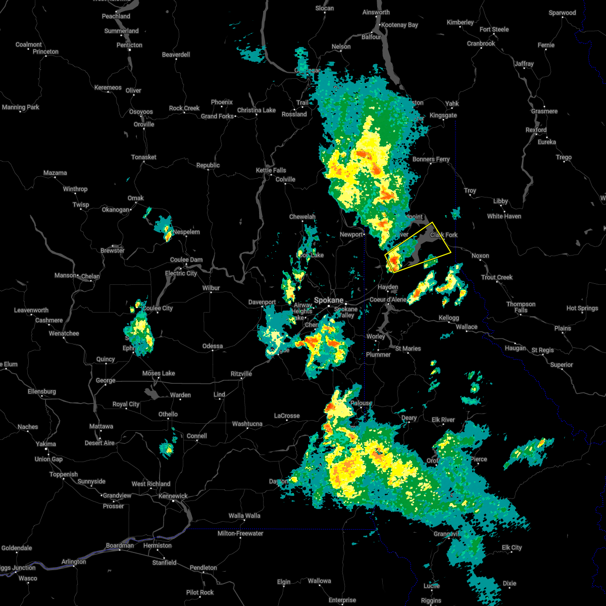
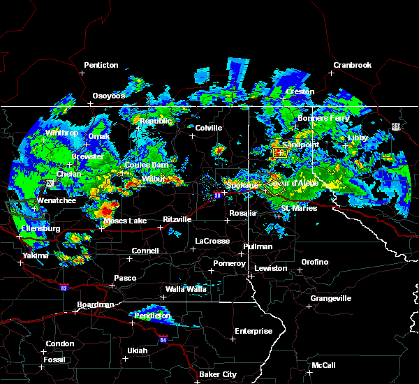
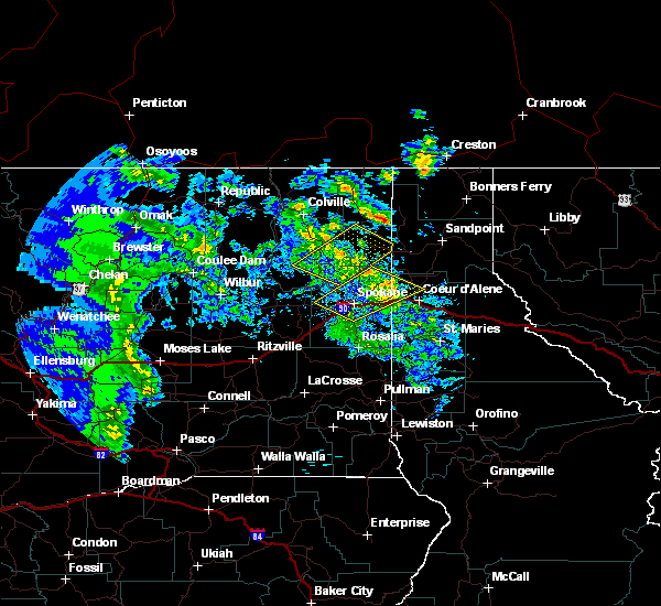
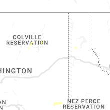
Hail Map for Athol, ID
The Athol, ID area has had 1 report of on-the-ground hail by trained spotters, and has been under severe weather warnings 1 time during the past 12 months. Doppler radar has detected hail at or near Athol, ID on 4 occasions, including 2 occasions during the past year.
| Name: | Athol, ID |
| Where Located: | 38.4 miles ENE of Spokane, WA |
| Map: | Google Map for Athol, ID |
| Population: | 692 |
| Housing Units: | 305 |
| More Info: | Search Google for Athol, ID |
0
The Top Recent Hail Date for Athol, ID is Monday, July 10, 2023 (4th out of 4)

Hail and Wind Damage Spotted near Athol, ID
| Date / Time | Report Details |
|---|---|
| 6/13/2023 4:20 PM PDT | Quarter sized hail reported 7.2 miles WSW of Athol, ID, photo of quarter size hail shared on facebook. |
| 6/13/2023 4:18 PM PDT | State park ranger reported camp site damage and tree damag in kootenai county ID, 6.1 miles WSW of Athol, ID |
| 6/13/2023 4:15 PM PDT |
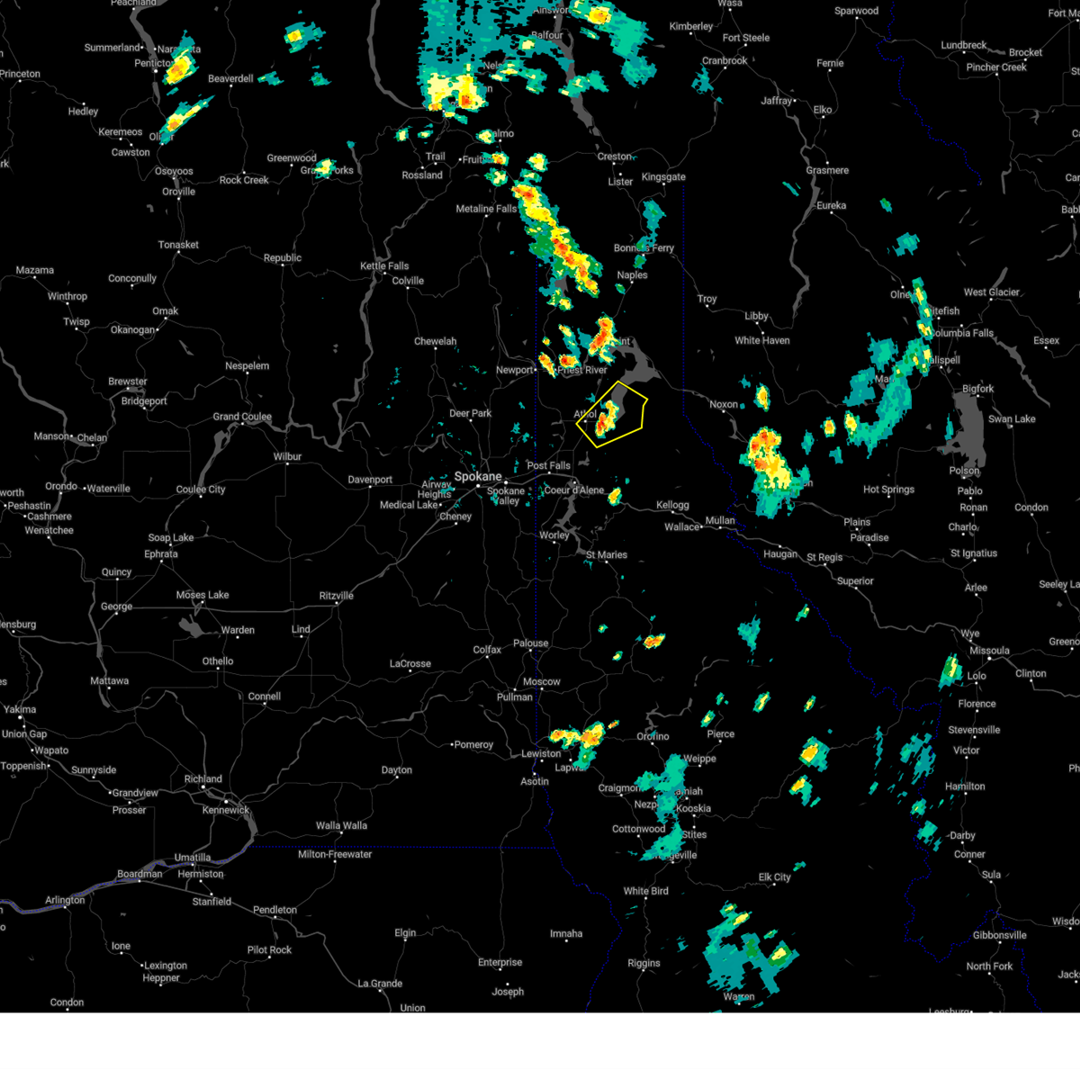 At 415 pm pdt, a severe thunderstorm was located near athol, or 16 miles northeast of hayden, moving northeast at 30 mph (radar indicated). Hazards include 60 mph wind gusts and quarter size hail. Hail damage to vehicles is expected. Expect wind damage to roofs, siding, and trees. At 415 pm pdt, a severe thunderstorm was located near athol, or 16 miles northeast of hayden, moving northeast at 30 mph (radar indicated). Hazards include 60 mph wind gusts and quarter size hail. Hail damage to vehicles is expected. Expect wind damage to roofs, siding, and trees.
|
| 6/8/2023 3:28 PM PDT | Social media report of downed trees and limbs in farragut state park. power outages reported nearby. time estimated from rada in kootenai county ID, 4.9 miles W of Athol, ID |
| 6/3/2022 5:21 PM PDT |
 The severe thunderstorm warning for southeastern bonner, northwestern shoshone and north central kootenai counties will expire at 530 pm pdt, the storm which prompted the warning has weakened below severe limits, and no longer poses an immediate threat to life or property. therefore, the warning will be allowed to expire. however heavy rain is still possible with this thunderstorm. to report severe weather, contact your nearest law enforcement agency. they will relay your report to the national weather service spokane. The severe thunderstorm warning for southeastern bonner, northwestern shoshone and north central kootenai counties will expire at 530 pm pdt, the storm which prompted the warning has weakened below severe limits, and no longer poses an immediate threat to life or property. therefore, the warning will be allowed to expire. however heavy rain is still possible with this thunderstorm. to report severe weather, contact your nearest law enforcement agency. they will relay your report to the national weather service spokane.
|
| 6/3/2022 5:05 PM PDT |
 At 504 pm pdt, a severe thunderstorm was located near athol, or 16 miles southeast of priest river, moving northeast at 25 mph (radar indicated). Hazards include quarter size hail. damage to vehicles is expected At 504 pm pdt, a severe thunderstorm was located near athol, or 16 miles southeast of priest river, moving northeast at 25 mph (radar indicated). Hazards include quarter size hail. damage to vehicles is expected
|
| 8/10/2019 7:14 PM PDT |
 The national weather service in spokane has issued a * severe thunderstorm warning for. south central bonner county in the panhandle of idaho. north central kootenai county in the panhandle of idaho. until 800 pm pdt. At 714 pm pdt, a severe thunderstorm was located over athol, or 13. The national weather service in spokane has issued a * severe thunderstorm warning for. south central bonner county in the panhandle of idaho. north central kootenai county in the panhandle of idaho. until 800 pm pdt. At 714 pm pdt, a severe thunderstorm was located over athol, or 13.
|
| 7/23/2019 9:35 PM PDT |
 At 934 pm pdt, severe thunderstorms were located along a line extending from 10 miles southwest of newport to near hayden lake, moving northeast at 75 mph (radar indicated). Hazards include 60 mph wind gusts and penny size hail. expect damage to roofs, siding, and trees At 934 pm pdt, severe thunderstorms were located along a line extending from 10 miles southwest of newport to near hayden lake, moving northeast at 75 mph (radar indicated). Hazards include 60 mph wind gusts and penny size hail. expect damage to roofs, siding, and trees
|
| 7/22/2016 5:12 PM PDT | The severe thunderstorm warning for northern kootenai and south central bonner counties will expire at 515 pm pdt, the storm which prompted the warning has weakened below severe limits, and no longer poses an immediate threat to life or property. therefore the warning will be allowed to expire. |
| 7/22/2016 4:30 PM PDT |
 At 429 pm pdt, doppler radar indicated a severe thunderstorm capable of producing quarter size hail. this storm was located near rathdrum and hayden, and moving northeast at 25 mph. At 429 pm pdt, doppler radar indicated a severe thunderstorm capable of producing quarter size hail. this storm was located near rathdrum and hayden, and moving northeast at 25 mph.
|
| 5/29/2015 8:46 PM PDT | At 841 pm pdt, weather service personnel measured a 53 mph wind gust at the weather office in airway heights. a trained weather spotter reported a dissipating funnel cloud near peone prairie. this storm was moving east at 30 mph. this severe storm will be near, post falls around 850 pm pdt. rathdrum around 855 pm pdt. hayden and dalton gardens around 905 pm pdt. coeur d`alene and hayden lake around 910 pm pdt. other locations impacted by this severe thunderstorm include mica, elk, newman lake, fernan lake village, laclede, mount spokane, opportunity, huetter, veradale and chilco. |
| 5/29/2015 8:46 PM PDT | At 841 pm pdt, weather service personnel measured a 53 mph wind gust at the weather office in airway heights. a trained weather spotter reported a dissipating funnel cloud near peone prairie. this storm was moving east at 30 mph. this severe storm will be near, post falls around 850 pm pdt. rathdrum around 855 pm pdt. hayden and dalton gardens around 905 pm pdt. coeur d`alene and hayden lake around 910 pm pdt. other locations impacted by this severe thunderstorm include mica, elk, newman lake, fernan lake village, laclede, mount spokane, opportunity, huetter, veradale and chilco. |
| 5/29/2015 8:31 PM PDT | At 827 pm pdt, doppler radar indicated a severe thunderstorm capable of producing damaging winds around 55 mph. this storm was located near trentwood, or 15 miles west of post falls, and moving east at 35 mph. small hail is also possible with this line of storms. * this severe thunderstorm will be near, liberty lake and otis orchards around 835 pm pdt. otis orchards-east farms around 840 pm pdt. hauser around 845 pm pdt. post falls around 850 pm pdt. rathdrum around 855 pm pdt. hayden, dalton gardens and hayden lake around 905 pm pdt. coeur d`alene around 910 pm pdt. other locations impacted by this severe thunderstorm include mica, elk, newman lake, fernan lake village, laclede, mount spokane, opportunity, huetter, veradale and chilco. |
| 5/29/2015 8:31 PM PDT | At 827 pm pdt, doppler radar indicated a severe thunderstorm capable of producing damaging winds around 55 mph. this storm was located near trentwood, or 15 miles west of post falls, and moving east at 35 mph. small hail is also possible with this line of storms. * this severe thunderstorm will be near, liberty lake and otis orchards around 835 pm pdt. otis orchards-east farms around 840 pm pdt. hauser around 845 pm pdt. post falls around 850 pm pdt. rathdrum around 855 pm pdt. hayden, dalton gardens and hayden lake around 905 pm pdt. coeur d`alene around 910 pm pdt. other locations impacted by this severe thunderstorm include mica, elk, newman lake, fernan lake village, laclede, mount spokane, opportunity, huetter, veradale and chilco. |
| 7/23/2014 2:52 PM PDT | *** 1 inj *** multiple trees down in rv park across the street from silverwood theme park. minor injuries of some people trapped in their rv in kootenai county ID, 2.4 miles N of Athol, ID |
| 7/20/2012 3:10 PM PDT | Lake pend oreille buoy in bonner county ID, 10.9 miles WSW of Athol, ID |
Hail Maps for Athol, ID


Connect with Interactive Hail Maps