

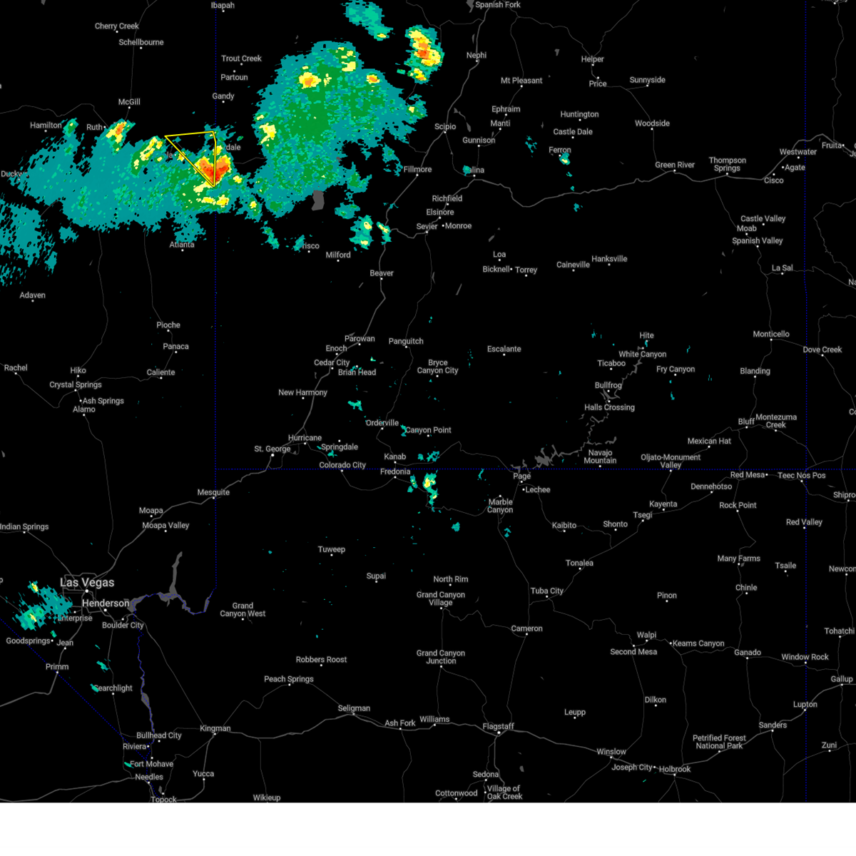
Hail Map for Baker, NV
The Baker, NV area has had 1 report of on-the-ground hail by trained spotters, and has been under severe weather warnings 0 times during the past 12 months. Doppler radar has detected hail at or near Baker, NV on 2 occasions.
| Name: | Baker, NV |
| Where Located: | 44.5 miles ESE of Ely, NV |
| Map: | Google Map for Baker, NV |
| Population: | 68 |
| Housing Units: | 38 |
| More Info: | Search Google for Baker, NV |
0
The Top Recent Hail Date for Baker, NV is Monday, August 12, 2024 (2nd out of 2)

Hail and Wind Damage Spotted near Baker, NV
| Date / Time | Report Details |
|---|---|
| 8/17/2024 10:10 AM PDT | Station: mather... id:mthn2... 9268 f in white pine county NV, 7.9 miles E of Baker, NV |
| 9/3/2023 3:11 PM PDT | Raws site mather (mthn2)... elevation 9268 fee in white pine county NV, 7.9 miles E of Baker, NV |
| 6/11/2023 2:34 PM PDT |
 At 232 pm pdt, a severe thunderstorm was located near baker, moving northwest at 30 mph (radar indicated). Hazards include 70 mph wind gusts and quarter size hail. Hail damage to vehicles is expected. expect considerable tree damage. Wind damage is also likely to mobile homes, roofs, and outbuildings. At 232 pm pdt, a severe thunderstorm was located near baker, moving northwest at 30 mph (radar indicated). Hazards include 70 mph wind gusts and quarter size hail. Hail damage to vehicles is expected. expect considerable tree damage. Wind damage is also likely to mobile homes, roofs, and outbuildings.
|
| 7/15/2022 5:50 PM PDT | Salt desert shrub (dnep8)... elevation 5185 fee in white pine county NV, 3.9 miles WSW of Baker, NV |
| 5/29/2022 5:30 PM PDT | Downburst wind of 58 mph measured at mesonet station dnep8 4.3 e baker (dri in white pine county NV, 3.9 miles WSW of Baker, NV |
| 4/18/2017 3:11 PM PDT | Mesonet station mthn2... mather raw in white pine county NV, 7.9 miles E of Baker, NV |
| 8/25/2013 6:50 PM PDT | Longnow sagebrush west dri site - elevation 5880 f in white pine county NV, 16.4 miles ENE of Baker, NV |
| 7/6/2013 4:12 PM PDT | Baker raws-5613 ft amsl in white pine county NV, 4.7 miles SSE of Baker, NV |
| 9/1/2012 11:15 AM MDT | Quarter sized hail reported 7.6 miles NW of Baker, NV |
| 4/26/2012 12:23 AM PDT | Mather raws-9268 ft amsl in white pine county NV, 7.9 miles E of Baker, NV |
Hail Maps for Baker, NV


Connect with Interactive Hail Maps