

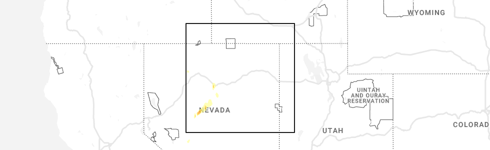
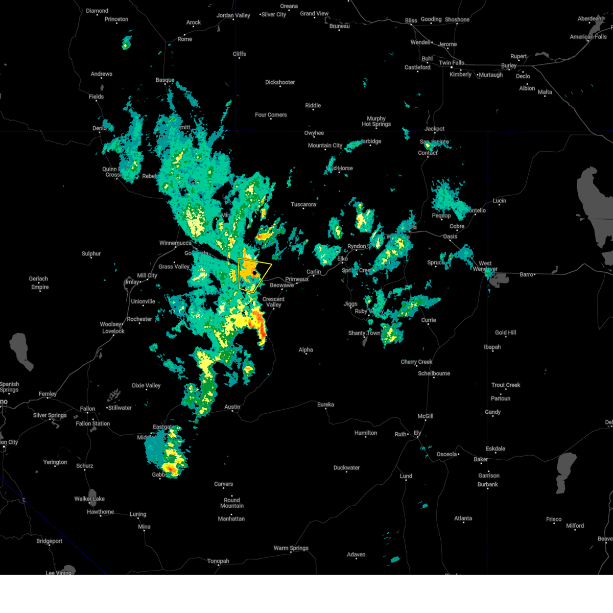
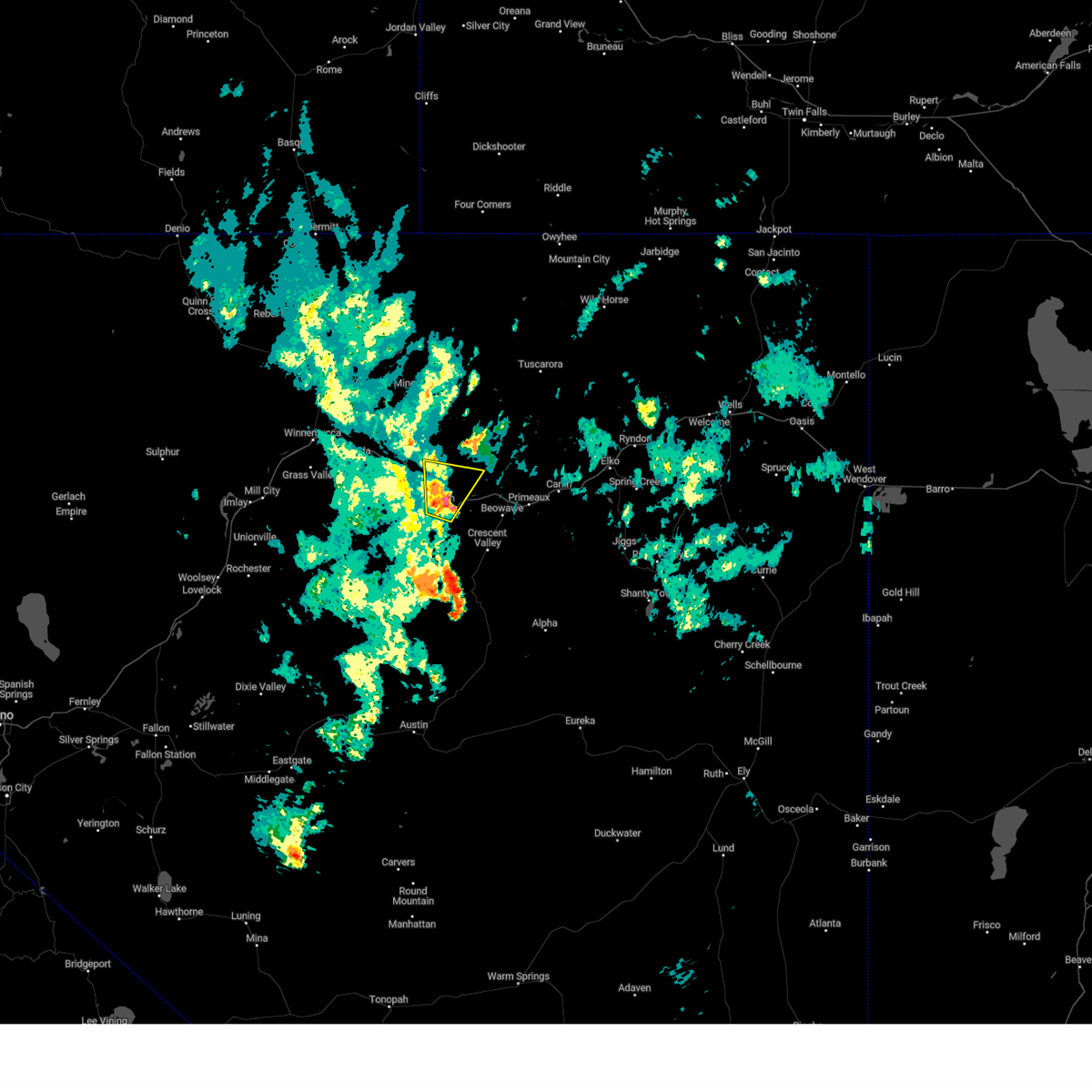
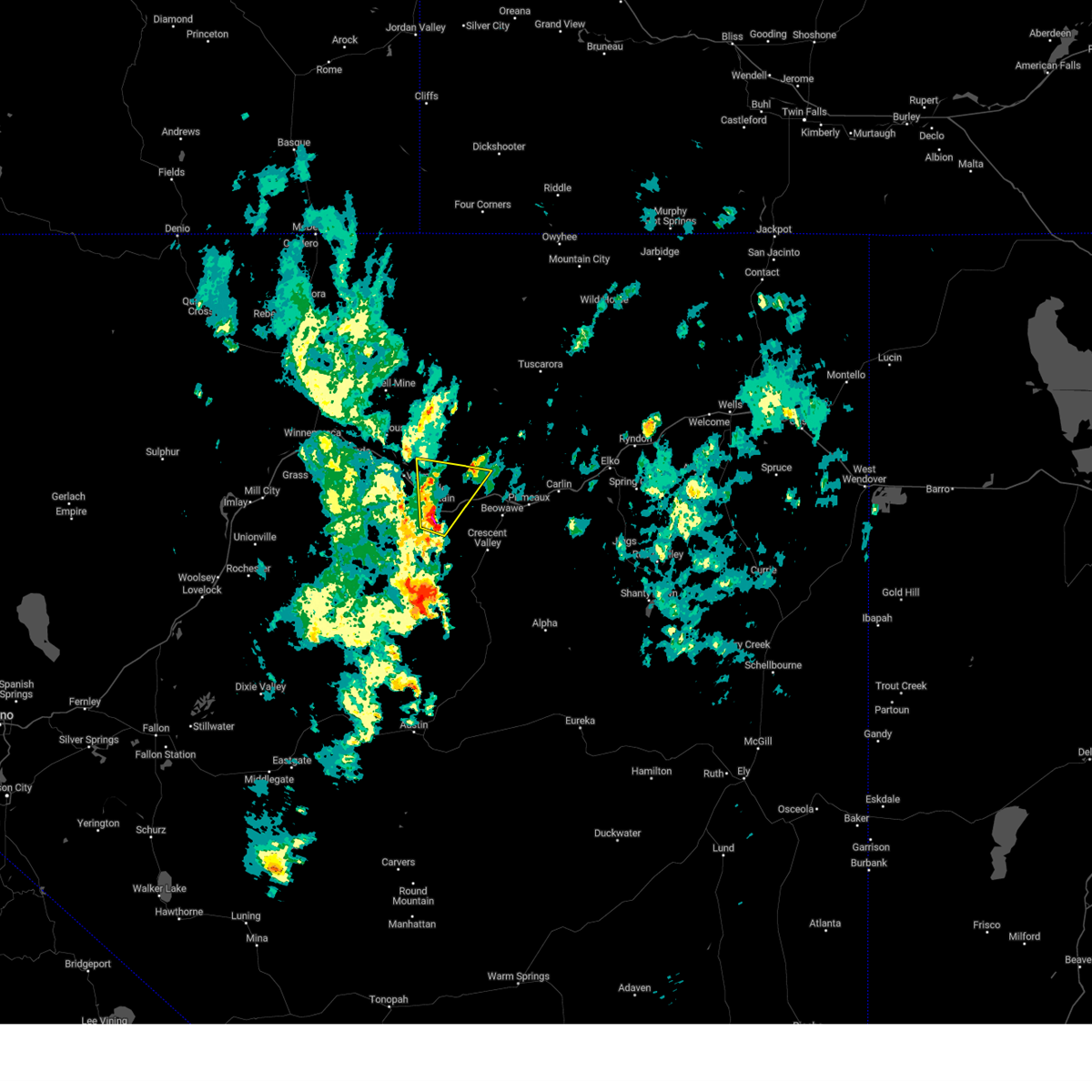
Hail Map for Battle Mountain, NV
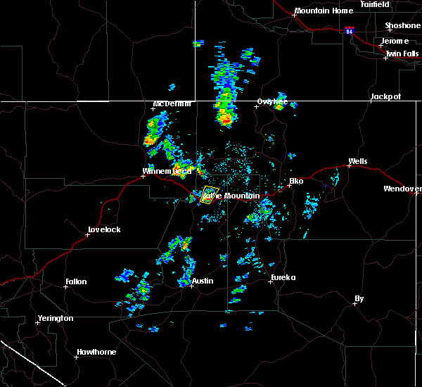
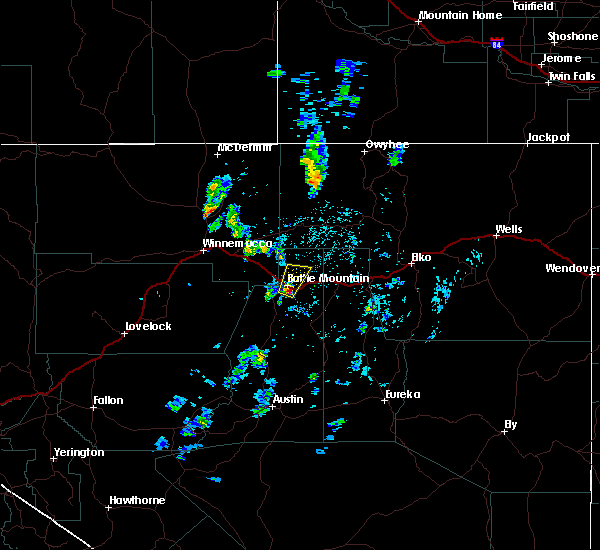
The Battle Mountain, NV area has had 0 reports of on-the-ground hail by trained spotters, and has been under severe weather warnings 6 times during the past 12 months. Doppler radar has detected hail at or near Battle Mountain, NV on 2 occasions, including 2 occasions during the past year.
| Name: | Battle Mountain, NV |
| Where Located: | 47.3 miles ESE of Winnemucca, NV |
| Map: | Google Map for Battle Mountain, NV |
| Population: | 3635 |
| Housing Units: | 1518 |
| More Info: | Search Google for Battle Mountain, NV |
5
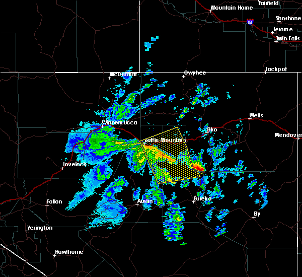
The Top Recent Hail Date for Battle Mountain, NV is Saturday, September 2, 2023 (1st out of 2)
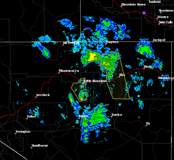
Hail and Wind Damage Spotted near Battle Mountain, NV
| Date / Time | Report Details |
|---|---|
| 9/3/2023 12:28 PM PDT |
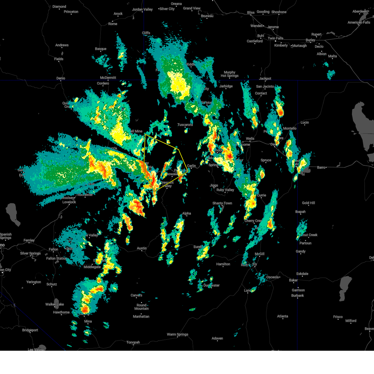 At 1228 pm pdt, severe thunderstorms were located along a line extending from 6 miles east of valmy to near battle mountain to near argenta, moving northeast at 50 mph (radar indicated). Hazards include 70 mph wind gusts and half dollar size hail. Hail damage to vehicles is expected. expect considerable tree damage. Wind damage is also likely to mobile homes, roofs, and outbuildings. At 1228 pm pdt, severe thunderstorms were located along a line extending from 6 miles east of valmy to near battle mountain to near argenta, moving northeast at 50 mph (radar indicated). Hazards include 70 mph wind gusts and half dollar size hail. Hail damage to vehicles is expected. expect considerable tree damage. Wind damage is also likely to mobile homes, roofs, and outbuildings.
|
| 9/3/2023 12:13 PM PDT |
 At 1213 pm pdt, a severe thunderstorm was located near battle mountain, moving northeast at 30 mph (radar indicated). Hazards include 70 mph wind gusts and half dollar size hail. Hail damage to vehicles is expected. expect considerable tree damage. wind damage is also likely to mobile homes, roofs, and outbuildings. locations impacted include, battle mountain and argenta. thunderstorm damage threat, considerable hail threat, radar indicated max hail size, 1. 25 in wind threat, radar indicated max wind gust, 70 mph. At 1213 pm pdt, a severe thunderstorm was located near battle mountain, moving northeast at 30 mph (radar indicated). Hazards include 70 mph wind gusts and half dollar size hail. Hail damage to vehicles is expected. expect considerable tree damage. wind damage is also likely to mobile homes, roofs, and outbuildings. locations impacted include, battle mountain and argenta. thunderstorm damage threat, considerable hail threat, radar indicated max hail size, 1. 25 in wind threat, radar indicated max wind gust, 70 mph.
|
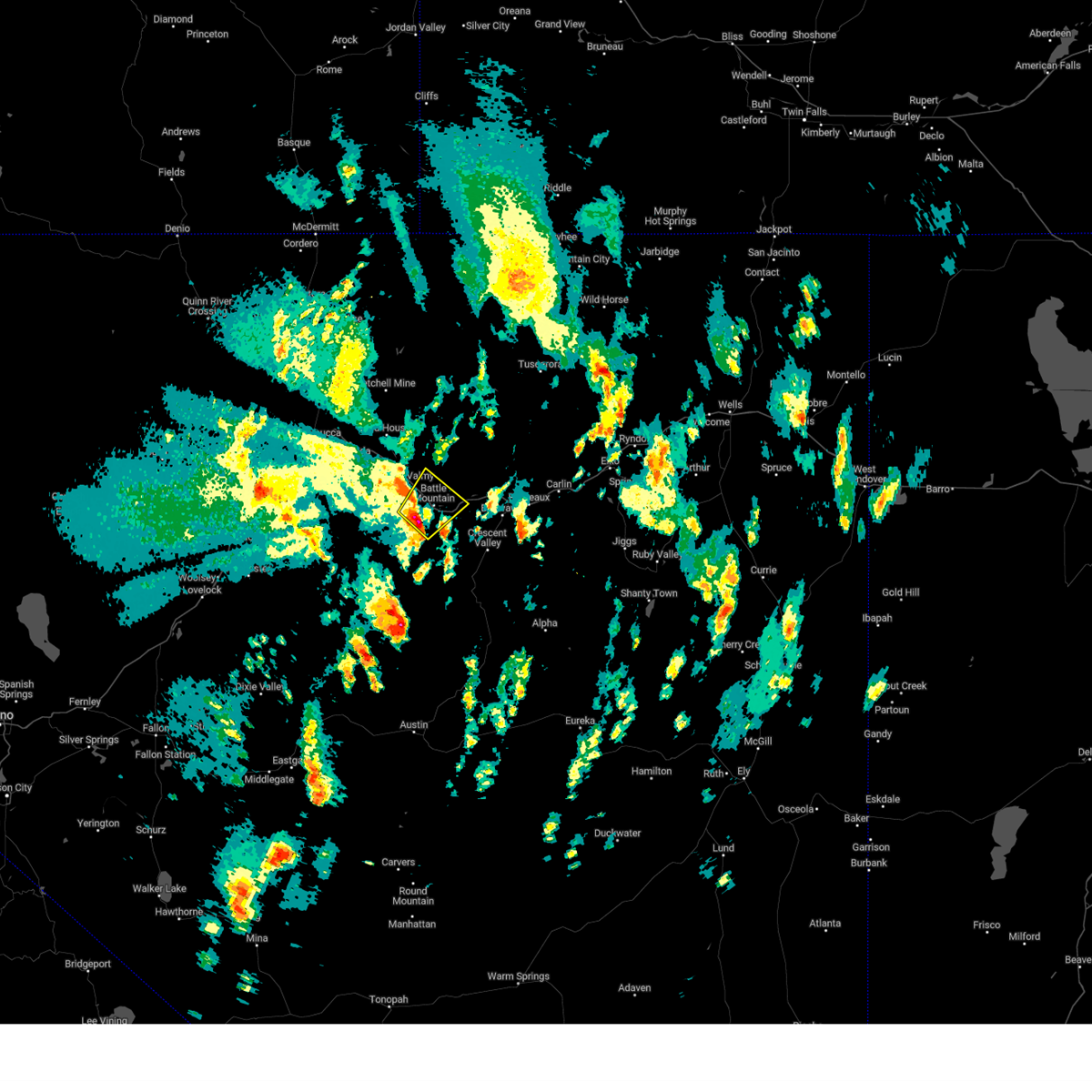
| 9/3/2023 12:01 PM PDT |
 At 1201 pm pdt, a severe thunderstorm was located 9 miles southwest of battle mountain, moving northeast at 30 mph (radar indicated). Hazards include 70 mph wind gusts and half dollar size hail. Hail damage to vehicles is expected. expect considerable tree damage. Wind damage is also likely to mobile homes, roofs, and outbuildings. At 1201 pm pdt, a severe thunderstorm was located 9 miles southwest of battle mountain, moving northeast at 30 mph (radar indicated). Hazards include 70 mph wind gusts and half dollar size hail. Hail damage to vehicles is expected. expect considerable tree damage. Wind damage is also likely to mobile homes, roofs, and outbuildings.
|
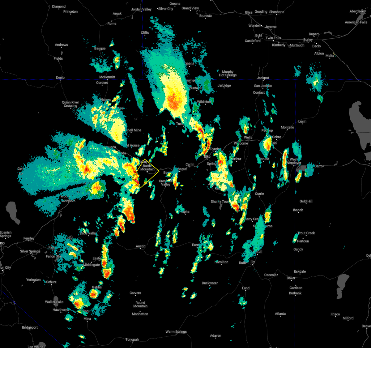
| 9/2/2023 5:12 PM PDT |
 The severe thunderstorm warning for northeastern lander county will expire at 515 pm pdt, the storm which prompted the warning has weakened below severe limits, and no longer poses an immediate threat to life or property. therefore, the warning will be allowed to expire. The severe thunderstorm warning for northeastern lander county will expire at 515 pm pdt, the storm which prompted the warning has weakened below severe limits, and no longer poses an immediate threat to life or property. therefore, the warning will be allowed to expire.
|
| 9/2/2023 5:05 PM PDT |
 At 504 pm pdt, a severe thunderstorm was located 13 miles north of argenta, moving north at 40 mph (radar indicated). Hazards include 60 mph wind gusts and nickel size hail. Expect damage to roofs, siding, and trees. locations impacted include, battle mountain, argenta, and i-80. hail threat, radar indicated max hail size, 0. 88 in wind threat, radar indicated max wind gust, 60 mph. At 504 pm pdt, a severe thunderstorm was located 13 miles north of argenta, moving north at 40 mph (radar indicated). Hazards include 60 mph wind gusts and nickel size hail. Expect damage to roofs, siding, and trees. locations impacted include, battle mountain, argenta, and i-80. hail threat, radar indicated max hail size, 0. 88 in wind threat, radar indicated max wind gust, 60 mph.
|
| 9/2/2023 4:43 PM PDT |
 At 442 pm pdt, a severe thunderstorm was located over battle mountain, moving north at 40 mph (radar indicated). Hazards include 70 mph wind gusts and half dollar size hail. Hail damage to vehicles is expected. expect considerable tree damage. Wind damage is also likely to mobile homes, roofs, and outbuildings. At 442 pm pdt, a severe thunderstorm was located over battle mountain, moving north at 40 mph (radar indicated). Hazards include 70 mph wind gusts and half dollar size hail. Hail damage to vehicles is expected. expect considerable tree damage. Wind damage is also likely to mobile homes, roofs, and outbuildings.
|
| 7/13/2022 3:39 PM PDT | Red butte raws (rbtn2). elevation 5026 f in lander county NV, 49.1 miles NNE of Battle Mountain, NV |
| 5/26/2022 5:09 PM PDT | Mesonet station bmrnv 0.6 sw battle mountain (nv dot) reported a 65 mph gust. downed tree onto a house was also reported on social media along with pictur in lander county NV, 0.8 miles NNE of Battle Mountain, NV |
| 7/21/2020 1:39 PM PDT | Mesonet station rbtn2 red butte raw in lander county NV, 49.1 miles NNE of Battle Mountain, NV |
| 7/24/2017 5:39 PM PDT | Thunderstorm downdraft at red butte raws sit in lander county NV, 49.1 miles NNE of Battle Mountain, NV |
| 5/6/2017 5:35 PM PDT |
 At 534 pm pdt, a severe thunderstorm was located 26 miles northwest of grass valley, moving north at 35 mph (radar indicated). Hazards include 70 mph wind gusts and quarter size hail. this storm has strengthened rapidly and is extremely dangerous to life and property. Hail damage to vehicles is expected. expect considerable tree damage. Wind damage is also likely to mobile homes, roofs, and outbuildings. At 534 pm pdt, a severe thunderstorm was located 26 miles northwest of grass valley, moving north at 35 mph (radar indicated). Hazards include 70 mph wind gusts and quarter size hail. this storm has strengthened rapidly and is extremely dangerous to life and property. Hail damage to vehicles is expected. expect considerable tree damage. Wind damage is also likely to mobile homes, roofs, and outbuildings.
|
| 5/5/2017 1:57 PM PDT |
 At 155 pm pdt, a severe thunderstorm was located near argenta, moving northeast at 35 mph (radar indicated). Hazards include 60 mph wind gusts and quarter size hail. Hail damage to vehicles is expected. expect wind damage to roofs, siding, and trees. locations impacted include, battle mountain. I-80 near battle mountain. At 155 pm pdt, a severe thunderstorm was located near argenta, moving northeast at 35 mph (radar indicated). Hazards include 60 mph wind gusts and quarter size hail. Hail damage to vehicles is expected. expect wind damage to roofs, siding, and trees. locations impacted include, battle mountain. I-80 near battle mountain.
|
| 5/5/2017 1:44 PM PDT |
 At 143 pm pdt, a severe thunderstorm was located near battle mountain, moving northeast at 35 mph (radar indicated). Hazards include 60 mph wind gusts and quarter size hail. Hail damage to vehicles is expected. Expect wind damage to roofs, siding, and trees. At 143 pm pdt, a severe thunderstorm was located near battle mountain, moving northeast at 35 mph (radar indicated). Hazards include 60 mph wind gusts and quarter size hail. Hail damage to vehicles is expected. Expect wind damage to roofs, siding, and trees.
|
| 9/13/2016 2:13 PM PDT |
 At 212 pm pdt, doppler radar indicated severe thunderstorms capable of producing damaging winds in excess of 60 mph. these storms were located along a line extending from 14 miles north of argenta to near palisade, moving northeast at 25 mph. penny size hail may also accompany the damaging winds. locations impacted include, battle mountain, pine valley, dunphy, palisade, beowawe, argenta, crescent valley, emigrant pass, mount tenabo and mule canyon reclamation project. At 212 pm pdt, doppler radar indicated severe thunderstorms capable of producing damaging winds in excess of 60 mph. these storms were located along a line extending from 14 miles north of argenta to near palisade, moving northeast at 25 mph. penny size hail may also accompany the damaging winds. locations impacted include, battle mountain, pine valley, dunphy, palisade, beowawe, argenta, crescent valley, emigrant pass, mount tenabo and mule canyon reclamation project.
|
| 9/13/2016 1:28 PM PDT |
 At 126 pm pdt, doppler radar indicated a line of severe thunderstorms capable of producing damaging winds in excess of 60 mph. these storms were located along a line extending from battle mountain to 13 miles southeast of crescent valley, and moving northeast at 25 mph. penny size hail may also accompany the damaging winds. this storm system will cross interstate 80 by 145 pm pdt and produce strong cross winds. all vehicles along interstate 80 will experience difficulty driving, and high profile vehicles could be overturned. brief torrential rains are also possible. * other locations impacted include, battle mountain, pine valley, dunphy, palisade, beowawe, argenta, crescent valley, emigrant pass, mount tenabo and mule canyon reclamation project. At 126 pm pdt, doppler radar indicated a line of severe thunderstorms capable of producing damaging winds in excess of 60 mph. these storms were located along a line extending from battle mountain to 13 miles southeast of crescent valley, and moving northeast at 25 mph. penny size hail may also accompany the damaging winds. this storm system will cross interstate 80 by 145 pm pdt and produce strong cross winds. all vehicles along interstate 80 will experience difficulty driving, and high profile vehicles could be overturned. brief torrential rains are also possible. * other locations impacted include, battle mountain, pine valley, dunphy, palisade, beowawe, argenta, crescent valley, emigrant pass, mount tenabo and mule canyon reclamation project.
|
| 6/28/2013 5:29 PM PDT | Wind gust to 62 mph from severe thunderstorm outflow boundar in lander county NV, 6.4 miles WNW of Battle Mountain, NV |
Hail Maps for Battle Mountain, NV


Connect with Interactive Hail Maps