

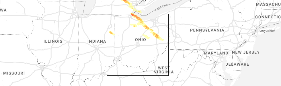
Hail Map for Bluffton, IN
The Bluffton, IN area has had 15 reports of on-the-ground hail by trained spotters, and has been under severe weather warnings 18 times during the past 12 months. Doppler radar has detected hail at or near Bluffton, IN on 47 occasions, including 2 occasions during the past year.
| Name: | Bluffton, IN |
| Where Located: | 23.6 miles S of Fort Wayne, IN |
| Map: | Google Map for Bluffton, IN |
| Population: | 9897 |
| Housing Units: | 4532 |
| More Info: | Search Google for Bluffton, IN |
2
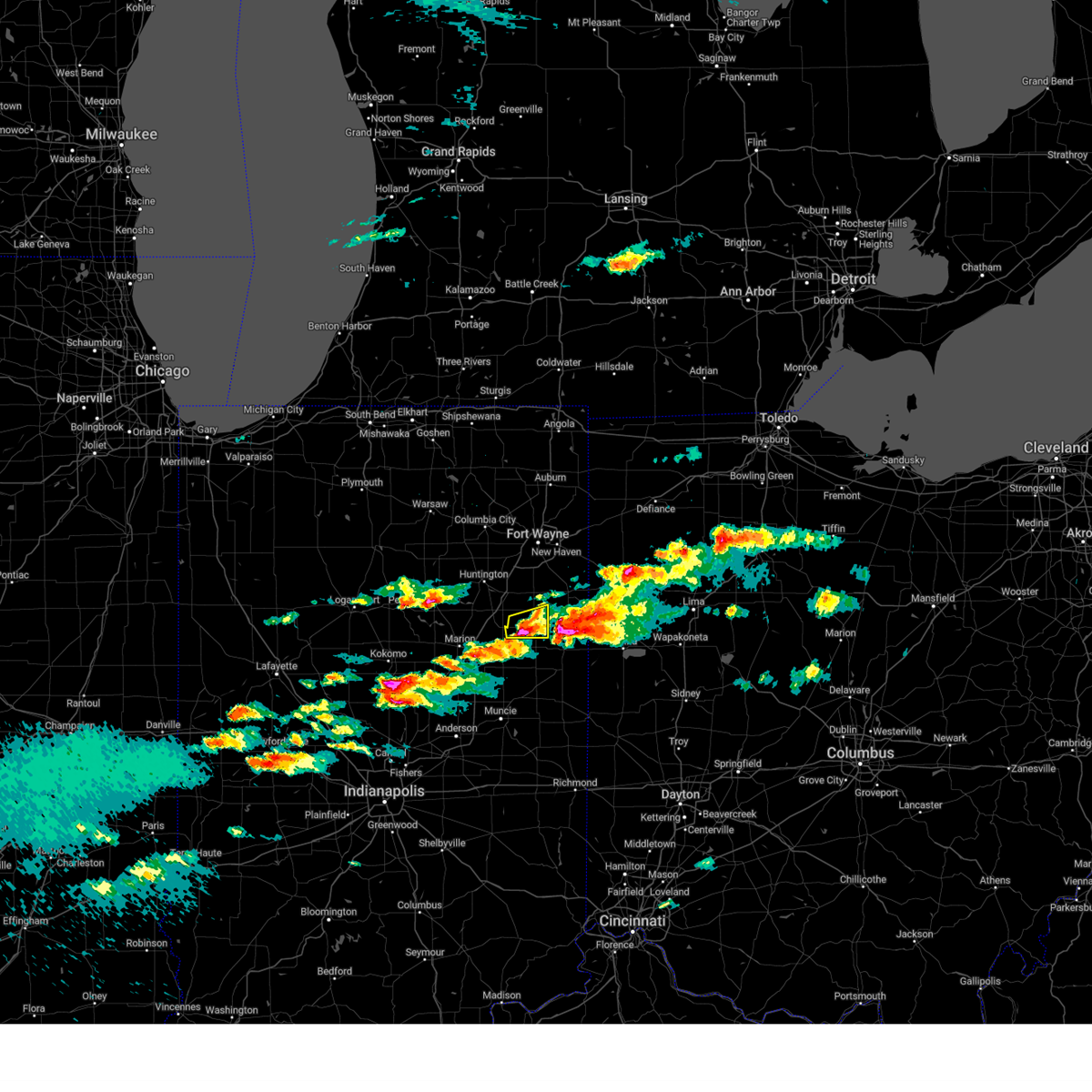
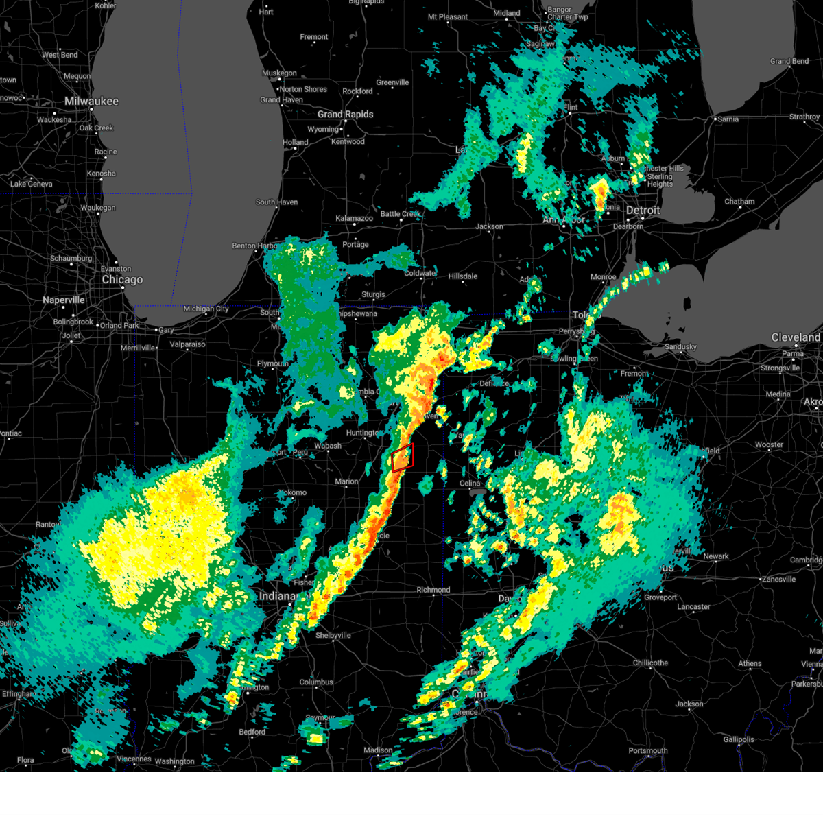
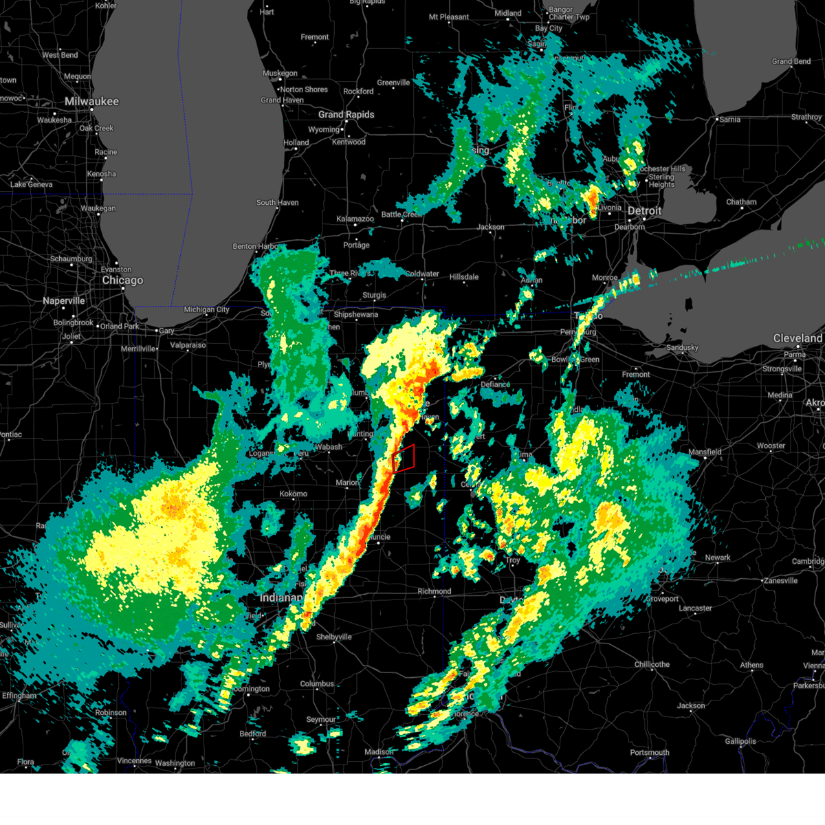
The Top Recent Hail Date for Bluffton, IN is Thursday, June 15, 2023 (3rd out of 47)
Hail and Wind Damage Spotted near Bluffton, IN
| Date / Time | Report Details |
|---|---|
| 3/14/2024 6:30 PM EDT |
 Svriwx the national weather service in northern indiana has issued a * severe thunderstorm warning for, southeastern wells county in northeastern indiana, * until 645 pm edt. * at 630 pm edt, a severe thunderstorm was located near montpelier, or 7 miles southwest of bluffton, moving east at 60 mph (radar indicated). Hazards include 60 mph wind gusts and half dollar size hail. Hail damage to vehicles is expected. Expect wind damage to roofs, siding, and trees. Svriwx the national weather service in northern indiana has issued a * severe thunderstorm warning for, southeastern wells county in northeastern indiana, * until 645 pm edt. * at 630 pm edt, a severe thunderstorm was located near montpelier, or 7 miles southwest of bluffton, moving east at 60 mph (radar indicated). Hazards include 60 mph wind gusts and half dollar size hail. Hail damage to vehicles is expected. Expect wind damage to roofs, siding, and trees.
|
| 3/14/2024 6:18 PM EDT | Quarter sized hail reported 4.8 miles NE of Bluffton, IN, report from mping: quarter (1.00 in.). |
| 3/14/2024 6:04 PM EDT | Quarter sized hail reported 0.6 miles N of Bluffton, IN |
| 3/14/2024 6:04 PM EDT |
 At 603 pm edt, a severe thunderstorm was located near bluffton, moving east at 45 mph (a storm chaser reported quarter inch hail in bluffton as of 6:02 pm edt). Hazards include 60 mph wind gusts and half dollar size hail. Hail damage to vehicles is expected. expect wind damage to roofs, siding, and trees. locations impacted include, bluffton, decatur, berne, monroe, warren, poneto, vera cruz, mcnatts, travisville, craigville, wellsburg, reiffsburg, liberty center, mount zion, peterson, plum tree, north oaks, buckeye, linn grove, and rockford. This includes interstate 69 in indiana between mile markers 278 and 279. At 603 pm edt, a severe thunderstorm was located near bluffton, moving east at 45 mph (a storm chaser reported quarter inch hail in bluffton as of 6:02 pm edt). Hazards include 60 mph wind gusts and half dollar size hail. Hail damage to vehicles is expected. expect wind damage to roofs, siding, and trees. locations impacted include, bluffton, decatur, berne, monroe, warren, poneto, vera cruz, mcnatts, travisville, craigville, wellsburg, reiffsburg, liberty center, mount zion, peterson, plum tree, north oaks, buckeye, linn grove, and rockford. This includes interstate 69 in indiana between mile markers 278 and 279.
|
| 3/14/2024 6:04 PM EDT |
 At 604 pm edt, a severe thunderstorm was located near van buren, or 14 miles west of bluffton, moving east at 40 mph (storm chasers reported quarter size hail in bluffton). Hazards include 60 mph wind gusts and half dollar size hail. Hail damage to vehicles is expected. expect wind damage to roofs, siding, and trees. locations impacted include, bluffton, van buren, warren, nottingham, poneto, vera cruz, mcnatts, travisville, craigville, wellsburg, reiffsburg, liberty center, mount zion, dillman, petroleum, plum tree, north oaks, buckeye, keystone, and rockford. This includes interstate 69 in indiana between mile markers 268 and 280. At 604 pm edt, a severe thunderstorm was located near van buren, or 14 miles west of bluffton, moving east at 40 mph (storm chasers reported quarter size hail in bluffton). Hazards include 60 mph wind gusts and half dollar size hail. Hail damage to vehicles is expected. expect wind damage to roofs, siding, and trees. locations impacted include, bluffton, van buren, warren, nottingham, poneto, vera cruz, mcnatts, travisville, craigville, wellsburg, reiffsburg, liberty center, mount zion, dillman, petroleum, plum tree, north oaks, buckeye, keystone, and rockford. This includes interstate 69 in indiana between mile markers 268 and 280.
|
| 3/14/2024 5:58 PM EDT |
 At 558 pm edt, a severe thunderstorm was located over bluffton, moving east at 45 mph (radar indicated). Hazards include 60 mph wind gusts and quarter size hail. Hail damage to vehicles is expected. expect wind damage to roofs, siding, and trees. locations impacted include, bluffton, decatur, berne, monroe, warren, poneto, vera cruz, mcnatts, travisville, craigville, wellsburg, reiffsburg, liberty center, mount zion, peterson, plum tree, north oaks, buckeye, linn grove, and rockford. This includes interstate 69 in indiana between mile markers 278 and 279. At 558 pm edt, a severe thunderstorm was located over bluffton, moving east at 45 mph (radar indicated). Hazards include 60 mph wind gusts and quarter size hail. Hail damage to vehicles is expected. expect wind damage to roofs, siding, and trees. locations impacted include, bluffton, decatur, berne, monroe, warren, poneto, vera cruz, mcnatts, travisville, craigville, wellsburg, reiffsburg, liberty center, mount zion, peterson, plum tree, north oaks, buckeye, linn grove, and rockford. This includes interstate 69 in indiana between mile markers 278 and 279.
|
| 3/14/2024 5:57 PM EDT |
 Svriwx the national weather service in northern indiana has issued a * severe thunderstorm warning for, northeastern grant county in central indiana, southern huntington county in northeastern indiana, wells county in northeastern indiana, * until 630 pm edt. * at 556 pm edt, a severe thunderstorm was located over van buren, or 10 miles northeast of marion, moving east at 40 mph (radar indicated). Hazards include 60 mph wind gusts and quarter size hail. Hail damage to vehicles is expected. Expect wind damage to roofs, siding, and trees. Svriwx the national weather service in northern indiana has issued a * severe thunderstorm warning for, northeastern grant county in central indiana, southern huntington county in northeastern indiana, wells county in northeastern indiana, * until 630 pm edt. * at 556 pm edt, a severe thunderstorm was located over van buren, or 10 miles northeast of marion, moving east at 40 mph (radar indicated). Hazards include 60 mph wind gusts and quarter size hail. Hail damage to vehicles is expected. Expect wind damage to roofs, siding, and trees.
|
| 3/14/2024 5:49 PM EDT |
 Svriwx the national weather service in northern indiana has issued a * severe thunderstorm warning for, southeastern huntington county in northeastern indiana, central wells county in northeastern indiana, central adams county in northeastern indiana, * until 615 pm edt. * at 549 pm edt, a severe thunderstorm was located 7 miles south of markle, or 8 miles west of bluffton, moving east at 45 mph (radar indicated). Hazards include 60 mph wind gusts and quarter size hail. Hail damage to vehicles is expected. Expect wind damage to roofs, siding, and trees. Svriwx the national weather service in northern indiana has issued a * severe thunderstorm warning for, southeastern huntington county in northeastern indiana, central wells county in northeastern indiana, central adams county in northeastern indiana, * until 615 pm edt. * at 549 pm edt, a severe thunderstorm was located 7 miles south of markle, or 8 miles west of bluffton, moving east at 45 mph (radar indicated). Hazards include 60 mph wind gusts and quarter size hail. Hail damage to vehicles is expected. Expect wind damage to roofs, siding, and trees.
|
| 3/14/2024 5:40 PM EDT |
 Svriwx the national weather service in northern indiana has issued a * severe thunderstorm warning for, southeastern allen county in northeastern indiana, northeastern wells county in northeastern indiana, northern adams county in northeastern indiana, southwestern paulding county in west central ohio, northwestern van wert county in west central ohio, * until 615 pm edt. * at 540 pm edt, a severe thunderstorm was located over ossian, moving east at 55 mph (radar indicated). Hazards include 60 mph wind gusts and quarter size hail. Hail damage to vehicles is expected. Expect wind damage to roofs, siding, and trees. Svriwx the national weather service in northern indiana has issued a * severe thunderstorm warning for, southeastern allen county in northeastern indiana, northeastern wells county in northeastern indiana, northern adams county in northeastern indiana, southwestern paulding county in west central ohio, northwestern van wert county in west central ohio, * until 615 pm edt. * at 540 pm edt, a severe thunderstorm was located over ossian, moving east at 55 mph (radar indicated). Hazards include 60 mph wind gusts and quarter size hail. Hail damage to vehicles is expected. Expect wind damage to roofs, siding, and trees.
|
| 3/14/2024 5:31 PM EDT |
 At 530 pm edt, a severe thunderstorm was located 7 miles south of markle, or 10 miles west of bluffton, moving east at 70 mph (radar indicated). Hazards include 60 mph wind gusts and quarter size hail. Hail damage to vehicles is expected. expect wind damage to roofs, siding, and trees. locations impacted include, marion, bluffton, van buren, warren, lancaster, uniondale, poneto, mount etna, vera cruz, mcnatts, landess, wellsburg, murray, liberty center, mount zion, buckeye, tocsin, majenica, banquo, and kingsland. This includes interstate 69 in indiana between mile markers 266 and 284. At 530 pm edt, a severe thunderstorm was located 7 miles south of markle, or 10 miles west of bluffton, moving east at 70 mph (radar indicated). Hazards include 60 mph wind gusts and quarter size hail. Hail damage to vehicles is expected. expect wind damage to roofs, siding, and trees. locations impacted include, marion, bluffton, van buren, warren, lancaster, uniondale, poneto, mount etna, vera cruz, mcnatts, landess, wellsburg, murray, liberty center, mount zion, buckeye, tocsin, majenica, banquo, and kingsland. This includes interstate 69 in indiana between mile markers 266 and 284.
|
| 3/14/2024 5:21 PM EDT |
 Svriwx the national weather service in northern indiana has issued a * severe thunderstorm warning for, southeastern wabash county in north central indiana, northern grant county in central indiana, southern huntington county in northeastern indiana, wells county in northeastern indiana, * until 545 pm edt. * at 519 pm edt, a severe thunderstorm was located near la fontaine, or 8 miles north of marion, moving east at 65 mph (radar indicated). Hazards include 60 mph wind gusts and quarter size hail. Hail damage to vehicles is expected. Expect wind damage to roofs, siding, and trees. Svriwx the national weather service in northern indiana has issued a * severe thunderstorm warning for, southeastern wabash county in north central indiana, northern grant county in central indiana, southern huntington county in northeastern indiana, wells county in northeastern indiana, * until 545 pm edt. * at 519 pm edt, a severe thunderstorm was located near la fontaine, or 8 miles north of marion, moving east at 65 mph (radar indicated). Hazards include 60 mph wind gusts and quarter size hail. Hail damage to vehicles is expected. Expect wind damage to roofs, siding, and trees.
|
| 3/14/2024 12:40 PM EDT | Damage to a power pole on sr-1 in bluffto in wells county IN, 0.8 miles S of Bluffton, IN |
| 3/14/2024 12:36 PM EDT |
 Svriwx the national weather service in northern indiana has issued a * severe thunderstorm warning for, eastern wells county in northeastern indiana, adams county in northeastern indiana, southwestern van wert county in west central ohio, * until 100 pm edt. * at 1236 pm edt, a severe thunderstorm was located over bluffton, moving southeast at 50 mph (radar indicated). Hazards include 60 mph wind gusts and quarter size hail. Hail damage to vehicles is expected. Expect wind damage to roofs, siding, and trees. Svriwx the national weather service in northern indiana has issued a * severe thunderstorm warning for, eastern wells county in northeastern indiana, adams county in northeastern indiana, southwestern van wert county in west central ohio, * until 100 pm edt. * at 1236 pm edt, a severe thunderstorm was located over bluffton, moving southeast at 50 mph (radar indicated). Hazards include 60 mph wind gusts and quarter size hail. Hail damage to vehicles is expected. Expect wind damage to roofs, siding, and trees.
|
| 7/29/2023 3:12 AM EDT |
 The severe thunderstorm warning for southwestern allen, eastern huntington and northeastern wells counties will expire at 315 am edt, the storms which prompted the warning have moved out of the area. therefore, the warning will be allowed to expire. a severe thunderstorm watch remains in effect until 500 am edt for northeastern indiana. The severe thunderstorm warning for southwestern allen, eastern huntington and northeastern wells counties will expire at 315 am edt, the storms which prompted the warning have moved out of the area. therefore, the warning will be allowed to expire. a severe thunderstorm watch remains in effect until 500 am edt for northeastern indiana.
|
| 7/29/2023 2:56 AM EDT |
 At 256 am edt, severe thunderstorms were located along a line extending from near fort wayne to 8 miles north of van buren, moving east at 40 mph (radar indicated). Hazards include 60 mph wind gusts. Expect damage to roofs, siding, and trees. locations impacted include, fort wayne, new haven, bluffton, ossian, markle, aboite, roanoke, lancaster, zanesville, uniondale, mount etna, nine mile, yoder, poe, murray, hessen cassel, plum tree, north oaks, tocsin, and majenica. this includes the following highways, interstate 469 between mile markers 0 and 12. interstate 69 in indiana between mile markers 278 and 312. hail threat, radar indicated max hail size, <. 75 in wind threat, radar indicated max wind gust, 60 mph. At 256 am edt, severe thunderstorms were located along a line extending from near fort wayne to 8 miles north of van buren, moving east at 40 mph (radar indicated). Hazards include 60 mph wind gusts. Expect damage to roofs, siding, and trees. locations impacted include, fort wayne, new haven, bluffton, ossian, markle, aboite, roanoke, lancaster, zanesville, uniondale, mount etna, nine mile, yoder, poe, murray, hessen cassel, plum tree, north oaks, tocsin, and majenica. this includes the following highways, interstate 469 between mile markers 0 and 12. interstate 69 in indiana between mile markers 278 and 312. hail threat, radar indicated max hail size, <. 75 in wind threat, radar indicated max wind gust, 60 mph.
|
| 7/29/2023 2:49 AM EDT |
 At 248 am edt, severe thunderstorms were located along a line extending from near huntington to near windfall, moving east at 55 mph (radar indicated). Hazards include 60 mph wind gusts. Expect damage to roofs, siding, and trees. locations impacted include, marion, hartford city, gas city, upland, fairmount, montpelier, jonesboro, sweetser, swayzee, la fontaine, van buren, matthews, warren, fowlerton, shamrock lakes, poneto, mcnatts, landess, wellsburg, and liberty center. this includes interstate 69 in indiana between mile markers 252 and 278. hail threat, radar indicated max hail size, <. 75 in wind threat, radar indicated max wind gust, 60 mph. At 248 am edt, severe thunderstorms were located along a line extending from near huntington to near windfall, moving east at 55 mph (radar indicated). Hazards include 60 mph wind gusts. Expect damage to roofs, siding, and trees. locations impacted include, marion, hartford city, gas city, upland, fairmount, montpelier, jonesboro, sweetser, swayzee, la fontaine, van buren, matthews, warren, fowlerton, shamrock lakes, poneto, mcnatts, landess, wellsburg, and liberty center. this includes interstate 69 in indiana between mile markers 252 and 278. hail threat, radar indicated max hail size, <. 75 in wind threat, radar indicated max wind gust, 60 mph.
|
| 7/29/2023 2:47 AM EDT |
 At 247 am edt, severe thunderstorms were located along a line extending from near fort wayne to near ossian to 6 miles north of van buren, moving east at 50 mph (radar indicated). Hazards include 60 mph wind gusts. expect damage to roofs, siding, and trees At 247 am edt, severe thunderstorms were located along a line extending from near fort wayne to near ossian to 6 miles north of van buren, moving east at 50 mph (radar indicated). Hazards include 60 mph wind gusts. expect damage to roofs, siding, and trees
|
| 7/29/2023 2:27 AM EDT |
 At 226 am edt, severe thunderstorms were located along a line extending from near wabash to 11 miles southwest of kokomo, moving east at 55 mph (radar indicated). Hazards include 60 mph wind gusts. expect damage to roofs, siding, and trees At 226 am edt, severe thunderstorms were located along a line extending from near wabash to 11 miles southwest of kokomo, moving east at 55 mph (radar indicated). Hazards include 60 mph wind gusts. expect damage to roofs, siding, and trees
|
| 7/29/2023 2:09 AM EDT |
 At 208 am edt, severe thunderstorms were located along a line extending from 6 miles south of winona lake to peru, moving east at 55 mph (radar indicated). Hazards include 60 mph wind gusts. expect damage to roofs, siding, and trees At 208 am edt, severe thunderstorms were located along a line extending from 6 miles south of winona lake to peru, moving east at 55 mph (radar indicated). Hazards include 60 mph wind gusts. expect damage to roofs, siding, and trees
|
| 6/15/2023 7:45 PM EDT | Metal roofing partially removed/peeled off an outhouse building. an empty 35k gallon fertilizer tank was tipped over on its sid in wells county IN, 5.3 miles NW of Bluffton, IN |
| 6/15/2023 5:47 PM EDT | Half Dollar sized hail reported 8.2 miles NW of Bluffton, IN, hail covering the road like snow... about two inches thick. average size was quarter sized... and then the largest spotter saw was half dollar. there is patchy dense fo |
| 6/15/2023 5:47 PM EDT | 24 inch diameter healthy maple uprooted... a grove of trees was heavily damaged... with trees of varying health and size were either uprooted or snappe in adams county IN, 8.2 miles NW of Bluffton, IN |
| 6/15/2023 5:45 PM EDT | Half Dollar sized hail reported 5.7 miles NW of Bluffton, IN, crop damage at 700e and 400s from the large hail that moved through the area. |
| 6/15/2023 5:45 PM EDT | Corrects previous tstm wnd dmg report from 1 ssw vera cruz. metal roofing partially removed/peeled off an outhouse building. an empty 35k gallon fertilizer tank was tip in wells county IN, 5.3 miles NW of Bluffton, IN |
| 6/15/2023 5:41 PM EDT | Mping 1 to 3 inch limbs reported down by spotter... also had a phone call about various 1-3 inch diameter limbs and tree debris around tow in wells county IN, 2.4 miles NW of Bluffton, IN |
| 6/15/2023 5:38 PM EDT | Various 1-3 inch limbs down. reported via mpin in wells county IN, 3.6 miles NNW of Bluffton, IN |
| 6/15/2023 5:36 PM EDT | Report relayed from near bluffton along 124... reports of trees down from thunderstorm wind. no information on size/tree healt in wells county IN, 1.5 miles W of Bluffton, IN |
| 6/15/2023 5:36 PM EDT | Reports of a large tree down on a mobile home in the park off us 124. no injuries or fatalities were reporte in wells county IN, 0.5 miles WSW of Bluffton, IN |
| 6/15/2023 5:31 PM EDT |
 At 531 pm edt, a severe thunderstorm was located over bluffton, moving east at 25 mph (radar indicated). Hazards include 60 mph wind gusts and quarter size hail. Hail damage to vehicles is expected. Expect wind damage to roofs, siding, and trees. At 531 pm edt, a severe thunderstorm was located over bluffton, moving east at 25 mph (radar indicated). Hazards include 60 mph wind gusts and quarter size hail. Hail damage to vehicles is expected. Expect wind damage to roofs, siding, and trees.
|
| 6/15/2023 5:30 PM EDT | Report from mping: 3-inch tree limbs broken; power poles broke in wells county IN, 0.8 miles S of Bluffton, IN |
| 6/3/2023 5:37 PM EDT | Likely wet microburst blew the side of a barn in... several large diameter trees damaged up to 48 inches in diameter... peeled roofing materials. time estimated from ra in wells county IN, 5.6 miles NNW of Bluffton, IN |
| 4/5/2023 1:52 PM EDT | Reports of tree damage at the intersection of hoosier highway and e 200 in wells county IN, 2.2 miles NNE of Bluffton, IN |
| 4/5/2023 1:36 PM EDT |
 The severe thunderstorm warning for southern allen, southeastern grant, blackford, southeastern huntington, wells, adams and jay counties will expire at 145 pm edt, the storms which prompted the warning have moved out of the area. therefore, the warning will be allowed to expire. a tornado watch remains in effect until 400 pm edt for northeastern and east central indiana, and west central ohio. The severe thunderstorm warning for southern allen, southeastern grant, blackford, southeastern huntington, wells, adams and jay counties will expire at 145 pm edt, the storms which prompted the warning have moved out of the area. therefore, the warning will be allowed to expire. a tornado watch remains in effect until 400 pm edt for northeastern and east central indiana, and west central ohio.
|
| 4/5/2023 1:23 PM EDT |
 The tornado warning for east central wells county will expire at 130 pm edt, the storm which prompted the warning has moved out of the area. therefore, the warning will be allowed to expire. a tornado watch remains in effect until 400 pm edt for northeastern indiana. The tornado warning for east central wells county will expire at 130 pm edt, the storm which prompted the warning has moved out of the area. therefore, the warning will be allowed to expire. a tornado watch remains in effect until 400 pm edt for northeastern indiana.
|
| 4/5/2023 1:16 PM EDT |
 At 115 pm edt, a severe thunderstorm capable of producing a tornado was located over bluffton, moving northeast at 50 mph (radar indicated rotation). Hazards include tornado. Flying debris will be dangerous to those caught without shelter. mobile homes will be damaged or destroyed. damage to roofs, windows, and vehicles will occur. tree damage is likely. This tornadic thunderstorm will remain over mainly rural areas of east central wells county, including the following locations, north oaks, tocsin, vera cruz, travisville, craigville, murray, curryville and wellsburg. At 115 pm edt, a severe thunderstorm capable of producing a tornado was located over bluffton, moving northeast at 50 mph (radar indicated rotation). Hazards include tornado. Flying debris will be dangerous to those caught without shelter. mobile homes will be damaged or destroyed. damage to roofs, windows, and vehicles will occur. tree damage is likely. This tornadic thunderstorm will remain over mainly rural areas of east central wells county, including the following locations, north oaks, tocsin, vera cruz, travisville, craigville, murray, curryville and wellsburg.
|
| 4/5/2023 1:15 PM EDT | A few trees downe in wells county IN, 0.7 miles NW of Bluffton, IN |
| 4/5/2023 1:13 PM EDT | Corrects previous tstm wnd dmg report from 2 nne travisville. reports of tree damage at the intersection of hoosier highway and e 200 in wells county IN, 2.2 miles NNE of Bluffton, IN |
| 4/5/2023 1:13 PM EDT |
 At 113 pm edt, severe thunderstorms were located along a line extending from near new haven to near hartford city, moving northeast at 80 mph (radar indicated). Hazards include 60 mph wind gusts. Expect damage to roofs, siding, and trees. locations impacted include, fort wayne, new haven, bluffton, decatur, portland, hartford city, berne, ossian, dunkirk, montpelier, woodburn, redkey, geneva, monroeville, markle, monroe, pennville, matthews, westchester and center. this includes the following highways, interstate 469 between mile markers 0 and 7, and between mile markers 9 and 23. Interstate 69 in indiana between mile markers 299 and 302, and between mile markers 304 and 306. At 113 pm edt, severe thunderstorms were located along a line extending from near new haven to near hartford city, moving northeast at 80 mph (radar indicated). Hazards include 60 mph wind gusts. Expect damage to roofs, siding, and trees. locations impacted include, fort wayne, new haven, bluffton, decatur, portland, hartford city, berne, ossian, dunkirk, montpelier, woodburn, redkey, geneva, monroeville, markle, monroe, pennville, matthews, westchester and center. this includes the following highways, interstate 469 between mile markers 0 and 7, and between mile markers 9 and 23. Interstate 69 in indiana between mile markers 299 and 302, and between mile markers 304 and 306.
|
| 4/5/2023 1:05 PM EDT |
 At 105 pm edt, a severe thunderstorm capable of producing a tornado was located 8 miles south of markle, or 8 miles west of bluffton, moving northeast at 50 mph (radar indicated rotation). Hazards include tornado. Flying debris will be dangerous to those caught without shelter. mobile homes will be damaged or destroyed. damage to roofs, windows, and vehicles will occur. tree damage is likely. This dangerous storm will be near, bluffton around 115 pm edt. At 105 pm edt, a severe thunderstorm capable of producing a tornado was located 8 miles south of markle, or 8 miles west of bluffton, moving northeast at 50 mph (radar indicated rotation). Hazards include tornado. Flying debris will be dangerous to those caught without shelter. mobile homes will be damaged or destroyed. damage to roofs, windows, and vehicles will occur. tree damage is likely. This dangerous storm will be near, bluffton around 115 pm edt.
|
| 4/5/2023 12:54 PM EDT |
 At 1254 pm edt, severe thunderstorms were located along a line extending from near markle to alexandria, moving northeast at 80 mph (radar indicated). Hazards include 60 mph wind gusts. expect damage to roofs, siding, and trees At 1254 pm edt, severe thunderstorms were located along a line extending from near markle to alexandria, moving northeast at 80 mph (radar indicated). Hazards include 60 mph wind gusts. expect damage to roofs, siding, and trees
|
| 4/1/2023 12:00 AM EDT | Storm damage reported in wells county IN, 1.5 miles W of Bluffton, IN |
| 2/27/2023 2:33 PM EST | 1 to 3 inch in diameter limbs blown down. some of the limbs had rot in them. time estimated by rada in wells county IN, 0.6 miles ESE of Bluffton, IN |
| 8/29/2022 5:07 PM EDT |
 At 506 pm edt, severe thunderstorms were located along a line extending from near hicksville to 6 miles southeast of ossian, moving east at 50 mph (radar indicated). Hazards include 70 mph wind gusts. Expect considerable tree damage. damage is likely to mobile homes, roofs, and outbuildings. locations impacted include, fort wayne, new haven, bluffton, decatur, ossian, butler, woodburn, monroeville, grabill, monroe, st. joe, leo-cedarville, middletown, concord, preble, dixon, newville, uniondale, yoder and edgerton in allen county. this includes interstate 469 between mile markers 5 and 6, and between mile markers 9 and 28. thunderstorm damage threat, considerable hail threat, radar indicated max hail size, <. 75 in wind threat, radar indicated max wind gust, 70 mph. At 506 pm edt, severe thunderstorms were located along a line extending from near hicksville to 6 miles southeast of ossian, moving east at 50 mph (radar indicated). Hazards include 70 mph wind gusts. Expect considerable tree damage. damage is likely to mobile homes, roofs, and outbuildings. locations impacted include, fort wayne, new haven, bluffton, decatur, ossian, butler, woodburn, monroeville, grabill, monroe, st. joe, leo-cedarville, middletown, concord, preble, dixon, newville, uniondale, yoder and edgerton in allen county. this includes interstate 469 between mile markers 5 and 6, and between mile markers 9 and 28. thunderstorm damage threat, considerable hail threat, radar indicated max hail size, <. 75 in wind threat, radar indicated max wind gust, 70 mph.
|
| 8/29/2022 4:47 PM EDT |
 At 447 pm edt, severe thunderstorms were located along a line extending from near auburn to 6 miles north of markle, moving east at 50 mph (radar indicated). Hazards include 70 mph wind gusts. Expect considerable tree damage. damage is likely to mobile homes, roofs, and outbuildings. locations impacted include, fort wayne, huntington, new haven, auburn, bluffton, decatur, garrett, ossian, butler, huntertown, waterloo, woodburn, monroeville, markle, grabill, monroe, st. joe, aboite, leo-cedarville and middletown. this includes the following highways, interstate 469 between mile markers 0 and 30. interstate 69 in indiana between mile markers 284 and 333. thunderstorm damage threat, considerable hail threat, radar indicated max hail size, <. 75 in wind threat, radar indicated max wind gust, 70 mph. At 447 pm edt, severe thunderstorms were located along a line extending from near auburn to 6 miles north of markle, moving east at 50 mph (radar indicated). Hazards include 70 mph wind gusts. Expect considerable tree damage. damage is likely to mobile homes, roofs, and outbuildings. locations impacted include, fort wayne, huntington, new haven, auburn, bluffton, decatur, garrett, ossian, butler, huntertown, waterloo, woodburn, monroeville, markle, grabill, monroe, st. joe, aboite, leo-cedarville and middletown. this includes the following highways, interstate 469 between mile markers 0 and 30. interstate 69 in indiana between mile markers 284 and 333. thunderstorm damage threat, considerable hail threat, radar indicated max hail size, <. 75 in wind threat, radar indicated max wind gust, 70 mph.
|
| 8/29/2022 4:34 PM EDT |
 At 433 pm edt, severe thunderstorms were located along a line extending from near avilla to 6 miles north of huntington, moving east at 50 mph (radar indicated). Hazards include 70 mph wind gusts. Expect considerable tree damage. Damage is likely to mobile homes, roofs, and outbuildings. At 433 pm edt, severe thunderstorms were located along a line extending from near avilla to 6 miles north of huntington, moving east at 50 mph (radar indicated). Hazards include 70 mph wind gusts. Expect considerable tree damage. Damage is likely to mobile homes, roofs, and outbuildings.
|
| 7/23/2022 9:06 AM EDT |
 At 906 am edt, severe thunderstorms were located along a line extending from near decatur to near bluffton, moving southeast at 45 mph (radar indicated). Hazards include 70 mph wind gusts. Expect considerable tree damage. Damage is likely to mobile homes, roofs, and outbuildings. At 906 am edt, severe thunderstorms were located along a line extending from near decatur to near bluffton, moving southeast at 45 mph (radar indicated). Hazards include 70 mph wind gusts. Expect considerable tree damage. Damage is likely to mobile homes, roofs, and outbuildings.
|
| 6/13/2022 11:07 PM EDT |
 The severe thunderstorm warning for southeastern allen, southeastern wells, adams and southwestern van wert counties will expire at 1115 pm edt, the storms which prompted the warning was moving out of the area. therefore, the warning will be allowed to expire. however gusty winds and heavy rain are still possible with these thunderstorms through 1130 pm edt. a severe thunderstorm watch remains in effect until midnight edt for northeastern and east central indiana, and west central ohio. The severe thunderstorm warning for southeastern allen, southeastern wells, adams and southwestern van wert counties will expire at 1115 pm edt, the storms which prompted the warning was moving out of the area. therefore, the warning will be allowed to expire. however gusty winds and heavy rain are still possible with these thunderstorms through 1130 pm edt. a severe thunderstorm watch remains in effect until midnight edt for northeastern and east central indiana, and west central ohio.
|
| 6/13/2022 10:51 PM EDT |
 At 1051 pm edt, severe thunderstorms were located along a line extending from near monroeville to decatur to near bluffton, moving southeast at 35 mph. these are destructive storms! (radar indicated). Hazards include 80 mph wind gusts. Flying debris will be dangerous to those caught without shelter. mobile homes will be heavily damaged. expect considerable damage to roofs, windows, and vehicles. extensive tree damage and power outages are likely. locations impacted include, bluffton, decatur, berne, geneva, monroeville, monroe, middlebury, preble, nottingham, willshire, wren, vera cruz, peterson, dull, tocsin, domestic, rivare, schumm, magley and craigville. thunderstorm damage threat, destructive hail threat, radar indicated max hail size, <. 75 in wind threat, radar indicated max wind gust, 80 mph. At 1051 pm edt, severe thunderstorms were located along a line extending from near monroeville to decatur to near bluffton, moving southeast at 35 mph. these are destructive storms! (radar indicated). Hazards include 80 mph wind gusts. Flying debris will be dangerous to those caught without shelter. mobile homes will be heavily damaged. expect considerable damage to roofs, windows, and vehicles. extensive tree damage and power outages are likely. locations impacted include, bluffton, decatur, berne, geneva, monroeville, monroe, middlebury, preble, nottingham, willshire, wren, vera cruz, peterson, dull, tocsin, domestic, rivare, schumm, magley and craigville. thunderstorm damage threat, destructive hail threat, radar indicated max hail size, <. 75 in wind threat, radar indicated max wind gust, 80 mph.
|
| 6/13/2022 10:27 PM EDT |
 At 1026 pm edt, severe thunderstorms were located along a line extending from near fort wayne to 7 miles north of ossian to 6 miles north of markle, moving southeast at 55 mph. these are destructive storms! (radar indicated). Hazards include 80 mph wind gusts. Flying debris will be dangerous to those caught without shelter. mobile homes will be heavily damaged. expect considerable damage to roofs, windows, and vehicles. Extensive tree damage and power outages are likely. At 1026 pm edt, severe thunderstorms were located along a line extending from near fort wayne to 7 miles north of ossian to 6 miles north of markle, moving southeast at 55 mph. these are destructive storms! (radar indicated). Hazards include 80 mph wind gusts. Flying debris will be dangerous to those caught without shelter. mobile homes will be heavily damaged. expect considerable damage to roofs, windows, and vehicles. Extensive tree damage and power outages are likely.
|
| 3/23/2022 2:04 PM EDT |
 At 204 pm edt, severe thunderstorms were located along a line extending from bluffton to 8 miles northeast of montpelier, moving northeast at 30 mph (radar indicated). Hazards include 60 mph wind gusts and quarter size hail. Hail damage to vehicles is expected. Expect wind damage to roofs, siding, and trees. At 204 pm edt, severe thunderstorms were located along a line extending from bluffton to 8 miles northeast of montpelier, moving northeast at 30 mph (radar indicated). Hazards include 60 mph wind gusts and quarter size hail. Hail damage to vehicles is expected. Expect wind damage to roofs, siding, and trees.
|
| 3/6/2022 3:28 AM EST |
 The severe thunderstorm warning for western allen, southeastern wabash, southeastern noble, northern grant, whitley, huntington and wells counties will expire at 330 am est, the storms which prompted the warning have moved out of the area. therefore, the warning will be allowed to expire. however gusty winds up to around 45 mph are still possible. a severe thunderstorm watch remains in effect until 500 am est for central, north central and northeastern indiana. there are other warnings still in effect. visit our website for more information. The severe thunderstorm warning for western allen, southeastern wabash, southeastern noble, northern grant, whitley, huntington and wells counties will expire at 330 am est, the storms which prompted the warning have moved out of the area. therefore, the warning will be allowed to expire. however gusty winds up to around 45 mph are still possible. a severe thunderstorm watch remains in effect until 500 am est for central, north central and northeastern indiana. there are other warnings still in effect. visit our website for more information.
|
| 3/6/2022 3:21 AM EST |
 At 321 am est, severe thunderstorms were located along a line extending from near auburn to near monroeville to near matthews, moving east at 80 mph (radar indicated). Hazards include 70 mph wind gusts. Expect considerable tree damage. Damage is likely to mobile homes, roofs, and outbuildings. At 321 am est, severe thunderstorms were located along a line extending from near auburn to near monroeville to near matthews, moving east at 80 mph (radar indicated). Hazards include 70 mph wind gusts. Expect considerable tree damage. Damage is likely to mobile homes, roofs, and outbuildings.
|
| 3/6/2022 3:13 AM EST |
 At 312 am est, severe thunderstorms were located along a line extending from huntertown to near markle to van buren, moving east at 65 mph (radar indicated). Hazards include 60 mph wind gusts. Expect damage to roofs, siding, and trees. locations impacted include, fort wayne, marion, huntington, new haven, bluffton, columbia city, ossian, tri-lakes, huntertown, avilla, churubusco, south whitley, sweetser, andrews, markle, la fontaine, van buren, aboite, leo-cedarville and swan. this includes the following highways, interstate 469 between mile markers 0 and 15, and between mile markers 25 and 30. Interstate 69 in indiana between mile markers 266 and 322. At 312 am est, severe thunderstorms were located along a line extending from huntertown to near markle to van buren, moving east at 65 mph (radar indicated). Hazards include 60 mph wind gusts. Expect damage to roofs, siding, and trees. locations impacted include, fort wayne, marion, huntington, new haven, bluffton, columbia city, ossian, tri-lakes, huntertown, avilla, churubusco, south whitley, sweetser, andrews, markle, la fontaine, van buren, aboite, leo-cedarville and swan. this includes the following highways, interstate 469 between mile markers 0 and 15, and between mile markers 25 and 30. Interstate 69 in indiana between mile markers 266 and 322.
|
| 3/6/2022 3:07 AM EST |
 At 307 am est, severe thunderstorms were located along a line extending from near churubusco to near markle to near van buren, moving east at 65 mph (radar indicated). Hazards include 60 mph wind gusts. Expect damage to roofs, siding, and trees. locations impacted include, fort wayne, marion, huntington, new haven, bluffton, columbia city, ossian, tri-lakes, huntertown, avilla, churubusco, south whitley, sweetser, andrews, markle, la fontaine, van buren, aboite, leo-cedarville and swan. this includes the following highways, interstate 469 between mile markers 0 and 15, and between mile markers 25 and 30. interstate 69 in indiana between mile markers 266 and 322. hail threat, radar indicated max hail size, <. 75 in wind threat, observed max wind gust, 60 mph. At 307 am est, severe thunderstorms were located along a line extending from near churubusco to near markle to near van buren, moving east at 65 mph (radar indicated). Hazards include 60 mph wind gusts. Expect damage to roofs, siding, and trees. locations impacted include, fort wayne, marion, huntington, new haven, bluffton, columbia city, ossian, tri-lakes, huntertown, avilla, churubusco, south whitley, sweetser, andrews, markle, la fontaine, van buren, aboite, leo-cedarville and swan. this includes the following highways, interstate 469 between mile markers 0 and 15, and between mile markers 25 and 30. interstate 69 in indiana between mile markers 266 and 322. hail threat, radar indicated max hail size, <. 75 in wind threat, observed max wind gust, 60 mph.
|
| 3/6/2022 2:43 AM EST |
 At 243 am est, severe thunderstorms were located along a line extending from near winona lake to 6 miles northwest of wabash to 6 miles northeast of kokomo, moving east at 65 mph (radar indicated). Hazards include 60 mph wind gusts. expect damage to roofs, siding, and trees At 243 am est, severe thunderstorms were located along a line extending from near winona lake to 6 miles northwest of wabash to 6 miles northeast of kokomo, moving east at 65 mph (radar indicated). Hazards include 60 mph wind gusts. expect damage to roofs, siding, and trees
|
| 8/11/2021 2:36 PM EDT |
 At 236 pm edt, severe thunderstorms were located along a line extending from 6 miles northeast of antwerp to near ohio city to near geneva, moving southeast at 40 mph (radar indicated). Hazards include 60 mph wind gusts and penny size hail. Expect damage to roofs, siding, and trees. locations impacted include, fort wayne, defiance, new haven, van wert, bluffton, decatur, berne, hicksville, ossian, paulding, antwerp, woodburn, geneva, monroeville, payne, markle, convoy, monroe, ohio city and westchester. this includes the following highways, interstate 469 near mile marker 6, and between mile markers 9 and 23. interstate 69 in indiana between mile markers 276 and 282. hail threat, radar indicated max hail size, 0. 75 in wind threat, radar indicated max wind gust, 60 mph. At 236 pm edt, severe thunderstorms were located along a line extending from 6 miles northeast of antwerp to near ohio city to near geneva, moving southeast at 40 mph (radar indicated). Hazards include 60 mph wind gusts and penny size hail. Expect damage to roofs, siding, and trees. locations impacted include, fort wayne, defiance, new haven, van wert, bluffton, decatur, berne, hicksville, ossian, paulding, antwerp, woodburn, geneva, monroeville, payne, markle, convoy, monroe, ohio city and westchester. this includes the following highways, interstate 469 near mile marker 6, and between mile markers 9 and 23. interstate 69 in indiana between mile markers 276 and 282. hail threat, radar indicated max hail size, 0. 75 in wind threat, radar indicated max wind gust, 60 mph.
|
| 8/11/2021 2:30 PM EDT | Rotted tree dow in wells county IN, 0.6 miles N of Bluffton, IN |
| 8/11/2021 2:14 PM EDT |
 At 214 pm edt, severe thunderstorms were located along a line extending from st. joe to near decatur to 7 miles north of montpelier, moving southeast at 40 mph (radar indicated). Hazards include 60 mph wind gusts and penny size hail. expect damage to roofs, siding, and trees At 214 pm edt, severe thunderstorms were located along a line extending from st. joe to near decatur to 7 miles north of montpelier, moving southeast at 40 mph (radar indicated). Hazards include 60 mph wind gusts and penny size hail. expect damage to roofs, siding, and trees
|
| 8/11/2021 1:48 PM EDT |
 At 148 pm edt, severe thunderstorms were located along a line extending from near avilla to 8 miles northwest of ossian to near la fontaine, moving east at 55 mph (radar indicated). Hazards include 60 mph wind gusts and penny size hail. expect damage to roofs, siding, and trees At 148 pm edt, severe thunderstorms were located along a line extending from near avilla to 8 miles northwest of ossian to near la fontaine, moving east at 55 mph (radar indicated). Hazards include 60 mph wind gusts and penny size hail. expect damage to roofs, siding, and trees
|
| 7/19/2020 2:31 PM EDT |
 At 230 pm edt, severe thunderstorms were located along a line extending from 8 miles north of huntington to 6 miles southwest of markle to near fairmount, moving east at 57 mph (radar indicated). Hazards include 60 mph wind gusts. Expect damage to roofs, siding, and trees. Locations impacted include, fort wayne, marion, huntington, bluffton, hartford city, gas city, upland, ossian, fairmount, montpelier, jonesboro, andrews, markle, van buren, matthews, aboite, roanoke, warren, lancaster and nottingham. At 230 pm edt, severe thunderstorms were located along a line extending from 8 miles north of huntington to 6 miles southwest of markle to near fairmount, moving east at 57 mph (radar indicated). Hazards include 60 mph wind gusts. Expect damage to roofs, siding, and trees. Locations impacted include, fort wayne, marion, huntington, bluffton, hartford city, gas city, upland, ossian, fairmount, montpelier, jonesboro, andrews, markle, van buren, matthews, aboite, roanoke, warren, lancaster and nottingham.
|
| 7/19/2020 2:22 PM EDT |
 At 222 pm edt, severe thunderstorms were located along a line extending from near south whitley to 8 miles south of huntington to 6 miles southwest of fairmount, moving east at 60 mph (radar indicated). Hazards include 60 mph wind gusts. Expect damage to roofs, siding, and trees. Locations impacted include, fort wayne, marion, huntington, new haven, bluffton, hartford city, north manchester, gas city, berne, upland, ossian, fairmount, dunkirk, montpelier, jonesboro, redkey, geneva, sweetser, andrews and markle. At 222 pm edt, severe thunderstorms were located along a line extending from near south whitley to 8 miles south of huntington to 6 miles southwest of fairmount, moving east at 60 mph (radar indicated). Hazards include 60 mph wind gusts. Expect damage to roofs, siding, and trees. Locations impacted include, fort wayne, marion, huntington, new haven, bluffton, hartford city, north manchester, gas city, berne, upland, ossian, fairmount, dunkirk, montpelier, jonesboro, redkey, geneva, sweetser, andrews and markle.
|
| 7/19/2020 2:12 PM EDT |
 At 212 pm edt, severe thunderstorms were located along a line extending from north manchester to 6 miles north of la fontaine to near windfall city, moving east at 60 mph (radar indicated). Hazards include 60 mph wind gusts. Expect damage to roofs, siding, and trees. Locations impacted include, fort wayne, marion, huntington, new haven, wabash, bluffton, hartford city, north manchester, gas city, berne, upland, ossian, fairmount, dunkirk, montpelier, jonesboro, redkey, geneva, sweetser and andrews. At 212 pm edt, severe thunderstorms were located along a line extending from north manchester to 6 miles north of la fontaine to near windfall city, moving east at 60 mph (radar indicated). Hazards include 60 mph wind gusts. Expect damage to roofs, siding, and trees. Locations impacted include, fort wayne, marion, huntington, new haven, wabash, bluffton, hartford city, north manchester, gas city, berne, upland, ossian, fairmount, dunkirk, montpelier, jonesboro, redkey, geneva, sweetser and andrews.
|
| 7/19/2020 1:58 PM EDT |
 At 158 pm edt, severe thunderstorms were located along a line extending from near akron to near wabash to 6 miles west of windfall city, moving east at 60 mph (radar indicated). Hazards include 60 mph wind gusts. expect damage to roofs, siding, and trees At 158 pm edt, severe thunderstorms were located along a line extending from near akron to near wabash to 6 miles west of windfall city, moving east at 60 mph (radar indicated). Hazards include 60 mph wind gusts. expect damage to roofs, siding, and trees
|
| 7/12/2020 1:06 PM EDT |
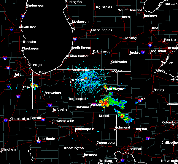 At 1252 pm edt, a severe thunderstorm was located near bluffton, moving southeast at 20 mph (radar indicated). Hazards include 60 mph wind gusts. Damage to roofs, siding, and trees possible. Locations impacted include, bluffton, poneto, vera cruz, travisville, domestic, wellsburg, reiffsburg, petroleum and liberty center. At 1252 pm edt, a severe thunderstorm was located near bluffton, moving southeast at 20 mph (radar indicated). Hazards include 60 mph wind gusts. Damage to roofs, siding, and trees possible. Locations impacted include, bluffton, poneto, vera cruz, travisville, domestic, wellsburg, reiffsburg, petroleum and liberty center.
|
| 7/12/2020 12:53 PM EDT |
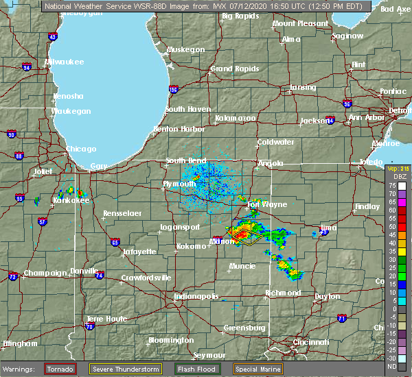 At 1252 pm edt, a severe thunderstorm was located near bluffton, moving southeast at 20 mph (radar indicated). Hazards include 60 mph wind gusts. Damage to roofs, siding, and trees possible. Locations impacted include, bluffton, poneto, vera cruz, travisville, domestic, wellsburg, reiffsburg, petroleum and liberty center. At 1252 pm edt, a severe thunderstorm was located near bluffton, moving southeast at 20 mph (radar indicated). Hazards include 60 mph wind gusts. Damage to roofs, siding, and trees possible. Locations impacted include, bluffton, poneto, vera cruz, travisville, domestic, wellsburg, reiffsburg, petroleum and liberty center.
|
| 7/12/2020 12:42 PM EDT |
 At 1241 pm edt, a severe thunderstorm was located over bluffton, moving southeast at 25 mph (radar indicated). Hazards include 60 mph wind gusts. expect damage to roofs, siding, and trees At 1241 pm edt, a severe thunderstorm was located over bluffton, moving southeast at 25 mph (radar indicated). Hazards include 60 mph wind gusts. expect damage to roofs, siding, and trees
|
| 7/8/2020 4:01 PM EDT |
 The national weather service in northern indiana has issued a * severe thunderstorm warning for. southwestern allen county in northeastern indiana. northeastern huntington county in northeastern indiana. northeastern wells county in northeastern indiana. Until 445 pm edt. The national weather service in northern indiana has issued a * severe thunderstorm warning for. southwestern allen county in northeastern indiana. northeastern huntington county in northeastern indiana. northeastern wells county in northeastern indiana. Until 445 pm edt.
|
| 7/8/2020 4:01 PM EDT |
 At 400 pm edt, a severe thunderstorm was located near ossian, moving south at 20 mph (radar indicated). Hazards include 60 mph wind gusts and penny size hail. expect damage to roofs, siding, and trees At 400 pm edt, a severe thunderstorm was located near ossian, moving south at 20 mph (radar indicated). Hazards include 60 mph wind gusts and penny size hail. expect damage to roofs, siding, and trees
|
| 7/8/2020 4:01 PM EDT |
 The national weather service in northern indiana has issued a * severe thunderstorm warning for. southwestern allen county in northeastern indiana. northeastern huntington county in northeastern indiana. northeastern wells county in northeastern indiana. Until 445 pm edt. The national weather service in northern indiana has issued a * severe thunderstorm warning for. southwestern allen county in northeastern indiana. northeastern huntington county in northeastern indiana. northeastern wells county in northeastern indiana. Until 445 pm edt.
|
| 6/10/2020 4:38 PM EDT | One tree down along with tree branches on the north side of bluffton... wind gusts estimated at 45 to 50 mp in wells county IN, 0.2 miles SE of Bluffton, IN |
| 6/10/2020 4:27 PM EDT |
 At 427 pm edt, a severe thunderstorm was located over montpelier, or 10 miles northeast of hartford city, moving northeast at 60 mph (radar indicated). Hazards include 60 mph wind gusts and quarter size hail. Hail damage to vehicles is expected. expect wind damage to roofs, siding, and trees. Locations impacted include, bluffton, montpelier, markle, nottingham, uniondale, poneto, vera cruz, mcnatts, wellsburg, murray, liberty center, mount zion, buckeye, tocsin, keystone, kingsland, travisville, craigville, reiffsburg and dillman. At 427 pm edt, a severe thunderstorm was located over montpelier, or 10 miles northeast of hartford city, moving northeast at 60 mph (radar indicated). Hazards include 60 mph wind gusts and quarter size hail. Hail damage to vehicles is expected. expect wind damage to roofs, siding, and trees. Locations impacted include, bluffton, montpelier, markle, nottingham, uniondale, poneto, vera cruz, mcnatts, wellsburg, murray, liberty center, mount zion, buckeye, tocsin, keystone, kingsland, travisville, craigville, reiffsburg and dillman.
|
| 6/10/2020 4:09 PM EDT |
 At 409 pm edt, a severe thunderstorm was located near matthews, or 9 miles northwest of muncie, moving north at 55 mph (radar indicated). Hazards include 60 mph wind gusts and quarter size hail. Hail damage to vehicles is expected. Expect wind damage to roofs, siding, and trees. At 409 pm edt, a severe thunderstorm was located near matthews, or 9 miles northwest of muncie, moving north at 55 mph (radar indicated). Hazards include 60 mph wind gusts and quarter size hail. Hail damage to vehicles is expected. Expect wind damage to roofs, siding, and trees.
|
| 6/10/2020 3:29 PM EDT |
 At 329 pm edt, a severe thunderstorm was located near ossian, moving northeast at 75 mph (radar indicated). Hazards include 70 mph wind gusts and quarter size hail. Hail damage to vehicles is expected. expect considerable tree damage. wind damage is also likely to mobile homes, roofs, and outbuildings. this severe storm will be near, new haven around 340 pm edt. fort wayne around 345 pm edt. Other locations impacted by this severe thunderstorm include mcnatts, preble, yoder, poneto, aboite, wellsburg, edgerton in allen county, murray, liberty center and mount zion. At 329 pm edt, a severe thunderstorm was located near ossian, moving northeast at 75 mph (radar indicated). Hazards include 70 mph wind gusts and quarter size hail. Hail damage to vehicles is expected. expect considerable tree damage. wind damage is also likely to mobile homes, roofs, and outbuildings. this severe storm will be near, new haven around 340 pm edt. fort wayne around 345 pm edt. Other locations impacted by this severe thunderstorm include mcnatts, preble, yoder, poneto, aboite, wellsburg, edgerton in allen county, murray, liberty center and mount zion.
|
| 6/10/2020 3:09 PM EDT |
 At 309 pm edt, a severe thunderstorm was located near van buren, or 9 miles northeast of upland, moving north at 75 mph (radar indicated). Hazards include 70 mph wind gusts and quarter size hail. Hail damage to vehicles is expected. expect considerable tree damage. wind damage is also likely to mobile homes, roofs, and outbuildings. this severe thunderstorm will be near, bluffton around 320 pm edt. markle around 325 pm edt. ossian around 330 pm edt. fort wayne around 345 pm edt. other locations impacted by this severe thunderstorm include nottingham, mcnatts, preble, yoder, landess, aboite, wellsburg, edgerton in allen county, liberty center and zulu. this includes the following highways, interstate 469 between mile markers 0 and 21. Interstate 69 in indiana between mile markers 252 and 305. At 309 pm edt, a severe thunderstorm was located near van buren, or 9 miles northeast of upland, moving north at 75 mph (radar indicated). Hazards include 70 mph wind gusts and quarter size hail. Hail damage to vehicles is expected. expect considerable tree damage. wind damage is also likely to mobile homes, roofs, and outbuildings. this severe thunderstorm will be near, bluffton around 320 pm edt. markle around 325 pm edt. ossian around 330 pm edt. fort wayne around 345 pm edt. other locations impacted by this severe thunderstorm include nottingham, mcnatts, preble, yoder, landess, aboite, wellsburg, edgerton in allen county, liberty center and zulu. this includes the following highways, interstate 469 between mile markers 0 and 21. Interstate 69 in indiana between mile markers 252 and 305.
|
| 5/10/2020 1:50 PM EDT |
 At 149 pm edt, a severe thunderstorm was located 8 miles northwest of ossian, moving northeast at 45 mph (radar indicated). Hazards include 70 mph wind gusts. Expect considerable tree damage. Damage is likely to mobile homes, roofs, and outbuildings. At 149 pm edt, a severe thunderstorm was located 8 miles northwest of ossian, moving northeast at 45 mph (radar indicated). Hazards include 70 mph wind gusts. Expect considerable tree damage. Damage is likely to mobile homes, roofs, and outbuildings.
|
| 6/1/2019 11:23 PM EDT |
 The severe thunderstorm warning for southeastern allen, east central wells and adams counties will expire at 1130 pm edt, the storms which prompted the warning have moved out of the warned. therefore, the warning will be allowed to expire. gusty winds to 50 mph and small hail will be possible through 1145 pm edt. The severe thunderstorm warning for southeastern allen, east central wells and adams counties will expire at 1130 pm edt, the storms which prompted the warning have moved out of the warned. therefore, the warning will be allowed to expire. gusty winds to 50 mph and small hail will be possible through 1145 pm edt.
|
| 6/1/2019 11:12 PM EDT |
 At 1112 pm edt, severe thunderstorms were located along a line extending from monroeville to near decatur to near berne, moving east at 45 mph (radar indicated). Hazards include 60 mph wind gusts and quarter size hail. Hail damage to vehicles is expected. expect wind damage to roofs, siding, and trees. Locations impacted include, bluffton, decatur, monroeville, monroe, preble, vera cruz, magley, craigville, peterson, monmouth, hoagland, rivare, curryville and pleasant mills. At 1112 pm edt, severe thunderstorms were located along a line extending from monroeville to near decatur to near berne, moving east at 45 mph (radar indicated). Hazards include 60 mph wind gusts and quarter size hail. Hail damage to vehicles is expected. expect wind damage to roofs, siding, and trees. Locations impacted include, bluffton, decatur, monroeville, monroe, preble, vera cruz, magley, craigville, peterson, monmouth, hoagland, rivare, curryville and pleasant mills.
|
| 6/1/2019 11:04 PM EDT |
 At 1104 pm edt, severe thunderstorms were located along a line extending from 7 miles west of monroeville to near decatur to near bluffton, moving east at 50 mph (radar indicated). Hazards include 60 mph wind gusts and nickel size hail. Expect damage to roofs, siding, and trees. Locations impacted include, bluffton, decatur, ossian, monroeville, monroe, middletown, preble, uniondale, vera cruz, magley, yoder, craigville, poe, murray, peterson, monmouth, north oaks, tocsin, hoagland and rockford. At 1104 pm edt, severe thunderstorms were located along a line extending from 7 miles west of monroeville to near decatur to near bluffton, moving east at 50 mph (radar indicated). Hazards include 60 mph wind gusts and nickel size hail. Expect damage to roofs, siding, and trees. Locations impacted include, bluffton, decatur, ossian, monroeville, monroe, middletown, preble, uniondale, vera cruz, magley, yoder, craigville, poe, murray, peterson, monmouth, north oaks, tocsin, hoagland and rockford.
|
| 6/1/2019 10:50 PM EDT |
 At 1050 pm edt, severe thunderstorms were located along a line extending from near ossian to 7 miles west of bluffton, moving northeast at 55 mph (radar indicated). Hazards include 60 mph wind gusts and quarter size hail. Hail damage to vehicles is expected. Expect wind damage to roofs, siding, and trees. At 1050 pm edt, severe thunderstorms were located along a line extending from near ossian to 7 miles west of bluffton, moving northeast at 55 mph (radar indicated). Hazards include 60 mph wind gusts and quarter size hail. Hail damage to vehicles is expected. Expect wind damage to roofs, siding, and trees.
|
| 5/28/2019 6:26 PM EDT |
 At 626 pm edt, a severe thunderstorm was located 7 miles southwest of markle, or 7 miles south of huntington, moving east at 40 mph (radar indicated). Hazards include quarter size hail. damage to vehicles is expected At 626 pm edt, a severe thunderstorm was located 7 miles southwest of markle, or 7 miles south of huntington, moving east at 40 mph (radar indicated). Hazards include quarter size hail. damage to vehicles is expected
|
| 5/28/2019 5:05 PM EDT |
 The severe thunderstorm warning for southeastern huntington, northeastern wells and western adams counties will expire at 515 pm edt, the storm which prompted the warning has moved out of the area. therefore, the warning will be allowed to expire. however heavy rain is still possible with this thunderstorm. a severe thunderstorm watch remains in effect until 800 pm edt for northeastern indiana. The severe thunderstorm warning for southeastern huntington, northeastern wells and western adams counties will expire at 515 pm edt, the storm which prompted the warning has moved out of the area. therefore, the warning will be allowed to expire. however heavy rain is still possible with this thunderstorm. a severe thunderstorm watch remains in effect until 800 pm edt for northeastern indiana.
|
| 5/28/2019 4:46 PM EDT |
 At 445 pm edt, a severe thunderstorm was located near markle, or 10 miles west of bluffton, moving east at 50 mph (trained weather spotters reported nickel sized hail at 440 pm edt 2 miles north of majenica). Hazards include 60 mph wind gusts and nickel size hail. expect damage to roofs, siding, and trees At 445 pm edt, a severe thunderstorm was located near markle, or 10 miles west of bluffton, moving east at 50 mph (trained weather spotters reported nickel sized hail at 440 pm edt 2 miles north of majenica). Hazards include 60 mph wind gusts and nickel size hail. expect damage to roofs, siding, and trees
|
| 5/27/2019 9:00 PM EDT |
 At 900 pm edt, a severe thunderstorm was located near van buren, or 14 miles west of bluffton, moving east at 25 mph (radar indicated). Hazards include 70 mph wind gusts and nickel size hail. Expect considerable tree damage. damage is likely to mobile homes, roofs, and outbuildings. Locations impacted include, bluffton, montpelier, van buren, warren, poneto, mcnatts, landess, travisville, wellsburg, liberty center, mount zion, dillman, plum tree, north oaks, hanfield, buckeye, keystone, rockford and roll. At 900 pm edt, a severe thunderstorm was located near van buren, or 14 miles west of bluffton, moving east at 25 mph (radar indicated). Hazards include 70 mph wind gusts and nickel size hail. Expect considerable tree damage. damage is likely to mobile homes, roofs, and outbuildings. Locations impacted include, bluffton, montpelier, van buren, warren, poneto, mcnatts, landess, travisville, wellsburg, liberty center, mount zion, dillman, plum tree, north oaks, hanfield, buckeye, keystone, rockford and roll.
|
| 5/27/2019 9:00 PM EDT |
 At 859 pm edt, a severe thunderstorm capable of producing a tornado was located over bluffton, moving east at 20 mph (radar indicated rotation). Hazards include tornado. Flying debris will be dangerous to those caught without shelter. mobile homes will be damaged or destroyed. damage to roofs, windows, and vehicles will occur. tree damage is likely. This tornadic thunderstorm will remain over mainly rural areas of east central wells and west central adams counties, including the following locations, vera cruz and craigville. At 859 pm edt, a severe thunderstorm capable of producing a tornado was located over bluffton, moving east at 20 mph (radar indicated rotation). Hazards include tornado. Flying debris will be dangerous to those caught without shelter. mobile homes will be damaged or destroyed. damage to roofs, windows, and vehicles will occur. tree damage is likely. This tornadic thunderstorm will remain over mainly rural areas of east central wells and west central adams counties, including the following locations, vera cruz and craigville.
|
| 5/27/2019 8:49 PM EDT |
 At 849 pm edt, a severe thunderstorm was located near van buren, or 11 miles northeast of marion, moving east at 25 mph (radar indicated). Hazards include 70 mph wind gusts and nickel size hail. Expect considerable tree damage. damage is likely to mobile homes, roofs, and outbuildings. Locations impacted include, marion, bluffton, montpelier, van buren, warren, lancaster, poneto, mount etna, mcnatts, landess, wellsburg, liberty center, mount zion, buckeye, majenica, keystone, banquo, pleasant plain, travisville and dillman. At 849 pm edt, a severe thunderstorm was located near van buren, or 11 miles northeast of marion, moving east at 25 mph (radar indicated). Hazards include 70 mph wind gusts and nickel size hail. Expect considerable tree damage. damage is likely to mobile homes, roofs, and outbuildings. Locations impacted include, marion, bluffton, montpelier, van buren, warren, lancaster, poneto, mount etna, mcnatts, landess, wellsburg, liberty center, mount zion, buckeye, majenica, keystone, banquo, pleasant plain, travisville and dillman.
|
| 5/27/2019 8:45 PM EDT |
 At 844 pm edt, a severe thunderstorm was located near bluffton, moving east at 25 mph (radar indicated). Hazards include half dollar size hail. Damage to vehicles is expected. this severe storm will be near, bluffton around 850 pm edt. Other locations impacted by this severe thunderstorm include north oaks, tocsin, vera cruz, travisville, rockford, craigville, kingsland, uniondale, murray and liberty center. At 844 pm edt, a severe thunderstorm was located near bluffton, moving east at 25 mph (radar indicated). Hazards include half dollar size hail. Damage to vehicles is expected. this severe storm will be near, bluffton around 850 pm edt. Other locations impacted by this severe thunderstorm include north oaks, tocsin, vera cruz, travisville, rockford, craigville, kingsland, uniondale, murray and liberty center.
|
| 5/27/2019 8:30 PM EDT |
 At 830 pm edt, a severe thunderstorm was located near la fontaine, or 8 miles north of marion, moving east at 25 mph (radar indicated). Hazards include 60 mph wind gusts. expect damage to roofs, siding, and trees At 830 pm edt, a severe thunderstorm was located near la fontaine, or 8 miles north of marion, moving east at 25 mph (radar indicated). Hazards include 60 mph wind gusts. expect damage to roofs, siding, and trees
|
| 5/27/2019 8:15 PM EDT |
 At 815 pm edt, a severe thunderstorm was located 7 miles southwest of markle, or 8 miles south of huntington, moving east at 25 mph (radar indicated). Hazards include quarter size hail. Damage to vehicles is expected. this severe thunderstorm will be near, markle around 835 pm edt. bluffton around 845 pm edt. ossian around 855 pm edt. other locations impacted by this severe thunderstorm include travisville, craigville, lancaster, uniondale, murray, liberty center, plum tree, north oaks, buckeye and tocsin. this includes interstate 69 in indiana between mile markers 275 and 287. A tornado watch remains in effect until 1000 pm edt for northeastern indiana. At 815 pm edt, a severe thunderstorm was located 7 miles southwest of markle, or 8 miles south of huntington, moving east at 25 mph (radar indicated). Hazards include quarter size hail. Damage to vehicles is expected. this severe thunderstorm will be near, markle around 835 pm edt. bluffton around 845 pm edt. ossian around 855 pm edt. other locations impacted by this severe thunderstorm include travisville, craigville, lancaster, uniondale, murray, liberty center, plum tree, north oaks, buckeye and tocsin. this includes interstate 69 in indiana between mile markers 275 and 287. A tornado watch remains in effect until 1000 pm edt for northeastern indiana.
|
| 5/23/2019 5:38 AM EDT | 70 mph winds estimated with power outages and trees down around town. time estimated from rada in wells county IN, 0.2 miles SE of Bluffton, IN |
| 5/23/2019 5:32 AM EDT |
 A severe thunderstorm warning remains in effect until 600 am edt for southern allen. eastern grant. blackford. southeastern huntington. wells. adams and western jay counties. At 531 am edt, severe thunderstorms were located along a line extending from near new haven to bluffton to near hartford city, moving east at 50 mph. A severe thunderstorm warning remains in effect until 600 am edt for southern allen. eastern grant. blackford. southeastern huntington. wells. adams and western jay counties. At 531 am edt, severe thunderstorms were located along a line extending from near new haven to bluffton to near hartford city, moving east at 50 mph.
|
| 5/23/2019 5:30 AM EDT | Storm damage reported in wells county IN, 0.2 miles SE of Bluffton, IN |
| 5/23/2019 5:03 AM EDT |
 At 503 am edt, severe thunderstorms were located along a line extending from 9 miles south of columbia city to 7 miles south of andrews to near windfall city, moving east at 65 mph (radar indicated). Hazards include 70 mph wind gusts and penny size hail. Expect considerable tree damage. Damage is likely to mobile homes, roofs, and outbuildings. At 503 am edt, severe thunderstorms were located along a line extending from 9 miles south of columbia city to 7 miles south of andrews to near windfall city, moving east at 65 mph (radar indicated). Hazards include 70 mph wind gusts and penny size hail. Expect considerable tree damage. Damage is likely to mobile homes, roofs, and outbuildings.
|
| 5/16/2019 10:08 PM EDT |
 At 1008 pm edt, a severe thunderstorm was located near bluffton, moving east at 30 mph (radar indicated). Hazards include 60 mph wind gusts and quarter size hail. Hail damage to vehicles is expected. expect wind damage to roofs, siding, and trees. Locations impacted include, bluffton, decatur, berne, geneva, monroe, preble, vera cruz, magley, travisville, craigville, ceylon, murray, reiffsburg, peterson, north oaks, tocsin, linn grove, kingsland, rivare and curryville. At 1008 pm edt, a severe thunderstorm was located near bluffton, moving east at 30 mph (radar indicated). Hazards include 60 mph wind gusts and quarter size hail. Hail damage to vehicles is expected. expect wind damage to roofs, siding, and trees. Locations impacted include, bluffton, decatur, berne, geneva, monroe, preble, vera cruz, magley, travisville, craigville, ceylon, murray, reiffsburg, peterson, north oaks, tocsin, linn grove, kingsland, rivare and curryville.
|
| 5/16/2019 10:05 PM EDT | Quarter sized hail reported 2.5 miles SSE of Bluffton, IN |
| 5/16/2019 9:52 PM EDT |
 At 952 pm edt, a severe thunderstorm was located near ossian, moving east at 25 mph (radar indicated). Hazards include golf ball size hail and 60 mph wind gusts. People and animals outdoors will be injured. expect hail damage to roofs, siding, windows, and vehicles. Expect wind damage to roofs, siding, and trees. At 952 pm edt, a severe thunderstorm was located near ossian, moving east at 25 mph (radar indicated). Hazards include golf ball size hail and 60 mph wind gusts. People and animals outdoors will be injured. expect hail damage to roofs, siding, windows, and vehicles. Expect wind damage to roofs, siding, and trees.
|
| 5/16/2019 9:45 PM EDT |
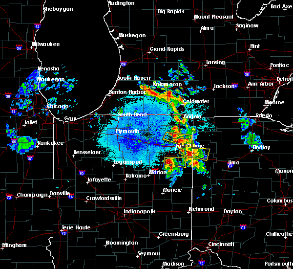 At 944 pm edt, a severe thunderstorm was located near markle, or near ossian, moving east at 35 mph (radar indicated). Hazards include golf ball size hail and 60 mph wind gusts. People and animals outdoors will be injured. expect hail damage to roofs, siding, windows, and vehicles. expect wind damage to roofs, siding, and trees. locations impacted include, bluffton, decatur, ossian, markle, monroe, preble, zanesville, uniondale, magley, craigville, murray, peterson, north oaks, tocsin, kingsland and curryville. This thunderstorm has a history of producing golf ball sized hail. At 944 pm edt, a severe thunderstorm was located near markle, or near ossian, moving east at 35 mph (radar indicated). Hazards include golf ball size hail and 60 mph wind gusts. People and animals outdoors will be injured. expect hail damage to roofs, siding, windows, and vehicles. expect wind damage to roofs, siding, and trees. locations impacted include, bluffton, decatur, ossian, markle, monroe, preble, zanesville, uniondale, magley, craigville, murray, peterson, north oaks, tocsin, kingsland and curryville. This thunderstorm has a history of producing golf ball sized hail.
|
| 5/16/2019 9:31 PM EDT |
 At 929 pm edt, a severe thunderstorm was located near huntington, moving east at 30 mph (radar indicated). Hazards include two inch hail and 60 mph wind gusts. People and animals outdoors will be injured. expect hail damage to roofs, siding, windows, and vehicles. expect wind damage to roofs, siding, and trees. locations impacted include, huntington, bluffton, decatur, ossian, markle, monroe, middletown, roanoke, preble, zanesville, uniondale, yoder, murray, peterson, tocsin, kingsland, nine mile, bowerstown, magley and craigville. At 925 pm edt, trained weather spotters reported golf ball sized hail 3 miles south of goblesville. At 929 pm edt, a severe thunderstorm was located near huntington, moving east at 30 mph (radar indicated). Hazards include two inch hail and 60 mph wind gusts. People and animals outdoors will be injured. expect hail damage to roofs, siding, windows, and vehicles. expect wind damage to roofs, siding, and trees. locations impacted include, huntington, bluffton, decatur, ossian, markle, monroe, middletown, roanoke, preble, zanesville, uniondale, yoder, murray, peterson, tocsin, kingsland, nine mile, bowerstown, magley and craigville. At 925 pm edt, trained weather spotters reported golf ball sized hail 3 miles south of goblesville.
|
| 5/16/2019 9:11 PM EDT |
 At 911 pm edt, a severe thunderstorm was located near huntington, moving east at 40 mph (radar indicated). Hazards include golf ball size hail and 60 mph wind gusts. People and animals outdoors will be injured. expect hail damage to roofs, siding, windows, and vehicles. Expect wind damage to roofs, siding, and trees. At 911 pm edt, a severe thunderstorm was located near huntington, moving east at 40 mph (radar indicated). Hazards include golf ball size hail and 60 mph wind gusts. People and animals outdoors will be injured. expect hail damage to roofs, siding, windows, and vehicles. Expect wind damage to roofs, siding, and trees.
|
| 8/20/2018 4:43 PM EDT |
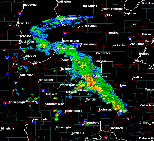 At 443 pm edt, a severe thunderstorm was located near bluffton, moving northeast at 25 mph (radar indicated). Hazards include 60 mph wind gusts and penny size hail. expect damage to roofs, siding, and trees At 443 pm edt, a severe thunderstorm was located near bluffton, moving northeast at 25 mph (radar indicated). Hazards include 60 mph wind gusts and penny size hail. expect damage to roofs, siding, and trees
|
| 7/20/2018 4:00 PM EDT | 13" tree down... several tree limbs snappe in wells county IN, 4.7 miles SW of Bluffton, IN |
| 7/20/2018 4:00 PM EDT |
 At 359 pm edt, a severe thunderstorm was located near berne, moving northeast at 45 mph (radar indicated). Hazards include 60 mph wind gusts and penny size hail. Expect damage to roofs, siding, and trees. locations impacted include, bluffton, hartford city, berne, ossian, montpelier, geneva, monroe, pennville, preble, nottingham, uniondale, bryant, shamrock lakes, poneto, vera cruz, mcnatts, trinity, wellsburg, murray and liberty center. A tornado watch remains in effect until 600 pm edt for central, northeastern and east central indiana. At 359 pm edt, a severe thunderstorm was located near berne, moving northeast at 45 mph (radar indicated). Hazards include 60 mph wind gusts and penny size hail. Expect damage to roofs, siding, and trees. locations impacted include, bluffton, hartford city, berne, ossian, montpelier, geneva, monroe, pennville, preble, nottingham, uniondale, bryant, shamrock lakes, poneto, vera cruz, mcnatts, trinity, wellsburg, murray and liberty center. A tornado watch remains in effect until 600 pm edt for central, northeastern and east central indiana.
|
| 7/20/2018 3:40 PM EDT |
 At 339 pm edt, a line of severe thunderstorms were located from near pleasant plain to just south of hartford city, moving northeast at 45 mph (radar indicated). Hazards include 60 mph wind gusts and penny size hail. expect damage to roofs, siding, and trees At 339 pm edt, a line of severe thunderstorms were located from near pleasant plain to just south of hartford city, moving northeast at 45 mph (radar indicated). Hazards include 60 mph wind gusts and penny size hail. expect damage to roofs, siding, and trees
|
| 5/31/2018 3:24 PM EDT |
 The severe thunderstorm warning for central allen, southeastern huntington, northern wells and northwestern adams counties will expire at 330 pm edt, the storms which prompted the warning have weakened below severe limits, and no longer pose an immediate threat to life or property. therefore, the warning will be allowed to expire. The severe thunderstorm warning for central allen, southeastern huntington, northern wells and northwestern adams counties will expire at 330 pm edt, the storms which prompted the warning have weakened below severe limits, and no longer pose an immediate threat to life or property. therefore, the warning will be allowed to expire.
|
| 5/31/2018 3:11 PM EDT |
 At 311 pm edt, severe thunderstorms were located along a line extending from near new haven to 6 miles south of markle, moving east at 30 mph (radar indicated). Hazards include 60 mph wind gusts and quarter size hail. Hail damage to vehicles is expected. expect wind damage to roofs, siding, and trees. Locations impacted include, fort wayne, new haven, bluffton, ossian, woodburn, markle, middletown, warren, zanesville, uniondale, yoder, murray, liberty center, zulu, buckeye, tocsin, kingsland, nine mile, magley and travisville. At 311 pm edt, severe thunderstorms were located along a line extending from near new haven to 6 miles south of markle, moving east at 30 mph (radar indicated). Hazards include 60 mph wind gusts and quarter size hail. Hail damage to vehicles is expected. expect wind damage to roofs, siding, and trees. Locations impacted include, fort wayne, new haven, bluffton, ossian, woodburn, markle, middletown, warren, zanesville, uniondale, yoder, murray, liberty center, zulu, buckeye, tocsin, kingsland, nine mile, magley and travisville.
|
| 5/31/2018 2:48 PM EDT |
 At 248 pm edt, severe thunderstorms were located along a line extending from near fort wayne to near van buren, moving east at 30 mph (radar indicated). Hazards include 60 mph wind gusts and quarter size hail. Hail damage to vehicles is expected. Expect wind damage to roofs, siding, and trees. At 248 pm edt, severe thunderstorms were located along a line extending from near fort wayne to near van buren, moving east at 30 mph (radar indicated). Hazards include 60 mph wind gusts and quarter size hail. Hail damage to vehicles is expected. Expect wind damage to roofs, siding, and trees.
|
| 11/5/2017 3:59 PM EDT |
 At 259 pm est, severe thunderstorms were located along a line extending from 6 miles east of ossian to 6 miles northwest of muncie, moving east at 55 mph (radar indicated). Hazards include 60 mph wind gusts. expect damage to roofs, siding, and trees At 259 pm est, severe thunderstorms were located along a line extending from 6 miles east of ossian to 6 miles northwest of muncie, moving east at 55 mph (radar indicated). Hazards include 60 mph wind gusts. expect damage to roofs, siding, and trees
|
| 7/10/2017 3:58 AM EDT |
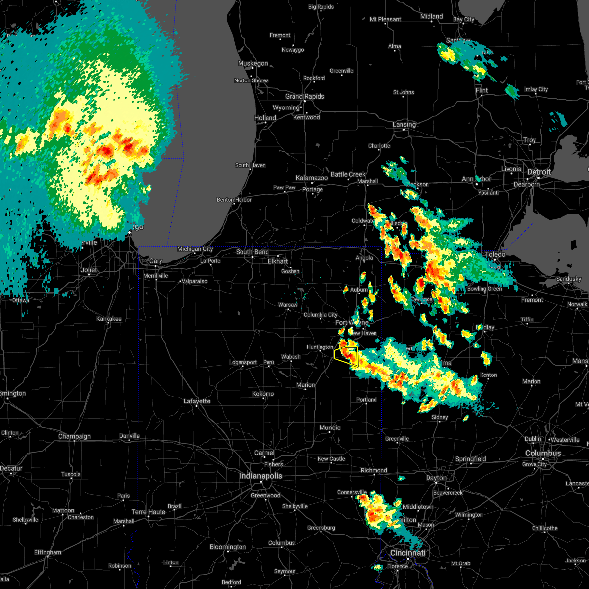 The severe thunderstorm warning for northeastern wells county will expire at 400 am edt, the storm which prompted the warning has weakened below severe limits, and no longer poses an immediate threat to life or property. therefore the warning will be allowed to expire. however small hail and heavy rain are still expected with this thunderstorm. The severe thunderstorm warning for northeastern wells county will expire at 400 am edt, the storm which prompted the warning has weakened below severe limits, and no longer poses an immediate threat to life or property. therefore the warning will be allowed to expire. however small hail and heavy rain are still expected with this thunderstorm.
|
| 7/10/2017 3:34 AM EDT |
 At 333 am edt, a severe thunderstorm was located over ossian, moving east at 20 mph (radar indicated). Hazards include quarter size hail. Damage to vehicles is expected. Locations impacted include, bluffton, ossian, markle, uniondale, tocsin, craigville, kingsland, murray and curryville. At 333 am edt, a severe thunderstorm was located over ossian, moving east at 20 mph (radar indicated). Hazards include quarter size hail. Damage to vehicles is expected. Locations impacted include, bluffton, ossian, markle, uniondale, tocsin, craigville, kingsland, murray and curryville.
|
| 7/10/2017 3:11 AM EDT |
 At 310 am edt, a severe thunderstorm was located over markle, or 8 miles east of huntington, moving east at 20 mph (radar indicated). Hazards include quarter size hail. damage to vehicles is expected At 310 am edt, a severe thunderstorm was located over markle, or 8 miles east of huntington, moving east at 20 mph (radar indicated). Hazards include quarter size hail. damage to vehicles is expected
|
| 7/7/2017 11:15 AM EDT |
 At 1115 am edt, a severe thunderstorm was located over bluffton, moving southeast at 25 mph (radar indicated). Hazards include 60 mph wind gusts and nickel size hail. expect damage to roofs, siding, and trees At 1115 am edt, a severe thunderstorm was located over bluffton, moving southeast at 25 mph (radar indicated). Hazards include 60 mph wind gusts and nickel size hail. expect damage to roofs, siding, and trees
|
| 6/18/2017 1:39 AM EDT |
 At 139 am edt, severe thunderstorms were located along a line extending from 7 miles northeast of la fontaine to near gas city to near fairmount, moving east at 45 mph (radar indicated). Hazards include 60 mph wind gusts. expect damage to roofs, siding, and trees At 139 am edt, severe thunderstorms were located along a line extending from 7 miles northeast of la fontaine to near gas city to near fairmount, moving east at 45 mph (radar indicated). Hazards include 60 mph wind gusts. expect damage to roofs, siding, and trees
|
| 5/28/2017 7:44 PM EDT |
 At 743 pm edt, a severe thunderstorm was located near markle, or 10 miles west of bluffton, moving east at 20 mph (radar indicated). Hazards include 60 mph wind gusts and quarter size hail. Hail damage to vehicles is possible. Wind damage to roofs, siding, and trees is also possible. At 743 pm edt, a severe thunderstorm was located near markle, or 10 miles west of bluffton, moving east at 20 mph (radar indicated). Hazards include 60 mph wind gusts and quarter size hail. Hail damage to vehicles is possible. Wind damage to roofs, siding, and trees is also possible.
|
| 5/28/2017 7:17 PM EDT |
 The national weather service in northern indiana has issued a * severe thunderstorm warning for. southern huntington county in northeastern indiana. central wells county in northeastern indiana. Until 800 pm edt * at 716 pm edt, a severe thunderstorm was located 7 miles southeast. The national weather service in northern indiana has issued a * severe thunderstorm warning for. southern huntington county in northeastern indiana. central wells county in northeastern indiana. Until 800 pm edt * at 716 pm edt, a severe thunderstorm was located 7 miles southeast.
|
| 4/26/2017 8:59 PM EDT |
 At 859 pm edt, a severe thunderstorm was located near montpelier, or 11 miles southwest of bluffton, moving northeast at 50 mph (radar indicated). Hazards include 60 mph wind gusts and penny size hail. expect damage to roofs, siding, and trees At 859 pm edt, a severe thunderstorm was located near montpelier, or 11 miles southwest of bluffton, moving northeast at 50 mph (radar indicated). Hazards include 60 mph wind gusts and penny size hail. expect damage to roofs, siding, and trees
|
| 3/30/2017 5:53 PM EDT |
 At 550 pm edt, a severe thunderstorm was located over montpelier, or near hartford city, moving northeast at 40 mph (trained weather spotters). Hazards include ping pong ball size hail and 60 mph wind gusts. People and animals outdoors will be injured. expect hail damage to roofs, siding, windows, and vehicles. expect wind damage to roofs, siding, and trees. locations impacted include, bluffton, hartford city, berne, upland, montpelier, geneva, pennville, matthews, nottingham, fowlerton, shamrock lakes, poneto, vera cruz, wellsburg, liberty center, mount zion, mill grove, keystone, domestic and balbec. trained spotters reported dime size hail 3 to 4 inches deep covering the ground in hartford city. hail up to ping pong size is still possible with this storm. reports of funnel clouds and a possible tornado have also been reported near the delaware and blackford county line. this includes interstate 69 in indiana between mile markers 252 and 255. A tornado watch remains in effect until 1000 pm edt for central, northeastern and east central indiana. At 550 pm edt, a severe thunderstorm was located over montpelier, or near hartford city, moving northeast at 40 mph (trained weather spotters). Hazards include ping pong ball size hail and 60 mph wind gusts. People and animals outdoors will be injured. expect hail damage to roofs, siding, windows, and vehicles. expect wind damage to roofs, siding, and trees. locations impacted include, bluffton, hartford city, berne, upland, montpelier, geneva, pennville, matthews, nottingham, fowlerton, shamrock lakes, poneto, vera cruz, wellsburg, liberty center, mount zion, mill grove, keystone, domestic and balbec. trained spotters reported dime size hail 3 to 4 inches deep covering the ground in hartford city. hail up to ping pong size is still possible with this storm. reports of funnel clouds and a possible tornado have also been reported near the delaware and blackford county line. this includes interstate 69 in indiana between mile markers 252 and 255. A tornado watch remains in effect until 1000 pm edt for central, northeastern and east central indiana.
|
| 3/30/2017 5:30 PM EDT |
 At 529 pm edt, a severe thunderstorm was located near matthews, or 8 miles south of upland, moving northeast at 40 mph (trained weather spotters). Hazards include ping pong ball size hail and 60 mph wind gusts. People and animals outdoors will be injured. expect hail damage to roofs, siding, windows, and vehicles. Expect wind damage to roofs, siding, and trees. At 529 pm edt, a severe thunderstorm was located near matthews, or 8 miles south of upland, moving northeast at 40 mph (trained weather spotters). Hazards include ping pong ball size hail and 60 mph wind gusts. People and animals outdoors will be injured. expect hail damage to roofs, siding, windows, and vehicles. Expect wind damage to roofs, siding, and trees.
|
| 3/1/2017 3:17 AM EST |
 At 316 am est, a severe thunderstorm was located near bluffton, moving east at 90 mph (radar indicated). Hazards include 60 mph wind gusts and quarter size hail. Hail damage to vehicles is expected. expect wind damage to roofs, siding, and trees. locations impacted include, bluffton, decatur, berne, ossian, montpelier, geneva, markle, van buren, monroe, middletown, warren, preble, nottingham, uniondale, poneto, vera cruz, mcnatts, yoder, wellsburg and murray. this includes the following highways, interstate 469 near mile marker 1, and between mile markers 4 and 6. interstate 69 in indiana between mile markers 262 and 264. A tornado watch remains in effect until 700 am est for central, northeastern and east central indiana. At 316 am est, a severe thunderstorm was located near bluffton, moving east at 90 mph (radar indicated). Hazards include 60 mph wind gusts and quarter size hail. Hail damage to vehicles is expected. expect wind damage to roofs, siding, and trees. locations impacted include, bluffton, decatur, berne, ossian, montpelier, geneva, markle, van buren, monroe, middletown, warren, preble, nottingham, uniondale, poneto, vera cruz, mcnatts, yoder, wellsburg and murray. this includes the following highways, interstate 469 near mile marker 1, and between mile markers 4 and 6. interstate 69 in indiana between mile markers 262 and 264. A tornado watch remains in effect until 700 am est for central, northeastern and east central indiana.
|
| 3/1/2017 2:59 AM EST |
 At 258 am est, a severe thunderstorm was located near la fontaine, or near marion, moving east at 75 mph (radar indicated). Hazards include 60 mph wind gusts and quarter size hail. Hail damage to vehicles is expected. Expect wind damage to roofs, siding, and trees. At 258 am est, a severe thunderstorm was located near la fontaine, or near marion, moving east at 75 mph (radar indicated). Hazards include 60 mph wind gusts and quarter size hail. Hail damage to vehicles is expected. Expect wind damage to roofs, siding, and trees.
|
| 11/18/2016 6:56 PM EST | . in wells county IN, 2.9 miles S of Bluffton, IN |
| 11/18/2016 6:55 PM EST | Wind measured by handheld anemomete in wells county IN, 1 miles W of Bluffton, IN |
| 11/18/2016 6:42 PM EST |
 At 642 pm est, a severe thunderstorm was located 8 miles northeast of van buren, or 11 miles southwest of bluffton, moving northeast at 70 mph (radar indicated). Hazards include 60 mph wind gusts. Expect damage to roofs. siding. and trees. this severe thunderstorm will be near, bluffton around 650 pm est. ossian around 655 pm est. decatur around 700 pm est. monroeville around 705 pm est. other locations impacted by this severe thunderstorm include vera cruz, domestic, dixon, liberty center, travisville, yoder, dillman, reiffsburg, nottingham and rockford. this includes the following highways, interstate 469 between mile markers 0 and 2, between mile markers 4 and 6, and between mile markers 9 and 15. Interstate 69 in indiana between mile markers 272 and 294. At 642 pm est, a severe thunderstorm was located 8 miles northeast of van buren, or 11 miles southwest of bluffton, moving northeast at 70 mph (radar indicated). Hazards include 60 mph wind gusts. Expect damage to roofs. siding. and trees. this severe thunderstorm will be near, bluffton around 650 pm est. ossian around 655 pm est. decatur around 700 pm est. monroeville around 705 pm est. other locations impacted by this severe thunderstorm include vera cruz, domestic, dixon, liberty center, travisville, yoder, dillman, reiffsburg, nottingham and rockford. this includes the following highways, interstate 469 between mile markers 0 and 2, between mile markers 4 and 6, and between mile markers 9 and 15. Interstate 69 in indiana between mile markers 272 and 294.
|
| 7/21/2016 5:12 PM EDT |
 At 512 pm edt, a severe thunderstorm was located near monroe, or 7 miles northwest of berne, moving southeast at 30 mph (radar indicated). Hazards include 60 mph wind gusts and nickel size hail. Expect damage to roofs. siding and trees. this severe thunderstorm will be near, monroe around 515 pm edt. berne around 525 pm edt. geneva around 535 pm edt. portland around 550 pm edt. Other locations impacted by this severe thunderstorm include liber, bryant, vera cruz, trinity, domestic, brice, reiffsburg, westchester, petroleum and new mount pleasant. At 512 pm edt, a severe thunderstorm was located near monroe, or 7 miles northwest of berne, moving southeast at 30 mph (radar indicated). Hazards include 60 mph wind gusts and nickel size hail. Expect damage to roofs. siding and trees. this severe thunderstorm will be near, monroe around 515 pm edt. berne around 525 pm edt. geneva around 535 pm edt. portland around 550 pm edt. Other locations impacted by this severe thunderstorm include liber, bryant, vera cruz, trinity, domestic, brice, reiffsburg, westchester, petroleum and new mount pleasant.
|
| 6/23/2016 1:15 AM EDT | Barn destroyed and trees damaged on south side of bluffton. exact location unknown. report from twitte in wells county IN, 0.6 miles N of Bluffton, IN |
| 6/23/2016 1:13 AM EDT |
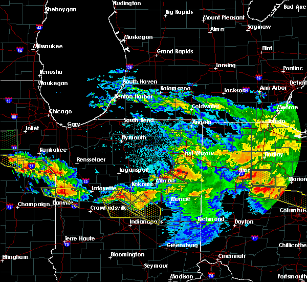 At 112 am edt, a confirmed tornado was located near bluffton, moving southeast at 40 mph (radar confirmed tornado). Hazards include damaging tornado. Flying debris will be dangerous to those caught without shelter. mobile homes will be damaged or destroyed. damage to roofs, windows and vehicles will occur. tree damage is likely. This tornadic thunderstorm will remain over mainly rural areas of central wells county, including the following locations, reiffsburg, rockford, travisville and north oaks. At 112 am edt, a confirmed tornado was located near bluffton, moving southeast at 40 mph (radar confirmed tornado). Hazards include damaging tornado. Flying debris will be dangerous to those caught without shelter. mobile homes will be damaged or destroyed. damage to roofs, windows and vehicles will occur. tree damage is likely. This tornadic thunderstorm will remain over mainly rural areas of central wells county, including the following locations, reiffsburg, rockford, travisville and north oaks.
|
| 6/23/2016 1:05 AM EDT |
 At 105 am edt, a tornado producing storm was located near markle, or 9 miles west of bluffton, moving southeast at 30 mph (radar confirmed tornado). Hazards include damaging tornado. Flying debris will be dangerous to those caught without shelter. mobile homes will be damaged or destroyed. damage to roofs, windows and vehicles will occur. tree damage is likely. this tornadic storm will be near, bluffton around 120 am edt. other locations impacted by this tornadic thunderstorm include reiffsburg, rockford, murray, travisville, north oaks and liberty center. This includes interstate 69 in indiana between mile markers 282 and 286. At 105 am edt, a tornado producing storm was located near markle, or 9 miles west of bluffton, moving southeast at 30 mph (radar confirmed tornado). Hazards include damaging tornado. Flying debris will be dangerous to those caught without shelter. mobile homes will be damaged or destroyed. damage to roofs, windows and vehicles will occur. tree damage is likely. this tornadic storm will be near, bluffton around 120 am edt. other locations impacted by this tornadic thunderstorm include reiffsburg, rockford, murray, travisville, north oaks and liberty center. This includes interstate 69 in indiana between mile markers 282 and 286.
|
| 6/23/2016 12:52 AM EDT |
 At 1251 am edt, a severe thunderstorm was located 7 miles south of huntington, moving southeast at 40 mph (radar indicated). Hazards include 60 mph wind gusts. Expect damage to roofs. siding and trees. this severe thunderstorm will be near, bluffton around 110 am edt. other locations impacted by this severe thunderstorm include vera cruz, pleasant plain, mount zion, domestic, mount etna, majenica, wellsburg, liberty center, travisville and plum tree. this includes interstate 69 in indiana between mile markers 272 and 286. A tornado watch remains in effect until 500 am edt for northeastern indiana. At 1251 am edt, a severe thunderstorm was located 7 miles south of huntington, moving southeast at 40 mph (radar indicated). Hazards include 60 mph wind gusts. Expect damage to roofs. siding and trees. this severe thunderstorm will be near, bluffton around 110 am edt. other locations impacted by this severe thunderstorm include vera cruz, pleasant plain, mount zion, domestic, mount etna, majenica, wellsburg, liberty center, travisville and plum tree. this includes interstate 69 in indiana between mile markers 272 and 286. A tornado watch remains in effect until 500 am edt for northeastern indiana.
|
| 6/20/2016 5:45 PM EDT | Measured on home mounted anemomete in wells county IN, 4.6 miles W of Bluffton, IN |
| 3/27/2016 6:43 PM EDT | Quarter sized hail reported 4.5 miles SSW of Bluffton, IN |
| 3/27/2016 6:35 PM EDT | Golf Ball sized hail reported 1 miles SE of Bluffton, IN |
| 3/27/2016 6:32 PM EDT |
 At 631 pm edt, a severe thunderstorm was located near ossian, moving northeast at 50 mph (radar indicated). Hazards include ping pong ball size hail and 60 mph wind gusts. People and animals outdoors will be injured. expect hail damage to roofs, siding, windows and vehicles. expect wind damage to roofs, siding and trees. locations impacted include, fort wayne, new haven, bluffton, decatur, ossian, monroeville, markle, monroe, middletown, preble, zanesville, uniondale, vera cruz, liberty center, travisville, yoder, rockford, hessen cassel, peterson and zulu. this includes the following highways, interstate 469 between mile markers 0 and 22, and near mile marker 30. Interstate 69 in indiana between mile markers 294 and 307, and between mile markers 311 and 314. At 631 pm edt, a severe thunderstorm was located near ossian, moving northeast at 50 mph (radar indicated). Hazards include ping pong ball size hail and 60 mph wind gusts. People and animals outdoors will be injured. expect hail damage to roofs, siding, windows and vehicles. expect wind damage to roofs, siding and trees. locations impacted include, fort wayne, new haven, bluffton, decatur, ossian, monroeville, markle, monroe, middletown, preble, zanesville, uniondale, vera cruz, liberty center, travisville, yoder, rockford, hessen cassel, peterson and zulu. this includes the following highways, interstate 469 between mile markers 0 and 22, and near mile marker 30. Interstate 69 in indiana between mile markers 294 and 307, and between mile markers 311 and 314.
|
| 3/27/2016 6:17 PM EDT |
 At 617 pm edt, a severe thunderstorm was located near markle, or 10 miles west of bluffton, moving northeast at 50 mph (radar indicated). Hazards include ping pong ball size hail and 60 mph wind gusts. People and animals outdoors will be injured. expect hail damage to roofs, siding, windows and vehicles. Expect wind damage to roofs, siding and trees. At 617 pm edt, a severe thunderstorm was located near markle, or 10 miles west of bluffton, moving northeast at 50 mph (radar indicated). Hazards include ping pong ball size hail and 60 mph wind gusts. People and animals outdoors will be injured. expect hail damage to roofs, siding, windows and vehicles. Expect wind damage to roofs, siding and trees.
|
| 9/4/2015 5:12 PM EDT | Quarter sized hail reported 6.6 miles NW of Bluffton, IN, hail pea to quarter size. also gust estimated to 50 mph. |
| 7/18/2015 8:36 PM EDT |
 At 836 pm edt, severe thunderstorms were located along a line extending from 6 miles northeast of ossian to near markle, moving east at 35 mph (radar indicated). Hazards include 60 mph wind gusts. Expect damage to roofs. Siding and trees. At 836 pm edt, severe thunderstorms were located along a line extending from 6 miles northeast of ossian to near markle, moving east at 35 mph (radar indicated). Hazards include 60 mph wind gusts. Expect damage to roofs. Siding and trees.
|
| 6/12/2015 12:30 PM EDT |
 At 1229 pm edt, a severe thunderstorm was located near bluffton, moving east at 45 mph (radar indicated). Hazards include 60 mph wind gusts. Expect damage to roofs. Siding and trees. At 1229 pm edt, a severe thunderstorm was located near bluffton, moving east at 45 mph (radar indicated). Hazards include 60 mph wind gusts. Expect damage to roofs. Siding and trees.
|
| 5/30/2015 3:26 PM EDT | The severe thunderstorm warning for southern wells county will expire at 330 pm edt/230 pm cdt/, the storm which prompted the warning has weakened below severe limits. therefore, the severe thunderstorm warning for southern wells county will be allowed to expire at 330 pm edt. however, heavy rain is still expected through 400 pm edt that may cause ponding of water on roadways. |
| 5/30/2015 3:25 PM EDT | Large and healthy tree limb down approximately 8 inches in diamete in wells county IN, 5 miles SW of Bluffton, IN |
| 5/30/2015 3:20 PM EDT | Large tree limb down-approx. 1 ft in diamete in wells county IN, 6.4 miles SW of Bluffton, IN |
| 5/30/2015 3:06 PM EDT | At 305 pm edt, a severe thunderstorm was located 6 miles north of montpelier, and moving east at 20 mph (radar indicated). Hazards include 60 mph wind gusts. Expect damage to roofs. siding and trees. Locations impacted include, bluffton, dillman, liberty center, poneto, wellsburg, travisville, petroleum, reiffsburg, domestic and vera cruz. |
| 5/30/2015 2:46 PM EDT | At 245 pm edt, a severe thunderstorm was located 5 miles northwest of montpelier, and moving east at 25 mph (radar indicated). Hazards include 60 mph wind gusts and nickel size hail. Expect damage to roofs. siding and trees. Locations impacted include, bluffton, montpelier, mount zion, keystone, dillman, liberty center, poneto, wellsburg, balbec, fiat, travisville, nottingham, petroleum, reiffsburg, domestic and vera cruz. |
| 5/30/2015 2:25 PM EDT | At 221 pm edt, a severe thunderstorm was located near van buren, and moving east at 25 mph (radar indicated). Hazards include 60 mph wind gusts and penny size hail. Expect damage to roofs. Siding and trees. |
| 5/11/2015 1:14 PM EDT | At 111 pm edt, a severe thunderstorm capable of producing a tornado was located near ossian, and moving northeast at 45 mph (radar indicated rotation). Hazards include tornado. Mobile homes will be damaged or destroyed. damage to roofs, windows and vehicles will occur. flying debris will be deadly to people and animals. Tree damage is likely. |
| 7/26/2014 3:48 PM EDT | Golf Ball sized hail reported 6.6 miles NW of Bluffton, IN |
| 7/26/2014 3:48 PM EDT | Hen Egg sized hail reported 0.8 miles S of Bluffton, IN |
| 7/1/2014 2:01 AM EDT | Trees down between bluffton adn kingsland. another tree down blocking road on 500 n east of sr 1 in wells count in wells county IN, 3.6 miles S of Bluffton, IN |
| 11/17/2013 4:15 PM EST | Estimated 59 mph wind gusts in central wells county. time estimated from rada in wells county IN, 0.2 miles SE of Bluffton, IN |
| 6/12/2013 11:02 PM EDT | Large tree down on the west side of bluffto in wells county IN, 1.3 miles ENE of Bluffton, IN |
| 9/7/2012 12:55 PM EDT | Power lines down in wells county IN, 6.4 miles ENE of Bluffton, IN |
| 7/1/2012 4:09 PM EDT | Quarter sized hail reported 0.2 miles SE of Bluffton, IN, maximum wind gust of 52. water over several roads in bluffton. |
| 6/29/2012 3:08 PM EDT | Trees down in wells county IN, 1.9 miles NW of Bluffton, IN |
| 6/29/2012 2:58 PM EDT | Trees and power lines down in wells county IN, 6.4 miles ENE of Bluffton, IN |
| 4/30/2012 6:00 PM EDT | Quarter sized hail reported 0.2 miles SE of Bluffton, IN, slighty larger than quarter sized |
| 4/30/2012 5:53 PM EDT | Quarter sized hail reported 6.4 miles ENE of Bluffton, IN, relayed by huntington county em |
| 1/1/0001 12:00 AM | Quarter sized hail reported 9 miles NW of Bluffton, IN, nickel to quarter size hail currently falling |
| 1/1/0001 12:00 AM | Multiple trees down in bluffton. time estimated from rada in wells county IN, 0.2 miles SE of Bluffton, IN |
| 1/1/0001 12:00 AM | Quarter sized hail reported 6.4 miles ENE of Bluffton, IN |
| 1/1/0001 12:00 AM | Measured 62mph wind gust. limbs and large branches down blocking the roa in wells county IN, 6.4 miles ENE of Bluffton, IN |
Hail Maps for Bluffton, IN


Connect with Interactive Hail Maps