

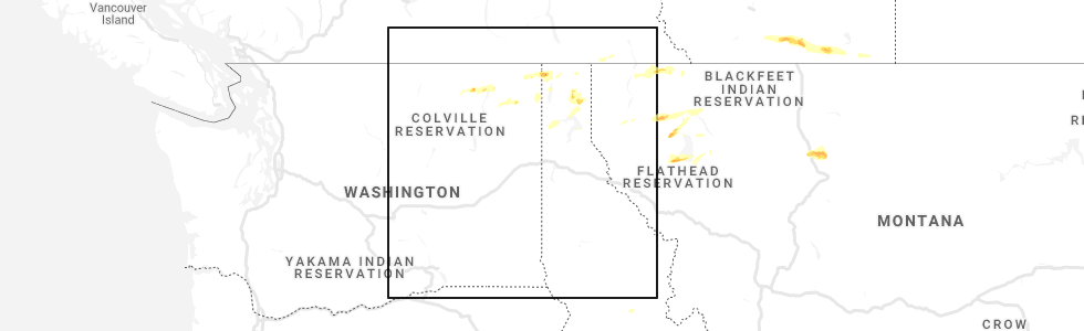
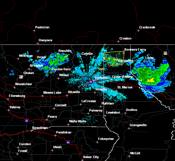
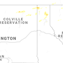
Hail Map for Bonners Ferry, ID
The Bonners Ferry, ID area has had 1 report of on-the-ground hail by trained spotters, and has been under severe weather warnings 0 times during the past 12 months. Doppler radar has detected hail at or near Bonners Ferry, ID on 2 occasions.
| Name: | Bonners Ferry, ID |
| Where Located: | 87.7 miles NE of Spokane, WA |
| Map: | Google Map for Bonners Ferry, ID |
| Population: | 2543 |
| Housing Units: | 1254 |
| More Info: | Search Google for Bonners Ferry, ID |
0
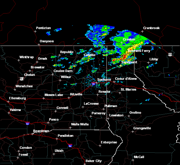
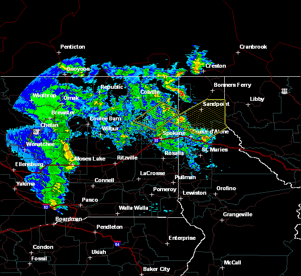
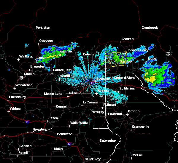
The Top Recent Hail Date for Bonners Ferry, ID is Wednesday, June 24, 2020 (2nd out of 2)
Hail and Wind Damage Spotted near Bonners Ferry, ID
| Date / Time | Report Details |
|---|---|
| 6/24/2020 4:08 PM PDT |
 At 407 pm pdt, a severe thunderstorm was located 7 miles southwest of bonners ferry, moving east at 30 mph (radar indicated). Hazards include quarter size hail. damage to vehicles is expected At 407 pm pdt, a severe thunderstorm was located 7 miles southwest of bonners ferry, moving east at 30 mph (radar indicated). Hazards include quarter size hail. damage to vehicles is expected
|
| 6/24/2020 2:35 PM PDT | Quarter sized hail reported 18.9 miles SSE of Bonners Ferry, ID |
| 7/23/2019 9:53 PM PDT |
 At 953 pm pdt, severe thunderstorms were located along a line extending from 20 miles southwest of nordman to near priest river, moving northeast at 60 mph (radar indicated). Hazards include 60 mph wind gusts and penny size hail. expect damage to roofs, siding, and trees At 953 pm pdt, severe thunderstorms were located along a line extending from 20 miles southwest of nordman to near priest river, moving northeast at 60 mph (radar indicated). Hazards include 60 mph wind gusts and penny size hail. expect damage to roofs, siding, and trees
|
| 8/10/2015 10:07 PM PDT |
 At 1000 pm, the large area of thunderstorms that prompted a severe thunderstorm warning has weakened considerably, stretching from colburn to bonners ferry and priest lake. we`ll let the warning expire at 1015 pm. winds gusts to 35 mph and dangerous lightning can be expected. At 1000 pm, the large area of thunderstorms that prompted a severe thunderstorm warning has weakened considerably, stretching from colburn to bonners ferry and priest lake. we`ll let the warning expire at 1015 pm. winds gusts to 35 mph and dangerous lightning can be expected.
|
| 8/10/2015 9:27 PM PDT |
 At 915 pm pdt, emergency management reported a severe thunderstorm producing damaging winds strong enough to down a few power lines in cocolalla. this storm was located 8 miles northwest of dover, or 8 miles west of sandpoint, and moving north at 30 mph. penny size hail may also accompany the damaging winds. another storm was strengthening just south of the boundary county line near colburn, which will produce the same dangerous weather. At 915 pm pdt, emergency management reported a severe thunderstorm producing damaging winds strong enough to down a few power lines in cocolalla. this storm was located 8 miles northwest of dover, or 8 miles west of sandpoint, and moving north at 30 mph. penny size hail may also accompany the damaging winds. another storm was strengthening just south of the boundary county line near colburn, which will produce the same dangerous weather.
|
| 7/23/2014 6:05 PM PDT | 6 to 7 inch trees down. one 8 to 10 inch diameter tree blown ove in boundary county ID, 3 miles SSW of Bonners Ferry, ID |
| 7/23/2014 6:00 PM PDT | Large tree blown down in boundary county ID, 0.3 miles NE of Bonners Ferry, ID |
| 7/23/2014 5:52 PM PDT | 4 inch diameter tree down in boundary county ID, 1.1 miles NW of Bonners Ferry, ID |
Hail Maps for Bonners Ferry, ID

Connect with Interactive Hail Maps