

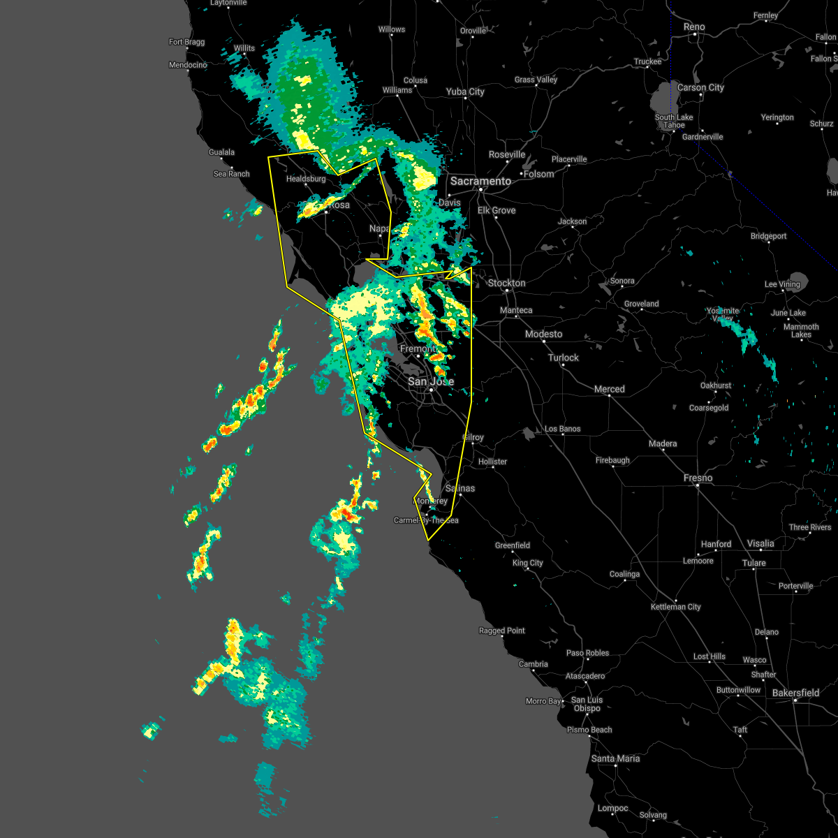
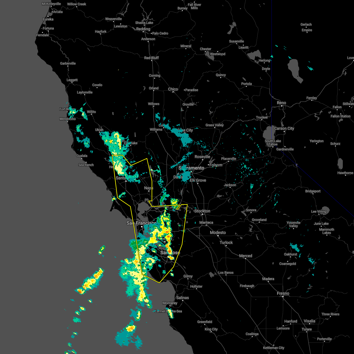
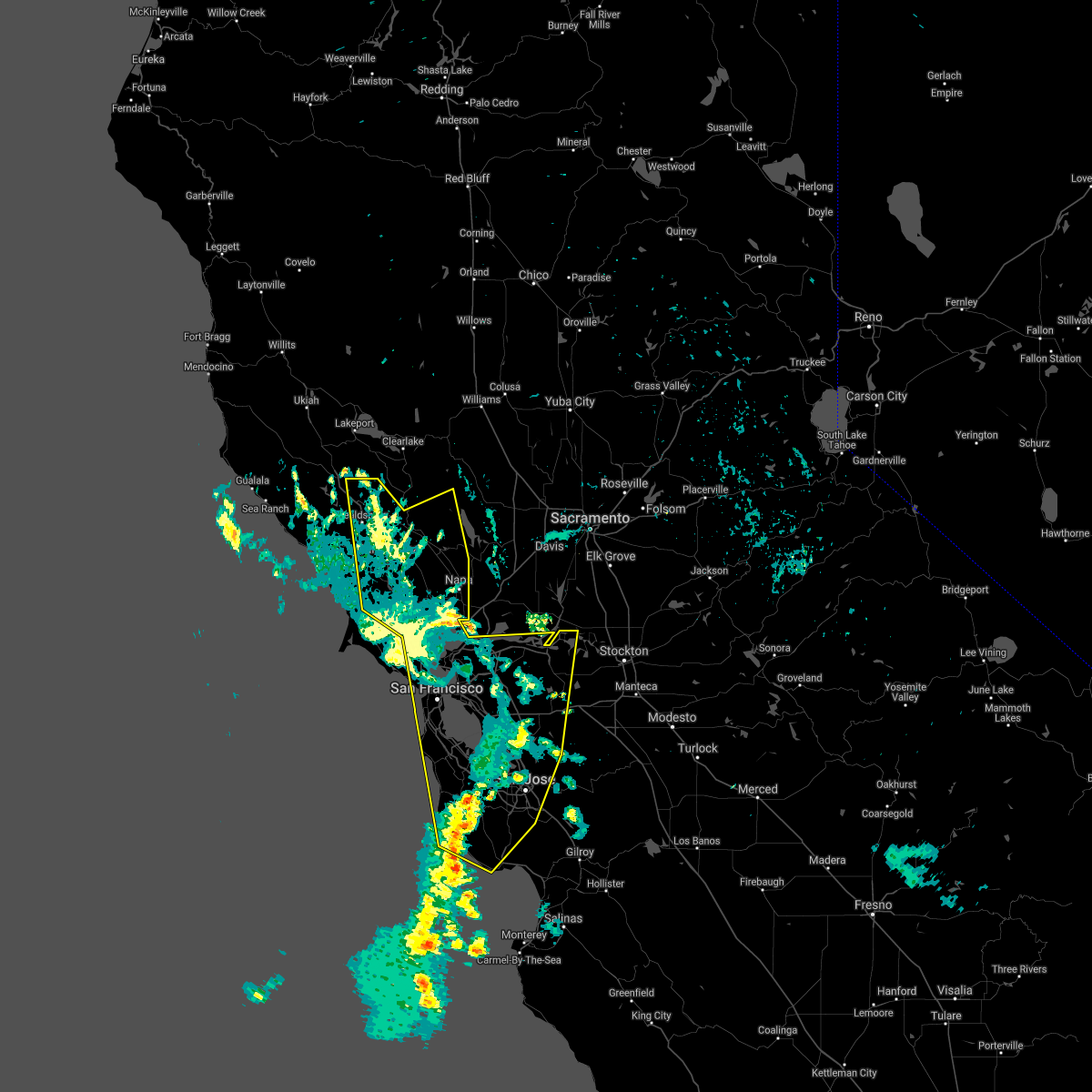
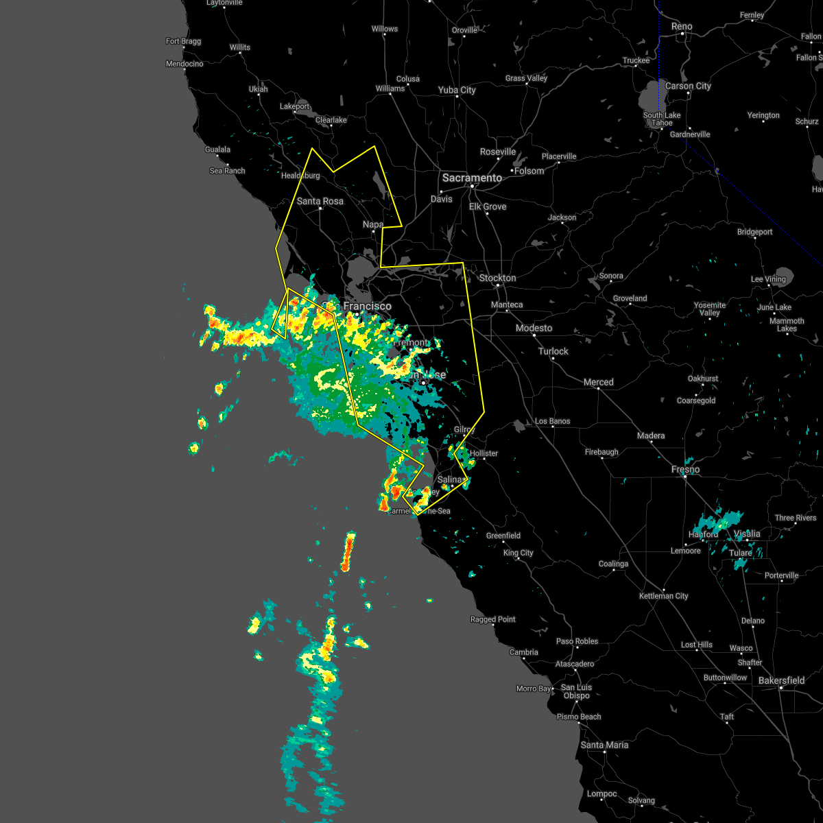
Hail Map for Byron, CA
The Byron, CA area has had 0 reports of on-the-ground hail by trained spotters, and has been under severe weather warnings 0 times during the past 12 months. Doppler radar has detected hail at or near Byron, CA on 1 occasion.
| Name: | Byron, CA |
| Where Located: | 39.1 miles NNE of San Jose, CA |
| Map: | Google Map for Byron, CA |
| Population: | 1277 |
| Housing Units: | 415 |
| More Info: | Search Google for Byron, CA |
0
The Top Recent Hail Date for Byron, CA is Sunday, March 31, 2013 (1st out of 1)

Hail and Wind Damage Spotted near Byron, CA
| Date / Time | Report Details |
|---|---|
| 8/16/2020 6:37 AM PDT |
 At 634 am pdt, public and radar indicate several training thunderstorms capable of producing gusty errastic winds and frequent lightning, moving north at 40 to 50mph across the region. a steady stream of new thunderstorms are expected to develop throughout the day (public). Hazards include erratic outflow wind gusts of 50 to 75 mph near thunderstorms. frequent lightning lead to new wildfire starts. expect down trees, down powerlines, power outages, wildfire starts in remote areas, difficulty driving in the winds At 634 am pdt, public and radar indicate several training thunderstorms capable of producing gusty errastic winds and frequent lightning, moving north at 40 to 50mph across the region. a steady stream of new thunderstorms are expected to develop throughout the day (public). Hazards include erratic outflow wind gusts of 50 to 75 mph near thunderstorms. frequent lightning lead to new wildfire starts. expect down trees, down powerlines, power outages, wildfire starts in remote areas, difficulty driving in the winds
|
| 8/16/2020 6:10 AM PDT |
 At 609 am pdt, several severe thunderstorms across the region were producing gusty erratic winds and frequent light, moving north at 40 to 50 mph (public). Hazards include erratic outflow wind gusts up to 60mph. frequent lightning. Expect damage to roofs, siding, and trees. wildfires may start in remote areas due to the lightning. Locations impacted include, san jose, san francisco, oakland, fremont, santa rosa, hayward, sunnyvale, concord, santa clara, berkeley, richmond, antioch, daly city, san mateo, san leandro, livermore, napa, redwood city, mountain view and alameda. At 609 am pdt, several severe thunderstorms across the region were producing gusty erratic winds and frequent light, moving north at 40 to 50 mph (public). Hazards include erratic outflow wind gusts up to 60mph. frequent lightning. Expect damage to roofs, siding, and trees. wildfires may start in remote areas due to the lightning. Locations impacted include, san jose, san francisco, oakland, fremont, santa rosa, hayward, sunnyvale, concord, santa clara, berkeley, richmond, antioch, daly city, san mateo, san leandro, livermore, napa, redwood city, mountain view and alameda.
|
| 8/16/2020 5:14 AM PDT |
 At 512 am pdt, severe thunderstorms were located along a line extending from 11 miles west of cloverdale to 8 miles west of boulder creek, moving north at 50 mph (public). Hazards include erratic outflow wind gusts of of 50-75 mph. frequent lightning. expect down trees, down powerlines, power outages, wildfire starts in remote areas, difficulty driving in the winds At 512 am pdt, severe thunderstorms were located along a line extending from 11 miles west of cloverdale to 8 miles west of boulder creek, moving north at 50 mph (public). Hazards include erratic outflow wind gusts of of 50-75 mph. frequent lightning. expect down trees, down powerlines, power outages, wildfire starts in remote areas, difficulty driving in the winds
|
| 8/16/2020 3:55 AM PDT |
 At 351 am pdt, a line of training severe thunderstorms were located over the san francisco peninsula, santa cruz mountains, and monterey bay, moving north at 45 mph (public). Hazards include erratic gusty outflow winds up to 60mph. frequent lightning which may lead to wildfire starts. Expect damage to roofs, siding, and trees. wildfire starts from the lightning. Power outages from the wind. At 351 am pdt, a line of training severe thunderstorms were located over the san francisco peninsula, santa cruz mountains, and monterey bay, moving north at 45 mph (public). Hazards include erratic gusty outflow winds up to 60mph. frequent lightning which may lead to wildfire starts. Expect damage to roofs, siding, and trees. wildfire starts from the lightning. Power outages from the wind.
|
Hail Maps for Byron, CA

Connect with Interactive Hail Maps