

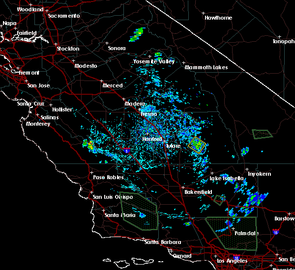
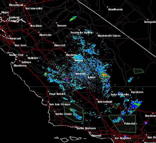
Hail Map for Camp Nelson, CA
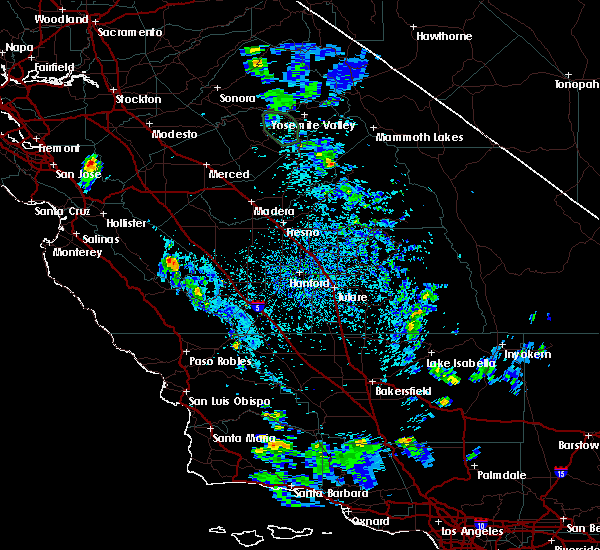
The Camp Nelson, CA area has had 0 reports of on-the-ground hail by trained spotters, and has been under severe weather warnings 3 times during the past 12 months. Doppler radar has detected hail at or near Camp Nelson, CA on 1 occasion.
| Name: | Camp Nelson, CA |
| Where Located: | 58.4 miles NNE of Bakersfield, CA |
| Map: | Google Map for Camp Nelson, CA |
| Population: | 97 |
| Housing Units: | 383 |
| More Info: | Search Google for Camp Nelson, CA |
0
The Top Recent Hail Date for Camp Nelson, CA is Tuesday, March 13, 2018 (1st out of 1)

Hail and Wind Damage Spotted near Camp Nelson, CA
| Date / Time | Report Details |
|---|---|
| 6/16/2023 3:58 PM PDT |
 The severe thunderstorm warning for central tulare county will expire at 400 pm pdt, the storm which prompted the warning has weakened below severe limits, and no longer poses an immediate threat to life or property. therefore, the warning will be allowed to expire. however, heavy rain is still possible with this thunderstorm. The severe thunderstorm warning for central tulare county will expire at 400 pm pdt, the storm which prompted the warning has weakened below severe limits, and no longer poses an immediate threat to life or property. therefore, the warning will be allowed to expire. however, heavy rain is still possible with this thunderstorm.
|
| 6/16/2023 3:38 PM PDT |
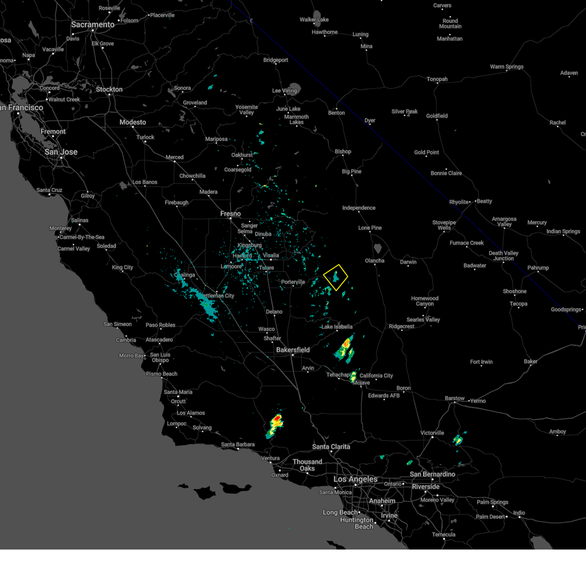
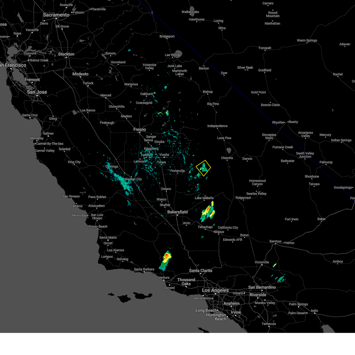 At 337 pm pdt, a severe thunderstorm was located 27 miles east of east porterville, or 28 miles west of olancha, moving southwest at 10 mph (radar indicated). Hazards include 60 mph wind gusts and half dollar size hail. Hail damage to vehicles is expected. expect wind damage to roofs, siding, and trees. locations impacted include, quaking aspen and ponderosa. hail threat, radar indicated max hail size, 1. 25 in wind threat, radar indicated max wind gust, 60 mph. At 337 pm pdt, a severe thunderstorm was located 27 miles east of east porterville, or 28 miles west of olancha, moving southwest at 10 mph (radar indicated). Hazards include 60 mph wind gusts and half dollar size hail. Hail damage to vehicles is expected. expect wind damage to roofs, siding, and trees. locations impacted include, quaking aspen and ponderosa. hail threat, radar indicated max hail size, 1. 25 in wind threat, radar indicated max wind gust, 60 mph.
|
| 6/16/2023 3:18 PM PDT |
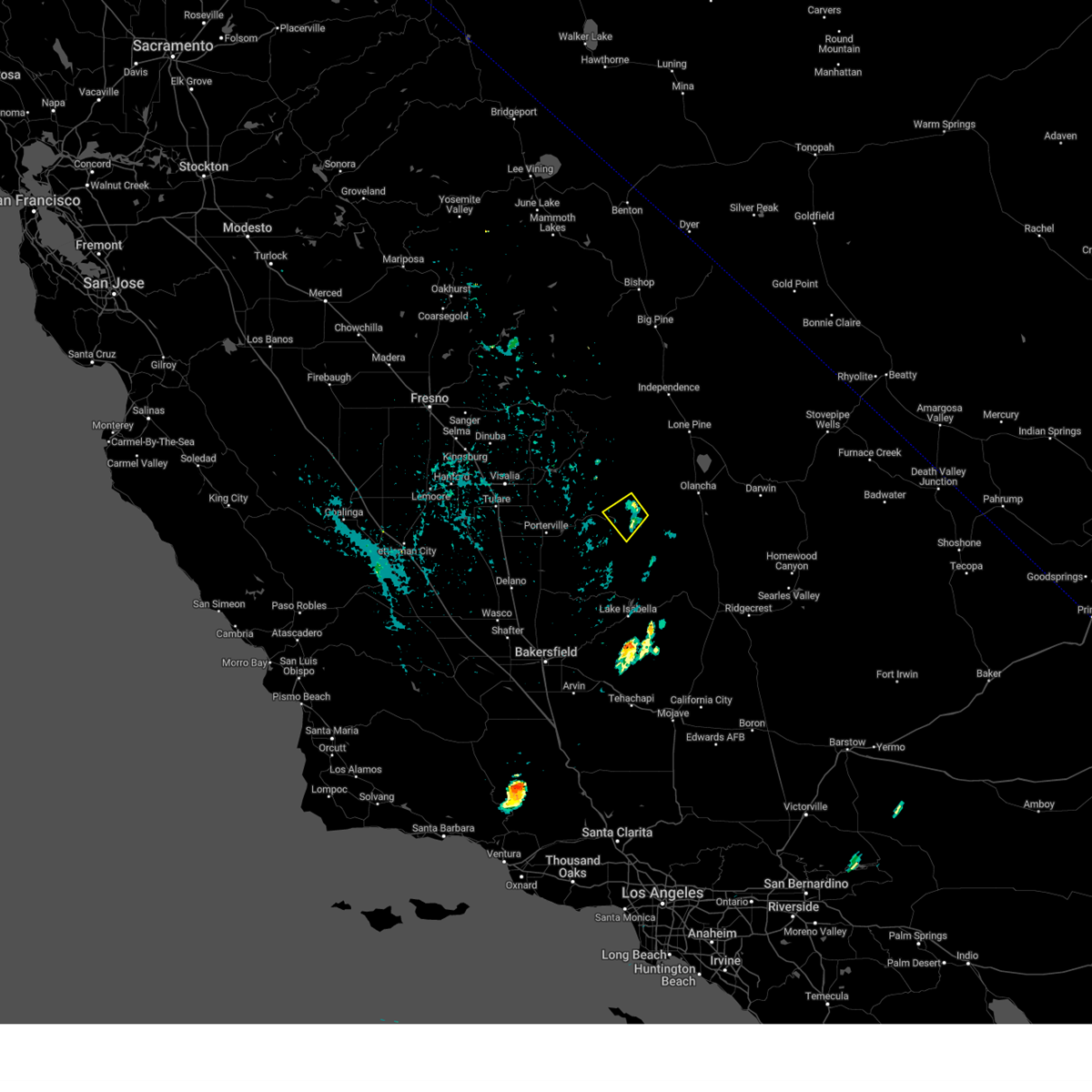 At 317 pm pdt, a severe thunderstorm was located 24 miles west of cartago, or 24 miles west of olancha, moving southwest at 10 mph (radar indicated). Hazards include 60 mph wind gusts and half dollar size hail. Hail damage to vehicles is expected. Expect wind damage to roofs, siding, and trees. At 317 pm pdt, a severe thunderstorm was located 24 miles west of cartago, or 24 miles west of olancha, moving southwest at 10 mph (radar indicated). Hazards include 60 mph wind gusts and half dollar size hail. Hail damage to vehicles is expected. Expect wind damage to roofs, siding, and trees.
|
| 6/1/2019 3:02 PM PDT |
 At 300 pm pdt, a severe thunderstorm was located about 24 miles east of porterville, moving to the north-northwest at around 15 mph (radar indicated). Hazards include 60 mph wind gusts and half dollar size hail. Hail damage to vehicles is expected. Expect wind damage to roofs, siding, and trees. At 300 pm pdt, a severe thunderstorm was located about 24 miles east of porterville, moving to the north-northwest at around 15 mph (radar indicated). Hazards include 60 mph wind gusts and half dollar size hail. Hail damage to vehicles is expected. Expect wind damage to roofs, siding, and trees.
|
| 6/12/2015 6:09 PM PDT |
 The severe thunderstorm warning for south central tulare county will expire at 615 pm pdt, the storm which prompted the warning has weakened below severe limits, and no longer poses an immediate threat to life or property. therefore the warning will be allowed to expire. heavy rain associated with this storm may cause creeks to rise briefly as radar estimated rainfall rates up to 1 inch per hour with this storm. report any flooding to 911. turn around and dont drown. The severe thunderstorm warning for south central tulare county will expire at 615 pm pdt, the storm which prompted the warning has weakened below severe limits, and no longer poses an immediate threat to life or property. therefore the warning will be allowed to expire. heavy rain associated with this storm may cause creeks to rise briefly as radar estimated rainfall rates up to 1 inch per hour with this storm. report any flooding to 911. turn around and dont drown.
|
| 6/12/2015 5:42 PM PDT |
 At 540 pm pdt, doppler radar indicated a severe thunderstorm capable of producing quarter size hail. this storm was located 15 miles northeast of east porterville, or 17 miles northeast of porterville, and moving south at 15 mph. At 540 pm pdt, doppler radar indicated a severe thunderstorm capable of producing quarter size hail. this storm was located 15 miles northeast of east porterville, or 17 miles northeast of porterville, and moving south at 15 mph.
|
Hail Maps for Camp Nelson, CA

Connect with Interactive Hail Maps