

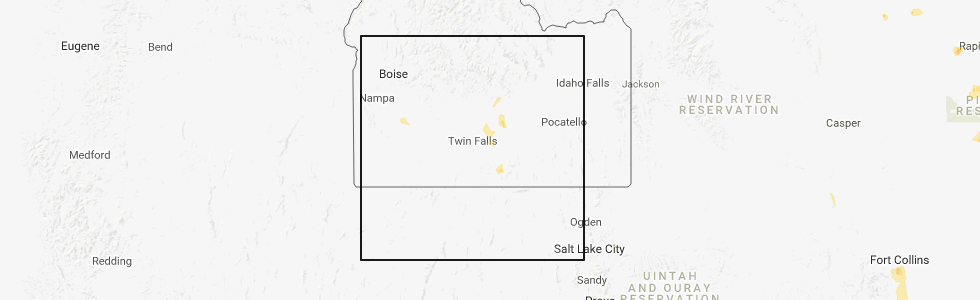
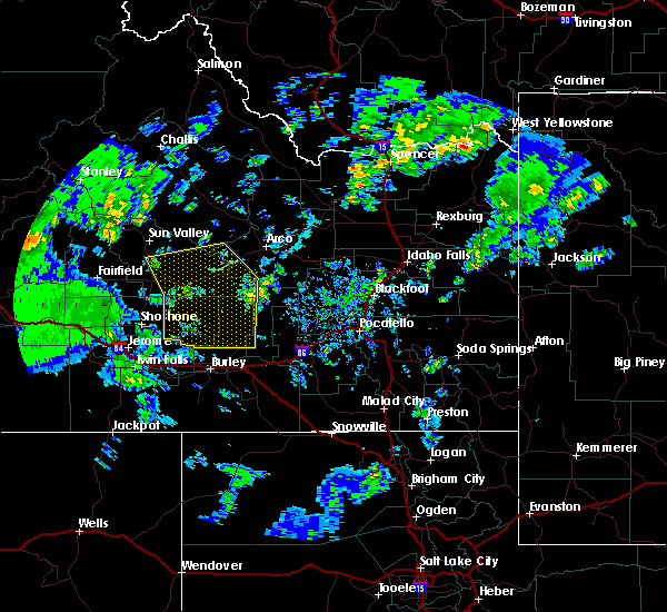
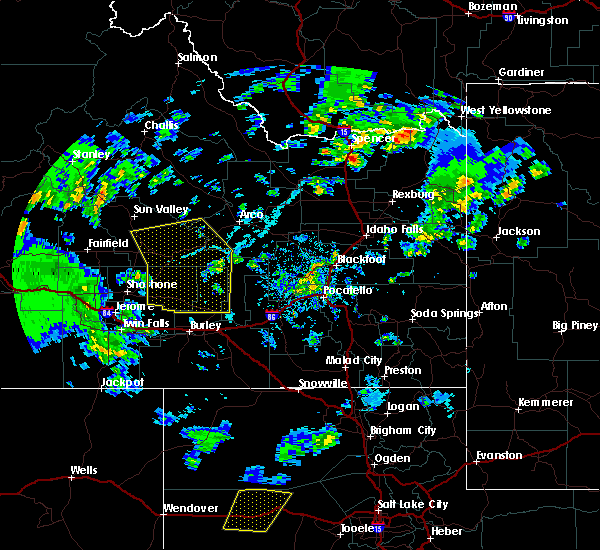
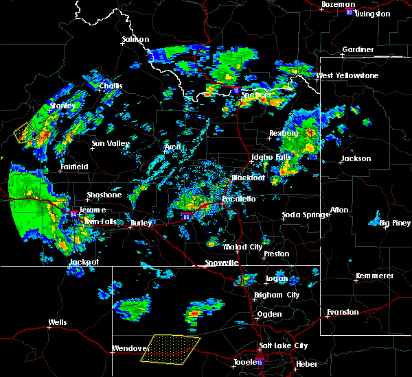
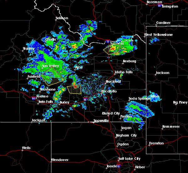
Hail Map for Carey, ID
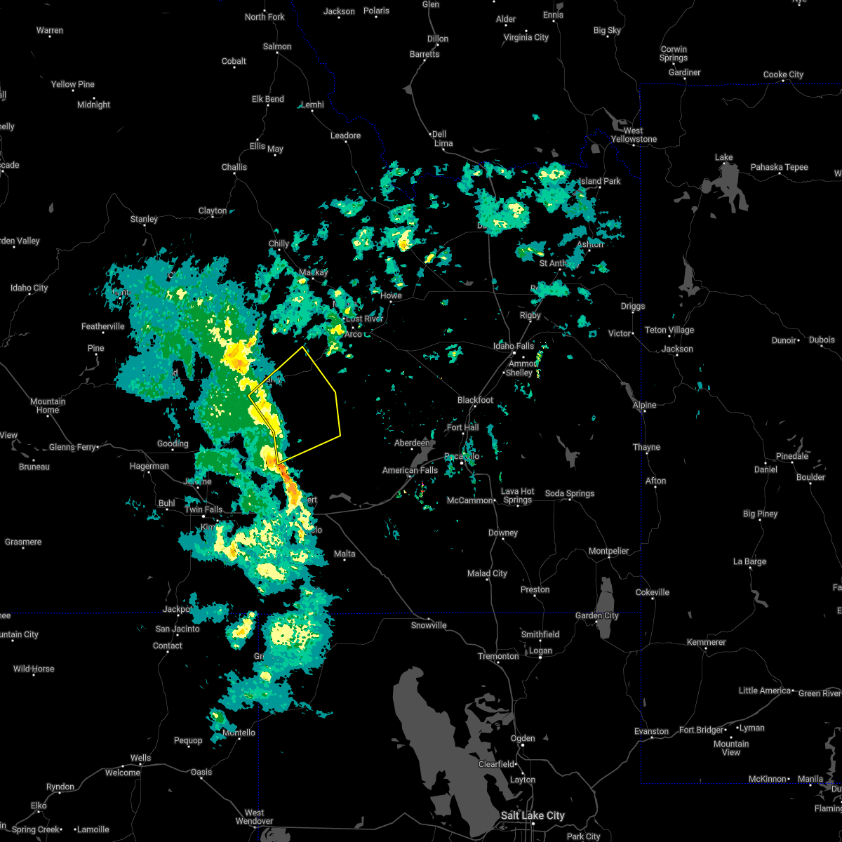
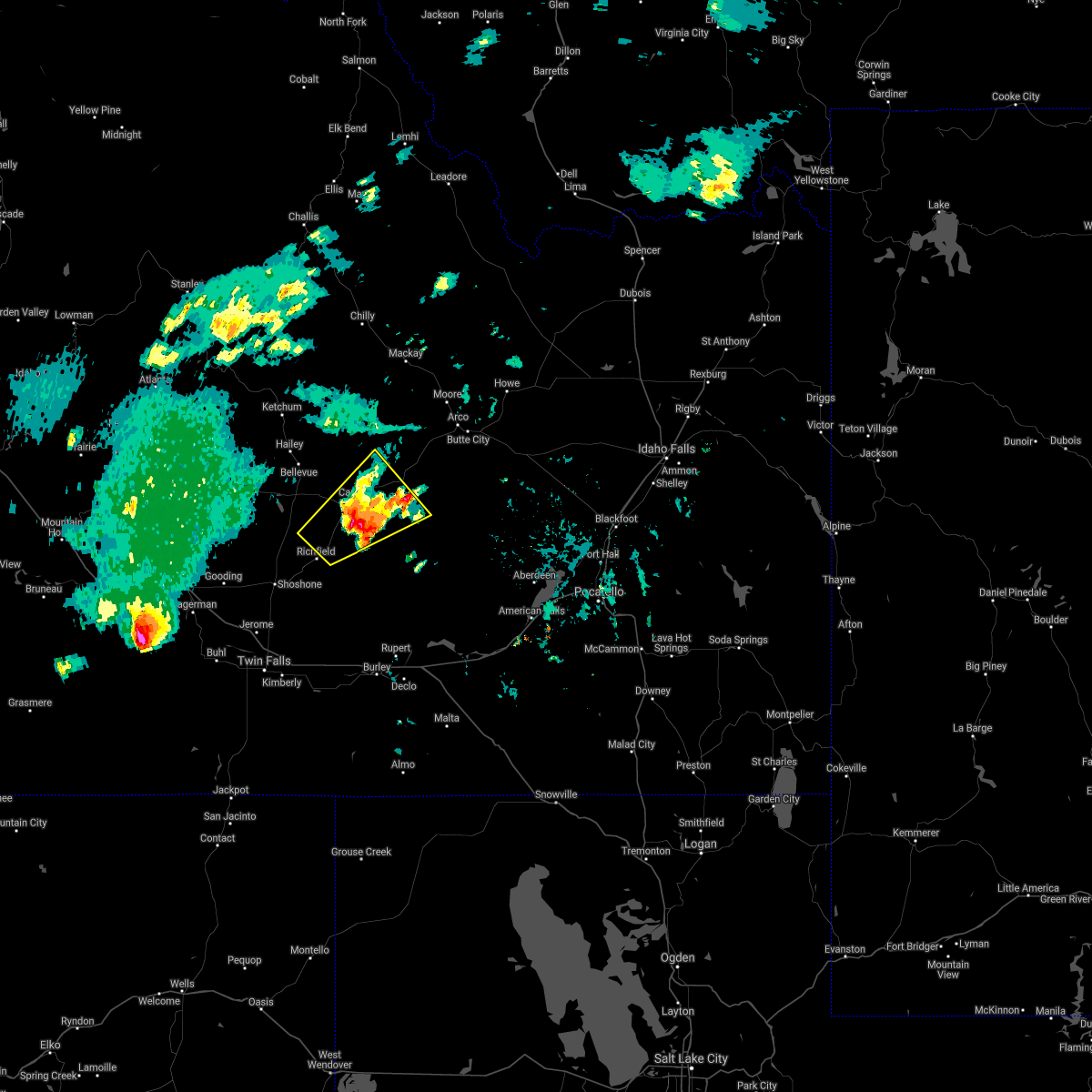
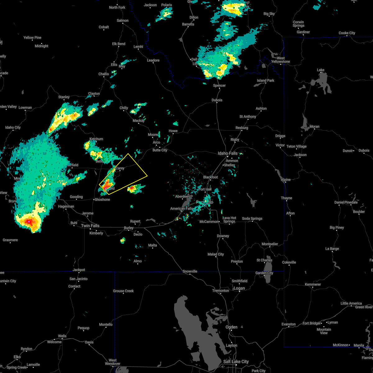
The Carey, ID area has had 0 reports of on-the-ground hail by trained spotters, and has been under severe weather warnings 0 times during the past 12 months. Doppler radar has detected hail at or near Carey, ID on 2 occasions.
| Name: | Carey, ID |
| Where Located: | 58.4 miles NNE of Twin Falls, ID |
| Map: | Google Map for Carey, ID |
| Population: | 604 |
| Housing Units: | 240 |
| More Info: | Search Google for Carey, ID |
5
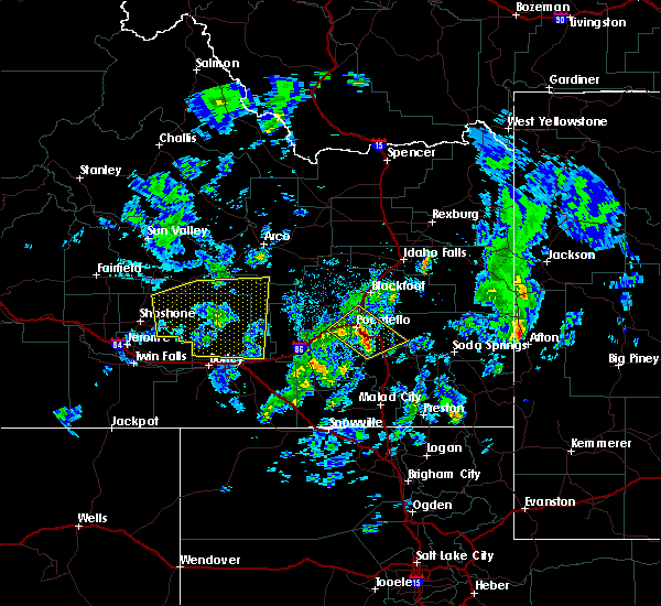
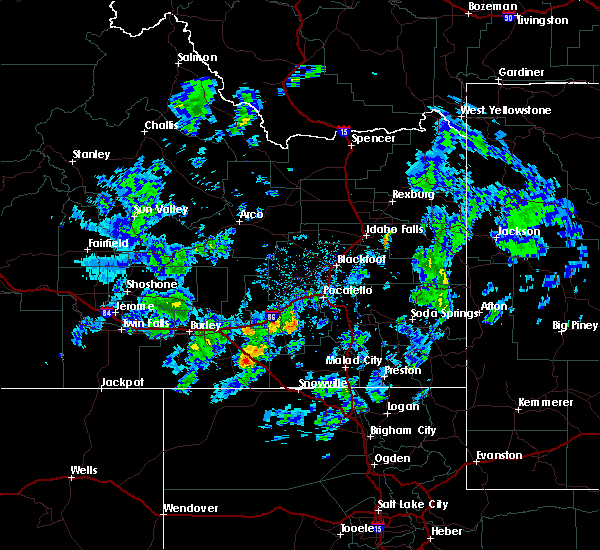
The Top Recent Hail Date for Carey, ID is Tuesday, May 22, 2018 (1st out of 2)
Hail and Wind Damage Spotted near Carey, ID
| Date / Time | Report Details |
|---|---|
| 3/2/2024 7:54 AM MST | Mesonet station pbui1 potter butt in blaine county ID, 19.7 miles WNW of Carey, ID |
| 5/2/2022 4:27 PM MDT |
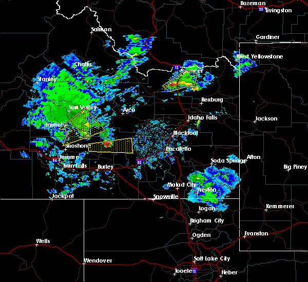
 At 427 pm mdt, severe thunderstorms were located along a line extending from near carey to 15 miles east of richfield to 22 miles northwest of minidoka, moving northeast at 30 mph (radar indicated). Hazards include 60 mph wind gusts and penny size hail. expect damage to roofs, siding, and trees At 427 pm mdt, severe thunderstorms were located along a line extending from near carey to 15 miles east of richfield to 22 miles northwest of minidoka, moving northeast at 30 mph (radar indicated). Hazards include 60 mph wind gusts and penny size hail. expect damage to roofs, siding, and trees
|
| 8/26/2020 7:11 PM MDT |
 The severe thunderstorm warning for central blaine, southwestern butte, northeastern lincoln and north central minidoka counties will expire at 715 pm mdt, the storm which prompted the warning has weakened below severe limits, and no longer poses an immediate threat to life or property. therefore, the warning will be allowed to expire. however gusty winds are still possible with this thunderstorm, and wind gusts may still approach severe limits. The severe thunderstorm warning for central blaine, southwestern butte, northeastern lincoln and north central minidoka counties will expire at 715 pm mdt, the storm which prompted the warning has weakened below severe limits, and no longer poses an immediate threat to life or property. therefore, the warning will be allowed to expire. however gusty winds are still possible with this thunderstorm, and wind gusts may still approach severe limits.
|
| 8/26/2020 6:49 PM MDT |
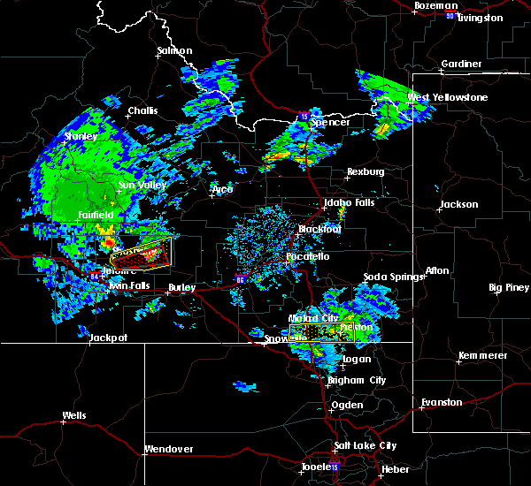
 At 648 pm mdt, a severe thunderstorm was located 8 miles south of carey, moving northeast at 30 mph (radar indicated). Hazards include 60 mph wind gusts and quarter size hail. Hail damage to vehicles is expected. expect wind damage to roofs, siding, and trees. Locations impacted include, carey, picabo and craters of the moon. At 648 pm mdt, a severe thunderstorm was located 8 miles south of carey, moving northeast at 30 mph (radar indicated). Hazards include 60 mph wind gusts and quarter size hail. Hail damage to vehicles is expected. expect wind damage to roofs, siding, and trees. Locations impacted include, carey, picabo and craters of the moon.
|
| 8/26/2020 6:37 PM MDT |
 At 637 pm mdt, a severe thunderstorm was located near richfield, or 11 miles south of picabo, moving northeast at 30 mph (radar indicated). Hazards include 60 mph wind gusts and quarter size hail. Hail damage to vehicles is expected. Expect wind damage to roofs, siding, and trees. At 637 pm mdt, a severe thunderstorm was located near richfield, or 11 miles south of picabo, moving northeast at 30 mph (radar indicated). Hazards include 60 mph wind gusts and quarter size hail. Hail damage to vehicles is expected. Expect wind damage to roofs, siding, and trees.
|
| 7/23/2020 7:01 PM MDT |
 At 700 pm mdt, severe winds associated with thunderstorm outflows were located along a line extending from 6 miles northeast of little wood reservoir to 11 miles southeast of carey to 14 miles northwest of minidoka, moving east at 35 mph (public reported damage to trees and roofs in shoshone). Hazards include 60 mph wind gusts. Expect damage to roofs, siding, and trees. Locations impacted include, carey, little wood reservoir, picabo, minidoka, craters of the moon, kimama and laidlaw corrals airport. At 700 pm mdt, severe winds associated with thunderstorm outflows were located along a line extending from 6 miles northeast of little wood reservoir to 11 miles southeast of carey to 14 miles northwest of minidoka, moving east at 35 mph (public reported damage to trees and roofs in shoshone). Hazards include 60 mph wind gusts. Expect damage to roofs, siding, and trees. Locations impacted include, carey, little wood reservoir, picabo, minidoka, craters of the moon, kimama and laidlaw corrals airport.
|
| 7/23/2020 6:38 PM MDT |
 At 636 pm mdt, severe winds associated with thunderstorm outflows were located along a line extending from near bellevue to 7 miles south of carey to 17 miles southeast of richfield, moving east at 40 mph (public). Hazards include 60 mph wind gusts. Expect damage to roofs, siding, and trees. Locations impacted include, hailey, carey, little wood reservoir, picabo, bellevue, richfield, minidoka, craters of the moon, gannett, kimama, garfield ranger station and laidlaw corrals airport. At 636 pm mdt, severe winds associated with thunderstorm outflows were located along a line extending from near bellevue to 7 miles south of carey to 17 miles southeast of richfield, moving east at 40 mph (public). Hazards include 60 mph wind gusts. Expect damage to roofs, siding, and trees. Locations impacted include, hailey, carey, little wood reservoir, picabo, bellevue, richfield, minidoka, craters of the moon, gannett, kimama, garfield ranger station and laidlaw corrals airport.
|
| 7/23/2020 6:25 PM MDT |
 At 623 pm mdt, severe winds associated with thunderstorm outflows were located along a line extending from near hailey to 9 miles north of richfield to 14 miles southeast of shoshone, moving east at 35 mph (public). Hazards include 60 mph wind gusts. expect wind damage to roofs, siding, and trees At 623 pm mdt, severe winds associated with thunderstorm outflows were located along a line extending from near hailey to 9 miles north of richfield to 14 miles southeast of shoshone, moving east at 35 mph (public). Hazards include 60 mph wind gusts. expect wind damage to roofs, siding, and trees
|
| 5/19/2020 4:26 PM MDT | Public reports 3 trees and power lines down across little wood reservoir rd just north of carey. blaine county 911 confirms fire department out on a call for wires down in blaine county ID, 0.8 miles SSE of Carey, ID |
| 5/19/2020 4:25 PM MDT | Photos received of sheet metal and wood 2x4 storage shed damaged with portions blown across the yard. time estimate in blaine county ID, 1 miles NW of Carey, ID |
| 4/30/2020 5:54 PM MDT | Mesonet station pbui1 potter butt in blaine county ID, 19.7 miles WNW of Carey, ID |
| 4/30/2020 5:10 PM MDT |
 The severe thunderstorm warning for central blaine and north central lincoln counties will expire at 515 pm mdt, the storms which prompted the warning are moving out of the warned area. therefore, the warning will be allowed to expire. however gusty winds are still possible with these thunderstorms. The severe thunderstorm warning for central blaine and north central lincoln counties will expire at 515 pm mdt, the storms which prompted the warning are moving out of the warned area. therefore, the warning will be allowed to expire. however gusty winds are still possible with these thunderstorms.
|
| 4/30/2020 4:54 PM MDT |
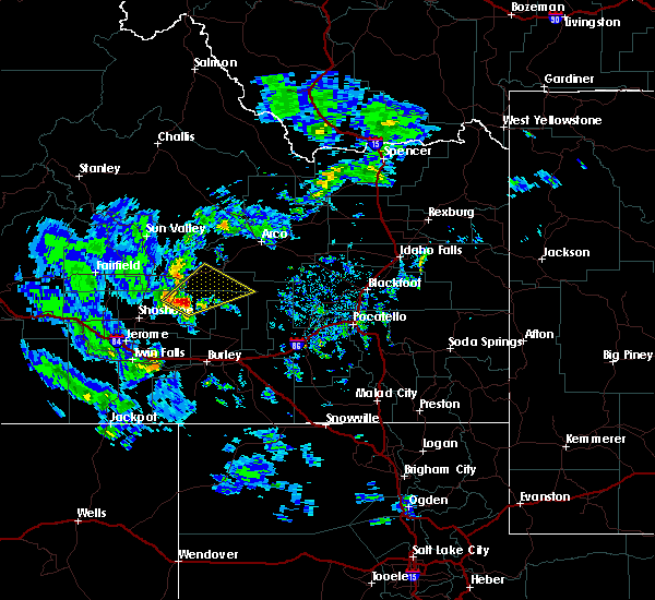
 At 453 pm mdt, severe thunderstorms were located along a line extending from near bellevue to near picabo, moving northeast at 55 mph (radar indicated). Hazards include 60 mph wind gusts and penny size hail. a wind gust to 57 mph was recorded at tom cat summit at 445 pm mdt and 56 mph at timmerman hill at 445pm mdt. Expect damage to roofs, siding, and trees. Locations impacted include, hailey, carey, little wood reservoir, picabo, bellevue, gannett and garfield ranger station. At 453 pm mdt, severe thunderstorms were located along a line extending from near bellevue to near picabo, moving northeast at 55 mph (radar indicated). Hazards include 60 mph wind gusts and penny size hail. a wind gust to 57 mph was recorded at tom cat summit at 445 pm mdt and 56 mph at timmerman hill at 445pm mdt. Expect damage to roofs, siding, and trees. Locations impacted include, hailey, carey, little wood reservoir, picabo, bellevue, gannett and garfield ranger station.
|
| 4/30/2020 4:29 PM MDT |
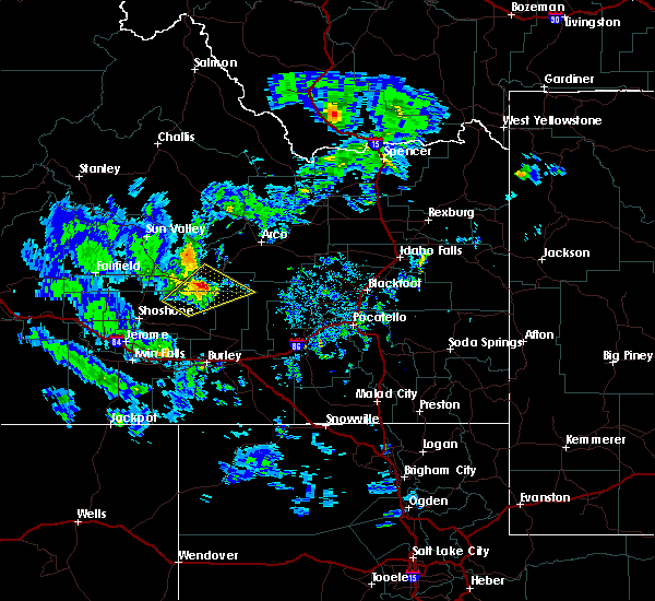
 At 427 pm mdt, severe thunderstorms were located along a line extending from 9 miles east of fairfield to 8 miles northwest of shoshone, moving northeast at 55 mph (radar indicated and confirmed by surface observations. these storms produced a 62 mph wind gust at gwinn ranch hill itd site at 415 pm mdt). Hazards include 60 mph wind gusts and penny size hail. expect damage to roofs, siding, and trees At 427 pm mdt, severe thunderstorms were located along a line extending from 9 miles east of fairfield to 8 miles northwest of shoshone, moving northeast at 55 mph (radar indicated and confirmed by surface observations. these storms produced a 62 mph wind gust at gwinn ranch hill itd site at 415 pm mdt). Hazards include 60 mph wind gusts and penny size hail. expect damage to roofs, siding, and trees
|
| 6/4/2017 8:48 PM MDT |
 At 847 pm mdt, a severe thunderstorm was located 11 miles east of carey, moving northeast at 60 mph (radar indicated). Hazards include 60 mph wind gusts and penny size hail. Expect damage to roofs, siding, and trees as well as hazardous crosswinds. Locations impacted include, carey and craters of the moon. At 847 pm mdt, a severe thunderstorm was located 11 miles east of carey, moving northeast at 60 mph (radar indicated). Hazards include 60 mph wind gusts and penny size hail. Expect damage to roofs, siding, and trees as well as hazardous crosswinds. Locations impacted include, carey and craters of the moon.
|
| 6/4/2017 8:32 PM MDT |
 At 832 pm mdt, a severe thunderstorm was located 12 miles east of richfield, or 12 miles south of carey, moving northeast at 60 mph (radar indicated). Hazards include 60 mph wind gusts and penny size hail. expect damage to roofs, siding, and trees along with hazardous crosswinds At 832 pm mdt, a severe thunderstorm was located 12 miles east of richfield, or 12 miles south of carey, moving northeast at 60 mph (radar indicated). Hazards include 60 mph wind gusts and penny size hail. expect damage to roofs, siding, and trees along with hazardous crosswinds
|
| 9/13/2016 9:57 PM MDT |
 The severe thunderstorm warning for eastern lincoln, northeastern cassia, southeastern custer, southwestern bingham, northwestern power, blaine, northwestern bannock, southwestern butte and minidoka counties will expire at 1000 pm mdt, the storms which prompted the warning have weakened. therefore the warning will be allowed to expire. however, wind over 40mph are still possible. The severe thunderstorm warning for eastern lincoln, northeastern cassia, southeastern custer, southwestern bingham, northwestern power, blaine, northwestern bannock, southwestern butte and minidoka counties will expire at 1000 pm mdt, the storms which prompted the warning have weakened. therefore the warning will be allowed to expire. however, wind over 40mph are still possible.
|
| 9/13/2016 9:28 PM MDT |
 At 926 pm mdt, doppler radar and mesonet observations indicated outflow winds producing damaging winds in excess of 60 mph. these storms were located along a line extending from near gannett to near lake walcott, and moving northeast at 35 mph. At 926 pm mdt, doppler radar and mesonet observations indicated outflow winds producing damaging winds in excess of 60 mph. these storms were located along a line extending from near gannett to near lake walcott, and moving northeast at 35 mph.
|
| 7/10/2016 3:54 PM MDT | Potter butte raw in blaine county ID, 19.7 miles WNW of Carey, ID |
| 7/10/2016 3:19 PM MDT |
 At 317 pm mdt, doppler radar indicated a severe thunderstorm capable of producing damaging winds in excess of 60 mph. this storm was located near richfield, or 13 miles east of shoshone. this storm was moving northeast around 50 mph. locations impacted include, rupert, carey, lake walcott, richfield, minidoka, craters of the moon, acequia, bear trap airport, kimama and laidlaw corrals airport. these storms have produced wind gusts up to 73 mph at tom cat summit. At 317 pm mdt, doppler radar indicated a severe thunderstorm capable of producing damaging winds in excess of 60 mph. this storm was located near richfield, or 13 miles east of shoshone. this storm was moving northeast around 50 mph. locations impacted include, rupert, carey, lake walcott, richfield, minidoka, craters of the moon, acequia, bear trap airport, kimama and laidlaw corrals airport. these storms have produced wind gusts up to 73 mph at tom cat summit.
|
| 7/10/2016 2:55 PM MDT |
 At 252 pm mdt, doppler radar indicated severe thunderstorm outflow winds in excess of 60 mph. thunderstorms outflow winds of 62 mph were measured at richfield. At 252 pm mdt, doppler radar indicated severe thunderstorm outflow winds in excess of 60 mph. thunderstorms outflow winds of 62 mph were measured at richfield.
|
Hail Maps for Carey, ID
Connect with Interactive Hail Maps