

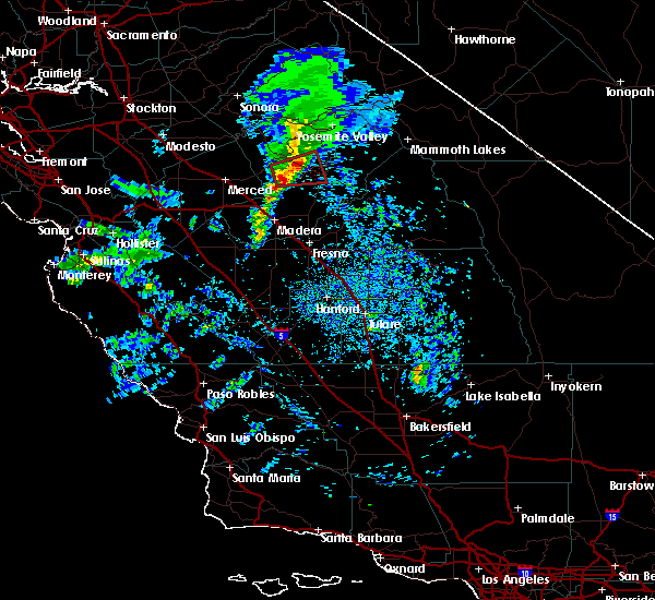
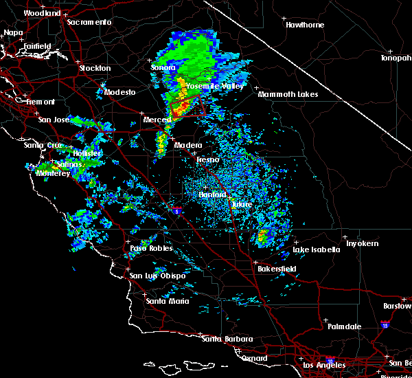
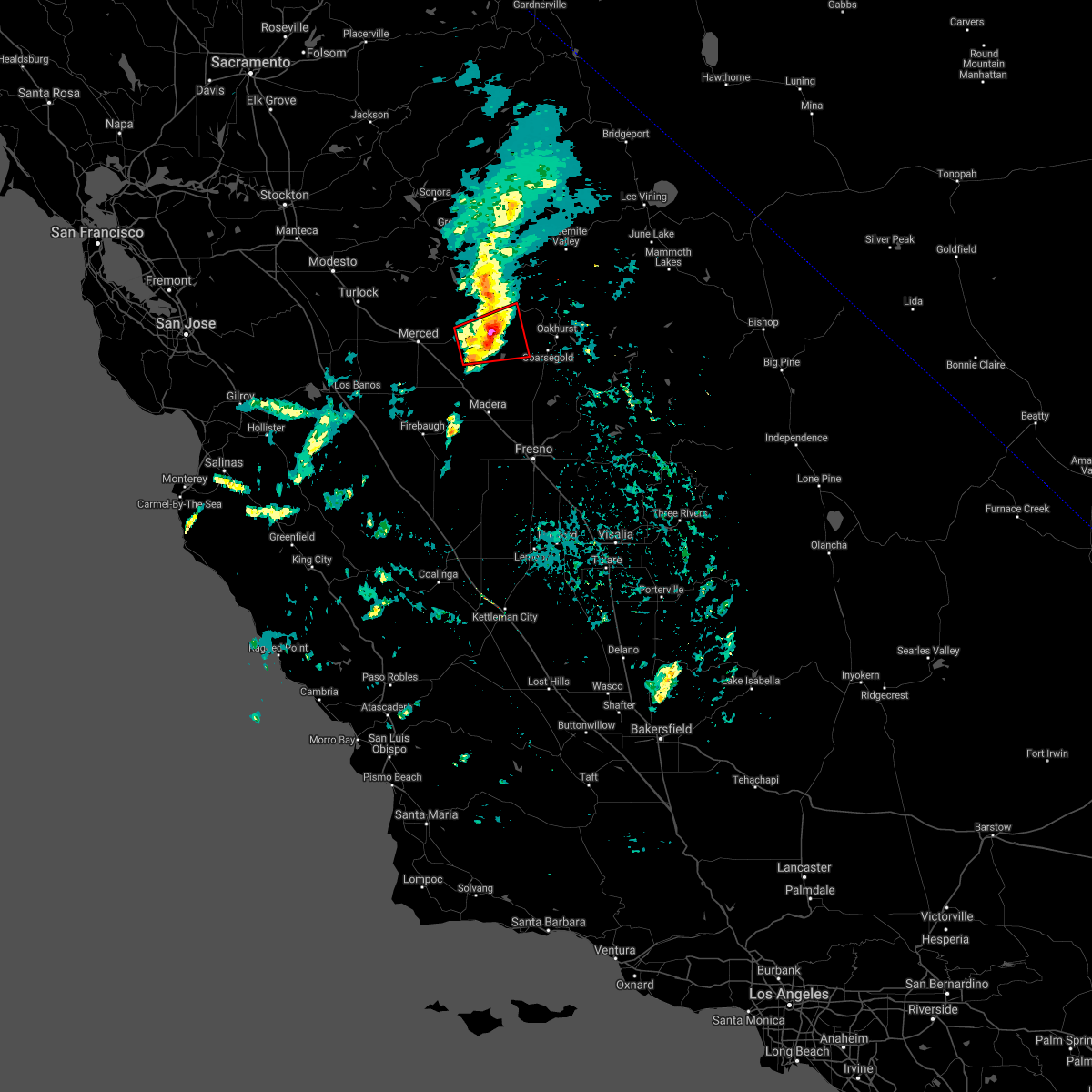
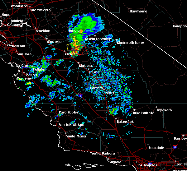
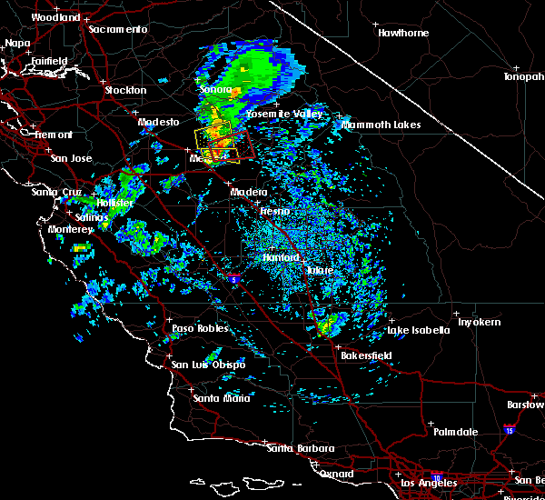
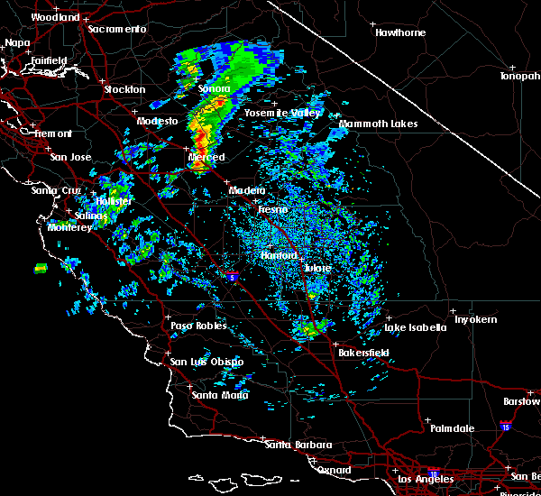
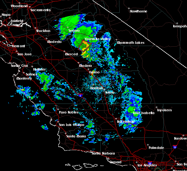
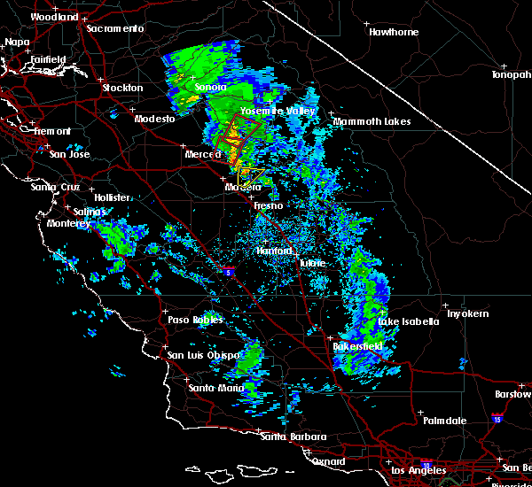
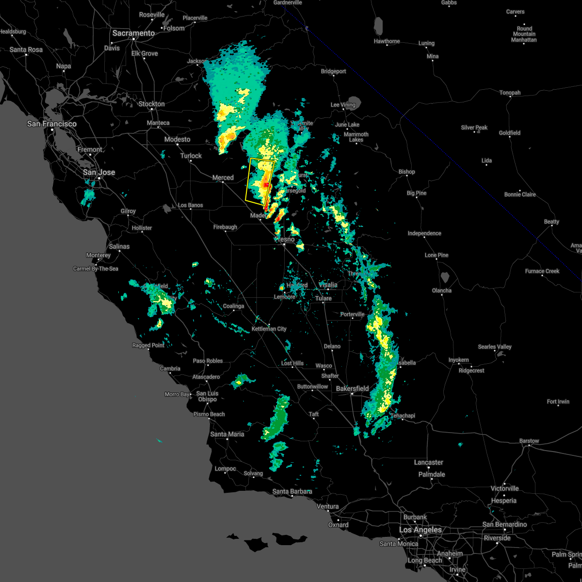
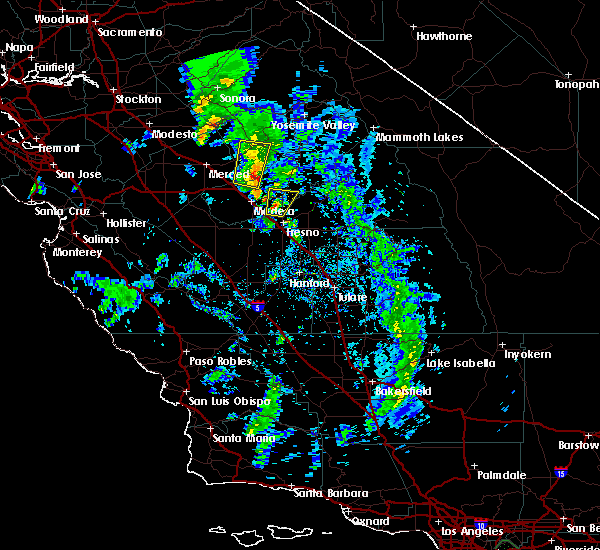
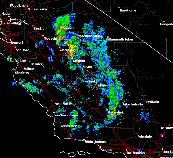
Hail Map for Catheys Valley, CA
The Catheys Valley, CA area has had 0 reports of on-the-ground hail by trained spotters, and has been under severe weather warnings 0 times during the past 12 months. Doppler radar has detected hail at or near Catheys Valley, CA on 1 occasion.
| Name: | Catheys Valley, CA |
| Where Located: | 50.8 miles NNW of Fresno, CA |
| Map: | Google Map for Catheys Valley, CA |
| Population: | 825 |
| Housing Units: | 381 |
| More Info: | Search Google for Catheys Valley, CA |
5
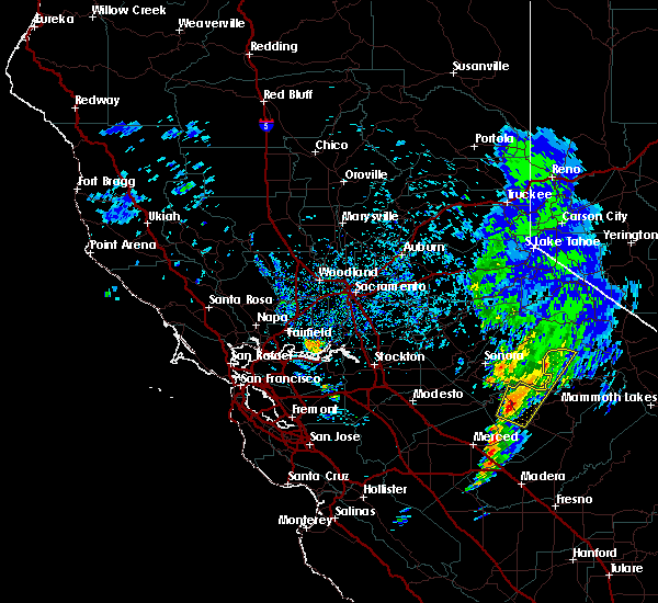
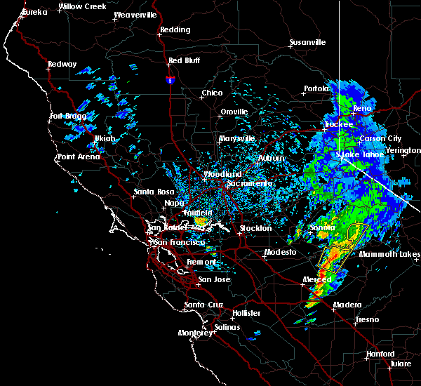
The Top Recent Hail Date for Catheys Valley, CA is Thursday, March 22, 2018 (1st out of 1)

Hail and Wind Damage Spotted near Catheys Valley, CA
| Date / Time | Report Details |
|---|---|
| 3/27/2019 6:23 PM PDT |
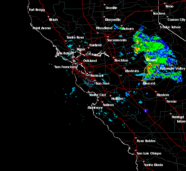
 The tornado warning for south central mariposa and central madera counties will expire at 630 pm pdt, the storm which prompted the warning has weakened below severe limits, and no longer appears capable of producing a tornado. therefore, the warning will be allowed to expire. however small hail, gusty winds and heavy rain are still possible with this thunderstorm. The tornado warning for south central mariposa and central madera counties will expire at 630 pm pdt, the storm which prompted the warning has weakened below severe limits, and no longer appears capable of producing a tornado. therefore, the warning will be allowed to expire. however small hail, gusty winds and heavy rain are still possible with this thunderstorm.
|
| 3/27/2019 6:16 PM PDT |
 At 614 pm pdt, a severe squall line capable of producing both tornadoes and extensive straight line wind damage was located near bootjack, or 16 miles southwest of yosemite south entrance, moving east at 20 mph (radar indicated rotation. trained spotter reported a wall cloud with warned storm. another strong storm is moving into the warned area and is increasing in intensity 5 miles east of legrand). Hazards include tornado and quarter size hail. Flying debris will be dangerous to those caught without shelter. mobile homes will be damaged or destroyed. damage to roofs, windows, and vehicles will occur. tree damage is likely. Locations impacted include, oakhurst, bootjack, mariposa, ahwahnee and metcalf gap. At 614 pm pdt, a severe squall line capable of producing both tornadoes and extensive straight line wind damage was located near bootjack, or 16 miles southwest of yosemite south entrance, moving east at 20 mph (radar indicated rotation. trained spotter reported a wall cloud with warned storm. another strong storm is moving into the warned area and is increasing in intensity 5 miles east of legrand). Hazards include tornado and quarter size hail. Flying debris will be dangerous to those caught without shelter. mobile homes will be damaged or destroyed. damage to roofs, windows, and vehicles will occur. tree damage is likely. Locations impacted include, oakhurst, bootjack, mariposa, ahwahnee and metcalf gap.
|
| 3/27/2019 5:57 PM PDT |
 At 557 pm pdt, severe thunderstorms capable of producing both tornadoes and extensive straight line wind damage were located 9 miles southwest of bootjack, or 22 miles southwest of yosemite south entrance, moving east at 20 mph (radar indicated rotation). Hazards include tornado and quarter size hail. Flying debris will be dangerous to those caught without shelter. mobile homes will be damaged or destroyed. damage to roofs, windows, and vehicles will occur. tree damage is likely. This tornadic thunderstorm will remain over mainly rural areas of south central mariposa and central madera counties, including the following locations, metcalf gap, ahwahnee and mariposa. At 557 pm pdt, severe thunderstorms capable of producing both tornadoes and extensive straight line wind damage were located 9 miles southwest of bootjack, or 22 miles southwest of yosemite south entrance, moving east at 20 mph (radar indicated rotation). Hazards include tornado and quarter size hail. Flying debris will be dangerous to those caught without shelter. mobile homes will be damaged or destroyed. damage to roofs, windows, and vehicles will occur. tree damage is likely. This tornadic thunderstorm will remain over mainly rural areas of south central mariposa and central madera counties, including the following locations, metcalf gap, ahwahnee and mariposa.
|
| 3/27/2019 5:56 PM PDT |
 The tornado warning for southwestern mariposa, central madera and eastern merced counties will expire at 600 pm pdt, a tornado warning still remains in effect for until 600 pm pdt. The tornado warning for southwestern mariposa, central madera and eastern merced counties will expire at 600 pm pdt, a tornado warning still remains in effect for until 600 pm pdt.
|
| 3/27/2019 5:36 PM PDT |
 The severe thunderstorm warning for southwestern mariposa and northeastern merced counties will expire at 545 pm pdt, the storm which prompted the warning has weakened below severe limits, and no longer poses an immediate threat to life or property. therefore, the warning will be allowed to expire. The severe thunderstorm warning for southwestern mariposa and northeastern merced counties will expire at 545 pm pdt, the storm which prompted the warning has weakened below severe limits, and no longer poses an immediate threat to life or property. therefore, the warning will be allowed to expire.
|
| 3/27/2019 5:31 PM PDT |
 At 530 pm pdt, severe thunderstorms capable of producing both tornadoes and extensive straight line wind damage were located 14 miles northeast of chowchilla, or 18 miles east of merced, moving east at 20 mph (radar indicated rotation). Hazards include tornado and quarter size hail. Flying debris will be dangerous to those caught without shelter. mobile homes will be damaged or destroyed. damage to roofs, windows, and vehicles will occur. tree damage is likely. This tornadic thunderstorm will remain over mainly rural areas of southwestern mariposa, central madera and eastern merced counties, including the following locations, mariposa. At 530 pm pdt, severe thunderstorms capable of producing both tornadoes and extensive straight line wind damage were located 14 miles northeast of chowchilla, or 18 miles east of merced, moving east at 20 mph (radar indicated rotation). Hazards include tornado and quarter size hail. Flying debris will be dangerous to those caught without shelter. mobile homes will be damaged or destroyed. damage to roofs, windows, and vehicles will occur. tree damage is likely. This tornadic thunderstorm will remain over mainly rural areas of southwestern mariposa, central madera and eastern merced counties, including the following locations, mariposa.
|
| 3/27/2019 5:08 PM PDT |
 At 507 pm pdt, a severe thunderstorm was located 13 miles northeast of merced, moving east at 15 mph (radar indicated). Hazards include quarter size hail. damage to vehicles is expected At 507 pm pdt, a severe thunderstorm was located 13 miles northeast of merced, moving east at 15 mph (radar indicated). Hazards include quarter size hail. damage to vehicles is expected
|
| 3/6/2019 3:32 PM PST |
 At 330 pm pst, a line of strong thunderstorms, a few at severe levels, extended from northwestern mariposa county into eastern merced county just east of merced. the line was moving east at about 25 mph (radar indicated). Hazards include 60 mph wind gusts and quarter size hail along with very heavy rain and possible flooding. any of these storms could spawn a funnel cloud. Hail damage to vehicles is expected. Expect wind damage to roofs, siding, and trees. At 330 pm pst, a line of strong thunderstorms, a few at severe levels, extended from northwestern mariposa county into eastern merced county just east of merced. the line was moving east at about 25 mph (radar indicated). Hazards include 60 mph wind gusts and quarter size hail along with very heavy rain and possible flooding. any of these storms could spawn a funnel cloud. Hail damage to vehicles is expected. Expect wind damage to roofs, siding, and trees.
|
| 2/2/2019 4:08 PM PST |
 The tornado warning for south central mariposa and northwestern madera counties will expire at 415 pm pst, the storm which prompted the warning has weakened below severe limits, and no longer appears capable of producing a tornado. therefore, the warning will be allowed to expire. The tornado warning for south central mariposa and northwestern madera counties will expire at 415 pm pst, the storm which prompted the warning has weakened below severe limits, and no longer appears capable of producing a tornado. therefore, the warning will be allowed to expire.
|
| 2/2/2019 3:50 PM PST |
 At 349 pm pst, a severe thunderstorm capable of producing a tornado was located near bootjack, or 17 miles southwest of yosemite south entrance, moving northeast at 50 mph (radar indicated rotation). Hazards include tornado and quarter size hail. Flying debris will be dangerous to those caught without shelter. mobile homes will be damaged or destroyed. damage to roofs, windows, and vehicles will occur. tree damage is likely. This tornadic thunderstorm will remain over mainly rural areas of south central mariposa and northwestern madera counties, including the following locations, jerseydale and mariposa. At 349 pm pst, a severe thunderstorm capable of producing a tornado was located near bootjack, or 17 miles southwest of yosemite south entrance, moving northeast at 50 mph (radar indicated rotation). Hazards include tornado and quarter size hail. Flying debris will be dangerous to those caught without shelter. mobile homes will be damaged or destroyed. damage to roofs, windows, and vehicles will occur. tree damage is likely. This tornadic thunderstorm will remain over mainly rural areas of south central mariposa and northwestern madera counties, including the following locations, jerseydale and mariposa.
|
| 2/2/2019 3:42 PM PST |
 The severe thunderstorm warning for southwestern mariposa, west central madera and east central merced counties will expire at 345 pm pst, the storm which prompted the warning has been replaced by a tornado warning. remember, a tornado warning still remains in effect for south central mariposa county in central california, central madera county in central california, east central merced county in central california,. The severe thunderstorm warning for southwestern mariposa, west central madera and east central merced counties will expire at 345 pm pst, the storm which prompted the warning has been replaced by a tornado warning. remember, a tornado warning still remains in effect for south central mariposa county in central california, central madera county in central california, east central merced county in central california,.
|
| 2/2/2019 3:30 PM PST |
 At 329 pm pst, a severe thunderstorm capable of producing a tornado was located 13 miles northeast of chowchilla, or 16 miles north of madera, moving north at 15 mph (radar indicated rotation). Hazards include tornado and quarter size hail. Flying debris will be dangerous to those caught without shelter. mobile homes will be damaged or destroyed. damage to roofs, windows, and vehicles will occur. tree damage is likely. This tornadic thunderstorm will remain over mainly rural areas of south central mariposa, central madera and east central merced counties. At 329 pm pst, a severe thunderstorm capable of producing a tornado was located 13 miles northeast of chowchilla, or 16 miles north of madera, moving north at 15 mph (radar indicated rotation). Hazards include tornado and quarter size hail. Flying debris will be dangerous to those caught without shelter. mobile homes will be damaged or destroyed. damage to roofs, windows, and vehicles will occur. tree damage is likely. This tornadic thunderstorm will remain over mainly rural areas of south central mariposa, central madera and east central merced counties.
|
| 2/2/2019 3:13 PM PST |
 The national weather service in hanford ca has issued a * severe thunderstorm warning for. southwestern mariposa county in central california. west central madera county in central california. east central merced county in central california. Until 345 pm pst. The national weather service in hanford ca has issued a * severe thunderstorm warning for. southwestern mariposa county in central california. west central madera county in central california. east central merced county in central california. Until 345 pm pst.
|
| 3/21/2017 3:14 PM PDT |
 At 314 pm pdt, doppler radar indicated a severe thunderstorm capable of producing large hail up to ping pong ball size and damaging winds in excess of 60 mph. this storm was located 10 miles south of smith station, or 26 miles southeast of sonora, and moving east northeast at 30 mph. At 314 pm pdt, doppler radar indicated a severe thunderstorm capable of producing large hail up to ping pong ball size and damaging winds in excess of 60 mph. this storm was located 10 miles south of smith station, or 26 miles southeast of sonora, and moving east northeast at 30 mph.
|
Hail Maps for Catheys Valley, CA
Connect with Interactive Hail Maps