

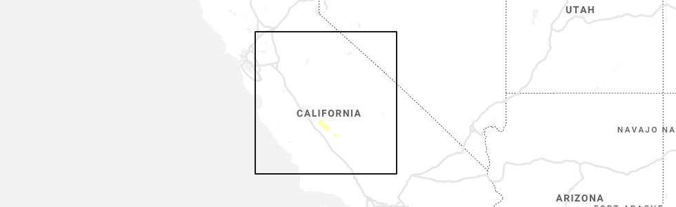
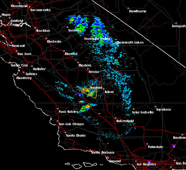
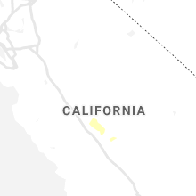
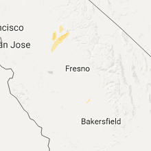
Hail Map for Corcoran, CA
The Corcoran, CA area has had 0 reports of on-the-ground hail by trained spotters, and has been under severe weather warnings 3 times during the past 12 months. Doppler radar has detected hail at or near Corcoran, CA on 2 occasions.
| Name: | Corcoran, CA |
| Where Located: | 46.1 miles SSE of Fresno, CA |
| Map: | Google Map for Corcoran, CA |
| Population: | 24813 |
| Housing Units: | 3958 |
| More Info: | Search Google for Corcoran, CA |
0
The Top Recent Hail Date for Corcoran, CA is Sunday, May 19, 2019 (2nd out of 2)
Hail and Wind Damage Spotted near Corcoran, CA
| Date / Time | Report Details |
|---|---|
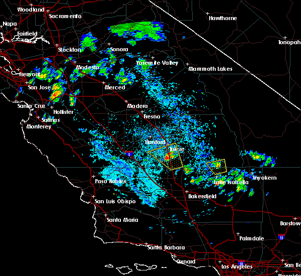
| 3/2/2024 4:53 PM PST |
 The tornadic thunderstorm which prompted the warning has weakened and moved out of the warned area. therefore, the warning will be allowed to expire. The tornadic thunderstorm which prompted the warning has weakened and moved out of the warned area. therefore, the warning will be allowed to expire.
|
| 3/2/2024 4:47 PM PST |
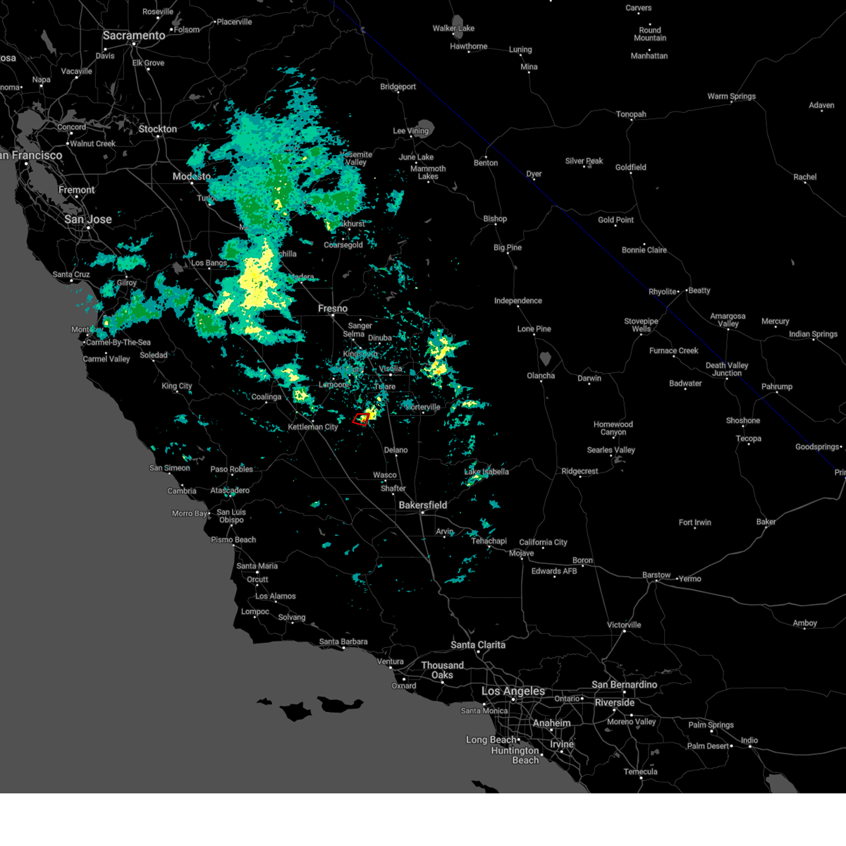 At 446 pm pst, a severe thunderstorm capable of producing a tornado was located near corcoran, or 14 miles southwest of tulare, moving east at 15 mph (radar indicated rotation). Hazards include tornado. Flying debris will be dangerous to those caught without shelter. mobile homes will be damaged or destroyed. damage to roofs, windows, and vehicles will occur. tree damage is likely. This tornadic thunderstorm will remain over mainly rural areas of east central kings and southwestern tulare counties. At 446 pm pst, a severe thunderstorm capable of producing a tornado was located near corcoran, or 14 miles southwest of tulare, moving east at 15 mph (radar indicated rotation). Hazards include tornado. Flying debris will be dangerous to those caught without shelter. mobile homes will be damaged or destroyed. damage to roofs, windows, and vehicles will occur. tree damage is likely. This tornadic thunderstorm will remain over mainly rural areas of east central kings and southwestern tulare counties.
|
| 3/2/2024 4:37 PM PST |
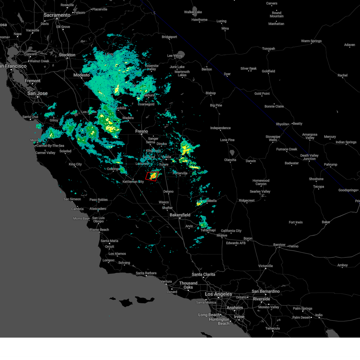 Torhnx the national weather service in hanford ca has issued a * tornado warning for, east central kings county in central california, western tulare county in central california, * until 500 pm pst. * at 436 pm pst, a severe thunderstorm capable of producing a tornado was located over corcoran, or 16 miles southwest of tulare, moving east at 15 mph (radar indicated rotation). Hazards include tornado. Flying debris will be dangerous to those caught without shelter. mobile homes will be damaged or destroyed. damage to roofs, windows, and vehicles will occur. tree damage is likely. This dangerous storm will be near, corcoran around 440 pm pst. Torhnx the national weather service in hanford ca has issued a * tornado warning for, east central kings county in central california, western tulare county in central california, * until 500 pm pst. * at 436 pm pst, a severe thunderstorm capable of producing a tornado was located over corcoran, or 16 miles southwest of tulare, moving east at 15 mph (radar indicated rotation). Hazards include tornado. Flying debris will be dangerous to those caught without shelter. mobile homes will be damaged or destroyed. damage to roofs, windows, and vehicles will occur. tree damage is likely. This dangerous storm will be near, corcoran around 440 pm pst.
|
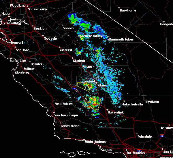
| 5/19/2019 5:13 PM PDT |
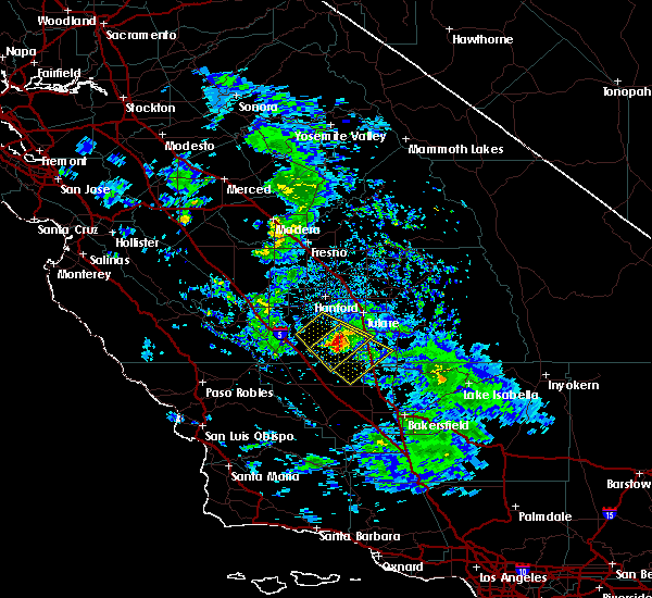 At 511 pm pdt, a severe thunderstorm was located 12 miles south of corcoran, or 17 miles northwest of delano, moving southeast at 50 mph (radar indicated). Hazards include hail up to one inch in diameter. frequent lightning. possible funnel cloud. damaging strong winds and hail which could damage vehicles At 511 pm pdt, a severe thunderstorm was located 12 miles south of corcoran, or 17 miles northwest of delano, moving southeast at 50 mph (radar indicated). Hazards include hail up to one inch in diameter. frequent lightning. possible funnel cloud. damaging strong winds and hail which could damage vehicles
|
| 5/19/2019 5:03 PM PDT |
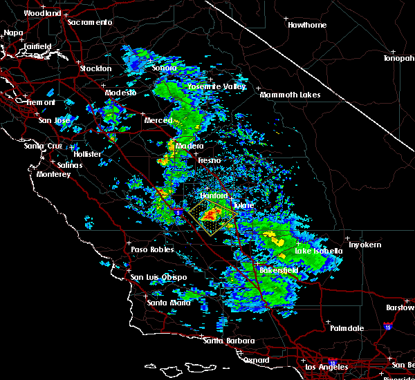 At 502 pm pdt, a severe thunderstorm was located 9 miles south of corcoran, or 20 miles southwest of tulare, moving southeast at 45 mph (radar indicated). Hazards include hail up to one inch in diameter. frequent lightning. possible funnel cloud. Damaging strong winds and hail which could damage vehicles. Locations impacted include, corcoran, pixley and alpaugh. At 502 pm pdt, a severe thunderstorm was located 9 miles south of corcoran, or 20 miles southwest of tulare, moving southeast at 45 mph (radar indicated). Hazards include hail up to one inch in diameter. frequent lightning. possible funnel cloud. Damaging strong winds and hail which could damage vehicles. Locations impacted include, corcoran, pixley and alpaugh.
|
| 5/19/2019 4:53 PM PDT |
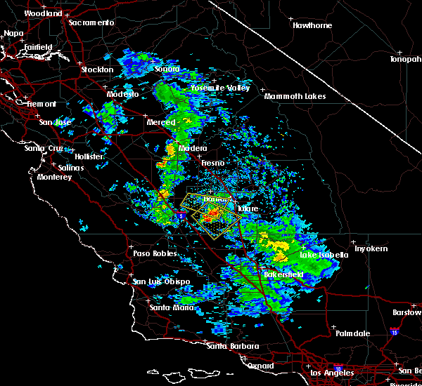 The national weather service in hanford ca has issued a * severe thunderstorm warning for. northwestern kern county in central california. southeastern kings county in central california. southwestern tulare county in central california. Until 515 pm pdt. The national weather service in hanford ca has issued a * severe thunderstorm warning for. northwestern kern county in central california. southeastern kings county in central california. southwestern tulare county in central california. Until 515 pm pdt.
|
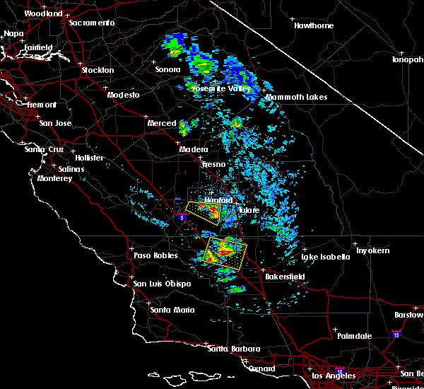
| 5/19/2019 4:27 PM PDT |
 At 426 pm pdt, a severe thunderstorm was located near stratford, or 14 miles southwest of hanford, moving southeast at 30 mph (radar indicated). Hazards include 60 mph wind gusts and quarter size hail. Hail damage to vehicles is expected. Expect wind damage to roofs, siding, and trees. At 426 pm pdt, a severe thunderstorm was located near stratford, or 14 miles southwest of hanford, moving southeast at 30 mph (radar indicated). Hazards include 60 mph wind gusts and quarter size hail. Hail damage to vehicles is expected. Expect wind damage to roofs, siding, and trees.
|
| 5/19/2019 4:18 PM PDT |
 At 415 pm pdt, a severe thunderstorm was located over stratford, or 15 miles southwest of hanford, moving east at 25 mph (radar indicated). Hazards include hail up to one inch in diameter. frequent lightning. possible funnel cloud. Damaging hail and strong winds. Locations impacted include, hanford, corcoran, lemoore, stratford and lemoore nas. At 415 pm pdt, a severe thunderstorm was located over stratford, or 15 miles southwest of hanford, moving east at 25 mph (radar indicated). Hazards include hail up to one inch in diameter. frequent lightning. possible funnel cloud. Damaging hail and strong winds. Locations impacted include, hanford, corcoran, lemoore, stratford and lemoore nas.
|
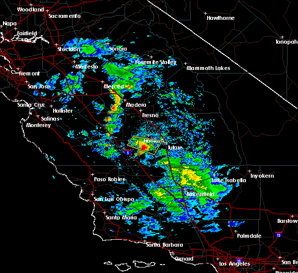
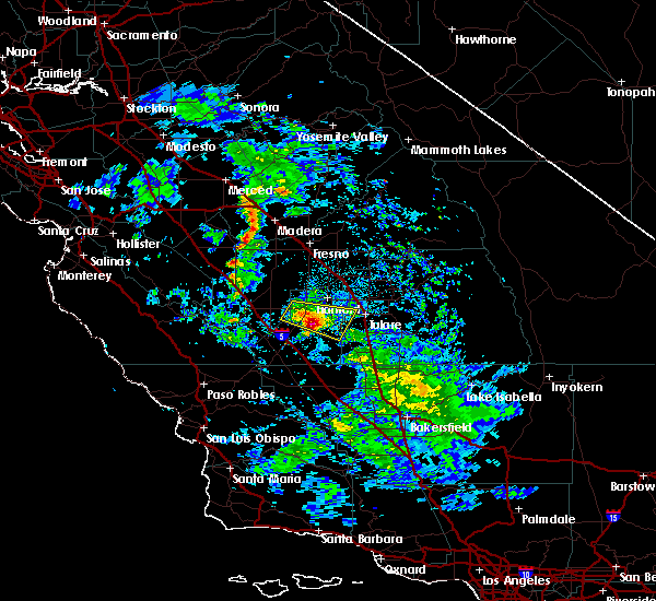
| 5/19/2019 4:01 PM PDT |
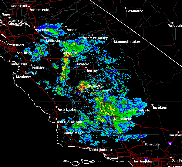 At 358 pm pdt, a severe thunderstorm was located over lanare, or 14 miles northwest of hanford, moving east at 80 mph (radar indicated). Hazards include .hail up to one inch in diameter. frequent lightning. possible funnel. damaging hail and strong winds At 358 pm pdt, a severe thunderstorm was located over lanare, or 14 miles northwest of hanford, moving east at 80 mph (radar indicated). Hazards include .hail up to one inch in diameter. frequent lightning. possible funnel. damaging hail and strong winds
|
| 9/11/2017 5:16 PM PDT |
 At 516 pm pdt, a severe thunderstorm was located 10 miles southeast of corcoran, or 12 miles south of tulare, moving northwest at 50 mph (radar indicated). Hazards include 60 mph wind gusts and quarter size hail in addition to frequent lightning and briefly heavy rain. Hail damage to vehicles is expected. Expect wind damage to roofs, siding, and trees. At 516 pm pdt, a severe thunderstorm was located 10 miles southeast of corcoran, or 12 miles south of tulare, moving northwest at 50 mph (radar indicated). Hazards include 60 mph wind gusts and quarter size hail in addition to frequent lightning and briefly heavy rain. Hail damage to vehicles is expected. Expect wind damage to roofs, siding, and trees.
|
| 9/11/2017 5:08 PM PDT |
 At 507 pm pdt, a severe thunderstorm was located 10 miles northwest of earlimart, or 14 miles south of tulare, moving northwest at 50 mph (radar indicated). Hazards include 60 mph wind gusts and quarter size hail. briefly heavy rain and frequent lightning is likely with this thunderstorm. Hail damage to vehicles is expected. expect wind damage to roofs, siding, and trees. Locations impacted include, tulare, delano, corcoran, earlimart, poplar-cotton center, woodville, richgrove, tipton, pixley and allensworth state park. At 507 pm pdt, a severe thunderstorm was located 10 miles northwest of earlimart, or 14 miles south of tulare, moving northwest at 50 mph (radar indicated). Hazards include 60 mph wind gusts and quarter size hail. briefly heavy rain and frequent lightning is likely with this thunderstorm. Hail damage to vehicles is expected. expect wind damage to roofs, siding, and trees. Locations impacted include, tulare, delano, corcoran, earlimart, poplar-cotton center, woodville, richgrove, tipton, pixley and allensworth state park.
|
| 9/11/2017 4:51 PM PDT |
 At 449 pm pdt, a severe thunderstorm was located near delano, moving northwest at 50 mph (radar indicated). Hazards include 60 mph wind gusts and quarter size hail. briefly heavy rain and frequent lightning is likely with this storm. Hail damage to vehicles is expected. Expect wind damage to roofs, siding, and trees. At 449 pm pdt, a severe thunderstorm was located near delano, moving northwest at 50 mph (radar indicated). Hazards include 60 mph wind gusts and quarter size hail. briefly heavy rain and frequent lightning is likely with this storm. Hail damage to vehicles is expected. Expect wind damage to roofs, siding, and trees.
|
| 9/3/2017 7:20 PM PDT |
 The severe thunderstorm warning for northwestern kern, kings, southwestern tulare and southwestern fresno counties will expire at 730 pm pdt, the storms which prompted the warning have weakened below severe limits, and no longer pose an immediate threat to life or property. therefore the warning will be allowed to expire. however gusty winds are still possible with these thunderstorms. The severe thunderstorm warning for northwestern kern, kings, southwestern tulare and southwestern fresno counties will expire at 730 pm pdt, the storms which prompted the warning have weakened below severe limits, and no longer pose an immediate threat to life or property. therefore the warning will be allowed to expire. however gusty winds are still possible with these thunderstorms.
|
| 9/3/2017 7:03 PM PDT |
 At 701 pm pdt, a gust front from thunderstorms were located along a line extending from porterville to near corcoran to 22 miles southeast of avenal, moving north at 55 mph (radar indicated). Hazards include 60 mph wind gusts. expect damage to roofs, siding, and trees At 701 pm pdt, a gust front from thunderstorms were located along a line extending from porterville to near corcoran to 22 miles southeast of avenal, moving north at 55 mph (radar indicated). Hazards include 60 mph wind gusts. expect damage to roofs, siding, and trees
|
| 4/24/2016 8:24 PM PDT |
 The severe thunderstorm warning for east central kings county will expire at 830 pm pdt, the severe thunderstorm which prompted the warning has weakened below warning criteria. therefore the warning will be allowed to expire. The severe thunderstorm warning for east central kings county will expire at 830 pm pdt, the severe thunderstorm which prompted the warning has weakened below warning criteria. therefore the warning will be allowed to expire.
|
| 4/24/2016 8:07 PM PDT |
 At 801 pm pdt, doppler radar indicated a severe thunderstorm capable of producing one inch size hail. this storm was located near corcoran moving east at 30 mph. the cell near stratford is weakening. the storm west of corcoran is maintaining strength. hail up to one inch in diameter is possible with this storm near corcoran. locations impacted include, corcoran and stratford. At 801 pm pdt, doppler radar indicated a severe thunderstorm capable of producing one inch size hail. this storm was located near corcoran moving east at 30 mph. the cell near stratford is weakening. the storm west of corcoran is maintaining strength. hail up to one inch in diameter is possible with this storm near corcoran. locations impacted include, corcoran and stratford.
|
| 4/24/2016 7:43 PM PDT |
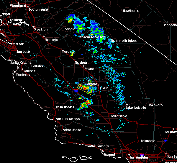 At 742 pm pdt, doppler radar indicated a severe thunderstorm capable of producing damaging hail up to 3/4 inch. this storm was located near corcoran, or 16 miles south of hanford, and moving east at 30 mph. At 742 pm pdt, doppler radar indicated a severe thunderstorm capable of producing damaging hail up to 3/4 inch. this storm was located near corcoran, or 16 miles south of hanford, and moving east at 30 mph.
|
| 4/24/2016 7:36 PM PDT |
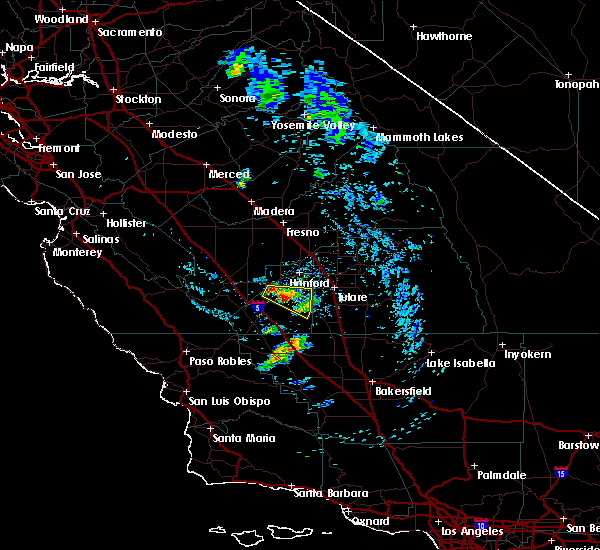 At 731 pm pdt, doppler radar indicated a severe thunderstorm. there are two separate cells within in the warning area. one cell is just south of lemoore and the second cell is just south of stratford. large hail and very heavy rain is possible with these individual cells, they are moving east at 30 mph. locations impacted include, corcoran and stratford. At 731 pm pdt, doppler radar indicated a severe thunderstorm. there are two separate cells within in the warning area. one cell is just south of lemoore and the second cell is just south of stratford. large hail and very heavy rain is possible with these individual cells, they are moving east at 30 mph. locations impacted include, corcoran and stratford.
|
| 4/24/2016 7:22 PM PDT |
 At 721 pm pdt, doppler radar indicated a severe thunderstorm. hail up 3/4 inch is possible with this storm. this storm was located near stratford, or 16 miles southwest of hanford, and moving east at 30 mph. At 721 pm pdt, doppler radar indicated a severe thunderstorm. hail up 3/4 inch is possible with this storm. this storm was located near stratford, or 16 miles southwest of hanford, and moving east at 30 mph.
|
Hail Maps for Corcoran, CA
Connect with Interactive Hail Maps