

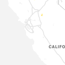
Hail Map for Dogtown, CA
The Dogtown, CA area has had 0 reports of on-the-ground hail by trained spotters, and has been under severe weather warnings 0 times during the past 12 months. Doppler radar has detected hail at or near Dogtown, CA on 1 occasion.
| Name: | Dogtown, CA |
| Where Located: | 34 miles SSE of Citrus Heights, CA |
| Map: | Google Map for Dogtown, CA |
| Population: | 2506 |
| Housing Units: | 924 |
| More Info: | Search Google for Dogtown, CA |
0
The Top Recent Hail Date for Dogtown, CA is Monday, May 18, 2020 (1st out of 1)

Hail and Wind Damage Spotted near Dogtown, CA
| Date / Time | Report Details |
|---|---|
| 4/7/2015 1:30 PM PDT | A severe thunderstorm warning remains in effect until 200 pm pdt for east central sacramento. extreme west central calaveras. southwestern amador and northeastern san joaquin counties. at 126 pm pdt. trained weather spotter reported a severe thunderstorm producing quarter size hail. this storm was located near lockeford. or 12 miles southeast of galt. Moving east at 15. |
| 4/7/2015 12:58 PM PDT | The national weather service in sacramento has issued a * severe thunderstorm warning for. southwestern amador county in central california. extreme west central calaveras county in central california. southeastern sacramento county in central california. Northeastern san joaquin county in central california. |
Hail Maps for Dogtown, CA
Connect with Interactive Hail Maps