

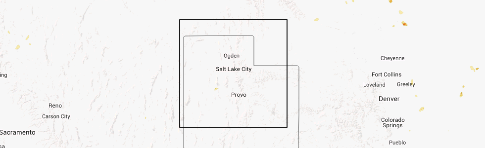
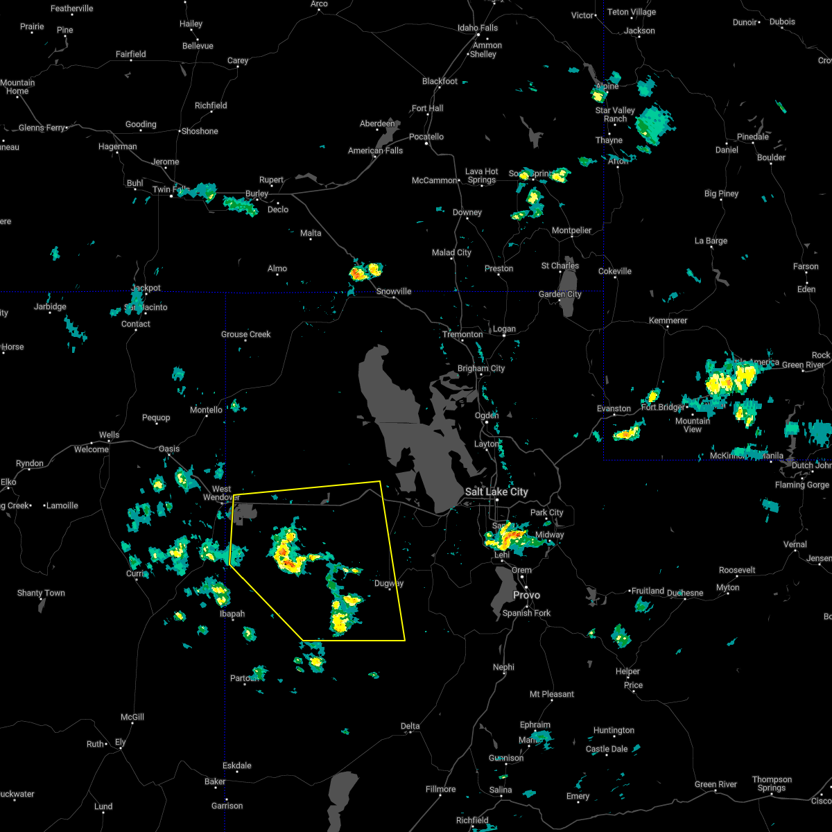
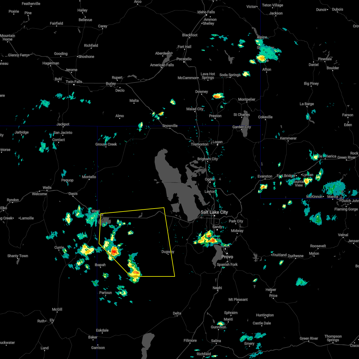
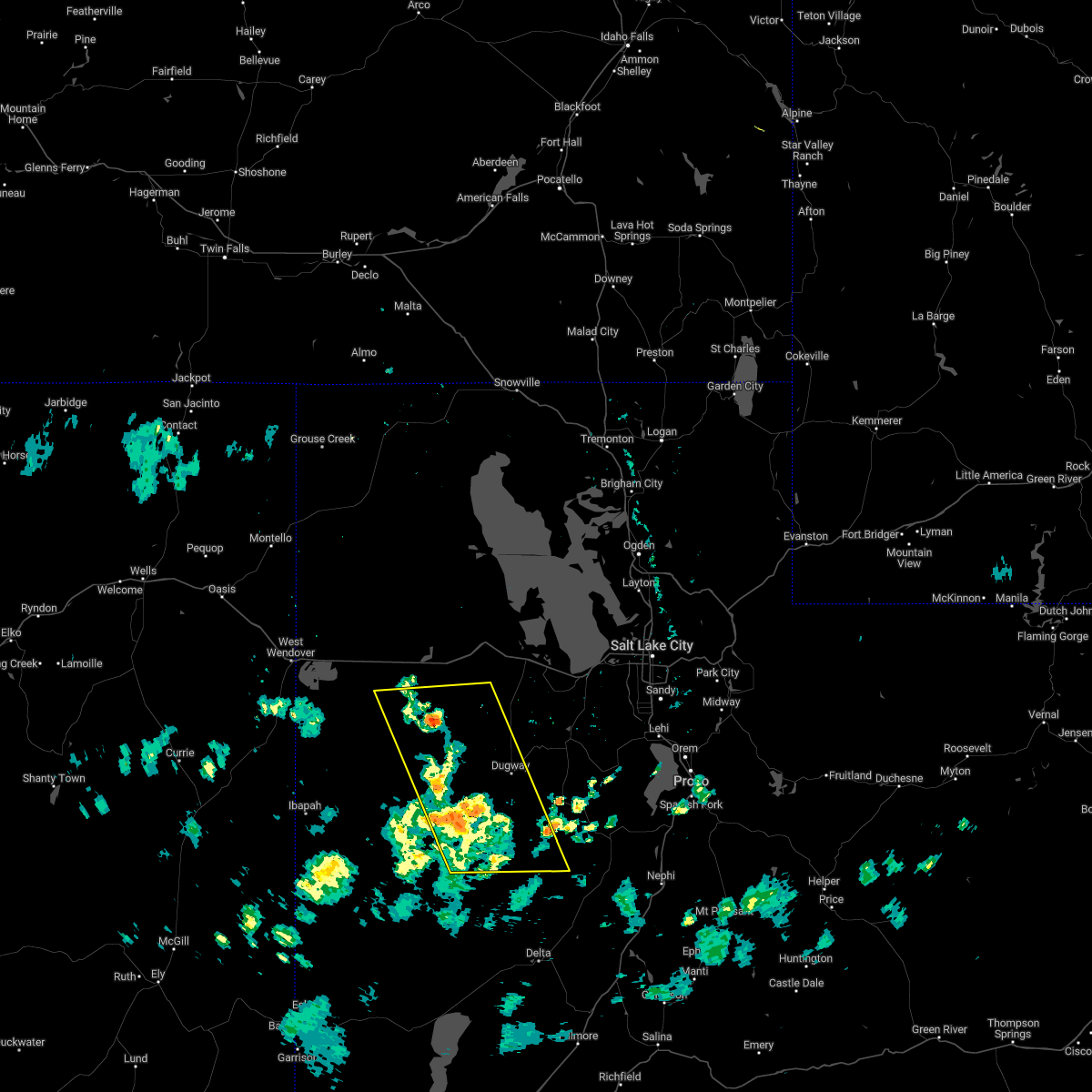
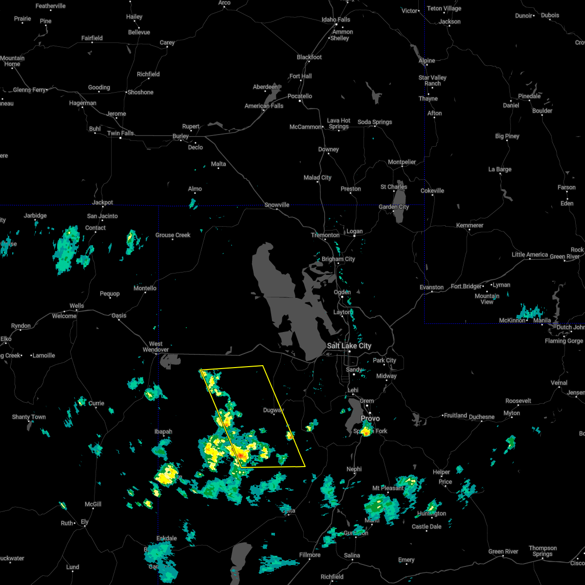
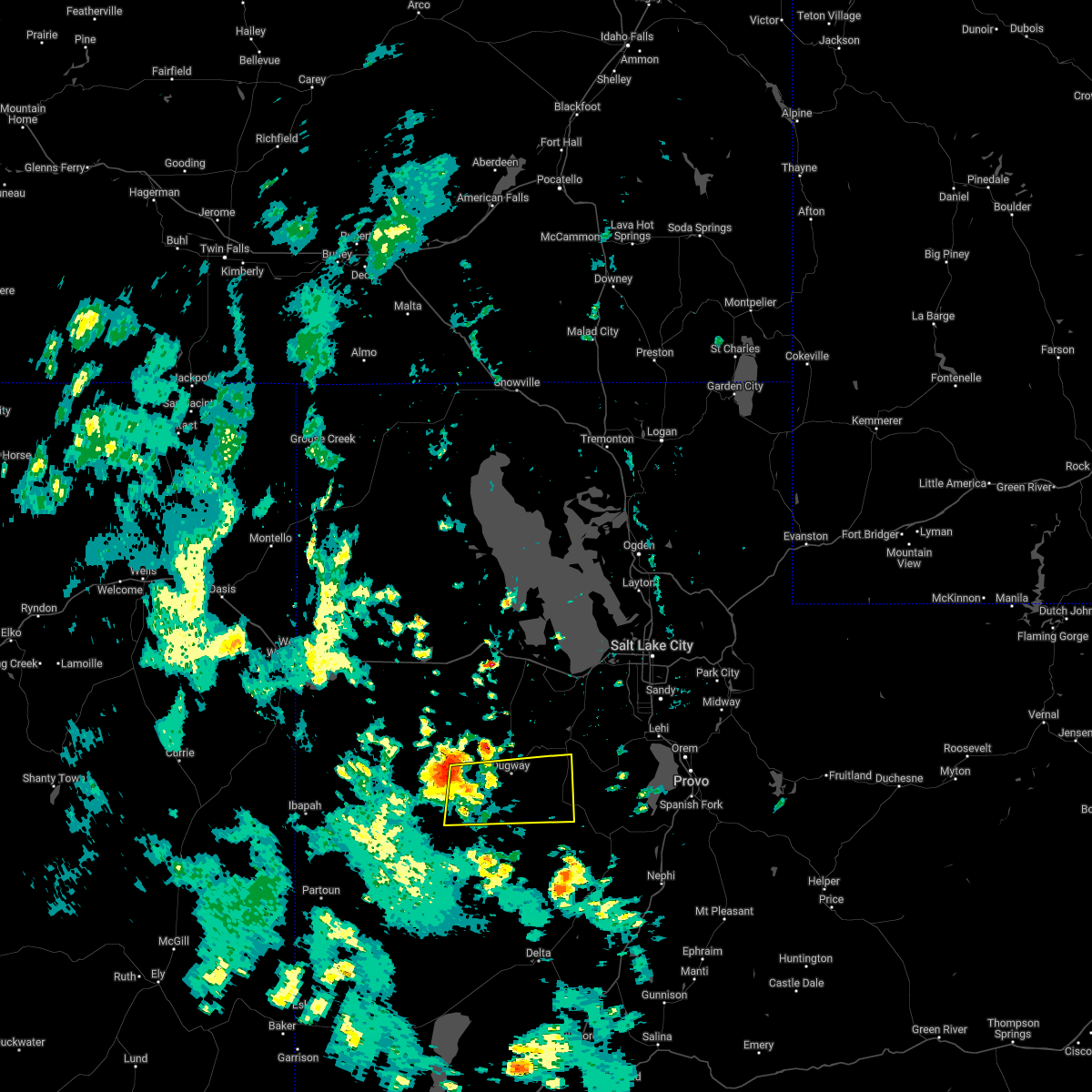
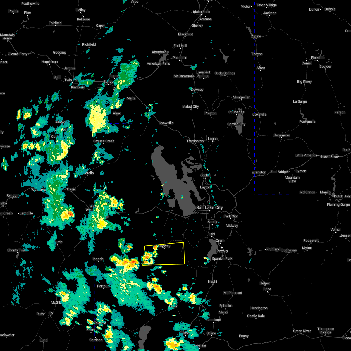
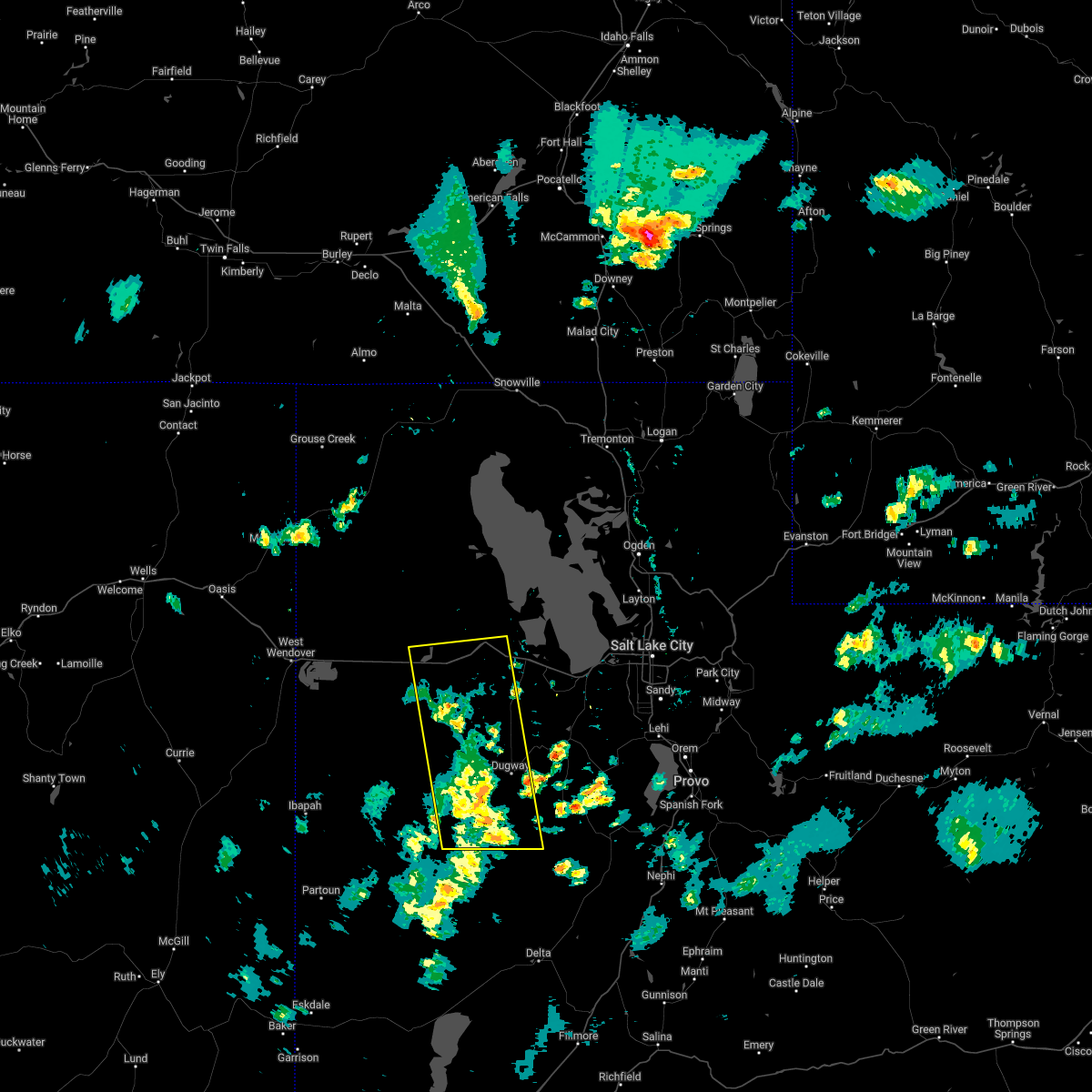
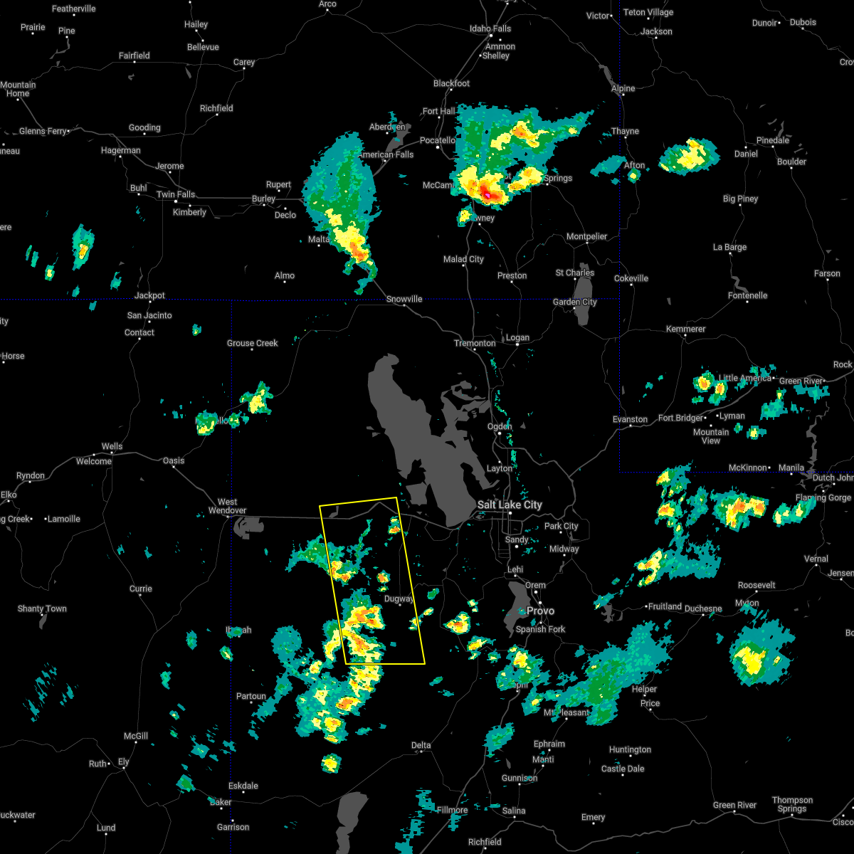
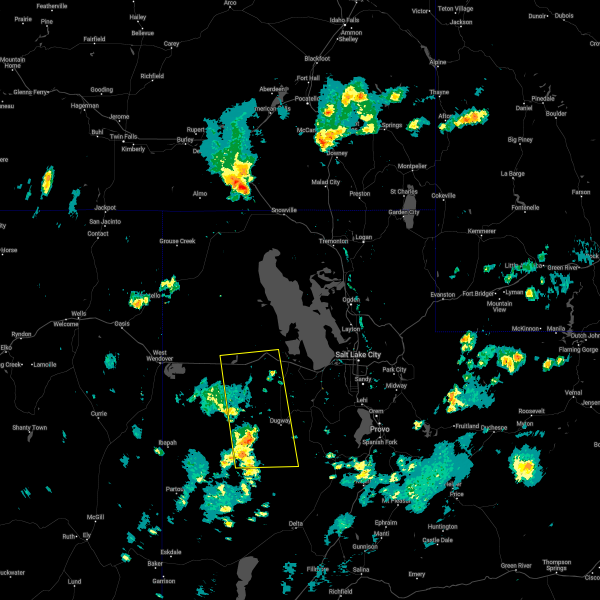
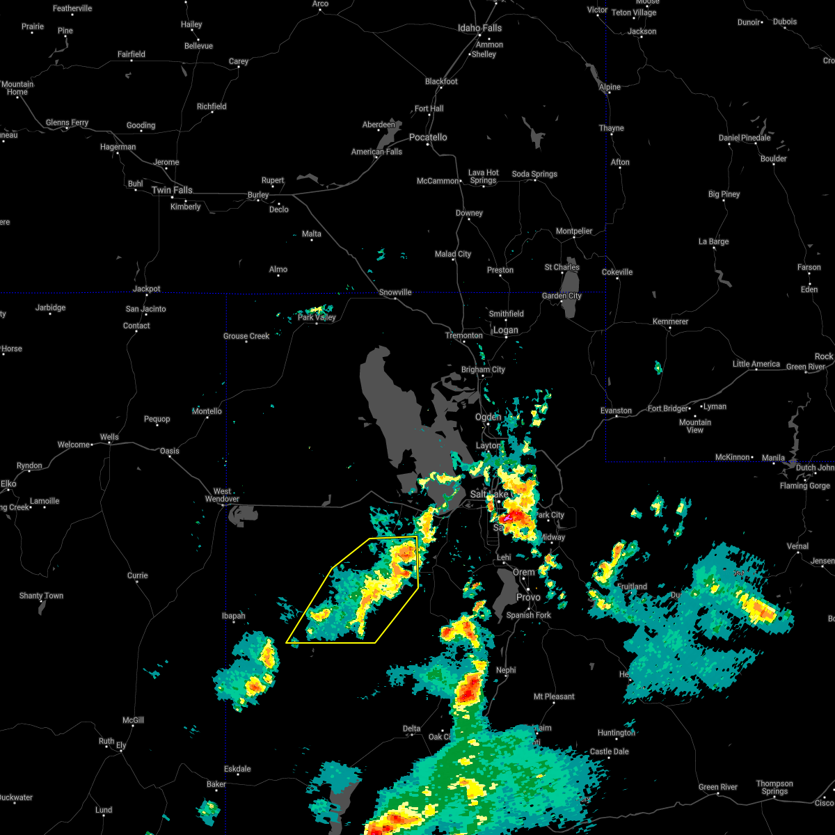
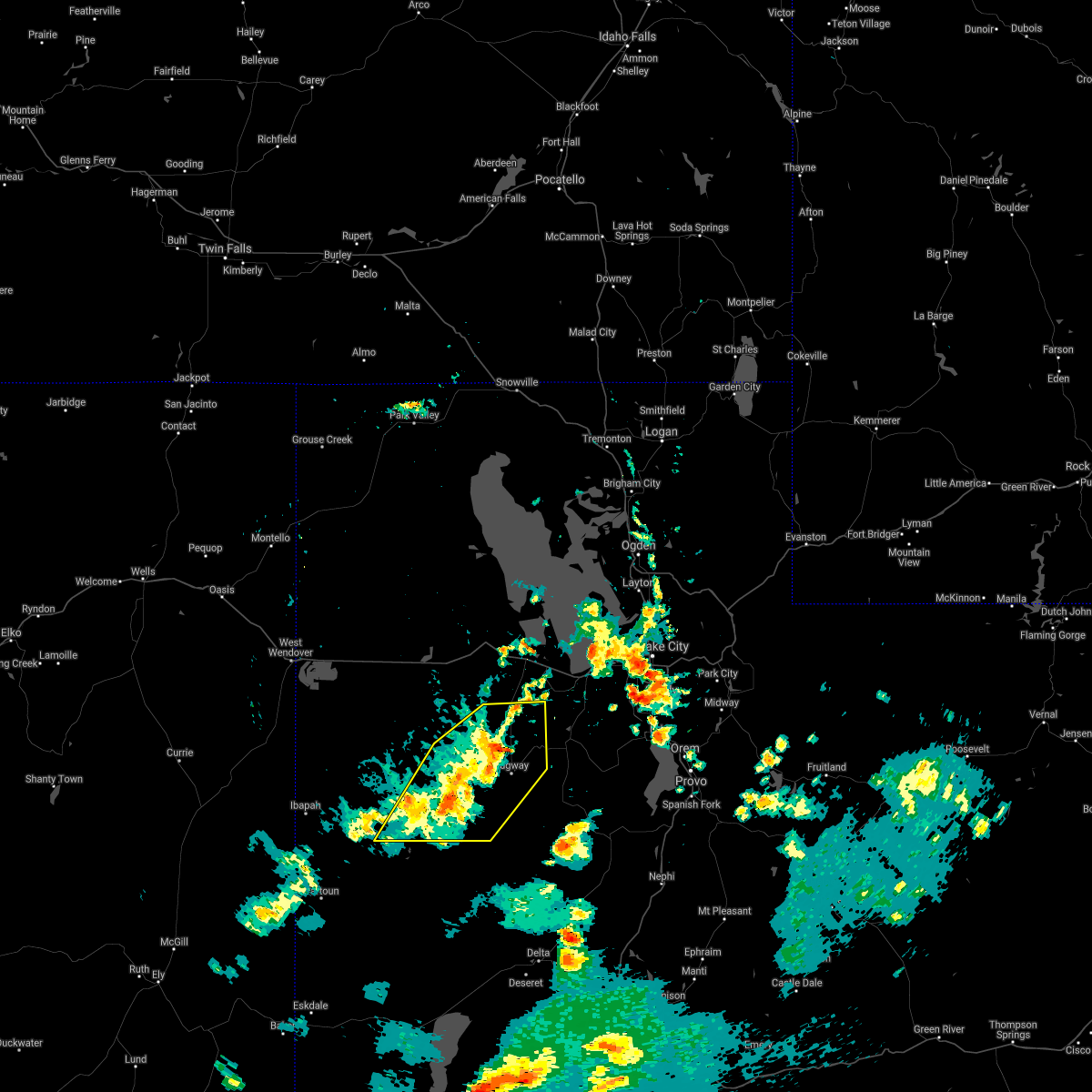
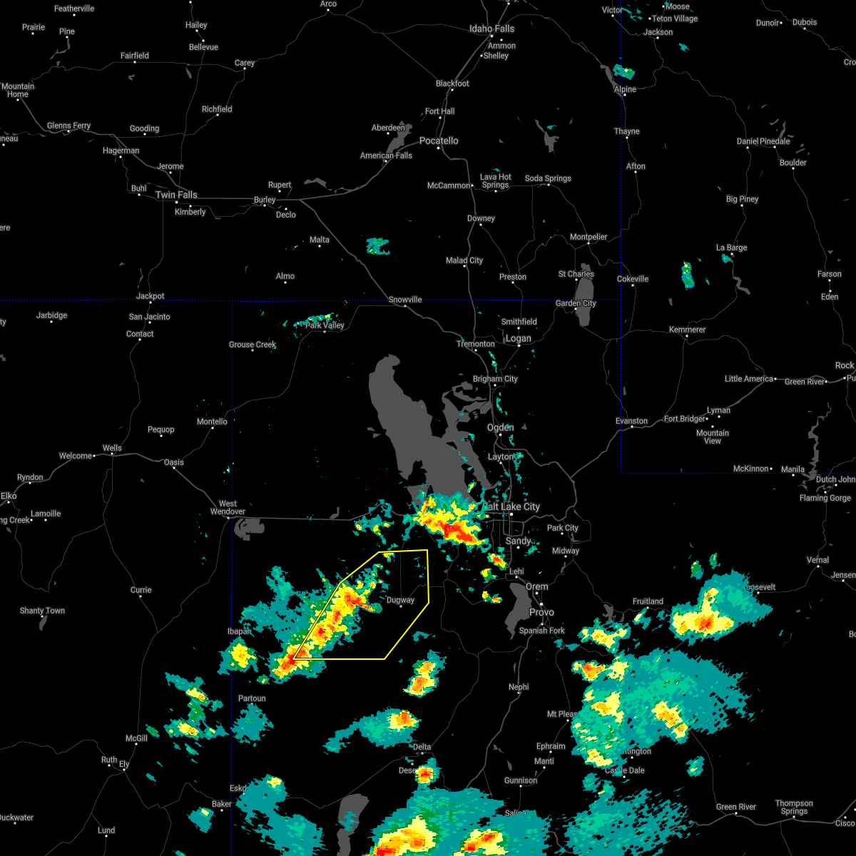
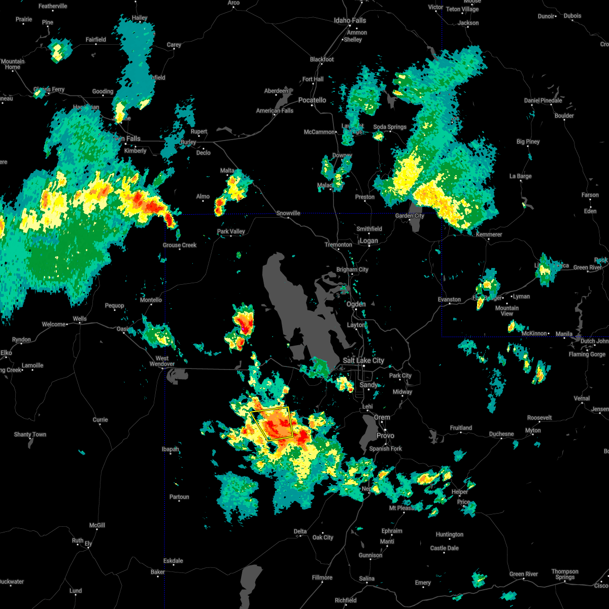
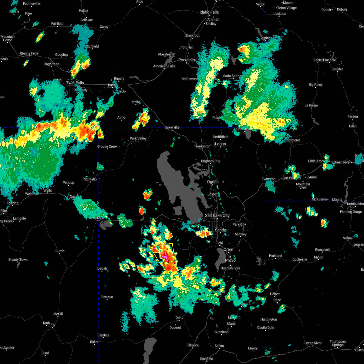
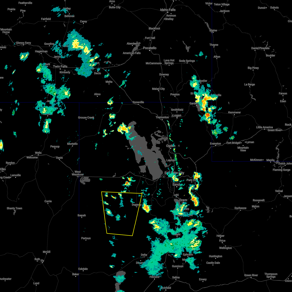
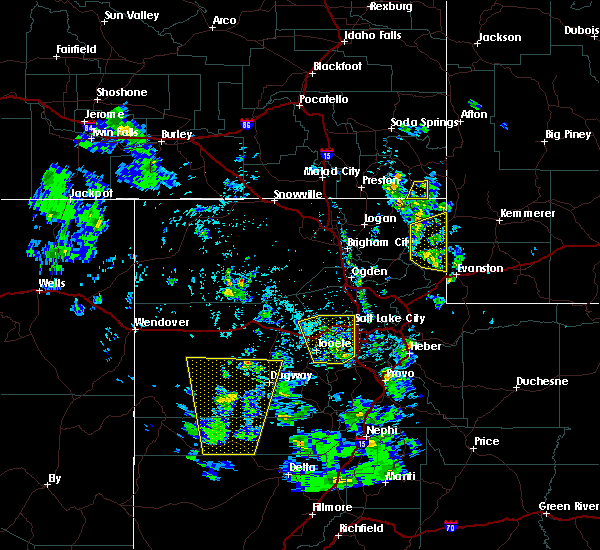
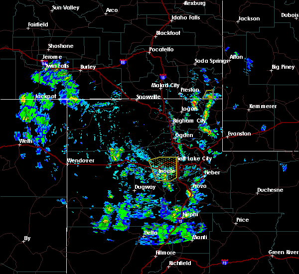
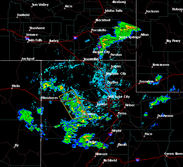
Hail Map for Dugway, UT
The Dugway, UT area has had 0 reports of on-the-ground hail by trained spotters, and has been under severe weather warnings 8 times during the past 12 months. Doppler radar has detected hail at or near Dugway, UT on 3 occasions.
| Name: | Dugway, UT |
| Where Located: | 59.1 miles SW of Salt Lake City, UT |
| Map: | Google Map for Dugway, UT |
| Population: | 795 |
| Housing Units: | 504 |
| More Info: | Search Google for Dugway, UT |
5
The Top Recent Hail Date for Dugway, UT is Tuesday, August 5, 2014 (1st out of 3)
Hail and Wind Damage Spotted near Dugway, UT
| Date / Time | Report Details |
|---|---|
| 7/26/2023 7:51 PM MDT |
 The severe thunderstorm warning for southeastern tooele county will expire at 800 pm mdt, the storms which prompted the warning have weakened below severe limits, and no longer pose an immediate threat to life or property. therefore, the warning will be allowed to expire. however gusty winds are still possible with these thunderstorms. The severe thunderstorm warning for southeastern tooele county will expire at 800 pm mdt, the storms which prompted the warning have weakened below severe limits, and no longer pose an immediate threat to life or property. therefore, the warning will be allowed to expire. however gusty winds are still possible with these thunderstorms.
|
| 7/26/2023 7:42 PM MDT |
 At 741 pm mdt, severe thunderstorms were located along a line extending from 16 miles northeast of dugway proving ground test range to 8 miles northeast of vernon, moving northeast at 25 mph (automated weather sensors). Hazards include 60 mph wind gusts. Expect damage to roofs, siding, and trees. locations impacted include, dugway english village, vernon, tooele army depot south, skull valley, dugway proving ground test range, rush valley, faust and lofgreen. hail threat, radar indicated max hail size, <. 75 in wind threat, observed max wind gust, 60 mph. At 741 pm mdt, severe thunderstorms were located along a line extending from 16 miles northeast of dugway proving ground test range to 8 miles northeast of vernon, moving northeast at 25 mph (automated weather sensors). Hazards include 60 mph wind gusts. Expect damage to roofs, siding, and trees. locations impacted include, dugway english village, vernon, tooele army depot south, skull valley, dugway proving ground test range, rush valley, faust and lofgreen. hail threat, radar indicated max hail size, <. 75 in wind threat, observed max wind gust, 60 mph.
|
| 7/26/2023 7:26 PM MDT |
 At 726 pm mdt, severe thunderstorms were located along a line extending from 12 miles northeast of dugway proving ground test range to near vernon, moving northeast at 25 mph (automated weather stations continue to report winds up to 65 mph). Hazards include 60 mph wind gusts. Expect damage to roofs, siding, and trees. locations impacted include, dugway english village, vernon, tooele army depot south, skull valley, dugway proving ground test range, rush valley, faust and lofgreen. hail threat, radar indicated max hail size, <. 75 in wind threat, observed max wind gust, 60 mph. At 726 pm mdt, severe thunderstorms were located along a line extending from 12 miles northeast of dugway proving ground test range to near vernon, moving northeast at 25 mph (automated weather stations continue to report winds up to 65 mph). Hazards include 60 mph wind gusts. Expect damage to roofs, siding, and trees. locations impacted include, dugway english village, vernon, tooele army depot south, skull valley, dugway proving ground test range, rush valley, faust and lofgreen. hail threat, radar indicated max hail size, <. 75 in wind threat, observed max wind gust, 60 mph.
|
| 7/26/2023 7:13 PM MDT |
 At 712 pm mdt, severe thunderstorms were located along a line extending from dugway proving ground test range to 8 miles southwest of vernon, moving northeast at 25 mph (automated weather stations reported wind gusts in excess of 60 mph). Hazards include 60 mph wind gusts. expect damage to roofs, siding, and trees At 712 pm mdt, severe thunderstorms were located along a line extending from dugway proving ground test range to 8 miles southwest of vernon, moving northeast at 25 mph (automated weather stations reported wind gusts in excess of 60 mph). Hazards include 60 mph wind gusts. expect damage to roofs, siding, and trees
|
| 7/26/2023 7:10 PM MDT | Mesonet station dpg14 wig mountain station elevation: 4352 f in tooele county UT, 18.6 miles ESE of Dugway, UT |
| 7/26/2023 7:10 PM MDT | Mesonet station dpg06 camel back mtn station elevation: 5077 f in tooele county UT, 12.1 miles NE of Dugway, UT |
| 7/26/2023 7:05 PM MDT | Mesonet station dpg06 camel back mtn station elevation: 5077 f in tooele county UT, 12.1 miles NE of Dugway, UT |
| 7/26/2023 6:55 PM MDT | Mesonet station dpg13 durand road station elevation: 4538 f in tooele county UT, 8.3 miles NNE of Dugway, UT |
| 7/26/2023 6:20 PM MDT | Mesonet station dpg19 fish spring in juab county UT, 37.8 miles NE of Dugway, UT |
| 7/19/2023 6:26 PM MDT |
 The severe thunderstorm warning for eastern tooele county will expire at 630 pm mdt, the storms which prompted the warning have weakened below severe limits, and have exited the warned area. therefore, the warning will be allowed to expire. however small hail, gusty winds and heavy rain are still possible with these thunderstorms. The severe thunderstorm warning for eastern tooele county will expire at 630 pm mdt, the storms which prompted the warning have weakened below severe limits, and have exited the warned area. therefore, the warning will be allowed to expire. however small hail, gusty winds and heavy rain are still possible with these thunderstorms.
|
| 7/19/2023 6:04 PM MDT |
 At 603 pm mdt, severe thunderstorms were located along a line extending from delle to 9 miles east of vernon, moving east at 25 mph (radar indicated). Hazards include 60 mph wind gusts and quarter size hail. Hail damage to vehicles is expected. expect wind damage to roofs, siding, and trees. locations impacted include, tooele, grantsville, dugway english village, vernon, ophir, delle, tooele army depot, clive, skull valley, knolls, tooele army depot south, stockton, rush valley and faust. this includes interstate 80 in utah between mile markers 41 and 84. hail threat, radar indicated max hail size, 1. 00 in wind threat, observed max wind gust, 60 mph. At 603 pm mdt, severe thunderstorms were located along a line extending from delle to 9 miles east of vernon, moving east at 25 mph (radar indicated). Hazards include 60 mph wind gusts and quarter size hail. Hail damage to vehicles is expected. expect wind damage to roofs, siding, and trees. locations impacted include, tooele, grantsville, dugway english village, vernon, ophir, delle, tooele army depot, clive, skull valley, knolls, tooele army depot south, stockton, rush valley and faust. this includes interstate 80 in utah between mile markers 41 and 84. hail threat, radar indicated max hail size, 1. 00 in wind threat, observed max wind gust, 60 mph.
|
| 7/19/2023 5:36 PM MDT |
 At 535 pm mdt, severe thunderstorms were located along a line extending from near clive to near vernon, moving east at 25 mph (radar indicated. wind gusts up to 69 mph have been observed). Hazards include 70 mph wind gusts and quarter size hail. Hail damage to vehicles is expected. expect considerable tree damage. Wind damage is also likely to mobile homes, roofs, and outbuildings. At 535 pm mdt, severe thunderstorms were located along a line extending from near clive to near vernon, moving east at 25 mph (radar indicated. wind gusts up to 69 mph have been observed). Hazards include 70 mph wind gusts and quarter size hail. Hail damage to vehicles is expected. expect considerable tree damage. Wind damage is also likely to mobile homes, roofs, and outbuildings.
|
| 7/19/2023 5:20 PM MDT | Mesonet station dpg06 camel back mt in tooele county UT, 12.1 miles NE of Dugway, UT |
| 7/3/2023 4:40 PM MDT | Mesonet station utjps 5.4 w clover (utah dot) station elevation: 6520 f in tooele county UT, 13 miles SW of Dugway, UT |
| 7/3/2023 4:31 PM MDT |
 At 431 pm mdt, a severe thunderstorm was located 9 miles east of dugway english village, moving northeast at 30 mph (radar indicated). Hazards include 60 mph wind gusts. expect damage to roofs, siding, and trees At 431 pm mdt, a severe thunderstorm was located 9 miles east of dugway english village, moving northeast at 30 mph (radar indicated). Hazards include 60 mph wind gusts. expect damage to roofs, siding, and trees
|
| 7/3/2023 4:20 PM MDT | Mesonet station dpg07 english village (dugway) station elevation: 4788 f in tooele county UT, 2 miles W of Dugway, UT |
| 7/3/2023 4:10 PM MDT | Mesonet station dpg06 14.0 sw dugway (dugway) station elevation: 5077 f in tooele county UT, 12.1 miles NE of Dugway, UT |
| 6/6/2023 2:35 PM MDT | Camel back mtn - 5077 ft in tooele county UT, 12.1 miles NE of Dugway, UT |
| 6/6/2023 2:15 PM MDT | White sage - 4363 ft in tooele county UT, 8 miles NE of Dugway, UT |
| 5/23/2023 4:25 PM MDT | Camel back mountain in tooele county UT, 12.1 miles NE of Dugway, UT |
| 9/28/2022 5:55 PM MDT | Tower grid sensor dpg11 in tooele county UT, 14.2 miles NE of Dugway, UT |
| 9/21/2022 1:45 PM MDT | Measured from dpg1 in tooele county UT, 18.6 miles ESE of Dugway, UT |
| 8/27/2022 3:30 PM MDT | Measured at dpg1 in tooele county UT, 18.6 miles ESE of Dugway, UT |
| 7/22/2022 4:30 PM MDT | Johnsons pass mesonet site in tooele county UT, 13 miles SW of Dugway, UT |
| 7/22/2022 4:28 PM MDT |
 At 426 pm mdt, severe thunderstorms were located along a line extending from 6 miles south of knolls to near skull valley to 9 miles southeast of dugway english village, moving northeast at 30 mph (radar indicated). Hazards include 60 mph wind gusts. Expect damage to roofs, siding, and trees. locations impacted include, grantsville, dugway english village, vernon, delle, knolls, tooele army depot south, skull valley, clive, tooele army depot, rush valley and faust. this includes interstate 80 in utah between mile markers 34 and 86. hail threat, radar indicated max hail size, <. 75 in wind threat, observed max wind gust, 60 mph. At 426 pm mdt, severe thunderstorms were located along a line extending from 6 miles south of knolls to near skull valley to 9 miles southeast of dugway english village, moving northeast at 30 mph (radar indicated). Hazards include 60 mph wind gusts. Expect damage to roofs, siding, and trees. locations impacted include, grantsville, dugway english village, vernon, delle, knolls, tooele army depot south, skull valley, clive, tooele army depot, rush valley and faust. this includes interstate 80 in utah between mile markers 34 and 86. hail threat, radar indicated max hail size, <. 75 in wind threat, observed max wind gust, 60 mph.
|
| 7/22/2022 4:15 PM MDT | Dugway 32 mesonet site in tooele county UT, 1.3 miles NNE of Dugway, UT |
| 7/22/2022 4:01 PM MDT |
 At 401 pm mdt, severe thunderstorms were located along a line extending from 6 miles north of utah test and training range south to 14 miles west of skull valley to 14 miles south of dugway english village, moving northeast at 30 mph (radar indicated). Hazards include 60 mph wind gusts. expect damage to roofs, siding, and trees At 401 pm mdt, severe thunderstorms were located along a line extending from 6 miles north of utah test and training range south to 14 miles west of skull valley to 14 miles south of dugway english village, moving northeast at 30 mph (radar indicated). Hazards include 60 mph wind gusts. expect damage to roofs, siding, and trees
|
| 7/22/2022 4:00 PM MDT | Lower cedar mountain mesonet site in tooele county UT, 11.8 miles ESE of Dugway, UT |
| 7/22/2022 3:45 PM MDT | Playa station mesonet site in tooele county UT, 17.1 miles E of Dugway, UT |
| 7/22/2022 3:37 PM MDT |
 At 336 pm mdt, severe thunderstorms were located along a line extending from 10 miles southwest of utah test and training range south to 8 miles south of dugway proving ground test range, moving northeast at 20 mph (radar indicated). Hazards include 70 mph wind gusts. Expect considerable tree damage. damage is likely to mobile homes, roofs, and outbuildings. locations impacted include, dugway english village, dugway proving ground test range, utah test and training range south, knolls, skull valley, clive and bonneville salt flats. this includes interstate 80 in utah between mile markers 4 and 68. thunderstorm damage threat, considerable hail threat, radar indicated max hail size, <. 75 in wind threat, observed max wind gust, 70 mph. At 336 pm mdt, severe thunderstorms were located along a line extending from 10 miles southwest of utah test and training range south to 8 miles south of dugway proving ground test range, moving northeast at 20 mph (radar indicated). Hazards include 70 mph wind gusts. Expect considerable tree damage. damage is likely to mobile homes, roofs, and outbuildings. locations impacted include, dugway english village, dugway proving ground test range, utah test and training range south, knolls, skull valley, clive and bonneville salt flats. this includes interstate 80 in utah between mile markers 4 and 68. thunderstorm damage threat, considerable hail threat, radar indicated max hail size, <. 75 in wind threat, observed max wind gust, 70 mph.
|
| 7/22/2022 3:09 PM MDT |
 At 309 pm mdt, severe thunderstorms were located along a line extending from 19 miles southwest of utah test and training range south to 9 miles north of fish springs wildlife refuge, moving northeast at 20 mph (radar indicated). Hazards include 70 mph wind gusts. Expect considerable tree damage. Damage is likely to mobile homes, roofs, and outbuildings. At 309 pm mdt, severe thunderstorms were located along a line extending from 19 miles southwest of utah test and training range south to 9 miles north of fish springs wildlife refuge, moving northeast at 20 mph (radar indicated). Hazards include 70 mph wind gusts. Expect considerable tree damage. Damage is likely to mobile homes, roofs, and outbuildings.
|
| 7/18/2022 5:56 PM MDT |
 At 555 pm mdt, severe thunderstorms were located along a line extending from 11 miles north of delle to 9 miles east of vernon, moving east at 30 mph (radar indicated). Hazards include 60 mph wind gusts. Expect damage to roofs, siding, and trees. locations impacted include, grantsville, dugway english village, vernon, skull valley, clive, tooele army depot south, tooele army depot, dugway proving ground test range, rush valley, jericho, faust, lofgreen and little sahara state park. this includes us route 6 between mile markers 123 and 127. hail threat, radar indicated max hail size, <. 75 in wind threat, radar indicated max wind gust, 60 mph. At 555 pm mdt, severe thunderstorms were located along a line extending from 11 miles north of delle to 9 miles east of vernon, moving east at 30 mph (radar indicated). Hazards include 60 mph wind gusts. Expect damage to roofs, siding, and trees. locations impacted include, grantsville, dugway english village, vernon, skull valley, clive, tooele army depot south, tooele army depot, dugway proving ground test range, rush valley, jericho, faust, lofgreen and little sahara state park. this includes us route 6 between mile markers 123 and 127. hail threat, radar indicated max hail size, <. 75 in wind threat, radar indicated max wind gust, 60 mph.
|
| 7/18/2022 5:40 PM MDT | English village sensor in tooele county UT, 2 miles W of Dugway, UT |
| 7/18/2022 5:29 PM MDT |
 At 528 pm mdt, severe thunderstorms were located along a line extending from near knolls to 18 miles southwest of vernon, moving east at 30 mph (radar indicated). Hazards include 60 mph wind gusts. expect damage to roofs, siding, and trees At 528 pm mdt, severe thunderstorms were located along a line extending from near knolls to 18 miles southwest of vernon, moving east at 30 mph (radar indicated). Hazards include 60 mph wind gusts. expect damage to roofs, siding, and trees
|
| 7/18/2022 5:14 PM MDT |
 At 513 pm mdt, severe thunderstorms were located along a line extending from 10 miles south of knolls to 20 miles southwest of vernon, moving east at 30 mph (radar indicated). Hazards include 70 mph wind gusts. Damage is likely to mobile homes, roofs, and outbuildings. locations impacted include, dugway english village, utah test and training range south, dugway proving ground test range and skull valley. thunderstorm damage threat, considerable hail threat, radar indicated max hail size, <. 75 in wind threat, radar indicated max wind gust, 70 mph. At 513 pm mdt, severe thunderstorms were located along a line extending from 10 miles south of knolls to 20 miles southwest of vernon, moving east at 30 mph (radar indicated). Hazards include 70 mph wind gusts. Damage is likely to mobile homes, roofs, and outbuildings. locations impacted include, dugway english village, utah test and training range south, dugway proving ground test range and skull valley. thunderstorm damage threat, considerable hail threat, radar indicated max hail size, <. 75 in wind threat, radar indicated max wind gust, 70 mph.
|
| 7/18/2022 5:03 PM MDT |
 At 503 pm mdt, severe thunderstorms were located along a line extending from 10 miles northeast of utah test and training range south to 23 miles southwest of vernon, moving east at 30 mph (radar indicated). Hazards include 70 mph wind gusts. Expect considerable tree damage. Damage is likely to mobile homes, roofs, and outbuildings. At 503 pm mdt, severe thunderstorms were located along a line extending from 10 miles northeast of utah test and training range south to 23 miles southwest of vernon, moving east at 30 mph (radar indicated). Hazards include 70 mph wind gusts. Expect considerable tree damage. Damage is likely to mobile homes, roofs, and outbuildings.
|
| 7/17/2022 5:28 PM MDT |
 The severe thunderstorm warning for south central box elder and eastern tooele counties will expire at 530 pm mdt, the storms which prompted the warning have weakened below severe limits. gusty winds up to 55 mph are still possible with these thunderstorms. The severe thunderstorm warning for south central box elder and eastern tooele counties will expire at 530 pm mdt, the storms which prompted the warning have weakened below severe limits. gusty winds up to 55 mph are still possible with these thunderstorms.
|
| 7/17/2022 5:14 PM MDT |
 At 514 pm mdt, severe thunderstorms were located along a line extending from 17 miles east of utah test and training range north to near delle to 13 miles west of vernon, moving east at 25 mph (trained weather spotters). Hazards include 60 mph wind gusts. Expect damage to roofs, siding, and trees. locations impacted include, grantsville, dugway english village, vernon, delle, skull valley, tooele army depot, utah test and training range north, great salt lake south of the causeway and rush valley. this includes interstate 80 in utah between mile markers 58 and 89. hail threat, radar indicated max hail size, <. 75 in wind threat, observed max wind gust, 60 mph. At 514 pm mdt, severe thunderstorms were located along a line extending from 17 miles east of utah test and training range north to near delle to 13 miles west of vernon, moving east at 25 mph (trained weather spotters). Hazards include 60 mph wind gusts. Expect damage to roofs, siding, and trees. locations impacted include, grantsville, dugway english village, vernon, delle, skull valley, tooele army depot, utah test and training range north, great salt lake south of the causeway and rush valley. this includes interstate 80 in utah between mile markers 58 and 89. hail threat, radar indicated max hail size, <. 75 in wind threat, observed max wind gust, 60 mph.
|
| 7/17/2022 4:58 PM MDT |
 At 457 pm mdt, severe thunderstorms were located along a line extending from 10 miles east of utah test and training range north to near delle to 17 miles south of dugway english village, moving east at 25 mph (trained weather spotters). Hazards include 70 mph wind gusts and penny size hail. Expect considerable tree damage. Damage is likely to mobile homes, roofs, and outbuildings. At 457 pm mdt, severe thunderstorms were located along a line extending from 10 miles east of utah test and training range north to near delle to 17 miles south of dugway english village, moving east at 25 mph (trained weather spotters). Hazards include 70 mph wind gusts and penny size hail. Expect considerable tree damage. Damage is likely to mobile homes, roofs, and outbuildings.
|
| 7/17/2022 4:55 PM MDT | Dugway mesonet english village in tooele county UT, 2 miles W of Dugway, UT |
| 7/17/2022 4:36 PM MDT |
 At 436 pm mdt, a severe thunderstorm was located 11 miles east of dugway proving ground test range, or 13 miles west of dugway english village, moving northeast at 40 mph (trained weather spotters). Hazards include 60 mph wind gusts. Expect damage to roofs, siding, and trees. locations impacted include, dugway english village, vernon, tooele army depot south, dugway proving ground test range and faust. hail threat, radar indicated max hail size, <. 75 in wind threat, radar indicated max wind gust, 60 mph. At 436 pm mdt, a severe thunderstorm was located 11 miles east of dugway proving ground test range, or 13 miles west of dugway english village, moving northeast at 40 mph (trained weather spotters). Hazards include 60 mph wind gusts. Expect damage to roofs, siding, and trees. locations impacted include, dugway english village, vernon, tooele army depot south, dugway proving ground test range and faust. hail threat, radar indicated max hail size, <. 75 in wind threat, radar indicated max wind gust, 60 mph.
|
| 7/17/2022 4:17 PM MDT |
 At 417 pm mdt, a severe thunderstorm was located 12 miles east of dugway proving ground test range, or 14 miles southwest of dugway english village, moving northeast at 40 mph (mesonet observations). Hazards include 60 mph wind gusts. expect damage to roofs, siding, and trees At 417 pm mdt, a severe thunderstorm was located 12 miles east of dugway proving ground test range, or 14 miles southwest of dugway english village, moving northeast at 40 mph (mesonet observations). Hazards include 60 mph wind gusts. expect damage to roofs, siding, and trees
|
| 7/17/2022 4:05 PM MDT | Wind gust recorded at camel back mountain mesonet sit in tooele county UT, 12.1 miles NE of Dugway, UT |
| 7/14/2022 5:28 PM MDT |
 The severe thunderstorm warning for north central juab and central tooele counties will expire at 530 pm mdt, the storm which prompted the warning has weakened below severe limits, and no longer poses an immediate threat to life or property. therefore, the warning will be allowed to expire. however gusty winds are still possible with this thunderstorm. The severe thunderstorm warning for north central juab and central tooele counties will expire at 530 pm mdt, the storm which prompted the warning has weakened below severe limits, and no longer poses an immediate threat to life or property. therefore, the warning will be allowed to expire. however gusty winds are still possible with this thunderstorm.
|
| 7/14/2022 5:25 PM MDT | Dugway mesonet lower cedar mountain station in tooele county UT, 11.8 miles ESE of Dugway, UT |
| 7/14/2022 5:12 PM MDT |
 At 511 pm mdt, a severe thunderstorm was located 8 miles west of skull valley, or 16 miles northwest of dugway english village, moving northeast at 30 mph (radar indicated). Hazards include 70 mph wind gusts. Damage is likely to mobile homes, roofs, and outbuildings. locations impacted include, dugway english village, dugway proving ground test range, delle, knolls, skull valley, clive and utah test and training range south. this includes interstate 80 in utah between mile markers 37 and 71. thunderstorm damage threat, considerable hail threat, radar indicated max hail size, <. 75 in wind threat, observed max wind gust, 70 mph. At 511 pm mdt, a severe thunderstorm was located 8 miles west of skull valley, or 16 miles northwest of dugway english village, moving northeast at 30 mph (radar indicated). Hazards include 70 mph wind gusts. Damage is likely to mobile homes, roofs, and outbuildings. locations impacted include, dugway english village, dugway proving ground test range, delle, knolls, skull valley, clive and utah test and training range south. this includes interstate 80 in utah between mile markers 37 and 71. thunderstorm damage threat, considerable hail threat, radar indicated max hail size, <. 75 in wind threat, observed max wind gust, 70 mph.
|
| 7/14/2022 5:05 PM MDT | Dugway mesonet at camel back mountain in tooele county UT, 12.1 miles NE of Dugway, UT |
| 7/14/2022 4:52 PM MDT |
 At 450 pm mdt, a line of severe thunderstorms was located 14 miles northeast of dugway proving ground test range, or 20 miles northwest of dugway english village, moving northeast at 30 mph. at 4:30 pm, a 70 mph wind was reported along i-80 at knolls associated with these thunderstorms (radar indicated). Hazards include 70 mph wind gusts. damage is likely to mobile homes, roofs, and outbuildings At 450 pm mdt, a line of severe thunderstorms was located 14 miles northeast of dugway proving ground test range, or 20 miles northwest of dugway english village, moving northeast at 30 mph. at 4:30 pm, a 70 mph wind was reported along i-80 at knolls associated with these thunderstorms (radar indicated). Hazards include 70 mph wind gusts. damage is likely to mobile homes, roofs, and outbuildings
|
| 7/14/2022 4:40 PM MDT | Dugway mesonet station at juliet road in tooele county UT, 20.4 miles ENE of Dugway, UT |
| 7/14/2022 4:15 PM MDT | Dugway mesonet station at fish springs in juab county UT, 37.8 miles NE of Dugway, UT |
| 6/29/2022 4:45 PM MDT | English village in tooele county UT, 2 miles W of Dugway, UT |
| 6/29/2022 4:20 PM MDT | Dugway - nw decon pad in tooele county UT, 10.3 miles E of Dugway, UT |
| 6/29/2022 2:40 PM MDT | Durand road in tooele county UT, 8.3 miles NNE of Dugway, UT |
| 6/23/2022 5:16 PM MDT |
 At 515 pm mdt, a severe thunderstorm was located 9 miles southwest of dugway english village, moving north at 40 mph (weather station reported gusts to 66 mph). Hazards include 70 mph wind gusts. Expect considerable tree damage. damage is likely to mobile homes, roofs, and outbuildings. locations impacted include, dugway english village, vernon, tooele army depot south, skull valley, dugway proving ground test range and rush valley. thunderstorm damage threat, considerable hail threat, radar indicated max hail size, <. 75 in wind threat, radar indicated max wind gust, 70 mph. At 515 pm mdt, a severe thunderstorm was located 9 miles southwest of dugway english village, moving north at 40 mph (weather station reported gusts to 66 mph). Hazards include 70 mph wind gusts. Expect considerable tree damage. damage is likely to mobile homes, roofs, and outbuildings. locations impacted include, dugway english village, vernon, tooele army depot south, skull valley, dugway proving ground test range and rush valley. thunderstorm damage threat, considerable hail threat, radar indicated max hail size, <. 75 in wind threat, radar indicated max wind gust, 70 mph.
|
| 6/23/2022 5:10 PM MDT | Wind gust recorded by camel back mountain mesonet sit in tooele county UT, 12.1 miles NE of Dugway, UT |
| 6/23/2022 4:57 PM MDT |
 At 457 pm mdt, a severe thunderstorm was located 18 miles southeast of dugway proving ground test range, or 20 miles southwest of dugway english village, moving north at 40 mph (mesonet reported gust to 66 mph). Hazards include 70 mph wind gusts. Expect considerable tree damage. Damage is likely to mobile homes, roofs, and outbuildings. At 457 pm mdt, a severe thunderstorm was located 18 miles southeast of dugway proving ground test range, or 20 miles southwest of dugway english village, moving north at 40 mph (mesonet reported gust to 66 mph). Hazards include 70 mph wind gusts. Expect considerable tree damage. Damage is likely to mobile homes, roofs, and outbuildings.
|
| 6/23/2022 4:55 PM MDT | Storm damage reported in tooele county UT, 12.1 miles NE of Dugway, UT |
| 5/2/2022 8:45 PM MDT | Mesonet station dpg05 9.9 sw dugway (dugway in tooele county UT, 8 miles NE of Dugway, UT |
| 5/2/2022 8:35 PM MDT | Mesonet station dpg16 15.6 nw dugway (dugway in tooele county UT, 15.8 miles SE of Dugway, UT |
| 5/2/2022 8:25 PM MDT |
 At 824 pm mdt, showers producing severe outflow winds were located along a line extending from 10 miles west of hooper to 11 miles north of grantsville to 15 miles southwest of dugway english village, moving east at 30 mph (weather stations observed). Hazards include 60 mph wind gusts. Expect damage to roofs, siding, and trees. locations impacted include, tooele, grantsville, dugway english village, stansbury park, delle, tooele army depot, skull valley, great salt lake south of the causeway, dugway proving ground test range, stockton, rush valley, hat island, erda, lake point and antelope island state park. this includes interstate 80 in utah between mile markers 67 and 101. hail threat, radar indicated max hail size, <. 75 in wind threat, radar indicated max wind gust, 60 mph. At 824 pm mdt, showers producing severe outflow winds were located along a line extending from 10 miles west of hooper to 11 miles north of grantsville to 15 miles southwest of dugway english village, moving east at 30 mph (weather stations observed). Hazards include 60 mph wind gusts. Expect damage to roofs, siding, and trees. locations impacted include, tooele, grantsville, dugway english village, stansbury park, delle, tooele army depot, skull valley, great salt lake south of the causeway, dugway proving ground test range, stockton, rush valley, hat island, erda, lake point and antelope island state park. this includes interstate 80 in utah between mile markers 67 and 101. hail threat, radar indicated max hail size, <. 75 in wind threat, radar indicated max wind gust, 60 mph.
|
| 5/2/2022 7:58 PM MDT |
 At 758 pm mdt, showers producing severe outflow winds were located along a line extending from 13 miles northwest of great salt lake south of the causeway to delle to near dugway proving ground test range, moving east at 30 mph (weather station observed). Hazards include 60 mph wind gusts. expect damage to roofs, siding, and trees At 758 pm mdt, showers producing severe outflow winds were located along a line extending from 13 miles northwest of great salt lake south of the causeway to delle to near dugway proving ground test range, moving east at 30 mph (weather station observed). Hazards include 60 mph wind gusts. expect damage to roofs, siding, and trees
|
| 5/2/2022 7:55 PM MDT | Mesonet station cdmu1 cedar mountai in tooele county UT, 5.1 miles S of Dugway, UT |
| 9/10/2021 4:50 PM MDT | Dpg14 in tooele county UT, 18.6 miles ESE of Dugway, UT |
| 9/2/2021 9:35 PM MDT | Upper cedar mtn sensor dpg16 in tooele county UT, 15.8 miles SE of Dugway, UT |
| 9/2/2021 4:50 PM MDT | English village sensor dpg07 in tooele county UT, 2 miles W of Dugway, UT |
| 8/21/2021 6:23 PM MDT |
 At 622 pm mdt, severe thunderstorms were located along a line extending from near hyrum to 7 miles south of syracuse to near skull valley, moving east at 40 mph (trained weather spotters have reported wind gusts to 65 mph and large branches down causing property damage). Hazards include 70 mph wind gusts. Expect considerable tree damage. damage is likely to mobile homes, roofs, and outbuildings. locations impacted include, salt lake city, west valley city, ogden, layton, murray, bountiful, tooele, farmington, brigham city, grantsville, morgan, randolph, hill air force base, dugway english village, west jordan, taylorsville, south jordan, roy, clearfield and midvale. this includes the following highways, interstate 15 between mile markers 299 and 371. interstate 84 between mile markers 82 and 113. interstate 80 in utah between mile markers 48 and 127. thunderstorm damage threat, considerable hail threat, radar indicated max hail size, <. 75 in wind threat, observed max wind gust, 70 mph. At 622 pm mdt, severe thunderstorms were located along a line extending from near hyrum to 7 miles south of syracuse to near skull valley, moving east at 40 mph (trained weather spotters have reported wind gusts to 65 mph and large branches down causing property damage). Hazards include 70 mph wind gusts. Expect considerable tree damage. damage is likely to mobile homes, roofs, and outbuildings. locations impacted include, salt lake city, west valley city, ogden, layton, murray, bountiful, tooele, farmington, brigham city, grantsville, morgan, randolph, hill air force base, dugway english village, west jordan, taylorsville, south jordan, roy, clearfield and midvale. this includes the following highways, interstate 15 between mile markers 299 and 371. interstate 84 between mile markers 82 and 113. interstate 80 in utah between mile markers 48 and 127. thunderstorm damage threat, considerable hail threat, radar indicated max hail size, <. 75 in wind threat, observed max wind gust, 70 mph.
|
| 8/21/2021 6:06 PM MDT |
 At 605 pm mdt, severe thunderstorms were located along a line extending from near wellsville to 7 miles east of great salt lake south of the causeway to 13 miles west of skull valley, moving east at 40 mph (trained weather spotters). Hazards include 70 mph wind gusts. Expect considerable tree damage. Damage is likely to mobile homes, roofs, and outbuildings. At 605 pm mdt, severe thunderstorms were located along a line extending from near wellsville to 7 miles east of great salt lake south of the causeway to 13 miles west of skull valley, moving east at 40 mph (trained weather spotters). Hazards include 70 mph wind gusts. Expect considerable tree damage. Damage is likely to mobile homes, roofs, and outbuildings.
|
| 8/21/2021 5:52 PM MDT |
 At 550 pm mdt, severe thunderstorms were located along a line extending from 11 miles northwest of great salt lake south of the causeway to 11 miles west of skull valley, moving east at 45 mph (trained weather spotters). Hazards include 60 mph wind gusts. Expect damage to roofs, siding, and trees. locations impacted include, salt lake city, west valley city, layton, bountiful, tooele, farmington, grantsville, west jordan, south jordan, kaysville, north salt lake, centerville, woods cross, stansbury park, west bountiful, ophir, kearns, delle, salt lake city international airport and tooele army depot. this includes the following highways, interstate 15 between mile markers 314 and 315, and between mile markers 317 and 330. interstate 80 in utah between mile markers 66 and 117. this lines of storms has a history of producing wind gusts to 65 mph even behind the main area of thunderstorms. hail threat, radar indicated max hail size, <. 75 in wind threat, observed max wind gust, 60 mph. At 550 pm mdt, severe thunderstorms were located along a line extending from 11 miles northwest of great salt lake south of the causeway to 11 miles west of skull valley, moving east at 45 mph (trained weather spotters). Hazards include 60 mph wind gusts. Expect damage to roofs, siding, and trees. locations impacted include, salt lake city, west valley city, layton, bountiful, tooele, farmington, grantsville, west jordan, south jordan, kaysville, north salt lake, centerville, woods cross, stansbury park, west bountiful, ophir, kearns, delle, salt lake city international airport and tooele army depot. this includes the following highways, interstate 15 between mile markers 314 and 315, and between mile markers 317 and 330. interstate 80 in utah between mile markers 66 and 117. this lines of storms has a history of producing wind gusts to 65 mph even behind the main area of thunderstorms. hail threat, radar indicated max hail size, <. 75 in wind threat, observed max wind gust, 60 mph.
|
| 8/21/2021 5:42 PM MDT |
 At 542 pm mdt, severe thunderstorms were located along a line extending from 15 miles northwest of great salt lake south of the causeway to 15 miles west of skull valley, moving east at 45 mph (radar indicated). Hazards include 60 mph wind gusts. expect damage to roofs, siding, and trees At 542 pm mdt, severe thunderstorms were located along a line extending from 15 miles northwest of great salt lake south of the causeway to 15 miles west of skull valley, moving east at 45 mph (radar indicated). Hazards include 60 mph wind gusts. expect damage to roofs, siding, and trees
|
| 8/17/2021 8:36 PM MDT | Upper cedar mountain mesonet recorded a 69 mph wind gus in tooele county UT, 15.8 miles SE of Dugway, UT |
| 8/17/2021 6:03 PM MDT |
 At 602 pm mdt, severe thunderstorms were located along a line extending from 8 miles east of skull valley to 12 miles southwest of dugway english village, moving northeast at 45 mph (radar indicated. at 545 pm a 78 mph wind gust was reported at the upper camel back mountain mesonet site). Hazards include 70 mph wind gusts and penny size hail. Expect considerable tree damage. damage is likely to mobile homes, roofs, and outbuildings. locations impacted include, dugway english village, dugway proving ground test range and skull valley. thunderstorm damage threat, considerable hail threat, radar indicated max hail size, 0. 75 in wind threat, observed max wind gust, 70 mph. At 602 pm mdt, severe thunderstorms were located along a line extending from 8 miles east of skull valley to 12 miles southwest of dugway english village, moving northeast at 45 mph (radar indicated. at 545 pm a 78 mph wind gust was reported at the upper camel back mountain mesonet site). Hazards include 70 mph wind gusts and penny size hail. Expect considerable tree damage. damage is likely to mobile homes, roofs, and outbuildings. locations impacted include, dugway english village, dugway proving ground test range and skull valley. thunderstorm damage threat, considerable hail threat, radar indicated max hail size, 0. 75 in wind threat, observed max wind gust, 70 mph.
|
| 8/17/2021 5:45 PM MDT | Storm damage reported in tooele county UT, 12.1 miles NE of Dugway, UT |
| 8/17/2021 5:34 PM MDT |
 At 533 pm mdt, severe thunderstorms were located along a line extending from 7 miles northwest of dugway english village to 11 miles north of fish springs wildlife refuge, moving northeast at 45 mph (radar indicated). Hazards include 60 mph wind gusts and penny size hail. Expect damage to roofs, siding, and trees. locations impacted include, dugway english village, dugway proving ground test range and skull valley. hail threat, radar indicated max hail size, 0. 75 in wind threat, radar indicated max wind gust, 60 mph. At 533 pm mdt, severe thunderstorms were located along a line extending from 7 miles northwest of dugway english village to 11 miles north of fish springs wildlife refuge, moving northeast at 45 mph (radar indicated). Hazards include 60 mph wind gusts and penny size hail. Expect damage to roofs, siding, and trees. locations impacted include, dugway english village, dugway proving ground test range and skull valley. hail threat, radar indicated max hail size, 0. 75 in wind threat, radar indicated max wind gust, 60 mph.
|
| 8/17/2021 5:15 PM MDT | Storm damage reported in tooele county UT, 11.8 miles ESE of Dugway, UT |
| 8/17/2021 5:15 PM MDT | Storm damage reported in tooele county UT, 15.8 miles SE of Dugway, UT |
| 8/17/2021 5:12 PM MDT |
 At 511 pm mdt, severe thunderstorms were located along a line extending from 10 miles northeast of dugway proving ground test range to 10 miles northwest of fish springs wildlife refuge, moving northeast at 45 mph (radar indicated). Hazards include 60 mph wind gusts and penny size hail. expect damage to roofs, siding, and trees At 511 pm mdt, severe thunderstorms were located along a line extending from 10 miles northeast of dugway proving ground test range to 10 miles northwest of fish springs wildlife refuge, moving northeast at 45 mph (radar indicated). Hazards include 60 mph wind gusts and penny size hail. expect damage to roofs, siding, and trees
|
| 8/17/2021 4:15 PM MDT | Upper cedar mtn mesonet sensor in tooele county UT, 15.8 miles SE of Dugway, UT |
| 7/31/2021 7:21 PM MDT |
 The severe thunderstorm warning for south central tooele county will expire at 730 pm mdt, the storm which prompted the warning has weakened below severe limits, and no longer poses an immediate threat to life or property. therefore, the warning will be allowed to expire. however gusty winds and heavy rain are still possible with this thunderstorm. The severe thunderstorm warning for south central tooele county will expire at 730 pm mdt, the storm which prompted the warning has weakened below severe limits, and no longer poses an immediate threat to life or property. therefore, the warning will be allowed to expire. however gusty winds and heavy rain are still possible with this thunderstorm.
|
| 7/31/2021 7:11 PM MDT |
 At 711 pm mdt, a severe thunderstorm was located near dugway english village, moving north at 10 mph (radar indicated). Hazards include 60 mph wind gusts and quarter size hail. Hail damage to vehicles is expected. expect wind damage to roofs, siding, and trees. Locations impacted include, dugway english village and skull valley. At 711 pm mdt, a severe thunderstorm was located near dugway english village, moving north at 10 mph (radar indicated). Hazards include 60 mph wind gusts and quarter size hail. Hail damage to vehicles is expected. expect wind damage to roofs, siding, and trees. Locations impacted include, dugway english village and skull valley.
|
| 7/31/2021 6:58 PM MDT |
 At 657 pm mdt, a severe thunderstorm was located near dugway english village, moving north at 10 mph (radar indicated). Hazards include 60 mph wind gusts and quarter size hail. Hail damage to vehicles is expected. Expect wind damage to roofs, siding, and trees. At 657 pm mdt, a severe thunderstorm was located near dugway english village, moving north at 10 mph (radar indicated). Hazards include 60 mph wind gusts and quarter size hail. Hail damage to vehicles is expected. Expect wind damage to roofs, siding, and trees.
|
| 7/18/2021 6:25 PM MDT | English village weather statio in tooele county UT, 2 miles W of Dugway, UT |
| 7/16/2021 5:00 PM MDT | Mesonet station dpg06 14.0 sw dugway (dugway in tooele county UT, 12.1 miles NE of Dugway, UT |
| 7/15/2021 5:40 PM MDT | Upper cedar mountain sit in tooele county UT, 15.8 miles SE of Dugway, UT |
| 7/13/2021 3:15 PM MDT | Camel back mtn mesonet site in tooele county UT, 12.1 miles NE of Dugway, UT |
| 7/13/2021 3:00 PM MDT | Tower grid mesonet site in tooele county UT, 14.2 miles NE of Dugway, UT |
| 7/27/2020 5:10 PM MDT | Target s mesonet site in tooele county UT, 19.3 miles NE of Dugway, UT |
| 6/28/2020 5:24 PM MDT |
 The severe thunderstorm warning for southeastern tooele county will expire at 530 pm mdt, the storm which prompted the warning has weakened below severe limits, and no longer poses an immediate threat to life or property. therefore, the warning will be allowed to expire. The severe thunderstorm warning for southeastern tooele county will expire at 530 pm mdt, the storm which prompted the warning has weakened below severe limits, and no longer poses an immediate threat to life or property. therefore, the warning will be allowed to expire.
|
| 6/28/2020 4:58 PM MDT |
 At 457 pm mdt, a severe thunderstorm was located 7 miles southwest of dugway english village, moving northeast at 50 mph (mesonet observed wind gusts). Hazards include 60 mph wind gusts. Expect damage to roofs, siding, and trees. Locations impacted include, dugway english village, tooele army depot south, skull valley, dugway proving ground test range and rush valley. At 457 pm mdt, a severe thunderstorm was located 7 miles southwest of dugway english village, moving northeast at 50 mph (mesonet observed wind gusts). Hazards include 60 mph wind gusts. Expect damage to roofs, siding, and trees. Locations impacted include, dugway english village, tooele army depot south, skull valley, dugway proving ground test range and rush valley.
|
| 6/28/2020 4:55 PM MDT | Storm damage reported in tooele county UT, 12.1 miles NE of Dugway, UT |
| 6/28/2020 4:30 PM MDT | Mesonet station utjps 5.4 w clover (utah dot in tooele county UT, 13 miles SW of Dugway, UT |
| 6/28/2020 4:25 PM MDT |
 At 424 pm mdt, a severe thunderstorm was located 9 miles north of fish springs wildlife refuge, or 34 miles southwest of dugway english village, moving northeast at 50 mph (radar indicated). Hazards include 60 mph wind gusts. expect damage to roofs, siding, and trees At 424 pm mdt, a severe thunderstorm was located 9 miles north of fish springs wildlife refuge, or 34 miles southwest of dugway english village, moving northeast at 50 mph (radar indicated). Hazards include 60 mph wind gusts. expect damage to roofs, siding, and trees
|
| 6/5/2020 6:18 PM MDT | Storm damage reported in tooele county UT, 15.8 miles SE of Dugway, UT |
| 6/5/2020 5:50 PM MDT |
 At 550 pm mdt, severe thunderstorms were located along a line extending from 19 miles southwest of dugway english village to near mapleton, moving north at 45 mph (provo airport measured with gust of 61 mph). Hazards include 60 mph wind gusts. expect damage to roofs, siding, and trees At 550 pm mdt, severe thunderstorms were located along a line extending from 19 miles southwest of dugway english village to near mapleton, moving north at 45 mph (provo airport measured with gust of 61 mph). Hazards include 60 mph wind gusts. expect damage to roofs, siding, and trees
|
| 5/30/2020 5:57 PM MDT |
 At 525 pm mdt, a severe thunderstorm was located near dugway proving ground test range, or 25 miles southwest of dugway english village, moving north at 50 mph (radar indicated). Hazards include 60 mph wind gusts. Expect damage to roofs, siding, and trees. Locations impacted include, dugway english village, utah test and training range south, dugway proving ground test range, fish springs wildlife refuge and skull valley. At 525 pm mdt, a severe thunderstorm was located near dugway proving ground test range, or 25 miles southwest of dugway english village, moving north at 50 mph (radar indicated). Hazards include 60 mph wind gusts. Expect damage to roofs, siding, and trees. Locations impacted include, dugway english village, utah test and training range south, dugway proving ground test range, fish springs wildlife refuge and skull valley.
|
| 5/30/2020 5:30 PM MDT | Dept of defense dugway proving ground sensors on camel back mountain reported a 91mph gust at 2m sensor height and a 92mph gust at 10m height. communicated with dugway in tooele county UT, 12.1 miles NE of Dugway, UT |
| 5/30/2020 5:30 PM MDT | Dept of defense dugway proving ground sensors on camel back mountain reported a 91mph gust at 2m sensor height and a 92mph gust at 10m height. communicated with dugway in tooele county UT, 12.1 miles NE of Dugway, UT |
| 5/30/2020 5:26 PM MDT |
 At 525 pm mdt, a severe thunderstorm was located near dugway proving ground test range, or 25 miles southwest of dugway english village, moving north at 50 mph (radar indicated). Hazards include 60 mph wind gusts. Expect damage to roofs, siding, and trees. Locations impacted include, dugway english village, utah test and training range south, dugway proving ground test range, fish springs wildlife refuge and skull valley. At 525 pm mdt, a severe thunderstorm was located near dugway proving ground test range, or 25 miles southwest of dugway english village, moving north at 50 mph (radar indicated). Hazards include 60 mph wind gusts. Expect damage to roofs, siding, and trees. Locations impacted include, dugway english village, utah test and training range south, dugway proving ground test range, fish springs wildlife refuge and skull valley.
|
| 5/30/2020 5:25 PM MDT | Mesonet station dpg11 15.8 sw dugway (dugway in tooele county UT, 14.2 miles NE of Dugway, UT |
| 5/30/2020 5:09 PM MDT |
 At 509 pm mdt, a severe thunderstorm was located 8 miles northeast of fish springs wildlife refuge, or 34 miles southwest of dugway english village, moving north at 50 mph (radar indicated). Hazards include 60 mph wind gusts. expect damage to roofs, siding, and trees At 509 pm mdt, a severe thunderstorm was located 8 miles northeast of fish springs wildlife refuge, or 34 miles southwest of dugway english village, moving north at 50 mph (radar indicated). Hazards include 60 mph wind gusts. expect damage to roofs, siding, and trees
|
| 8/8/2019 5:42 PM MDT |
 At 541 pm mdt, a severe thunderstorm was located near vernon, or 15 miles southeast of dugway english village, moving northeast at 35 mph (radar indicated). Hazards include 60 mph wind gusts. Expect damage to roofs, siding, and trees. Locations impacted include, dugway english village, vernon, tooele army depot south, rush valley, faust and lofgreen. At 541 pm mdt, a severe thunderstorm was located near vernon, or 15 miles southeast of dugway english village, moving northeast at 35 mph (radar indicated). Hazards include 60 mph wind gusts. Expect damage to roofs, siding, and trees. Locations impacted include, dugway english village, vernon, tooele army depot south, rush valley, faust and lofgreen.
|
| 8/8/2019 5:17 PM MDT |
 At 516 pm mdt, a severe thunderstorm was located 15 miles southwest of vernon, or 18 miles south of dugway english village, moving northeast at 35 mph (radar indicated). Hazards include 60 mph wind gusts. expect damage to roofs, siding, and trees At 516 pm mdt, a severe thunderstorm was located 15 miles southwest of vernon, or 18 miles south of dugway english village, moving northeast at 35 mph (radar indicated). Hazards include 60 mph wind gusts. expect damage to roofs, siding, and trees
|
| 6/6/2019 6:05 PM MDT | Storm damage reported in tooele county UT, 2 miles W of Dugway, UT |
| 6/6/2019 5:57 PM MDT |
 At 534 pm mdt, severe thunderstorms were located along a line extending from 8 miles southeast of clive to 20 miles south of dugway, moving northeast at 40 mph (radar indicated). Hazards include 60 mph wind gusts. Expect damage to roofs, siding, and trees. Locations impacted include, grantsville, dugway, delle, clive and rush valley. At 534 pm mdt, severe thunderstorms were located along a line extending from 8 miles southeast of clive to 20 miles south of dugway, moving northeast at 40 mph (radar indicated). Hazards include 60 mph wind gusts. Expect damage to roofs, siding, and trees. Locations impacted include, grantsville, dugway, delle, clive and rush valley.
|
| 6/6/2019 5:35 PM MDT |
 At 534 pm mdt, severe thunderstorms were located along a line extending from 8 miles southeast of clive to 20 miles south of dugway, moving northeast at 40 mph (radar indicated). Hazards include 60 mph wind gusts. Expect damage to roofs, siding, and trees. Locations impacted include, grantsville, dugway, delle, clive and rush valley. At 534 pm mdt, severe thunderstorms were located along a line extending from 8 miles southeast of clive to 20 miles south of dugway, moving northeast at 40 mph (radar indicated). Hazards include 60 mph wind gusts. Expect damage to roofs, siding, and trees. Locations impacted include, grantsville, dugway, delle, clive and rush valley.
|
| 6/6/2019 5:12 PM MDT |
 At 511 pm mdt, a severe thunderstorm was located 19 miles southwest of dugway, moving northeast at 30 mph (radar indicated). Hazards include 60 mph wind gusts. expect damage to roofs, siding, and trees At 511 pm mdt, a severe thunderstorm was located 19 miles southwest of dugway, moving northeast at 30 mph (radar indicated). Hazards include 60 mph wind gusts. expect damage to roofs, siding, and trees
|
| 4/24/2019 7:10 PM MDT | Fish springs - 4282 ft in juab county UT, 37.8 miles NE of Dugway, UT |
| 8/2/2018 6:25 PM MDT | Camel back mountain senso in tooele county UT, 12.1 miles NE of Dugway, UT |
| 8/2/2018 6:24 PM MDT | Dugway-w senso in tooele county UT, 19.6 miles ENE of Dugway, UT |
| 8/2/2018 6:05 PM MDT | Upper cedar mountain senso in tooele county UT, 15.8 miles SE of Dugway, UT |
| 8/2/2018 5:40 PM MDT | Playa station senso in tooele county UT, 17.1 miles E of Dugway, UT |
| 5/30/2018 7:55 PM MDT | Camel back mountain - 5077 f in tooele county UT, 12.1 miles NE of Dugway, UT |
| 7/29/2017 7:20 AM MDT | Fish springs dpg19 dugway 4282 ft in tooele county UT, 37.8 miles NE of Dugway, UT |
| 7/17/2017 4:55 PM MDT |
 The severe thunderstorm warning for southern box elder and central tooele counties will expire at 500 pm mdt, the storms which prompted the warning have weakened below severe limits, and no longer pose an immediate threat to life or property. therefore the warning will be allowed to expire. The severe thunderstorm warning for southern box elder and central tooele counties will expire at 500 pm mdt, the storms which prompted the warning have weakened below severe limits, and no longer pose an immediate threat to life or property. therefore the warning will be allowed to expire.
|
| 7/17/2017 4:50 PM MDT | Mesonet station dpg14 in tooele county UT, 18.6 miles ESE of Dugway, UT |
| 7/17/2017 4:41 PM MDT |
 At 437 pm mdt, severe thunderstorms were located along a line extending from 22 miles north of knolls to near dugway, moving northeast at 35 mph (i-80 sensor reported gust to 65 mph). Hazards include 70 mph wind gusts. Reduced visibilities on i-80 in blowing sand and dust. expect considerable tree damage. damage is likely to mobile homes, roofs, and outbuildings. Locations impacted include, dugway, clive and knolls. At 437 pm mdt, severe thunderstorms were located along a line extending from 22 miles north of knolls to near dugway, moving northeast at 35 mph (i-80 sensor reported gust to 65 mph). Hazards include 70 mph wind gusts. Reduced visibilities on i-80 in blowing sand and dust. expect considerable tree damage. damage is likely to mobile homes, roofs, and outbuildings. Locations impacted include, dugway, clive and knolls.
|
| 7/17/2017 4:23 PM MDT |
 At 421 pm mdt, severe thunderstorms were located along a line extending from 17 miles north of knolls to 10 miles southwest of dugway, moving northeast at 35 mph (radar indicated. i-80 sensor reported gust to 65 mph). Hazards include 70 mph wind gusts. Reduced visibility in blowing sand and dust. expect considerable tree damage. Damage is likely to mobile homes, roofs, and outbuildings. At 421 pm mdt, severe thunderstorms were located along a line extending from 17 miles north of knolls to 10 miles southwest of dugway, moving northeast at 35 mph (radar indicated. i-80 sensor reported gust to 65 mph). Hazards include 70 mph wind gusts. Reduced visibility in blowing sand and dust. expect considerable tree damage. Damage is likely to mobile homes, roofs, and outbuildings.
|
| 7/17/2017 4:20 PM MDT | Mesonet station dpg09 in tooele county UT, 17.1 miles E of Dugway, UT |
| 6/26/2017 7:05 PM MDT | English village mesonet site in tooele county UT, 2 miles W of Dugway, UT |
| 6/20/2017 4:40 PM MDT | Wig mountain... dpg1 in tooele county UT, 18.6 miles ESE of Dugway, UT |
| 6/20/2017 4:35 PM MDT | Upper cedar mountain... dpg1 in tooele county UT, 15.8 miles SE of Dugway, UT |
| 6/20/2017 4:25 PM MDT | Playa station... dpg0 in tooele county UT, 17.1 miles E of Dugway, UT |
| 12/16/2016 11:30 AM MST | Storm damage reported in tooele county UT, 2 miles W of Dugway, UT |
| 12/16/2016 11:20 AM MST | Target s mesonet site in tooele county UT, 19.3 miles NE of Dugway, UT |
| 12/16/2016 11:20 AM MST | White sage mesonet sit in tooele county UT, 8 miles NE of Dugway, UT |
| 12/16/2016 11:20 AM MST |
 At 1119 am mst, doppler radar indicated a line of severe thunderstorms capable of producing damaging winds in excess of 60 mph. these storms were located along a line extending from north ogden to 6 miles north of dugway, and moving east at 40 mph. At 1119 am mst, doppler radar indicated a line of severe thunderstorms capable of producing damaging winds in excess of 60 mph. these storms were located along a line extending from north ogden to 6 miles north of dugway, and moving east at 40 mph.
|
| 11/23/2016 3:56 PM MST |
 At 355 pm mst, doppler radar indicated a line of severe thunderstorms with a history of producing damaging winds in excess of 60 mph. these storms were located along a line extending from near dugway to 26 miles east of fish springs wildlife refuge, and moving southeast at 30 mph. At 355 pm mst, doppler radar indicated a line of severe thunderstorms with a history of producing damaging winds in excess of 60 mph. these storms were located along a line extending from near dugway to 26 miles east of fish springs wildlife refuge, and moving southeast at 30 mph.
|
| 11/23/2016 3:50 PM MST | Durand road - 4538 ft in tooele county UT, 8.3 miles NNE of Dugway, UT |
| 11/23/2016 3:50 PM MST | White sage - 4363 ft in tooele county UT, 8 miles NE of Dugway, UT |
| 11/23/2016 3:45 PM MST | Ditto - 4345 ft in tooele county UT, 8.7 miles ENE of Dugway, UT |
| 11/23/2016 3:40 PM MST | Camel back mtn - 5077 ft in tooele county UT, 12.1 miles NE of Dugway, UT |
| 11/23/2016 3:40 PM MST |
 At 338 pm mst, doppler radar indicated severe thunderstorms capable of producing damaging winds in excess of 60 mph. these storms were located along a line extending from 17 miles south of delle to 18 miles east of fish springs wildlife refuge, moving east at 35 mph. this line of thunderstorms has a history of producing gusts in excess of 60 mph across the dugway proving grounds. locations impacted include, grantsville and dugway. At 338 pm mst, doppler radar indicated severe thunderstorms capable of producing damaging winds in excess of 60 mph. these storms were located along a line extending from 17 miles south of delle to 18 miles east of fish springs wildlife refuge, moving east at 35 mph. this line of thunderstorms has a history of producing gusts in excess of 60 mph across the dugway proving grounds. locations impacted include, grantsville and dugway.
|
| 11/23/2016 3:35 PM MST | Baker lab - 4294 ft in tooele county UT, 13.8 miles ENE of Dugway, UT |
| 11/23/2016 3:35 PM MST | Tower grid - 4346 ft in tooele county UT, 14.2 miles NE of Dugway, UT |
| 11/23/2016 3:30 PM MST |
 At 330 pm mst, doppler radar indicated a line of severe thunderstorms capable of producing damaging winds in excess of 60 mph. these storms were located along a line extending from 16 miles southeast of clive to 13 miles east of fish springs wildlife refuge, and moving east at 35 mph. At 330 pm mst, doppler radar indicated a line of severe thunderstorms capable of producing damaging winds in excess of 60 mph. these storms were located along a line extending from 16 miles southeast of clive to 13 miles east of fish springs wildlife refuge, and moving east at 35 mph.
|
| 11/23/2016 3:25 PM MST | Juliet road - 4324 ft in tooele county UT, 20.4 miles ENE of Dugway, UT |
| 11/23/2016 3:20 PM MST | Fish springs - 4282 ft in juab county UT, 37.8 miles NE of Dugway, UT |
| 10/2/2016 5:05 PM MDT | Upper cdar mtn - 7052 ft in tooele county UT, 15.8 miles SE of Dugway, UT |
| 9/22/2016 2:55 PM MDT | Cedar mountain mesonet site in tooele county UT, 5.1 miles S of Dugway, UT |
| 9/13/2016 6:20 PM MDT | Dpg01 sensor ditto in tooele county UT, 8.7 miles ENE of Dugway, UT |
| 9/1/2016 5:20 PM MDT | Upper cedar mtn mesonet site in tooele county UT, 15.8 miles SE of Dugway, UT |
| 9/1/2016 4:49 PM MDT |
 At 448 pm mdt, doppler radar indicated a severe thunderstorm capable of producing damaging winds in excess of 60 mph. this storm was located 18 miles southwest of dugway, moving northeast at 30 mph. locations impacted include, dugway. At 448 pm mdt, doppler radar indicated a severe thunderstorm capable of producing damaging winds in excess of 60 mph. this storm was located 18 miles southwest of dugway, moving northeast at 30 mph. locations impacted include, dugway.
|
| 9/1/2016 4:25 PM MDT |
 At 423 pm mdt, doppler radar indicated a severe thunderstorm capable of producing damaging winds in excess of 60 mph. this storm was located 10 miles northeast of fish springs wildlife refuge, or 31 miles southwest of dugway, and moving northeast at 30 mph. At 423 pm mdt, doppler radar indicated a severe thunderstorm capable of producing damaging winds in excess of 60 mph. this storm was located 10 miles northeast of fish springs wildlife refuge, or 31 miles southwest of dugway, and moving northeast at 30 mph.
|
| 8/15/2016 3:10 PM MDT | English village sensor dpg07 in tooele county UT, 2 miles W of Dugway, UT |
| 7/21/2016 9:45 PM MDT | Storm damage reported in tooele county UT, 2 miles W of Dugway, UT |
| 7/21/2016 9:23 PM MDT |
 At 922 pm mdt, doppler radar indicated a severe thunderstorm capable of producing damaging winds in excess of 60 mph. this storm was located 8 miles southwest of dugway, moving northeast at 15 mph. locations impacted include, dugway and rush valley. At 922 pm mdt, doppler radar indicated a severe thunderstorm capable of producing damaging winds in excess of 60 mph. this storm was located 8 miles southwest of dugway, moving northeast at 15 mph. locations impacted include, dugway and rush valley.
|
| 7/21/2016 8:55 PM MDT | Storm damage reported in tooele county UT, 12.1 miles NE of Dugway, UT |
| 7/21/2016 8:52 PM MDT |
 At 851 pm mdt, doppler radar indicated a severe thunderstorm capable of producing damaging winds in excess of 60 mph. this storm was located 13 miles west of dugway, and moving northeast at 35 mph. At 851 pm mdt, doppler radar indicated a severe thunderstorm capable of producing damaging winds in excess of 60 mph. this storm was located 13 miles west of dugway, and moving northeast at 35 mph.
|
| 7/21/2016 8:50 PM MDT | Storm damage reported in tooele county UT, 13.8 miles ENE of Dugway, UT |
| 7/21/2016 8:45 PM MDT | Storm damage reported in tooele county UT, 14.2 miles NE of Dugway, UT |
| 6/8/2016 9:15 PM MDT | Lower cedar mountain mesonet site in tooele county UT, 11.8 miles ESE of Dugway, UT |
| 6/8/2016 8:54 PM MDT |
 At 853 pm mdt, doppler radar indicated severe thunderstorms capable of producing damaging winds in excess of 60 mph. these storms were located along a line extending from near knolls to 14 miles southeast of fish springs wildlife refuge. an additional storm was located 10 miles west of wendover. these storms are moving northeast at 30 mph. locations impacted include, wendover, dugway, knolls, clive, fish springs wildlife refuge and bonneville salt flats. At 853 pm mdt, doppler radar indicated severe thunderstorms capable of producing damaging winds in excess of 60 mph. these storms were located along a line extending from near knolls to 14 miles southeast of fish springs wildlife refuge. an additional storm was located 10 miles west of wendover. these storms are moving northeast at 30 mph. locations impacted include, wendover, dugway, knolls, clive, fish springs wildlife refuge and bonneville salt flats.
|
| 6/8/2016 8:34 PM MDT |
 At 832 pm mdt, doppler radar indicated severe thunderstorms capable of producing damaging winds in excess of 60 mph. these storms were located along a line extending from near wendover to 8 miles east of fish springs wildlife refuge, moving northeast at 25 mph. in addition, at 755 pm a wind gust of 67 mph was recorded 18 miles northeast of calleo. locations impacted include, wendover, dugway, knolls, clive, fish springs wildlife refuge and bonneville salt flats. At 832 pm mdt, doppler radar indicated severe thunderstorms capable of producing damaging winds in excess of 60 mph. these storms were located along a line extending from near wendover to 8 miles east of fish springs wildlife refuge, moving northeast at 25 mph. in addition, at 755 pm a wind gust of 67 mph was recorded 18 miles northeast of calleo. locations impacted include, wendover, dugway, knolls, clive, fish springs wildlife refuge and bonneville salt flats.
|
| 6/8/2016 8:11 PM MDT |
 At 808 pm mdt, doppler radar indicated a line of severe thunderstorms capable of producing destructive microburst winds in excess of 70 mph. these storms were located along a line extending from near west wendover to near fish springs wildlife refuge, and moving northeast at 25 mph. At 808 pm mdt, doppler radar indicated a line of severe thunderstorms capable of producing destructive microburst winds in excess of 70 mph. these storms were located along a line extending from near west wendover to near fish springs wildlife refuge, and moving northeast at 25 mph.
|
| 5/19/2016 6:50 PM MDT | English village mesonet site in tooele county UT, 2 miles W of Dugway, UT |
| 5/19/2016 6:25 PM MDT | Camelback mountain mesonet in tooele county UT, 12.1 miles NE of Dugway, UT |
| 5/19/2016 6:20 PM MDT | Playa station mesonet in tooele county UT, 17.1 miles E of Dugway, UT |
| 3/6/2016 3:20 PM MST | White sage dpg05 4363 ft in tooele county UT, 8 miles NE of Dugway, UT |
| 3/6/2016 3:00 PM MST | Camel back mountain sensor dpg06 in tooele county UT, 12.1 miles NE of Dugway, UT |
| 3/6/2016 2:45 PM MST | Upper cedar mtn sensor dpg16 in tooele county UT, 15.8 miles SE of Dugway, UT |
| 8/11/2015 3:35 PM MDT | Upper cedar mountain sensor dpg16 in tooele county UT, 15.8 miles SE of Dugway, UT |
| 8/7/2015 6:01 PM MDT |
 At 558 pm mdt, doppler radar indicated a line of severe thunderstorms capable of producing quarter size hail and destructive winds in excess of 70 mph. these storms were located from southwest of lakeside, to delle, to dugway, moving east at 45 mph. these storms have a history of producing winds greater than 70 mph, hail and copious lightning, along with brief heavy rainfall. locations impacted include, interstate 80, tooele, grantsville, dugway, stansbury park, ophir, clive, knolls, delle, stockton, rush valley, hat island, lake point, gunnison island, erda and lakeside. these storms will impact the great salt lake with copious lightning, and damaging winds. boaters should seek the safety of shore until these storms pass. At 558 pm mdt, doppler radar indicated a line of severe thunderstorms capable of producing quarter size hail and destructive winds in excess of 70 mph. these storms were located from southwest of lakeside, to delle, to dugway, moving east at 45 mph. these storms have a history of producing winds greater than 70 mph, hail and copious lightning, along with brief heavy rainfall. locations impacted include, interstate 80, tooele, grantsville, dugway, stansbury park, ophir, clive, knolls, delle, stockton, rush valley, hat island, lake point, gunnison island, erda and lakeside. these storms will impact the great salt lake with copious lightning, and damaging winds. boaters should seek the safety of shore until these storms pass.
|
| 8/7/2015 6:00 PM MDT | Camel back mountain in tooele county UT, 12.1 miles NE of Dugway, UT |
| 8/7/2015 5:55 PM MDT | Lower cedar mtn in tooele county UT, 11.8 miles ESE of Dugway, UT |
| 8/7/2015 5:40 PM MDT | Playa station in tooele county UT, 17.1 miles E of Dugway, UT |
| 8/7/2015 5:35 PM MDT |
 At 532 pm mdt, doppler radar indicated a line of severe thunderstorms capable of producing large hail up to ping pong ball size and destructive winds in excess of 70 mph. these storms were located in a line from east of lucin, to knolls, to near dugway, moving east at 30 mph. these storms have a history of producing winds greater than 70 mph, hail and copious lightning. locations impacted include, interstate 80, tooele, grantsville, dugway, stansbury park, ophir, clive, knolls, delle, stockton, rush valley, bonneville salt flats, hat island, lake point, gunnison island, erda, lucin and lakeside. these storms will impact the great salt lake with copious lightning, and damaging winds. boaters should seek the safety of shore until these storms pass. At 532 pm mdt, doppler radar indicated a line of severe thunderstorms capable of producing large hail up to ping pong ball size and destructive winds in excess of 70 mph. these storms were located in a line from east of lucin, to knolls, to near dugway, moving east at 30 mph. these storms have a history of producing winds greater than 70 mph, hail and copious lightning. locations impacted include, interstate 80, tooele, grantsville, dugway, stansbury park, ophir, clive, knolls, delle, stockton, rush valley, bonneville salt flats, hat island, lake point, gunnison island, erda, lucin and lakeside. these storms will impact the great salt lake with copious lightning, and damaging winds. boaters should seek the safety of shore until these storms pass.
|
| 8/7/2015 5:21 PM MDT |
 At 519 pm mdt, doppler radar indicated a line of severe thunderstorms capable of producing large hail up to ping pong ball size and destructive winds in excess of 70 mph. these storms were over the salt flats, knolls, and dugway , and moving east at 30 mph. At 519 pm mdt, doppler radar indicated a line of severe thunderstorms capable of producing large hail up to ping pong ball size and destructive winds in excess of 70 mph. these storms were over the salt flats, knolls, and dugway , and moving east at 30 mph.
|
| 7/4/2015 6:25 PM MDT | Upper cedar mountain in tooele county UT, 15.8 miles SE of Dugway, UT |
| 8/12/2014 4:40 PM MDT | Durand road sensor dpg13 in tooele county UT, 8.3 miles NNE of Dugway, UT |
| 7/14/2014 7:50 PM MDT | Camel back mtn-5077 ft sensor in tooele county UT, 11.9 miles NE of Dugway, UT |
| 7/3/2014 2:40 PM MDT | Playa station sensor...dpg0 in tooele county UT, 17.1 miles E of Dugway, UT |
| 6/10/2014 6:25 PM MDT | Juliet road sensor in the dugway mesonet...dpg1 in tooele county UT, 20.4 miles ENE of Dugway, UT |
| 6/10/2014 4:50 PM MDT | White sage sensor dpg05 in tooele county UT, 8 miles NE of Dugway, UT |
| 6/10/2014 4:15 PM MDT | Durand road sensor in the dugway mesonet...dpg1 in tooele county UT, 8.3 miles NNE of Dugway, UT |
| 6/10/2014 3:05 PM MDT | Durand road sensor dpg13 in tooele county UT, 8.3 miles NNE of Dugway, UT |
| 7/6/2013 4:50 PM MDT | Target s dpg04 4349 ft in tooele county UT, 19.3 miles NE of Dugway, UT |
| 7/6/2013 4:40 PM MDT | Juliet road dpg12 4324 ft in tooele county UT, 20.4 miles ENE of Dugway, UT |
| 7/5/2013 4:35 PM MDT | Storm damage reported in tooele county UT, 12.1 miles NE of Dugway, UT |
| 7/5/2013 4:20 PM MDT | Storm damage reported in tooele county UT, 20.4 miles ENE of Dugway, UT |
| 7/5/2013 12:00 AM MDT | Dugway mesonet - lower cedar mountain in tooele county UT, 11.8 miles ESE of Dugway, UT |
| 8/30/2012 4:55 PM MDT | Camel back mtn - 5077 ft in tooele county UT, 12.1 miles NE of Dugway, UT |
| 7/26/2012 10:45 PM MDT | Playa station - 4280 ft in tooele county UT, 17.1 miles E of Dugway, UT |
| 7/12/2012 7:45 PM MDT | Target s - 4349 ft in tooele county UT, 19.3 miles NE of Dugway, UT |
| 5/17/2012 4:40 PM MDT | Durand road sensor in tooele county UT, 8.3 miles NNE of Dugway, UT |
| 1/1/0001 12:00 AM | Ditto senso in tooele county UT, 8.7 miles ENE of Dugway, UT |
| 1/1/0001 12:00 AM | Camel back mountain in tooele county UT, 12.1 miles NE of Dugway, UT |
| 1/1/0001 12:00 AM | Dugway mesonet upper cedar mtn in tooele county UT, 19.9 miles SE of Dugway, UT |
| 1/1/0001 12:00 AM | Dugway mesonet playa station in tooele county UT, 19.2 miles E of Dugway, UT |
| 1/1/0001 12:00 AM | Juliet road s in tooele county UT, 20.4 miles ENE of Dugway, UT |
| 1/1/0001 12:00 AM | Wig mountain s in tooele county UT, 18.6 miles ESE of Dugway, UT |
| 1/1/0001 12:00 AM | Camel back mountain dpg06 - 5077 f in tooele county UT, 12.1 miles NE of Dugway, UT |
| 1/1/0001 12:00 AM | Playa station dpg09 - 4280 ft in tooele county UT, 17.1 miles E of Dugway, UT |
| 1/1/0001 12:00 AM | Ditto in tooele county UT, 8.7 miles ENE of Dugway, UT |
| 1/1/0001 12:00 AM | White sage sensor in tooele county UT, 8 miles NE of Dugway, UT |
| 1/1/0001 12:00 AM | Baker lab sensor in tooele county UT, 13.8 miles ENE of Dugway, UT |
| 1/1/0001 12:00 AM | English village sensor in tooele county UT, 2.5 miles W of Dugway, UT |
| 1/1/0001 12:00 AM | English village in tooele county UT, 2.5 miles W of Dugway, UT |
| 1/1/0001 12:00 AM | Camel back mountain in tooele county UT, 12.1 miles NE of Dugway, UT |
| 1/1/0001 12:00 AM | Tower grid sensor in tooele county UT, 12.6 miles NE of Dugway, UT |
| 1/1/0001 12:00 AM | Nw decon pad dugway sensor in tooele county UT, 10.3 miles E of Dugway, UT |
| 1/1/0001 12:00 AM | Camel back mountain station in tooele county UT, 12.1 miles NE of Dugway, UT |
| 1/1/0001 12:00 AM | Upper cedar mountain sensor in tooele county UT, 15.8 miles SE of Dugway, UT |
| 1/1/0001 12:00 AM | Playa station sensor in tooele county UT, 17.1 miles E of Dugway, UT |
| 1/1/0001 12:00 AM | Upper cedar mountain sensor in tooele county UT, 15.8 miles SE of Dugway, UT |
| 1/1/0001 12:00 AM | Playa station sensor in tooele county UT, 17.1 miles E of Dugway, UT |
Hail Maps for Dugway, UT


Connect with Interactive Hail Maps