

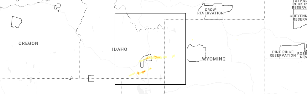
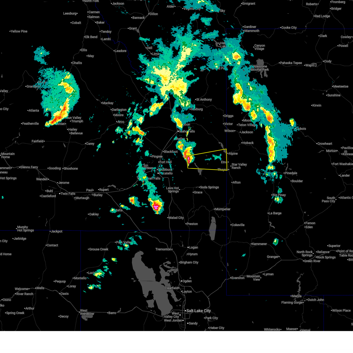
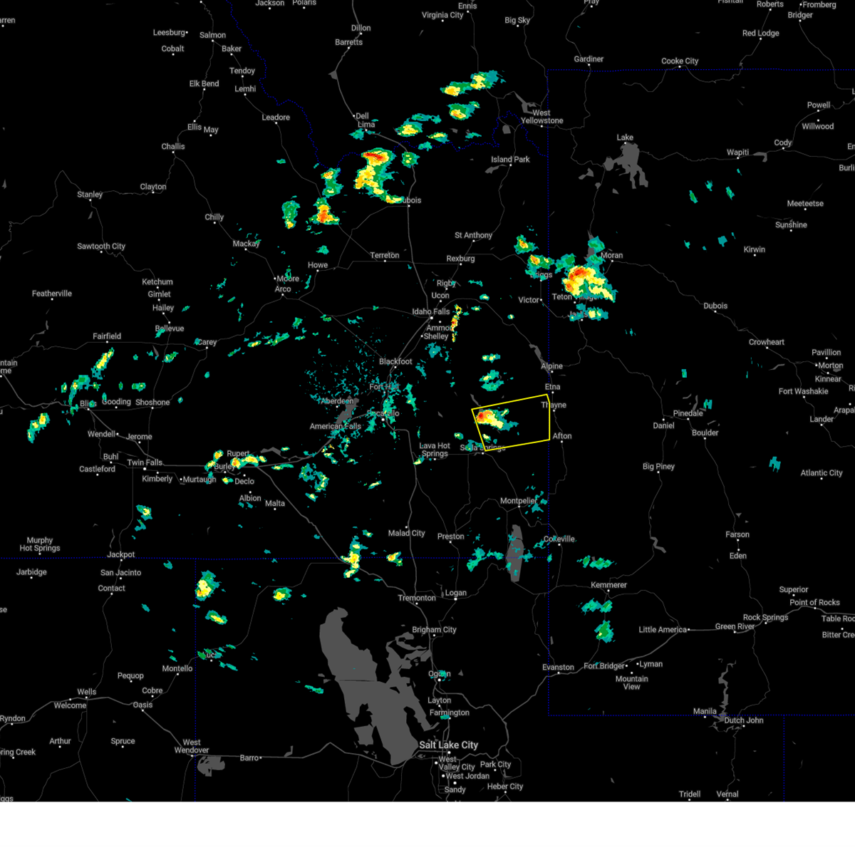
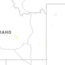
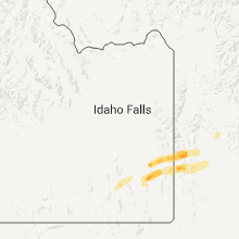
Hail Map for Freedom, WY
The Freedom, WY area has had 2 reports of on-the-ground hail by trained spotters, and has been under severe weather warnings 12 times during the past 12 months. Doppler radar has detected hail at or near Freedom, WY on 11 occasions, including 2 occasions during the past year.
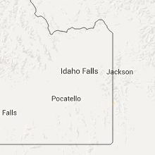
| Name: | Freedom, WY |
| Where Located: | 62.2 miles SE of Idaho Falls, ID |
| Map: | Google Map for Freedom, WY |
| Population: | 214 |
| Housing Units: | 92 |
| More Info: | Search Google for Freedom, WY |
0
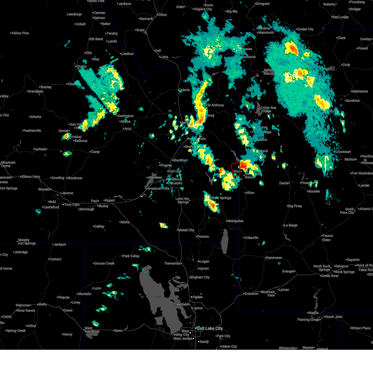
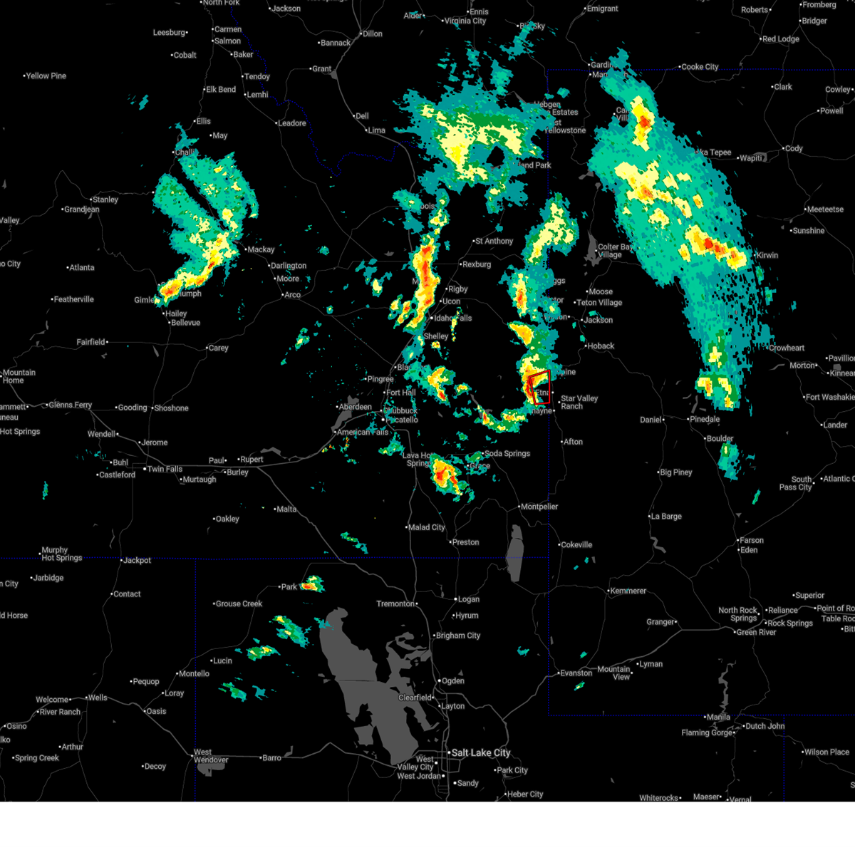
The Top Recent Hail Date for Freedom, WY is Wednesday, June 11, 2025 (11th out of 11)
Hail and Wind Damage Spotted near Freedom, WY
| Date / Time | Report Details |
|---|---|
| 6/11/2025 4:18 PM MDT |
 The tornadic thunderstorm which prompted the warning has moved out of the warned area. therefore, the warning has been allowed to expire. a severe thunderstorm watch remains in effect until 900 pm mdt for southeastern idaho. The tornadic thunderstorm which prompted the warning has moved out of the warned area. therefore, the warning has been allowed to expire. a severe thunderstorm watch remains in effect until 900 pm mdt for southeastern idaho.
|
| 6/11/2025 4:14 PM MDT |
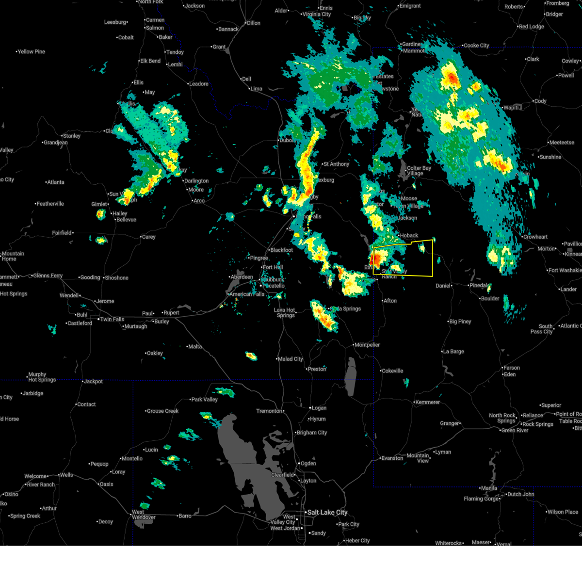 Svrriw the national weather service in riverton has issued a * severe thunderstorm warning for, northwestern sublette county in west central wyoming, northwestern lincoln county in west central wyoming, * until 500 pm mdt. * at 413 pm mdt, a severe thunderstorm was located over stewart peak, which is near alpine, moving east at 45 mph (radar indicated). Hazards include quarter size hail. damage to vehicles is expected Svrriw the national weather service in riverton has issued a * severe thunderstorm warning for, northwestern sublette county in west central wyoming, northwestern lincoln county in west central wyoming, * until 500 pm mdt. * at 413 pm mdt, a severe thunderstorm was located over stewart peak, which is near alpine, moving east at 45 mph (radar indicated). Hazards include quarter size hail. damage to vehicles is expected
|
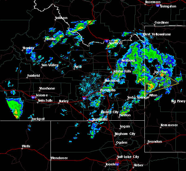
| 6/11/2025 4:04 PM MDT |
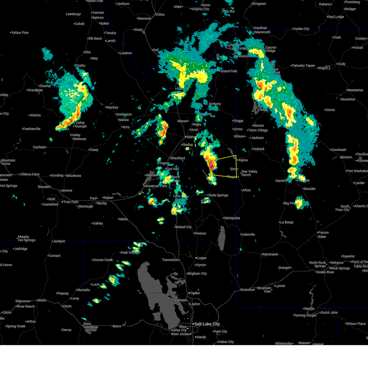
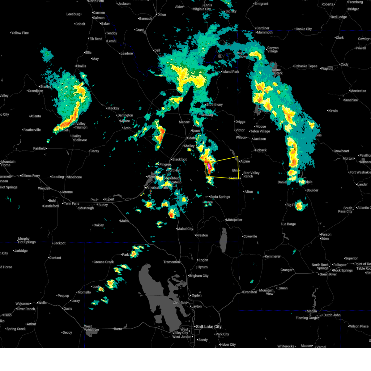
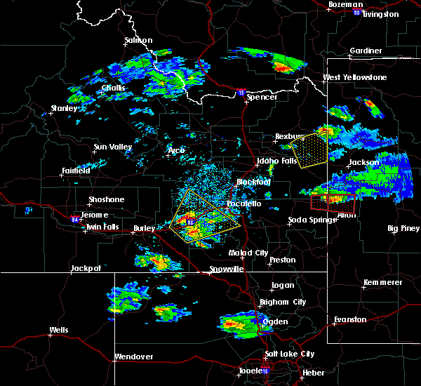
 Torpih the national weather service in pocatello has issued a * tornado warning for, northeastern caribou county in southeastern idaho, southeastern bonneville county in southeastern idaho, * until 415 pm mdt. * at 404 pm mdt, a severe thunderstorm capable of producing a tornado was located near freedom, or 7 miles southwest of alpine, moving east at 45 mph (radar indicated rotation). Hazards include tornado and half dollar size hail. Flying debris will be dangerous to those caught without shelter. mobile homes will be damaged or destroyed. damage to roofs, windows, and vehicles will occur. tree damage is likely. This tornadic thunderstorm will remain over mainly rural areas of northeastern caribou and southeastern bonneville counties, including the following locations, freedom. Torpih the national weather service in pocatello has issued a * tornado warning for, northeastern caribou county in southeastern idaho, southeastern bonneville county in southeastern idaho, * until 415 pm mdt. * at 404 pm mdt, a severe thunderstorm capable of producing a tornado was located near freedom, or 7 miles southwest of alpine, moving east at 45 mph (radar indicated rotation). Hazards include tornado and half dollar size hail. Flying debris will be dangerous to those caught without shelter. mobile homes will be damaged or destroyed. damage to roofs, windows, and vehicles will occur. tree damage is likely. This tornadic thunderstorm will remain over mainly rural areas of northeastern caribou and southeastern bonneville counties, including the following locations, freedom.
|
| 6/11/2025 3:58 PM MDT |
 The storm which prompted the warning has moved out of the area and into western wyoming. therefore, the warning will be allowed to expire. a severe thunderstorm watch remains in effect until 900 pm mdt for southeastern idaho. The storm which prompted the warning has moved out of the area and into western wyoming. therefore, the warning will be allowed to expire. a severe thunderstorm watch remains in effect until 900 pm mdt for southeastern idaho.
|
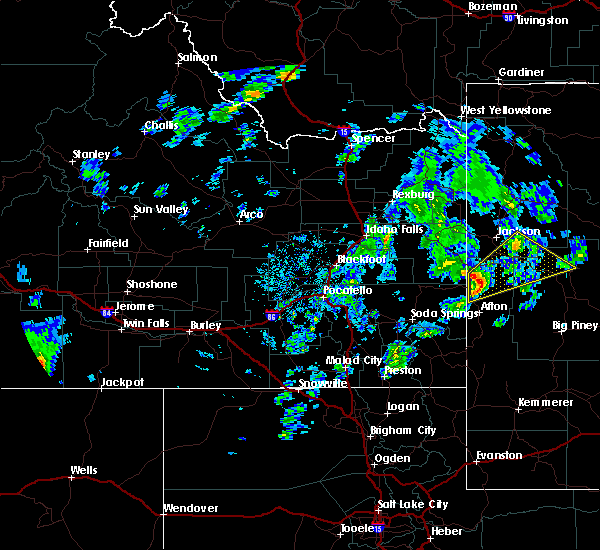
| 6/11/2025 3:56 PM MDT |
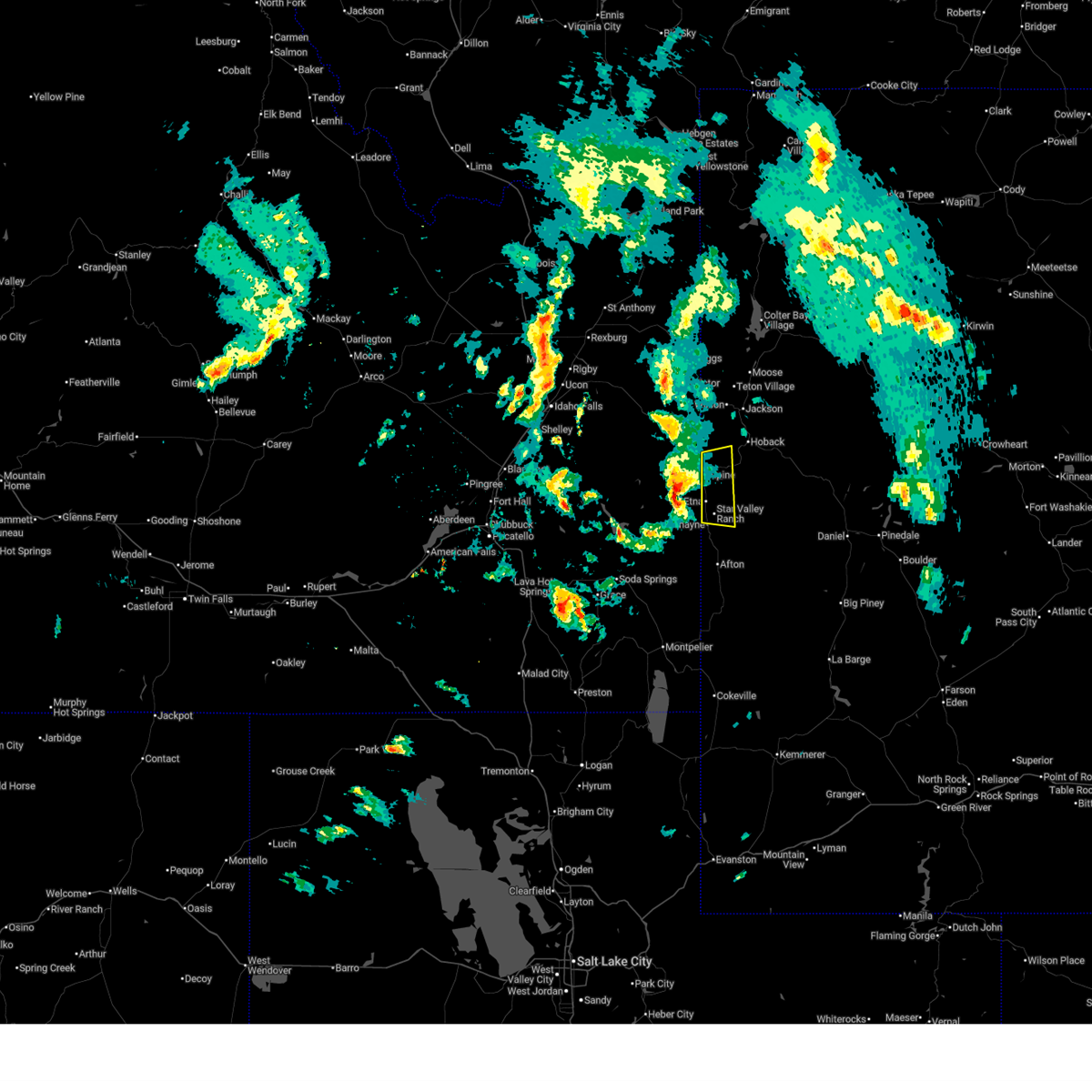 Svrriw the national weather service in riverton has issued a * severe thunderstorm warning for, northwestern lincoln county in west central wyoming, * until 415 pm mdt. * at 355 pm mdt, a severe thunderstorm was located 9 miles northwest of freedom, which is 10 miles northeast of wayan, moving east at 35 mph (radar indicated). Hazards include quarter size hail. Damage to vehicles is expected. This severe thunderstorm will remain over mainly rural areas of northwestern lincoln county, including the following locations, alpine airport and etna. Svrriw the national weather service in riverton has issued a * severe thunderstorm warning for, northwestern lincoln county in west central wyoming, * until 415 pm mdt. * at 355 pm mdt, a severe thunderstorm was located 9 miles northwest of freedom, which is 10 miles northeast of wayan, moving east at 35 mph (radar indicated). Hazards include quarter size hail. Damage to vehicles is expected. This severe thunderstorm will remain over mainly rural areas of northwestern lincoln county, including the following locations, alpine airport and etna.
|
| 6/11/2025 3:50 PM MDT |
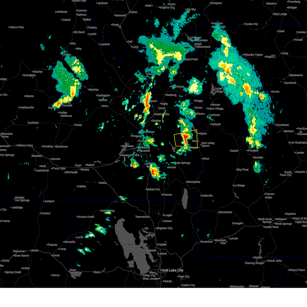 At 350 pm mdt, a severe thunderstorm was located 10 miles northwest of freedom, or 10 miles northeast of wayan, moving east at 40 mph (radar indicated). Hazards include golf ball size hail and 60 mph wind gusts. People and animals outdoors will be injured. expect hail damage to roofs, siding, windows, and vehicles. expect wind damage to roofs, siding, and trees. Locations impacted include, wayan, southern palisades reservoir, freedom, and grays lake. At 350 pm mdt, a severe thunderstorm was located 10 miles northwest of freedom, or 10 miles northeast of wayan, moving east at 40 mph (radar indicated). Hazards include golf ball size hail and 60 mph wind gusts. People and animals outdoors will be injured. expect hail damage to roofs, siding, windows, and vehicles. expect wind damage to roofs, siding, and trees. Locations impacted include, wayan, southern palisades reservoir, freedom, and grays lake.
|
| 6/11/2025 3:37 PM MDT |
 the severe thunderstorm warning has been cancelled and is no longer in effect the severe thunderstorm warning has been cancelled and is no longer in effect
|
| 6/11/2025 3:37 PM MDT |
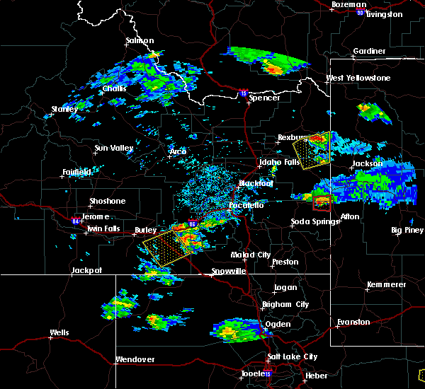
 At 336 pm mdt, a severe thunderstorm was located near wayan, moving east at 45 mph (radar indicated). Hazards include golf ball size hail and 60 mph wind gusts. People and animals outdoors will be injured. expect hail damage to roofs, siding, windows, and vehicles. expect wind damage to roofs, siding, and trees. Locations impacted include, wayan, southern palisades reservoir, freedom, and grays lake. At 336 pm mdt, a severe thunderstorm was located near wayan, moving east at 45 mph (radar indicated). Hazards include golf ball size hail and 60 mph wind gusts. People and animals outdoors will be injured. expect hail damage to roofs, siding, windows, and vehicles. expect wind damage to roofs, siding, and trees. Locations impacted include, wayan, southern palisades reservoir, freedom, and grays lake.
|
| 6/11/2025 3:27 PM MDT |
 At 327 pm mdt, a severe thunderstorm was located 9 miles northwest of wayan, moving east at 50 mph (radar indicated). Hazards include ping pong ball size hail and 60 mph wind gusts. People and animals outdoors will be injured. expect hail damage to roofs, siding, windows, and vehicles. expect wind damage to roofs, siding, and trees. Locations impacted include, wayan, southern palisades reservoir, blackfoot reservoir, freedom, and grays lake. At 327 pm mdt, a severe thunderstorm was located 9 miles northwest of wayan, moving east at 50 mph (radar indicated). Hazards include ping pong ball size hail and 60 mph wind gusts. People and animals outdoors will be injured. expect hail damage to roofs, siding, windows, and vehicles. expect wind damage to roofs, siding, and trees. Locations impacted include, wayan, southern palisades reservoir, blackfoot reservoir, freedom, and grays lake.
|
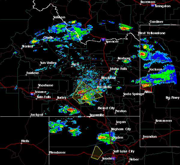
| 6/11/2025 3:13 PM MDT |
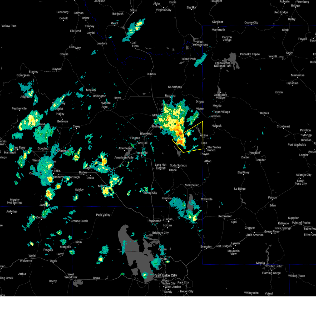
 Svrpih the national weather service in pocatello has issued a * severe thunderstorm warning for, northeastern caribou county in southeastern idaho, southeastern bonneville county in southeastern idaho, east central bingham county in southeastern idaho, * until 400 pm mdt. * at 313 pm mdt, a severe thunderstorm was located 10 miles northwest of blackfoot reservoir, moving east at 40 mph (radar indicated). Hazards include quarter size hail. damage to vehicles is expected Svrpih the national weather service in pocatello has issued a * severe thunderstorm warning for, northeastern caribou county in southeastern idaho, southeastern bonneville county in southeastern idaho, east central bingham county in southeastern idaho, * until 400 pm mdt. * at 313 pm mdt, a severe thunderstorm was located 10 miles northwest of blackfoot reservoir, moving east at 40 mph (radar indicated). Hazards include quarter size hail. damage to vehicles is expected
|
| 5/11/2025 2:42 PM MDT |
 At 242 pm mdt, a severe thunderstorm was located 8 miles north of wayan, moving northeast at 55 mph (radar indicated). Hazards include 60 mph wind gusts and penny size hail. Expect damage to roofs, siding, and trees. Locations impacted include, wayan, freedom, palisades reservoir, and grays lake. At 242 pm mdt, a severe thunderstorm was located 8 miles north of wayan, moving northeast at 55 mph (radar indicated). Hazards include 60 mph wind gusts and penny size hail. Expect damage to roofs, siding, and trees. Locations impacted include, wayan, freedom, palisades reservoir, and grays lake.
|
| 5/11/2025 2:25 PM MDT |
 Svrpih the national weather service in pocatello has issued a * severe thunderstorm warning for, northeastern caribou county in southeastern idaho, southeastern bonneville county in southeastern idaho, southeastern bingham county in southeastern idaho, * until 315 pm mdt. * at 224 pm mdt, a severe thunderstorm was located 8 miles northwest of blackfoot reservoir, moving northeast at 55 mph (radar indicated). Hazards include 60 mph wind gusts and quarter size hail. Hail damage to vehicles is expected. Expect wind damage to roofs, siding, and trees. Svrpih the national weather service in pocatello has issued a * severe thunderstorm warning for, northeastern caribou county in southeastern idaho, southeastern bonneville county in southeastern idaho, southeastern bingham county in southeastern idaho, * until 315 pm mdt. * at 224 pm mdt, a severe thunderstorm was located 8 miles northwest of blackfoot reservoir, moving northeast at 55 mph (radar indicated). Hazards include 60 mph wind gusts and quarter size hail. Hail damage to vehicles is expected. Expect wind damage to roofs, siding, and trees.
|
| 7/3/2023 2:27 PM MDT |
 The severe thunderstorm warning for northeastern caribou and southeastern bonneville counties will expire at 230 pm mdt, the storm which prompted the warning has weakened below severe limits, and has exited the warned area. therefore, the warning will be allowed to expire. however small hail, gusty winds and heavy rain are still possible with this thunderstorm. The severe thunderstorm warning for northeastern caribou and southeastern bonneville counties will expire at 230 pm mdt, the storm which prompted the warning has weakened below severe limits, and has exited the warned area. therefore, the warning will be allowed to expire. however small hail, gusty winds and heavy rain are still possible with this thunderstorm.
|
| 7/3/2023 2:05 PM MDT |
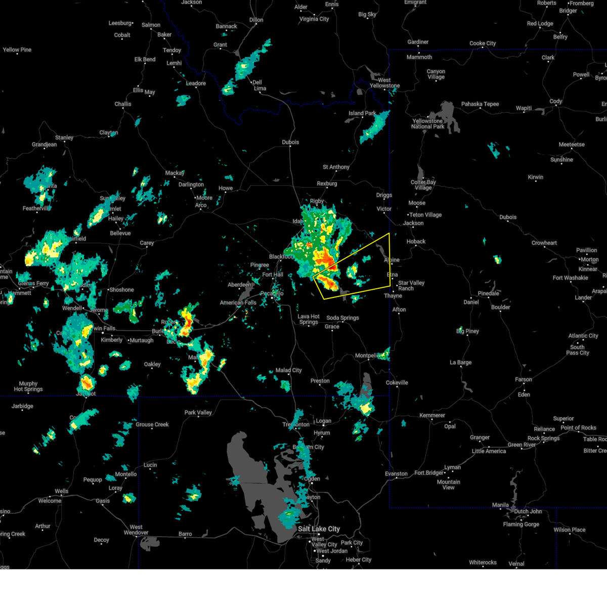
 At 204 pm mdt, a severe thunderstorm was located 8 miles south of henry, or 10 miles northeast of soda springs. another severe thunderstorm was located just west of henry. both were moving east at 40 mph (radar indicated). Hazards include 60 mph wind gusts and quarter size hail. Hail damage to vehicles is expected. Expect wind damage to roofs, siding, and trees. At 204 pm mdt, a severe thunderstorm was located 8 miles south of henry, or 10 miles northeast of soda springs. another severe thunderstorm was located just west of henry. both were moving east at 40 mph (radar indicated). Hazards include 60 mph wind gusts and quarter size hail. Hail damage to vehicles is expected. Expect wind damage to roofs, siding, and trees.
|
| 7/10/2016 1:03 PM MDT |
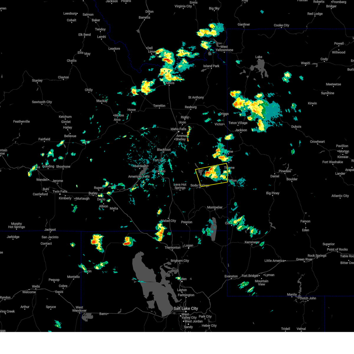
 At 102 pm mdt, a severe thunderstorm was located 11 miles east of stewart peak, which is 15 miles east of alpine, moving northeast at 55 mph (trained weather spotters). Hazards include 60 mph wind gusts and quarter size hail. Hail damage to vehicles is expected. expect wind damage to roofs, siding and trees. this severe storm will be near, bondurant around 120 pm mdt. granite falls hot springs around 125 pm mdt. Other locations impacted by this severe thunderstorm include etna, thayne, granite creek campground, cedar creek golf course and wolf creek campground. At 102 pm mdt, a severe thunderstorm was located 11 miles east of stewart peak, which is 15 miles east of alpine, moving northeast at 55 mph (trained weather spotters). Hazards include 60 mph wind gusts and quarter size hail. Hail damage to vehicles is expected. expect wind damage to roofs, siding and trees. this severe storm will be near, bondurant around 120 pm mdt. granite falls hot springs around 125 pm mdt. Other locations impacted by this severe thunderstorm include etna, thayne, granite creek campground, cedar creek golf course and wolf creek campground.
|
| 7/10/2016 12:55 PM MDT |
 At 1254 pm mdt, a severe thunderstorm was located near stewart peak, which is 11 miles southeast of alpine, moving northeast at 55 mph (radar indicated). Hazards include 60 mph wind gusts and quarter size hail. Hail damage to vehicles is expected. expect wind damage to roofs, siding and trees. this severe thunderstorm will be near, bondurant around 120 pm mdt. granite falls hot springs around 125 pm mdt. Other locations impacted by this severe thunderstorm include etna, thayne, cedar creek golf course and wolf creek campground. At 1254 pm mdt, a severe thunderstorm was located near stewart peak, which is 11 miles southeast of alpine, moving northeast at 55 mph (radar indicated). Hazards include 60 mph wind gusts and quarter size hail. Hail damage to vehicles is expected. expect wind damage to roofs, siding and trees. this severe thunderstorm will be near, bondurant around 120 pm mdt. granite falls hot springs around 125 pm mdt. Other locations impacted by this severe thunderstorm include etna, thayne, cedar creek golf course and wolf creek campground.
|
| 6/15/2015 7:36 PM MDT |
 At 735 pm mdt, a severe thunderstorm was located 8 miles southwest of star valley rest area, which is 9 miles southwest of thayne, moving east at 40 mph (radar indicated). Hazards include 60 mph wind gusts and quarter size to half dollar size hail. Hail damage to vehicles is expected. expect wind damage to roofs, siding and trees. this severe thunderstorm will be near, star valley rest area around 745 pm mdt. afton, turnerville and grover around 750 pm mdt. periodic spring around 755 pm mdt. Other locations impacted by this severe thunderstorm include smoot koa campground, afton star valley medical center, lincoln county fairgrounds, valli vu golf course, thayne branch library, forest park campground, cedar creek golf course, swift creek campground, cottonwood lake campground and afton municipal airport. At 735 pm mdt, a severe thunderstorm was located 8 miles southwest of star valley rest area, which is 9 miles southwest of thayne, moving east at 40 mph (radar indicated). Hazards include 60 mph wind gusts and quarter size to half dollar size hail. Hail damage to vehicles is expected. expect wind damage to roofs, siding and trees. this severe thunderstorm will be near, star valley rest area around 745 pm mdt. afton, turnerville and grover around 750 pm mdt. periodic spring around 755 pm mdt. Other locations impacted by this severe thunderstorm include smoot koa campground, afton star valley medical center, lincoln county fairgrounds, valli vu golf course, thayne branch library, forest park campground, cedar creek golf course, swift creek campground, cottonwood lake campground and afton municipal airport.
|
| 6/15/2015 5:18 PM MDT |
 At 518 pm mdt, a severe thunderstorm capable of producing a tornado was located near star valley ranch, which is 8 miles northeast of thayne, moving east at 20 mph (radar indicated rotation). Hazards include tornado and golf ball size hail. golf ball sized hail has been reported by a trained spotter. Flying debris will be dangerous to those caught without shelter. mobile homes will be damaged or destroyed. damage to roofs, windows and vehicles will occur. tree damage is likely. this dangerous storm will be near, meadow creek guard station around 530 pm mdt. other locations impacted by this tornadic thunderstorm include moose flat campground, aspen hills golf course, etna, flat creek rv park, murphy creek campground, star valley ranch resort golf course, strawberry creek lower valley energy inc power plant, thayne branch library, forest park campground and bedford. At 518 pm mdt, a severe thunderstorm capable of producing a tornado was located near star valley ranch, which is 8 miles northeast of thayne, moving east at 20 mph (radar indicated rotation). Hazards include tornado and golf ball size hail. golf ball sized hail has been reported by a trained spotter. Flying debris will be dangerous to those caught without shelter. mobile homes will be damaged or destroyed. damage to roofs, windows and vehicles will occur. tree damage is likely. this dangerous storm will be near, meadow creek guard station around 530 pm mdt. other locations impacted by this tornadic thunderstorm include moose flat campground, aspen hills golf course, etna, flat creek rv park, murphy creek campground, star valley ranch resort golf course, strawberry creek lower valley energy inc power plant, thayne branch library, forest park campground and bedford.
|
| 6/15/2015 5:15 PM MDT |
 At 514 pm mdt, a severe thunderstorm capable of producing a tornado was located near star valley ranch, which is near thayne, moving east at 20 mph (radar indicated rotation). Hazards include tornado and quarter size hail. Flying debris will be dangerous to those caught without shelter. mobile homes will be damaged or destroyed. damage to roofs, windows and vehicles will occur. tree damage is likely. this dangerous storm will be near, meadow creek guard station around 530 pm mdt. other locations impacted by this tornadic thunderstorm include moose flat campground, aspen hills golf course, etna, flat creek rv park, murphy creek campground, star valley ranch resort golf course, strawberry creek lower valley energy inc power plant, thayne branch library, forest park campground and bedford. At 514 pm mdt, a severe thunderstorm capable of producing a tornado was located near star valley ranch, which is near thayne, moving east at 20 mph (radar indicated rotation). Hazards include tornado and quarter size hail. Flying debris will be dangerous to those caught without shelter. mobile homes will be damaged or destroyed. damage to roofs, windows and vehicles will occur. tree damage is likely. this dangerous storm will be near, meadow creek guard station around 530 pm mdt. other locations impacted by this tornadic thunderstorm include moose flat campground, aspen hills golf course, etna, flat creek rv park, murphy creek campground, star valley ranch resort golf course, strawberry creek lower valley energy inc power plant, thayne branch library, forest park campground and bedford.
|
| 6/15/2015 5:11 PM MDT |
 At 452 pm mdt, doppler radar indicated a severe thunderstorm capable of producing a tornado. this dangerous storm was located near freedom, or 9 miles northwest of thayne, and moving east at 35 mph. in addition, ping pong ball size hail and winds over 60 mph are possible with this storm!. At 452 pm mdt, doppler radar indicated a severe thunderstorm capable of producing a tornado. this dangerous storm was located near freedom, or 9 miles northwest of thayne, and moving east at 35 mph. in addition, ping pong ball size hail and winds over 60 mph are possible with this storm!.
|
| 6/15/2015 5:04 PM MDT | Quarter sized hail reported 1.1 miles E of Freedom, WY, picture of a few stones around 1 inch. most were smaller. |
| 6/15/2015 4:57 PM MDT |
 At 456 pm mdt, a severe thunderstorm capable of producing a tornado was located over freedom, which is near thayne, moving east at 20 mph (radar indicated rotation). Hazards include tornado and quarter size hail. Flying debris will be dangerous to those caught without shelter. mobile homes will be damaged or destroyed. damage to roofs, windows and vehicles will occur. tree damage is likely. this dangerous storm will be near, thayne and star valley rest area around 500 pm mdt. star valley ranch around 505 pm mdt. stewart peak around 510 pm mdt. meadow creek guard station around 530 pm mdt. other locations impacted by this tornadic thunderstorm include moose flat campground, aspen hills golf course, etna, flat creek rv park, murphy creek campground, star valley ranch resort golf course, strawberry creek lower valley energy inc power plant, thayne branch library, forest park campground and bedford. At 456 pm mdt, a severe thunderstorm capable of producing a tornado was located over freedom, which is near thayne, moving east at 20 mph (radar indicated rotation). Hazards include tornado and quarter size hail. Flying debris will be dangerous to those caught without shelter. mobile homes will be damaged or destroyed. damage to roofs, windows and vehicles will occur. tree damage is likely. this dangerous storm will be near, thayne and star valley rest area around 500 pm mdt. star valley ranch around 505 pm mdt. stewart peak around 510 pm mdt. meadow creek guard station around 530 pm mdt. other locations impacted by this tornadic thunderstorm include moose flat campground, aspen hills golf course, etna, flat creek rv park, murphy creek campground, star valley ranch resort golf course, strawberry creek lower valley energy inc power plant, thayne branch library, forest park campground and bedford.
|
| 6/15/2015 4:53 PM MDT |
 At 452 pm mdt, doppler radar indicated a severe thunderstorm capable of producing a tornado. this dangerous storm was located near freedom, or 9 miles northwest of thayne, and moving east at 35 mph. in addition, ping pong ball size hail and winds over 60 mph are possible with this storm!. At 452 pm mdt, doppler radar indicated a severe thunderstorm capable of producing a tornado. this dangerous storm was located near freedom, or 9 miles northwest of thayne, and moving east at 35 mph. in addition, ping pong ball size hail and winds over 60 mph are possible with this storm!.
|
| 6/15/2015 4:36 PM MDT | Golf Ball sized hail reported 17.8 miles ESE of Freedom, WY, measured at time of event. raining heavily at time of report. |
| 8/5/2013 4:20 PM MDT | Dale bitner raws. time of event estimated coincident with weak radar echoes moving through the area. wind gust occurred sometime between 1546 and 1645 md in bonneville county ID, 19.1 miles ESE of Freedom, WY |
Hail Maps for Freedom, WY


Connect with Interactive Hail Maps