

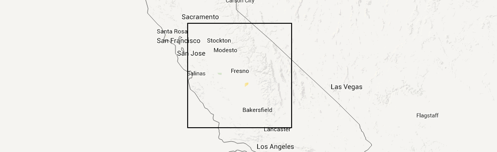
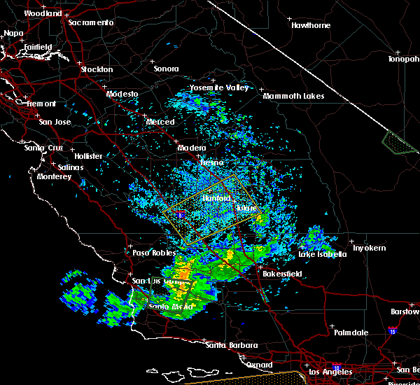
Hail Map for Hanford, CA
The Hanford, CA area has had 3 reports of on-the-ground hail by trained spotters, and has been under severe weather warnings 0 times during the past 12 months. Doppler radar has detected hail at or near Hanford, CA on 1 occasion.
| Name: | Hanford, CA |
| Where Located: | 29.6 miles SSE of Fresno, CA |
| Map: | Google Map for Hanford, CA |
| Population: | 53967 |
| Housing Units: | 18493 |
| More Info: | Search Google for Hanford, CA |
0
The Top Recent Hail Date for Hanford, CA is Wednesday, April 11, 2012 (1st out of 1)
Hail and Wind Damage Spotted near Hanford, CA
| Date / Time | Report Details |
|---|---|
| 3/12/2023 7:35 PM PDT |
 The severe thunderstorm warning for northeastern kings, west central tulare and central fresno counties will expire at 745 pm pdt, the storm which prompted the warning has weakened below severe limits, and no longer poses an immediate threat to life or property. therefore, the warning will be allowed to expire. however gusty winds are still possible with this thunderstorm. The severe thunderstorm warning for northeastern kings, west central tulare and central fresno counties will expire at 745 pm pdt, the storm which prompted the warning has weakened below severe limits, and no longer poses an immediate threat to life or property. therefore, the warning will be allowed to expire. however gusty winds are still possible with this thunderstorm.
|
| 3/12/2023 7:06 PM PDT |
 At 706 pm pdt, a severe thunderstorm was located near selma, or 14 miles southeast of fresno, moving southeast at 20 mph (radar indicated). Hazards include 60 mph wind gusts. Expect damage to roofs, siding, and trees. locations impacted include, hanford, reedley, selma, dinuba, parlier, kingsburg, bowles, traver, home garden, london, del rey, fowler and laton. hail threat, radar indicated max hail size, <. 75 in wind threat, radar indicated max wind gust, 60 mph. At 706 pm pdt, a severe thunderstorm was located near selma, or 14 miles southeast of fresno, moving southeast at 20 mph (radar indicated). Hazards include 60 mph wind gusts. Expect damage to roofs, siding, and trees. locations impacted include, hanford, reedley, selma, dinuba, parlier, kingsburg, bowles, traver, home garden, london, del rey, fowler and laton. hail threat, radar indicated max hail size, <. 75 in wind threat, radar indicated max wind gust, 60 mph.
|
| 3/12/2023 6:56 PM PDT |
 At 656 pm pdt, a severe thunderstorm was located over bowles, or 12 miles south of fresno, moving southeast at 20 mph (radar indicated). Hazards include 60 mph wind gusts. expect damage to roofs, siding, and trees At 656 pm pdt, a severe thunderstorm was located over bowles, or 12 miles south of fresno, moving southeast at 20 mph (radar indicated). Hazards include 60 mph wind gusts. expect damage to roofs, siding, and trees
|
| 5/19/2019 4:27 PM PDT |
 At 426 pm pdt, a severe thunderstorm was located near stratford, or 14 miles southwest of hanford, moving southeast at 30 mph (radar indicated). Hazards include 60 mph wind gusts and quarter size hail. Hail damage to vehicles is expected. Expect wind damage to roofs, siding, and trees. At 426 pm pdt, a severe thunderstorm was located near stratford, or 14 miles southwest of hanford, moving southeast at 30 mph (radar indicated). Hazards include 60 mph wind gusts and quarter size hail. Hail damage to vehicles is expected. Expect wind damage to roofs, siding, and trees.
|
| 5/19/2019 4:18 PM PDT |
 At 415 pm pdt, a severe thunderstorm was located over stratford, or 15 miles southwest of hanford, moving east at 25 mph (radar indicated). Hazards include hail up to one inch in diameter. frequent lightning. possible funnel cloud. Damaging hail and strong winds. Locations impacted include, hanford, corcoran, lemoore, stratford and lemoore nas. At 415 pm pdt, a severe thunderstorm was located over stratford, or 15 miles southwest of hanford, moving east at 25 mph (radar indicated). Hazards include hail up to one inch in diameter. frequent lightning. possible funnel cloud. Damaging hail and strong winds. Locations impacted include, hanford, corcoran, lemoore, stratford and lemoore nas.
|
| 5/19/2019 4:01 PM PDT |
 At 358 pm pdt, a severe thunderstorm was located over lanare, or 14 miles northwest of hanford, moving east at 80 mph (radar indicated). Hazards include .hail up to one inch in diameter. frequent lightning. possible funnel. damaging hail and strong winds At 358 pm pdt, a severe thunderstorm was located over lanare, or 14 miles northwest of hanford, moving east at 80 mph (radar indicated). Hazards include .hail up to one inch in diameter. frequent lightning. possible funnel. damaging hail and strong winds
|
| 9/11/2017 8:28 PM PDT | Large tree limbs in roadway on maple ave between excelsior and lewiston... per ch in kings county CA, 7.7 miles SE of Hanford, CA |
| 9/11/2017 6:00 PM PDT | Reported via social media; damage to outdoor furniture near hanford high schoo in kings county CA, 1.6 miles S of Hanford, CA |
| 9/11/2017 5:58 PM PDT | Down telephone poles (8 reported) on roadway along jackson ave near 9th av in kings county CA, 5.4 miles N of Hanford, CA |
| 9/11/2017 5:56 PM PDT |
 At 555 pm pdt, a severe thunderstorm was located near raisin city, or 16 miles south of fresno, moving northwest at 45 mph (radar indicated). Hazards include 60 mph wind gusts and quarter size hail. Hail damage to vehicles is expected. expect wind damage to roofs, siding, and trees. very heavy rain and frequent lightning is occurring with these thunderstorms. ponding of water is likely on roads with localized flooding. Locations impacted include, fresno, hanford, armona, bowles, home garden, easton, raisin city, lanare, riverdale, laton and caruthers. At 555 pm pdt, a severe thunderstorm was located near raisin city, or 16 miles south of fresno, moving northwest at 45 mph (radar indicated). Hazards include 60 mph wind gusts and quarter size hail. Hail damage to vehicles is expected. expect wind damage to roofs, siding, and trees. very heavy rain and frequent lightning is occurring with these thunderstorms. ponding of water is likely on roads with localized flooding. Locations impacted include, fresno, hanford, armona, bowles, home garden, easton, raisin city, lanare, riverdale, laton and caruthers.
|
| 9/11/2017 5:55 PM PDT | Tree fell onto vehicle near 13th ave & houston av in kings county CA, 3 miles NE of Hanford, CA |
| 9/11/2017 5:53 PM PDT | Fence blew onto roadway on highway 198 near 11th av in kings county CA, 0.5 miles NNE of Hanford, CA |
| 9/11/2017 5:52 PM PDT | Tree debris on roadway of highway 198 near hanford-armona r in kings county CA, 3.1 miles ENE of Hanford, CA |
| 9/11/2017 5:42 PM PDT | Dairy farm had several barns with extensive roof damage in kings county CA, 5.3 miles N of Hanford, CA |
| 9/11/2017 5:37 PM PDT |
 At 534 pm pdt, a severe thunderstorm was located near hanford, moving northwest at 45 mph (radar indicated). Hazards include quarter size hail. briefly heavy rain, frequent dangerous lighnting and gusty winds are likely with this thunderstorm At 534 pm pdt, a severe thunderstorm was located near hanford, moving northwest at 45 mph (radar indicated). Hazards include quarter size hail. briefly heavy rain, frequent dangerous lighnting and gusty winds are likely with this thunderstorm
|
| 9/3/2017 7:20 PM PDT |
 The severe thunderstorm warning for northwestern kern, kings, southwestern tulare and southwestern fresno counties will expire at 730 pm pdt, the storms which prompted the warning have weakened below severe limits, and no longer pose an immediate threat to life or property. therefore the warning will be allowed to expire. however gusty winds are still possible with these thunderstorms. The severe thunderstorm warning for northwestern kern, kings, southwestern tulare and southwestern fresno counties will expire at 730 pm pdt, the storms which prompted the warning have weakened below severe limits, and no longer pose an immediate threat to life or property. therefore the warning will be allowed to expire. however gusty winds are still possible with these thunderstorms.
|
| 9/3/2017 7:03 PM PDT |
 At 701 pm pdt, a gust front from thunderstorms were located along a line extending from porterville to near corcoran to 22 miles southeast of avenal, moving north at 55 mph (radar indicated). Hazards include 60 mph wind gusts. expect damage to roofs, siding, and trees At 701 pm pdt, a gust front from thunderstorms were located along a line extending from porterville to near corcoran to 22 miles southeast of avenal, moving north at 55 mph (radar indicated). Hazards include 60 mph wind gusts. expect damage to roofs, siding, and trees
|
| 4/7/2015 4:31 PM PDT | The national weather service in hanford ca has issued a * severe thunderstorm warning for. southwestern fresno county in central california. northeastern kings county in central california. until 500 pm pdt * at 430 pm pdt. Doppler radar indicated a severe thunderstorm. |
| 4/11/2012 2:22 PM PDT | Quarter sized hail reported 9.7 miles SW of Hanford, CA, some accumulation on the roads |
| 4/11/2012 2:10 PM PDT | Quarter sized hail reported 5.1 miles S of Hanford, CA |
| 4/11/2012 2:03 PM PDT | Quarter sized hail reported 0.3 miles SSE of Hanford, CA |
| 1/1/0001 12:00 AM | Tree down in center divider of north 11th avenue just north of west lacey blv in kings county CA, 0.3 miles SSE of Hanford, CA |
Hail Maps for Hanford, CA
Connect with Interactive Hail Maps