

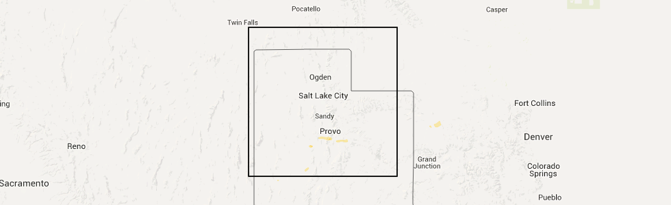
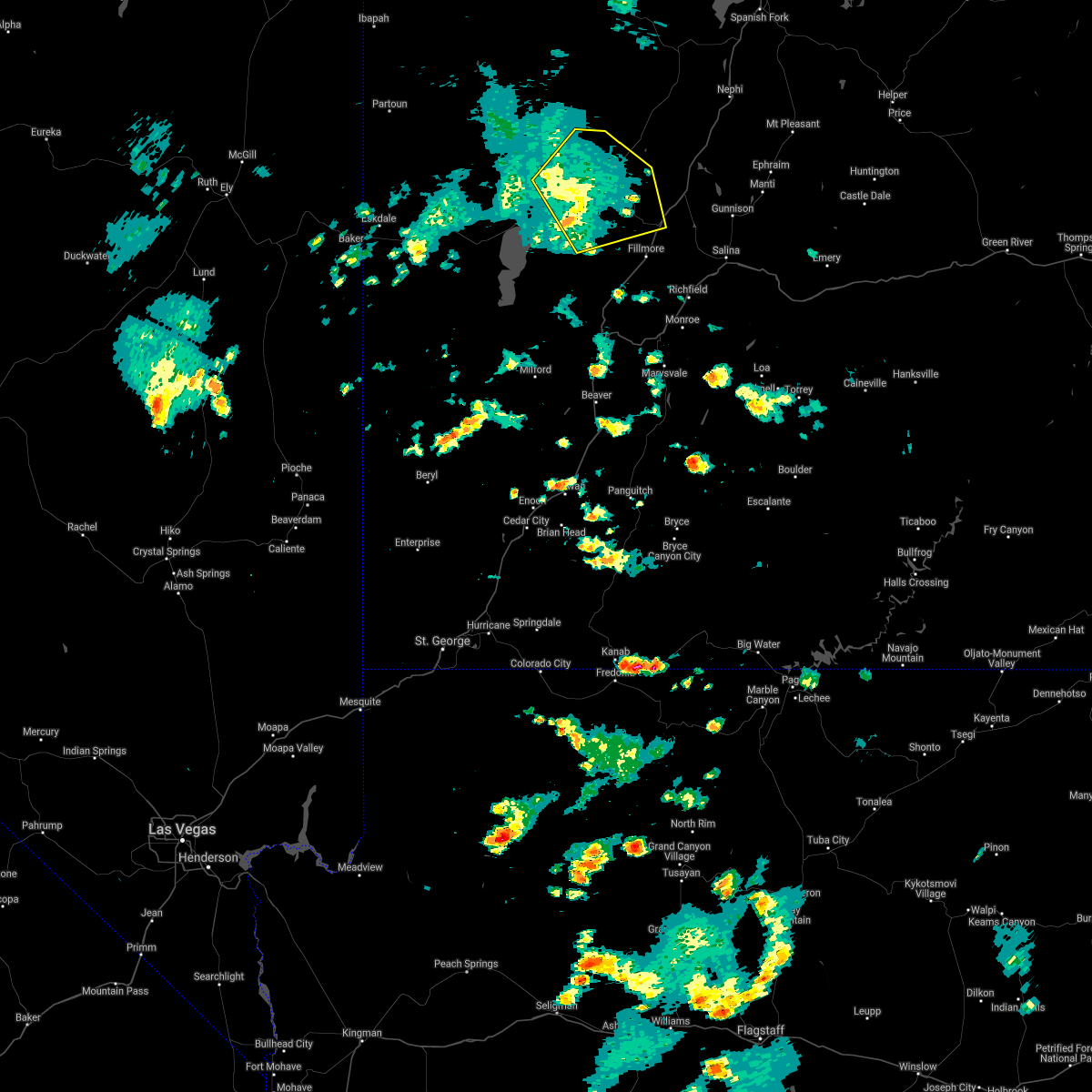
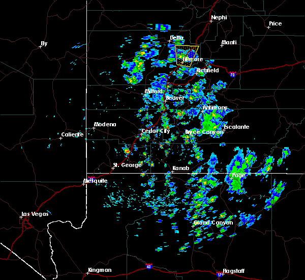
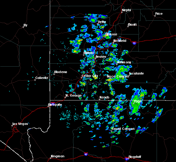
Hail Map for Holden, UT
The Holden, UT area has had 0 reports of on-the-ground hail by trained spotters, and has been under severe weather warnings 5 times during the past 12 months. Doppler radar has detected hail at or near Holden, UT on 1 occasion.
| Name: | Holden, UT |
| Where Located: | 33.3 miles NNW of Monroe, UT |
| Map: | Google Map for Holden, UT |
| Population: | 378 |
| Housing Units: | 168 |
| More Info: | Search Google for Holden, UT |
0
The Top Recent Hail Date for Holden, UT is Sunday, May 15, 2016 (1st out of 1)
Hail and Wind Damage Spotted near Holden, UT
| Date / Time | Report Details |
|---|---|
| 8/2/2023 1:02 PM MDT |
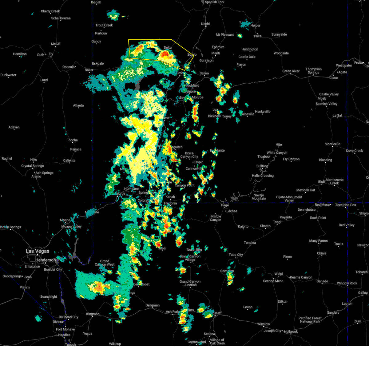 At 102 pm mdt, severe thunderstorms were located along a line extending from 22 miles northwest of delta to near scipio, moving northeast at 40 mph (radar indicated). Hazards include 60 mph wind gusts and quarter size hail. Hail damage to vehicles is expected. expect wind damage to roofs, siding, and trees. locations impacted include, delta, scipio, hinckley, oak city, holden, abraham, greenwood, mc cornick, sutherland and sugarville. this includes the following highways, interstate 15 between mile markers 172 and 190. us route 6 between mile markers 65 and 100. us route 50 between mile markers 90 and 132. hail threat, radar indicated max hail size, 1. 00 in wind threat, radar indicated max wind gust, 60 mph. At 102 pm mdt, severe thunderstorms were located along a line extending from 22 miles northwest of delta to near scipio, moving northeast at 40 mph (radar indicated). Hazards include 60 mph wind gusts and quarter size hail. Hail damage to vehicles is expected. expect wind damage to roofs, siding, and trees. locations impacted include, delta, scipio, hinckley, oak city, holden, abraham, greenwood, mc cornick, sutherland and sugarville. this includes the following highways, interstate 15 between mile markers 172 and 190. us route 6 between mile markers 65 and 100. us route 50 between mile markers 90 and 132. hail threat, radar indicated max hail size, 1. 00 in wind threat, radar indicated max wind gust, 60 mph.
|
| 8/2/2023 12:52 PM MDT |
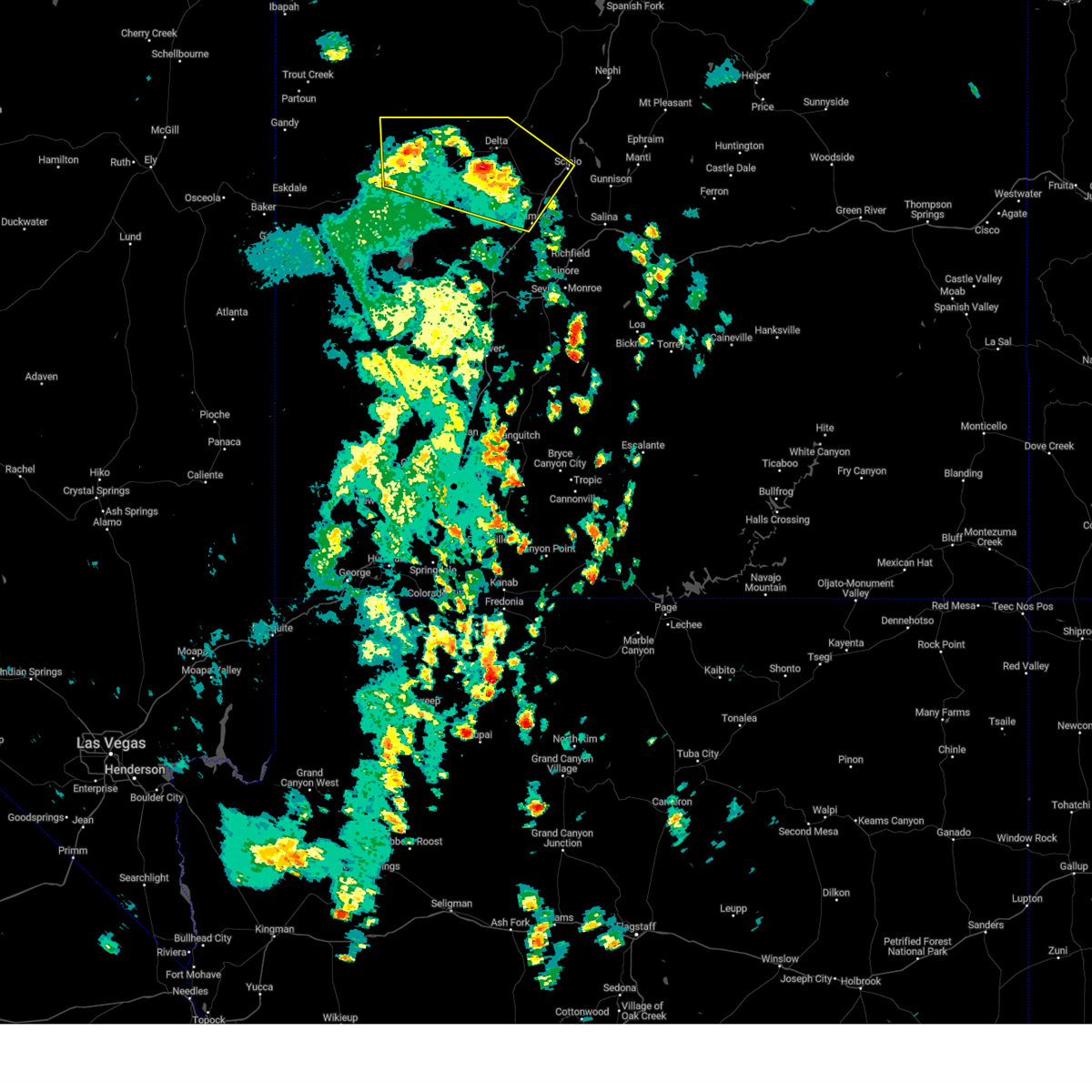 At 1252 pm mdt, severe thunderstorms were located along a line extending from 24 miles west of delta to 11 miles southwest of scipio, moving northeast at 40 mph (radar indicated). Hazards include 60 mph wind gusts and quarter size hail. Hail damage to vehicles is expected. expect wind damage to roofs, siding, and trees. locations impacted include, delta, fillmore, scipio, hinckley, oak city, holden, abraham, flowell, greenwood, mc cornick, sutherland and sugarville. this includes the following highways, interstate 15 between mile markers 162 and 190. us route 6 between mile markers 53 and 100. us route 50 between mile markers 90 and 132. hail threat, radar indicated max hail size, 1. 00 in wind threat, radar indicated max wind gust, 60 mph. At 1252 pm mdt, severe thunderstorms were located along a line extending from 24 miles west of delta to 11 miles southwest of scipio, moving northeast at 40 mph (radar indicated). Hazards include 60 mph wind gusts and quarter size hail. Hail damage to vehicles is expected. expect wind damage to roofs, siding, and trees. locations impacted include, delta, fillmore, scipio, hinckley, oak city, holden, abraham, flowell, greenwood, mc cornick, sutherland and sugarville. this includes the following highways, interstate 15 between mile markers 162 and 190. us route 6 between mile markers 53 and 100. us route 50 between mile markers 90 and 132. hail threat, radar indicated max hail size, 1. 00 in wind threat, radar indicated max wind gust, 60 mph.
|
| 8/2/2023 12:30 PM MDT |
 At 1229 pm mdt, severe thunderstorms were located along a line extending from 30 miles west of delta to near fillmore, moving north at 30 mph (radar indicated). Hazards include 60 mph wind gusts and quarter size hail. Hail damage to vehicles is expected. Expect wind damage to roofs, siding, and trees. At 1229 pm mdt, severe thunderstorms were located along a line extending from 30 miles west of delta to near fillmore, moving north at 30 mph (radar indicated). Hazards include 60 mph wind gusts and quarter size hail. Hail damage to vehicles is expected. Expect wind damage to roofs, siding, and trees.
|
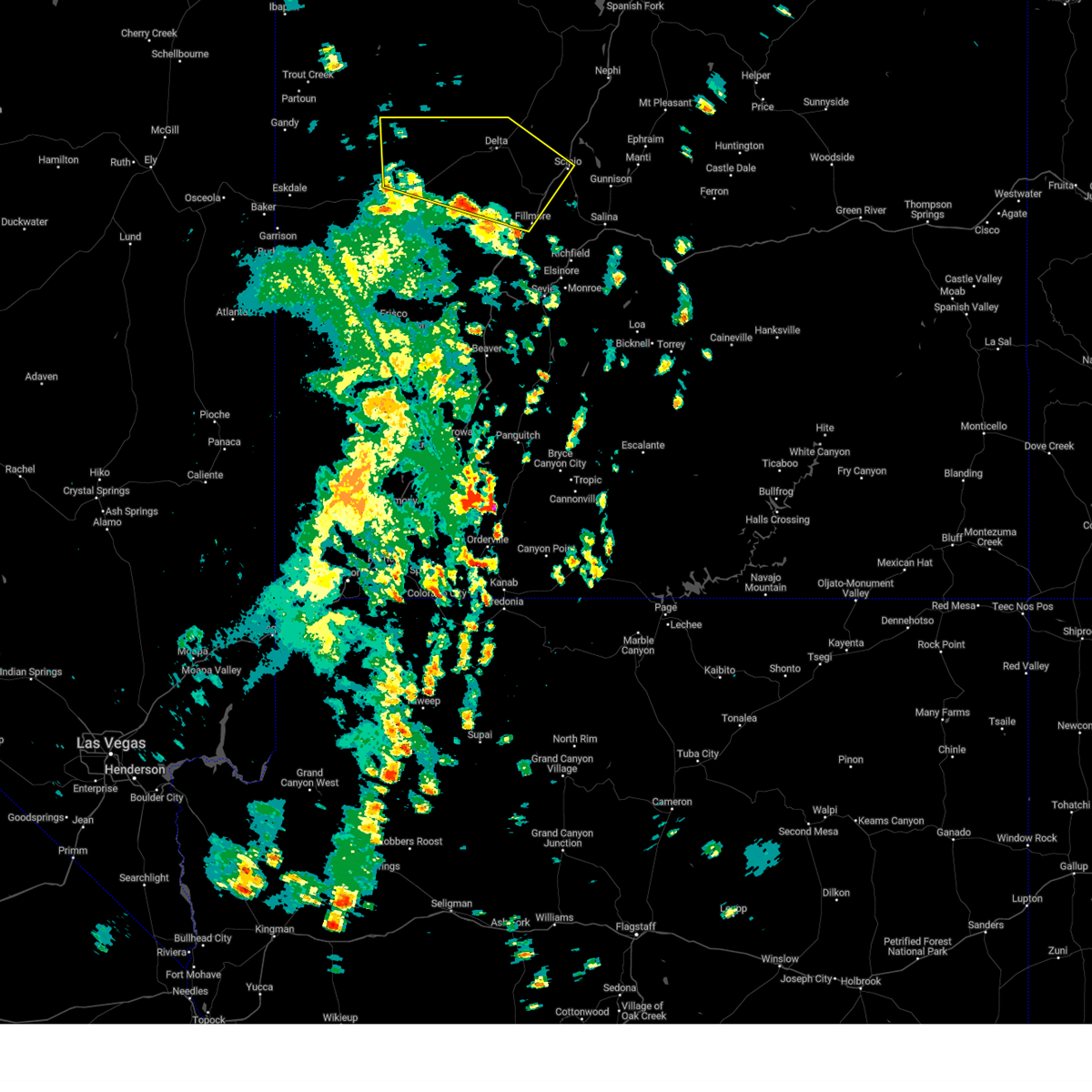
| 8/2/2023 12:07 PM MDT |
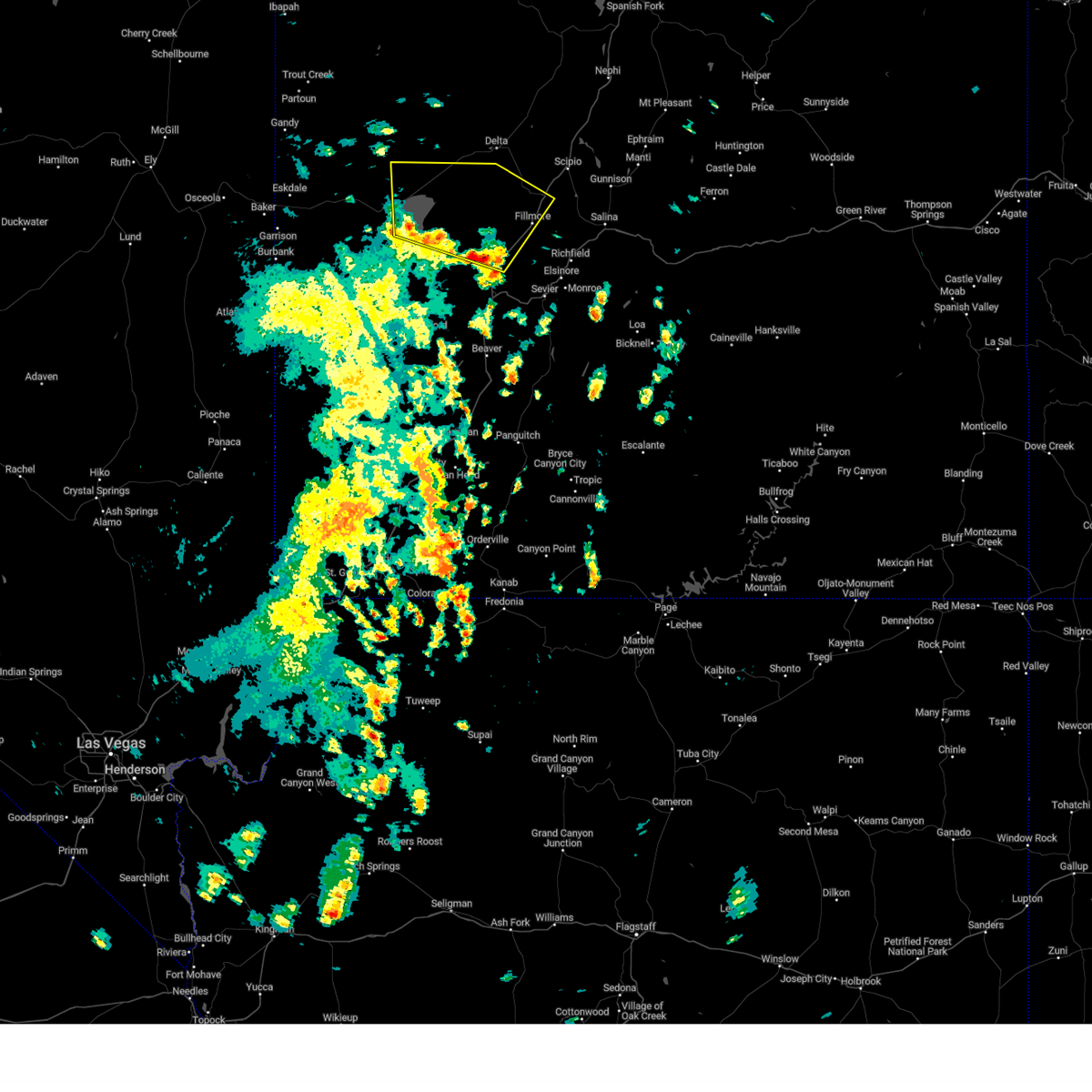 At 1206 pm mdt, severe thunderstorms were located along a line extending from 35 miles southwest of delta to near meadow, moving north at 30 mph (radar indicated). Hazards include 60 mph wind gusts and quarter size hail. Hail damage to vehicles is expected. expect wind damage to roofs, siding, and trees. locations impacted include, fillmore, kanosh, meadow, holden, hatton, flowell and greenwood. this includes the following highways, interstate 15 between mile markers 144 and 176. us route 6 between mile markers 45 and 71. us route 50 between mile markers 106 and 117. hail threat, radar indicated max hail size, 1. 00 in wind threat, radar indicated max wind gust, 60 mph. At 1206 pm mdt, severe thunderstorms were located along a line extending from 35 miles southwest of delta to near meadow, moving north at 30 mph (radar indicated). Hazards include 60 mph wind gusts and quarter size hail. Hail damage to vehicles is expected. expect wind damage to roofs, siding, and trees. locations impacted include, fillmore, kanosh, meadow, holden, hatton, flowell and greenwood. this includes the following highways, interstate 15 between mile markers 144 and 176. us route 6 between mile markers 45 and 71. us route 50 between mile markers 106 and 117. hail threat, radar indicated max hail size, 1. 00 in wind threat, radar indicated max wind gust, 60 mph.
|
| 8/2/2023 11:51 AM MDT |
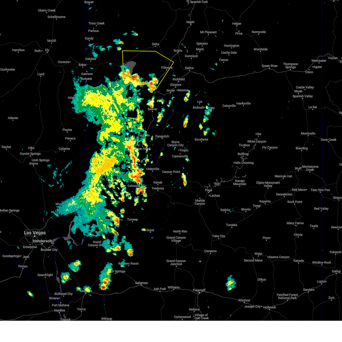 At 1151 am mdt, severe thunderstorms were located along a line extending from 39 miles northwest of cove fort to near kanosh, moving north at 30 mph (radar indicated). Hazards include 60 mph wind gusts and nickel size hail. expect damage to roofs, siding, and trees At 1151 am mdt, severe thunderstorms were located along a line extending from 39 miles northwest of cove fort to near kanosh, moving north at 30 mph (radar indicated). Hazards include 60 mph wind gusts and nickel size hail. expect damage to roofs, siding, and trees
|
| 7/16/2021 5:04 PM MDT |
 At 504 pm mdt, a severe thunderstorm was located 9 miles southwest of delta, moving northeast at 10 mph (radar indicated). Hazards include 70 mph wind gusts. Expect considerable tree damage. Damage is likely to mobile homes, roofs, and outbuildings. At 504 pm mdt, a severe thunderstorm was located 9 miles southwest of delta, moving northeast at 10 mph (radar indicated). Hazards include 70 mph wind gusts. Expect considerable tree damage. Damage is likely to mobile homes, roofs, and outbuildings.
|
| 5/30/2020 3:45 PM MDT |
 At 345 pm mdt, a severe thunderstorm was located 8 miles north of fillmore, moving north at 30 mph (radar indicated). Hazards include 60 mph wind gusts. Expect damage to roofs, siding, and trees. locations impacted include, fillmore, scipio, holden, flowell, greenwood and mc cornick. this includes the following highways, interstate 15 between mile markers 162 and 190. Us route 50 between mile markers 99 and 135. At 345 pm mdt, a severe thunderstorm was located 8 miles north of fillmore, moving north at 30 mph (radar indicated). Hazards include 60 mph wind gusts. Expect damage to roofs, siding, and trees. locations impacted include, fillmore, scipio, holden, flowell, greenwood and mc cornick. this includes the following highways, interstate 15 between mile markers 162 and 190. Us route 50 between mile markers 99 and 135.
|
| 5/30/2020 3:35 PM MDT |
 At 334 pm mdt, a severe thunderstorm was located over fillmore, moving north at 30 mph (radar indicated). Hazards include 60 mph wind gusts. expect damage to roofs, siding, and trees At 334 pm mdt, a severe thunderstorm was located over fillmore, moving north at 30 mph (radar indicated). Hazards include 60 mph wind gusts. expect damage to roofs, siding, and trees
|
Hail Maps for Holden, UT
Connect with Interactive Hail Maps