

Hail Map for Hornitos, CA
The Hornitos, CA area has had 0 reports of on-the-ground hail by trained spotters, and has been under severe weather warnings 0 times during the past 12 months. Doppler radar has detected hail at or near Hornitos, CA on 1 occasion.
| Name: | Hornitos, CA |
| Where Located: | 58.3 miles NNW of Fresno, CA |
| Map: | Google Map for Hornitos, CA |
| Population: | 75 |
| Housing Units: | 43 |
| More Info: | Search Google for Hornitos, CA |
0
The Top Recent Hail Date for Hornitos, CA is Thursday, March 22, 2018 (1st out of 1)

Hail and Wind Damage Spotted near Hornitos, CA
| Date / Time | Report Details |
|---|---|
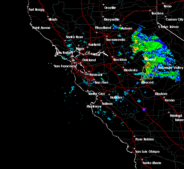
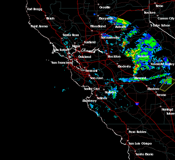
| 3/27/2019 5:36 PM PDT |
 The severe thunderstorm warning for southwestern mariposa and northeastern merced counties will expire at 545 pm pdt, the storm which prompted the warning has weakened below severe limits, and no longer poses an immediate threat to life or property. therefore, the warning will be allowed to expire. The severe thunderstorm warning for southwestern mariposa and northeastern merced counties will expire at 545 pm pdt, the storm which prompted the warning has weakened below severe limits, and no longer poses an immediate threat to life or property. therefore, the warning will be allowed to expire.
|
| 3/27/2019 5:08 PM PDT |
 At 507 pm pdt, a severe thunderstorm was located 13 miles northeast of merced, moving east at 15 mph (radar indicated). Hazards include quarter size hail. damage to vehicles is expected At 507 pm pdt, a severe thunderstorm was located 13 miles northeast of merced, moving east at 15 mph (radar indicated). Hazards include quarter size hail. damage to vehicles is expected
|
| 3/27/2019 4:05 PM PDT |
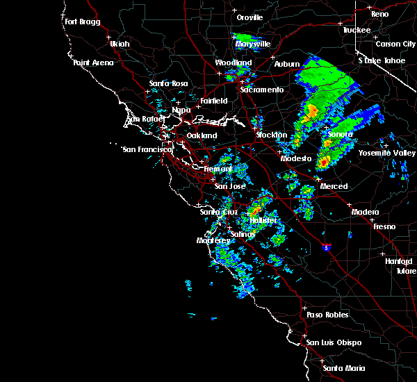 At 404 pm pdt, a severe thunderstorm was located 8 miles southeast of la grange, or 17 miles northeast of atwater, moving northeast at 20 mph (radar indicated). Hazards include quarter size hail. damage to vehicles is expected At 404 pm pdt, a severe thunderstorm was located 8 miles southeast of la grange, or 17 miles northeast of atwater, moving northeast at 20 mph (radar indicated). Hazards include quarter size hail. damage to vehicles is expected
|
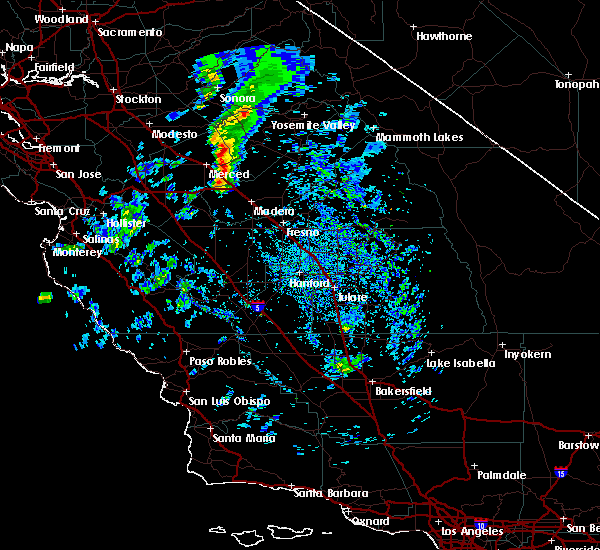
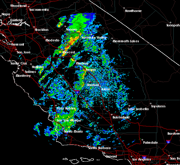
| 3/6/2019 3:32 PM PST |
 At 330 pm pst, a line of strong thunderstorms, a few at severe levels, extended from northwestern mariposa county into eastern merced county just east of merced. the line was moving east at about 25 mph (radar indicated). Hazards include 60 mph wind gusts and quarter size hail along with very heavy rain and possible flooding. any of these storms could spawn a funnel cloud. Hail damage to vehicles is expected. Expect wind damage to roofs, siding, and trees. At 330 pm pst, a line of strong thunderstorms, a few at severe levels, extended from northwestern mariposa county into eastern merced county just east of merced. the line was moving east at about 25 mph (radar indicated). Hazards include 60 mph wind gusts and quarter size hail along with very heavy rain and possible flooding. any of these storms could spawn a funnel cloud. Hail damage to vehicles is expected. Expect wind damage to roofs, siding, and trees.
|
| 3/6/2019 3:02 PM PST |
 At 301 pm pst, a severe thunderstorm was located 10 miles south of la grange, or 14 miles northeast of atwater, moving northeast at 15 mph (radar indicated). Hazards include 60 mph wind gusts and quarter size hail along with very heavy rain and possible flooding. this storm could spawn a funnel cloud. Hail damage to vehicles is expected. Expect wind damage to roofs, siding, and trees. At 301 pm pst, a severe thunderstorm was located 10 miles south of la grange, or 14 miles northeast of atwater, moving northeast at 15 mph (radar indicated). Hazards include 60 mph wind gusts and quarter size hail along with very heavy rain and possible flooding. this storm could spawn a funnel cloud. Hail damage to vehicles is expected. Expect wind damage to roofs, siding, and trees.
|
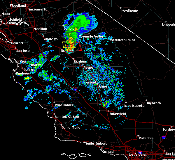
| 3/22/2018 2:37 PM PDT |
 The severe thunderstorm warning for southwestern mariposa and northeastern merced counties will expire at 245 pm pdt, the storm which prompted the warning has weakened below severe limits, and no longer poses an immediate threat to life or property. therefore the warning will be allowed to expire. however heavy rain is still possible with this thunderstorm. The severe thunderstorm warning for southwestern mariposa and northeastern merced counties will expire at 245 pm pdt, the storm which prompted the warning has weakened below severe limits, and no longer poses an immediate threat to life or property. therefore the warning will be allowed to expire. however heavy rain is still possible with this thunderstorm.
|
| 3/22/2018 2:32 PM PDT |
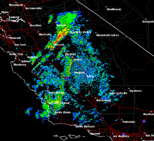 At 231 pm pdt, a severe thunderstorm was located 15 miles southeast of la grange, or 22 miles northeast of merced, moving northeast at 25 mph (radar indicated). Hazards include 60 mph wind gusts and quarter size hail. Hail damage to vehicles is expected. expect wind damage to roofs, siding, and trees. This severe thunderstorm will remain over mainly rural areas of southwestern mariposa and northeastern merced counties. At 231 pm pdt, a severe thunderstorm was located 15 miles southeast of la grange, or 22 miles northeast of merced, moving northeast at 25 mph (radar indicated). Hazards include 60 mph wind gusts and quarter size hail. Hail damage to vehicles is expected. expect wind damage to roofs, siding, and trees. This severe thunderstorm will remain over mainly rural areas of southwestern mariposa and northeastern merced counties.
|
| 3/22/2018 2:12 PM PDT |
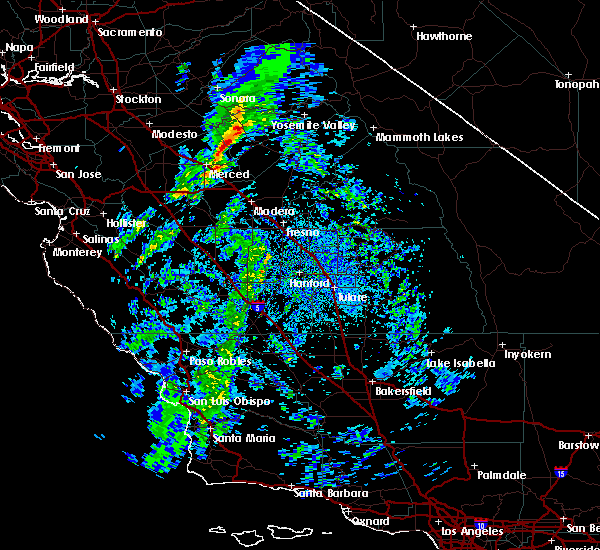 At 211 pm pdt, a severe thunderstorm was located 14 miles northeast of merced, moving northeast at 25 mph (radar indicated). Hazards include 60 mph wind gusts and quarter size hail. Hail damage to vehicles is expected. expect wind damage to roofs, siding, and trees. This severe thunderstorm will remain over mainly rural areas of southwestern mariposa and northeastern merced counties. At 211 pm pdt, a severe thunderstorm was located 14 miles northeast of merced, moving northeast at 25 mph (radar indicated). Hazards include 60 mph wind gusts and quarter size hail. Hail damage to vehicles is expected. expect wind damage to roofs, siding, and trees. This severe thunderstorm will remain over mainly rural areas of southwestern mariposa and northeastern merced counties.
|
Hail Maps for Hornitos, CA
Connect with Interactive Hail Maps