

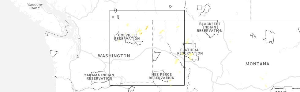
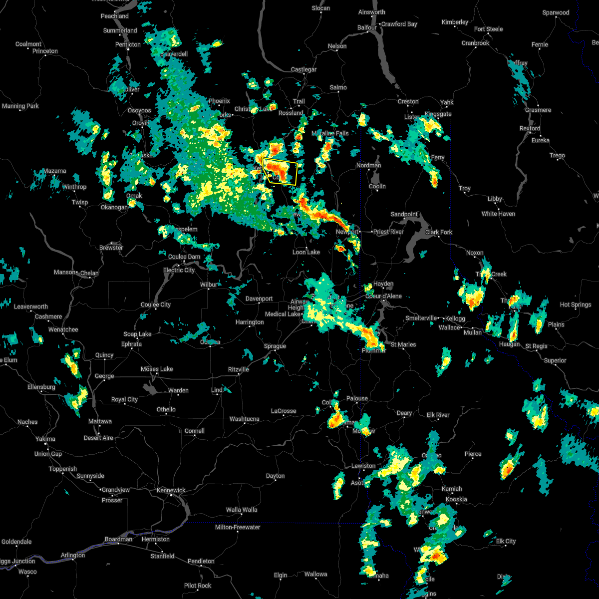
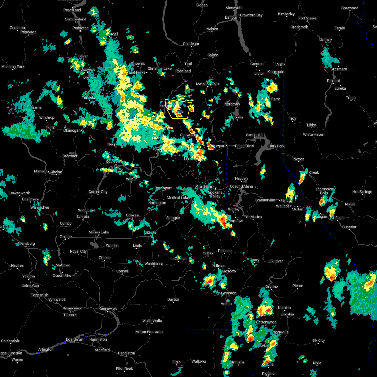
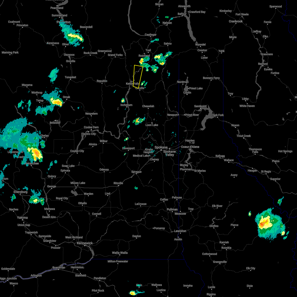
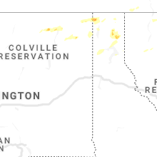
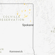
Hail Map for Kettle Falls, WA
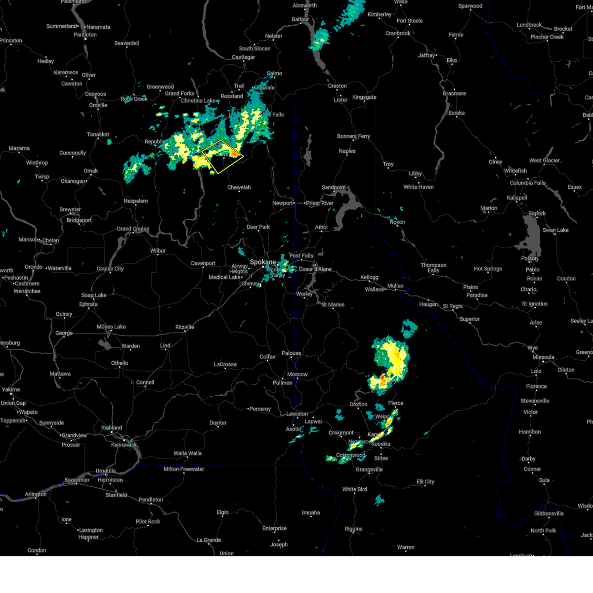
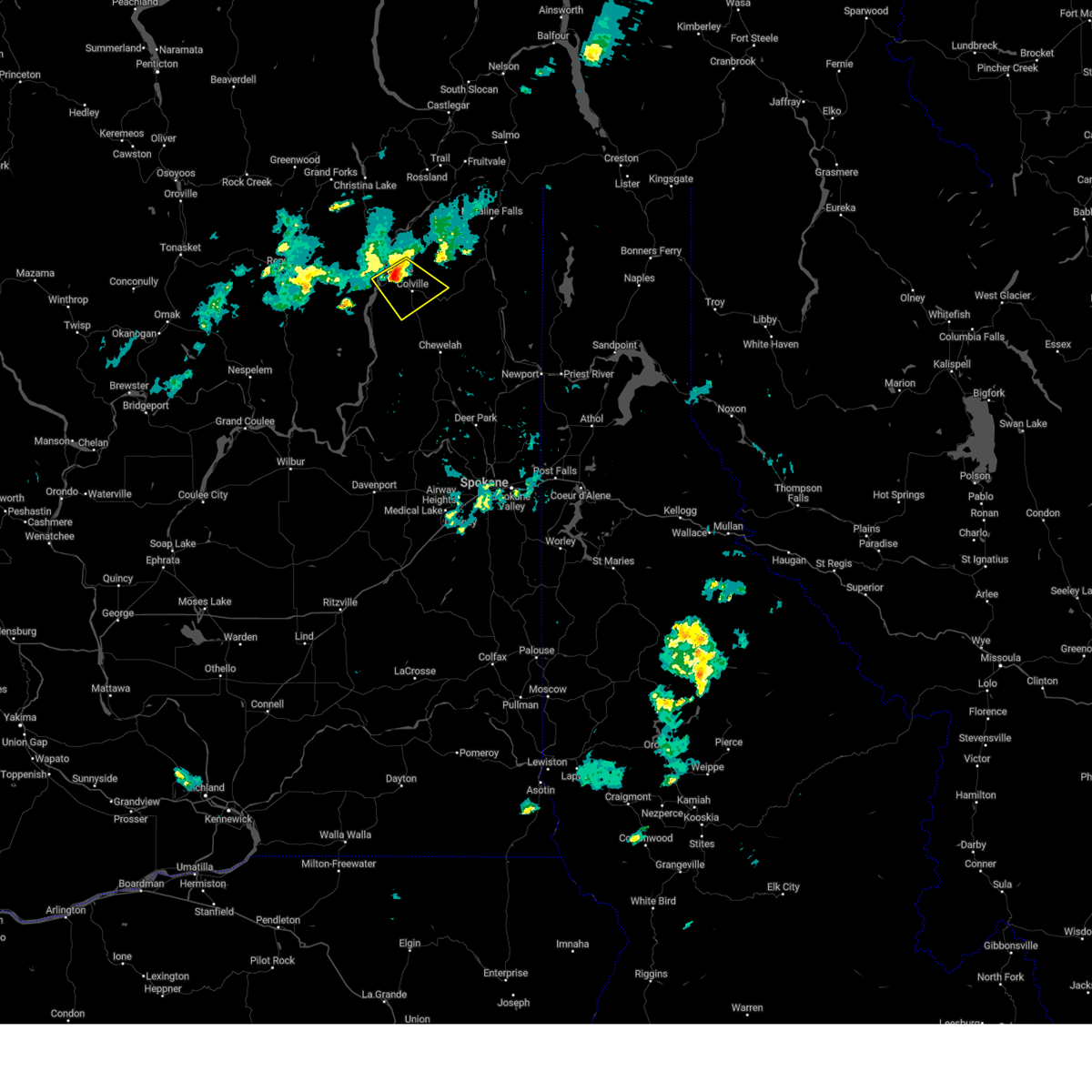
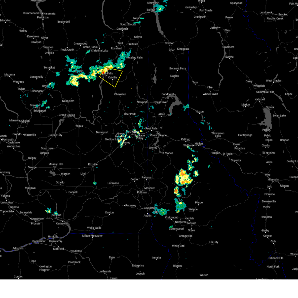
The Kettle Falls, WA area has had 5 reports of on-the-ground hail by trained spotters, and has been under severe weather warnings 3 times during the past 12 months. Doppler radar has detected hail at or near Kettle Falls, WA on 6 occasions, including 1 occasion during the past year.
| Name: | Kettle Falls, WA |
| Where Located: | 68.5 miles E of Omak, WA |
| Map: | Google Map for Kettle Falls, WA |
| Population: | 1595 |
| Housing Units: | 726 |
| More Info: | Search Google for Kettle Falls, WA |
0
The Top Recent Hail Date for Kettle Falls, WA is Sunday, May 21, 2023 (6th out of 6)
Hail and Wind Damage Spotted near Kettle Falls, WA
| Date / Time | Report Details |
|---|---|
| 9/3/2023 6:58 PM PDT |
 The severe thunderstorm warning for central stevens and east central ferry counties will expire at 700 pm pdt, the storm which prompted the warning has weakened below severe limits, and no longer poses an immediate threat to life or property. for this reason, the warning will be allowed to expire. however, small hail, gusty winds and heavy rain are still possible with this thunderstorm as it continues to move eastward across northeast washington. frequent lightning will continue to be a threat as well. The severe thunderstorm warning for central stevens and east central ferry counties will expire at 700 pm pdt, the storm which prompted the warning has weakened below severe limits, and no longer poses an immediate threat to life or property. for this reason, the warning will be allowed to expire. however, small hail, gusty winds and heavy rain are still possible with this thunderstorm as it continues to move eastward across northeast washington. frequent lightning will continue to be a threat as well.
|
| 9/3/2023 6:45 PM PDT | Thunderstorm damage. power outage via local power compan in ferry county WA, 9.6 miles SE of Kettle Falls, WA |
| 9/3/2023 6:24 PM PDT |
 At 623 pm pdt, a severe thunderstorm was located near colville, or 55 miles northwest of priest river, moving southeast at 10 mph. this storm is likely producing heavy downpouring rain (radar indicated). Hazards include 60 mph wind gusts and quarter size hail. Hail damage to vehicles is expected. Expect wind damage to roofs, siding, and trees. At 623 pm pdt, a severe thunderstorm was located near colville, or 55 miles northwest of priest river, moving southeast at 10 mph. this storm is likely producing heavy downpouring rain (radar indicated). Hazards include 60 mph wind gusts and quarter size hail. Hail damage to vehicles is expected. Expect wind damage to roofs, siding, and trees.
|
| 9/3/2023 6:03 PM PDT |
 At 602 pm pdt, a severe thunderstorm was located 9 miles northwest of colville, or 61 miles northwest of priest river, moving southeast at 15 mph (radar indicated). Hazards include 60 mph wind gusts and quarter size hail. Hail damage to vehicles is expected. expect wind damage to roofs, siding, and trees. Gusty conditions on area lakes. At 602 pm pdt, a severe thunderstorm was located 9 miles northwest of colville, or 61 miles northwest of priest river, moving southeast at 15 mph (radar indicated). Hazards include 60 mph wind gusts and quarter size hail. Hail damage to vehicles is expected. expect wind damage to roofs, siding, and trees. Gusty conditions on area lakes.
|
| 7/3/2022 2:27 PM PDT |
 At 226 pm pdt, a severe thunderstorm was located just north of colville, moving north at 10 mph (radar indicated). Hazards include 60 mph wind gusts and quarter size hail. Hail damage to vehicles is expected. expect wind damage to roofs, siding, and trees. locations impacted include, colville, kettle falls, marcus and evans. hail threat, radar indicated max hail size, 1. 00 in wind threat, radar indicated max wind gust, 60 mph. At 226 pm pdt, a severe thunderstorm was located just north of colville, moving north at 10 mph (radar indicated). Hazards include 60 mph wind gusts and quarter size hail. Hail damage to vehicles is expected. expect wind damage to roofs, siding, and trees. locations impacted include, colville, kettle falls, marcus and evans. hail threat, radar indicated max hail size, 1. 00 in wind threat, radar indicated max wind gust, 60 mph.
|
| 7/3/2022 2:03 PM PDT |
 At 202 pm pdt, a severe thunderstorm was located over colville, or 51 miles northwest of priest river, moving north at 5 mph (radar indicated). Hazards include 60 mph wind gusts and half dollar size hail. Hail damage to vehicles is expected. Expect wind damage to roofs, siding, and trees. At 202 pm pdt, a severe thunderstorm was located over colville, or 51 miles northwest of priest river, moving north at 5 mph (radar indicated). Hazards include 60 mph wind gusts and half dollar size hail. Hail damage to vehicles is expected. Expect wind damage to roofs, siding, and trees.
|
| 8/4/2021 5:34 AM PDT | Avista utilities reports power outages to approximately 700 customers near orient... w in stevens county WA, 18.7 miles SSE of Kettle Falls, WA |
| 6/13/2021 8:12 PM PDT |
 The severe thunderstorm warning for north central stevens county will expire at 815 pm pdt, the storm which prompted the warning has weakened below severe limits, and has exited the warned area. therefore, the warning will be allowed to expire. however small hail and gusty winds are still possible with this thunderstorm. The severe thunderstorm warning for north central stevens county will expire at 815 pm pdt, the storm which prompted the warning has weakened below severe limits, and has exited the warned area. therefore, the warning will be allowed to expire. however small hail and gusty winds are still possible with this thunderstorm.
|
| 6/13/2021 7:59 PM PDT |
 At 758 pm pdt, a severe thunderstorm was located 11 miles north of colville, or 60 miles northwest of priest river, moving north at 60 mph (radar indicated). Hazards include 60 mph wind gusts and quarter size hail. Hail damage to vehicles is expected. expect wind damage to roofs, siding, and trees. Locations impacted include, kettle falls, marble and evans. At 758 pm pdt, a severe thunderstorm was located 11 miles north of colville, or 60 miles northwest of priest river, moving north at 60 mph (radar indicated). Hazards include 60 mph wind gusts and quarter size hail. Hail damage to vehicles is expected. expect wind damage to roofs, siding, and trees. Locations impacted include, kettle falls, marble and evans.
|
| 6/13/2021 7:45 PM PDT |
 At 744 pm pdt, a severe thunderstorm was located near colville, or 54 miles northwest of priest river, moving north at 60 mph (radar indicated). Hazards include quarter size hail. damage to vehicles is expected At 744 pm pdt, a severe thunderstorm was located near colville, or 54 miles northwest of priest river, moving north at 60 mph (radar indicated). Hazards include quarter size hail. damage to vehicles is expected
|
| 6/24/2020 1:56 PM PDT |
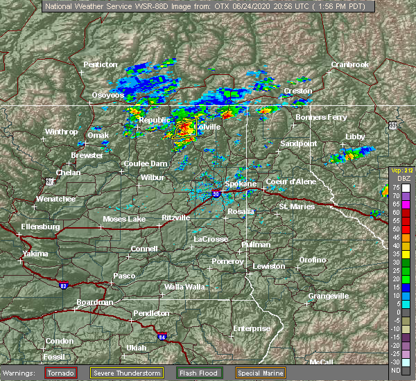 At 155 pm pdt, a severe thunderstorm was located 10 miles northwest of colville, or 60 miles northwest of priest river, moving east at 15 mph (radar indicated). Hazards include ping pong ball size hail and 60 mph wind gusts. People and animals outdoors will be injured. expect hail damage to roofs, siding, windows, and vehicles. expect wind damage to roofs, siding, and trees. Locations impacted include, colville, kettle falls, marcus and evans. At 155 pm pdt, a severe thunderstorm was located 10 miles northwest of colville, or 60 miles northwest of priest river, moving east at 15 mph (radar indicated). Hazards include ping pong ball size hail and 60 mph wind gusts. People and animals outdoors will be injured. expect hail damage to roofs, siding, windows, and vehicles. expect wind damage to roofs, siding, and trees. Locations impacted include, colville, kettle falls, marcus and evans.
|
| 6/24/2020 1:55 PM PDT | Ping Pong Ball sized hail reported 3.9 miles S of Kettle Falls, WA |
| 6/24/2020 1:45 PM PDT |
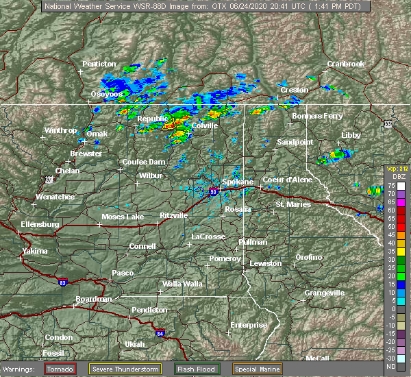 At 144 pm pdt, a severe thunderstorms were located over lake roosevelt around marcus and evens or 12 miles northwest of colville, moving east at 15 mph (radar indicated). Hazards include ping pong ball size hail and 60 mph wind gusts. People and animals outdoors will be injured. expect hail damage to roofs, siding, windows, and vehicles. Expect wind damage to roofs, siding, and trees. At 144 pm pdt, a severe thunderstorms were located over lake roosevelt around marcus and evens or 12 miles northwest of colville, moving east at 15 mph (radar indicated). Hazards include ping pong ball size hail and 60 mph wind gusts. People and animals outdoors will be injured. expect hail damage to roofs, siding, windows, and vehicles. Expect wind damage to roofs, siding, and trees.
|
| 6/24/2020 1:40 PM PDT | Ping Pong Ball sized hail reported 4.1 miles SE of Kettle Falls, WA, report from blue moose lodging along highway 395 on the west shore of lake roosevelt. |
| 5/30/2015 7:10 PM PDT | Quarter sized hail reported 18.4 miles SSW of Kettle Falls, WA, also reported heavy rain... gusty winds... and one quarter mile visibility. |
| 5/29/2015 3:52 PM PDT | At 350 pm pdt, doppler radar indicated a severe thunderstorm capable of producing quarter size hail. this storm was located 13 miles northwest of colville, or 64 miles northwest of priest river, moving east at 15 mph. locations impacted include, kettle falls, marcus, boyds and evans. |
| 5/29/2015 3:33 PM PDT | At 332 pm pdt, doppler radar indicated a severe thunderstorm capable of producing quarter size hail. this storm was located 13 miles east of sherman pass, or 63 miles east of omak, and moving east at 15 mph. |
| 7/23/2014 3:30 PM PDT | Ping Pong Ball sized hail reported 2.3 miles WNW of Kettle Falls, WA, hail left dents on metal roof of shop building. resident of 72 years says its the worst storm he has ever seen. also said a car on highway 395 had all of its windows br |
| 7/8/2013 2:00 PM PDT | Half Dollar sized hail reported 8 miles S of Kettle Falls, WA, mostly pea-sized hail or 1/4 inch hail. a few 1.25 inch hailstones. |
Hail Maps for Kettle Falls, WA


Connect with Interactive Hail Maps