

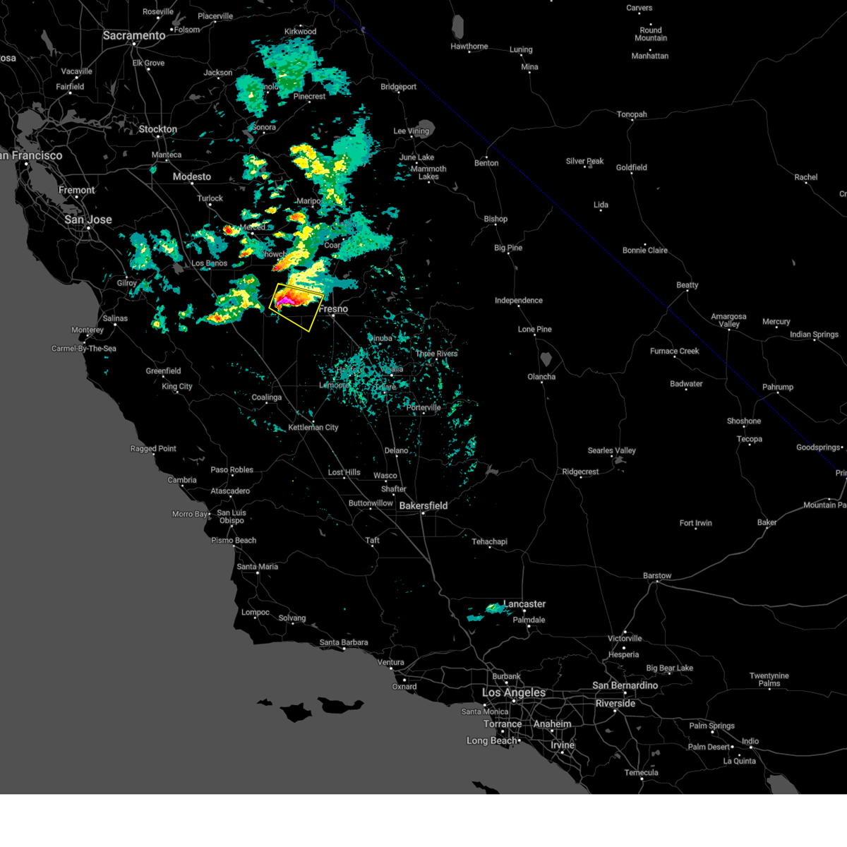
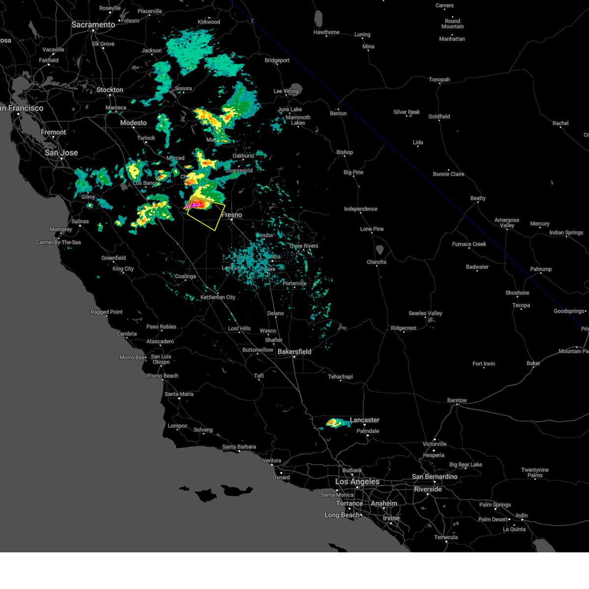
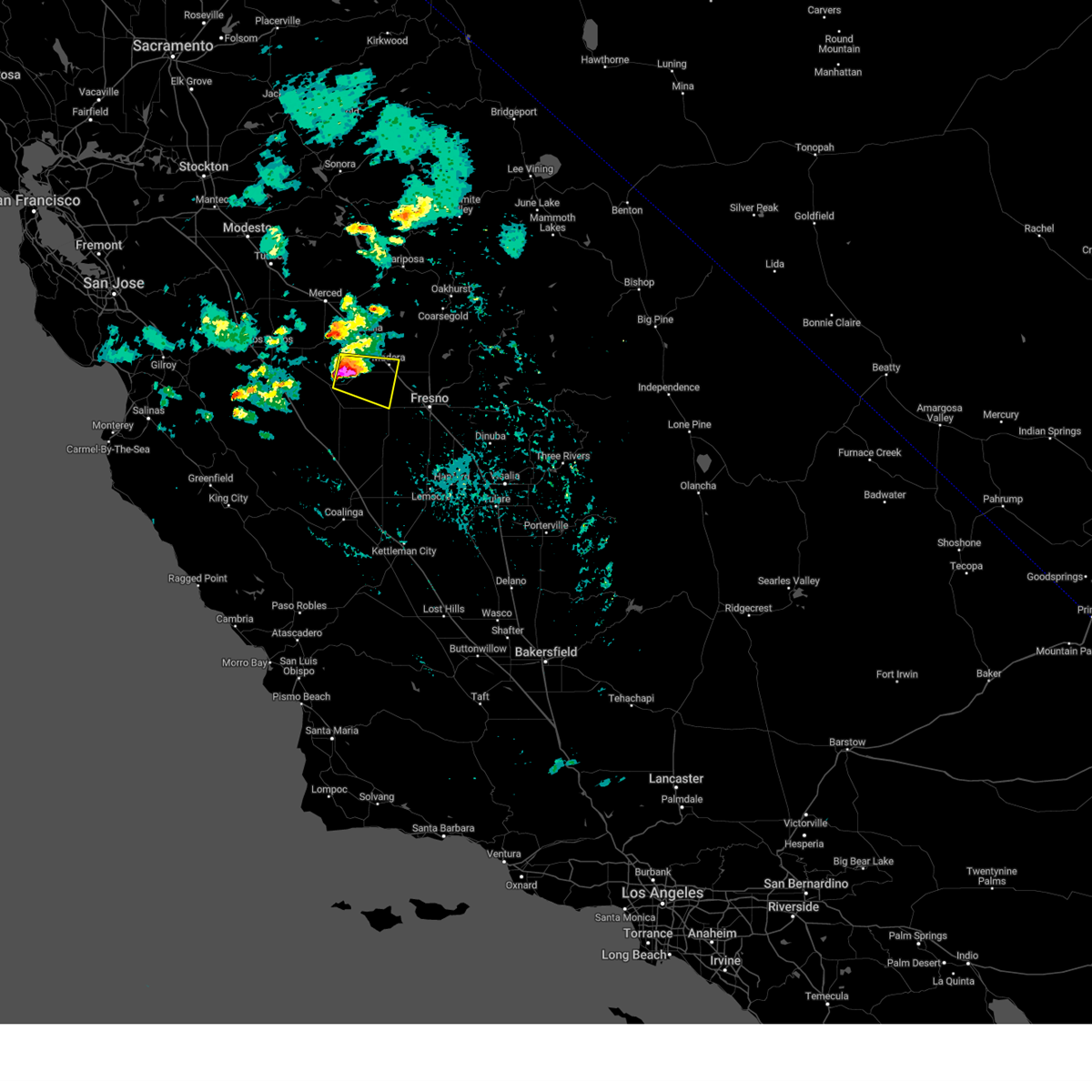
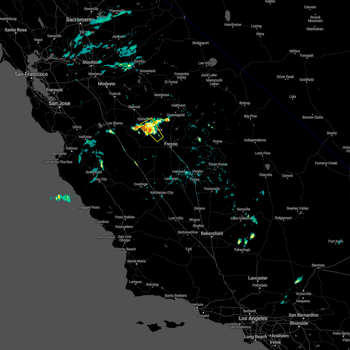
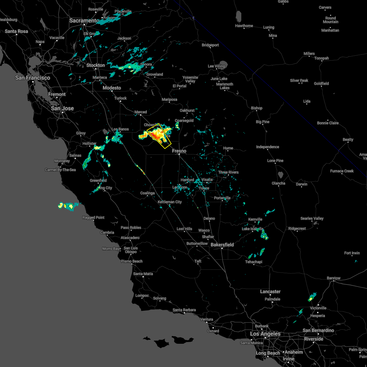
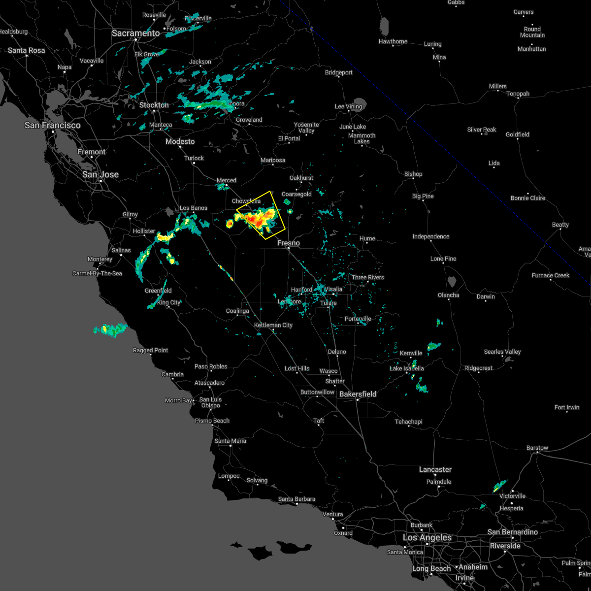
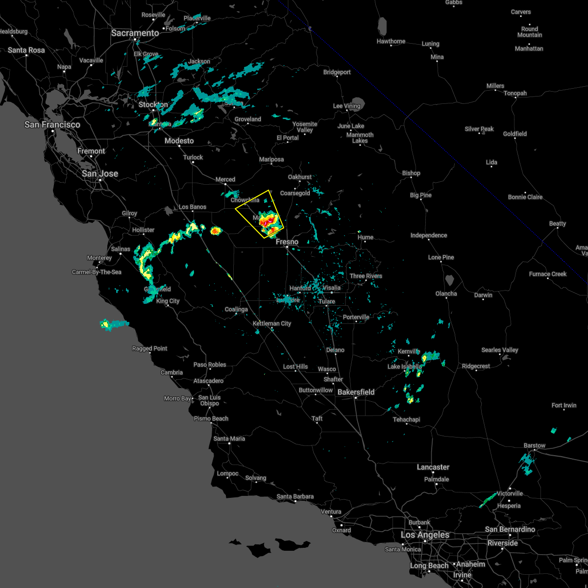
Hail Map for La Vina, CA
The La Vina, CA area has had 0 reports of on-the-ground hail by trained spotters, and has been under severe weather warnings 0 times during the past 12 months. Doppler radar has detected hail at or near La Vina, CA on 1 occasion.
| Name: | La Vina, CA |
| Where Located: | 20.6 miles WNW of Fresno, CA |
| Map: | Google Map for La Vina, CA |
| Population: | 279 |
| Housing Units: | 67 |
| More Info: | Search Google for La Vina, CA |
5
The Top Recent Hail Date for La Vina, CA is Sunday, March 12, 2023 (1st out of 1)

Hail and Wind Damage Spotted near La Vina, CA
| Date / Time | Report Details |
|---|---|
| 3/12/2023 6:05 PM PDT |
 At 604 pm pdt, a severe thunderstorm was located near kerman, or 10 miles southwest of fresno, moving southeast at 15 mph (radar indicated). Hazards include half dollar size hail. Damage to vehicles is expected. Locations impacted include, fresno, kerman, raisin city and biola. At 604 pm pdt, a severe thunderstorm was located near kerman, or 10 miles southwest of fresno, moving southeast at 15 mph (radar indicated). Hazards include half dollar size hail. Damage to vehicles is expected. Locations impacted include, fresno, kerman, raisin city and biola.
|
| 3/12/2023 5:28 PM PDT |
 At 528 pm pdt, a severe thunderstorm was located near kerman, or 12 miles south of madera, moving southeast at 20 mph (radar indicated). Hazards include half dollar size hail. damage to vehicles is expected At 528 pm pdt, a severe thunderstorm was located near kerman, or 12 miles south of madera, moving southeast at 20 mph (radar indicated). Hazards include half dollar size hail. damage to vehicles is expected
|
| 3/12/2023 5:15 PM PDT |
 At 458 pm pdt, a severe thunderstorm was located 10 miles southwest of madera, moving east at 20 mph (radar indicated). Hazards include half dollar size hail. damage to vehicles is expected At 458 pm pdt, a severe thunderstorm was located 10 miles southwest of madera, moving east at 20 mph (radar indicated). Hazards include half dollar size hail. damage to vehicles is expected
|
| 3/12/2023 4:58 PM PDT |
 At 458 pm pdt, a severe thunderstorm was located 10 miles southwest of madera, moving east at 20 mph (radar indicated). Hazards include half dollar size hail. damage to vehicles is expected At 458 pm pdt, a severe thunderstorm was located 10 miles southwest of madera, moving east at 20 mph (radar indicated). Hazards include half dollar size hail. damage to vehicles is expected
|
| 3/12/2023 4:48 PM PDT |
 At 448 pm pdt, a severe thunderstorm was located 9 miles east of firebaugh, or 12 miles southwest of madera, moving southeast at 20 mph (radar indicated). Hazards include 60 mph wind gusts and half dollar size hail. Hail damage to vehicles is expected. expect wind damage to roofs, siding, and trees. Locations impacted include, madera and parkwood. At 448 pm pdt, a severe thunderstorm was located 9 miles east of firebaugh, or 12 miles southwest of madera, moving southeast at 20 mph (radar indicated). Hazards include 60 mph wind gusts and half dollar size hail. Hail damage to vehicles is expected. expect wind damage to roofs, siding, and trees. Locations impacted include, madera and parkwood.
|
| 3/12/2023 4:35 PM PDT |
 At 434 pm pdt, a severe thunderstorm was located 8 miles northeast of firebaugh, or 13 miles west of madera, moving east at 20 mph (radar indicated). Hazards include 60 mph wind gusts and half dollar size hail. Hail damage to vehicles is expected. Expect wind damage to roofs, siding, and trees. At 434 pm pdt, a severe thunderstorm was located 8 miles northeast of firebaugh, or 13 miles west of madera, moving east at 20 mph (radar indicated). Hazards include 60 mph wind gusts and half dollar size hail. Hail damage to vehicles is expected. Expect wind damage to roofs, siding, and trees.
|
| 6/22/2022 11:06 PM PDT |
 The severe thunderstorm warning for southwestern madera and eastern merced counties will expire at 1115 pm pdt, the storm which prompted the warning has weakened below severe limits. therefore, the warning will be allowed to expire. The severe thunderstorm warning for southwestern madera and eastern merced counties will expire at 1115 pm pdt, the storm which prompted the warning has weakened below severe limits. therefore, the warning will be allowed to expire.
|
| 6/22/2022 10:59 PM PDT |
 At 1058 pm pdt, a severe thunderstorm was located near chowchilla, or 11 miles northwest of madera, moving northwest at 15 mph (radar indicated). Hazards include 60 mph wind gusts and quarter size hail. Hail damage to vehicles is expected. expect wind damage to roofs, siding, and trees. locations impacted include, madera, chowchilla, parkwood, parksdale and madera acres. hail threat, radar indicated max hail size, 1. 00 in wind threat, radar indicated max wind gust, 60 mph. At 1058 pm pdt, a severe thunderstorm was located near chowchilla, or 11 miles northwest of madera, moving northwest at 15 mph (radar indicated). Hazards include 60 mph wind gusts and quarter size hail. Hail damage to vehicles is expected. expect wind damage to roofs, siding, and trees. locations impacted include, madera, chowchilla, parkwood, parksdale and madera acres. hail threat, radar indicated max hail size, 1. 00 in wind threat, radar indicated max wind gust, 60 mph.
|
| 6/22/2022 10:47 PM PDT |
 At 1047 pm pdt, a severe thunderstorm was located near chowchilla, or 8 miles northwest of madera, moving northwest at 15 mph (radar indicated). Hazards include 60 mph wind gusts and quarter size hail. Hail damage to vehicles is expected. expect wind damage to roofs, siding, and trees. locations impacted include, madera, chowchilla, parkwood, parksdale, bonadelle ranchos-madera ranchos and madera acres. hail threat, radar indicated max hail size, 1. 00 in wind threat, radar indicated max wind gust, 60 mph. At 1047 pm pdt, a severe thunderstorm was located near chowchilla, or 8 miles northwest of madera, moving northwest at 15 mph (radar indicated). Hazards include 60 mph wind gusts and quarter size hail. Hail damage to vehicles is expected. expect wind damage to roofs, siding, and trees. locations impacted include, madera, chowchilla, parkwood, parksdale, bonadelle ranchos-madera ranchos and madera acres. hail threat, radar indicated max hail size, 1. 00 in wind threat, radar indicated max wind gust, 60 mph.
|
| 6/22/2022 10:29 PM PDT |
 At 1028 pm pdt, a severe thunderstorm was located over parksdale, or over madera, moving northwest at 10 mph (radar indicated). Hazards include 60 mph wind gusts and penny size hail. expect damage to roofs, siding, and trees At 1028 pm pdt, a severe thunderstorm was located over parksdale, or over madera, moving northwest at 10 mph (radar indicated). Hazards include 60 mph wind gusts and penny size hail. expect damage to roofs, siding, and trees
|
| 9/11/2017 6:42 PM PDT |
 At 641 pm pdt, a severe thunderstorm was located 9 miles southwest of parkwood, or 9 miles southwest of madera, moving northwest at 45 mph (radar indicated). Hazards include 60 mph wind gusts and quarter size hail. Hail damage to vehicles is expected. expect wind damage to roofs, siding, and trees. thunderstorms have had a history of producing very heavy rain and frequent cloud to ground lightning. Flooding is possible on roads and in poor drainage areas. At 641 pm pdt, a severe thunderstorm was located 9 miles southwest of parkwood, or 9 miles southwest of madera, moving northwest at 45 mph (radar indicated). Hazards include 60 mph wind gusts and quarter size hail. Hail damage to vehicles is expected. expect wind damage to roofs, siding, and trees. thunderstorms have had a history of producing very heavy rain and frequent cloud to ground lightning. Flooding is possible on roads and in poor drainage areas.
|
Hail Maps for La Vina, CA

Connect with Interactive Hail Maps