

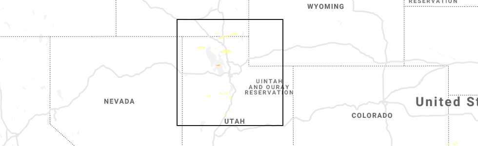
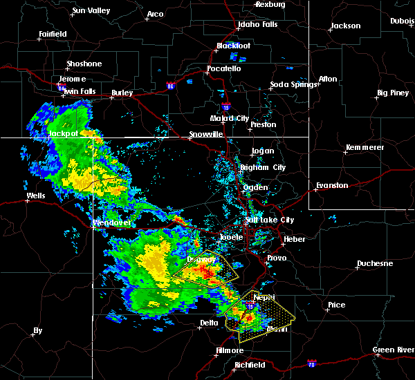
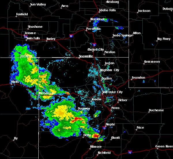
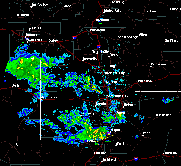
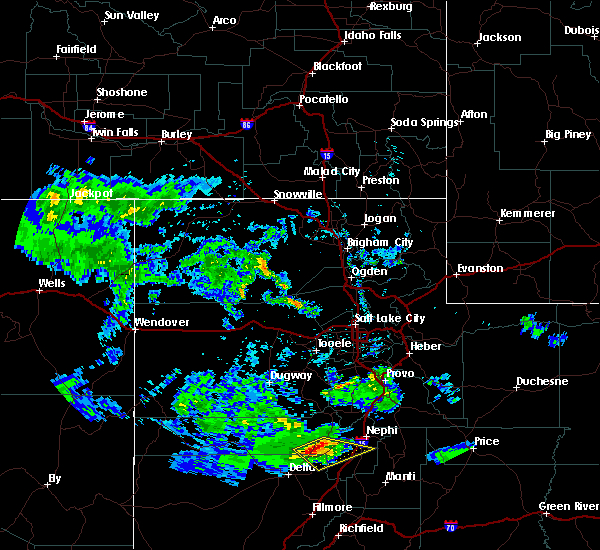
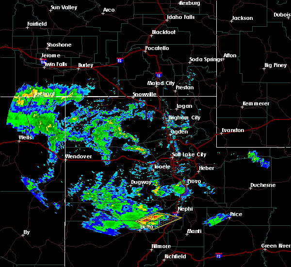
Hail Map for Levan, UT
The Levan, UT area has had 0 reports of on-the-ground hail by trained spotters, and has been under severe weather warnings 2 times during the past 12 months. Doppler radar has detected hail at or near Levan, UT on 3 occasions.
| Name: | Levan, UT |
| Where Located: | 56.1 miles W of Price, UT |
| Map: | Google Map for Levan, UT |
| Population: | 841 |
| Housing Units: | 322 |
| More Info: | Search Google for Levan, UT |
0
The Top Recent Hail Date for Levan, UT is Friday, April 26, 2019 (3rd out of 3)
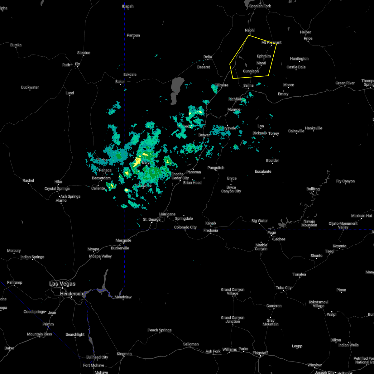
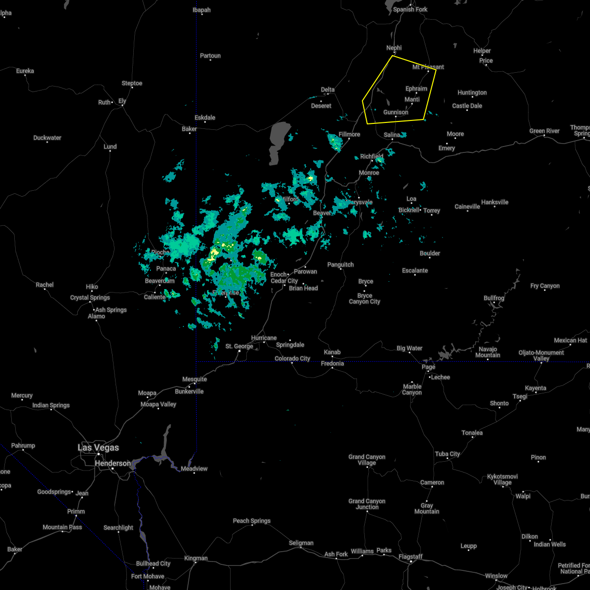
Hail and Wind Damage Spotted near Levan, UT
| Date / Time | Report Details |
|---|---|
| 8/2/2023 1:30 PM MDT |
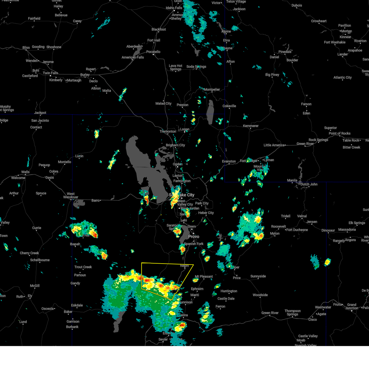 At 128 pm mdt, severe thunderstorms were located along a line extending from 12 miles north of delta to 11 miles northeast of scipio, moving northeast at 35 mph (radar indicated. at 110 pm a wind gust to 54 mph was reported at the delta airport). Hazards include 60 mph wind gusts and quarter size hail. Hail damage to vehicles is expected. expect wind damage to roofs, siding, and trees. locations impacted include, nephi, delta, scipio, levan, oak city, leamington, lynndyl, little sahara state park, jericho, sugarville, mills and yuba lake state park. this includes the following highways, interstate 15 between mile markers 188 and 229. us route 6 between mile markers 91 and 126. us route 50 near mile marker 93, and between mile markers 130 and 131. hail threat, radar indicated max hail size, 1. 00 in wind threat, radar indicated max wind gust, 60 mph. At 128 pm mdt, severe thunderstorms were located along a line extending from 12 miles north of delta to 11 miles northeast of scipio, moving northeast at 35 mph (radar indicated. at 110 pm a wind gust to 54 mph was reported at the delta airport). Hazards include 60 mph wind gusts and quarter size hail. Hail damage to vehicles is expected. expect wind damage to roofs, siding, and trees. locations impacted include, nephi, delta, scipio, levan, oak city, leamington, lynndyl, little sahara state park, jericho, sugarville, mills and yuba lake state park. this includes the following highways, interstate 15 between mile markers 188 and 229. us route 6 between mile markers 91 and 126. us route 50 near mile marker 93, and between mile markers 130 and 131. hail threat, radar indicated max hail size, 1. 00 in wind threat, radar indicated max wind gust, 60 mph.
|
| 8/2/2023 1:20 PM MDT | Mesonet station ut26 i-15 at sevier river n in juab county UT, 14.3 miles NE of Levan, UT |
| 8/2/2023 1:10 PM MDT |
 At 109 pm mdt, severe thunderstorms were located along a line extending from 7 miles north of delta to near scipio, moving northeast at 40 mph (radar indicated. at 1252 pm a wind gust to 61 mph was reported near delta). Hazards include 60 mph wind gusts and quarter size hail. Hail damage to vehicles is expected. Expect wind damage to roofs, siding, and trees. At 109 pm mdt, severe thunderstorms were located along a line extending from 7 miles north of delta to near scipio, moving northeast at 40 mph (radar indicated. at 1252 pm a wind gust to 61 mph was reported near delta). Hazards include 60 mph wind gusts and quarter size hail. Hail damage to vehicles is expected. Expect wind damage to roofs, siding, and trees.
|
| 4/16/2022 5:04 PM MDT |
 At 504 pm mdt, a severe thunderstorm was located near fayette, or 8 miles west of manti, moving east at 55 mph (radar indicated). Hazards include 60 mph wind gusts. Expect damage to roofs, siding, and trees. locations impacted include, manti, moroni, scipio, ephraim, gunnison, mount pleasant, wales, fayette, centerfield, fountain green, spring city, levan, mayfield, sterling and yuba lake state park. this includes the following highways, interstate 15 between mile markers 184 and 217, and between mile markers 221 and 222. us route 50 between mile markers 130 and 141. us route 89 between mile markers 239 and 280. hail threat, radar indicated max hail size, <. 75 in wind threat, radar indicated max wind gust, 60 mph. At 504 pm mdt, a severe thunderstorm was located near fayette, or 8 miles west of manti, moving east at 55 mph (radar indicated). Hazards include 60 mph wind gusts. Expect damage to roofs, siding, and trees. locations impacted include, manti, moroni, scipio, ephraim, gunnison, mount pleasant, wales, fayette, centerfield, fountain green, spring city, levan, mayfield, sterling and yuba lake state park. this includes the following highways, interstate 15 between mile markers 184 and 217, and between mile markers 221 and 222. us route 50 between mile markers 130 and 141. us route 89 between mile markers 239 and 280. hail threat, radar indicated max hail size, <. 75 in wind threat, radar indicated max wind gust, 60 mph.
|
| 4/16/2022 4:50 PM MDT |
 At 449 pm mdt, a severe thunderstorm was located near scipio, moving east at 55 mph (radar indicated). Hazards include 60 mph wind gusts. expect damage to roofs, siding, and trees At 449 pm mdt, a severe thunderstorm was located near scipio, moving east at 55 mph (radar indicated). Hazards include 60 mph wind gusts. expect damage to roofs, siding, and trees
|
| 8/8/2019 5:48 PM MDT |
 At 548 pm mdt, a severe thunderstorm was located 11 miles south of nephi, moving northeast at 35 mph (radar indicated). Hazards include 60 mph wind gusts. Expect damage to roofs, siding, and trees. Locations impacted include, nephi, moroni, ephraim, mount pleasant, wales, mona, fairview, fountain green, spring city, levan and mills. At 548 pm mdt, a severe thunderstorm was located 11 miles south of nephi, moving northeast at 35 mph (radar indicated). Hazards include 60 mph wind gusts. Expect damage to roofs, siding, and trees. Locations impacted include, nephi, moroni, ephraim, mount pleasant, wales, mona, fairview, fountain green, spring city, levan and mills.
|
| 8/8/2019 5:28 PM MDT |
 At 527 pm mdt, a severe thunderstorm was located 13 miles north of scipio, moving northeast at 35 mph (radar indicated). Hazards include 60 mph wind gusts. expect damage to roofs, siding, and trees At 527 pm mdt, a severe thunderstorm was located 13 miles north of scipio, moving northeast at 35 mph (radar indicated). Hazards include 60 mph wind gusts. expect damage to roofs, siding, and trees
|
| 6/13/2019 5:40 PM MDT | Sevier river bridge on i-1 in juab county UT, 15.2 miles NE of Levan, UT |
| 6/30/2015 9:54 PM MDT |
 The severe thunderstorm warning for northeastern millard and southeastern juab counties will expire at 1000 pm mdt, the line of storms which prompted the warning have weakened below severe limits, and exited the warned area. therefore the warning will be allowed to expire. The severe thunderstorm warning for northeastern millard and southeastern juab counties will expire at 1000 pm mdt, the line of storms which prompted the warning have weakened below severe limits, and exited the warned area. therefore the warning will be allowed to expire.
|
| 6/30/2015 9:30 PM MDT |
 At 930 pm mdt, doppler radar indicated a line of severe thunderstorms capable of producing quarter size hail and damaging winds in excess of 60 mph. these storms were located along a line extending from 17 miles west of nephi to 17 miles northeast of delta, moving east northeast at 15 mph. locations impacted include, levan, leamington, lynndyl and mills. At 930 pm mdt, doppler radar indicated a line of severe thunderstorms capable of producing quarter size hail and damaging winds in excess of 60 mph. these storms were located along a line extending from 17 miles west of nephi to 17 miles northeast of delta, moving east northeast at 15 mph. locations impacted include, levan, leamington, lynndyl and mills.
|
| 6/30/2015 9:02 PM MDT |
 At 902 pm mdt, doppler radar indicated a line of severe thunderstorms capable of producing quarter size hail and damaging winds in excess of 60 mph. these storms were located along a line extending from 20 miles west of nephi to 12 miles northeast of delta, and moving east at 15 mph. At 902 pm mdt, doppler radar indicated a line of severe thunderstorms capable of producing quarter size hail and damaging winds in excess of 60 mph. these storms were located along a line extending from 20 miles west of nephi to 12 miles northeast of delta, and moving east at 15 mph.
|
Hail Maps for Levan, UT


Connect with Interactive Hail Maps