

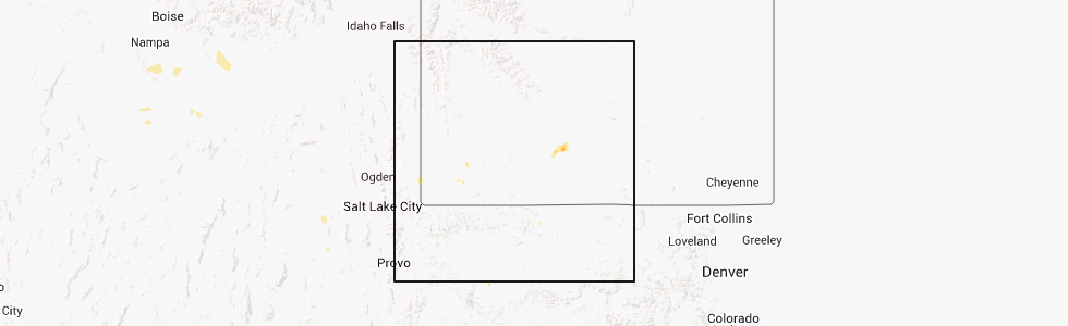
Hail Map for Little America, WY
The Little America, WY area has had 0 reports of on-the-ground hail by trained spotters, and has been under severe weather warnings 3 times during the past 12 months. Doppler radar has detected hail at or near Little America, WY on 1 occasion.
| Name: | Little America, WY |
| Where Located: | 32.8 miles W of Rock Springs, WY |
| Map: | Google Map for Little America, WY |
| Population: | 68 |
| Housing Units: | 42 |
| More Info: | Search Google for Little America, WY |
0
The Top Recent Hail Date for Little America, WY is Thursday, September 12, 2013 (1st out of 1)
Hail and Wind Damage Spotted near Little America, WY
| Date / Time | Report Details |
|---|---|
| 5/26/2023 1:27 PM MDT |
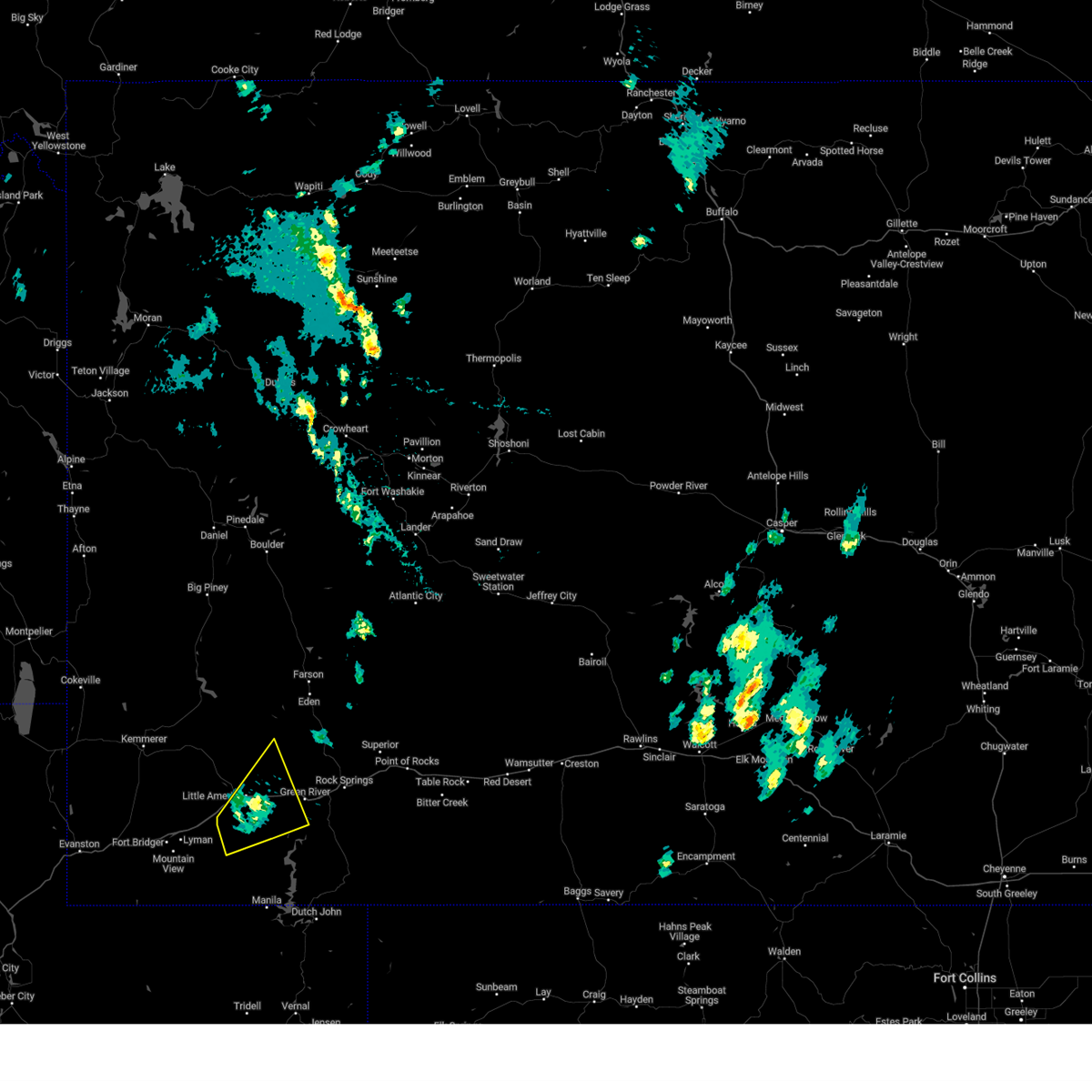 The severe thunderstorm warning for west central sweetwater county will expire at 130 pm mdt, the storm which prompted the warning has weakened below severe limits, and no longer poses an immediate threat to life or property. therefore, the warning will be allowed to expire. The severe thunderstorm warning for west central sweetwater county will expire at 130 pm mdt, the storm which prompted the warning has weakened below severe limits, and no longer poses an immediate threat to life or property. therefore, the warning will be allowed to expire.
|
| 5/26/2023 1:03 PM MDT |
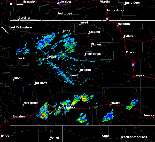
 At 103 pm mdt, a severe thunderstorm was located near little america, or 10 miles east of granger, moving northeast at 35 mph (radar indicated). Hazards include quarter size hail. Damage to vehicles is expected. locations impacted include, southwestern green river, little america and flaming gorge national recreation area. this includes interstate 80 between mile markers 63 and 86. hail threat, radar indicated max hail size, 1. 00 in wind threat, radar indicated max wind gust, <50 mph. At 103 pm mdt, a severe thunderstorm was located near little america, or 10 miles east of granger, moving northeast at 35 mph (radar indicated). Hazards include quarter size hail. Damage to vehicles is expected. locations impacted include, southwestern green river, little america and flaming gorge national recreation area. this includes interstate 80 between mile markers 63 and 86. hail threat, radar indicated max hail size, 1. 00 in wind threat, radar indicated max wind gust, <50 mph.
|
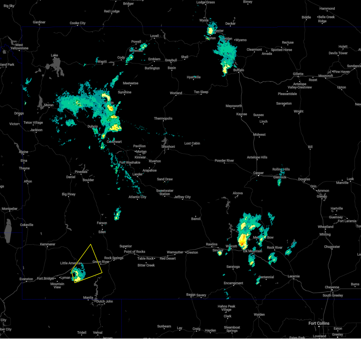
| 5/26/2023 12:28 PM MDT |
 At 1228 pm mdt, a severe thunderstorm was located 14 miles east of lyman, or 16 miles south of granger, moving northeast at 25 mph (radar indicated). Hazards include quarter size hail. damage to vehicles is expected At 1228 pm mdt, a severe thunderstorm was located 14 miles east of lyman, or 16 miles south of granger, moving northeast at 25 mph (radar indicated). Hazards include quarter size hail. damage to vehicles is expected
|
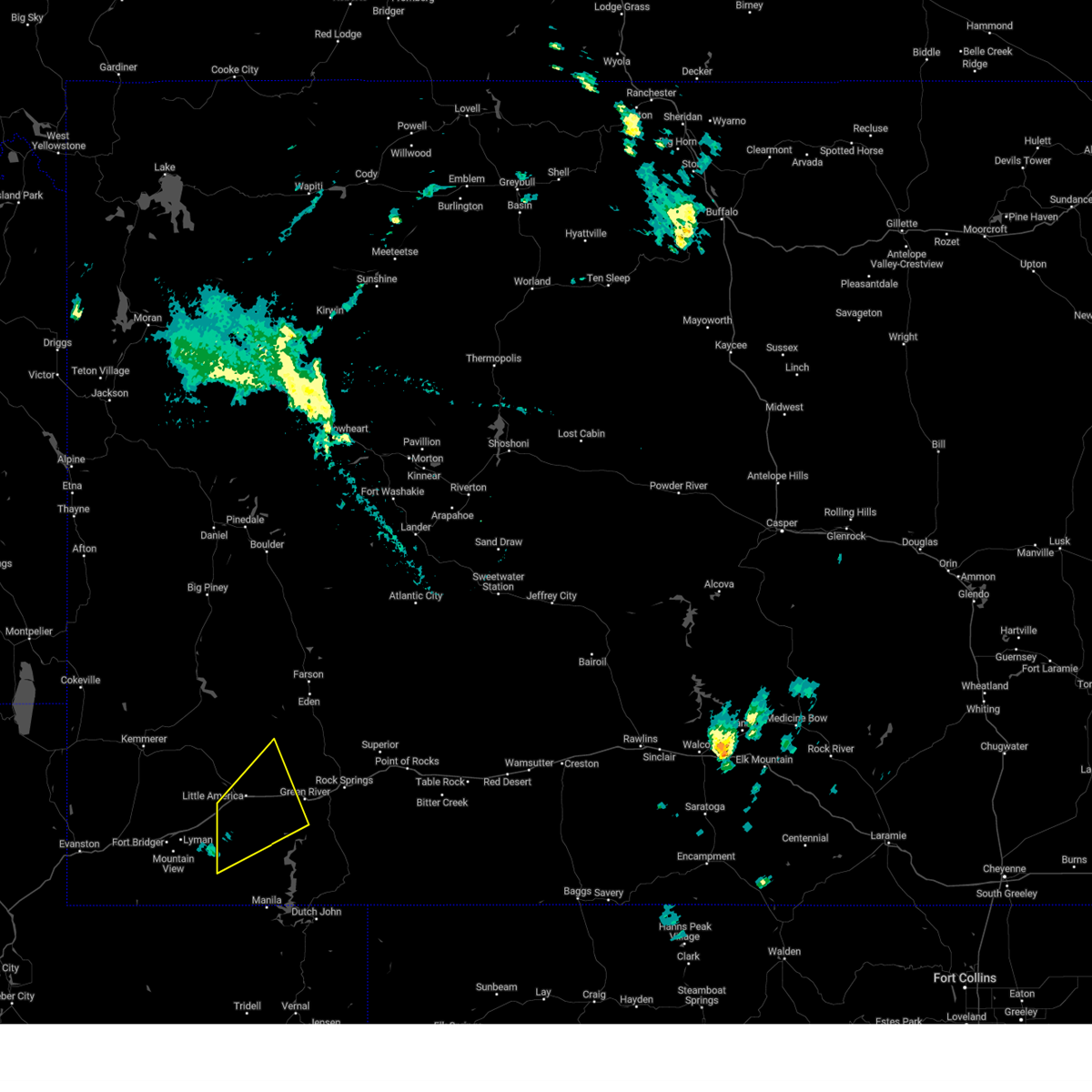
| 6/12/2016 2:30 PM MDT |
 At 229 pm mdt, a severe thunderstorm was located 12 miles southeast of little america, which is 16 miles southwest of green river, moving northeast at 25 mph (radar indicated). Hazards include golf ball size hail and 60 mph wind gusts. People and animals outdoors will be injured. expect hail damage to roofs, siding, windows and vehicles. expect wind damage to roofs, siding and trees. this severe storm will be near, green river around 300 pm mdt. This includes interstate 80 between mile markers 71 and 92. At 229 pm mdt, a severe thunderstorm was located 12 miles southeast of little america, which is 16 miles southwest of green river, moving northeast at 25 mph (radar indicated). Hazards include golf ball size hail and 60 mph wind gusts. People and animals outdoors will be injured. expect hail damage to roofs, siding, windows and vehicles. expect wind damage to roofs, siding and trees. this severe storm will be near, green river around 300 pm mdt. This includes interstate 80 between mile markers 71 and 92.
|
| 6/12/2016 2:20 PM MDT |
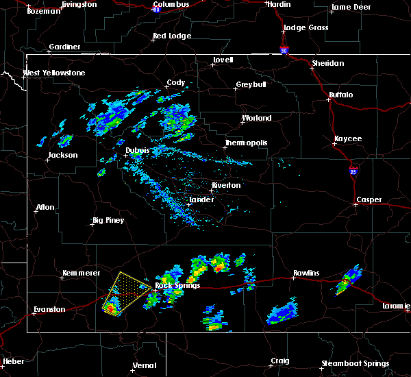 At 220 pm mdt, a severe thunderstorm was located 13 miles south of little america, which is 17 miles southeast of granger, moving northeast at 40 mph (radar indicated). Hazards include 60 mph wind gusts and quarter size hail. Hail damage to vehicles is expected. expect wind damage to roofs, siding and trees. this severe thunderstorm will be near, green river around 250 pm mdt. other locations impacted by this severe thunderstorm include truman elementary school, monroe middle school, rolling green country club, white mountain wind teton power wind farm, washington elementary school, expedition academy in green river, general chemical corporation power plant, tex`s travel camp, green river union pacific railroad yard and harrison elementary school. This includes interstate 80 between mile markers 69 and 93. At 220 pm mdt, a severe thunderstorm was located 13 miles south of little america, which is 17 miles southeast of granger, moving northeast at 40 mph (radar indicated). Hazards include 60 mph wind gusts and quarter size hail. Hail damage to vehicles is expected. expect wind damage to roofs, siding and trees. this severe thunderstorm will be near, green river around 250 pm mdt. other locations impacted by this severe thunderstorm include truman elementary school, monroe middle school, rolling green country club, white mountain wind teton power wind farm, washington elementary school, expedition academy in green river, general chemical corporation power plant, tex`s travel camp, green river union pacific railroad yard and harrison elementary school. This includes interstate 80 between mile markers 69 and 93.
|
Hail Maps for Little America, WY

Connect with Interactive Hail Maps