

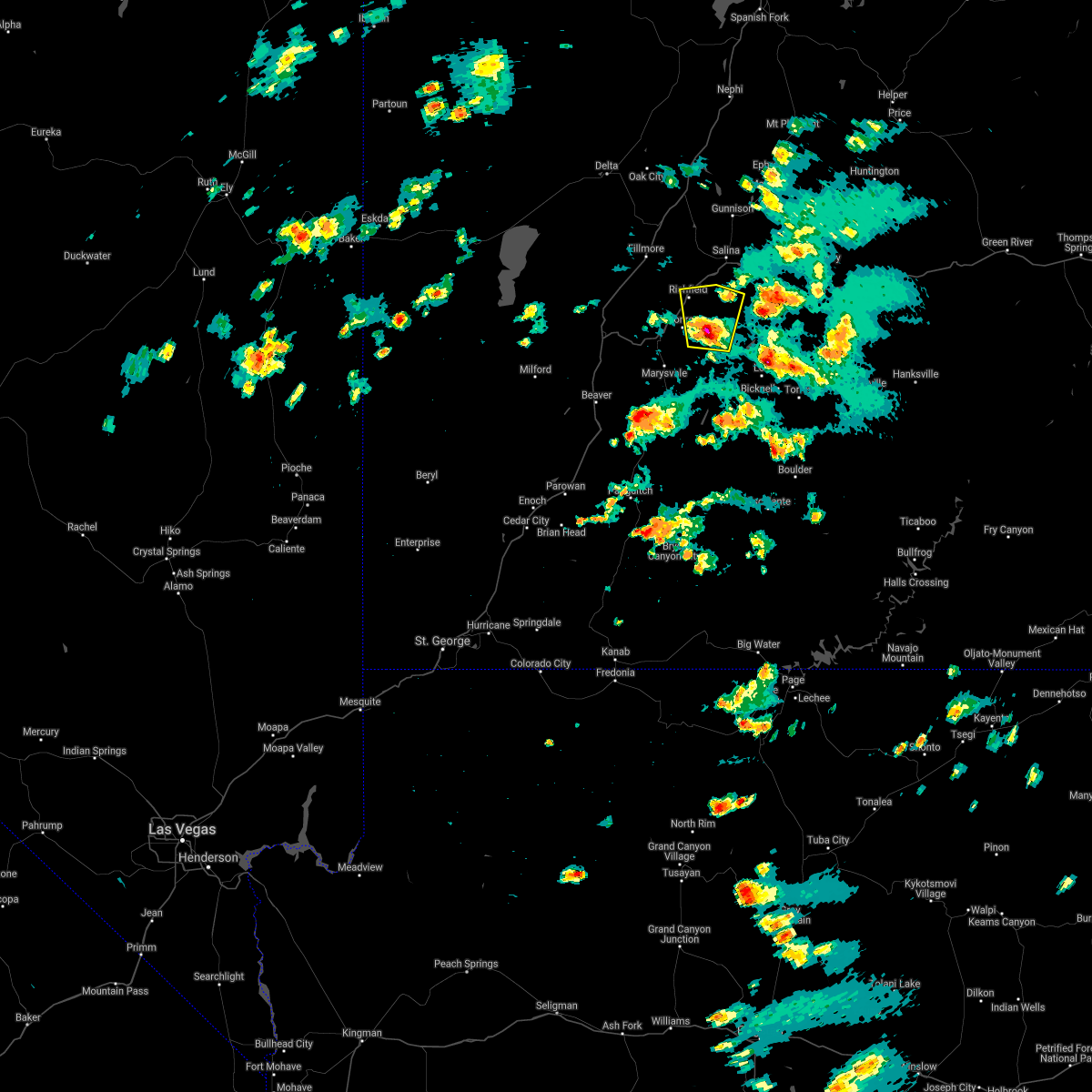
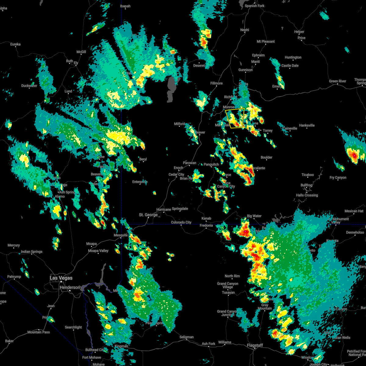
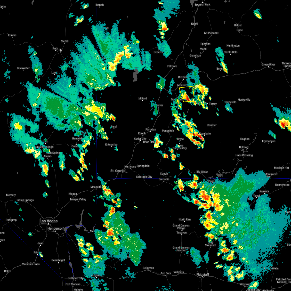
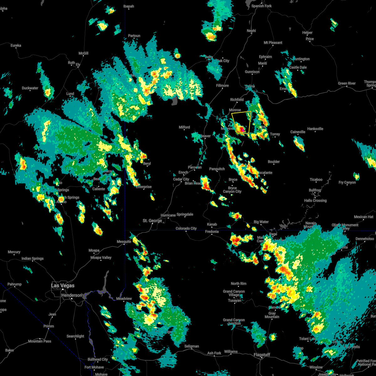
Hail Map for Monroe, UT
The Monroe, UT area has had 0 reports of on-the-ground hail by trained spotters, and has been under severe weather warnings 0 times during the past 12 months. Doppler radar has detected hail at or near Monroe, UT on 3 occasions, including 1 occasion during the past year.
| Name: | Monroe, UT |
| Where Located: | 0.6 miles S of Monroe, UT |
| Map: | Google Map for Monroe, UT |
| Population: | 2256 |
| Housing Units: | 882 |
| More Info: | Search Google for Monroe, UT |
0
The Top Recent Hail Date for Monroe, UT is Sunday, May 14, 2023 (3rd out of 3)

Hail and Wind Damage Spotted near Monroe, UT
| Date / Time | Report Details |
|---|---|
| 8/17/2021 3:29 PM MDT |
 At 329 pm mdt, a severe thunderstorm was located 8 miles northwest of koosharem, or 12 miles southeast of richfield, moving north at 15 mph (radar indicated). Hazards include 60 mph wind gusts and quarter size hail. Hail damage to vehicles is expected. Expect wind damage to roofs, siding, and trees. At 329 pm mdt, a severe thunderstorm was located 8 miles northwest of koosharem, or 12 miles southeast of richfield, moving north at 15 mph (radar indicated). Hazards include 60 mph wind gusts and quarter size hail. Hail damage to vehicles is expected. Expect wind damage to roofs, siding, and trees.
|
| 7/29/2021 5:24 PM MDT |
 The severe thunderstorm warning for northeastern piute and south central sevier counties will expire at 530 pm mdt, the storm which prompted the warning has weakened below severe limits, and no longer poses an immediate threat to life or property. therefore, the warning will be allowed to expire. however gusty winds are still possible with this thunderstorm. The severe thunderstorm warning for northeastern piute and south central sevier counties will expire at 530 pm mdt, the storm which prompted the warning has weakened below severe limits, and no longer poses an immediate threat to life or property. therefore, the warning will be allowed to expire. however gusty winds are still possible with this thunderstorm.
|
| 7/29/2021 5:10 PM MDT |
 At 509 pm mdt, a severe thunderstorm was located near koosharem, or 20 miles south of richfield, moving north at 20 mph (radar indicated). Hazards include 60 mph wind gusts and quarter size hail. Hail damage to vehicles is expected. expect wind damage to roofs, siding, and trees. Locations impacted include, monroe, koosharem, burrville and greenwich. At 509 pm mdt, a severe thunderstorm was located near koosharem, or 20 miles south of richfield, moving north at 20 mph (radar indicated). Hazards include 60 mph wind gusts and quarter size hail. Hail damage to vehicles is expected. expect wind damage to roofs, siding, and trees. Locations impacted include, monroe, koosharem, burrville and greenwich.
|
| 7/29/2021 4:54 PM MDT |
 At 453 pm mdt, a severe thunderstorm was located 9 miles southwest of koosharem, or 17 miles northeast of junction, moving north at 20 mph (radar indicated). Hazards include 60 mph wind gusts and quarter size hail. Hail damage to vehicles is expected. Expect wind damage to roofs, siding, and trees. At 453 pm mdt, a severe thunderstorm was located 9 miles southwest of koosharem, or 17 miles northeast of junction, moving north at 20 mph (radar indicated). Hazards include 60 mph wind gusts and quarter size hail. Hail damage to vehicles is expected. Expect wind damage to roofs, siding, and trees.
|
| 7/3/2020 4:08 PM MDT | Signal peak raws in sevier county UT, 3.3 miles W of Monroe, UT |
| 6/5/2020 4:08 PM MDT | Storm damage reported in sevier county UT, 3.3 miles W of Monroe, UT |
| 5/20/2018 1:08 PM MDT | Signal peak raws. time estimate in sevier county UT, 3.3 miles W of Monroe, UT |
| 5/17/2012 3:08 PM MDT | Signal peak raws in sevier county UT, 3.3 miles W of Monroe, UT |
Hail Maps for Monroe, UT


Connect with Interactive Hail Maps