

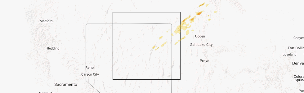
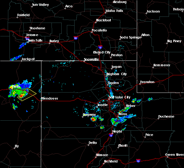
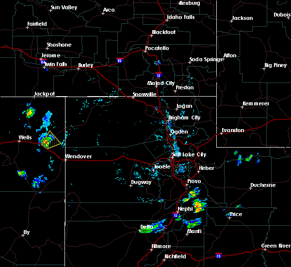
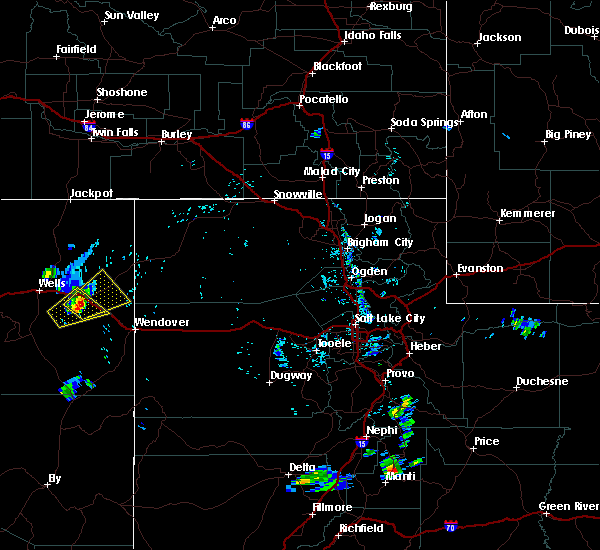
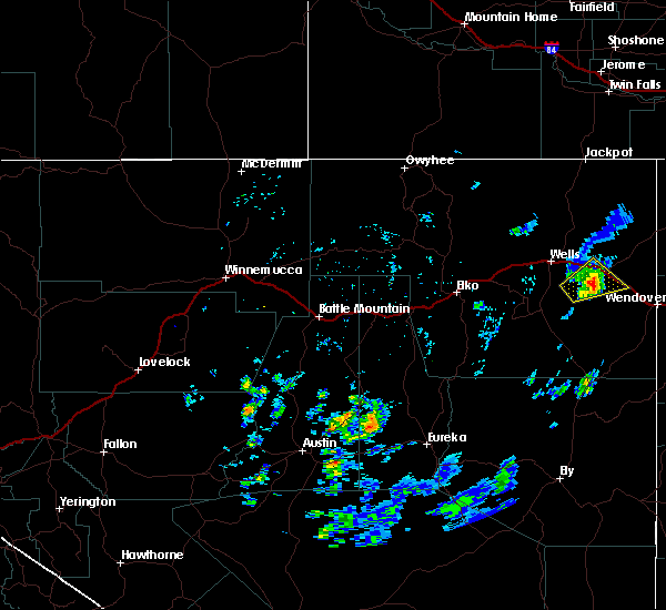
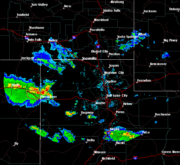
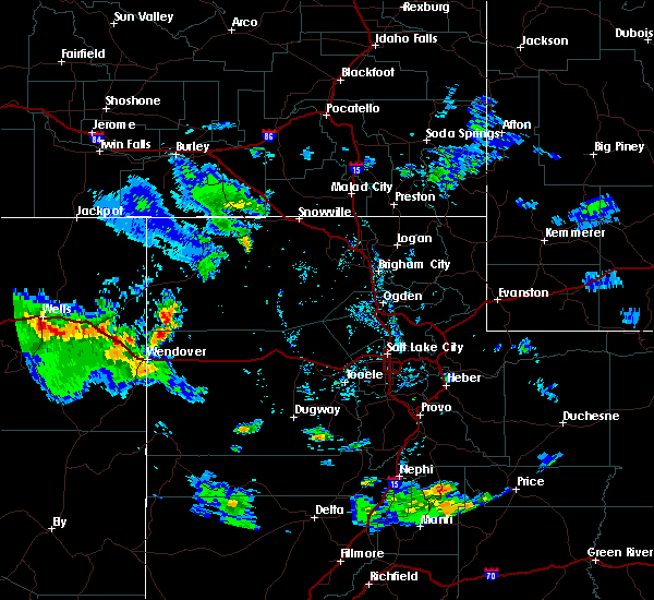
Hail Map for Oasis, NV
The Oasis, NV area has had 0 reports of on-the-ground hail by trained spotters, and has been under severe weather warnings 0 times during the past 12 months. Doppler radar has detected hail at or near Oasis, NV on 1 occasion.
| Name: | Oasis, NV |
| Where Located: | 68.9 miles E of Elko, NV |
| Map: | Google Map for Oasis, NV |
| Population: | 29 |
| Housing Units: | 20 |
| More Info: | Search Google for Oasis, NV |
5
The Top Recent Hail Date for Oasis, NV is Thursday, September 18, 2014 (1st out of 1)
Hail and Wind Damage Spotted near Oasis, NV
| Date / Time | Report Details |
|---|---|
| 8/22/2018 5:51 AM PDT |
 The severe thunderstorm warning for east central elko county will expire at 600 am pdt, the severe thunderstorm which prompted the warning has weakened and is moving into utah. therefore, the warning will be allowed to expire. The severe thunderstorm warning for east central elko county will expire at 600 am pdt, the severe thunderstorm which prompted the warning has weakened and is moving into utah. therefore, the warning will be allowed to expire.
|
| 8/22/2018 5:25 AM PDT |
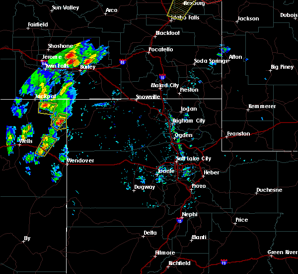
 At 524 am pdt, a severe thunderstorm was located 10 miles southwest of montello, moving northeast at 30 mph. the leading edge of the storm should arrive at montello by about 540 am pdt or 640 am mdt. this is a potentially dangerous storm with dangerous and damaging winds expected (radar indicated). Hazards include 60 mph wind gusts. Expect damage to roofs, siding, and trees. Locations impacted include, oasis, pequop summit and montello, state route 233 from montello to the utah state line. At 524 am pdt, a severe thunderstorm was located 10 miles southwest of montello, moving northeast at 30 mph. the leading edge of the storm should arrive at montello by about 540 am pdt or 640 am mdt. this is a potentially dangerous storm with dangerous and damaging winds expected (radar indicated). Hazards include 60 mph wind gusts. Expect damage to roofs, siding, and trees. Locations impacted include, oasis, pequop summit and montello, state route 233 from montello to the utah state line.
|
| 8/22/2018 5:06 AM PDT |
 At 504 am pdt, a severe thunderstorm was located over oasis, moving northeast at 30 mph (radar indicated). Hazards include 60 mph wind gusts. expect damage to roofs, siding, and trees At 504 am pdt, a severe thunderstorm was located over oasis, moving northeast at 30 mph (radar indicated). Hazards include 60 mph wind gusts. expect damage to roofs, siding, and trees
|
| 5/31/2018 1:19 PM PDT |
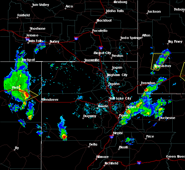
 At 118 pm pdt, a severe thunderstorm was located 10 miles northeast of oasis, moving northeast at 55 mph (radar indicated). Hazards include 60 mph wind gusts and quarter size hail. Hail damage to vehicles is expected. expect wind damage to roofs, siding, and trees. Locations impacted include, oasis and pequop summit. At 118 pm pdt, a severe thunderstorm was located 10 miles northeast of oasis, moving northeast at 55 mph (radar indicated). Hazards include 60 mph wind gusts and quarter size hail. Hail damage to vehicles is expected. expect wind damage to roofs, siding, and trees. Locations impacted include, oasis and pequop summit.
|
| 5/31/2018 1:04 PM PDT |
 At 103 pm pdt, a severe thunderstorm was located over oasis, moving northeast at 30 mph (radar indicated). Hazards include 60 mph wind gusts and quarter size hail. Hail damage to vehicles is expected. Expect wind damage to roofs, siding, and trees. At 103 pm pdt, a severe thunderstorm was located over oasis, moving northeast at 30 mph (radar indicated). Hazards include 60 mph wind gusts and quarter size hail. Hail damage to vehicles is expected. Expect wind damage to roofs, siding, and trees.
|
| 6/12/2016 2:57 PM PDT | The severe thunderstorm warning for east central elko county will expire at 300 pm pdt, the severe thunderstorm which prompted the warning has weakened and moved north of interstate 80. therefore the warning will be allowed to expire. |
| 6/12/2016 2:33 PM PDT |
 At 232 pm pdt, doppler radar indicated a severe thunderstorm capable of producing half dollar size hail and damaging winds in excess of 60 mph. this storm was located over oasis, moving northeast at 25 mph. locations impacted include, oasis, pequop summit and silver zone pass. At 232 pm pdt, doppler radar indicated a severe thunderstorm capable of producing half dollar size hail and damaging winds in excess of 60 mph. this storm was located over oasis, moving northeast at 25 mph. locations impacted include, oasis, pequop summit and silver zone pass.
|
| 6/12/2016 2:01 PM PDT |
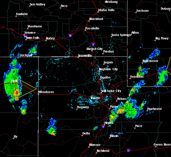 At 200 pm pdt, doppler radar indicated a severe thunderstorm capable of producing half dollar size hail and damaging winds in excess of 60 mph. this storm was located 16 miles east of clover valley, and moving northeast at 25 mph. At 200 pm pdt, doppler radar indicated a severe thunderstorm capable of producing half dollar size hail and damaging winds in excess of 60 mph. this storm was located 16 miles east of clover valley, and moving northeast at 25 mph.
|
| 8/13/2015 7:21 PM PDT |
 At 719 pm pdt, doppler radar indicated a severe thunderstorm capable of producing half dollar size hail and destructive winds in excess of 70 mph. this storm was located 10 miles southwest of oasis, moving northeast at 20 mph. locations impacted include, oasis and silver zone pass. interstate 80 near oasis. this includes mile marker 388 shafter peak. At 719 pm pdt, doppler radar indicated a severe thunderstorm capable of producing half dollar size hail and destructive winds in excess of 70 mph. this storm was located 10 miles southwest of oasis, moving northeast at 20 mph. locations impacted include, oasis and silver zone pass. interstate 80 near oasis. this includes mile marker 388 shafter peak.
|
| 8/13/2015 7:05 PM PDT |
 At 704 pm pdt, doppler radar indicated a severe thunderstorm capable of producing quarter size hail and damaging winds in excess of 60 mph. this storm was located 13 miles southwest of oasis, and moving northeast at 20 mph. At 704 pm pdt, doppler radar indicated a severe thunderstorm capable of producing quarter size hail and damaging winds in excess of 60 mph. this storm was located 13 miles southwest of oasis, and moving northeast at 20 mph.
|
| 8/13/2015 5:25 PM PDT |
 The severe thunderstorm warning for east central elko county will expire at 530 pm pdt, the storm which prompted the warning has weakened below severe limits, and no longer poses an immediate threat to life or property. therefore the warning will be allowed to expire. however gusty winds are still possible with this thunderstorm. The severe thunderstorm warning for east central elko county will expire at 530 pm pdt, the storm which prompted the warning has weakened below severe limits, and no longer poses an immediate threat to life or property. therefore the warning will be allowed to expire. however gusty winds are still possible with this thunderstorm.
|
| 8/13/2015 5:15 PM PDT |
 At 512 pm pdt, doppler radar indicated a severe thunderstorm capable of producing quarter size hail and destructive winds in excess of 70 mph. this storm was located near oasis, moving northeast at 10 mph. national weather service employee reported pea size hail to a depth of one inch from near mile maker 378 and to the east of oasis. locations impacted include, areas north of oasis. At 512 pm pdt, doppler radar indicated a severe thunderstorm capable of producing quarter size hail and destructive winds in excess of 70 mph. this storm was located near oasis, moving northeast at 10 mph. national weather service employee reported pea size hail to a depth of one inch from near mile maker 378 and to the east of oasis. locations impacted include, areas north of oasis.
|
| 8/13/2015 4:42 PM PDT |
 At 441 pm pdt, doppler radar indicated a severe thunderstorm capable of producing quarter size hail and destructive winds in excess of 70 mph. this storm was located 9 miles southwest of oasis, and moving northeast at 10 mph. At 441 pm pdt, doppler radar indicated a severe thunderstorm capable of producing quarter size hail and destructive winds in excess of 70 mph. this storm was located 9 miles southwest of oasis, and moving northeast at 10 mph.
|
| 8/13/2015 4:25 PM PDT |
 At 423 pm pdt, doppler radar indicated a severe thunderstorm capable of producing quarter size hail. this storm was located 12 miles southwest of pequop summit, moving northeast at 10 mph. locations impacted include, oasis, pequop summit and silver zone pass. this includes mile marker 388 shafter peak. At 423 pm pdt, doppler radar indicated a severe thunderstorm capable of producing quarter size hail. this storm was located 12 miles southwest of pequop summit, moving northeast at 10 mph. locations impacted include, oasis, pequop summit and silver zone pass. this includes mile marker 388 shafter peak.
|
| 8/13/2015 4:01 PM PDT |
 At 400 pm pdt, doppler radar indicated a severe thunderstorm capable of producing quarter size hail and damaging winds in excess of 60 mph. this storm was located 16 miles east of clover valley, and moving northeast at 10 mph. At 400 pm pdt, doppler radar indicated a severe thunderstorm capable of producing quarter size hail and damaging winds in excess of 60 mph. this storm was located 16 miles east of clover valley, and moving northeast at 10 mph.
|
| 7/8/2015 4:23 PM PDT |
 At 422 pm pdt, doppler radar indicated a severe thunderstorm capable of producing quarter size hail and damaging winds in excess of 60 mph. this storm was located 10 miles southwest of montello, moving northeast at 15 mph. very frequent, dangerous cloud to ground lightning is occurring with this storm. locations impacted include, silver zone pass. this includes mile marker 388 shafter peak and mile marker 399 pilot peak. At 422 pm pdt, doppler radar indicated a severe thunderstorm capable of producing quarter size hail and damaging winds in excess of 60 mph. this storm was located 10 miles southwest of montello, moving northeast at 15 mph. very frequent, dangerous cloud to ground lightning is occurring with this storm. locations impacted include, silver zone pass. this includes mile marker 388 shafter peak and mile marker 399 pilot peak.
|
| 7/8/2015 4:09 PM PDT |
 At 408 pm pdt, doppler radar indicated a severe thunderstorm capable of producing quarter size hail and damaging winds in excess of 60 mph. this storm was located 12 miles southeast of oasis, and moving northeast at 20 mph. At 408 pm pdt, doppler radar indicated a severe thunderstorm capable of producing quarter size hail and damaging winds in excess of 60 mph. this storm was located 12 miles southeast of oasis, and moving northeast at 20 mph.
|
| 6/3/2015 3:42 PM PDT | At 341 pm pdt, doppler radar indicated a severe thunderstorm capable of producing quarter size hail and damaging winds in excess of 60 mph. this storm was located 10 miles southwest of montello, or near pequop summit, moving northeast at 25 mph. locations impacted include, oasis and pequop summit. interstate 80 near pequop summit. |
| 6/3/2015 3:30 PM PDT | At 330 pm pdt, doppler radar indicated a severe thunderstorm capable of producing quarter size hail and damaging winds in excess of 60 mph. this storm was located over pequop summit, moving northeast at 25 mph. locations impacted include, oasis and pequop summit. interstate 80 near pequop summit. |
| 6/3/2015 3:24 PM PDT | At 323 pm pdt, doppler radar indicated a severe thunderstorm capable of producing damaging winds in excess of 60 mph. this storm was located near pequop summit, and moving northeast at 30 mph. * strong winds and areas of blowing dust are likely. |
Hail Maps for Oasis, NV
Connect with Interactive Hail Maps