

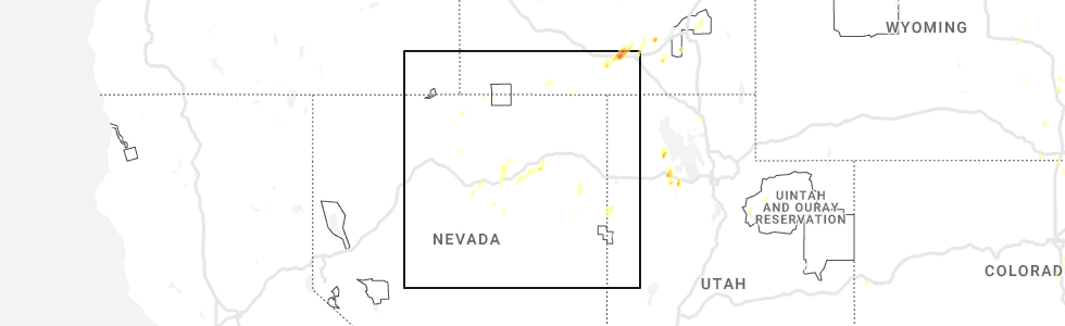
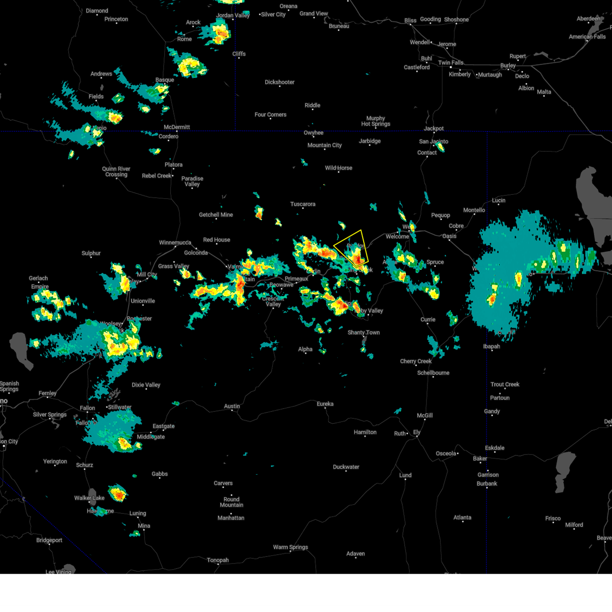
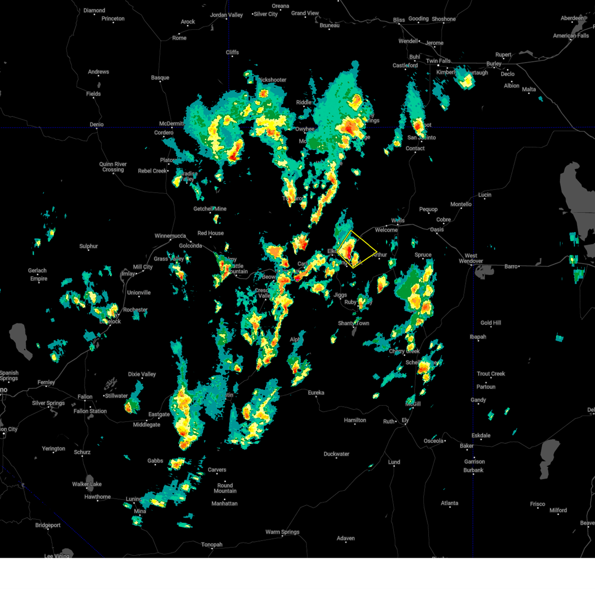
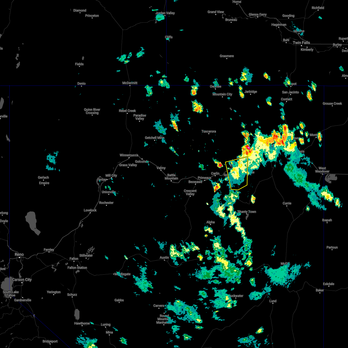
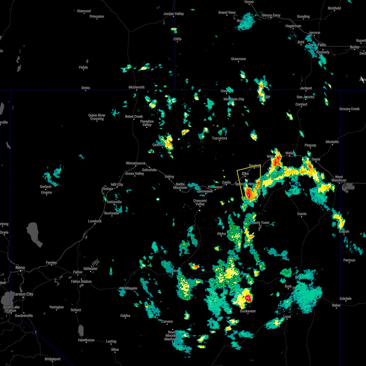
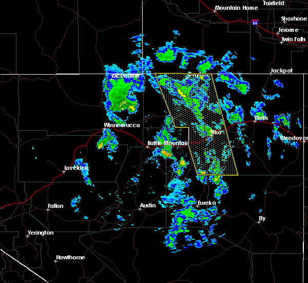
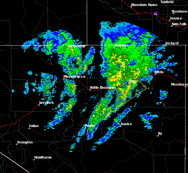
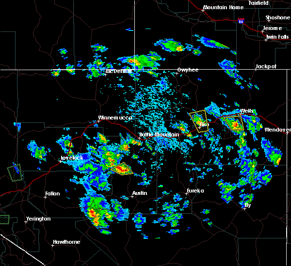
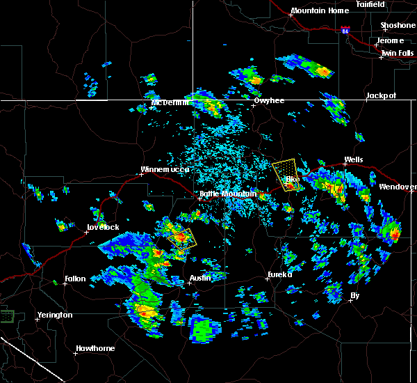
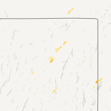
Hail Map for Osino, NV
The Osino, NV area has had 0 reports of on-the-ground hail by trained spotters, and has been under severe weather warnings 3 times during the past 12 months. Doppler radar has detected hail at or near Osino, NV on 2 occasions, including 1 occasion during the past year.
| Name: | Osino, NV |
| Where Located: | 9.1 miles NE of Elko, NV |
| Map: | Google Map for Osino, NV |
| Population: | 709 |
| Housing Units: | 239 |
| More Info: | Search Google for Osino, NV |
0
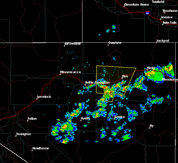
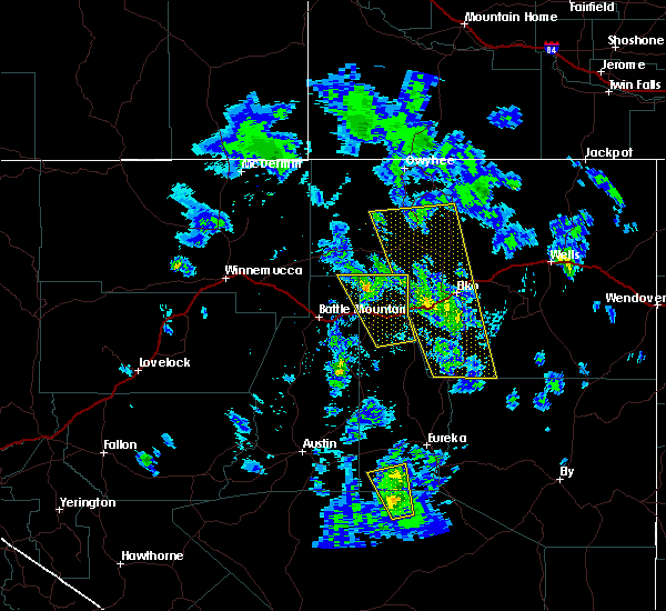
The Top Recent Hail Date for Osino, NV is Wednesday, May 24, 2023 (2nd out of 2)
Hail and Wind Damage Spotted near Osino, NV
| Date / Time | Report Details |
|---|---|
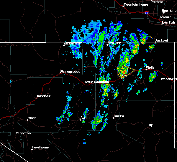
| 6/6/2023 3:00 PM PDT |
 At 300 pm pdt, a severe thunderstorm was located over ryndon, moving northwest at 15 mph (radar indicated). Hazards include 60 mph wind gusts and quarter size hail. Hail damage to vehicles is expected. expect wind damage to roofs, siding, and trees. locations impacted include, ryndon. hail threat, radar indicated max hail size, 1. 00 in wind threat, radar indicated max wind gust, 60 mph. At 300 pm pdt, a severe thunderstorm was located over ryndon, moving northwest at 15 mph (radar indicated). Hazards include 60 mph wind gusts and quarter size hail. Hail damage to vehicles is expected. expect wind damage to roofs, siding, and trees. locations impacted include, ryndon. hail threat, radar indicated max hail size, 1. 00 in wind threat, radar indicated max wind gust, 60 mph.
|
| 6/6/2023 2:43 PM PDT |
 At 242 pm pdt, a severe thunderstorm was located near ryndon, moving northwest at 15 mph (radar indicated). Hazards include 60 mph wind gusts and quarter size hail. Hail damage to vehicles is expected. Expect wind damage to roofs, siding, and trees. At 242 pm pdt, a severe thunderstorm was located near ryndon, moving northwest at 15 mph (radar indicated). Hazards include 60 mph wind gusts and quarter size hail. Hail damage to vehicles is expected. Expect wind damage to roofs, siding, and trees.
|
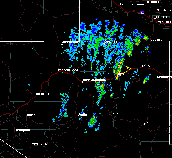
| 5/24/2023 1:35 PM PDT |
 At 135 pm pdt, a severe thunderstorm was located 8 miles southeast of ryndon, moving northeast at 20 mph (radar indicated). Hazards include 60 mph wind gusts and quarter size hail. Hail damage to vehicles is expected. expect wind damage to roofs, siding, and trees. locations impacted include, lamoille, ryndon, spring creek and halleck. hail threat, radar indicated max hail size, 1. 00 in wind threat, radar indicated max wind gust, 60 mph. At 135 pm pdt, a severe thunderstorm was located 8 miles southeast of ryndon, moving northeast at 20 mph (radar indicated). Hazards include 60 mph wind gusts and quarter size hail. Hail damage to vehicles is expected. expect wind damage to roofs, siding, and trees. locations impacted include, lamoille, ryndon, spring creek and halleck. hail threat, radar indicated max hail size, 1. 00 in wind threat, radar indicated max wind gust, 60 mph.
|
| 7/31/2021 4:09 PM PDT |
 The severe thunderstorm warning for south central elko county will expire at 415 pm pdt, the storm which prompted the warning has weakened below severe limits, and no longer poses an immediate threat to life or property. therefore, the warning will be allowed to expire. however gusty winds and heavy rain are still possible with this thunderstorm. The severe thunderstorm warning for south central elko county will expire at 415 pm pdt, the storm which prompted the warning has weakened below severe limits, and no longer poses an immediate threat to life or property. therefore, the warning will be allowed to expire. however gusty winds and heavy rain are still possible with this thunderstorm.
|
| 7/31/2021 3:24 PM PDT |
 At 324 pm pdt, a severe thunderstorm was located near south fork, moving north at 35 mph (radar indicated). Hazards include 60 mph wind gusts and quarter size hail. Hail damage to vehicles is expected. Expect wind damage to roofs, siding, and trees. At 324 pm pdt, a severe thunderstorm was located near south fork, moving north at 35 mph (radar indicated). Hazards include 60 mph wind gusts and quarter size hail. Hail damage to vehicles is expected. Expect wind damage to roofs, siding, and trees.
|
| 5/31/2018 11:41 AM PDT |
 At 1141 am pdt, a severe thunderstorm was located near ryndon, moving northeast at 25 mph (radar indicated). Hazards include 60 mph wind gusts and quarter size hail. Hail damage to vehicles is expected. Expect wind damage to roofs, siding, and trees. At 1141 am pdt, a severe thunderstorm was located near ryndon, moving northeast at 25 mph (radar indicated). Hazards include 60 mph wind gusts and quarter size hail. Hail damage to vehicles is expected. Expect wind damage to roofs, siding, and trees.
|
| 5/31/2018 11:20 AM PDT |
 At 1120 am pdt, a severe thunderstorm was located near ryndon, moving northeast at 35 mph (radar indicated). Hazards include 60 mph wind gusts and quarter size hail. Hail damage to vehicles is expected. Expect wind damage to roofs, siding, and trees. At 1120 am pdt, a severe thunderstorm was located near ryndon, moving northeast at 35 mph (radar indicated). Hazards include 60 mph wind gusts and quarter size hail. Hail damage to vehicles is expected. Expect wind damage to roofs, siding, and trees.
|
| 5/30/2018 2:34 PM PDT |
 At 233 pm pdt, an area of several thunderstorms over northern eureka county and southwest elko county was moring northeast at around 30 mph (radar indicated). Hazards include 60 mph wind gusts and nickel size hail. expect damage to roofs, siding, and trees At 233 pm pdt, an area of several thunderstorms over northern eureka county and southwest elko county was moring northeast at around 30 mph (radar indicated). Hazards include 60 mph wind gusts and nickel size hail. expect damage to roofs, siding, and trees
|
| 7/23/2017 6:06 PM PDT |
 The severe thunderstorm warning for central elko county will expire at 615 pm pdt, the storm which prompted the warning has weakened below severe limits, and has exited the warned area. therefore, the warning will be allowed to expire. however gusty winds are still possible with this thunderstorm. The severe thunderstorm warning for central elko county will expire at 615 pm pdt, the storm which prompted the warning has weakened below severe limits, and has exited the warned area. therefore, the warning will be allowed to expire. however gusty winds are still possible with this thunderstorm.
|
| 7/23/2017 5:49 PM PDT |
 At 548 pm pdt, a severe thunderstorm was located over ryndon, moving east at 10 mph (radar indicated). Hazards include 60 mph wind gusts and small hail. Expect minor damage to roofs, siding, and trees. Locations impacted include, ryndon and halleck. At 548 pm pdt, a severe thunderstorm was located over ryndon, moving east at 10 mph (radar indicated). Hazards include 60 mph wind gusts and small hail. Expect minor damage to roofs, siding, and trees. Locations impacted include, ryndon and halleck.
|
| 7/23/2017 5:25 PM PDT |
 At 523 pm pdt, a severe thunderstorm was located near ryndon and osino, moving east at 10 mph. multiple gustnadoes are forming near and along the oil well fire burn scar. these may produce localized wind gusts in excess of 60 mph (radar indicated). Hazards include 60 mph wind gusts and dime size hail. expect damage to roofs, siding, and trees At 523 pm pdt, a severe thunderstorm was located near ryndon and osino, moving east at 10 mph. multiple gustnadoes are forming near and along the oil well fire burn scar. these may produce localized wind gusts in excess of 60 mph (radar indicated). Hazards include 60 mph wind gusts and dime size hail. expect damage to roofs, siding, and trees
|
| 5/6/2017 4:42 PM PDT |
 At 440 pm pdt, a severe thunderstorm was located near south fork, moving north at 30 mph (radar indicated). Hazards include 60 mph wind gusts and penny size hail. these storms have already produced winds over 50 mph at automated sites. expect damage to roofs, siding, and trees At 440 pm pdt, a severe thunderstorm was located near south fork, moving north at 30 mph (radar indicated). Hazards include 60 mph wind gusts and penny size hail. these storms have already produced winds over 50 mph at automated sites. expect damage to roofs, siding, and trees
|
| 5/6/2017 3:44 PM PDT |
 At 343 pm pdt, a severe thunderstorm was located 9 miles west of ryndon, moving north at 45 mph. this storm has produced winds of 57 mph at elko (radar indicated). Hazards include 60 mph wind gusts and penny size hail. Expect damage to roofs, siding, and trees. Winds could blow vehicles off roads. At 343 pm pdt, a severe thunderstorm was located 9 miles west of ryndon, moving north at 45 mph. this storm has produced winds of 57 mph at elko (radar indicated). Hazards include 60 mph wind gusts and penny size hail. Expect damage to roofs, siding, and trees. Winds could blow vehicles off roads.
|
| 10/30/2016 4:39 PM PDT |
 At 439 pm pdt, doppler radar indicated a severe thunderstorm capable of producing damaging winds in excess of 60 mph. this storm was located 12 miles west of jiggs, and moving northeast at 45 mph. penny size hail may also accompany the damaging winds. At 439 pm pdt, doppler radar indicated a severe thunderstorm capable of producing damaging winds in excess of 60 mph. this storm was located 12 miles west of jiggs, and moving northeast at 45 mph. penny size hail may also accompany the damaging winds.
|
| 7/9/2015 2:11 PM PDT | The severe thunderstorm warning for central elko county will expire at 215 pm pdt, the storm which prompted the warning has weakened below severe limits, and no longer poses an immediate threat to life or property. therefore the warning will be allowed to expire. |
| 7/9/2015 2:09 PM PDT |
 At 207 pm pdt, doppler radar indicated a severe thunderstorm capable of producing quarter size hail and damaging winds in excess of 60 mph. this storm was located 8 miles northwest of ryndon, moving north at 20 mph. dime sized hail (1/2 inch) reported at elko nws office. locations impacted include, elko, ryndon, spring creek and lamoille summit. this includes mile marker 312 osino. At 207 pm pdt, doppler radar indicated a severe thunderstorm capable of producing quarter size hail and damaging winds in excess of 60 mph. this storm was located 8 miles northwest of ryndon, moving north at 20 mph. dime sized hail (1/2 inch) reported at elko nws office. locations impacted include, elko, ryndon, spring creek and lamoille summit. this includes mile marker 312 osino.
|
| 7/9/2015 1:36 PM PDT |
 At 135 pm pdt, doppler radar indicated a severe thunderstorm capable of producing quarter size hail and damaging winds in excess of 60 mph. this storm was located near elko, and moving north at 20 mph. At 135 pm pdt, doppler radar indicated a severe thunderstorm capable of producing quarter size hail and damaging winds in excess of 60 mph. this storm was located near elko, and moving north at 20 mph.
|
| 6/29/2015 4:50 PM PDT | Mesonet station coal mine canyon n7nnv cwop /as326/ in elko county NV, 8.4 miles SW of Osino, NV |
| 5/31/2015 4:50 PM PDT | Dry microburs in elko county NV, 8.4 miles SW of Osino, NV |
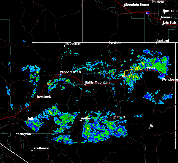
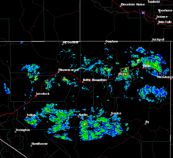
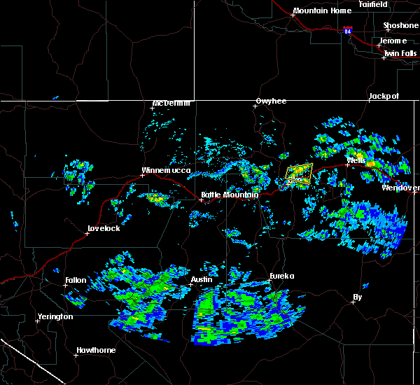
Hail Maps for Osino, NV

Connect with Interactive Hail Maps