

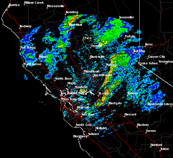
Hail Map for Peters, CA
The Peters, CA area has had 0 reports of on-the-ground hail by trained spotters, and has been under severe weather warnings 0 times during the past 12 months. Doppler radar has detected hail at or near Peters, CA on 1 occasion.
| Name: | Peters, CA |
| Where Located: | 51.4 miles SSE of Citrus Heights, CA |
| Map: | Google Map for Peters, CA |
| Population: | 672 |
| Housing Units: | 220 |
| More Info: | Search Google for Peters, CA |
5
The Top Recent Hail Date for Peters, CA is Saturday, March 11, 2023 (1st out of 1)

Hail and Wind Damage Spotted near Peters, CA
| Date / Time | Report Details |
|---|---|
| 3/11/2023 1:32 PM PST |
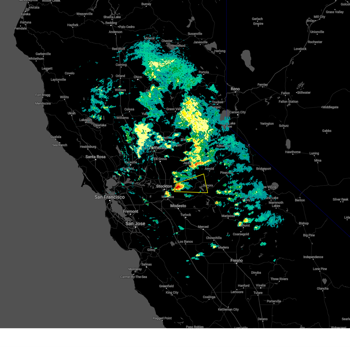 At 129 pm pst, a severe thunderstorm was located near milton, or 17 miles north of oakdale, moving east northeast at 30 mph (the public has reported quarter size hail in stockton). Hazards include quarter size hail. damage to vehicles is expected At 129 pm pst, a severe thunderstorm was located near milton, or 17 miles north of oakdale, moving east northeast at 30 mph (the public has reported quarter size hail in stockton). Hazards include quarter size hail. damage to vehicles is expected
|
| 3/11/2023 1:06 PM PST |
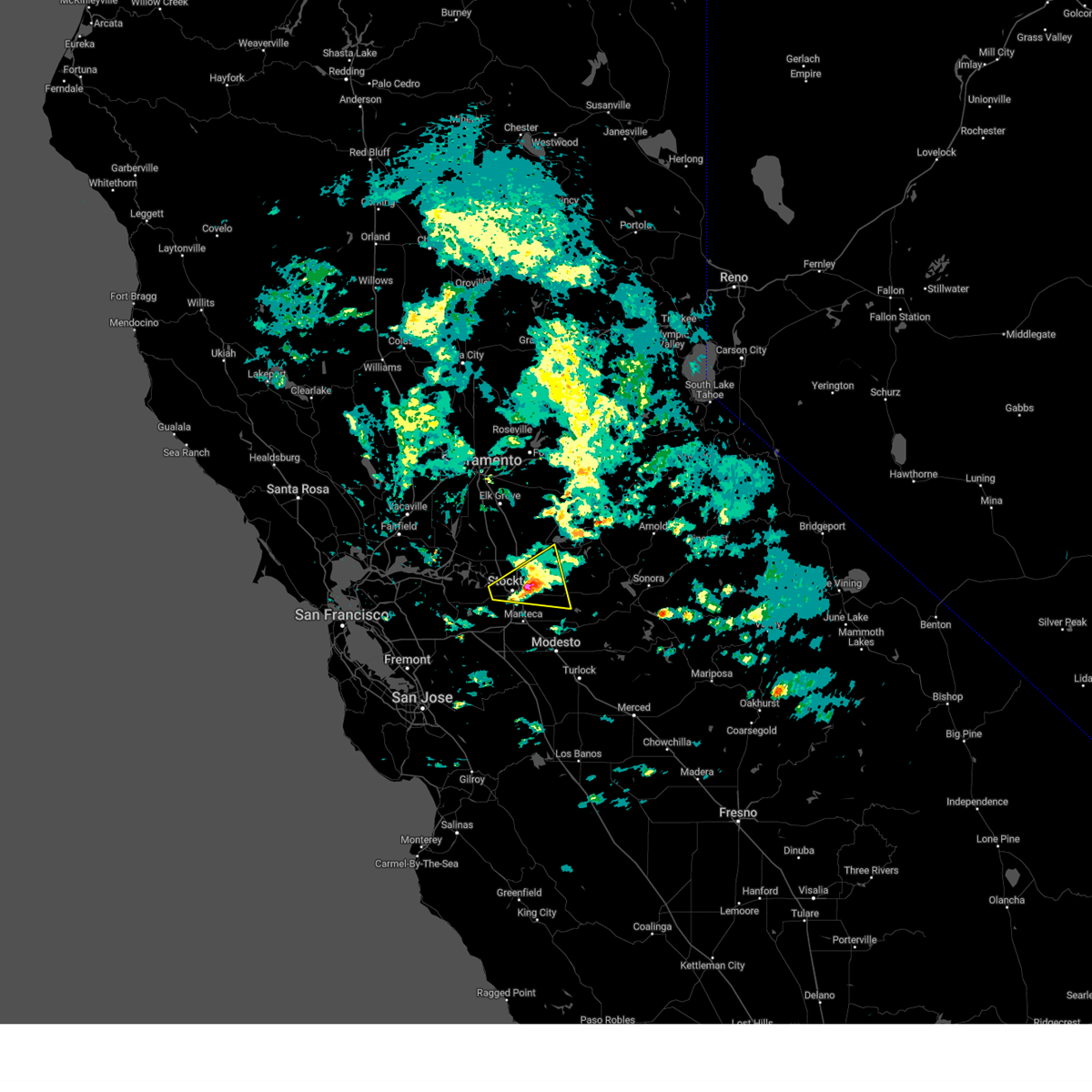 At 104 pm pst, a severe thunderstorm was located over garden acres, or near stockton, moving east at 25 mph (there was a public report of quarter sized hail in stockton). Hazards include quarter size hail. Damage to vehicles is expected. locations impacted include, stockton, waterloo, farmington, country club, taft mosswood, garden acres, kennedy, august, linden, morada, lincoln village and lockeford. hail threat, observed max hail size, 1. 00 in wind threat, radar indicated max wind gust, <50 mph. At 104 pm pst, a severe thunderstorm was located over garden acres, or near stockton, moving east at 25 mph (there was a public report of quarter sized hail in stockton). Hazards include quarter size hail. Damage to vehicles is expected. locations impacted include, stockton, waterloo, farmington, country club, taft mosswood, garden acres, kennedy, august, linden, morada, lincoln village and lockeford. hail threat, observed max hail size, 1. 00 in wind threat, radar indicated max wind gust, <50 mph.
|
| 3/11/2023 12:42 PM PST |
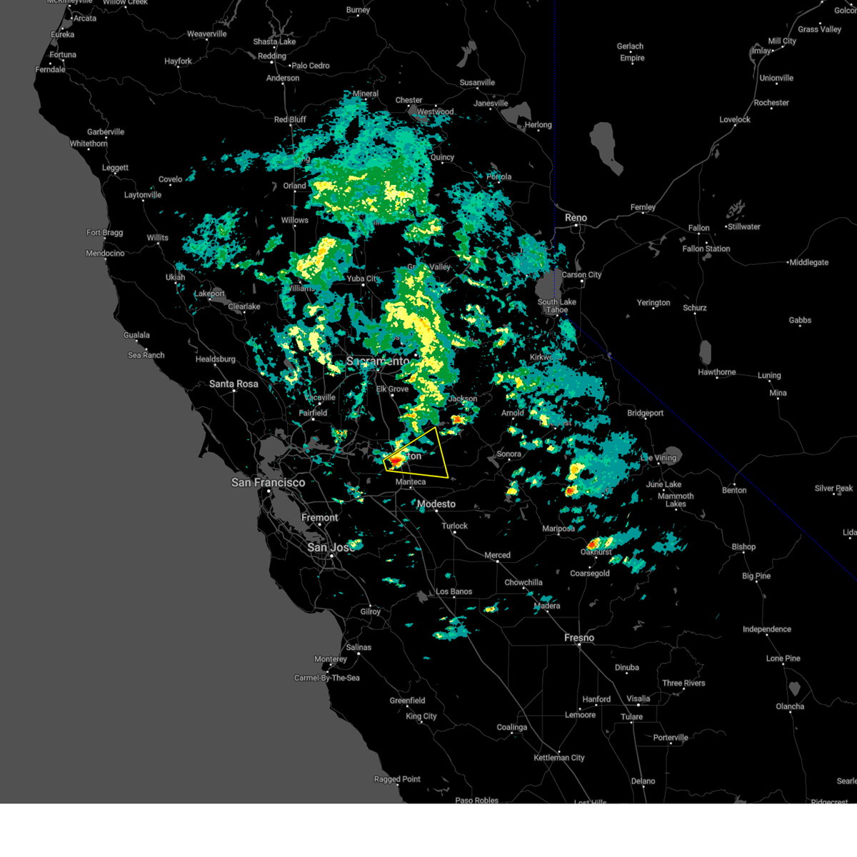 At 1242 pm pst, a severe thunderstorm was located over country club, or near stockton, moving east at 25 mph (radar indicated). Hazards include quarter size hail. damage to vehicles is expected At 1242 pm pst, a severe thunderstorm was located over country club, or near stockton, moving east at 25 mph (radar indicated). Hazards include quarter size hail. damage to vehicles is expected
|
| 1/10/2023 3:35 AM PST |
 At 335 am pst, a severe thunderstorm capable of producing a tornado was located near farmington, or 12 miles east of stockton, moving northeast at 50 mph (radar indicated rotation). Hazards include tornado. Flying debris will be dangerous to those caught without shelter. mobile homes will be damaged or destroyed. damage to roofs, windows, and vehicles will occur. tree damage is likely. this dangerous storm will be near, milton around 350 am pst. rancho calaveras and wallace around 355 am pst. paloma, campo seco and valley springs around 400 am pst. Other locations impacted by this tornadic thunderstorm include linden. At 335 am pst, a severe thunderstorm capable of producing a tornado was located near farmington, or 12 miles east of stockton, moving northeast at 50 mph (radar indicated rotation). Hazards include tornado. Flying debris will be dangerous to those caught without shelter. mobile homes will be damaged or destroyed. damage to roofs, windows, and vehicles will occur. tree damage is likely. this dangerous storm will be near, milton around 350 am pst. rancho calaveras and wallace around 355 am pst. paloma, campo seco and valley springs around 400 am pst. Other locations impacted by this tornadic thunderstorm include linden.
|
| 1/20/2019 2:28 PM PST |
 At 226 pm pst, a severe thunderstorm capable of producing a tornado was located near linden and waterloo, or 12 miles northeast of stockton, moving northeast at 20 mph (radar indicated rotation). Hazards include tornado. Flying debris will be dangerous to those caught without shelter. damage to roofs, windows, and vehicles will occur. tree damage is likely. This dangerous storm will be near, camanche reservoir around 240 pm pst. At 226 pm pst, a severe thunderstorm capable of producing a tornado was located near linden and waterloo, or 12 miles northeast of stockton, moving northeast at 20 mph (radar indicated rotation). Hazards include tornado. Flying debris will be dangerous to those caught without shelter. damage to roofs, windows, and vehicles will occur. tree damage is likely. This dangerous storm will be near, camanche reservoir around 240 pm pst.
|
Hail Maps for Peters, CA

Connect with Interactive Hail Maps