

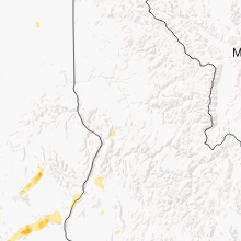
Hail Map for Prairie City, OR
The Prairie City, OR area has had 0 reports of on-the-ground hail by trained spotters, and has been under severe weather warnings 0 times during the past 12 months. Doppler radar has detected hail at or near Prairie City, OR on 1 occasion.
| Name: | Prairie City, OR |
| Where Located: | 62.6 miles NNE of Burns, OR |
| Map: | Google Map for Prairie City, OR |
| Population: | 909 |
| Housing Units: | 476 |
| More Info: | Search Google for Prairie City, OR |
0
The Top Recent Hail Date for Prairie City, OR is Saturday, July 14, 2012 (1st out of 1)

Hail and Wind Damage Spotted near Prairie City, OR
| Date / Time | Report Details |
|---|---|
| 5/1/2023 6:51 PM PDT |
 The severe thunderstorm warning for east central grant county will expire at 700 pm pdt, the storm which prompted the warning has weakened below severe limits, and no longer poses an immediate threat to life or property. therefore, the warning will be allowed to expire. however small hail and gusty winds are still possible with this thunderstorm. The severe thunderstorm warning for east central grant county will expire at 700 pm pdt, the storm which prompted the warning has weakened below severe limits, and no longer poses an immediate threat to life or property. therefore, the warning will be allowed to expire. however small hail and gusty winds are still possible with this thunderstorm.
|
| 5/1/2023 6:29 PM PDT |
 At 628 pm pdt, a severe thunderstorm was located 13 miles southeast of prairie city, or 23 miles east of john day, moving north at 40 mph (radar indicated). Hazards include 60 mph wind gusts and quarter size hail. Hail damage to vehicles is expected. expect wind damage to roofs, siding, and trees. locations impacted include, prairie city, bates and greenhorn. hail threat, radar indicated max hail size, 1. 00 in wind threat, radar indicated max wind gust, 60 mph. At 628 pm pdt, a severe thunderstorm was located 13 miles southeast of prairie city, or 23 miles east of john day, moving north at 40 mph (radar indicated). Hazards include 60 mph wind gusts and quarter size hail. Hail damage to vehicles is expected. expect wind damage to roofs, siding, and trees. locations impacted include, prairie city, bates and greenhorn. hail threat, radar indicated max hail size, 1. 00 in wind threat, radar indicated max wind gust, 60 mph.
|
| 5/1/2023 5:57 PM PDT |
 At 554 pm pdt, a severe thunderstorm was located 19 miles east of silvies, or 30 miles southeast of john day, moving north at 45 mph (radar indicated). Hazards include 60 mph wind gusts and quarter size hail. Hail damage to vehicles is expected. Expect wind damage to roofs, siding, and trees. At 554 pm pdt, a severe thunderstorm was located 19 miles east of silvies, or 30 miles southeast of john day, moving north at 45 mph (radar indicated). Hazards include 60 mph wind gusts and quarter size hail. Hail damage to vehicles is expected. Expect wind damage to roofs, siding, and trees.
|
| 4/29/2020 4:25 PM PDT |
 At 425 pm pdt, a severe thunderstorm was located 12 miles southwest of mount vernon, or 19 miles southwest of john day, moving northeast at 40 mph (radar indicated). Hazards include 60 mph wind gusts and nickel size hail. expect damage to roofs, siding, and trees At 425 pm pdt, a severe thunderstorm was located 12 miles southwest of mount vernon, or 19 miles southwest of john day, moving northeast at 40 mph (radar indicated). Hazards include 60 mph wind gusts and nickel size hail. expect damage to roofs, siding, and trees
|
| 6/26/2017 1:26 PM PDT |
 At 124 pm pdt, a severe thunderstorm was located over john day, moving northeast at 35 mph (radar indicated). Hazards include 60 mph wind gusts and quarter size hail. Hail damage to vehicles is expected. Expect wind damage to roofs, siding, and trees. At 124 pm pdt, a severe thunderstorm was located over john day, moving northeast at 35 mph (radar indicated). Hazards include 60 mph wind gusts and quarter size hail. Hail damage to vehicles is expected. Expect wind damage to roofs, siding, and trees.
|
| 9/5/2013 5:00 PM PDT | 1/2 inch hail in grant county OR, 0.3 miles SSE of Prairie City, OR |
| 9/5/2013 3:30 PM PDT | 1/2 inch hail in grant county OR, 0.3 miles SSE of Prairie City, OR |
| 9/5/2013 3:30 PM PDT | Storm damage reported in grant county OR, 0.3 miles SSE of Prairie City, OR |
Hail Maps for Prairie City, OR
Connect with Interactive Hail Maps