

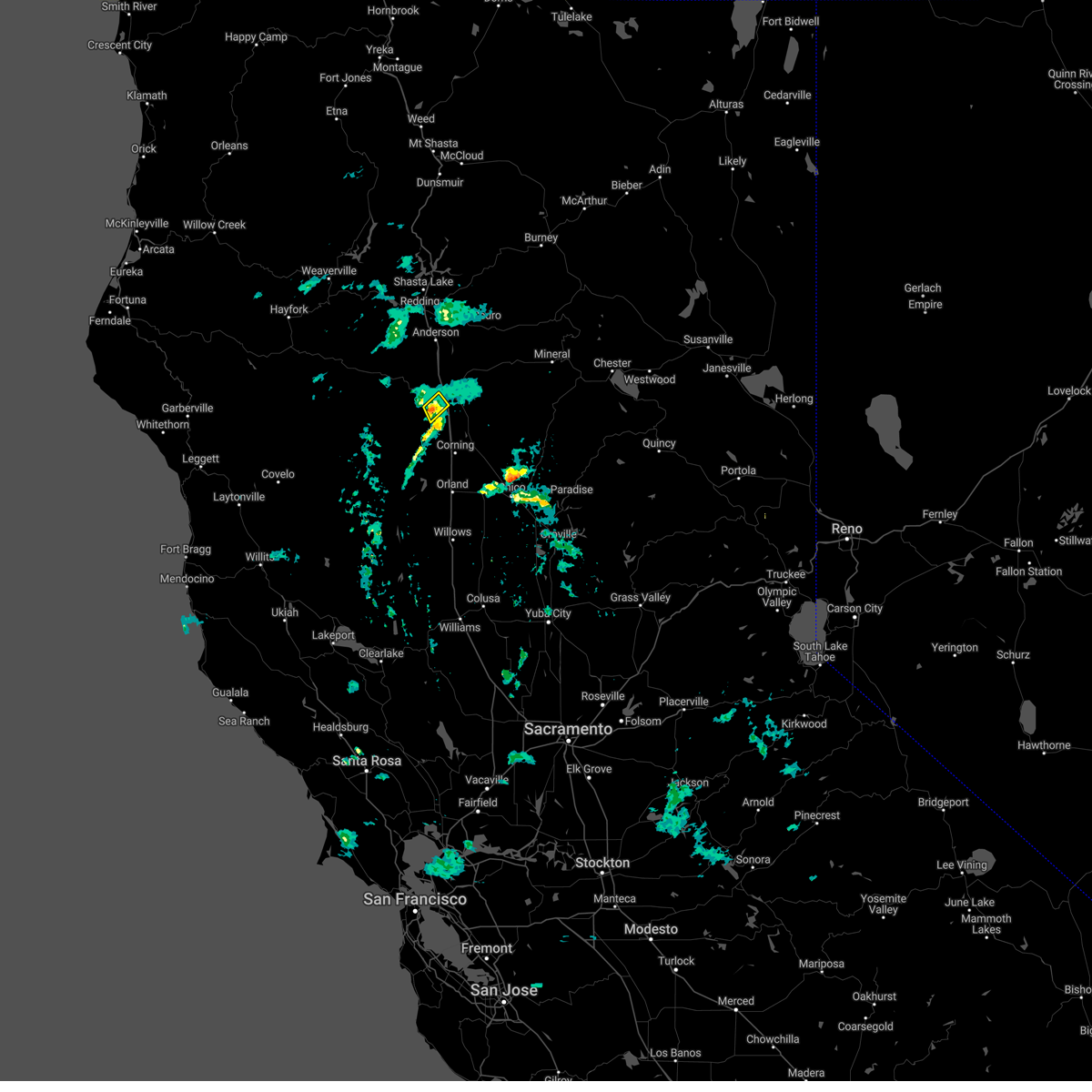
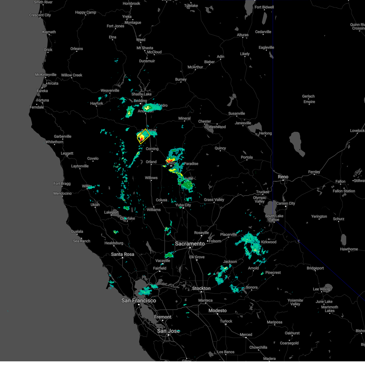
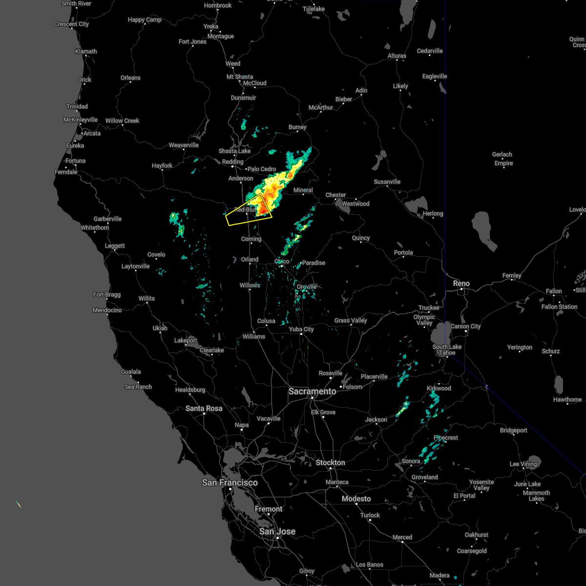
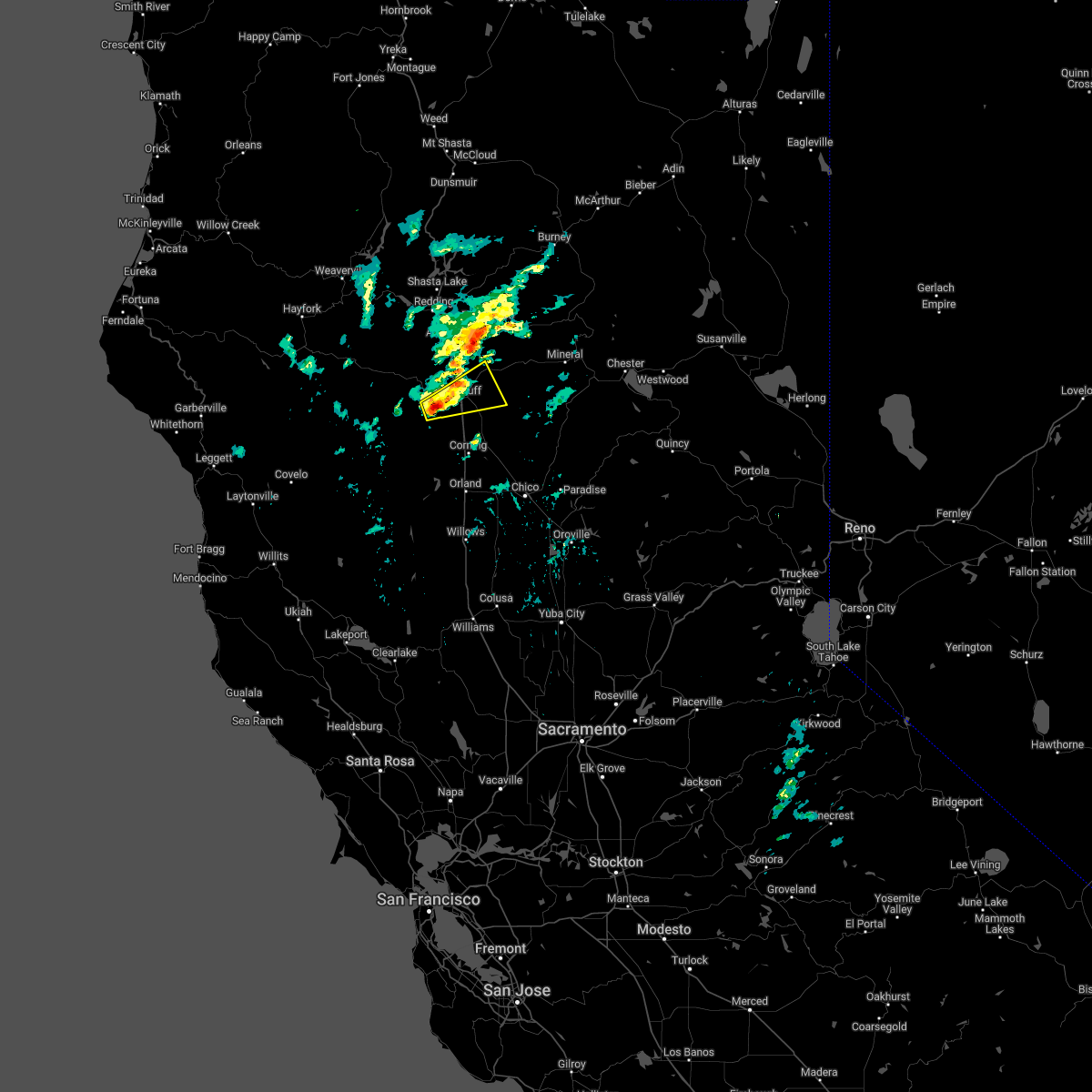
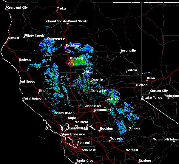
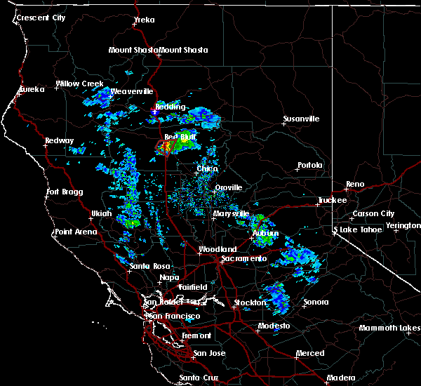
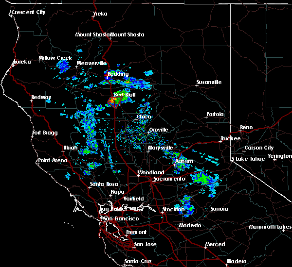
Hail Map for Red Bluff, CA
The Red Bluff, CA area has had 2 reports of on-the-ground hail by trained spotters, and has been under severe weather warnings 0 times during the past 12 months. Doppler radar has detected hail at or near Red Bluff, CA on 1 occasion.
| Name: | Red Bluff, CA |
| Where Located: | 29.2 miles SSE of Redding, CA |
| Map: | Google Map for Red Bluff, CA |
| Population: | 14076 |
| Housing Units: | 5872 |
| More Info: | Search Google for Red Bluff, CA |
5
The Top Recent Hail Date for Red Bluff, CA is Sunday, October 2, 2016 (1st out of 1)

Hail and Wind Damage Spotted near Red Bluff, CA
| Date / Time | Report Details |
|---|---|
| 3/6/2023 5:38 PM PST |
 At 535 pm pst, a severe thunderstorm was located near red bluff, moving northeast at 15 mph (radar indicated). Hazards include half inch size hail. Hail covered roads and hazardous driving conditions. locations impacted include, red bluff. hail threat, radar indicated 0. 75 in wind threat, radar indicated <50 mph. At 535 pm pst, a severe thunderstorm was located near red bluff, moving northeast at 15 mph (radar indicated). Hazards include half inch size hail. Hail covered roads and hazardous driving conditions. locations impacted include, red bluff. hail threat, radar indicated 0. 75 in wind threat, radar indicated <50 mph.
|
| 3/6/2023 5:21 PM PST |
 At 520 pm pst, a severe thunderstorm was located near blossom, or 8 miles southwest of red bluff, moving northeast at 20 mph (radar indicated). Hazards include quarter size hail. damage to vehicles is expected At 520 pm pst, a severe thunderstorm was located near blossom, or 8 miles southwest of red bluff, moving northeast at 20 mph (radar indicated). Hazards include quarter size hail. damage to vehicles is expected
|
| 6/12/2022 12:21 PM PDT |
 The severe thunderstorm warning for northeastern tehama county will expire at 1230 pm pdt, the storm which prompted the warning has weakened below severe limits, and has exited the warned area. therefore, the warning will be allowed to expire. The severe thunderstorm warning for northeastern tehama county will expire at 1230 pm pdt, the storm which prompted the warning has weakened below severe limits, and has exited the warned area. therefore, the warning will be allowed to expire.
|
| 6/12/2022 11:42 AM PDT |
 At 1141 am pdt, a severe thunderstorm was located near blossom, or near red bluff, moving east at 25 mph (radar indicated). Hazards include quarter size hail. damage to vehicles is expected At 1141 am pdt, a severe thunderstorm was located near blossom, or near red bluff, moving east at 25 mph (radar indicated). Hazards include quarter size hail. damage to vehicles is expected
|
| 8/10/2019 12:13 AM PDT | Large tree branch blocking both lane in tehama county CA, 5.2 miles ENE of Red Bluff, CA |
| 8/10/2019 12:04 AM PDT | Tree down blocking both lane in tehama county CA, 4 miles ENE of Red Bluff, CA |
| 8/9/2019 11:56 PM PDT |
 At 1155 pm pdt, a severe thunderstorm was located near blossom, or 7 miles northwest of red bluff, moving north at 30 mph (radar indicated). Hazards include 60 mph wind gusts and half dollar size hail. Hail damage to vehicles is expected. Expect wind damage to roofs, siding, and trees. At 1155 pm pdt, a severe thunderstorm was located near blossom, or 7 miles northwest of red bluff, moving north at 30 mph (radar indicated). Hazards include 60 mph wind gusts and half dollar size hail. Hail damage to vehicles is expected. Expect wind damage to roofs, siding, and trees.
|
| 10/2/2016 2:41 PM PDT |
 At 239 pm pdt, doppler radar indicated a severe thunderstorm capable of producing quarter size hail and damaging winds in excess of 60 mph. this storm was located 7 miles south of anderson, or 13 miles north of red bluff, and moving east at 20 mph. * large amounts of small hail are expected to impact travel on interstate 5. use extreme caution driving as hail can bring very slippery conditions!. At 239 pm pdt, doppler radar indicated a severe thunderstorm capable of producing quarter size hail and damaging winds in excess of 60 mph. this storm was located 7 miles south of anderson, or 13 miles north of red bluff, and moving east at 20 mph. * large amounts of small hail are expected to impact travel on interstate 5. use extreme caution driving as hail can bring very slippery conditions!.
|
| 1/23/2016 3:34 PM PST |
 At 328 pm pst, trained weather spotters reported a funnel cloud 7 miles southwest of red bluff. a tornado may develop at any time. this dangerous storm was located 7 miles south of red bluff over i5, slowly moving east southeast at 5 mph. in addition, at small hail 3 inches deep was reported on i5 4 miles south of red bluff. traffic is at a standstill and numerous accidents have been reported. locations impacted include, i5 south of red bluff, richfield tehama, gerber-las flores and los molinos. At 328 pm pst, trained weather spotters reported a funnel cloud 7 miles southwest of red bluff. a tornado may develop at any time. this dangerous storm was located 7 miles south of red bluff over i5, slowly moving east southeast at 5 mph. in addition, at small hail 3 inches deep was reported on i5 4 miles south of red bluff. traffic is at a standstill and numerous accidents have been reported. locations impacted include, i5 south of red bluff, richfield tehama, gerber-las flores and los molinos.
|
| 1/23/2016 3:14 PM PST |
 At 312 pm pst, trained weather spotters reported a funnel cloud near paskenta road south of red bluff. a tornado may develop at any time. doppler radar showed this dangerous storm moving east southast at 8 mph. At 312 pm pst, trained weather spotters reported a funnel cloud near paskenta road south of red bluff. a tornado may develop at any time. doppler radar showed this dangerous storm moving east southast at 8 mph.
|
| 1/23/2016 3:12 PM PST | Tea Cup sized hail reported 7.2 miles NNE of Red Bluff, CA, spiked hail 3 inches in diameter across the spikes. |
| 1/23/2016 2:54 PM PST |
 At 250 pm pst, doppler radar indicated a severe thunderstorm capable of producing a tornado. this dangerous storm was located south southwest of red bluff, moving east southeast at 10 mph. locations impacted include, interstate 5 south of red bluff. the tornado will cross interstate 5 between flores avenue and gyle road. At 250 pm pst, doppler radar indicated a severe thunderstorm capable of producing a tornado. this dangerous storm was located south southwest of red bluff, moving east southeast at 10 mph. locations impacted include, interstate 5 south of red bluff. the tornado will cross interstate 5 between flores avenue and gyle road.
|
| 1/23/2016 2:36 PM PST |
 At 233 pm pst, doppler radar indicated severe thunderstorms capable of producing a tornado located near red bluff and south along i5, and moving east at 10 mph. At 233 pm pst, doppler radar indicated severe thunderstorms capable of producing a tornado located near red bluff and south along i5, and moving east at 10 mph.
|
| 1/1/0001 12:00 AM | Quarter sized hail reported 0.8 miles NNW of Red Bluff, CA, location 1/2 mile east of red bluff airport |
Hail Maps for Red Bluff, CA

Connect with Interactive Hail Maps