

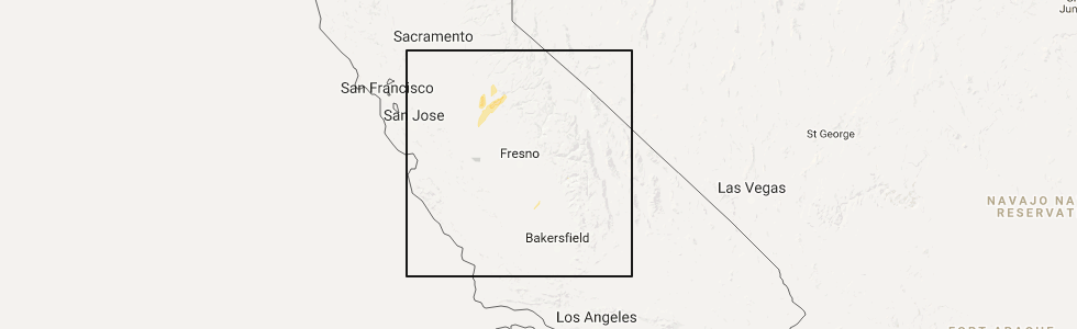
Hail Map for Snelling, CA
The Snelling, CA area has had 0 reports of on-the-ground hail by trained spotters, and has been under severe weather warnings 0 times during the past 12 months. Doppler radar has detected hail at or near Snelling, CA on 2 occasions.
| Name: | Snelling, CA |
| Where Located: | 64.8 miles NW of Fresno, CA |
| Map: | Google Map for Snelling, CA |
| Population: | 231 |
| Housing Units: | 112 |
| More Info: | Search Google for Snelling, CA |
5
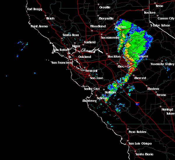
The Top Recent Hail Date for Snelling, CA is Tuesday, March 21, 2017 (1st out of 2)
Hail and Wind Damage Spotted near Snelling, CA
| Date / Time | Report Details |
|---|---|
| 3/17/2025 5:10 PM PDT |
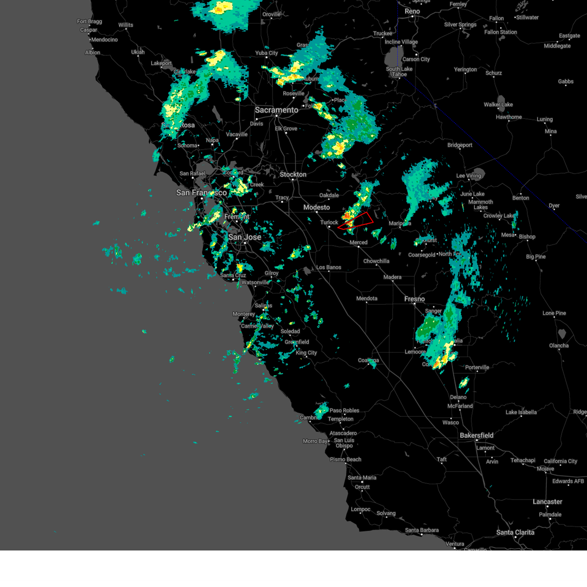 Torhnx the national weather service in hanford ca has issued a * tornado warning for, western mariposa county in central california, southwestern tuolumne county in northern california, north central merced county in central california, * until 545 pm pdt. * at 510 pm pdt, a severe thunderstorm capable of producing a tornado was located 9 miles northeast of delhi, or 11 miles east of turlock, moving northeast at 20 mph (radar indicated rotation). Hazards include tornado. Flying debris will be dangerous to those caught without shelter. mobile homes will be damaged or destroyed. damage to roofs, windows, and vehicles will occur. tree damage is likely. This tornadic thunderstorm will remain over mainly rural areas of western mariposa, southwestern tuolumne and north central merced counties. Torhnx the national weather service in hanford ca has issued a * tornado warning for, western mariposa county in central california, southwestern tuolumne county in northern california, north central merced county in central california, * until 545 pm pdt. * at 510 pm pdt, a severe thunderstorm capable of producing a tornado was located 9 miles northeast of delhi, or 11 miles east of turlock, moving northeast at 20 mph (radar indicated rotation). Hazards include tornado. Flying debris will be dangerous to those caught without shelter. mobile homes will be damaged or destroyed. damage to roofs, windows, and vehicles will occur. tree damage is likely. This tornadic thunderstorm will remain over mainly rural areas of western mariposa, southwestern tuolumne and north central merced counties.
|
| 3/27/2019 4:05 PM PDT |
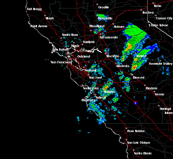 At 404 pm pdt, a severe thunderstorm was located 8 miles southeast of la grange, or 17 miles northeast of atwater, moving northeast at 20 mph (radar indicated). Hazards include quarter size hail. damage to vehicles is expected At 404 pm pdt, a severe thunderstorm was located 8 miles southeast of la grange, or 17 miles northeast of atwater, moving northeast at 20 mph (radar indicated). Hazards include quarter size hail. damage to vehicles is expected
|
| 3/6/2019 3:02 PM PST |
 At 301 pm pst, a severe thunderstorm was located 10 miles south of la grange, or 14 miles northeast of atwater, moving northeast at 15 mph (radar indicated). Hazards include 60 mph wind gusts and quarter size hail along with very heavy rain and possible flooding. this storm could spawn a funnel cloud. Hail damage to vehicles is expected. Expect wind damage to roofs, siding, and trees. At 301 pm pst, a severe thunderstorm was located 10 miles south of la grange, or 14 miles northeast of atwater, moving northeast at 15 mph (radar indicated). Hazards include 60 mph wind gusts and quarter size hail along with very heavy rain and possible flooding. this storm could spawn a funnel cloud. Hail damage to vehicles is expected. Expect wind damage to roofs, siding, and trees.
|
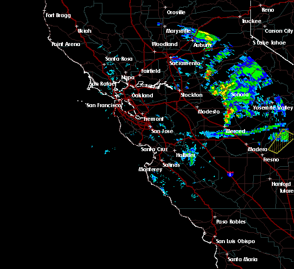
| 9/11/2017 7:40 PM PDT |
 At 738 pm pdt, an area of strong thunderstorms, a few of them severe, were located 9 miles north of south dos palos, or 14 miles southwest of merced, moving northwest at 55 mph (radar indicated). Hazards include 60 mph wind gusts and quarter size hail. Hail damage to vehicles is expected. expect wind damage to roofs, siding, and trees. in addition to frequent cloud to ground lightning, thunderstorms may bring very heavy rain and possible flooding. Motorists should expect ponding of water on roads. At 738 pm pdt, an area of strong thunderstorms, a few of them severe, were located 9 miles north of south dos palos, or 14 miles southwest of merced, moving northwest at 55 mph (radar indicated). Hazards include 60 mph wind gusts and quarter size hail. Hail damage to vehicles is expected. expect wind damage to roofs, siding, and trees. in addition to frequent cloud to ground lightning, thunderstorms may bring very heavy rain and possible flooding. Motorists should expect ponding of water on roads.
|
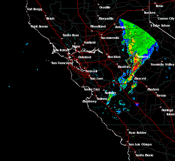
| 3/21/2017 2:21 PM PDT |
 At 220 pm pdt, doppler radar continued to indicate a severe thunderstorm capable of producing quarter size hail and damaging winds in excess of 60 mph. this storm was located near smith station, or 17 miles southeast of sonora, moving northeast at 45 mph. locations impacted include, lake mcclure. At 220 pm pdt, doppler radar continued to indicate a severe thunderstorm capable of producing quarter size hail and damaging winds in excess of 60 mph. this storm was located near smith station, or 17 miles southeast of sonora, moving northeast at 45 mph. locations impacted include, lake mcclure.
|
| 3/21/2017 2:16 PM PDT |
 At 215 pm pdt, doppler radar indicated a severe thunderstorm capable of producing damaging winds in excess of 60 mph. this storm was located 10 miles southwest of smith station, or 20 miles south of sonora, and moving east northeast at 35 mph. At 215 pm pdt, doppler radar indicated a severe thunderstorm capable of producing damaging winds in excess of 60 mph. this storm was located 10 miles southwest of smith station, or 20 miles south of sonora, and moving east northeast at 35 mph.
|
| 3/21/2017 2:00 PM PDT |
 At 159 pm pdt, doppler radar continued to indicate a severe thunderstorm capable of producing a tornado. this dangerous storm was located near la grange, or 21 miles south of sonora, moving northeast at 35 mph. this tornadic thunderstorm will remain over mainly rural areas of western mariposa, southwestern tuolumne and north central merced counties. At 159 pm pdt, doppler radar continued to indicate a severe thunderstorm capable of producing a tornado. this dangerous storm was located near la grange, or 21 miles south of sonora, moving northeast at 35 mph. this tornadic thunderstorm will remain over mainly rural areas of western mariposa, southwestern tuolumne and north central merced counties.
|
| 3/21/2017 1:39 PM PDT |
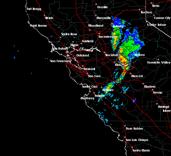 At 138 pm pdt, doppler radar indicated a severe thunderstorm capable of producing a tornado. this dangerous storm was located 10 miles north of winton, or 12 miles north of atwater, and moving northeast at 35 mph. * this tornadic thunderstorm will remain over mainly rural areas of western mariposa, southwestern tuolumne and north central merced counties. At 138 pm pdt, doppler radar indicated a severe thunderstorm capable of producing a tornado. this dangerous storm was located 10 miles north of winton, or 12 miles north of atwater, and moving northeast at 35 mph. * this tornadic thunderstorm will remain over mainly rural areas of western mariposa, southwestern tuolumne and north central merced counties.
|
| 3/21/2017 1:35 PM PDT |
 At 134 pm pdt, doppler radar continued to indicate a severe thunderstorm capable of producing a tornado. this dangerous storm was located 9 miles north of winton, or 10 miles north of atwater, moving northeast at 30 mph. this tornadic thunderstorm will remain over mainly rural areas of north central merced county. At 134 pm pdt, doppler radar continued to indicate a severe thunderstorm capable of producing a tornado. this dangerous storm was located 9 miles north of winton, or 10 miles north of atwater, moving northeast at 30 mph. this tornadic thunderstorm will remain over mainly rural areas of north central merced county.
|
| 3/21/2017 1:18 PM PDT |
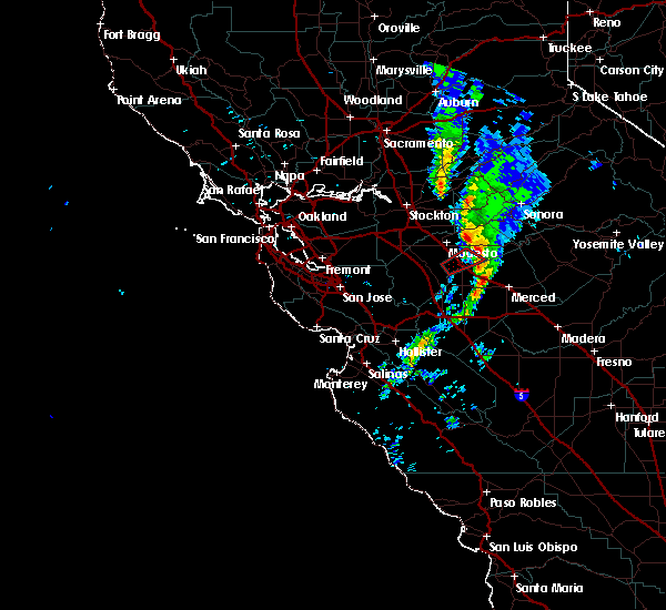 At 116 pm pdt, doppler radar indicated a severe thunderstorm capable of producing a tornado. this dangerous storm was located over winton, or near atwater, and moving northeast at 30 mph. At 116 pm pdt, doppler radar indicated a severe thunderstorm capable of producing a tornado. this dangerous storm was located over winton, or near atwater, and moving northeast at 30 mph.
|
Hail Maps for Snelling, CA
Connect with Interactive Hail Maps