

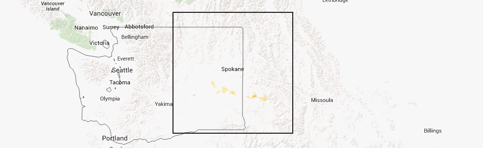
Hail Map for St. John, WA
The St. John, WA area has had 0 reports of on-the-ground hail by trained spotters, and has been under severe weather warnings 0 times during the past 12 months. Doppler radar has detected hail at or near St. John, WA on 1 occasion.
| Name: | St. John, WA |
| Where Located: | 39.9 miles SSW of Spokane, WA |
| Map: | Google Map for St. John, WA |
| Population: | 537 |
| Housing Units: | 304 |
| More Info: | Search Google for St. John, WA |
0
The Top Recent Hail Date for St. John, WA is Monday, July 16, 2012 (1st out of 1)
Hail and Wind Damage Spotted near St. John, WA
| Date / Time | Report Details |
|---|---|
| 7/13/2022 12:04 AM PDT |
 At 1204 am pdt, a severe thunderstorm was located 13 miles north of colfax, or 26 miles northwest of pullman, moving northeast at 50 mph (radar indicated). Hazards include quarter size hail. Damage to vehicles is expected. locations impacted include, rosalia, st. john, oakesdale, malden, thornton and pine city. hail threat, radar indicated max hail size, 1. 00 in wind threat, radar indicated max wind gust, <50 mph. At 1204 am pdt, a severe thunderstorm was located 13 miles north of colfax, or 26 miles northwest of pullman, moving northeast at 50 mph (radar indicated). Hazards include quarter size hail. Damage to vehicles is expected. locations impacted include, rosalia, st. john, oakesdale, malden, thornton and pine city. hail threat, radar indicated max hail size, 1. 00 in wind threat, radar indicated max wind gust, <50 mph.
|
| 7/12/2022 11:44 PM PDT |
 At 1144 pm pdt, a severe thunderstorm was located 17 miles west of colfax, or 30 miles northwest of pullman, moving northeast at 45 mph (radar indicated). Hazards include quarter size hail. damage to vehicles is expected At 1144 pm pdt, a severe thunderstorm was located 17 miles west of colfax, or 30 miles northwest of pullman, moving northeast at 45 mph (radar indicated). Hazards include quarter size hail. damage to vehicles is expected
|
| 5/30/2020 6:42 PM PDT |
 At 640 pm pdt, severe thunderstorms were located along a line extending from 19 miles east of ritzville to near colfax, moving northeast at 50 mph (radar indicated). Hazards include 70 mph wind gusts and quarter size hail. blowing dust with visibility locally reduced to less than one mile. Expect considerable tree damage. wind damage is also likely to mobile homes, roofs, and outbuildings. locations impacted include, pullman, colfax, ritzville, albion, st. John, endicott, lamont, marcellus, steptoe, tokio, revere, diamond, almota, mayview, ralston, pizzro, dusty, pine city, wawawai and marengo. At 640 pm pdt, severe thunderstorms were located along a line extending from 19 miles east of ritzville to near colfax, moving northeast at 50 mph (radar indicated). Hazards include 70 mph wind gusts and quarter size hail. blowing dust with visibility locally reduced to less than one mile. Expect considerable tree damage. wind damage is also likely to mobile homes, roofs, and outbuildings. locations impacted include, pullman, colfax, ritzville, albion, st. John, endicott, lamont, marcellus, steptoe, tokio, revere, diamond, almota, mayview, ralston, pizzro, dusty, pine city, wawawai and marengo.
|
| 5/30/2020 6:14 PM PDT |
 At 613 pm pdt, severe thunderstorms were located along a line extending from 16 miles south of ritzville to near pomeroy, moving northeast at 50 mph (radar indicated). Hazards include 70 mph wind gusts and quarter size hail. Expect considerable tree damage. wind damage is also likely to mobile homes, roofs, and outbuildings. Isolated large hail is also expected. At 613 pm pdt, severe thunderstorms were located along a line extending from 16 miles south of ritzville to near pomeroy, moving northeast at 50 mph (radar indicated). Hazards include 70 mph wind gusts and quarter size hail. Expect considerable tree damage. wind damage is also likely to mobile homes, roofs, and outbuildings. Isolated large hail is also expected.
|
| 5/30/2020 5:36 PM PDT |
 At 533 pm pdt, a severe thunderstorm was located near kahlotus, or 17 miles east of connell, moving northeast at 50 mph (radar indicated). Hazards include golf ball size hail and 70 mph wind gusts. Expect considerable tree damage. wind damage is also likely to mobile homes, roofs, and outbuildings. Isolated large hail is expected which may cause damage to roofs, siding, windows, and vehicles. At 533 pm pdt, a severe thunderstorm was located near kahlotus, or 17 miles east of connell, moving northeast at 50 mph (radar indicated). Hazards include golf ball size hail and 70 mph wind gusts. Expect considerable tree damage. wind damage is also likely to mobile homes, roofs, and outbuildings. Isolated large hail is expected which may cause damage to roofs, siding, windows, and vehicles.
|
| 9/15/2013 9:30 PM PDT | Tree on power in whitman county WA, 0.6 miles WNW of St. John, WA |
Hail Maps for St. John, WA

Connect with Interactive Hail Maps