

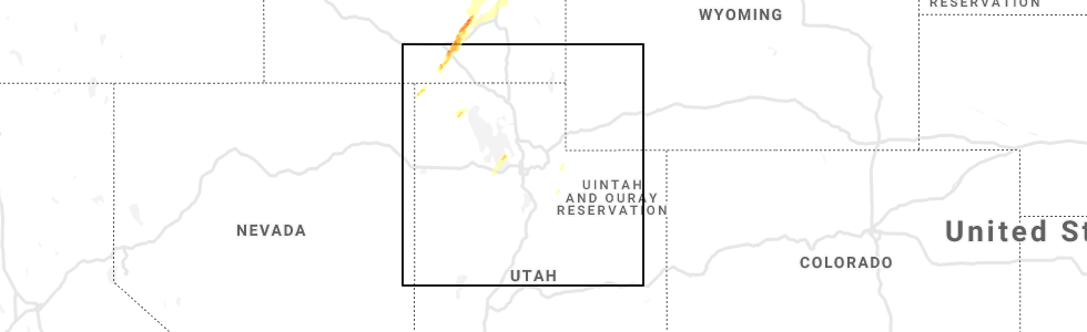
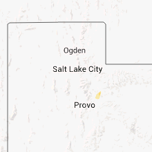
Hail Map for Timber Lakes, UT
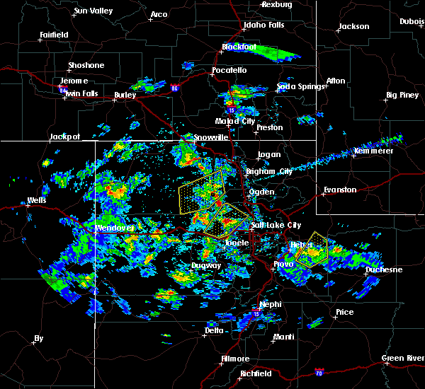
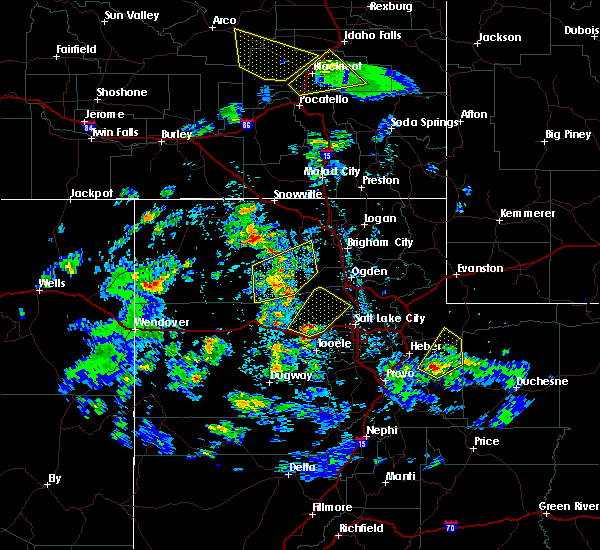
The Timber Lakes, UT area has had 0 reports of on-the-ground hail by trained spotters, and has been under severe weather warnings 10 times during the past 12 months. Doppler radar has detected hail at or near Timber Lakes, UT on 6 occasions.
| Name: | Timber Lakes, UT |
| Where Located: | 39.1 miles ESE of Salt Lake City, UT |
| Map: | Google Map for Timber Lakes, UT |
| Population: | 607 |
| Housing Units: | 833 |
| More Info: | Search Google for Timber Lakes, UT |
0
The Top Recent Hail Date for Timber Lakes, UT is Thursday, June 6, 2019 (5th out of 6)
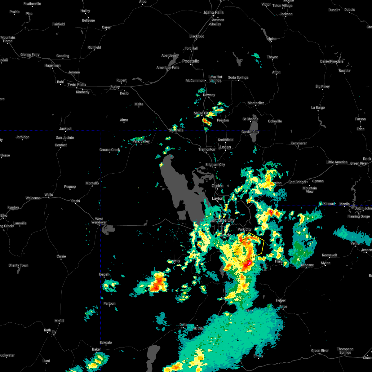
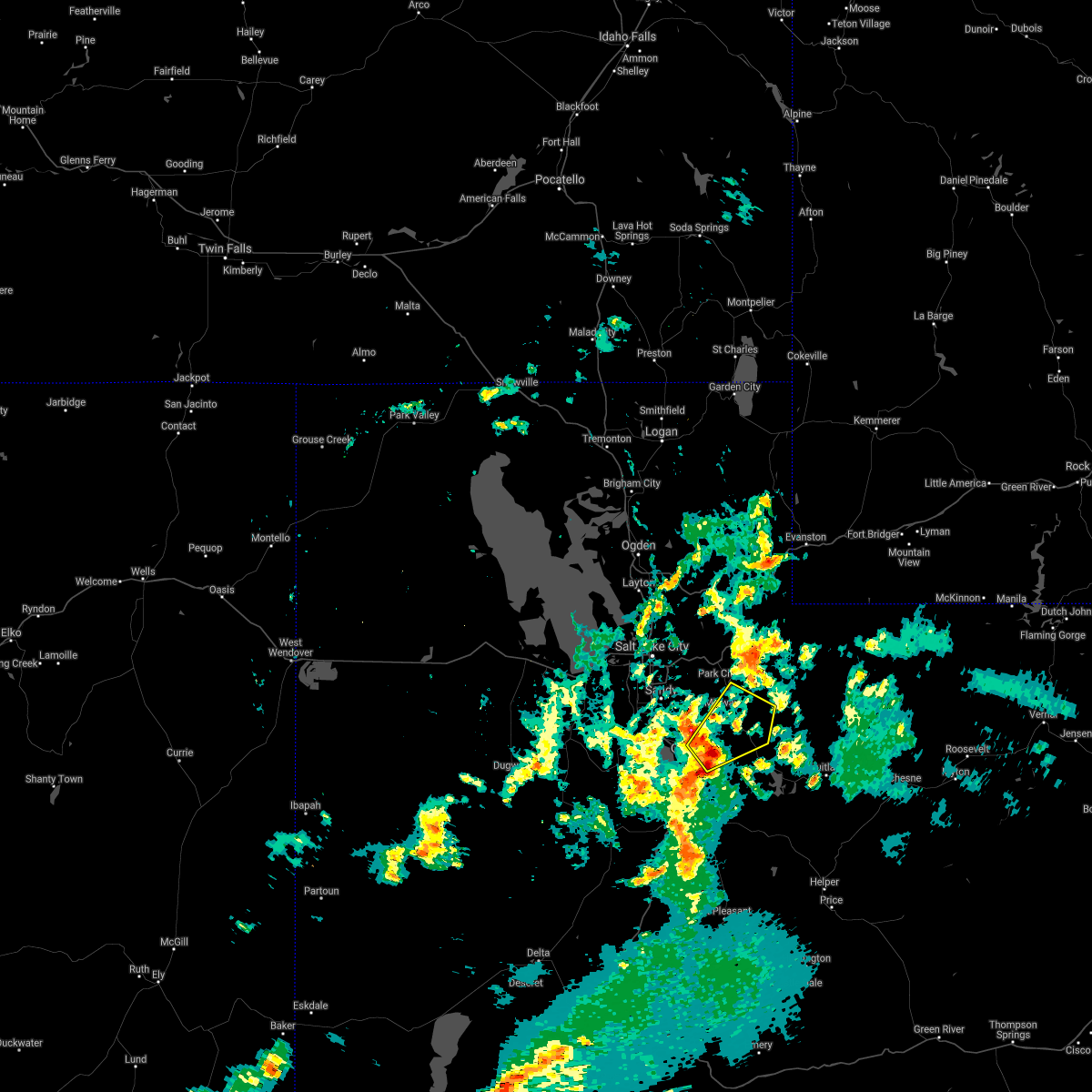
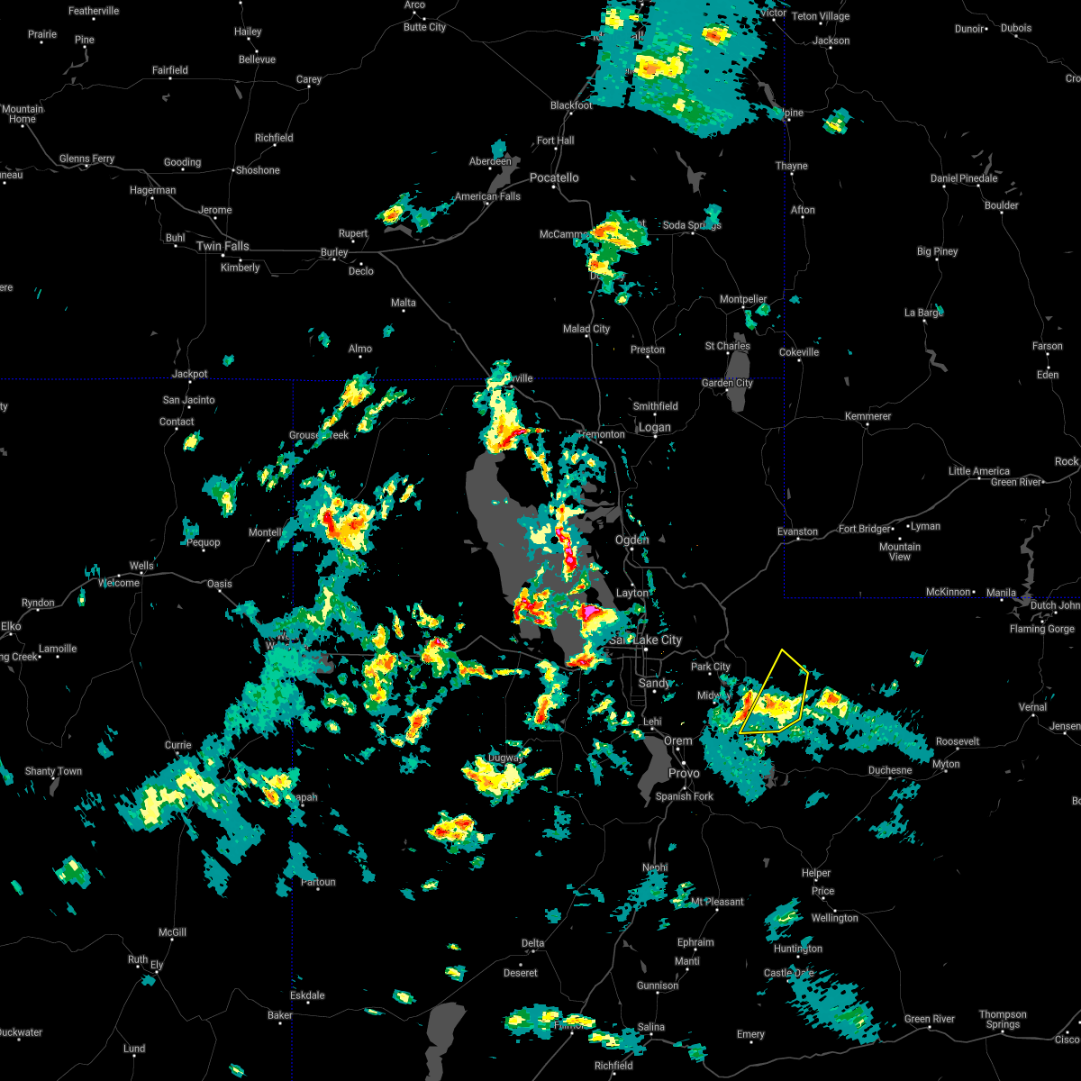
Hail and Wind Damage Spotted near Timber Lakes, UT
| Date / Time | Report Details |
|---|---|
| 8/2/2023 2:40 PM MDT |
 At 239 pm mdt, severe thunderstorms were located along a line extending from 6 miles southeast of tooele army depot south to lake shore, moving north at 25 mph (radar indicated). Hazards include 70 mph wind gusts and quarter size hail. Hail damage to vehicles is expected. expect considerable tree damage. wind damage is also likely to mobile homes, roofs, and outbuildings. locations impacted include, provo, heber city, orem, lehi, draper, pleasant grove, springville, american fork, eagle mountain, heber, lindon, alpine, daniel, cedar fort, vineyard, ophir, brigham young university, wasatch mountain state park, tooele army depot south and utah lake. this includes the following highways, interstate 15 between mile markers 262 and 285. us route 40 between mile markers 13 and 24. thunderstorm damage threat, considerable hail threat, radar indicated max hail size, 1. 00 in wind threat, radar indicated max wind gust, 70 mph. At 239 pm mdt, severe thunderstorms were located along a line extending from 6 miles southeast of tooele army depot south to lake shore, moving north at 25 mph (radar indicated). Hazards include 70 mph wind gusts and quarter size hail. Hail damage to vehicles is expected. expect considerable tree damage. wind damage is also likely to mobile homes, roofs, and outbuildings. locations impacted include, provo, heber city, orem, lehi, draper, pleasant grove, springville, american fork, eagle mountain, heber, lindon, alpine, daniel, cedar fort, vineyard, ophir, brigham young university, wasatch mountain state park, tooele army depot south and utah lake. this includes the following highways, interstate 15 between mile markers 262 and 285. us route 40 between mile markers 13 and 24. thunderstorm damage threat, considerable hail threat, radar indicated max hail size, 1. 00 in wind threat, radar indicated max wind gust, 70 mph.
|
| 8/2/2023 2:27 PM MDT |
 At 226 pm mdt, severe thunderstorms were located along a line extending from near tooele army depot south to near brigham young university, moving north at 35 mph (radar indicated). Hazards include 70 mph wind gusts and quarter size hail. Hail damage to vehicles is expected. expect considerable tree damage. Wind damage is also likely to mobile homes, roofs, and outbuildings. At 226 pm mdt, severe thunderstorms were located along a line extending from near tooele army depot south to near brigham young university, moving north at 35 mph (radar indicated). Hazards include 70 mph wind gusts and quarter size hail. Hail damage to vehicles is expected. expect considerable tree damage. Wind damage is also likely to mobile homes, roofs, and outbuildings.
|
| 7/26/2023 5:57 PM MDT |
 The severe thunderstorm warning for northwestern wasatch, southeastern salt lake and north central utah counties will expire at 600 pm mdt, the storms which prompted the warning have weakened below severe limits, and no longer pose an immediate threat to life or property. therefore, the warning will be allowed to expire. however gusty winds are still possible with these thunderstorms. The severe thunderstorm warning for northwestern wasatch, southeastern salt lake and north central utah counties will expire at 600 pm mdt, the storms which prompted the warning have weakened below severe limits, and no longer pose an immediate threat to life or property. therefore, the warning will be allowed to expire. however gusty winds are still possible with these thunderstorms.
|
| 7/26/2023 5:45 PM MDT |
 At 544 pm mdt, severe thunderstorms were located along a line extending from granite to 8 miles northeast of mapleton, moving east at 20 mph (automated sensors at provo airport and deer creek dam). Hazards include 60 mph wind gusts. Expect damage to roofs, siding, and trees. locations impacted include, provo, heber city, heber, summit park, daniel, little cottonwood canyon, wasatch mountain state park, mill creek canyon, big cottonwood canyon, timber lakes, midway, charleston, alta, wallsburg, brighton, deer creek state park, snowbird, sundance, hailstone and jordanelle reservoir. this includes the following highways, interstate 80 in utah between mile markers 137 and 138. us route 40 between mile markers 7 and 35. hail threat, radar indicated max hail size, <. 75 in wind threat, observed max wind gust, 60 mph. At 544 pm mdt, severe thunderstorms were located along a line extending from granite to 8 miles northeast of mapleton, moving east at 20 mph (automated sensors at provo airport and deer creek dam). Hazards include 60 mph wind gusts. Expect damage to roofs, siding, and trees. locations impacted include, provo, heber city, heber, summit park, daniel, little cottonwood canyon, wasatch mountain state park, mill creek canyon, big cottonwood canyon, timber lakes, midway, charleston, alta, wallsburg, brighton, deer creek state park, snowbird, sundance, hailstone and jordanelle reservoir. this includes the following highways, interstate 80 in utah between mile markers 137 and 138. us route 40 between mile markers 7 and 35. hail threat, radar indicated max hail size, <. 75 in wind threat, observed max wind gust, 60 mph.
|
| 7/26/2023 5:36 PM MDT |
 At 535 pm mdt, severe thunderstorms were located along a line extending from sandy to near springville, moving east at 20 mph (automated sensor at provo airport). Hazards include 60 mph wind gusts. Expect damage to roofs, siding, and trees. locations impacted include, provo, sandy, heber city, orem, lehi, draper, pleasant grove, cottonwood heights, springville, american fork, heber, lindon, alpine, mapleton, summit park, daniel, vineyard, little cottonwood canyon, brigham young university and wasatch mountain state park. this includes the following highways, interstate 15 between mile markers 262 and 265, and between mile markers 271 and 274. interstate 80 in utah between mile markers 136 and 138. us route 40 between mile markers 7 and 35. hail threat, radar indicated max hail size, <. 75 in wind threat, observed max wind gust, 60 mph. At 535 pm mdt, severe thunderstorms were located along a line extending from sandy to near springville, moving east at 20 mph (automated sensor at provo airport). Hazards include 60 mph wind gusts. Expect damage to roofs, siding, and trees. locations impacted include, provo, sandy, heber city, orem, lehi, draper, pleasant grove, cottonwood heights, springville, american fork, heber, lindon, alpine, mapleton, summit park, daniel, vineyard, little cottonwood canyon, brigham young university and wasatch mountain state park. this includes the following highways, interstate 15 between mile markers 262 and 265, and between mile markers 271 and 274. interstate 80 in utah between mile markers 136 and 138. us route 40 between mile markers 7 and 35. hail threat, radar indicated max hail size, <. 75 in wind threat, observed max wind gust, 60 mph.
|
| 7/26/2023 5:25 PM MDT |
 At 524 pm mdt, severe thunderstorms were located along a line extending from sandy to near springville, moving northeast at 20 mph. a wind gusts to 58 mph was just reported at provo airport (mesonet). Hazards include 60 mph wind gusts. expect damage to roofs, siding, and trees At 524 pm mdt, severe thunderstorms were located along a line extending from sandy to near springville, moving northeast at 20 mph. a wind gusts to 58 mph was just reported at provo airport (mesonet). Hazards include 60 mph wind gusts. expect damage to roofs, siding, and trees
|
| 7/3/2023 6:24 PM MDT |
 At 623 pm mdt, severe thunderstorms were located along a line extending from 15 miles northeast of morgan to 8 miles northwest of fruitland, moving east at 55 mph (radar indicated). Hazards include 60 mph wind gusts. expect damage to roofs, siding, and trees At 623 pm mdt, severe thunderstorms were located along a line extending from 15 miles northeast of morgan to 8 miles northwest of fruitland, moving east at 55 mph (radar indicated). Hazards include 60 mph wind gusts. expect damage to roofs, siding, and trees
|
| 7/3/2023 6:14 PM MDT |
 At 614 pm mdt, severe thunderstorms were located along a line extending from 8 miles north of morgan to 10 miles south of timber lakes, moving northeast at 40 mph (radar indicated). Hazards include 60 mph wind gusts. Expect damage to roofs, siding, and trees. locations impacted include, park city, morgan, coalville, heber city, heber, summit park, kamas, oakley, francis, daniel, wanship, wasatch mountain state park, south snyderville basin, samak, east canyon state park, north snyderville basin, timber lakes, emigration canyon, mill creek canyon and big cottonwood canyon. this includes the following highways, interstate 84 between mile markers 92 and 119. interstate 80 in utah between mile markers 136 and 177. us route 40 between mile markers 0 and 47. utah route 35 between mile markers 0 and 21. mirror lake highway between mile markers 0 and 14. hail threat, radar indicated max hail size, <. 75 in wind threat, observed max wind gust, 60 mph. At 614 pm mdt, severe thunderstorms were located along a line extending from 8 miles north of morgan to 10 miles south of timber lakes, moving northeast at 40 mph (radar indicated). Hazards include 60 mph wind gusts. Expect damage to roofs, siding, and trees. locations impacted include, park city, morgan, coalville, heber city, heber, summit park, kamas, oakley, francis, daniel, wanship, wasatch mountain state park, south snyderville basin, samak, east canyon state park, north snyderville basin, timber lakes, emigration canyon, mill creek canyon and big cottonwood canyon. this includes the following highways, interstate 84 between mile markers 92 and 119. interstate 80 in utah between mile markers 136 and 177. us route 40 between mile markers 0 and 47. utah route 35 between mile markers 0 and 21. mirror lake highway between mile markers 0 and 14. hail threat, radar indicated max hail size, <. 75 in wind threat, observed max wind gust, 60 mph.
|
| 7/3/2023 5:52 PM MDT |
 At 552 pm mdt, severe thunderstorms were located along a line extending from layton to 9 miles northeast of mapleton, moving northeast at 40 mph (radar indicated). Hazards include 60 mph wind gusts. expect damage to roofs, siding, and trees At 552 pm mdt, severe thunderstorms were located along a line extending from layton to 9 miles northeast of mapleton, moving northeast at 40 mph (radar indicated). Hazards include 60 mph wind gusts. expect damage to roofs, siding, and trees
|
| 9/21/2022 2:22 PM MDT |
 At 222 pm mdt, a severe thunderstorm was located near brigham young university, or near provo, moving northeast at 30 mph (radar indicated). Hazards include 60 mph wind gusts and quarter size hail. Hail damage to vehicles is expected. expect wind damage to roofs, siding, and trees. locations impacted include, provo, heber city, orem, heber, lindon, daniel, brigham young university, wasatch mountain state park, timber lakes, midway, charleston, wallsburg, deer creek state park and sundance. this includes the following highways, interstate 15 near mile marker 271. us route 40 between mile markers 11 and 25. hail threat, radar indicated max hail size, 1. 00 in wind threat, radar indicated max wind gust, 60 mph. At 222 pm mdt, a severe thunderstorm was located near brigham young university, or near provo, moving northeast at 30 mph (radar indicated). Hazards include 60 mph wind gusts and quarter size hail. Hail damage to vehicles is expected. expect wind damage to roofs, siding, and trees. locations impacted include, provo, heber city, orem, heber, lindon, daniel, brigham young university, wasatch mountain state park, timber lakes, midway, charleston, wallsburg, deer creek state park and sundance. this includes the following highways, interstate 15 near mile marker 271. us route 40 between mile markers 11 and 25. hail threat, radar indicated max hail size, 1. 00 in wind threat, radar indicated max wind gust, 60 mph.
|
| 9/21/2022 2:11 PM MDT |
 At 210 pm mdt, a severe thunderstorm was located over brigham young university, or over provo, moving northeast at 35 mph (radar indicated). Hazards include 60 mph wind gusts and quarter size hail. Hail damage to vehicles is expected. Expect wind damage to roofs, siding, and trees. At 210 pm mdt, a severe thunderstorm was located over brigham young university, or over provo, moving northeast at 35 mph (radar indicated). Hazards include 60 mph wind gusts and quarter size hail. Hail damage to vehicles is expected. Expect wind damage to roofs, siding, and trees.
|
| 7/17/2022 7:24 PM MDT |
 The severe thunderstorm warning for eastern weber, northern wasatch, northeastern salt lake, northeastern davis, morgan, western summit and north central utah counties will expire at 730 pm mdt, the storms which prompted the warning have weakened below severe limits, though wind gusts to 55 mph are still possible from mountain green to sundance and east. a special weather statement is now in effect. The severe thunderstorm warning for eastern weber, northern wasatch, northeastern salt lake, northeastern davis, morgan, western summit and north central utah counties will expire at 730 pm mdt, the storms which prompted the warning have weakened below severe limits, though wind gusts to 55 mph are still possible from mountain green to sundance and east. a special weather statement is now in effect.
|
| 7/17/2022 7:10 PM MDT |
 At 708 pm mdt, severe thunderstorms were located along a line extending from 14 miles east of weber state university to timber lakes, moving east at 35 mph (trained weather spotters). Hazards include 60 mph wind gusts. Expect damage to roofs, siding, and trees. locations impacted include, park city, morgan, coalville, heber city, heber, summit park, kamas, oakley, francis, daniel, wanship, south snyderville basin, mill creek canyon, samak, east canyon state park and emigration canyon. this includes the following highways, interstate 84 between mile markers 88 and 119. interstate 80 in utah between mile markers 131 and 179. us route 40 between mile markers 0 and 27. utah route 35 between mile markers 0 and 14. mirror lake highway between mile markers 0 and 17. hail threat, radar indicated max hail size, <. 75 in wind threat, radar indicated max wind gust, 60 mph. At 708 pm mdt, severe thunderstorms were located along a line extending from 14 miles east of weber state university to timber lakes, moving east at 35 mph (trained weather spotters). Hazards include 60 mph wind gusts. Expect damage to roofs, siding, and trees. locations impacted include, park city, morgan, coalville, heber city, heber, summit park, kamas, oakley, francis, daniel, wanship, south snyderville basin, mill creek canyon, samak, east canyon state park and emigration canyon. this includes the following highways, interstate 84 between mile markers 88 and 119. interstate 80 in utah between mile markers 131 and 179. us route 40 between mile markers 0 and 27. utah route 35 between mile markers 0 and 14. mirror lake highway between mile markers 0 and 17. hail threat, radar indicated max hail size, <. 75 in wind threat, radar indicated max wind gust, 60 mph.
|
| 7/17/2022 6:45 PM MDT |
 At 644 pm mdt, severe thunderstorms were located along a line extending from near weber state university to near daniel, moving east at 40 mph (trained weather spotters). Hazards include 60 mph wind gusts. expect damage to roofs, siding, and trees At 644 pm mdt, severe thunderstorms were located along a line extending from near weber state university to near daniel, moving east at 40 mph (trained weather spotters). Hazards include 60 mph wind gusts. expect damage to roofs, siding, and trees
|
| 8/17/2021 7:39 PM MDT |
 The severe thunderstorm warning for northwestern wasatch and southwestern summit counties will expire at 745 pm mdt, the storm which prompted the warning has weakened below severe limits, and has exited the warned area. therefore, the warning will be allowed to expire. however small hail and gusty winds are still possible with this thunderstorm. The severe thunderstorm warning for northwestern wasatch and southwestern summit counties will expire at 745 pm mdt, the storm which prompted the warning has weakened below severe limits, and has exited the warned area. therefore, the warning will be allowed to expire. however small hail and gusty winds are still possible with this thunderstorm.
|
| 8/17/2021 7:14 PM MDT |
 At 713 pm mdt, a severe thunderstorm was located near timber lakes, or near heber city, moving northeast at 40 mph (radar indicated. at 700 pm a 69 mph wind gust was reported at deer creek dam). Hazards include 60 mph wind gusts. expect damage to roofs, siding, and trees At 713 pm mdt, a severe thunderstorm was located near timber lakes, or near heber city, moving northeast at 40 mph (radar indicated. at 700 pm a 69 mph wind gust was reported at deer creek dam). Hazards include 60 mph wind gusts. expect damage to roofs, siding, and trees
|
| 8/17/2021 7:07 PM MDT |
 At 705 pm mdt, a severe thunderstorm was located near timber lakes, or 7 miles southeast of heber city, moving northeast at 45 mph (radar indicated). Hazards include 60 mph wind gusts. Expect damage to roofs, siding, and trees. locations impacted include, provo, heber city, orem, heber, lindon, daniel, wasatch mountain state park, timber lakes, midway, charleston, wallsburg, deer creek state park, sundance, hailstone and jordanelle reservoir. this includes us route 40 between mile markers 9 and 31. hail threat, radar indicated max hail size, <. 75 in wind threat, observed max wind gust, 60 mph. At 705 pm mdt, a severe thunderstorm was located near timber lakes, or 7 miles southeast of heber city, moving northeast at 45 mph (radar indicated). Hazards include 60 mph wind gusts. Expect damage to roofs, siding, and trees. locations impacted include, provo, heber city, orem, heber, lindon, daniel, wasatch mountain state park, timber lakes, midway, charleston, wallsburg, deer creek state park, sundance, hailstone and jordanelle reservoir. this includes us route 40 between mile markers 9 and 31. hail threat, radar indicated max hail size, <. 75 in wind threat, observed max wind gust, 60 mph.
|
| 8/17/2021 6:49 PM MDT |
 At 648 pm mdt, a severe thunderstorm was located 7 miles northeast of brigham young university, or 8 miles northeast of provo, moving northeast at 45 mph (radar indicated). Hazards include 60 mph wind gusts and quarter size hail. Hail damage to vehicles is expected. Expect wind damage to roofs, siding, and trees. At 648 pm mdt, a severe thunderstorm was located 7 miles northeast of brigham young university, or 8 miles northeast of provo, moving northeast at 45 mph (radar indicated). Hazards include 60 mph wind gusts and quarter size hail. Hail damage to vehicles is expected. Expect wind damage to roofs, siding, and trees.
|
| 6/6/2019 4:57 PM MDT |
 The severe thunderstorm warning for northeastern wasatch and south central summit counties will expire at 500 pm mdt, the storm which prompted the warning has weakened below severe limits, and no longer poses an immediate threat to life or property. therefore, the warning will be allowed to expire. however gusty winds and heavy rain are still possible with this thunderstorm. a severe thunderstorm watch remains in effect until 1100 pm mdt for northern utah. The severe thunderstorm warning for northeastern wasatch and south central summit counties will expire at 500 pm mdt, the storm which prompted the warning has weakened below severe limits, and no longer poses an immediate threat to life or property. therefore, the warning will be allowed to expire. however gusty winds and heavy rain are still possible with this thunderstorm. a severe thunderstorm watch remains in effect until 1100 pm mdt for northern utah.
|
| 6/6/2019 4:51 PM MDT |
 At 451 pm mdt, a severe thunderstorm was located 7 miles east of timber lakes, or 16 miles east of heber city, moving northeast at 30 mph (radar indicated). Hazards include 60 mph wind gusts and quarter size hail. Hail damage to vehicles is expected. expect wind damage to roofs, siding, and trees. Locations impacted include, timber lakes and trial lk. At 451 pm mdt, a severe thunderstorm was located 7 miles east of timber lakes, or 16 miles east of heber city, moving northeast at 30 mph (radar indicated). Hazards include 60 mph wind gusts and quarter size hail. Hail damage to vehicles is expected. expect wind damage to roofs, siding, and trees. Locations impacted include, timber lakes and trial lk.
|
| 6/6/2019 4:37 PM MDT |
 At 436 pm mdt, a severe thunderstorm was located near timber lakes, or 14 miles southeast of heber city, moving northeast at 30 mph (radar indicated). Hazards include 60 mph wind gusts and quarter size hail. Hail damage to vehicles is expected. Expect wind damage to roofs, siding, and trees. At 436 pm mdt, a severe thunderstorm was located near timber lakes, or 14 miles southeast of heber city, moving northeast at 30 mph (radar indicated). Hazards include 60 mph wind gusts and quarter size hail. Hail damage to vehicles is expected. Expect wind damage to roofs, siding, and trees.
|
| 12/16/2016 12:58 PM MST |
 The severe thunderstorm warning for utah, southeastern tooele, eastern salt lake, northeastern juab, south central morgan, northwestern wasatch and southwestern summit counties will expire at 100 pm mst, the storms which prompted the warning have weakened below severe limits, and no longer pose an immediate threat to life or property. therefore the warning will be allowed to expire. however gusty winds are still possible with any lingering thunderstorms. The severe thunderstorm warning for utah, southeastern tooele, eastern salt lake, northeastern juab, south central morgan, northwestern wasatch and southwestern summit counties will expire at 100 pm mst, the storms which prompted the warning have weakened below severe limits, and no longer pose an immediate threat to life or property. therefore the warning will be allowed to expire. however gusty winds are still possible with any lingering thunderstorms.
|
| 12/16/2016 12:20 PM MST |
 At 1218 pm mst, doppler radar indicated a line of severe thunderstorms capable of producing damaging winds in excess of 60 mph. these storms were located along a line extending from near summit park to 25 miles northwest of delta, and moving southeast at 35 mph. At 1218 pm mst, doppler radar indicated a line of severe thunderstorms capable of producing damaging winds in excess of 60 mph. these storms were located along a line extending from near summit park to 25 miles northwest of delta, and moving southeast at 35 mph.
|
Hail Maps for Timber Lakes, UT


Connect with Interactive Hail Maps