

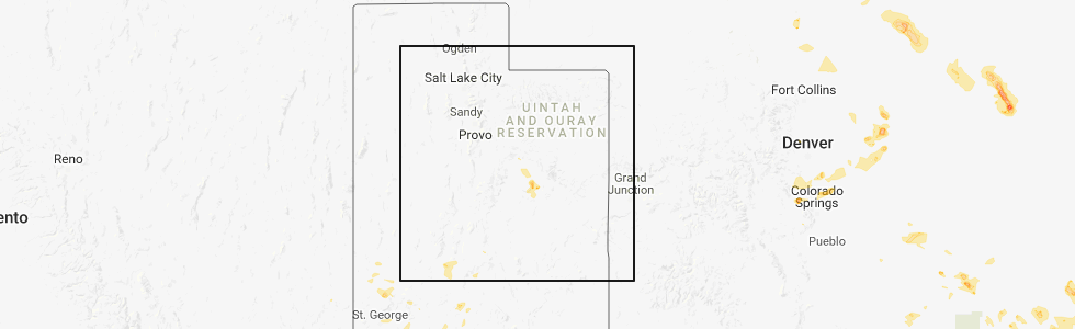
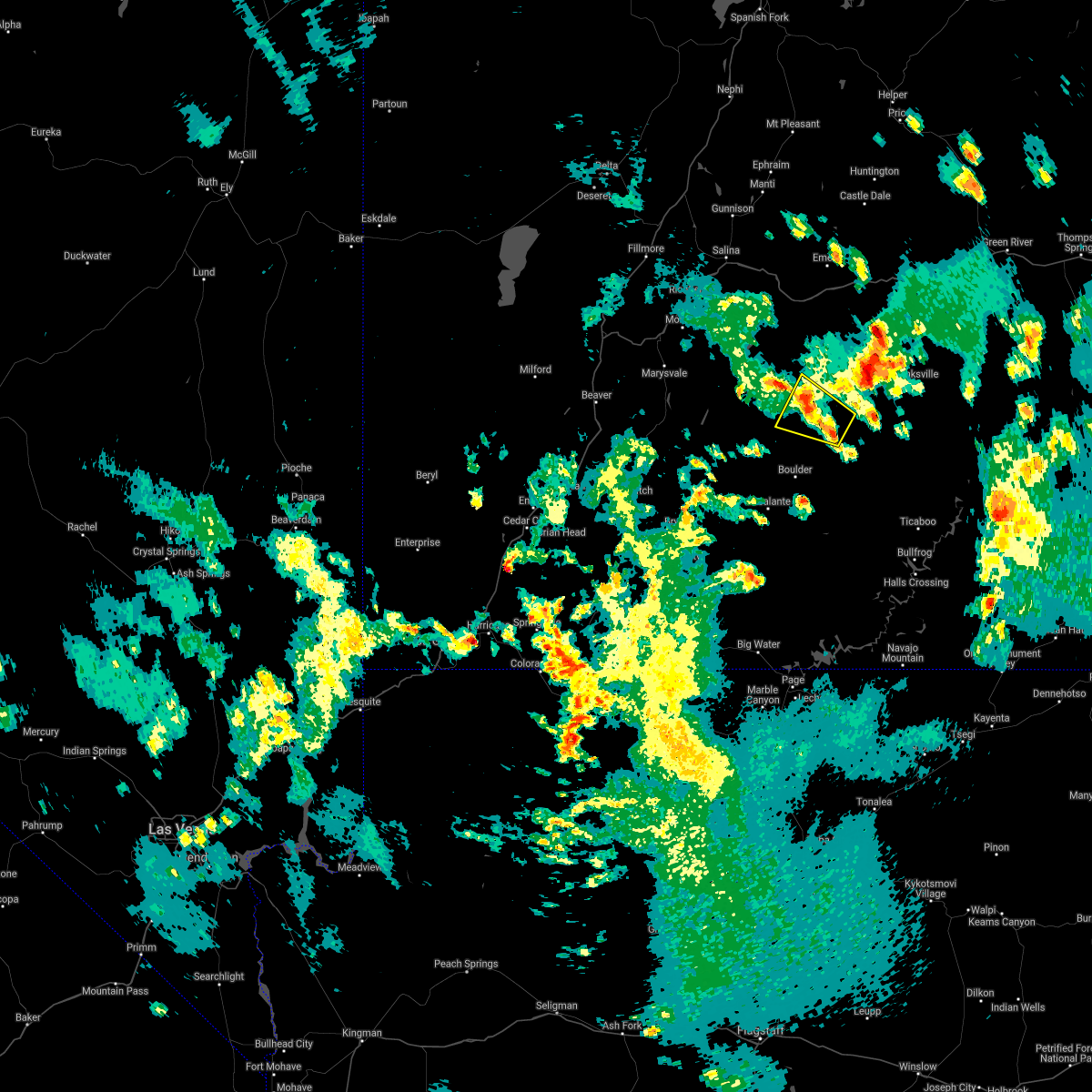
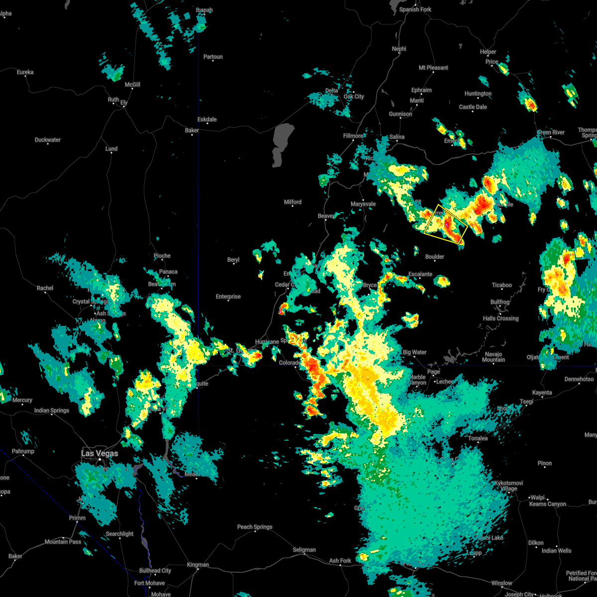
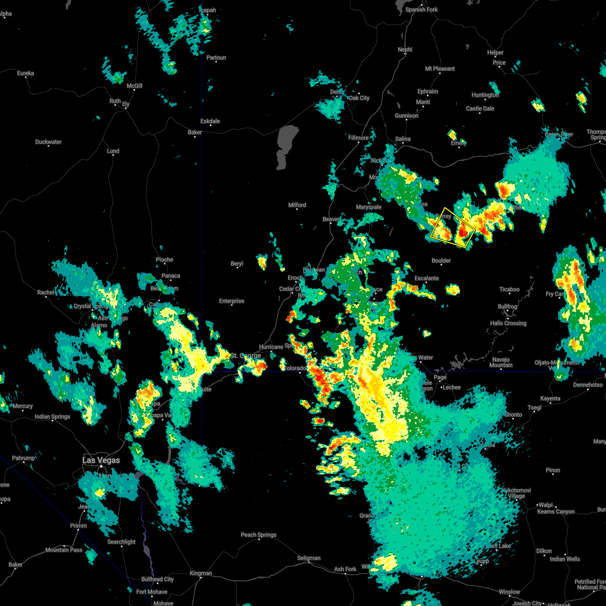
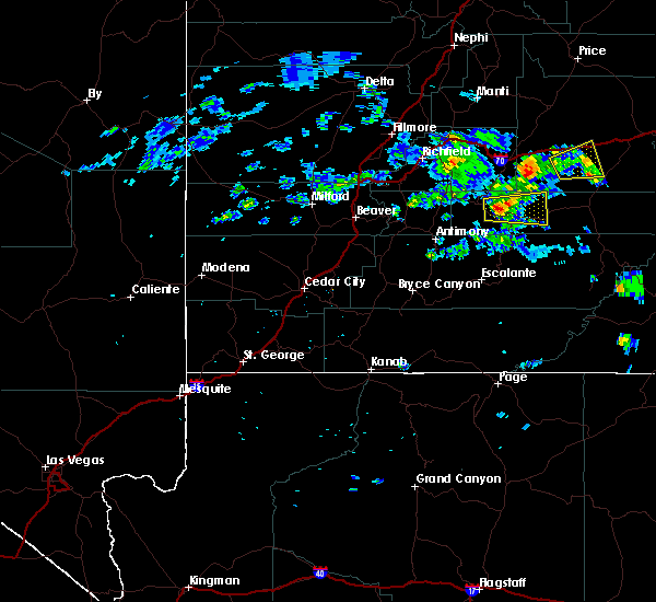
Hail Map for Torrey, UT
The Torrey, UT area has had 0 reports of on-the-ground hail by trained spotters, and has been under severe weather warnings 0 times during the past 12 months. Doppler radar has detected hail at or near Torrey, UT on 2 occasions.
| Name: | Torrey, UT |
| Where Located: | 44.2 miles ESE of Monroe, UT |
| Map: | Google Map for Torrey, UT |
| Population: | 182 |
| Housing Units: | 147 |
| More Info: | Search Google for Torrey, UT |
0
The Top Recent Hail Date for Torrey, UT is Tuesday, July 17, 2018 (2nd out of 2)
Hail and Wind Damage Spotted near Torrey, UT
| Date / Time | Report Details |
|---|---|
| 7/29/2021 8:08 PM MDT |
 The severe thunderstorm warning for north central garfield and southwestern wayne counties will expire at 815 pm mdt, the severe thunderstorm which prompted the warning has weakened. therefore, the warning will be allowed to expire. however small hail and gusty winds are still possible with this thunderstorm. The severe thunderstorm warning for north central garfield and southwestern wayne counties will expire at 815 pm mdt, the severe thunderstorm which prompted the warning has weakened. therefore, the warning will be allowed to expire. however small hail and gusty winds are still possible with this thunderstorm.
|
| 7/29/2021 7:57 PM MDT |
 At 757 pm mdt, a severe thunderstorm was located 7 miles southwest of capitol reef national park, moving northwest at 20 mph (radar indicated). Hazards include 60 mph wind gusts and half dollar size hail. Hail damage to vehicles is expected. expect wind damage to roofs, siding, and trees. locations impacted include, capitol reef national park, torrey, teasdale and fruita. this includes the following highways, utah route 12 between mile markers 107 and 122. Utah route 24 between mile markers 66 and 84. At 757 pm mdt, a severe thunderstorm was located 7 miles southwest of capitol reef national park, moving northwest at 20 mph (radar indicated). Hazards include 60 mph wind gusts and half dollar size hail. Hail damage to vehicles is expected. expect wind damage to roofs, siding, and trees. locations impacted include, capitol reef national park, torrey, teasdale and fruita. this includes the following highways, utah route 12 between mile markers 107 and 122. Utah route 24 between mile markers 66 and 84.
|
| 7/29/2021 7:41 PM MDT |
 At 741 pm mdt, a severe thunderstorm was located near capitol reef national park, moving northwest at 20 mph (radar indicated). Hazards include 60 mph wind gusts and half dollar size hail. Hail damage to vehicles is expected. Expect wind damage to roofs, siding, and trees. At 741 pm mdt, a severe thunderstorm was located near capitol reef national park, moving northwest at 20 mph (radar indicated). Hazards include 60 mph wind gusts and half dollar size hail. Hail damage to vehicles is expected. Expect wind damage to roofs, siding, and trees.
|
| 9/14/2017 3:05 PM MDT | Measured at henry mountain raws. observation arrived at 357pm due to hourly reporting... but radar indicates convective line passed at 305p in garfield county UT, 37.3 miles WNW of Torrey, UT |
| 8/3/2015 7:18 PM MDT |
 At 718 pm mdt, doppler radar indicated a severe thunderstorm capable of producing quarter size hail and damaging winds in excess of 60 mph. this storm was located near torrey, or 15 miles west of capitol reef national park, and moving east at 25 mph. At 718 pm mdt, doppler radar indicated a severe thunderstorm capable of producing quarter size hail and damaging winds in excess of 60 mph. this storm was located near torrey, or 15 miles west of capitol reef national park, and moving east at 25 mph.
|
Hail Maps for Torrey, UT


Connect with Interactive Hail Maps