

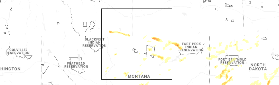
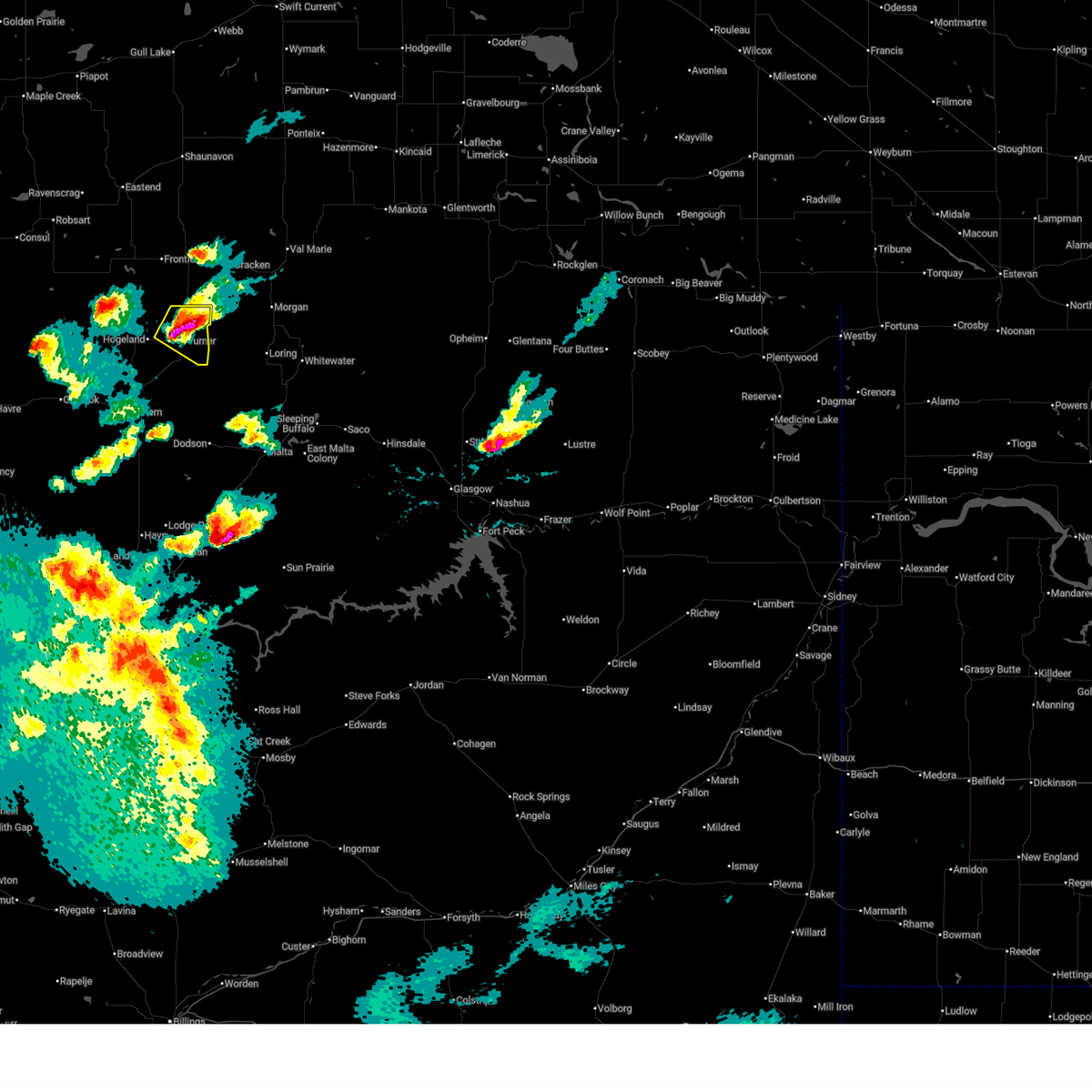
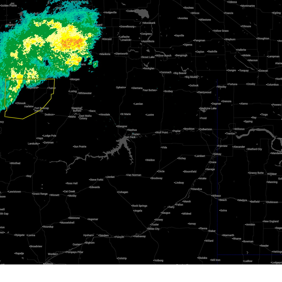
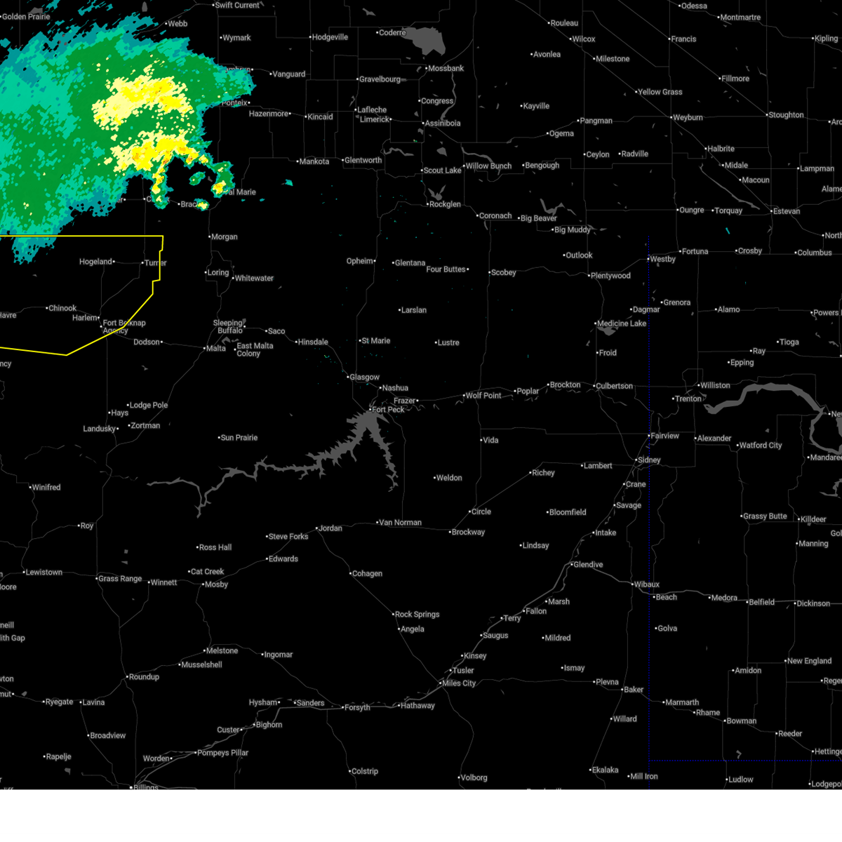
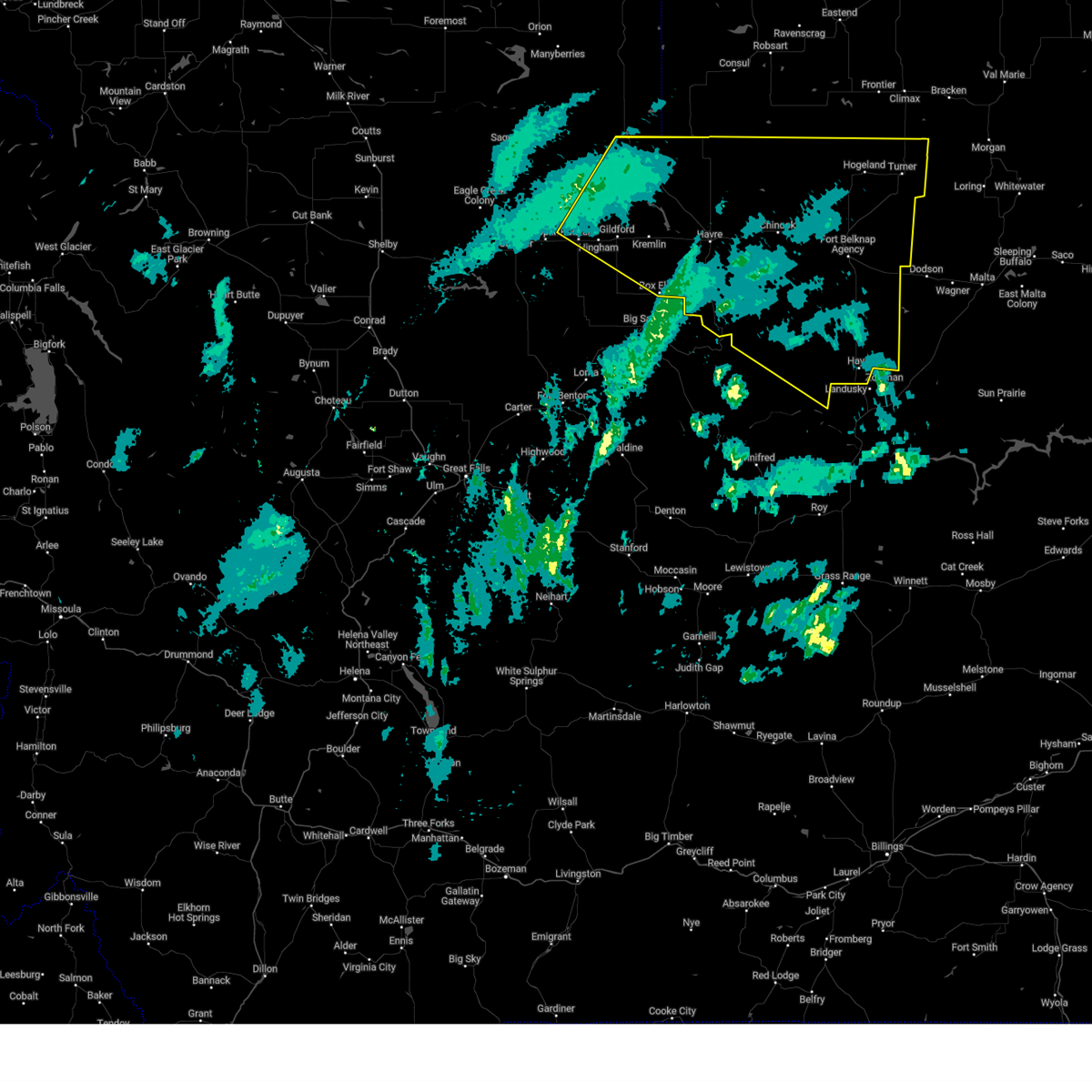
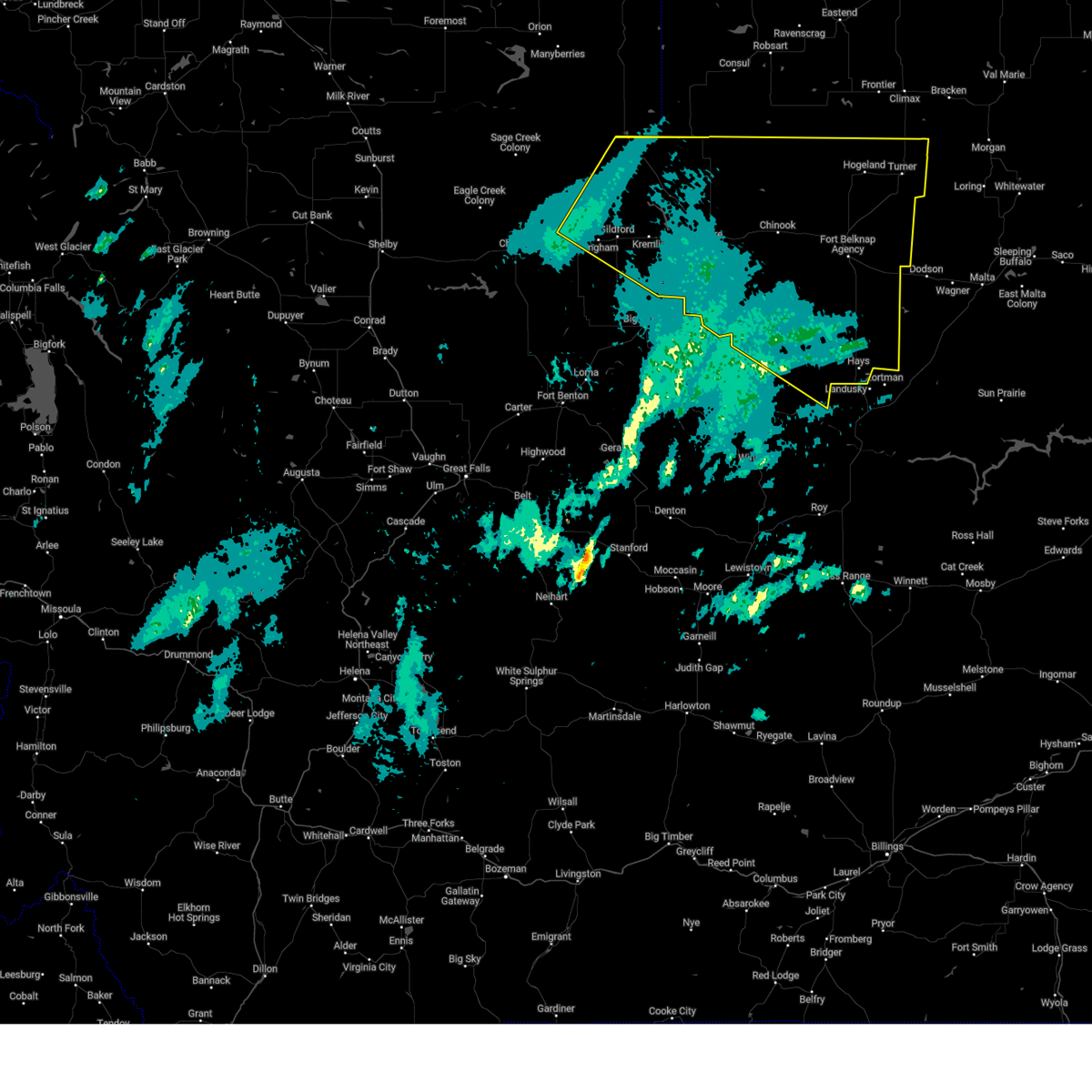
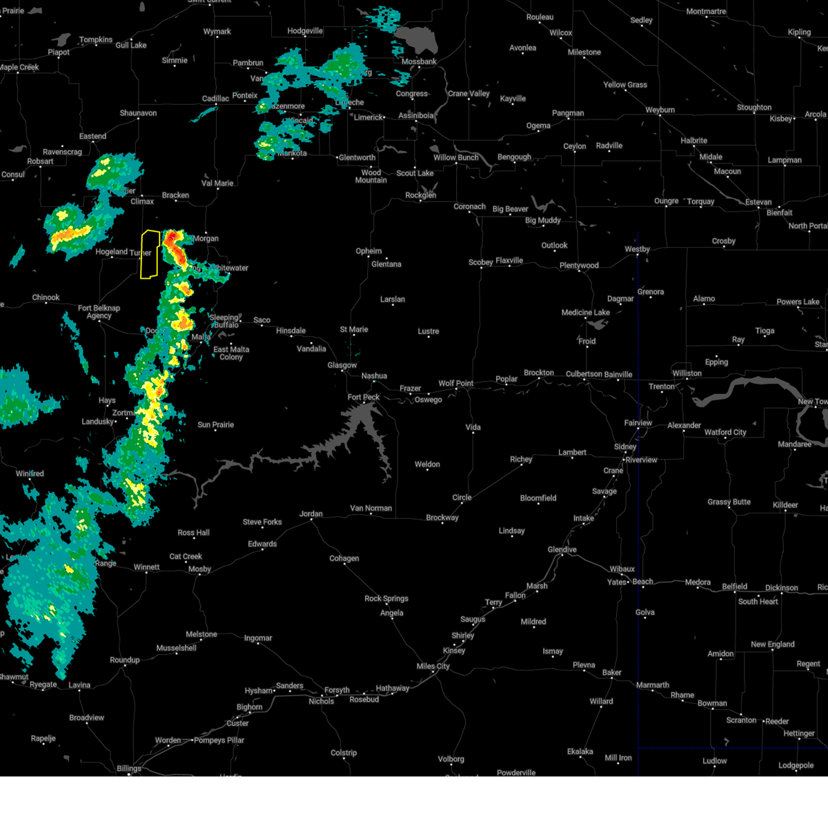
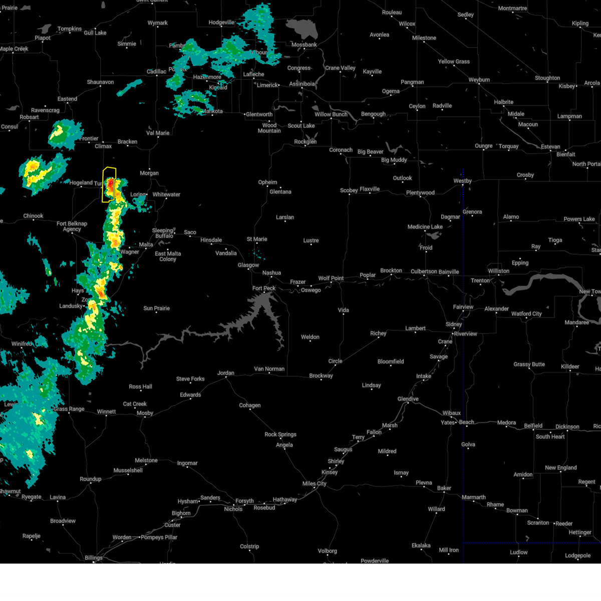
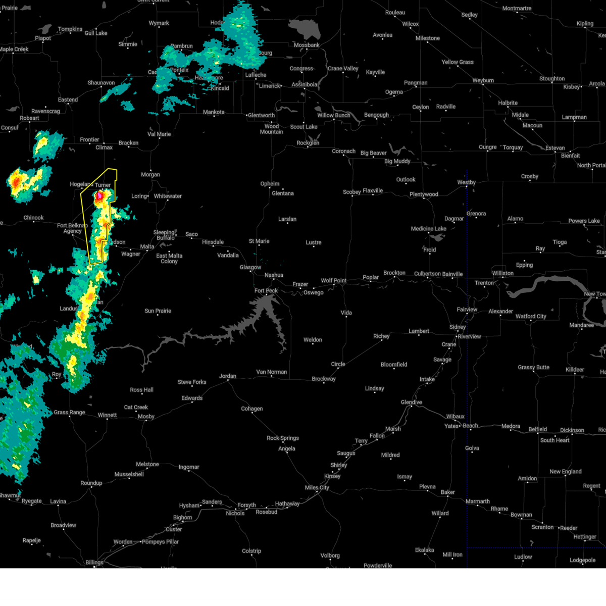
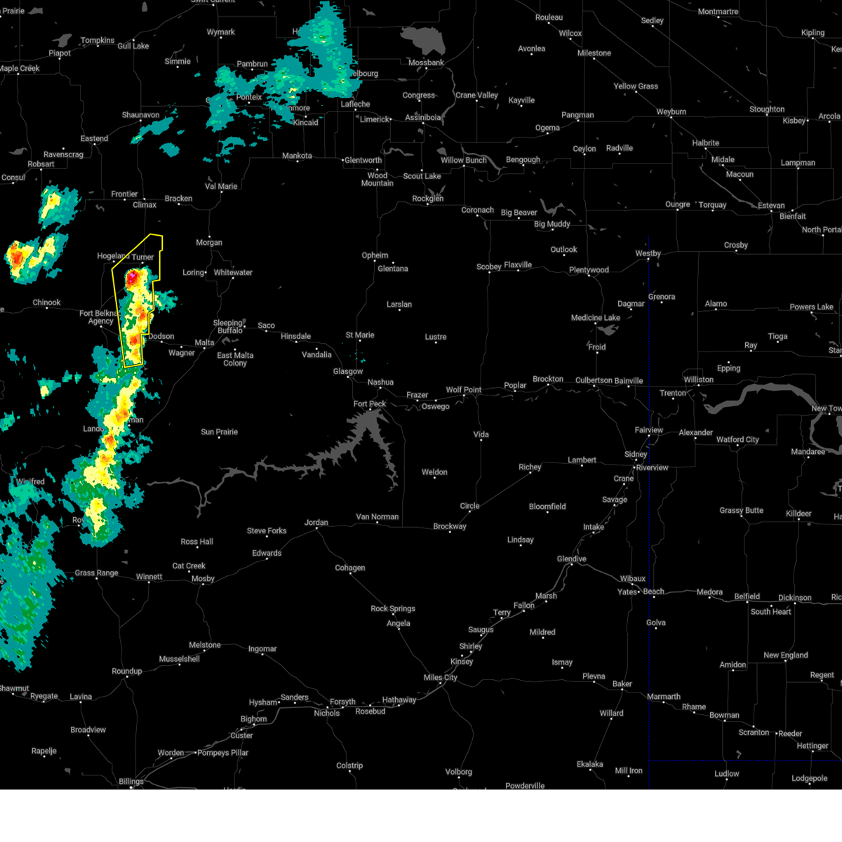
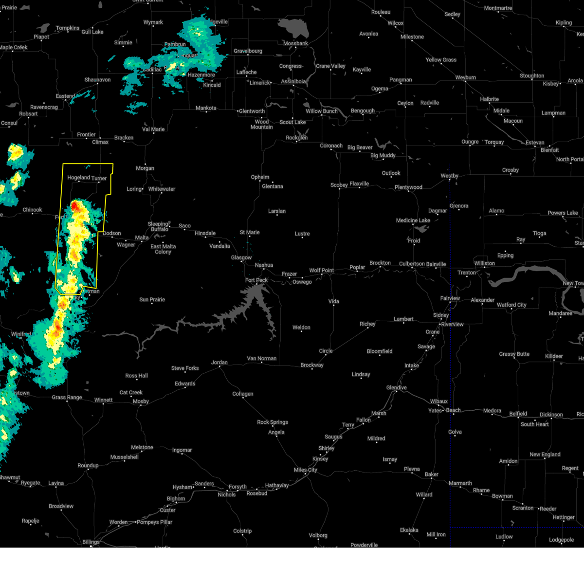
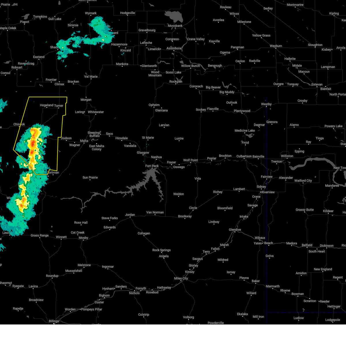
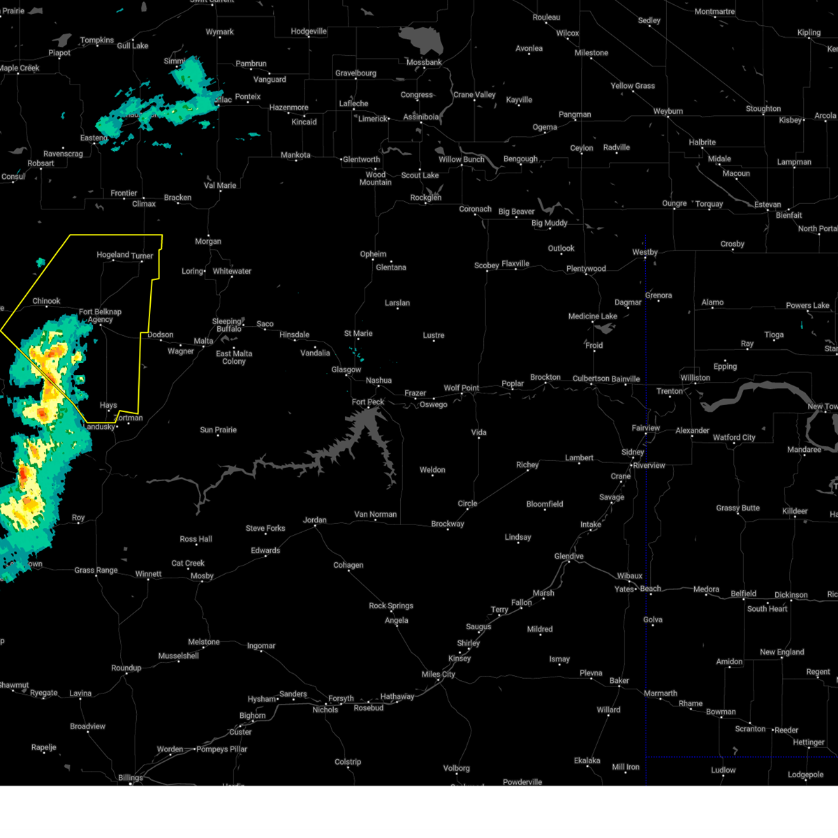
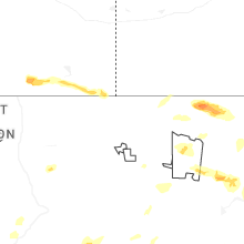
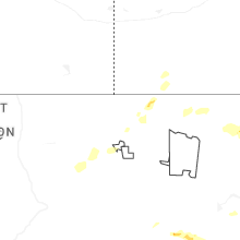
Hail Map for Turner, MT
The Turner, MT area has had 7 reports of on-the-ground hail by trained spotters, and has been under severe weather warnings 23 times during the past 12 months. Doppler radar has detected hail at or near Turner, MT on 17 occasions, including 2 occasions during the past year.
| Name: | Turner, MT |
| Where Located: | 61.5 miles ENE of Havre, MT |
| Map: | Google Map for Turner, MT |
| Population: | 61 |
| Housing Units: | 47 |
| More Info: | Search Google for Turner, MT |
2
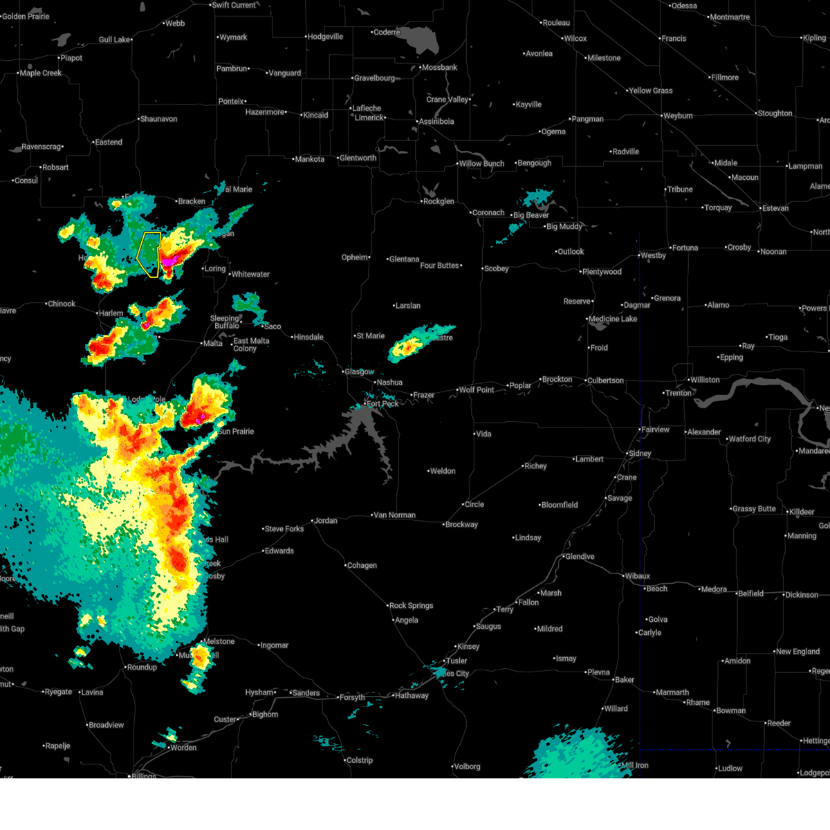
The Top Recent Hail Date for Turner, MT is Saturday, July 26, 2025 (3rd out of 17)
Hail and Wind Damage Spotted near Turner, MT
| Date / Time | Report Details |
|---|---|
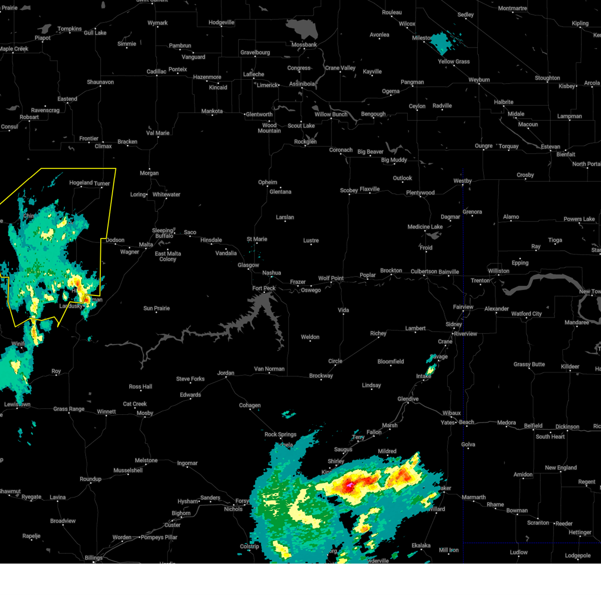
| 7/26/2025 7:55 PM MDT | Golf Ball sized hail reported 0.6 miles NE of Turner, MT, video on social media. |
| 7/26/2025 7:50 PM MDT |
 The storm which prompted the warning has moved out of the area. therefore, the warning will be allowed to expire. however, gusty winds are still possible with this thunderstorm. a severe thunderstorm watch remains in effect until 100 am mdt for north central montana. The storm which prompted the warning has moved out of the area. therefore, the warning will be allowed to expire. however, gusty winds are still possible with this thunderstorm. a severe thunderstorm watch remains in effect until 100 am mdt for north central montana.
|
| 7/26/2025 7:38 PM MDT |
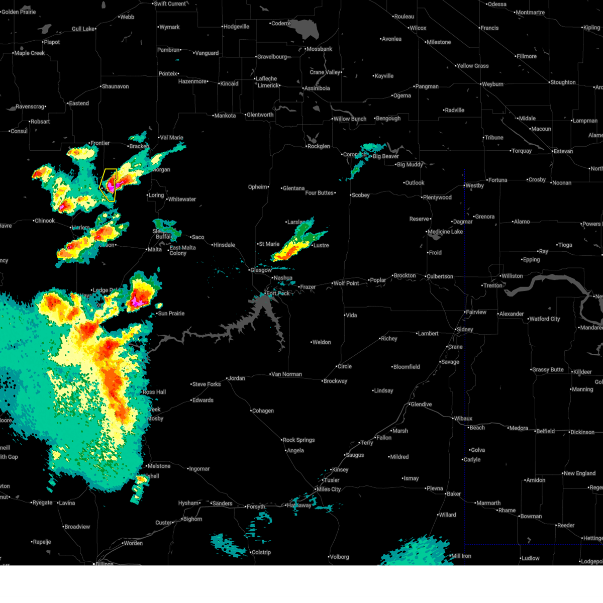 At 738 pm mdt, a severe thunderstorm was located near turner, or 29 miles west of whitewater, moving southeast at 20 mph (radar indicated). Hazards include ping pong ball size hail and 60 mph wind gusts. People and animals outdoors will be injured. expect hail damage to roofs, siding, windows, and vehicles. expect wind damage to roofs, siding, and trees. Locations impacted include, turner. At 738 pm mdt, a severe thunderstorm was located near turner, or 29 miles west of whitewater, moving southeast at 20 mph (radar indicated). Hazards include ping pong ball size hail and 60 mph wind gusts. People and animals outdoors will be injured. expect hail damage to roofs, siding, windows, and vehicles. expect wind damage to roofs, siding, and trees. Locations impacted include, turner.
|
| 7/26/2025 7:26 PM MDT |
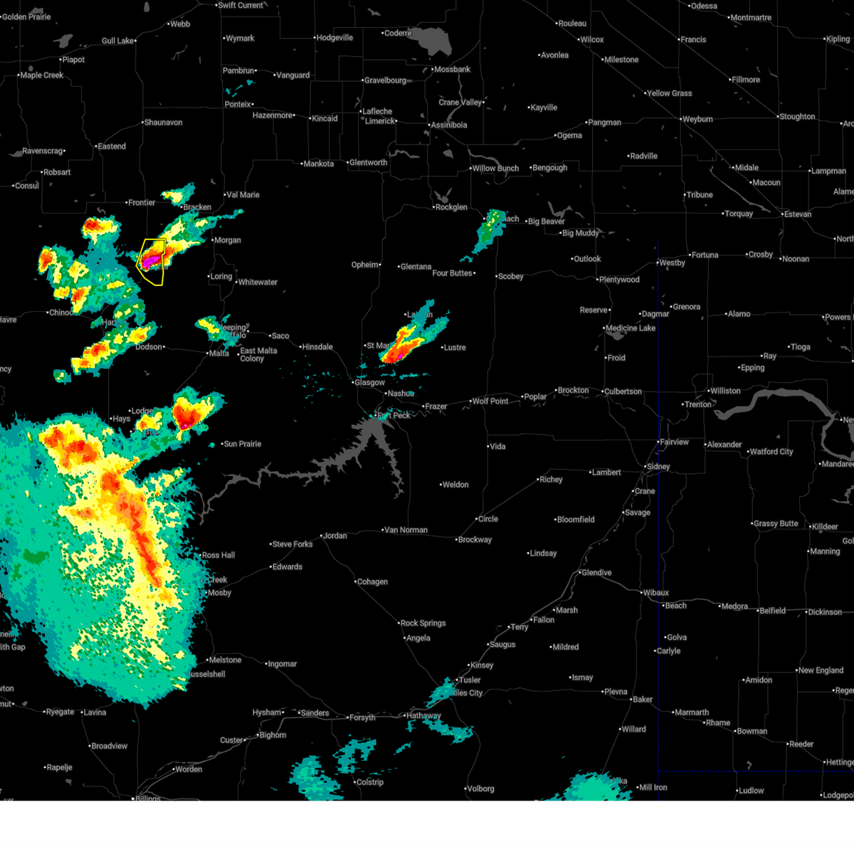 At 725 pm mdt, a severe thunderstorm was located near turner, or 33 miles west of whitewater, moving southeast at 20 mph (radar indicated). Hazards include ping pong ball size hail and 60 mph wind gusts. People and animals outdoors will be injured. expect hail damage to roofs, siding, windows, and vehicles. expect wind damage to roofs, siding, and trees. Locations impacted include, turner. At 725 pm mdt, a severe thunderstorm was located near turner, or 33 miles west of whitewater, moving southeast at 20 mph (radar indicated). Hazards include ping pong ball size hail and 60 mph wind gusts. People and animals outdoors will be injured. expect hail damage to roofs, siding, windows, and vehicles. expect wind damage to roofs, siding, and trees. Locations impacted include, turner.
|
| 7/26/2025 7:13 PM MDT |
 Svrtfx the national weather service in great falls has issued a * severe thunderstorm warning for, northeastern blaine county in north central montana, * until 800 pm mdt. * at 713 pm mdt, a severe thunderstorm was located near turner, or 37 miles west of whitewater, moving southeast at 20 mph (radar indicated). Hazards include 60 mph wind gusts and quarter size hail. Hail damage to vehicles is expected. Expect wind damage to roofs, siding, and trees. Svrtfx the national weather service in great falls has issued a * severe thunderstorm warning for, northeastern blaine county in north central montana, * until 800 pm mdt. * at 713 pm mdt, a severe thunderstorm was located near turner, or 37 miles west of whitewater, moving southeast at 20 mph (radar indicated). Hazards include 60 mph wind gusts and quarter size hail. Hail damage to vehicles is expected. Expect wind damage to roofs, siding, and trees.
|
| 7/14/2025 12:54 AM MDT |
 The storms which prompted the warning have weakened below severe limits, and no longer pose an immediate threat to life or property. therefore, the warning will be allowed to expire. The storms which prompted the warning have weakened below severe limits, and no longer pose an immediate threat to life or property. therefore, the warning will be allowed to expire.
|
| 7/14/2025 12:29 AM MDT |
 the severe thunderstorm warning has been cancelled and is no longer in effect the severe thunderstorm warning has been cancelled and is no longer in effect
|
| 7/14/2025 12:29 AM MDT |
 At 1227 am mdt, severe thunderstorms were located along a line extending from 28 miles northwest of turner to 22 miles northwest of harlem to near chinook to 7 miles south of havre, moving east at 55 mph (radar indicated). Hazards include 60 mph wind gusts. Expect damage to roofs, siding, and trees. Locations impacted include, chinook, harlem, fort belknap, turner, lohman, hogeland, and zurich. At 1227 am mdt, severe thunderstorms were located along a line extending from 28 miles northwest of turner to 22 miles northwest of harlem to near chinook to 7 miles south of havre, moving east at 55 mph (radar indicated). Hazards include 60 mph wind gusts. Expect damage to roofs, siding, and trees. Locations impacted include, chinook, harlem, fort belknap, turner, lohman, hogeland, and zurich.
|
| 7/13/2025 11:56 PM MDT |
 Svrtfx the national weather service in great falls has issued a * severe thunderstorm warning for, northern blaine county in north central montana, northeastern hill county in north central montana, * until 100 am mdt. * at 1155 pm mdt, severe thunderstorms were located along a line extending from 36 miles north of chinook to 20 miles north of havre to 6 miles north of beaver creek to 9 miles south of gildford, moving east at 55 mph (radar indicated). Hazards include 60 mph wind gusts. expect damage to roofs, siding, and trees Svrtfx the national weather service in great falls has issued a * severe thunderstorm warning for, northern blaine county in north central montana, northeastern hill county in north central montana, * until 100 am mdt. * at 1155 pm mdt, severe thunderstorms were located along a line extending from 36 miles north of chinook to 20 miles north of havre to 6 miles north of beaver creek to 9 miles south of gildford, moving east at 55 mph (radar indicated). Hazards include 60 mph wind gusts. expect damage to roofs, siding, and trees
|
| 5/12/2025 4:40 PM MDT |
 the severe thunderstorm warning has been cancelled and is no longer in effect the severe thunderstorm warning has been cancelled and is no longer in effect
|
| 5/12/2025 4:06 PM MDT |
 Svrtfx the national weather service in great falls has issued a * severe thunderstorm warning for, blaine county in north central montana, hill county in north central montana, * until 500 pm mdt. * at 403 pm mdt, severe thunderstorm winds were moving through portions of hill and blaine county (radar indicated). Hazards include 60 mph wind gusts. expect damage to roofs, siding, and trees Svrtfx the national weather service in great falls has issued a * severe thunderstorm warning for, blaine county in north central montana, hill county in north central montana, * until 500 pm mdt. * at 403 pm mdt, severe thunderstorm winds were moving through portions of hill and blaine county (radar indicated). Hazards include 60 mph wind gusts. expect damage to roofs, siding, and trees
|
| 5/11/2025 6:54 PM MDT |
 the severe thunderstorm warning has been cancelled and is no longer in effect the severe thunderstorm warning has been cancelled and is no longer in effect
|
| 5/11/2025 6:34 PM MDT |
 At 631 pm mdt, scattered severe thunderstorm wind gusts were located over portions of hill and blaine counties (radar indicated). Hazards include 60 mph wind gusts. Expect damage to roofs, siding, and trees. Locations impacted include, beaver creek, lohman, lodge pole, cleveland, zurich, hays, harlem, havre, chinook, fort belknap, turner, lloyd, and hogeland. At 631 pm mdt, scattered severe thunderstorm wind gusts were located over portions of hill and blaine counties (radar indicated). Hazards include 60 mph wind gusts. Expect damage to roofs, siding, and trees. Locations impacted include, beaver creek, lohman, lodge pole, cleveland, zurich, hays, harlem, havre, chinook, fort belknap, turner, lloyd, and hogeland.
|
| 5/11/2025 6:34 PM MDT |
 the severe thunderstorm warning has been cancelled and is no longer in effect the severe thunderstorm warning has been cancelled and is no longer in effect
|
| 5/11/2025 5:56 PM MDT |
 Svrtfx the national weather service in great falls has issued a * severe thunderstorm warning for, northern fergus county in central montana, blaine county in north central montana, southeastern hill county in north central montana, northeastern chouteau county in north central montana, * until 730 pm mdt. * at 554 pm mdt, severe thunderstorms were located along a line extending from 19 miles northwest of chinook to 21 miles northeast of roy, moving northeast at 30 mph (radar indicated). Hazards include 60 mph wind gusts. expect damage to roofs, siding, and trees Svrtfx the national weather service in great falls has issued a * severe thunderstorm warning for, northern fergus county in central montana, blaine county in north central montana, southeastern hill county in north central montana, northeastern chouteau county in north central montana, * until 730 pm mdt. * at 554 pm mdt, severe thunderstorms were located along a line extending from 19 miles northwest of chinook to 21 miles northeast of roy, moving northeast at 30 mph (radar indicated). Hazards include 60 mph wind gusts. expect damage to roofs, siding, and trees
|
| 5/10/2025 7:08 PM MDT |
 the severe thunderstorm warning has been cancelled and is no longer in effect the severe thunderstorm warning has been cancelled and is no longer in effect
|
| 5/10/2025 6:59 PM MDT |
 At 658 pm mdt, severe thunderstorms were located along a line extending from near turner to 8 miles north of dodson, moving northeast at 60 mph (radar indicated). Hazards include 60 mph wind gusts and quarter size hail. Hail damage to vehicles is expected. expect wind damage to roofs, siding, and trees. These severe thunderstorms will remain over mainly rural areas of northeastern blaine county. At 658 pm mdt, severe thunderstorms were located along a line extending from near turner to 8 miles north of dodson, moving northeast at 60 mph (radar indicated). Hazards include 60 mph wind gusts and quarter size hail. Hail damage to vehicles is expected. expect wind damage to roofs, siding, and trees. These severe thunderstorms will remain over mainly rural areas of northeastern blaine county.
|
| 5/10/2025 6:47 PM MDT |
 At 646 pm mdt, severe thunderstorms were located along a line extending from near turner to 8 miles west of dodson, moving east at 55 mph (radar indicated). Hazards include 60 mph wind gusts and half dollar size hail. Hail damage to vehicles is expected. expect wind damage to roofs, siding, and trees. Locations impacted include, turner. At 646 pm mdt, severe thunderstorms were located along a line extending from near turner to 8 miles west of dodson, moving east at 55 mph (radar indicated). Hazards include 60 mph wind gusts and half dollar size hail. Hail damage to vehicles is expected. expect wind damage to roofs, siding, and trees. Locations impacted include, turner.
|
| 5/10/2025 6:43 PM MDT |
 The storms which prompted the warning have moved out of the warned area. therefore, the warning will be allowed to expire. however, gusty winds are still possible with these thunderstorms. remember, a severe thunderstorm warning still remains in effect for northeastern blaine county in north central montana until 730 pm mdt. The storms which prompted the warning have moved out of the warned area. therefore, the warning will be allowed to expire. however, gusty winds are still possible with these thunderstorms. remember, a severe thunderstorm warning still remains in effect for northeastern blaine county in north central montana until 730 pm mdt.
|
| 5/10/2025 6:41 PM MDT |
 Svrtfx the national weather service in great falls has issued a * severe thunderstorm warning for, northeastern blaine county in north central montana, * until 730 pm mdt. * at 641 pm mdt, severe thunderstorms were located along a line extending from 8 miles southwest of turner to 11 miles west of dodson, moving northeast at 55 mph (radar indicated). Hazards include 60 mph wind gusts. expect damage to roofs, siding, and trees Svrtfx the national weather service in great falls has issued a * severe thunderstorm warning for, northeastern blaine county in north central montana, * until 730 pm mdt. * at 641 pm mdt, severe thunderstorms were located along a line extending from 8 miles southwest of turner to 11 miles west of dodson, moving northeast at 55 mph (radar indicated). Hazards include 60 mph wind gusts. expect damage to roofs, siding, and trees
|
| 5/10/2025 6:28 PM MDT |
 At 628 pm mdt, severe thunderstorms were located along a line extending from 14 miles north of harlem to 16 miles east of fort belknap to 11 miles south of dodson, moving northeast at 55 mph (radar indicated). Hazards include 60 mph wind gusts. Expect damage to roofs, siding, and trees. Locations impacted include, hays, harlem, lodge pole, hogeland, fort belknap, and turner. At 628 pm mdt, severe thunderstorms were located along a line extending from 14 miles north of harlem to 16 miles east of fort belknap to 11 miles south of dodson, moving northeast at 55 mph (radar indicated). Hazards include 60 mph wind gusts. Expect damage to roofs, siding, and trees. Locations impacted include, hays, harlem, lodge pole, hogeland, fort belknap, and turner.
|
| 5/10/2025 6:09 PM MDT |
 the severe thunderstorm warning has been cancelled and is no longer in effect the severe thunderstorm warning has been cancelled and is no longer in effect
|
| 5/10/2025 6:09 PM MDT |
 At 608 pm mdt, severe thunderstorms were located along a line extending from 7 miles east of chinook to 6 miles south of fort belknap to 11 miles northeast of hays, moving east at 55 mph (radar indicated). Hazards include 60 mph wind gusts. Expect damage to roofs, siding, and trees. Locations impacted include, hays, harlem, fort belknap, turner, lodge pole, hogeland, cleveland, and zurich. At 608 pm mdt, severe thunderstorms were located along a line extending from 7 miles east of chinook to 6 miles south of fort belknap to 11 miles northeast of hays, moving east at 55 mph (radar indicated). Hazards include 60 mph wind gusts. Expect damage to roofs, siding, and trees. Locations impacted include, hays, harlem, fort belknap, turner, lodge pole, hogeland, cleveland, and zurich.
|
| 5/10/2025 5:48 PM MDT |
 Svrtfx the national weather service in great falls has issued a * severe thunderstorm warning for, blaine county in north central montana, southeastern hill county in north central montana, * until 645 pm mdt. * at 547 pm mdt, severe thunderstorms were located along a line extending from 12 miles southwest of chinook to 21 miles southwest of fort belknap to 6 miles southwest of hays, moving northeast at 55 mph (public). Hazards include 60 mph wind gusts. expect damage to roofs, siding, and trees Svrtfx the national weather service in great falls has issued a * severe thunderstorm warning for, blaine county in north central montana, southeastern hill county in north central montana, * until 645 pm mdt. * at 547 pm mdt, severe thunderstorms were located along a line extending from 12 miles southwest of chinook to 21 miles southwest of fort belknap to 6 miles southwest of hays, moving northeast at 55 mph (public). Hazards include 60 mph wind gusts. expect damage to roofs, siding, and trees
|
| 7/30/2023 9:55 PM MDT |
 The severe thunderstorm warning for northeastern blaine county will expire at 1000 pm mdt, the storms which prompted the warning have weakened below severe limits, and have exited the warned area. therefore, the warning will be allowed to expire. strong gusty winds and small hail are still possible. The severe thunderstorm warning for northeastern blaine county will expire at 1000 pm mdt, the storms which prompted the warning have weakened below severe limits, and have exited the warned area. therefore, the warning will be allowed to expire. strong gusty winds and small hail are still possible.
|
| 7/30/2023 9:47 PM MDT |
 At 946 pm mdt, a severe thunderstorm was located 13 miles east of harlem, or 32 miles northwest of malta, moving east at 30 mph (radar indicated). Hazards include 60 mph wind gusts and quarter size hail. Hail damage to vehicles is expected. expect wind damage to roofs, siding, and trees. locations impacted include, harlem, fort belknap, turner and hogeland. hail threat, radar indicated max hail size, 1. 00 in wind threat, radar indicated max wind gust, 60 mph. At 946 pm mdt, a severe thunderstorm was located 13 miles east of harlem, or 32 miles northwest of malta, moving east at 30 mph (radar indicated). Hazards include 60 mph wind gusts and quarter size hail. Hail damage to vehicles is expected. expect wind damage to roofs, siding, and trees. locations impacted include, harlem, fort belknap, turner and hogeland. hail threat, radar indicated max hail size, 1. 00 in wind threat, radar indicated max wind gust, 60 mph.
|
| 7/30/2023 9:13 PM MDT |
 At 912 pm mdt, a severe thunderstorm was located over harlem, or 17 miles east of chinook, moving east at 30 mph (radar indicated). Hazards include 60 mph wind gusts and quarter size hail. Hail damage to vehicles is expected. Expect wind damage to roofs, siding, and trees. At 912 pm mdt, a severe thunderstorm was located over harlem, or 17 miles east of chinook, moving east at 30 mph (radar indicated). Hazards include 60 mph wind gusts and quarter size hail. Hail damage to vehicles is expected. Expect wind damage to roofs, siding, and trees.
|
| 6/6/2023 1:19 PM MDT |
 At 119 pm mdt, a severe thunderstorm was located 7 miles south of turner, or 35 miles west of whitewater, and is nearly stationary (radar indicated). Hazards include quarter size hail. damage to vehicles is expected At 119 pm mdt, a severe thunderstorm was located 7 miles south of turner, or 35 miles west of whitewater, and is nearly stationary (radar indicated). Hazards include quarter size hail. damage to vehicles is expected
|
| 7/9/2022 8:12 PM MDT |
 The severe thunderstorm warning for blaine county will expire at 815 pm mdt, the storms which prompted the warning have moved out of the area. therefore, the warning will be allowed to expire. a severe thunderstorm watch remains in effect until 1000 pm mdt for north central montana. The severe thunderstorm warning for blaine county will expire at 815 pm mdt, the storms which prompted the warning have moved out of the area. therefore, the warning will be allowed to expire. a severe thunderstorm watch remains in effect until 1000 pm mdt for north central montana.
|
| 7/9/2022 7:51 PM MDT |
 At 751 pm mdt, severe thunderstorms were located along a line extending from 23 miles west of turner to fort belknap to 20 miles west of hays, moving east at 55 mph (radar indicated). Hazards include 60 mph wind gusts. Expect damage to roofs, siding, and trees. locations impacted include, chinook, harlem, fort belknap, turner, lodge pole, lloyd, hogeland, cleveland and zurich. hail threat, radar indicated max hail size, <. 75 in wind threat, radar indicated max wind gust, 60 mph. At 751 pm mdt, severe thunderstorms were located along a line extending from 23 miles west of turner to fort belknap to 20 miles west of hays, moving east at 55 mph (radar indicated). Hazards include 60 mph wind gusts. Expect damage to roofs, siding, and trees. locations impacted include, chinook, harlem, fort belknap, turner, lodge pole, lloyd, hogeland, cleveland and zurich. hail threat, radar indicated max hail size, <. 75 in wind threat, radar indicated max wind gust, 60 mph.
|
| 7/9/2022 7:35 PM MDT |
 At 735 pm mdt, severe thunderstorms were located along a line extending from 34 miles northeast of havre to 10 miles southeast of chinook to 20 miles southeast of parker school, moving east at 55 mph (radar indicated). Hazards include 60 mph wind gusts. Expect damage to roofs, siding, and trees. locations impacted include, chinook, harlem, fort belknap, turner, parker school, lohman, lodge pole, lloyd, hogeland, cleveland and zurich. hail threat, radar indicated max hail size, <. 75 in wind threat, radar indicated max wind gust, 60 mph. At 735 pm mdt, severe thunderstorms were located along a line extending from 34 miles northeast of havre to 10 miles southeast of chinook to 20 miles southeast of parker school, moving east at 55 mph (radar indicated). Hazards include 60 mph wind gusts. Expect damage to roofs, siding, and trees. locations impacted include, chinook, harlem, fort belknap, turner, parker school, lohman, lodge pole, lloyd, hogeland, cleveland and zurich. hail threat, radar indicated max hail size, <. 75 in wind threat, radar indicated max wind gust, 60 mph.
|
| 7/9/2022 7:24 PM MDT |
 At 723 pm mdt, severe thunderstorms were located along a line extending from 29 miles north of havre to 8 miles southwest of chinook to 15 miles south of parker school, moving east at 50 mph (radar indicated). Hazards include 70 mph wind gusts. Expect considerable tree damage. damage is likely to mobile homes, roofs, and outbuildings. this storm produce wind gusts near 65 mph as it went through the city of havre. locations impacted include, havre, chinook, harlem, parker school, beaver creek, agency, fort belknap, turner, azure, sangrey, st. pierre, rocky boy, lohman, lodge pole, cleveland, zurich, lloyd and hogeland. thunderstorm damage threat, considerable hail threat, radar indicated max hail size, <. 75 in wind threat, radar indicated max wind gust, 70 mph. At 723 pm mdt, severe thunderstorms were located along a line extending from 29 miles north of havre to 8 miles southwest of chinook to 15 miles south of parker school, moving east at 50 mph (radar indicated). Hazards include 70 mph wind gusts. Expect considerable tree damage. damage is likely to mobile homes, roofs, and outbuildings. this storm produce wind gusts near 65 mph as it went through the city of havre. locations impacted include, havre, chinook, harlem, parker school, beaver creek, agency, fort belknap, turner, azure, sangrey, st. pierre, rocky boy, lohman, lodge pole, cleveland, zurich, lloyd and hogeland. thunderstorm damage threat, considerable hail threat, radar indicated max hail size, <. 75 in wind threat, radar indicated max wind gust, 70 mph.
|
| 7/9/2022 6:58 PM MDT |
 At 658 pm mdt, a severe thunderstorm was located over havre, moving east at 55 mph (radar indicated). Hazards include 60 mph wind gusts and penny size hail. expect damage to roofs, siding, and trees At 658 pm mdt, a severe thunderstorm was located over havre, moving east at 55 mph (radar indicated). Hazards include 60 mph wind gusts and penny size hail. expect damage to roofs, siding, and trees
|
| 7/8/2022 9:19 PM MDT |
 At 917 pm mdt, severe thunderstorms were located along a line extending from 15 miles north of havre to 9 miles west of harlem to near fort belknap, moving northeast at 45 mph (radar indicated). Hazards include 70 mph wind gusts and ping pong ball size hail. People and animals outdoors will be injured. expect hail damage to roofs, siding, windows, and vehicles. expect considerable tree damage. wind damage is also likely to mobile homes, roofs, and outbuildings. Locations impacted include, harlem, fort belknap, turner, hogeland and zurich. At 917 pm mdt, severe thunderstorms were located along a line extending from 15 miles north of havre to 9 miles west of harlem to near fort belknap, moving northeast at 45 mph (radar indicated). Hazards include 70 mph wind gusts and ping pong ball size hail. People and animals outdoors will be injured. expect hail damage to roofs, siding, windows, and vehicles. expect considerable tree damage. wind damage is also likely to mobile homes, roofs, and outbuildings. Locations impacted include, harlem, fort belknap, turner, hogeland and zurich.
|
| 7/8/2022 8:48 PM MDT |
 At 847 pm mdt, severe thunderstorms were located along a line extending from 6 miles northwest of beaver creek to 13 miles south of chinook to 21 miles southwest of fort belknap, moving northeast at 45 mph (radar and automated sensor indicated. at 845 pm, 60 mph wind was reported chinook). Hazards include 70 mph wind gusts and ping pong ball size hail. People and animals outdoors will be injured. expect hail damage to roofs, siding, windows, and vehicles. expect considerable tree damage. wind damage is also likely to mobile homes, roofs, and outbuildings. Locations impacted include, havre, chinook, harlem, beaver creek, fort belknap, turner, lohman, lloyd, kremlin, hogeland, cleveland and zurich. At 847 pm mdt, severe thunderstorms were located along a line extending from 6 miles northwest of beaver creek to 13 miles south of chinook to 21 miles southwest of fort belknap, moving northeast at 45 mph (radar and automated sensor indicated. at 845 pm, 60 mph wind was reported chinook). Hazards include 70 mph wind gusts and ping pong ball size hail. People and animals outdoors will be injured. expect hail damage to roofs, siding, windows, and vehicles. expect considerable tree damage. wind damage is also likely to mobile homes, roofs, and outbuildings. Locations impacted include, havre, chinook, harlem, beaver creek, fort belknap, turner, lohman, lloyd, kremlin, hogeland, cleveland and zurich.
|
| 7/8/2022 8:41 PM MDT |
 At 840 pm mdt, severe thunderstorms were located along a line extending from 7 miles northwest of beaver creek to 13 miles south of chinook to 23 miles southwest of fort belknap, moving northeast at 40 mph (radar indicated). Hazards include 70 mph wind gusts and ping pong ball size hail. People and animals outdoors will be injured. expect hail damage to roofs, siding, windows, and vehicles. expect considerable tree damage. Wind damage is also likely to mobile homes, roofs, and outbuildings. At 840 pm mdt, severe thunderstorms were located along a line extending from 7 miles northwest of beaver creek to 13 miles south of chinook to 23 miles southwest of fort belknap, moving northeast at 40 mph (radar indicated). Hazards include 70 mph wind gusts and ping pong ball size hail. People and animals outdoors will be injured. expect hail damage to roofs, siding, windows, and vehicles. expect considerable tree damage. Wind damage is also likely to mobile homes, roofs, and outbuildings.
|
| 7/6/2022 5:38 PM MDT |
 At 538 pm mdt, a severe thunderstorm was located 9 miles northwest of turner moving northeast at 25 mph (radar indicated). Hazards include quarter size hail. Damage to vehicles is expected. locations impacted include, turner and hogeland. hail threat, radar indicated max hail size, 1. 00 in wind threat, radar indicated max wind gust, <50 mph. At 538 pm mdt, a severe thunderstorm was located 9 miles northwest of turner moving northeast at 25 mph (radar indicated). Hazards include quarter size hail. Damage to vehicles is expected. locations impacted include, turner and hogeland. hail threat, radar indicated max hail size, 1. 00 in wind threat, radar indicated max wind gust, <50 mph.
|
| 7/6/2022 5:23 PM MDT |
 At 523 pm mdt, a severe thunderstorm was located 10 miles west of turner, moving northeast at 25 mph (radar indicated). Hazards include quarter size hail. Damage to vehicles is expected. locations impacted include, harlem, turner and hogeland. hail threat, radar indicated max hail size, 1. 00 in wind threat, radar indicated max wind gust, <50 mph. At 523 pm mdt, a severe thunderstorm was located 10 miles west of turner, moving northeast at 25 mph (radar indicated). Hazards include quarter size hail. Damage to vehicles is expected. locations impacted include, harlem, turner and hogeland. hail threat, radar indicated max hail size, 1. 00 in wind threat, radar indicated max wind gust, <50 mph.
|
| 7/6/2022 5:03 PM MDT |
 At 503 pm mdt, a severe thunderstorm was located 7 miles north of harlem, moving east at 15 mph (radar indicated). Hazards include quarter size hail. damage to vehicles is expected At 503 pm mdt, a severe thunderstorm was located 7 miles north of harlem, moving east at 15 mph (radar indicated). Hazards include quarter size hail. damage to vehicles is expected
|
| 7/11/2021 6:51 PM MDT |
 The severe thunderstorm warning for blaine, eastern hill and east central chouteau counties will expire at 700 pm mdt, wind speeds have weakened. therefore, the warning will be allowed to expire. however, gusty winds of 40 to 50 mph are still possible over the next 30 to 60 minutes. The severe thunderstorm warning for blaine, eastern hill and east central chouteau counties will expire at 700 pm mdt, wind speeds have weakened. therefore, the warning will be allowed to expire. however, gusty winds of 40 to 50 mph are still possible over the next 30 to 60 minutes.
|
| 7/11/2021 6:26 PM MDT |
 At 625 pm mdt, severe thunderstorms were located along a line extending from 16 miles west of turner to 20 miles west of hays, moving east at 45 mph (radar indicated). Hazards include 60 mph wind gusts. the severe wind gusts are occurring with only light to moderate rainfall. Expect damage to roofs, siding, and trees. Locations impacted include, chinook, harlem, hays, fort belknap, turner, lohman, lodge pole, lloyd, hogeland, cleveland and zurich. At 625 pm mdt, severe thunderstorms were located along a line extending from 16 miles west of turner to 20 miles west of hays, moving east at 45 mph (radar indicated). Hazards include 60 mph wind gusts. the severe wind gusts are occurring with only light to moderate rainfall. Expect damage to roofs, siding, and trees. Locations impacted include, chinook, harlem, hays, fort belknap, turner, lohman, lodge pole, lloyd, hogeland, cleveland and zurich.
|
| 7/11/2021 5:55 PM MDT |
 At 554 pm mdt, severe thunderstorms were located along a line extending from 25 miles north of chinook to 15 miles southeast of parker school, moving east at 50 mph (radar indicated). Hazards include 60 mph wind gusts. much of the severe wind gusts are occurring with only light to moderate rainfall. expect damage to roofs, siding, and trees At 554 pm mdt, severe thunderstorms were located along a line extending from 25 miles north of chinook to 15 miles southeast of parker school, moving east at 50 mph (radar indicated). Hazards include 60 mph wind gusts. much of the severe wind gusts are occurring with only light to moderate rainfall. expect damage to roofs, siding, and trees
|
| 7/6/2021 8:02 PM MDT |
 At 802 pm mdt, severe thunderstorms were located along a line extending from 10 miles east of turner to 14 miles north of harlem, moving southeast at 25 mph (radar indicated). Hazards include golf ball size hail and 60 mph wind gusts. People and animals outdoors will be injured. expect hail damage to roofs, siding, windows, and vehicles. expect wind damage to roofs, siding, and trees. Locations impacted include, harlem, fort belknap and turner. At 802 pm mdt, severe thunderstorms were located along a line extending from 10 miles east of turner to 14 miles north of harlem, moving southeast at 25 mph (radar indicated). Hazards include golf ball size hail and 60 mph wind gusts. People and animals outdoors will be injured. expect hail damage to roofs, siding, windows, and vehicles. expect wind damage to roofs, siding, and trees. Locations impacted include, harlem, fort belknap and turner.
|
| 7/6/2021 7:52 PM MDT |
 At 751 pm mdt, severe thunderstorms were located along a line extending from 9 miles northeast of turner to 17 miles north of harlem, moving southeast at 25 mph (radar indicated). Hazards include golf ball size hail and 60 mph wind gusts. People and animals outdoors will be injured. expect hail damage to roofs, siding, windows, and vehicles. expect wind damage to roofs, siding, and trees. Locations impacted include, harlem, fort belknap, turner, hogeland and zurich. At 751 pm mdt, severe thunderstorms were located along a line extending from 9 miles northeast of turner to 17 miles north of harlem, moving southeast at 25 mph (radar indicated). Hazards include golf ball size hail and 60 mph wind gusts. People and animals outdoors will be injured. expect hail damage to roofs, siding, windows, and vehicles. expect wind damage to roofs, siding, and trees. Locations impacted include, harlem, fort belknap, turner, hogeland and zurich.
|
| 7/6/2021 7:43 PM MDT |
 At 743 pm mdt, severe thunderstorms were located along a line extending from 9 miles northeast of turner to 19 miles north of harlem, moving southeast at 25 mph (radar indicated). Hazards include golf ball size hail and 60 mph wind gusts. People and animals outdoors will be injured. expect hail damage to roofs, siding, windows, and vehicles. expect wind damage to roofs, siding, and trees. Locations impacted include, harlem, fort belknap, turner, hogeland and zurich. At 743 pm mdt, severe thunderstorms were located along a line extending from 9 miles northeast of turner to 19 miles north of harlem, moving southeast at 25 mph (radar indicated). Hazards include golf ball size hail and 60 mph wind gusts. People and animals outdoors will be injured. expect hail damage to roofs, siding, windows, and vehicles. expect wind damage to roofs, siding, and trees. Locations impacted include, harlem, fort belknap, turner, hogeland and zurich.
|
| 7/6/2021 7:27 PM MDT |
 At 726 pm mdt, severe thunderstorms were located along a line extending from 12 miles north of turner to 25 miles north of harlem, moving southeast at 20 mph (radar indicated). Hazards include golf ball size hail and 60 mph wind gusts. People and animals outdoors will be injured. expect hail damage to roofs, siding, windows, and vehicles. Expect wind damage to roofs, siding, and trees. At 726 pm mdt, severe thunderstorms were located along a line extending from 12 miles north of turner to 25 miles north of harlem, moving southeast at 20 mph (radar indicated). Hazards include golf ball size hail and 60 mph wind gusts. People and animals outdoors will be injured. expect hail damage to roofs, siding, windows, and vehicles. Expect wind damage to roofs, siding, and trees.
|
| 7/6/2021 7:22 PM MDT |
 At 722 pm mdt, severe thunderstorms were located along a line extending from 14 miles north of turner to 30 miles north of chinook, moving southeast at 20 mph (radar indicated). Hazards include golf ball size hail and 60 mph wind gusts. People and animals outdoors will be injured. expect hail damage to roofs, siding, windows, and vehicles. expect wind damage to roofs, siding, and trees. Locations impacted include, harlem, turner and hogeland. At 722 pm mdt, severe thunderstorms were located along a line extending from 14 miles north of turner to 30 miles north of chinook, moving southeast at 20 mph (radar indicated). Hazards include golf ball size hail and 60 mph wind gusts. People and animals outdoors will be injured. expect hail damage to roofs, siding, windows, and vehicles. expect wind damage to roofs, siding, and trees. Locations impacted include, harlem, turner and hogeland.
|
| 7/6/2021 7:15 PM MDT |
 At 714 pm mdt, severe thunderstorms were located along a line extending from 15 miles north of turner to 31 miles north of chinook, moving southeast at 20 mph (radar indicated). Hazards include golf ball size hail and 60 mph wind gusts. People and animals outdoors will be injured. expect hail damage to roofs, siding, windows, and vehicles. expect wind damage to roofs, siding, and trees. Locations impacted include, harlem, turner and hogeland. At 714 pm mdt, severe thunderstorms were located along a line extending from 15 miles north of turner to 31 miles north of chinook, moving southeast at 20 mph (radar indicated). Hazards include golf ball size hail and 60 mph wind gusts. People and animals outdoors will be injured. expect hail damage to roofs, siding, windows, and vehicles. expect wind damage to roofs, siding, and trees. Locations impacted include, harlem, turner and hogeland.
|
| 7/6/2021 6:50 PM MDT |
 At 649 pm mdt, severe thunderstorms were located along a line extending from 22 miles north of turner to 35 miles north of chinook, moving southeast at 20 mph (radar indicated). Hazards include golf ball size hail and 60 mph wind gusts. People and animals outdoors will be injured. expect hail damage to roofs, siding, windows, and vehicles. Expect wind damage to roofs, siding, and trees. At 649 pm mdt, severe thunderstorms were located along a line extending from 22 miles north of turner to 35 miles north of chinook, moving southeast at 20 mph (radar indicated). Hazards include golf ball size hail and 60 mph wind gusts. People and animals outdoors will be injured. expect hail damage to roofs, siding, windows, and vehicles. Expect wind damage to roofs, siding, and trees.
|
| 7/7/2020 4:58 PM MDT |
 The severe thunderstorm warning for northeastern blaine county will expire at 500 pm mdt, this severe thunderstorm warning will be replaced with another warning. a severe thunderstorm watch remains in effect until 900 pm mdt for north central montana. The severe thunderstorm warning for northeastern blaine county will expire at 500 pm mdt, this severe thunderstorm warning will be replaced with another warning. a severe thunderstorm watch remains in effect until 900 pm mdt for north central montana.
|
| 7/7/2020 4:56 PM MDT |
 At 456 pm mdt, a severe thunderstorm was located 7 miles south of turner, or 34 miles west of whitewater, moving northeast at 40 mph (radar indicated). Hazards include ping pong ball size hail and 60 mph wind gusts. People and animals outdoors will be injured. expect hail damage to roofs, siding, windows, and vehicles. Expect wind damage to roofs, siding, and trees. At 456 pm mdt, a severe thunderstorm was located 7 miles south of turner, or 34 miles west of whitewater, moving northeast at 40 mph (radar indicated). Hazards include ping pong ball size hail and 60 mph wind gusts. People and animals outdoors will be injured. expect hail damage to roofs, siding, windows, and vehicles. Expect wind damage to roofs, siding, and trees.
|
| 7/7/2020 4:54 PM MDT | 3-4 foot chunks of tree branches down. a few bigger chunks in tow in blaine county MT, 0.6 miles SE of Turner, MT |
| 7/7/2020 4:50 PM MDT |
 At 449 pm mdt, a severe thunderstorm was located 28 miles east of port of morgan, or 29 miles northeast of whitewater, moving northeast at 45 mph (radar indicated). Hazards include ping pong ball size hail and 60 mph wind gusts. People and animals outdoors will be injured. expect hail damage to roofs, siding, windows, and vehicles. expect wind damage to roofs, siding, and trees. Locations impacted include, turner and hogeland. At 449 pm mdt, a severe thunderstorm was located 28 miles east of port of morgan, or 29 miles northeast of whitewater, moving northeast at 45 mph (radar indicated). Hazards include ping pong ball size hail and 60 mph wind gusts. People and animals outdoors will be injured. expect hail damage to roofs, siding, windows, and vehicles. expect wind damage to roofs, siding, and trees. Locations impacted include, turner and hogeland.
|
| 7/7/2020 4:34 PM MDT |
 At 433 pm mdt, severe thunderstorms were located over northern blaine county, moving east northeast at 45 mph (radar indicated). Hazards include ping pong ball size hail and 60 mph wind gusts. People and animals outdoors will be injured. expect hail damage to roofs, siding, windows, and vehicles. expect wind damage to roofs, siding, and trees. Locations impacted include, turner and hogeland. At 433 pm mdt, severe thunderstorms were located over northern blaine county, moving east northeast at 45 mph (radar indicated). Hazards include ping pong ball size hail and 60 mph wind gusts. People and animals outdoors will be injured. expect hail damage to roofs, siding, windows, and vehicles. expect wind damage to roofs, siding, and trees. Locations impacted include, turner and hogeland.
|
| 7/7/2020 4:30 PM MDT | 15-20 foot tall flowering crab apple tree down... along with a flagpole. received a little less than 1in of rai in blaine county MT, 17.8 miles E of Turner, MT |
| 7/7/2020 4:14 PM MDT |
 At 413 pm mdt, severe thunderstorms were located near chinook, moving east northeast at 45 mph (radar indicated). Hazards include ping pong ball size hail and 60 mph wind gusts. People and animals outdoors will be injured. expect hail damage to roofs, siding, windows, and vehicles. Expect wind damage to roofs, siding, and trees. At 413 pm mdt, severe thunderstorms were located near chinook, moving east northeast at 45 mph (radar indicated). Hazards include ping pong ball size hail and 60 mph wind gusts. People and animals outdoors will be injured. expect hail damage to roofs, siding, windows, and vehicles. Expect wind damage to roofs, siding, and trees.
|
| 6/27/2019 7:34 PM MDT |
 At 734 pm mdt, severe thunderstorms were located along a line extending from 17 miles northwest of turner to 21 miles east of roy, moving east at 30 mph (radar indicated). Hazards include 70 mph wind gusts and quarter size hail. Hail damage to vehicles is expected. expect wind damage to roofs, siding, and trees. Locations impacted include, hays, turner, valentine, lodge pole, hogeland and fred robinson bridge. At 734 pm mdt, severe thunderstorms were located along a line extending from 17 miles northwest of turner to 21 miles east of roy, moving east at 30 mph (radar indicated). Hazards include 70 mph wind gusts and quarter size hail. Hail damage to vehicles is expected. expect wind damage to roofs, siding, and trees. Locations impacted include, hays, turner, valentine, lodge pole, hogeland and fred robinson bridge.
|
| 6/27/2019 7:12 PM MDT |
 At 712 pm mdt, severe thunderstorms were located along a line extending from 27 miles west of turner to 12 miles east of roy, moving east at 30 mph (radar indicated). Hazards include 60 mph wind gusts and quarter size hail. Hail damage to vehicles is expected. expect wind damage to roofs, siding, and trees. Locations impacted include, harlem, hays, fort belknap, turner, fred robinson bridge, valentine, lodge pole and hogeland. At 712 pm mdt, severe thunderstorms were located along a line extending from 27 miles west of turner to 12 miles east of roy, moving east at 30 mph (radar indicated). Hazards include 60 mph wind gusts and quarter size hail. Hail damage to vehicles is expected. expect wind damage to roofs, siding, and trees. Locations impacted include, harlem, hays, fort belknap, turner, fred robinson bridge, valentine, lodge pole and hogeland.
|
| 6/27/2019 6:45 PM MDT |
 At 645 pm mdt, severe thunderstorms were located along a line extending from 27 miles north of chinook to near roy, moving east at 35 mph (radar indicated). Hazards include 60 mph wind gusts and quarter size hail. Hail damage to vehicles is expected. Expect wind damage to roofs, siding, and trees. At 645 pm mdt, severe thunderstorms were located along a line extending from 27 miles north of chinook to near roy, moving east at 35 mph (radar indicated). Hazards include 60 mph wind gusts and quarter size hail. Hail damage to vehicles is expected. Expect wind damage to roofs, siding, and trees.
|
| 7/10/2018 4:45 PM MDT | Quarter sized hail reported 2.8 miles NNE of Turner, MT, quarter sized hail reported in ne blaine county. semi and trailer also reported to be blown over in the area. |
| 7/4/2015 10:54 PM MDT |
 The severe thunderstorm warning for northeastern blaine county will expire at 1100 pm mdt, the storm which prompted the warning has moved out of the area. therefore the warning will be allowed to expire. a severe thunderstorm watch remains in effect until 500 am mdt for north central montana. The severe thunderstorm warning for northeastern blaine county will expire at 1100 pm mdt, the storm which prompted the warning has moved out of the area. therefore the warning will be allowed to expire. a severe thunderstorm watch remains in effect until 500 am mdt for north central montana.
|
| 7/4/2015 10:41 PM MDT |
 At 1041 pm mdt, a severe thunderstorm was located 11 miles north of dodson, or 24 miles northwest of malta, moving southeast at 55 mph (radar indicated). Hazards include 70 mph wind gusts and quarter size hail. Hail damage to vehicles is expected. expect considerable tree damage. wind damage is also likely to mobile homes, roofs and outbuildings. Locations impacted include, harlem, turner and hogeland. At 1041 pm mdt, a severe thunderstorm was located 11 miles north of dodson, or 24 miles northwest of malta, moving southeast at 55 mph (radar indicated). Hazards include 70 mph wind gusts and quarter size hail. Hail damage to vehicles is expected. expect considerable tree damage. wind damage is also likely to mobile homes, roofs and outbuildings. Locations impacted include, harlem, turner and hogeland.
|
| 7/4/2015 10:26 PM MDT |
 The severe thunderstorm warning for eastern hill and northern blaine counties will expire at 1030 pm mdt, the storm which prompted the warning has moved out of the area. therefore the warning will be allowed to expire. a severe thunderstorm watch remains in effect until 500 am mdt for north central montana. The severe thunderstorm warning for eastern hill and northern blaine counties will expire at 1030 pm mdt, the storm which prompted the warning has moved out of the area. therefore the warning will be allowed to expire. a severe thunderstorm watch remains in effect until 500 am mdt for north central montana.
|
| 7/4/2015 10:25 PM MDT |
 At 1025 pm mdt, a severe thunderstorm was located 11 miles northeast of harlem, or 29 miles east of chinook, moving southeast at 50 mph (radar indicated). Hazards include 70 mph wind gusts and quarter size hail. Hail damage to vehicles is expected. expect considerable tree damage. Wind damage is also likely to mobile homes, roofs and outbuildings. At 1025 pm mdt, a severe thunderstorm was located 11 miles northeast of harlem, or 29 miles east of chinook, moving southeast at 50 mph (radar indicated). Hazards include 70 mph wind gusts and quarter size hail. Hail damage to vehicles is expected. expect considerable tree damage. Wind damage is also likely to mobile homes, roofs and outbuildings.
|
| 7/4/2015 10:05 PM MDT |
 At 1005 pm mdt, a severe thunderstorm was located 14 miles north of harlem, or 19 miles northeast of chinook, moving southeast at 50 mph (radar indicated). Hazards include 70 mph wind gusts and ping pong ball size hail. People and animals outdoors will be injured. expect hail damage to roofs, siding, windows and vehicles. expect considerable tree damage. wind damage is also likely to mobile homes, roofs and outbuildings. Locations impacted include, harlem, turner, hogeland and zurich. At 1005 pm mdt, a severe thunderstorm was located 14 miles north of harlem, or 19 miles northeast of chinook, moving southeast at 50 mph (radar indicated). Hazards include 70 mph wind gusts and ping pong ball size hail. People and animals outdoors will be injured. expect hail damage to roofs, siding, windows and vehicles. expect considerable tree damage. wind damage is also likely to mobile homes, roofs and outbuildings. Locations impacted include, harlem, turner, hogeland and zurich.
|
| 7/4/2015 9:54 PM MDT |
 At 954 pm mdt, a severe thunderstorm was located 16 miles northeast of chinook, moving southeast at 45 mph (radar indicated). Hazards include 70 mph wind gusts and quarter size hail. Hail damage to vehicles is expected. expect considerable tree damage. Wind damage is also likely to mobile homes, roofs and outbuildings. At 954 pm mdt, a severe thunderstorm was located 16 miles northeast of chinook, moving southeast at 45 mph (radar indicated). Hazards include 70 mph wind gusts and quarter size hail. Hail damage to vehicles is expected. expect considerable tree damage. Wind damage is also likely to mobile homes, roofs and outbuildings.
|
| 8/28/2014 9:10 PM MDT | Golf Ball sized hail reported 7.9 miles WNW of Turner, MT, hail mixed with heavy rain. |
| 8/28/2014 8:47 PM MDT | Quarter sized hail reported 0.6 miles NE of Turner, MT |
| 8/28/2014 8:47 PM MDT | Storm damage reported in blaine county MT, 0.6 miles NE of Turner, MT |
| 5/28/2014 8:28 PM MDT | Quarter sized hail reported 10.1 miles ENE of Turner, MT |
| 5/28/2014 8:28 PM MDT | Storm damage reported in blaine county MT, 10.1 miles ENE of Turner, MT |
| 7/23/2012 6:10 PM MDT | Golf Ball sized hail reported 0.6 miles SE of Turner, MT, golf ball sized hail and heavy rain. |
| 6/8/2012 3:25 PM MDT | Quarter sized hail reported 12.1 miles ENE of Turner, MT |
Hail Maps for Turner, MT


Connect with Interactive Hail Maps