

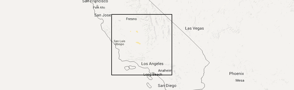
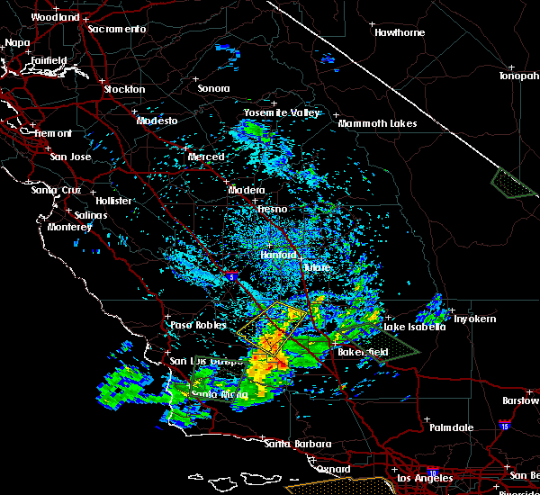
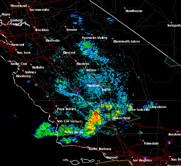
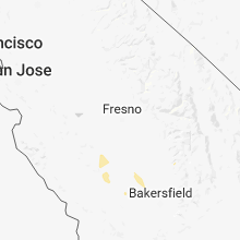
Hail Map for Wasco, CA
The Wasco, CA area has had 0 reports of on-the-ground hail by trained spotters, and has been under severe weather warnings 0 times during the past 12 months. Doppler radar has detected hail at or near Wasco, CA on 2 occasions.
| Name: | Wasco, CA |
| Where Located: | 24.3 miles NW of Bakersfield, CA |
| Map: | Google Map for Wasco, CA |
| Population: | 25545 |
| Housing Units: | 5477 |
| More Info: | Search Google for Wasco, CA |
5
The Top Recent Hail Date for Wasco, CA is Sunday, April 24, 2016 (1st out of 2)
Hail and Wind Damage Spotted near Wasco, CA
| Date / Time | Report Details |
|---|---|
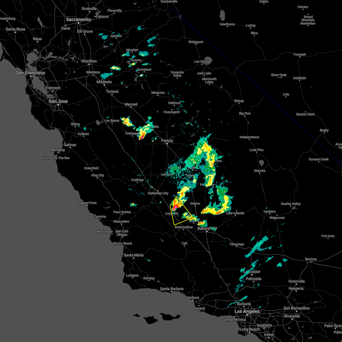
| 10/25/2021 5:26 PM PDT |
 The severe thunderstorm warning for north central kern county will expire at 530 pm pdt, the storm which prompted the warning has weakened below severe limits, and has exited the warned area. therefore, the warning will be allowed to expire. however gusty winds and heavy rain are still possible with this thunderstorm. to report severe weather, contact your nearest law enforcement agency. they will relay your report to the national weather service hanford ca. The severe thunderstorm warning for north central kern county will expire at 530 pm pdt, the storm which prompted the warning has weakened below severe limits, and has exited the warned area. therefore, the warning will be allowed to expire. however gusty winds and heavy rain are still possible with this thunderstorm. to report severe weather, contact your nearest law enforcement agency. they will relay your report to the national weather service hanford ca.
|
| 10/25/2021 4:42 PM PDT |
 At 441 pm pdt, a severe thunderstorm was located 7 miles southwest of wasco, or 21 miles southwest of delano, moving southeast at 30 mph (radar indicated). Hazards include 60 mph wind gusts and quarter size hail. Hail damage to vehicles is expected. Expect wind damage to roofs, siding, and trees. At 441 pm pdt, a severe thunderstorm was located 7 miles southwest of wasco, or 21 miles southwest of delano, moving southeast at 30 mph (radar indicated). Hazards include 60 mph wind gusts and quarter size hail. Hail damage to vehicles is expected. Expect wind damage to roofs, siding, and trees.
|
| 10/25/2021 4:15 PM PDT |
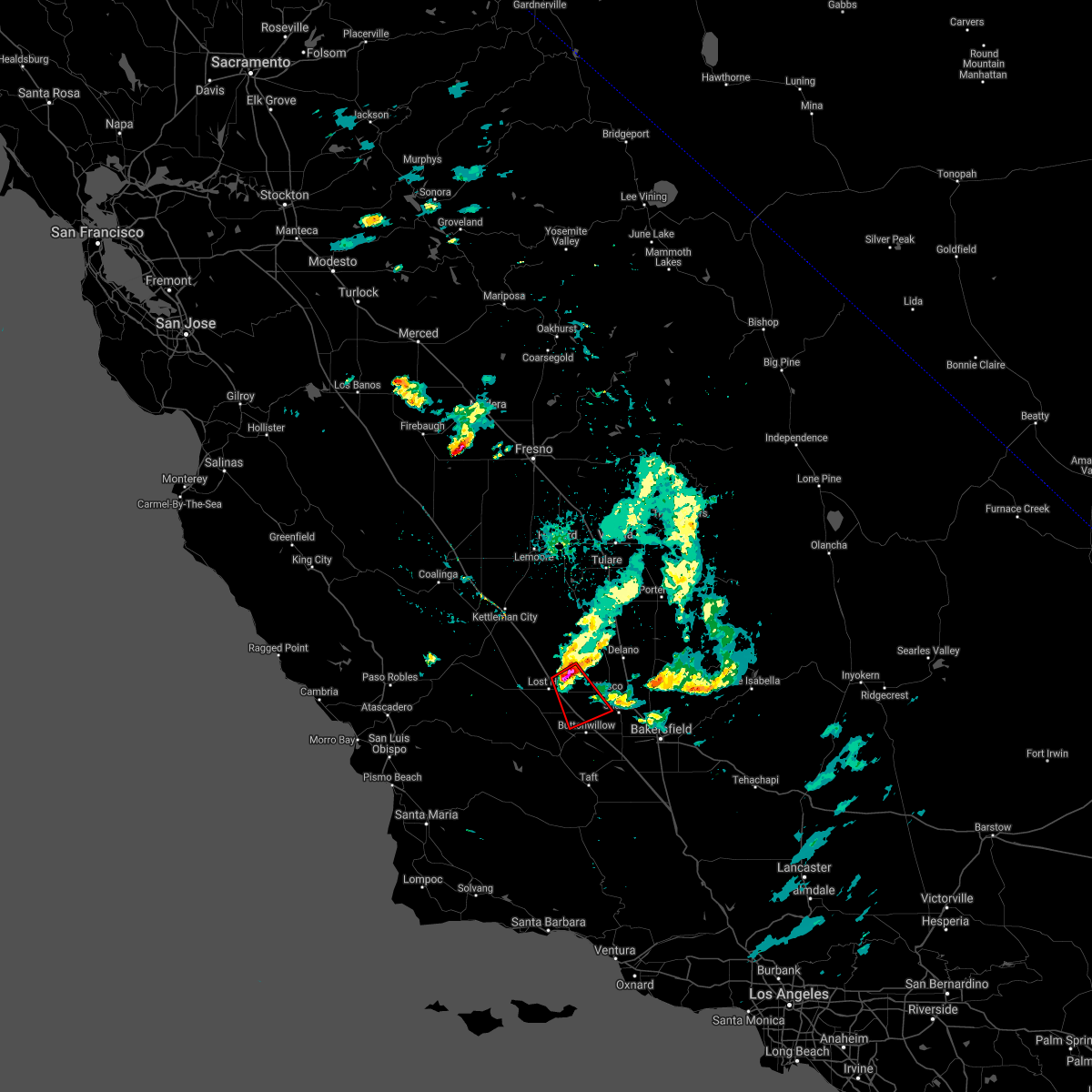 At 415 pm pdt, a severe thunderstorm capable of producing a tornado was located 11 miles west of wasco, or 19 miles southwest of delano, moving southeast at 25 mph (radar indicated rotation). Hazards include tornado and quarter size hail. Flying debris will be dangerous to those caught without shelter. mobile homes will be damaged or destroyed. damage to roofs, windows, and vehicles will occur. tree damage is likely. this dangerous storm will be near, wasco around 435 pm pdt. Other locations impacted by this tornadic thunderstorm include lost hills. At 415 pm pdt, a severe thunderstorm capable of producing a tornado was located 11 miles west of wasco, or 19 miles southwest of delano, moving southeast at 25 mph (radar indicated rotation). Hazards include tornado and quarter size hail. Flying debris will be dangerous to those caught without shelter. mobile homes will be damaged or destroyed. damage to roofs, windows, and vehicles will occur. tree damage is likely. this dangerous storm will be near, wasco around 435 pm pdt. Other locations impacted by this tornadic thunderstorm include lost hills.
|
| 10/25/2021 4:04 PM PDT |
 At 404 pm pdt, a severe thunderstorm was located 16 miles northwest of wasco, or 22 miles west of delano, moving southeast at 30 mph (radar indicated). Hazards include 60 mph wind gusts and quarter size hail. Hail damage to vehicles is expected. Expect wind damage to roofs, siding, and trees. At 404 pm pdt, a severe thunderstorm was located 16 miles northwest of wasco, or 22 miles west of delano, moving southeast at 30 mph (radar indicated). Hazards include 60 mph wind gusts and quarter size hail. Hail damage to vehicles is expected. Expect wind damage to roofs, siding, and trees.
|
| 9/3/2017 6:41 PM PDT |
 The severe thunderstorm warning for northwestern kern county will expire at 645 pm pdt, the storms which prompted the warning have weakened below severe limits, and have exited the warned area. therefore the warning will be allowed to expire. however gusty winds are still possible with these thunderstorms. The severe thunderstorm warning for northwestern kern county will expire at 645 pm pdt, the storms which prompted the warning have weakened below severe limits, and have exited the warned area. therefore the warning will be allowed to expire. however gusty winds are still possible with these thunderstorms.
|
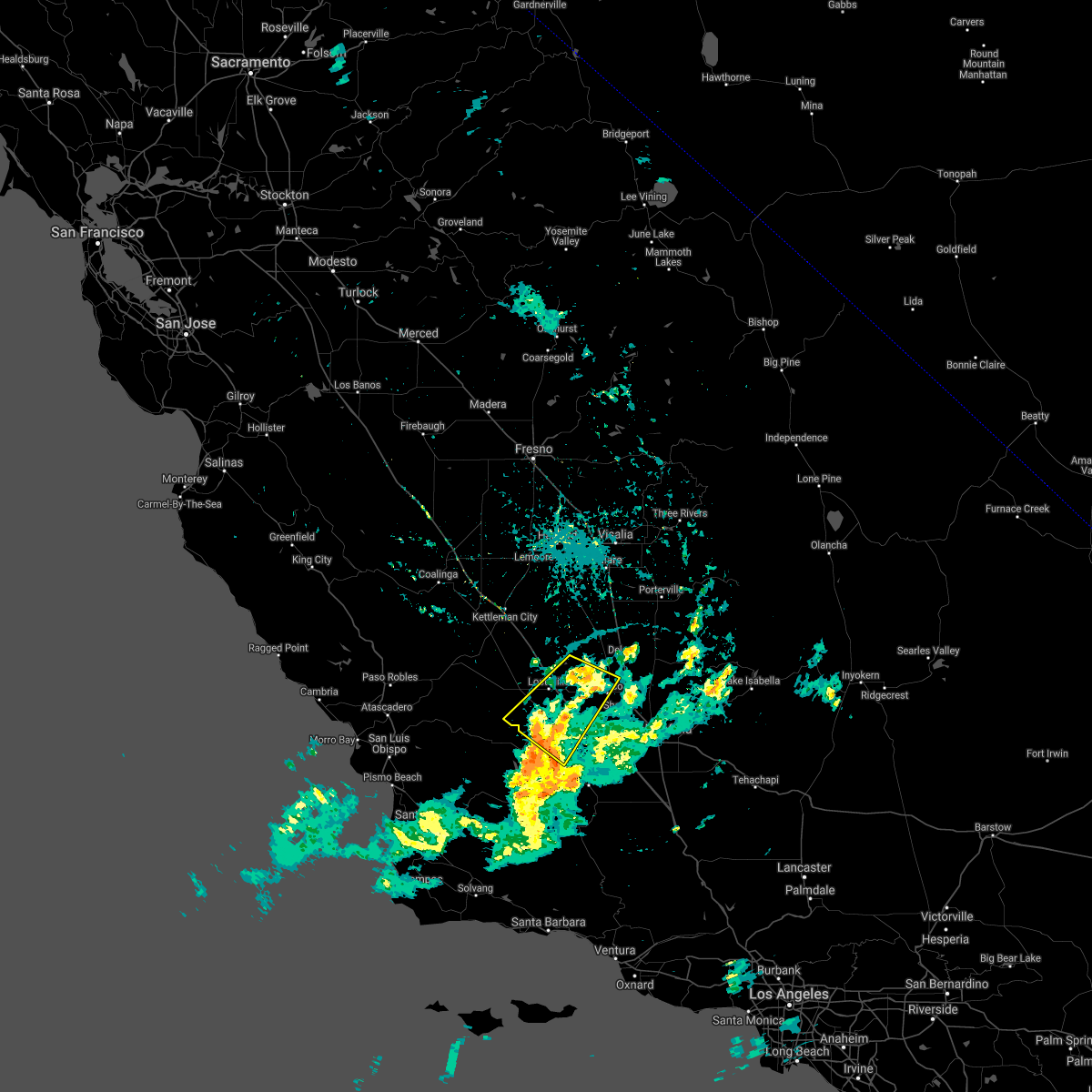
| 9/3/2017 6:31 PM PDT |
 At 630 pm pdt, severe thunderstorms were located along a line extending from 13 miles west of delano to 16 miles west of wasco to 8 miles north of mckittrick, moving northwest at 35 mph. downed trees and power lines have been reported in the warned area (radar indicated). Hazards include 60 mph wind gusts. Expect damage to roofs, siding, and trees. Locations impacted include, wasco, derby acres, mckittrick, lost hills, belridge and buttonwillow. At 630 pm pdt, severe thunderstorms were located along a line extending from 13 miles west of delano to 16 miles west of wasco to 8 miles north of mckittrick, moving northwest at 35 mph. downed trees and power lines have been reported in the warned area (radar indicated). Hazards include 60 mph wind gusts. Expect damage to roofs, siding, and trees. Locations impacted include, wasco, derby acres, mckittrick, lost hills, belridge and buttonwillow.
|
| 9/3/2017 6:17 PM PDT |
 At 617 pm pdt, severe thunderstorms were located along a line extending from 7 miles northwest of wasco to 16 miles west of shafter to near mckittrick, moving northwest at 35 mph (radar indicated). Hazards include 60 mph wind gusts. expect damage to roofs, siding, and trees At 617 pm pdt, severe thunderstorms were located along a line extending from 7 miles northwest of wasco to 16 miles west of shafter to near mckittrick, moving northwest at 35 mph (radar indicated). Hazards include 60 mph wind gusts. expect damage to roofs, siding, and trees
|
| 4/27/2016 4:20 PM PDT |
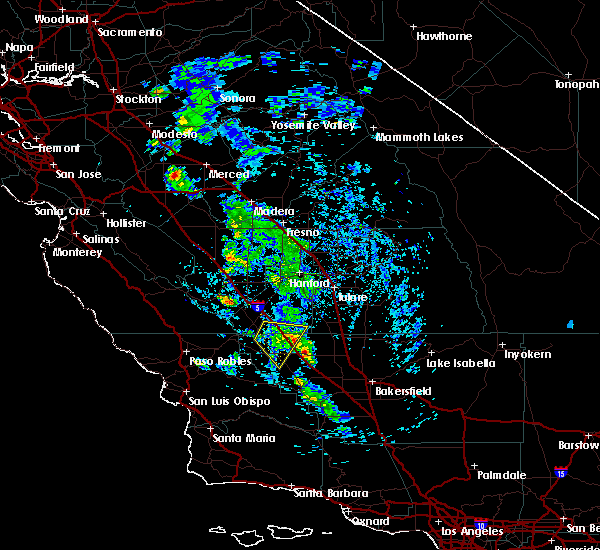 At 420 pm pdt, doppler radar indicated a severe thunderstorm capable of producing quarter size hail. this storm was located 14 miles west of wasco, or 21 miles southwest of delano, and moving southeast at 15 mph. At 420 pm pdt, doppler radar indicated a severe thunderstorm capable of producing quarter size hail. this storm was located 14 miles west of wasco, or 21 miles southwest of delano, and moving southeast at 15 mph.
|
| 4/24/2016 7:59 PM PDT |
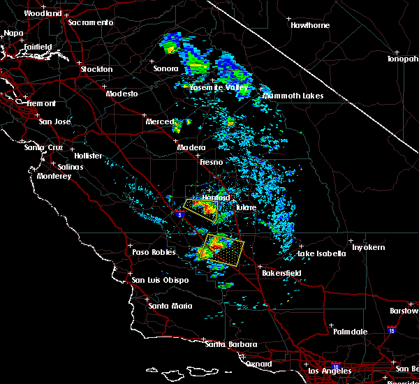 At 756 pm pdt, doppler radar indicated a severe thunderstorm capable of producing quarter size hail. this storm was located 12 miles west of wasco, or 20 miles southwest of delano, and moving east at 25 mph. At 756 pm pdt, doppler radar indicated a severe thunderstorm capable of producing quarter size hail. this storm was located 12 miles west of wasco, or 20 miles southwest of delano, and moving east at 25 mph.
|
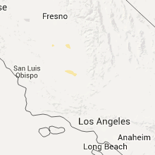
Hail Maps for Wasco, CA
Connect with Interactive Hail Maps