

Hail Map for Wilton, CA
The Wilton, CA area has had 0 reports of on-the-ground hail by trained spotters, and has been under severe weather warnings 0 times during the past 12 months. Doppler radar has detected hail at or near Wilton, CA on 1 occasion.
| Name: | Wilton, CA |
| Where Located: | 19.8 miles S of Citrus Heights, CA |
| Map: | Google Map for Wilton, CA |
| Population: | 5363 |
| Housing Units: | 2090 |
| More Info: | Search Google for Wilton, CA |
5
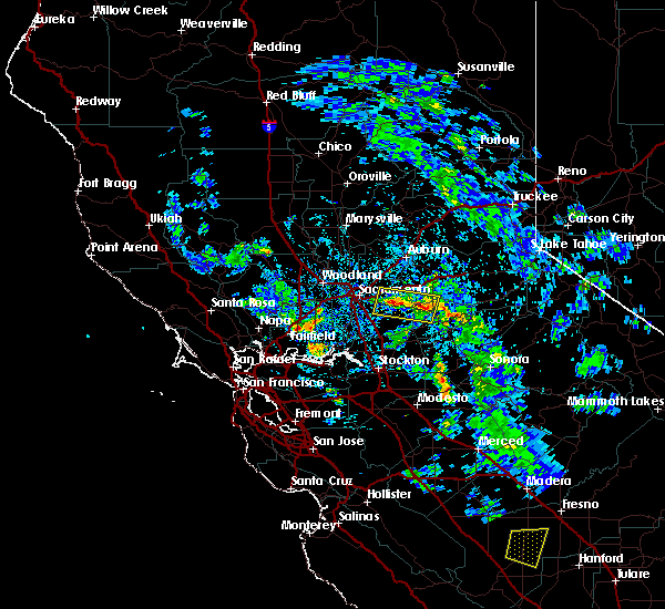
The Top Recent Hail Date for Wilton, CA is Monday, May 18, 2020 (1st out of 1)

Hail and Wind Damage Spotted near Wilton, CA
| Date / Time | Report Details |
|---|---|
| 4/27/2016 3:58 PM PDT |
 At 356 pm pdt, doppler radar indicated a severe thunderstorm capable of producing quarter size hail and damaging winds in excess of 60 mph. this storm was located over sloughhouse, or 10 miles northeast of elk grove. this storm was nearly stationary. locations impacted include, fair oaks, rancho cordova, ione, rancho murieta, forest home, latrobe, sheldon, mather afb cdp, sloughhouse, gold river, mather afb, vineyard, carbondale and wilton. At 356 pm pdt, doppler radar indicated a severe thunderstorm capable of producing quarter size hail and damaging winds in excess of 60 mph. this storm was located over sloughhouse, or 10 miles northeast of elk grove. this storm was nearly stationary. locations impacted include, fair oaks, rancho cordova, ione, rancho murieta, forest home, latrobe, sheldon, mather afb cdp, sloughhouse, gold river, mather afb, vineyard, carbondale and wilton.
|
| 4/27/2016 3:13 PM PDT |
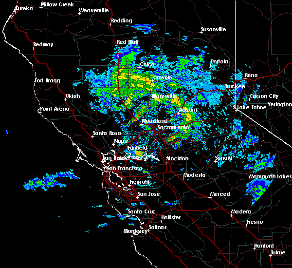
 At 311 pm pdt, doppler radar indicated a severe thunderstorm capable of producing quarter size hail and damaging winds in excess of 60 mph. funnel clouds may be possible with this storm. this storm was located over rancho murieta, or 13 miles southeast of fair oaks, and moving east at 10 mph. At 311 pm pdt, doppler radar indicated a severe thunderstorm capable of producing quarter size hail and damaging winds in excess of 60 mph. funnel clouds may be possible with this storm. this storm was located over rancho murieta, or 13 miles southeast of fair oaks, and moving east at 10 mph.
|
| 11/9/2015 5:47 PM PST |
 At 544 pm pst, doppler radar indicated a possible tornado. this dangerous storm was located near sheldon, or 8 miles east of elk grove, and moving northeast at 25 mph over wilton. At 544 pm pst, doppler radar indicated a possible tornado. this dangerous storm was located near sheldon, or 8 miles east of elk grove, and moving northeast at 25 mph over wilton.
|
| 4/7/2015 3:23 PM PDT | The severe thunderstorm warning for northeastern sacramento. southwestern placer and southwestern el dorado counties will expire at 330 pm pdt. this line of thunderstorms has weakened and the severe thunderstorm warning has been allowed to expire. this storm is still capable of producing heavy rain. small hail. And ponding of water on area. |
| 4/7/2015 2:57 PM PDT | A severe thunderstorm warning remains in effect until 330 pm pdt for northeastern sacramento. southwestern placer and southwestern el dorado counties. at 254 pm pdt. national weather service doppler radar continued to indicate a severe thunderstorm capable of producing quarter size hail. This line of storms was located near antelope south to. |
| 4/7/2015 2:25 PM PDT | The national weather service in sacramento has issued a * severe thunderstorm warning for. southwestern el dorado county. southwestern placer county. northern sacramento county. Extreme southeastern sutter county. |
Hail Maps for Wilton, CA
Connect with Interactive Hail Maps