

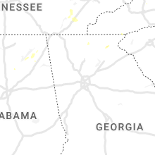
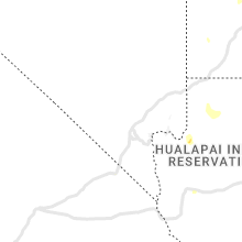
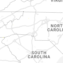
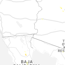
Hail Map for Tuesday, August 9, 2022

Number of Impacted Households on 8/9/2022
0
Impacted by 1" or Larger Hail
0
Impacted by 1.75" or Larger Hail
0
Impacted by 2.5" or Larger Hail
Square Miles of Populated Area Impacted on 8/9/2022
0
Impacted by 1" or Larger Hail
0
Impacted by 1.75" or Larger Hail
0
Impacted by 2.5" or Larger Hail


Cities Most Affected by Hail Storms of 8/9/2022
| Hail Size | Demographics of Zip Codes Affected | ||||||
|---|---|---|---|---|---|---|---|
| City | Count | Average | Largest | Pop Density | House Value | Income | Age |
Hail and Wind Damage Spotted on 8/9/2022
Filter by Report Type:Hail ReportsWind Reports
States Impacted
Alabama, Tennessee, Kentucky, Georgia, Florida, Massachusetts, Texas, Arizona, North Carolina, Oklahoma, Oregon, Virginia, Maryland, IndianaAlabama
| Local Time | Report Details |
|---|---|
| 12:48 PM CDT | Trees reported down in the deans chapel community. time estimated by rada in jackson county AL, 40.8 miles SW of Chattanooga, TN |
| 12:54 PM CDT | Trees snapped or uprooted along county road 162 near pisgah. time estimated by rada in jackson county AL, 40.8 miles SW of Chattanooga, TN |
| 1:24 PM CDT | Trees reported down near geraldine. time estimated by rada in dekalb county AL, 62 miles SW of Chattanooga, TN |
| 1:42 PM CDT | Trees reported snapped or uprooted along county road 43 near section. time estimated by rada in jackson county AL, 51.2 miles SW of Chattanooga, TN |
| 3:34 PM CDT | Corrects time on previous tstm wnd dmg report from 2 nne blountsville. trees blown down along cr 55 north of blountsville. time estimated by rada in blount county AL, 42.8 miles NNE of Birmingham, AL |
| 4:00 PM CDT | Trees blown down along cr 55 north of blountsvill in blount county AL, 42.8 miles NNE of Birmingham, AL |
| 4:30 PM CDT | Tree down blocking road along springville blvd near hickory ridge road. time estimated by radar. winds likely sub-sever in blount county AL, 34.4 miles NE of Birmingham, AL |
Tennessee
| Local Time | Report Details |
|---|---|
| 1:43 PM CDT | Trees dow in henry county TN, 17.2 miles N of Mc Kenzie, TN |
| 4:10 PM EDT | Numerous trees were blown down including the highway 68 and highway 27 intersection... and also tom garrison road in the wolf creek are in rhea county TN, 48.8 miles NNE of Chattanooga, TN |
| 4:45 PM EDT | Several trees reported blown down between whitesburg... tn and bulls gap... t in hamblen county TN, 50.1 miles ENE of Knoxville, TN |
| 5:10 PM EDT | Several trees dow in mcminn county TN, 39.6 miles NE of Chattanooga, TN |
| 5:36 PM EDT | Several trees dow in anderson county TN, 19.6 miles W of Knoxville, TN |
| 5:45 PM EDT | Several trees down across jefferson city... talbott... and new marke in jefferson county TN, 28.1 miles ENE of Knoxville, TN |
| 6:48 PM EDT | Trees and stop light dow in claiborne county TN, 40.2 miles NNE of Knoxville, TN |
Kentucky
| Local Time | Report Details |
|---|---|
| 2:58 PM EDT | One tree down near the 2700 block of louden-meadow creek roa in whitley county KY, 56.1 miles N of Knoxville, TN |
| 5:30 PM CDT | Several trees downed in the new concord area... some of which caused power line damag in calloway county KY, 40.8 miles NE of Mc Kenzie, TN |
| 7:55 PM EDT | Reports of trees down across ky-3 in trimble county KY, 52.4 miles WSW of Cincinnati, OH |
Georgia
| Local Time | Report Details |
|---|---|
| 3:15 PM EDT | Trees reported down on top of mt yona in white county GA, 64.6 miles WSW of Greenville, SC |
| 3:30 PM EDT | 911 call center reported trees fell on powerlines and blocking roadway on earls ford roa in rabun county GA, 36.6 miles W of Greenville, SC |
| 3:55 PM EDT | 911 call center reported trees fell on powerlines and blocking roadway on lake rabun roa in rabun county GA, 49.1 miles W of Greenville, SC |
| 3:55 PM EDT | 911 call center reported tree blocking roadway on brandon mill roa in rabun county GA, 48.6 miles W of Greenville, SC |
| 5:44 PM EDT | Tree down on 4-h club r in lowndes county GA, 59.7 miles SSW of Douglas, GA |
| 5:49 PM EDT | Tree down on sherwood roa in lowndes county GA, 56.5 miles SSW of Douglas, GA |
| 5:49 PM EDT | Tree down near intersection of bay ln and fred l in lowndes county GA, 54 miles SSW of Douglas, GA |
| 5:50 PM EDT | Tree down on poplar s in lowndes county GA, 53.4 miles SSW of Douglas, GA |
| 5:50 PM EDT | Power line down on tucker r in lowndes county GA, 54 miles SSW of Douglas, GA |
| 5:53 PM EDT | Tree down on murphy s in lowndes county GA, 52.2 miles SSW of Douglas, GA |
| 6:55 PM EDT | Trees down along us 221 with a couple of transformers blown in the surrounding area. time estimated by rada in clinch county GA, 25.5 miles SSW of Douglas, GA |
| 7:40 PM EDT | Report of trees down across highway 135 caused by thunderstor in coffee county GA, 2.1 miles SW of Douglas, GA |
| 8:37 PM EDT | Trees and powerlines were reported down along old dairy roa in montgomery county GA, 54 miles NNE of Douglas, GA |
Florida
| Local Time | Report Details |
|---|---|
| 3:30 PM EDT | Tree down on a power line partially blocking the road near alan a dale and joe cotton trai in leon county FL, 8.1 miles NNE of Tallahassee, FL |
| 3:30 PM EDT | Large branches were blown down in the area of 3200 shannon lakes in leon county FL, 7.5 miles NE of Tallahassee, FL |
| 4:37 PM EDT | Fallen trees or limbs resulted in a small power outag in taylor county FL, 48.7 miles ESE of Tallahassee, FL |
| 4:40 PM EDT | Fallen trees or limbs resulted in a small power outag in taylor county FL, 47.5 miles ESE of Tallahassee, FL |
| 5:20 PM EDT | Tree down on ne raintree av in madison county FL, 57.9 miles ENE of Tallahassee, FL |
Massachusetts
| Local Time | Report Details |
|---|---|
| 3:36 PM EDT | In scituate... a tree and wires were down on beaver dam roa in plymouth county MA, 43.7 miles NE of Providence, RI |
| 3:38 PM EDT | Large tree on wires on flint locke roa in plymouth county MA, 41 miles ENE of Providence, RI |
Texas
| Local Time | Report Details |
|---|---|
| 2:45 PM CDT | Storm damage reported in lamb county TX, 43 miles NW of Lubbock, TX |
| 4:42 PM MDT | Ping Pong Ball sized hail reported near El Paso, TX, 10.9 miles NW of El Paso, TX |
| 4:52 PM MDT | Quarter sized hail reported near El Paso, TX, 12.3 miles NW of El Paso, TX, time estimated from radar. report from twitter. |
Arizona
| Local Time | Report Details |
|---|---|
| 12:59 PM MST | Reported from wunderground location kazkirkl in yavapai county AZ, 68.2 miles NNW of Phoenix, AZ |
| 3:35 PM MST | Power poles down on linda vista blvd between bald eagle ave and waterbuck d in pima county AZ, 12.4 miles NNW of Tucson, AZ |
| 3:42 PM MST | Trained spotter reports a 20 foot palo verde tree and a mesquite tree fallen over in the neighborhood. pea size hail fell in the are in pima county AZ, 10.6 miles NNW of Tucson, AZ |
| 5:25 PM MST | At 525 pm the pierce ferry hads sensor recorded a gust of 60 mp in mohave county AZ, 60.4 miles E of Las Vegas, NV |
North Carolina
| Local Time | Report Details |
|---|---|
| 4:00 PM EDT | 911 call center reported a tree blocking roadway on barnardsville hw in buncombe county NC, 57.7 miles SSW of Bristol, TN |
| 4:10 PM EDT | 911 call center reported a tree blocking the roadway on dillingham roa in buncombe county NC, 58.5 miles SSW of Bristol, TN |
| 4:10 PM EDT | Several tree limbs were blown down in the are in guilford county NC, 76.7 miles WNW of Raleigh, NC |
Oklahoma
| Local Time | Report Details |
|---|---|
| 4:42 PM CDT | Minor wind damage als in kay county OK, 68 miles SSE of Wichita, KS |
| 6:02 PM CDT | Power pole downe in oklahoma county OK, 16.9 miles NNW of Oklahoma City, OK |
| 6:15 PM CDT | Storm damage reported in grady county OK, 37.9 miles SW of Oklahoma City, OK |
| 6:20 PM CDT | Quarter sized hail reported near Guthrie, OK, 24.6 miles NNE of Oklahoma City, OK |
| 7:15 PM CDT | Quarter sized hail reported near Lawton, OK, 50 miles N of Wichita Falls, TX |
| 8:05 PM CDT | Acme sit in grady county OK, 53.7 miles SSW of Oklahoma City, OK |
Oregon
| Local Time | Report Details |
|---|---|
| 2:55 PM PDT | Sheriff relayed reports from public regarding a couple of hay barns collapsing from the winds. time estimated from rada in lake county OR, 65.5 miles S of Bend, OR |
| 9:40 PM PDT | Quarter sized hail reported near Eugene, OR, 2.1 miles N of Eugene, OR, spotter found a hailstone that was 1 inch in length. |
| 9:45 PM PDT | Half Dollar sized hail reported near Eugene, OR, 2.8 miles N of Eugene, OR, in direct comparison to a quarter via social media photo...was clearly wider than the quarter. |
Virginia
| Local Time | Report Details |
|---|---|
| 6:00 PM EDT | Tree across roa in roanoke county VA, 7.6 miles WNW of Roanoke, VA |
| 6:08 PM EDT | Powerlines down. tree blown against powerlin in roanoke county VA, 4.1 miles N of Roanoke, VA |
| 6:10 PM EDT | Quarter sized hail reported near Roanoke, VA, 4 miles NNE of Roanoke, VA, nickel to quarter size hail observed at the waning point. power went out briefly. frequent lightning also observed. aep indicates upwards of 2000 customers without powe |
| 6:13 PM EDT | Tree fell across powerline and the roa in roanoke county VA, 4 miles NNE of Roanoke, VA |
| 6:15 PM EDT | Tree fell across roa in roanoke county VA, 4.6 miles NNE of Roanoke, VA |
Maryland
| Local Time | Report Details |
|---|---|
| 7:47 PM EDT | Numerous trees and wires blew down on the west side of frederick. several trees and wires blew down knocking over a couple of poles and causing a transformer fire on ho in frederick county MD, 45.2 miles W of Baltimore, MD |
Indiana
| Local Time | Report Details |
|---|---|
| 8:09 PM EDT | Siding off a building and reports of a couple of trees dow in jefferson county IN, 47.4 miles WSW of Cincinnati, OH |
Connect with Interactive Hail Maps