

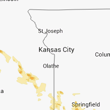
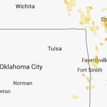
Hail Map for Wednesday, September 17, 2014

Number of Impacted Households on 9/17/2014
0
Impacted by 1" or Larger Hail
0
Impacted by 1.75" or Larger Hail
0
Impacted by 2.5" or Larger Hail
Square Miles of Populated Area Impacted on 9/17/2014
0
Impacted by 1" or Larger Hail
0
Impacted by 1.75" or Larger Hail
0
Impacted by 2.5" or Larger Hail


Cities Most Affected by Hail Storms of 9/17/2014
| Hail Size | Demographics of Zip Codes Affected | ||||||
|---|---|---|---|---|---|---|---|
| City | Count | Average | Largest | Pop Density | House Value | Income | Age |
| Harrison, AR | 2 | 1.88 | 2.00 | 81 | $77k | $30.5k | 40.7 |
| Minneapolis, KS | 2 | 1.88 | 2.00 | 11 | $64k | $35.5k | 41.7 |
| Clay Center, KS | 1 | 1.75 | 1.75 | 17 | $56k | $35.2k | 44.5 |
Hail and Wind Damage Spotted on 9/17/2014
Filter by Report Type:Hail ReportsWind Reports
Missouri
| Local Time | Report Details |
|---|---|
| 12:08 PM CDT | Tree down along highway bb south of seymour near webster douglas county lin in webster county MO, 27.2 miles ESE of Springfield, MO |
| 12:56 PM CDT | Quarter sized hail reported near Thornfield, MO, 54 miles SE of Springfield, MO |
| 12:58 PM CDT | Quarter sized hail reported near Ash Grove, MO, 19.1 miles WSW of Springfield, MO |
| 1:36 PM CDT | Quarter sized hail reported near Crane, MO, 25.7 miles SW of Springfield, MO, fire department reports nickel to quarter size hail. |
| 2:05 PM CDT | Quarter sized hail reported near Shell Knob, MO, 44.1 miles SSW of Springfield, MO |
Arkansas
| Local Time | Report Details |
|---|---|
| 1:39 PM CDT | A tree was blown down onto a county road...and a number of large limbs were blown dow in baxter county AR, 78.8 miles SE of Springfield, MO |
| 3:02 PM CDT | Quarter sized hail reported near Eureka Springs, AR, 60 miles SSW of Springfield, MO, reported there was a lot of hail. |
| 3:06 PM CDT | Golf Ball sized hail reported near Harrison, AR, 67.5 miles S of Springfield, MO, hail started out as penny size...increased to nickel size...and now golfball sized hail is falling. |
| 3:10 PM CDT | Quarter sized hail reported near Harrison, AR, 67.5 miles S of Springfield, MO, quarter sized hail was falling at harrison police department. |
| 3:10 PM CDT | Hen Egg sized hail reported near Harrison, AR, 69.1 miles S of Springfield, MO |
| 3:15 PM CDT | Quarter sized hail reported near Harrison, AR, 67.5 miles S of Springfield, MO |
| 3:15 PM CDT | Half Dollar sized hail reported near Harrison, AR, 67.5 miles S of Springfield, MO |
| 3:30 PM CDT | Large tree blocking highway 123 near the highway 74 intersectio in newton county AR, 85.6 miles S of Springfield, MO |
| 4:23 PM CDT | Fourteen inch diameter trees dow in searcy county AR, 71.9 miles NNW of Little Rock, AR |
| 4:50 PM CDT | Tree damage from thunderstorm winds in little flock. socila media report with pictur in benton county AR, 71 miles NNE of Fort Smith, AR |
| 4:59 PM CDT | Downed power line in rogers. social media report with pictur in benton county AR, 67.3 miles NNE of Fort Smith, AR |
| 6:00 PM CDT | Quarter sized hail reported near Fayetteville, AR, 48.8 miles NNE of Fort Smith, AR |
South Carolina
| Local Time | Report Details |
|---|---|
| 4:35 PM EDT | Quarter sized hail reported near Bamberg, SC, 56 miles ESE of Augusta, GA, report of quarter-size hail in bamberg |
| 4:45 PM EDT | Orangeburg dispatch reported powerlines downed on norway rd. time estimated by rada in orangeburg county SC, 57.5 miles E of Augusta, GA |
| 4:55 PM EDT | Warning point reported tree down at the intersection of lake warren road and luray highwa in hampton county SC, 53.2 miles N of Savannah, GA |
| 4:59 PM EDT | Quarter sized hail reported near Cordova, SC, 57 miles WNW of Charleston, SC, quarter size hail on hwy 301 at legrand smoak st. |
| 5:41 PM EDT | Warning point reported tree down on pine level church roa in jasper county SC, 43 miles N of Savannah, GA |
| 6:44 PM EDT | Warning point reported 2 trees down...one at the intersection of tillman road and cotton hill road. the other at tillman road and tarboro roa in jasper county SC, 26.2 miles N of Savannah, GA |
| 6:44 PM EDT | Warning point reported 2 trees down...one at the intersection of tillman road and cotton hill road. the other at tillman road and tarboro roa in jasper county SC, 27.2 miles N of Savannah, GA |
North Carolina
| Local Time | Report Details |
|---|---|
| 5:15 PM EDT | Quarter sized hail reported near Richlands, NC, 44.3 miles NNE of Wilmington, NC |
Oklahoma
| Local Time | Report Details |
|---|---|
| 10:10 PM CDT | Large trees down in the haw creek communit in le flore county OK, 44.1 miles S of Fort Smith, AR |
| 10:25 PM CDT | Small trees and power lines down 2 miles east of leflor in le flore county OK, 44.7 miles SW of Fort Smith, AR |
Kansas
| Local Time | Report Details |
|---|---|
| 1:20 AM CDT | Hen Egg sized hail reported near Minneapolis, KS, 61.8 miles W of Manhattan, KS |
| 1:21 AM CDT | Golf Ball sized hail reported near Minneapolis, KS, 61.3 miles W of Manhattan, KS |
| 1:35 AM CDT | Golf Ball sized hail reported near Clay Center, KS, 28.5 miles WNW of Manhattan, KS |
| 2:30 AM CDT | Quarter sized hail reported near Waverly, KS, 42 miles N of Chanute, KS |
Connect with Interactive Hail Maps