

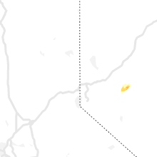
Hail Map for Wednesday, August 10, 2022

Number of Impacted Households on 8/10/2022
0
Impacted by 1" or Larger Hail
0
Impacted by 1.75" or Larger Hail
0
Impacted by 2.5" or Larger Hail
Square Miles of Populated Area Impacted on 8/10/2022
0
Impacted by 1" or Larger Hail
0
Impacted by 1.75" or Larger Hail
0
Impacted by 2.5" or Larger Hail


Cities Most Affected by Hail Storms of 8/10/2022
| Hail Size | Demographics of Zip Codes Affected | ||||||
|---|---|---|---|---|---|---|---|
| City | Count | Average | Largest | Pop Density | House Value | Income | Age |
Hail and Wind Damage Spotted on 8/10/2022
Filter by Report Type:Hail ReportsWind Reports
States Impacted
Virginia, North Carolina, Texas, Tennessee, Georgia, Maryland, Oklahoma, Oregon, Nevada, IdahoVirginia
| Local Time | Report Details |
|---|---|
| 1:29 PM EDT | Thunderstorm winds blew down one tree on greenlevel roa in franklin county VA, 12.7 miles S of Roanoke, VA |
| 1:54 PM EDT | Tree down along shawsville pike blocking part of the roa in floyd county VA, 20.8 miles SW of Roanoke, VA |
| 2:26 PM EDT | Power line down along firehouse road just north of willi in floyd county VA, 40.6 miles SW of Roanoke, VA |
| 2:30 PM EDT | Over 200 power outages wnw of charles city likely due to storm. time estimated from rada in charles city county VA, 27.3 miles ESE of Richmond, VA |
| 2:37 PM EDT | Several trees down along little calf pasture highway in augusta county VA, 63.3 miles SSE of Elkins, WV |
| 2:54 PM EDT | Few trees down near intersection of parkersburg turnpike and miss phillips rd in augusta county VA, 65.3 miles SE of Elkins, WV |
| 2:55 PM EDT | Nearly 500 power outages likely caused by storm near glenns. time estimate in gloucester county VA, 57.4 miles E of Richmond, VA |
| 3:04 PM EDT | Tree down at 500 block mt. hermon rd in augusta county VA, 61.3 miles NNE of Roanoke, VA |
| 3:05 PM EDT | Trees blew down in the 500 block va-979 mount hermon roa in rockingham county VA, 73.2 miles ESE of Elkins, WV |
| 3:30 PM EDT | Nearly 200 power outages just north of ware neck. time estimate in gloucester county VA, 50.9 miles NNW of Virginia Beach, VA |
| 3:35 PM EDT | Tree down near intersection of peyton hill rd and indian ridge rd in augusta county VA, 67.2 miles NE of Roanoke, VA |
| 3:53 PM EDT | Large tree down at 775 gateway dr se in loudoun county VA, 52.2 miles WSW of Baltimore, MD |
| 4:23 PM EDT | Tree down on honda roa in fairfax county VA, 48.5 miles SW of Baltimore, MD |
| 4:30 PM EDT | Trees blew down near oakton. a tree blew down on honda road. a tree blew down near the intersection of maximilian court and valley ridge driv in fairfax county VA, 49.7 miles SW of Baltimore, MD |
| 4:40 PM EDT | Tree down near intersection of waterway dr and avon d in prince william county VA, 60.9 miles SW of Baltimore, MD |
| 4:40 PM EDT | Tree down near intersection of delaney rd and minnieville rd in prince william county VA, 60 miles SW of Baltimore, MD |
| 4:40 PM EDT | Trees blew down on va-738/va-309 old dominion drive near va-123 dolley madison boulevar in fairfax county VA, 39.5 miles SW of Baltimore, MD |
| 4:52 PM EDT | Trees down on waterway driv in prince william county VA, 63 miles SW of Baltimore, MD |
| 5:00 PM EDT | Numerous power outages likely caused by storm in southeast portions of louisa county. time estimate in louisa county VA, 23.1 miles NNW of Richmond, VA |
| 5:05 PM EDT | Trees down near triangle on jefferson davis highway... cabin road... and locust shade driv in prince william county VA, 63.5 miles SW of Baltimore, MD |
| 5:12 PM EDT | Trees blew down near the intersection of waterway drive and avon drive. trees blew down near the intersection of va-610 delaney road and minnieville roa in prince william county VA, 60.9 miles SW of Baltimore, MD |
| 5:15 PM EDT | Trees blew down near triangle on us-1 jefferson davis highway... cabin road... and locust shade driv in prince william county VA, 63.5 miles SW of Baltimore, MD |
| 5:15 PM EDT | Tree down at maximilian ct and valley ridge dr in fairfax county VA, 49.7 miles SW of Baltimore, MD |
| 5:20 PM EDT | Tree down. time estimated from rada in southampton county VA, 51.6 miles W of Virginia Beach, VA |
| 5:48 PM EDT | Trees down in whites corne in king george county VA, 57.3 miles NNE of Richmond, VA |
| 5:55 PM EDT | Tree down on i-64 at mm 165. time estimate in goochland county VA, 18.2 miles NNW of Richmond, VA |
| 5:57 PM EDT | Trees down on james madison parkway near chesnut hil in king george county VA, 62.4 miles NNE of Richmond, VA |
| 6:00 PM EDT | Tree down on rote 703 in dinwiddie county. time estimate in dinwiddie county VA, 33.6 miles SSE of Richmond, VA |
| 6:00 PM EDT | Several reports of downed trees in the saltville are in smyth county VA, 32.4 miles NE of Bristol, TN |
| 6:05 PM EDT | Around 500 power outages just northeast of alberta. time estimate in brunswick county VA, 44.2 miles SSW of Richmond, VA |
| 6:25 PM EDT | A few trees down. time estimated from rada in chesterfield county VA, 11.5 miles SE of Richmond, VA |
| 6:26 PM EDT | A couple trees down on boydton plank road. time estimate in dinwiddie county VA, 27 miles SSE of Richmond, VA |
| 7:15 PM EDT | Nearly 300 power outages likely caused by storm west of ruthville in charles city county. time estimated from rada in charles city county VA, 31.2 miles ESE of Richmond, VA |
| 7:45 PM EDT | Large tree branches down in yard. time estimated from rada in southampton county VA, 58.4 miles SSE of Richmond, VA |
| 8:37 PM EDT | Peak gust at 3rd island weatherflow statio in anz632 county VA, 19.7 miles N of Virginia Beach, VA |
North Carolina
| Local Time | Report Details |
|---|---|
| 2:00 PM EDT | Trees down on the northbound lanes of us-421 in the purlear are in wilkes county NC, 61.2 miles ESE of Bristol, TN |
| 4:15 PM EDT | One tree down near the intersection of blackwell road and foster roa in caswell county NC, 60.1 miles NW of Raleigh, NC |
| 4:18 PM EDT | Quarter sized hail reported near Charlotte, NC, 11.2 miles E of Charlotte, NC, one inch hail near intersection of i-485 and albemarle rd |
| 4:43 PM EDT | Reports of trees down near the city of locust... n in stanly county NC, 23.2 miles E of Charlotte, NC |
| 5:17 PM EDT | Tree fell and landed on a car. no injuries were reported. time estimated by rada in wake county NC, 5.5 miles SSE of Raleigh, NC |
| 5:35 PM EDT | Corrects previous tstm wnd dmg report from 8 e gordontown. report of down trees from mping. time estimated by rada in randolph county NC, 59.6 miles NE of Charlotte, NC |
| 5:40 PM EDT | Report of down trees from mping. time estimated by rada in randolph county NC, 59.6 miles NE of Charlotte, NC |
| 6:28 PM EDT | Power outage due to trees damaging equipment. time estimated by rada in randolph county NC, 58.3 miles W of Raleigh, NC |
| 6:33 PM EDT | Public report of a tree down on a residence near rustic wood lane and hickory nut cour in guilford county NC, 64.9 miles W of Raleigh, NC |
| 7:04 PM EDT | Several trees down around the city of halifax. all of halifax... nc is without power. time estimated by rada in halifax county NC, 69.9 miles ENE of Raleigh, NC |
Texas
| Local Time | Report Details |
|---|---|
| 1:29 PM CDT | 60 mph wind gust measured on home weather statio in ellis county TX, 31.9 miles S of Dallas, TX |
| 4:48 PM CDT | 60 mph wind gust measured from home weather statio in denton county TX, 46.5 miles NNW of Dallas, TX |
| 5:03 PM CDT | Childress airport asos in childress county TX, 3.9 miles W of Childress, TX |
| 5:58 PM CDT | West texas mesonet in cottle county TX, 38.7 miles SSW of Childress, TX |
| 6:48 PM CDT | Tree snapped and covers roadway near north houston aldine mail route and hawkins av in harris county TX, 9.7 miles N of Houston, TX |
| 7:15 PM CDT | Gust at houston executive airpor in waller county TX, 32 miles W of Houston, TX |
| 7:24 PM CDT | Roof damage in the polo ranch community on fm 109 in fort bend county TX, 32.7 miles W of Houston, TX |
| 7:24 PM CDT | Large trees dow in harris county TX, 27.2 miles W of Houston, TX |
Tennessee
| Local Time | Report Details |
|---|---|
| 2:50 PM CDT | Pole and lines across road at 5795 hilham rd.... large tree across road at 1367 west whitehall r in putnam county TN, 71.1 miles E of Nashville, TN |
Georgia
| Local Time | Report Details |
|---|---|
| 3:51 PM EDT | Emergency manager reported at toney brothers road and ga-33 near new elm... that there are several pecan trees down and 2 road signs were knocked dow in colquitt county GA, 59.5 miles WSW of Douglas, GA |
| 4:10 PM EDT | Several power lines reported down in alban in dougherty county GA, 78.7 miles W of Douglas, GA |
| 4:10 PM EDT | Tree down on powerlines along macon rd near intersection of s dixon d in muscogee county GA, 32.4 miles ESE of Auburn, AL |
| 4:14 PM EDT | Tree down with power line on boyette road... lanier county georgi in lanier county GA, 37.9 miles SSW of Douglas, GA |
| 4:40 PM EDT | Several trees and power lines down across the count in decatur county GA, 37 miles NNW of Tallahassee, FL |
| 5:08 PM EDT | Several trees and power lines down across the count in grady county GA, 30.6 miles N of Tallahassee, FL |
| 5:26 PM EDT | Scattered trees dow in mitchell county GA, 49 miles N of Tallahassee, FL |
| 5:30 PM EDT | 466 kierce road... tree fell on power lin in mitchell county GA, 45.7 miles N of Tallahassee, FL |
| 6:10 PM EDT | Tree down near the intersection of west whitney ave and harding s in dougherty county GA, 78 miles W of Douglas, GA |
| 6:20 PM EDT | Tree down near the 100 block of lexington stree in lee county GA, 78.7 miles W of Douglas, GA |
| 6:30 PM EDT | Wire down near intersection of james pond rd and highway 32 in lee county GA, 80.9 miles W of Douglas, GA |
| 6:30 PM EDT | Tree down near intersection of robert lee road and peach stree in lee county GA, 78.7 miles W of Douglas, GA |
| 7:45 PM EDT | Social media report of trees down... power lines down... and some damage to roofs. time estimated from radar dat in bryan county GA, 24.2 miles WNW of Savannah, GA |
Maryland
| Local Time | Report Details |
|---|---|
| 4:09 PM EDT | Several trees down on billingsley road near leonardtown road. wires down as wel in charles county MD, 51.6 miles SSW of Baltimore, MD |
| 4:46 PM EDT | Tree down on i-495 inner loop before us-29/coolesville roa in montgomery county MD, 28.9 miles SW of Baltimore, MD |
| 5:05 PM EDT | A large tree and large tree limbs blew down in university par in prince georges county MD, 27.5 miles SW of Baltimore, MD |
| 5:10 PM EDT | Trees blew down on md-564 at woodstream driv in prince georges county MD, 24.5 miles SSW of Baltimore, MD |
| 5:14 PM EDT | Several trees blew down on md-564 at woodstream driv in prince georges county MD, 24.5 miles SSW of Baltimore, MD |
| 5:38 PM EDT | At least 4 trees blew down on the south side of glen burni in anne arundel county MD, 9.7 miles S of Baltimore, MD |
| 5:43 PM EDT | Trees down on md-424 near md-45 in anne arundel county MD, 21 miles S of Baltimore, MD |
| 5:52 PM EDT | At least six trees blew down on/near defense highway near the intersection of huntwood driv in anne arundel county MD, 20.7 miles S of Baltimore, MD |
| 5:55 PM EDT | Tree down on central ave near rolling roa in anne arundel county MD, 24.9 miles S of Baltimore, MD |
| 6:44 PM EDT | Tree down near intersection of drayden rd and cherryfield rd in st. marys county MD, 76.6 miles W of Ocean City, MD |
Oklahoma
| Local Time | Report Details |
|---|---|
| 3:25 PM CDT | Burneyville sit in love county OK, 70.8 miles E of Wichita Falls, TX |
| 6:55 PM CDT | Altus airport awo in jackson county OK, 52.3 miles ENE of Childress, TX |
| 6:55 PM CDT | Corrects previous tstm wnd gst report from altus. altus airport awo in jackson county OK, 53.6 miles ENE of Childress, TX |
Oregon
| Local Time | Report Details |
|---|---|
| 2:45 PM MDT | Mesonet station rtfo3 red butt in malheur county OR, 61.6 miles E of Burns, OR |
Nevada
| Local Time | Report Details |
|---|---|
| 3:15 PM PDT | Kane springs raws site measured a gust of 58 mph. time estimated using rada in lincoln county NV, 62.9 miles W of Saint George, UT |
| 6:15 PM PDT | Gust of 58 mph was measured at arl sord site a01a in nye county NV, 79.4 miles NW of Las Vegas, NV |
| 7:15 PM PDT | 60 mph wind gust measured at arl sord site a27a in nye county NV, 67.5 miles NW of Las Vegas, NV |
| 8:15 PM PDT | 61 mph wind gust was measured at arl sord site a06a in nye county NV, 70.4 miles NW of Las Vegas, NV |
Idaho
| Local Time | Report Details |
|---|---|
| 6:39 PM MDT | Rabbit creek pws station. reported 0.92 inches of rainfall storm tota in owyhee county ID, 35.1 miles SW of Boise, ID |
Connect with Interactive Hail Maps