

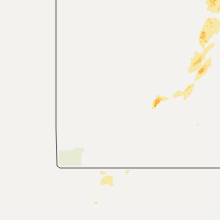
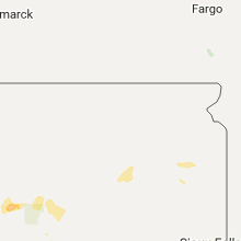
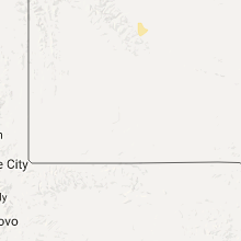
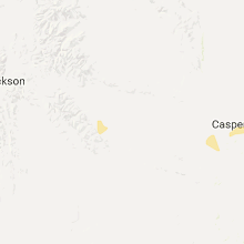
Hail Map for Thursday, August 11, 2016

Number of Impacted Households on 8/11/2016
0
Impacted by 1" or Larger Hail
0
Impacted by 1.75" or Larger Hail
0
Impacted by 2.5" or Larger Hail
Square Miles of Populated Area Impacted on 8/11/2016
0
Impacted by 1" or Larger Hail
0
Impacted by 1.75" or Larger Hail
0
Impacted by 2.5" or Larger Hail


Cities Most Affected by Hail Storms of 8/11/2016
| Hail Size | Demographics of Zip Codes Affected | ||||||
|---|---|---|---|---|---|---|---|
| City | Count | Average | Largest | Pop Density | House Value | Income | Age |
| Gordon, NE | 1 | 1.75 | 1.75 | 2 | $46k | $28.0k | 45.1 |
| Hemingford, NE | 1 | 1.75 | 1.75 | 1 | $56k | $34.0k | 45.7 |
Hail and Wind Damage Spotted on 8/11/2016
Filter by Report Type:Hail ReportsWind Reports
States Impacted
Iowa, Illinois, South Dakota, Connecticut, Texas, Utah, Ohio, Mississippi, Kansas, Louisiana, Pennsylvania, Nebraska, New York, FloridaIowa
| Local Time | Report Details |
|---|---|
| 11:30 AM CDT | Davenport public works reported trees down on locust and grand streets. time estimate in scott county IA, 62.5 miles ESE of Cedar Rapids, IA |
| 6:17 PM CDT | Tree down across highwa in woodbury county IA, 59.8 miles WSW of Storm Lake, IA |
| 6:20 PM CDT | Grain bin blown over...time estimated from rada in woodbury county IA, 56.7 miles WSW of Storm Lake, IA |
| 6:21 PM CDT | Iowa department of transportation observatio in monona county IA, 42.9 miles N of Omaha, NE |
| 6:23 PM CDT | Measured on personal weather station...time estimated from rada in woodbury county IA, 52.4 miles WSW of Storm Lake, IA |
| 6:37 PM CDT | 7 inch tree branches down...gas station canopy blown ove in woodbury county IA, 47.1 miles SW of Storm Lake, IA |
| 6:40 PM CDT | Gusty winds lasted for 15 minute in harrison county IA, 39.7 miles N of Omaha, NE |
| 7:35 PM CDT | Storm damage reported in shelby county IA, 41.5 miles NE of Omaha, NE |
| 7:54 PM CDT | Storm damage reported in audubon county IA, 61.3 miles ENE of Omaha, NE |
| 7:55 PM CDT | Storm damage reported in audubon county IA, 61.3 miles ENE of Omaha, NE |
| 8:05 PM CDT | Power lines down in town. 4 to 6 in limbs down in town. time estimated from rada in guthrie county IA, 52 miles WNW of Des Moines, IA |
| 8:08 PM CDT | Reported at kai in cass county IA, 47.4 miles ENE of Omaha, NE |
| 8:10 PM CDT | Trees down... power lines down... transformers blowing. in cass county IA, 48.8 miles ENE of Omaha, NE |
| 8:46 PM CDT | Numerous trees and power lines down throughout dallas county. cities affected include adel... dallas center... redfield... and dexter. tree limb on em's roof. time esti in dallas county IA, 21.5 miles W of Des Moines, IA |
| 9:03 PM CDT | A few tree branches down as wel in polk county IA, 12.6 miles NW of Des Moines, IA |
| 9:07 PM CDT | A few tree branches down as wel in polk county IA, 10.2 miles WNW of Des Moines, IA |
| 9:07 PM CDT | A couple large tree branches down...roughly 5-7 inches in diameter and 10-15 feet in length along east 1st street near intersection of little beaver drive. several smal in polk county IA, 11.4 miles NW of Des Moines, IA |
| 9:08 PM CDT | Reported via social medi in dallas county IA, 12.7 miles W of Des Moines, IA |
| 9:09 PM CDT | Storm damage reported in polk county IA, 9.3 miles NW of Des Moines, IA |
| 9:10 PM CDT | Trained spotter reported 5 to 6 inch diameter branch down in cumming. report via social media. time and location estimated from rada in warren county IA, 10.6 miles SW of Des Moines, IA |
| 9:10 PM CDT | Large tree blown onto roof of two-story residence. time and location estimated from rada in polk county IA, 7.6 miles W of Des Moines, IA |
| 9:15 PM CDT | Reported by mid american. power lines down in urbandale via social media. time estimated from rada in polk county IA, 7.3 miles WNW of Des Moines, IA |
| 9:15 PM CDT | Creston airport awo in union county IA, 55.2 miles SW of Des Moines, IA |
| 9:23 PM CDT | Measured on home weather statio in clarke county IA, 42.6 miles SSW of Des Moines, IA |
Illinois
| Local Time | Report Details |
|---|---|
| 11:49 AM CDT | 2 to 4 inch limb down. report from social media was delayed. the time is estimated using rada in rock island county IL, 69.8 miles ESE of Cedar Rapids, IA |
| 11:54 AM CDT | 12 inch diameter tree knocked down...relayed by broadcast media via twitter. time estimated using rada in rock island county IL, 70.5 miles NNW of Peoria, IL |
South Dakota
| Local Time | Report Details |
|---|---|
| 12:41 PM CDT | Quarter sized hail reported near Lesterville, SD, 59.1 miles SW of Sioux Falls, SD |
| 3:41 PM MDT | Quarter sized hail reported near Hermosa, SD, 22.9 miles S of Rapid City, SD, mix of pea to quarter size hail fell for about 5 minutes |
| 4:02 PM MDT | *** 2 inj *** sheriff reported 2 injuries with trailer blown over in ziebach county SD, 75.5 miles ENE of Rapid City, SD |
| 4:02 PM MDT | Dupree sheriff office reported fema trailer blown over by thunderstorm winds in ziebach county SD, 76.6 miles WNW of Pierre, SD |
| 4:38 PM MDT | Storm damage reported in ziebach county SD, 60.5 miles WNW of Pierre, SD |
| 5:12 PM MDT | Storm damage reported in jackson county SD, 73.6 miles NW of Valentine, NE |
| 5:40 PM MDT | Pea hai in stanley county SD, 21 miles WSW of Pierre, SD |
| 6:04 PM MDT | Half Dollar sized hail reported near Kyle, SD, 62.9 miles ESE of Rapid City, SD |
| 6:23 PM MDT | Quarter sized hail reported near Interior, SD, 71.8 miles ESE of Rapid City, SD, ground almost covered in hail. lasted 5 minutes. |
Connecticut
| Local Time | Report Details |
|---|---|
| 2:20 PM EDT | Wires down on hampton rd. off madison av in hartford county CT, 60.6 miles W of Providence, RI |
| 4:45 PM EDT | Trees and wires down on summit street near route 44 in hartford county CT, 57.3 miles W of Providence, RI |
| 6:10 PM EDT | Wires down on glazier drive in hartford county CT, 62 miles W of Providence, RI |
| 6:11 PM EDT | Trees and wires down on farmcliff drive in hartford county CT, 62 miles W of Providence, RI |
| 6:31 PM EDT | Multiple trees and wires down on johnny cake lane in hartford county CT, 62 miles W of Providence, RI |
| 6:32 PM EDT | Wires down on russet road and cider mill road in hartford county CT, 62.3 miles W of Providence, RI |
| 6:34 PM EDT | Trees and wires down closing the road on new london turnpike at cider mill road in hartford county CT, 62.3 miles W of Providence, RI |
| 7:30 PM EDT | Trees down on middle stree in middlesex county CT, 69.7 miles WSW of Providence, RI |
| 8:00 PM EDT | Multiple trees and power lines down throughout the tow in middlesex county CT, 66.8 miles WSW of Providence, RI |
| 9:03 PM EDT | Wires down at the intersection of clapboard ridge road and farm stree in fairfield county CT, 56.5 miles NNE of Brooklyn, NY |
| 9:05 PM EDT | Tree down near farm street and beckerle stree in fairfield county CT, 56.5 miles NNE of Brooklyn, NY |
Texas
| Local Time | Report Details |
|---|---|
| 1:43 PM CDT | Storm damage reported in wichita county TX, 4.3 miles N of Wichita Falls, TX |
| 2:43 PM CDT | Storm damage reported in wichita county TX, 4.3 miles N of Wichita Falls, TX |
| 5:42 PM CDT | Storm damage reported in potter county TX, 6.5 miles E of Amarillo, TX |
Utah
| Local Time | Report Details |
|---|---|
| 1:19 PM MDT | Skywarn spotter and coop obsvr at jarvie ranch reported winds of 50g65 mph with tree limbs broken to 2" and larger. also reported 3/8" hail. . the duration of the tstm in daggett county UT, 43.9 miles S of Rock Springs, WY |
| 2:00 PM MDT | Quarter sized hail reported near Kamas, UT, 33.5 miles ESE of Salt Lake City, UT |
Ohio
| Local Time | Report Details |
|---|---|
| 4:30 PM EDT | Large limbs and tree down on detroit road between dover and crocke in cuyahoga county OH, 13 miles WSW of Cleveland, OH |
| 4:42 PM EDT | Several trees down across rocky river including one blocking detroit road east of basset in cuyahoga county OH, 8.6 miles WSW of Cleveland, OH |
Mississippi
| Local Time | Report Details |
|---|---|
| 3:55 PM CDT | Damage to a bar in lawrence county MS, 55.8 miles S of Jackson, MS |
Kansas
| Local Time | Report Details |
|---|---|
| 4:41 PM CDT | A few tree branches were blown down in the city of russel in russell county KS, 26 miles E of Hays, KS |
| 4:48 PM CDT | They reported several tree limbs dow in meade county KS, 60.9 miles SE of Garden City, KS |
| 5:11 PM CDT | Storm damage reported in russell county KS, 27.6 miles E of Hays, KS |
| 5:30 PM CDT | Mitchell county dispatch relayed the repor in mitchell county KS, 65.5 miles NE of Hays, KS |
| 5:45 PM CDT | Mesonet indicated a peak of 63 mph with a recorded gust of 60 at 545 p in mitchell county KS, 70 miles NE of Hays, KS |
| 5:56 PM CDT | Large tree limb down near hwy 13 and r road. time estimated from rada in jewell county KS, 77 miles S of Grand Island, NE |
| 5:57 PM CDT | Storm damage reported in hodgeman county KS, 47.2 miles E of Garden City, KS |
| 6:20 PM CDT | Storm damage reported in russell county KS, 27.6 miles E of Hays, KS |
| 6:20 PM CDT | 2 power poles down on k in rush county KS, 26.9 miles SSE of Hays, KS |
| 6:25 PM CDT | Delayed report of a measured wind speed by gauge operated by union pacifi in russell county KS, 31.9 miles E of Hays, KS |
| 10:05 PM CDT | Delayed report of lots of tree damage in peabody and power lines are down. report sent via social medi in marion county KS, 35.5 miles NNE of Wichita, KS |
| 10:11 PM CDT | Estimated 60 mph winds blew tree limbs dow in marion county KS, 37.8 miles NNE of Wichita, KS |
| 1:11 AM CDT | Storm damage reported in cheyenne county KS, 29.6 miles WNW of Colby, KS |
Louisiana
| Local Time | Report Details |
|---|---|
| 4:50 PM CDT | Power lines were downed on highway 504 in the oak grove area near interstate 4 in natchitoches county LA, 62.7 miles SE of Shreveport, LA |
Pennsylvania
| Local Time | Report Details |
|---|---|
| 5:50 PM EDT | Trees and power lines down in oakland township. time estimated from rada in butler county PA, 33.5 miles NNE of Pittsburgh, PA |
| 7:25 PM EDT | Trees down in armstrong county PA, 40.7 miles ENE of Pittsburgh, PA |
| 7:35 PM EDT | Trees down in armstrong county PA, 40.7 miles ENE of Pittsburgh, PA |
Nebraska
| Local Time | Report Details |
|---|---|
| 4:15 PM MDT | Ping Pong Ball sized hail reported near Crawford, NE, 47.9 miles NNE of Scottsbluff, NE |
| 5:32 PM CDT | Tree down...damage to farm outbuildings...time estimated from rada in dixon county NE, 85.8 miles S of Sioux Falls, SD |
| 5:35 PM CDT | Storm damage reported in wayne county NE, 84.7 miles E of Oneill, NE |
| 4:40 PM MDT | Storm damage reported in box butte county NE, 43.6 miles NE of Scottsbluff, NE |
| 5:42 PM CDT | Several trees uprooted between pender and emerso in thurston county NE, 77 miles NNW of Omaha, NE |
| 6:00 PM CDT | Tree down...time estimated from rada in dakota county NE, 69.6 miles WSW of Storm Lake, IA |
| 5:08 PM MDT | Golf Ball sized hail reported near Hemingford, NE, 51.2 miles NE of Scottsbluff, NE |
| 7:09 PM CDT | 60 to 70 mph wind gusts estimated by trained spotter. tree limbs to 4 inches snapped. time adjusted by rada in thayer county NE, 58.5 miles SSE of Grand Island, NE |
| 7:10 PM CDT | On highway 4 near davenport. winds in excess of 60 mp in thayer county NE, 50.7 miles SSE of Grand Island, NE |
| 7:24 PM CDT | Winds in excess of 60 mph ongoing in belvider in thayer county NE, 62.1 miles SE of Grand Island, NE |
| 7:27 PM CDT | Gusts estimated at 60mph currently ongoing in brunnin in thayer county NE, 57.5 miles SE of Grand Island, NE |
| 7:28 PM CDT | Wind gusts estimated at 60 to 65 mph currently ongoing north of hebro in thayer county NE, 62.1 miles SE of Grand Island, NE |
| 7:30 PM CDT | Tree down on transformer. 44mph measured wind gust in jefferson county NE, 74.1 miles NNW of Manhattan, KS |
| 7:35 PM CDT | Storm damage reported in custer county NE, 64.3 miles WNW of Grand Island, NE |
| 6:45 PM MDT | Golf Ball sized hail reported near Gordon, NE, 69.9 miles W of Valentine, NE, golf ball size hail and 60 mph wind gusts occurred. |
| 7:34 PM MDT | Scottsbluff raws in scotts bluff county NE, 3.3 miles SW of Scottsbluff, NE |
| 10:08 PM MDT | Thunderstorm wind gusts measured 64 mph at the ogallala airpor in keith county NE, 51.5 miles W of North Platte, NE |
| 10:19 PM MDT | Thunderstorm wind gusts measure at 67 mp in keith county NE, 43.7 miles W of North Platte, NE |
| 11:19 PM CDT | Sustained winds of 58 mph gusting to 72 mph at the north platte aso in lincoln county NE, 2.8 miles E of North Platte, NE |
| 12:05 AM CDT | Storm damage reported in lincoln county NE, 10.7 miles NNW of North Platte, NE |
| 12:34 AM CDT | Sustained winds of 58 mph gusting to 72 mph at the north platte aso in lincoln county NE, 2.8 miles E of North Platte, NE |
| 12:38 AM CDT | Measured at north platte regional airport in lincoln county NE, 4.3 miles E of North Platte, NE |
| 1:08 AM CDT | Quarter sized hail reported near Gothenburg, NE, 34.6 miles ESE of North Platte, NE, 50 mph winds reported with quarter size hail. |
New York
| Local Time | Report Details |
|---|---|
| 6:37 PM EDT | Tree down on the long island expressway service road at shelter rock roa in nassau county NY, 17.6 miles ENE of Brooklyn, NY |
| 6:42 PM EDT | Branch down partially blocking smith stree in nassau county NY, 21.2 miles ENE of Brooklyn, NY |
| 7:00 PM EDT | Tree down across road and trees on power lines at laurel hollow road and stewart lan in nassau county NY, 29.4 miles ENE of Brooklyn, NY |
| 8:40 PM EDT | Trees down on 1-84 just west of the new york-connecticut borde in putnam county NY, 52.7 miles NNE of Brooklyn, NY |
Florida
| Local Time | Report Details |
|---|---|
| 7:35 PM EDT | One tree reported down in bronso in levy county FL, 84.7 miles SW of Jacksonville, FL |
Connect with Interactive Hail Maps