

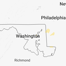
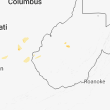
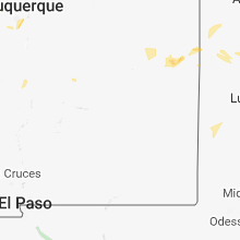
Hail Map for Saturday, August 11, 2018

Number of Impacted Households on 8/11/2018
0
Impacted by 1" or Larger Hail
0
Impacted by 1.75" or Larger Hail
0
Impacted by 2.5" or Larger Hail
Square Miles of Populated Area Impacted on 8/11/2018
0
Impacted by 1" or Larger Hail
0
Impacted by 1.75" or Larger Hail
0
Impacted by 2.5" or Larger Hail


Cities Most Affected by Hail Storms of 8/11/2018
| Hail Size | Demographics of Zip Codes Affected | ||||||
|---|---|---|---|---|---|---|---|
| City | Count | Average | Largest | Pop Density | House Value | Income | Age |
| Williams, AZ | 1 | 1.75 | 1.75 | 4 | $101k | $33.8k | 44.5 |
Hail and Wind Damage Spotted on 8/11/2018
Filter by Report Type:Hail ReportsWind Reports
States Impacted
Nevada, Ohio, Kentucky, Pennsylvania, New Jersey, Oklahoma, Missouri, Arizona, North Carolina, Virginia, Indiana, Michigan, Texas, Maryland, Montana, TennesseeNevada
| Local Time | Report Details |
|---|---|
| 8:32 AM PDT | Timber mountain raws gusted to 58 mph with thunderstorm outflow in nye county NV, 68.4 miles SSW of Ely, NV |
| 2:49 PM PDT | Shingles blown off of trained spotters house. estimated wind gusts 70 mp in clark county NV, 5.5 miles WSW of Las Vegas, NV |
| 7:28 PM MST | Trained spotter reports wind gusts of 63 mph in laughli in clark county NV, 49.6 miles NNW of Lake Havasu City, AZ |
| 7:35 PM PDT | Webeoc fire rescue reported that several windows had been blown out from thunderstorm related wind gusts at the riverside hotel in laughlin. time estimated from rada in clark county NV, 49.3 miles NNW of Lake Havasu City, AZ |
| 8:29 PM PDT | Wind gust of 60 mph recorded on the east side of the las vegas valle in clark county NV, 2.3 miles ENE of Las Vegas, NV |
| 8:29 PM PDT | 61 mph wind gusts measured on the east side of the las vegas valle in clark county NV, 4.4 miles ENE of Las Vegas, NV |
| 8:35 PM PDT | Airplane at henderson executive airport reported a tipped plane onto its nose from thunderstorm related wind gust in clark county NV, 13.2 miles S of Las Vegas, NV |
| 8:37 PM PDT | 71 mph wind gusts recorded at nellis air force bas in clark county NV, 6.1 miles NE of Las Vegas, NV |
| 8:40 PM PDT | Power poles were downed on the corner of bruce st and fremont st according to medi in clark county NV, 1 miles SE of Las Vegas, NV |
| 8:41 PM PDT | Wind gusts of 69 mph measured north of henderso in clark county NV, 12.2 miles SE of Las Vegas, NV |
| 8:45 PM PDT | Reports of a tree downed from thunderstorm related wind damage from a hotel guest at the bellagio hotel taxi tunne in clark county NV, 4.8 miles SSW of Las Vegas, NV |
| 8:50 PM PDT | Thunderstorm related wind gusts damaged a car port according to a social media repor in clark county NV, 6.3 miles SSE of Las Vegas, NV |
| 8:50 PM PDT | Wind gusts measured at 62 mph on the west side of the cit in clark county NV, 10.2 miles W of Las Vegas, NV |
| 8:50 PM PDT | Quarter sized hail reported near , , 20 miles NE of Las Vegas, NV, spotter reported 1 inch hail at the interchange of i-15 and us 93. |
| 8:52 PM PDT | 62 mph wind gust reported wsw of las vega in clark county NV, 6.2 miles E of Las Vegas, NV |
| 8:53 PM PDT | Wind gust of 63 mph measured east of i 15 and south of enterpris in clark county NV, 12.8 miles SW of Las Vegas, NV |
| 8:53 PM PDT | 61 mph wind gusts recorded on the south side of las vega in clark county NV, 13.3 miles SSW of Las Vegas, NV |
| 8:53 PM PDT | Nws employee reported a tree uprooted near sierra vista high schoo in clark county NV, 11.1 miles SW of Las Vegas, NV |
| 8:55 PM PDT | Media report received via social media of significant damage to the exterior of the el cortez hote in clark county NV, 0.1 miles S of Las Vegas, NV |
| 8:55 PM PDT | Thunderstorm related wind gusts damaged roof to a house and an awnin in clark county NV, 5.7 miles SE of Las Vegas, NV |
| 8:56 PM PDT | Wind gust to 66 mph reported by mccarran airport aso in clark county NV, 7.1 miles S of Las Vegas, NV |
| 8:56 PM PDT | Quarter sized hail reported near Henderson, NV, 13.5 miles SSE of Las Vegas, NV, 1 inch hail was estimated in cadence. |
| 8:57 PM PDT | 63 mph wind gust reported just west of las vega in clark county NV, 2.8 miles W of Las Vegas, NV |
| 8:58 PM PDT | Wind gusts of 63 mph measured just west of the las vegas stri in clark county NV, 2.8 miles W of Las Vegas, NV |
| 9:01 PM PDT | Las vegas fire department reports 4 power poles down due to thunderstorm wind in clark county NV, 0.8 miles NE of Las Vegas, NV |
| 9:02 PM PDT | Wind gusts recorded of 75 mph south of enterpris in clark county NV, 15.5 miles S of Las Vegas, NV |
| 9:10 PM PDT | Henderson em reported two trees downed near the intersection of warm springs road and la mesa drive. time estimated by rada in clark county NV, 8.2 miles SSE of Las Vegas, NV |
| 9:10 PM PDT | Public report received via social media of a tree dow in clark county NV, 12.3 miles NW of Las Vegas, NV |
| 9:15 PM PDT | Henderson em reported seven trees down in the seven hills area. time estimated by rada in clark county NV, 13.3 miles S of Las Vegas, NV |
| 9:15 PM PDT | Tree down on house reported via social medi in clark county NV, 12.9 miles NW of Las Vegas, NV |
| 9:19 PM PDT | Tree down over fence near the intersection of charleston and hollywood... relayed via social medi in clark county NV, 6.2 miles E of Las Vegas, NV |
| 9:26 PM PDT | Power out due to thunderstorm wind gusts at callville bay marina on lake mead. relayed by lake mead dispatch cente in clark county NV, 23.5 miles E of Las Vegas, NV |
| 9:29 PM PDT | Tree down across frank sinatra drive relayed via social medi in clark county NV, 4.2 miles SSW of Las Vegas, NV |
| 10:10 PM PDT | Thunderstorm related wind gusts blew down a tree on the corner of annie oakley an harmon according to a social media repor in clark county NV, 5.1 miles SSE of Las Vegas, NV |
Ohio
| Local Time | Report Details |
|---|---|
| 12:53 PM EDT | Tree downed along colley rd near mcdermott. time estimated by rada in scioto county OH, 77.5 miles S of Columbus, OH |
| 12:54 PM EDT | Tree downed along duck run rd. time estimated by rada in scioto county OH, 76.1 miles S of Columbus, OH |
| 1:38 PM EDT | Tree downed along mill rd. near wheelersburg. time estimated by rada in scioto county OH, 69.9 miles WNW of Charleston, WV |
Kentucky
| Local Time | Report Details |
|---|---|
| 1:40 PM EDT | Limbs down along raikes mill roa in greenup county KY, 72.3 miles WNW of Charleston, WV |
| 4:22 PM EDT | Tree downed near 5000 block of idlewild road. time estimated by rada in boone county KY, 13 miles WSW of Cincinnati, OH |
| 4:28 PM EDT | Tree reported down along austin branch roa in lawrence county KY, 57.3 miles WSW of Charleston, WV |
| 5:15 PM EDT | A couple of trees downed along/near ky 19 in the southern part of the county. time estimate in bracken county KY, 41.1 miles SSE of Cincinnati, OH |
| 5:21 PM EDT | Large tree down in cynthiana. time estimated from rada in harrison county KY, 50.7 miles SSE of Cincinnati, OH |
| 5:35 PM EDT | Tree downed in 4000 block of lower river road. time estimated by rada in boone county KY, 21.8 miles SW of Cincinnati, OH |
| 5:53 PM EDT | One large tree down near scott and vine in paris. two other trees down near 833 brentsville r in bourbon county KY, 38.3 miles NNW of Irvine, KY |
| 6:30 PM EDT | At least 5 large trees down in southern scott county. some power outages als in scott county KY, 48.4 miles NW of Irvine, KY |
| 6:35 PM EDT | Multiple trees down in three different areas in midwa in woodford county KY, 49.5 miles NW of Irvine, KY |
| 6:44 PM EDT | 1 small tree dow in fayette county KY, 43.5 miles NW of Irvine, KY |
| 6:56 PM EDT | Tree down in millvill in woodford county KY, 49.9 miles ENE of Louisville, KY |
| 7:33 PM EDT | 1 tree dow in anderson county KY, 43.5 miles E of Louisville, KY |
Pennsylvania
| Local Time | Report Details |
|---|---|
| 1:43 PM EDT | Tree down on wires between bridgeport and hughes rail stations... causing delays in service for nearly an hour. time estimated from rada in montgomery county PA, 83.3 miles WSW of Brooklyn, NY |
| 3:40 PM EDT | Tree down on schlegel rd near township line rd. damage likely caused due to a combination of strong thunderstorm winds and heavy rain. time estimated from rada in berks county PA, 72.5 miles S of Scranton, PA |
New Jersey
| Local Time | Report Details |
|---|---|
| 2:10 PM EDT | Tree and wires down on lock st near logan st. damage likely due to a combination of strong thunderstorm winds and heavy rain. time estimated from rada in warren county NJ, 56.8 miles SSE of Scranton, PA |
Oklahoma
| Local Time | Report Details |
|---|---|
| 2:30 PM CDT | Storm damage reported in muskogee county OK, 29.1 miles SE of Tulsa, OK |
| 3:30 PM CDT | Strong thunderstorm wind blew down a tree in delaware county OK, 60 miles E of Tulsa, OK |
Missouri
| Local Time | Report Details |
|---|---|
| 3:15 PM CDT | Corrects the timing of the previous tstm wnd gst report from 2 w west branson. branson west (kfwb) asos reported a gust of 53 knots (61mph in stone county MO, 35.6 miles S of Springfield, MO |
| 3:18 PM CDT | Branson west (kfwb) asos reported a gust of 53 knots (61mph in stone county MO, 35.6 miles S of Springfield, MO |
Arizona
| Local Time | Report Details |
|---|---|
| 1:25 PM MST | Golf Ball sized hail reported near Williams, AZ, 31.2 miles WNW of Flagstaff, AZ, hail up to the size of a golf ball was reported at the koa campground north of williams. |
| 1:45 PM MST | Quarter sized hail reported near Williams, AZ, 32.2 miles WNW of Flagstaff, AZ, soft hail... some plants in the garden were shredded... no damage to metal structures. |
| 2:50 PM MST | Quarter sized hail reported near Sedona, AZ, 29.5 miles SSW of Flagstaff, AZ, report of quarter to half dollar size hail. |
| 7:35 PM MST | 62 mph wind gust reported at bullhead city airpor in mohave county AZ, 48.8 miles NNW of Lake Havasu City, AZ |
| 7:52 PM MST | Wind gust of 58 mph reported from the union pass raw in mohave county AZ, 52.1 miles N of Lake Havasu City, AZ |
| 9:08 PM MST | Spotter reported that power is out along us 95 from bullhead city to fort mohave due to thunderstorm wind in mohave county AZ, 41 miles NNW of Lake Havasu City, AZ |
North Carolina
| Local Time | Report Details |
|---|---|
| 4:25 PM EDT | One tree blown down on the 500 block of forehand road in pikevill in wayne county NC, 44.3 miles ESE of Raleigh, NC |
Virginia
| Local Time | Report Details |
|---|---|
| 5:11 PM EDT | Asos station orf... norfolk intl airpor in city of norfolk county VA, 12.4 miles NW of Virginia Beach, VA |
| 5:30 PM EDT | Buoy station 44064... 6 nw cape henr in anz634 county VA, 17 miles N of Virginia Beach, VA |
| 5:35 PM EDT | Mesonet station xbbt... third islan in anz632 county VA, 19.7 miles N of Virginia Beach, VA |
Indiana
| Local Time | Report Details |
|---|---|
| 5:19 PM EDT | Two trees were reported knocked down on soap hill roa in dearborn county IN, 23.9 miles W of Cincinnati, OH |
Michigan
| Local Time | Report Details |
|---|---|
| 5:42 PM EDT | Multiple reports of trees and power lines down. the worst damage is confined to horse head lake. time estimated by rada in mecosta county MI, 53.6 miles NNE of Grand Rapids, MI |
| 5:56 PM EDT | Multiple 3 ft in diameter and 20 ft tall trees uprooted. dime size hail as wel in mecosta county MI, 53.9 miles NNE of Grand Rapids, MI |
| 1:28 AM EDT | Tree down at this location. 4 to 5 trees down across the count in jackson county MI, 57.6 miles SSW of Flint, MI |
| 1:38 AM EDT | Tree down at this locatio in jackson county MI, 62.9 miles SSW of Flint, MI |
Texas
| Local Time | Report Details |
|---|---|
| 5:55 PM CDT | 10-12 inch trees down on fm 147 1 mile north of marlin in falls county TX, 50.7 miles ENE of Killeen, TX |
Maryland
| Local Time | Report Details |
|---|---|
| 6:58 PM EDT | Social media photos of several large tree branches down at a residence near grasonville. time approximated from rada in queen anne's county MD, 32.1 miles SE of Baltimore, MD |
| 8:20 PM EDT | Wind gust of 65 mph reported at the knapps narrows drawbridge mddot gaug in talbot county MD, 42.1 miles SSE of Baltimore, MD |
Montana
| Local Time | Report Details |
|---|---|
| 8:05 PM MDT | Storm damage reported in cascade county MT, 19.9 miles E of Great Falls, MT |
| 8:17 PM MDT | Strong winds knocked down some tree branches up to 33 inches in lengt in cascade county MT, 3.6 miles E of Great Falls, MT |
| 8:42 PM MDT | Dot senso in chouteau county MT, 48.5 miles NE of Great Falls, MT |
Tennessee
| Local Time | Report Details |
|---|---|
| 12:15 AM CDT | Storm damage reported in henderson county TN, 29.8 miles S of Mc Kenzie, TN |
Connect with Interactive Hail Maps